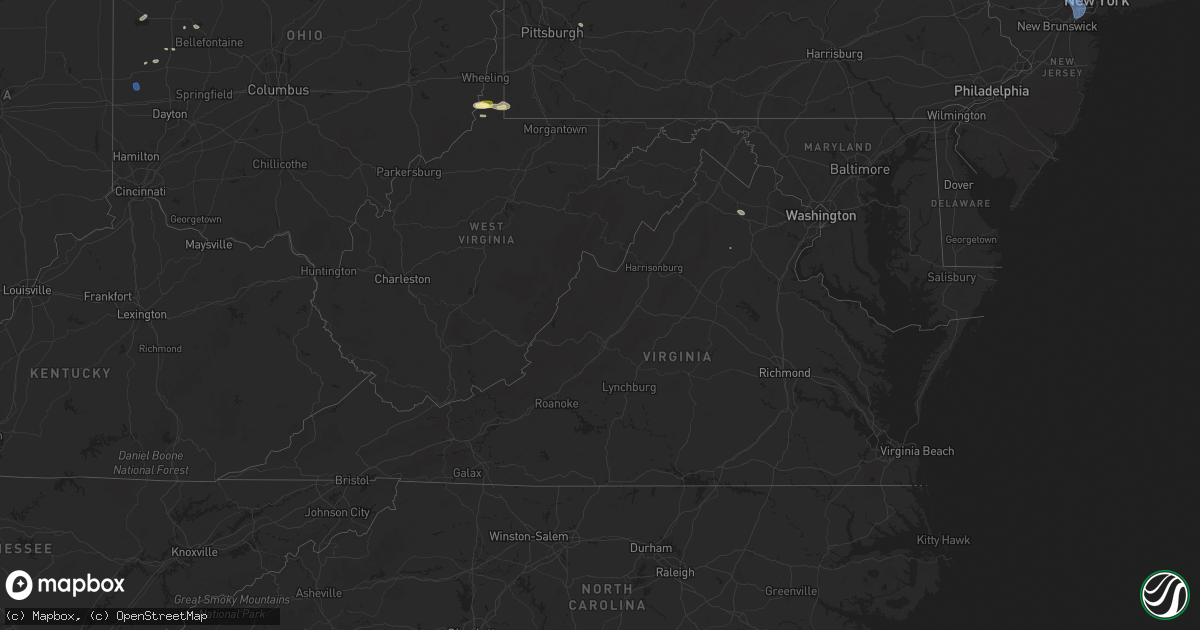
Hail Map in Virginia on July 25, 2025
Get this storm
July 25 map
$229
one time, instant access
Download today. No call, no setup
Keep the $229
Bought the map and want the full workflow? Apply the entire $229 to a subscription within 7 days. None of it is wasted.
Every map, not just this one
This buys you this map. Subscription and you get every map we run, in the markets you choose from a few cities to whole states to nationwide. Plus real-time alerts the moment a storm fires.
Contact data
Name, contact info, occupancy, even credit band for addresses in the footprint. You go from where it hit to who to call.
Become the source they trust
Unlimited branding weather history reports on demand. You already have the documented answer ready for the property owner, and you are the one who showed up with it.
Property data and RoofTrace estimates
Pull up any address you have got, its value and the exact code rules for that jurisdiction, straight from One Click Code. Then RoofTrace estimates the squares, pitch, and roof value, priced the way you price.
Storm reports in Virginia
Virginia
| Date | Description |
|---|---|
| 07/25/20254:05 PM CDT | Trees and wires blew down near the intersection of montrose street and cherokee avenue. |
| 07/25/20254:00 PM CDT | Trees blew down near the intersection of orange plank road and chancellor way. |
| 07/25/20253:57 PM CDT | A tree blew down onto a house in the 7100 block of rolling forest avenue. |
| 07/25/20253:57 PM CDT | Trees blew down on eastbound va-640 sydenstricker road at briarcliff drive. |
| 07/25/20253:57 PM CDT | Trees blew down on gregory court. |
| 07/25/20252:31 PM CDT | Trees and wires down near the intersection of delaplane grade road and va-710 carr lane. |
| 07/25/20252:22 PM CDT | Tree down near the intersection of gravels road and triple ridge lane. |
All States Impacted by Hail Map on July 25, 2025
Cities Impacted by Hail Map on July 25, 2025
- South Lee, MA
- Stockbridge, MA
- Great Barrington, MA
- Monterey, MA
- Tyringham, MA
- Lee, MA
- Otis, MA
- Moundsville, WV
- Powhatan Point, OH
- Proctor, WV
- Clarington, OH
- Woodbury, CT
- Middlebury, CT
- Watertown, CT
- Waterbury, CT
- Glen Easton, WV
- Bethlehem, CT
- Washington, CT
- Wind Ridge, PA
- Aleppo, PA
- Cameron, WV
- Pine Plains, NY
- Coburn, PA
- Aaronsburg, PA
- Woodward, PA
- Ancramdale, NY
- Millerton, NY
- Ancram, NY
- Millmont, PA
- Milroy, PA
- Cheshire, CT
- Hamden, CT
- Prospect, CT
- Chepachet, RI
- Wallingford, CT
- North Haven, CT
- Lincoln, RI
- Cumberland, RI
- Providence, RI
- Smithfield, RI
- Bethany, CT
- Dornsife, PA
- Parsippany, NJ
- Mountain Lakes, NJ
- Mount Tabor, NJ
- Morristown, NJ
- Cedar Knolls, NJ
- Whippany, NJ
- Montville, NJ
- Lake Hiawatha, NJ
- Boonton, NJ
- Morris Plains, NJ
- Denville, NJ
- Florham Park, NJ
- Madison, NJ
- East Hanover, NJ
- Chatham, NJ
- Green Village, NJ
- Summit, NJ
- Short Hills, NJ
- Livingston, NJ
- Pine Brook, NJ
- Fairfield, NJ
- Roseland, NJ
- West Orange, NJ
- Essex Fells, NJ
- Caldwell, NJ
- Delaplane, VA
- Markham, VA
- Millburn, NJ
- Springfield, NJ
- Newark, NJ
- Union, NJ
- Vauxhall, NJ
- Maplewood, NJ
- South Orange, NJ
- Irvington, NJ
- Kenilworth, NJ
- Roselle Park, NJ
- Elizabeth, NJ
- Roselle, NJ
- Hillside, NJ
- Cranford, NJ
- Linden, NJ
- Carteret, NJ
- Rahway, NJ
- Avenel, NJ
- Port Reading, NJ
- Murrysville, PA
- Pittsburgh, PA
- New Kensington, PA
- Hagerstown, IN
- Cambridge City, IN
- North Scituate, RI
- Johnston, RI
- Cranston, RI
- Jackson Center, OH
- Huntsville, OH
- Lakeview, OH
- Sewaren, NJ
- Russells Point, OH
- Apollo, PA
- Elizabethport, NJ
- Staten Island, NY
- Bayonne, NJ
- Arcanum, OH
- Bell, FL
- Bradford, OH
- Versailles, OH
- Houston, OH
- Covington, OH
- Russia, OH
- Rixeyville, VA
- Amissville, VA
- Celina, OH
- Sidney, OH
- Piqua, OH
- Dryden, TX
- Cohagen, MT
- Osawatomie, KS
- Paola, KS
- Saint Marys, OH
- Angela, MT
- Fort Stockton, TX
- Madison, KS
- Logansport, IN
- Richwood, OH
- Marysville, OH
- Flemington, NJ
- Skillman, NJ
- Belle Mead, NJ
- Rocky Hill, NJ
- Hopewell, NJ
- Princeton, NJ
- Plainsboro, NJ
- Pennington, NJ
- Monmouth Junction, NJ
- Kingston, NJ
- Princeton Junction, NJ
- Hillsborough, NJ
- Cranbury, NJ
- Brockway, MT
- Neshanic Station, NJ
- Waverly, KS
- Williamsburg, KS
- Allentown, NJ
- Robbinsville, NJ
- Hightstown, NJ
- Cream Ridge, NJ
- Windsor, NJ
- Millstone Township, NJ
- Monroe Township, NJ
- Roosevelt, NJ
- Culbertson, MT
- Blairsden Graeagle, CA
- Kinsey, MT
- Louisburg, KS
- Peru, IN
- Wabash, IN
- Clio, CA
- Lansdowne, PA
- Holmes, PA
- Norwood, PA
- Springfield, PA
- Folcroft, PA
- Drexel Hill, PA
- Glenolden, PA
- Essington, PA
- Sharon Hill, PA
- Darby, PA
- Philadelphia, PA
- Clifton Heights, PA
- Prospect Park, PA
- Folsom, PA
- Ridley Park, PA
- Morton, PA
- Broxton, GA
- Vincentown, NJ
- Terry, MT
- Dagmar, MT
- Termo, CA
- Canyon Dam, CA
- Twain, CA
- Chatsworth, NJ
- Raton, NM
- Heath, OH
- Madeline, CA
- Cedarville, CA
- Bainville, MT
- Greenville, CA
- Jal, NM
- Cimarron, NM
- Williston, ND
- Waukomis, OK
- Enid, OK
- Alturas, CA
- Belden, CA
- Susanville, CA
- Eureka, KS
- Ozona, TX
- Fairview, MT
- Fallon, MT
- Carnelian Bay, CA
- Truckee, CA
- Canon City, CO
- Sunbury, PA
- Shamokin Dam, PA
- Selinsgrove, PA
- Northumberland, PA
- Medford, OK
- Rebuck, PA
- Brooksville, FL
- Paxinos, PA
- Ismay, MT
- Platina, CA
- Shamokin, PA
- Trevorton, PA
- Vernon, TX
- Epping, ND
- Lookout, CA
- Douglas City, CA
- Fall River Mills, CA
- Trenton, ND
- Matador, TX
- Flomot, TX
- Grenville, NM
- Livermore, CO
- Plevna, MT
- Baker, MT
- Ray, ND
- White Earth, ND
- Tioga, ND
- Caldwell, KS
- Sedalia, CO
- Elizabeth, CO
- Mayfield, KS
- Kiowa, CO
- Mulvane, KS
- Belle Plaine, KS
- Milan, KS
- Wellington, KS
- Winfield, PA
- Stanley, ND
- New Town, ND
- Ross, ND
- Watford City, ND
- Marmarth, ND
- Hat Creek, CA
- Cassel, CA
- Teague, TX
- Argonia, KS
- Trinity Center, CA
- Lewiston, CA
- Conway Springs, KS
- Bennett, CO
- Clearwater, KS
- Rhame, ND
- Palermo, ND
- Keene, ND
- Parshall, ND
- Wichita, KS
- Goddard, KS
- El Dorado, KS
- Burns, KS
- Strasburg, CO
- Potwin, KS
- Maize, KS
- McIntire, IA
- Stacyville, IA
- Bowman, ND
- Berthold, ND
- Plaza, ND
- Carpio, ND
- Donnybrook, ND
- Valley Center, KS
- Groesbeck, TX
- Colwich, KS
- Towanda, KS
- Streetman, TX
- Farmersville, IL
- Cassoday, KS
- Powers Lake, ND
- Economy, IN
- Greens Fork, IN
- Virden, IL
- Glenarm, IL
- Springfield, IL
- Medora, ND
- Riverton, IL
- Lansford, ND
- Dickinson, ND
- Lefor, ND
- New England, ND
- Regent, ND
- Taylor, ND
- Gladstone, ND
- Richardton, ND
- Mott, ND
- Hebron, ND
- Glen Ullin, ND
- New Leipzig, ND
- Elgin, ND
- Mason City, IL
- Middletown, IL
- Greenview, IL
- Souris, ND
- Pleasant Plains, IL
- Dawson, IL
- Girard, IL
- Sherman, IL
- Williamsville, IL
- Alexander, IL
- New Berlin, IL
- New Salem, ND
- Carson, ND
- Almont, ND
- Granville, ND
- Buffalo, IL
- Towner, ND
- Washburn, ND
- Lincoln, IL
- Elkhart, IL
- New Holland, IL
- Mercer, ND
- Underwood, ND
- Balfour, ND
- Hazen, ND
- Beulah, ND
- Stanton, ND
- Center, ND
- Flasher, ND
- Mcclusky, ND
- Weatherford, OK
- Rugby, ND
- Mount Sterling, IL
- Wapella, IL
- Lawndale, IL
- Atlanta, IL
- Goodrich, ND
- McLean, IL
- Willow City, ND
- Shirley, IL
- Bismarck, ND
- Mandan, ND
- Rolette, ND
- Bloomington, IL
- Downs, IL
- Towanda, IL
- Lexington, IL
- Delavan, IL
- Ellsworth, IL
- Emden, IL
- Minier, IL
- Heyworth, IL
- Beason, IL
- Hartsburg, IL
- Danvers, IL
- Hudson, IL
- Kenney, IL
- Mount Pulaski, IL
- Clinton, IL
- Normal, IL
- Stanford, IL
- Armington, IL
- Le Roy, IL
- Cooksville, IL
- Chestnut, IL
- Waynesville, IL
- Arrowsmith, IL
- Colfax, IL
- Baldwin, ND
- Mylo, ND
- Wolford, ND
- Hurdsfield, ND
- Denhoff, ND
- Anchor, IL
- Cropsey, IL
- Knox, ND
- Wing, ND
- Sibley, IL
- Bisbee, ND
- Perth, ND
- Max, ND
- Chaseley, ND
- Harvey, ND
- Rocklake, ND
- Minot, ND
- Sawyer, ND
- Benedict, ND
- Bowdon, ND
- Norwich, ND
- Pettibone, ND
- Munich, ND
- Robinson, ND
- Chandlerville, IL
- Fessenden, ND
- Langdon, ND
- Woodworth, ND
- Sykeston, ND
- Velva, ND
- Starkweather, ND
- York, ND
- Cathay, ND
- Egeland, ND
- New Rockford, ND
- Karlsruhe, ND
- Carrington, ND
- Pingree, ND
- Alexandria, MO
- Canton, MO
- Warsaw, IL
- Drake, ND
- Mchenry, ND
- Glenfield, ND
- Kensal, ND
- Jamestown, ND
- Buchanan, ND
- Athens, IL
- Montpelier, ND
- Binford, ND
- Butte, ND
- Anamoose, ND
- Park River, ND
- Courtenay, ND
- Pekin, ND
- Mcville, ND
- Yarmouth, IA
- Ypsilanti, ND
- Arbela, MO
- Princeton, MO
- Wimbledon, ND
- Cooperstown, ND
- Luray, MO
- Wyaconda, MO
- Spiritwood, ND
- Rogers, ND
- Dazey, ND
- Grace City, ND
- Sutton, ND
- Hannaford, ND
- Luverne, ND
- Marion, ND
- Sanborn, ND
- Litchville, ND
- Valley City, ND
- Hope, ND
- Page, ND
- Buffalo, ND
- Tower City, ND
- Oriska, ND
- Fingal, ND
- Kathryn, ND
- Ayr, ND
- Absaraka, ND
- Amenia, ND
- Wheatland, ND
- Enderlin, ND
- Mapleton, ND
- Arthur, ND
- Davenport, ND
- Casselton, ND
- Leonard, ND
- Horace, ND
- Fargo, ND
- West Fargo, ND
- Thornville, OH
- Barnesville, MN
- Hawley, MN
- Pelican Rapids, MN
- Burlington, ND


