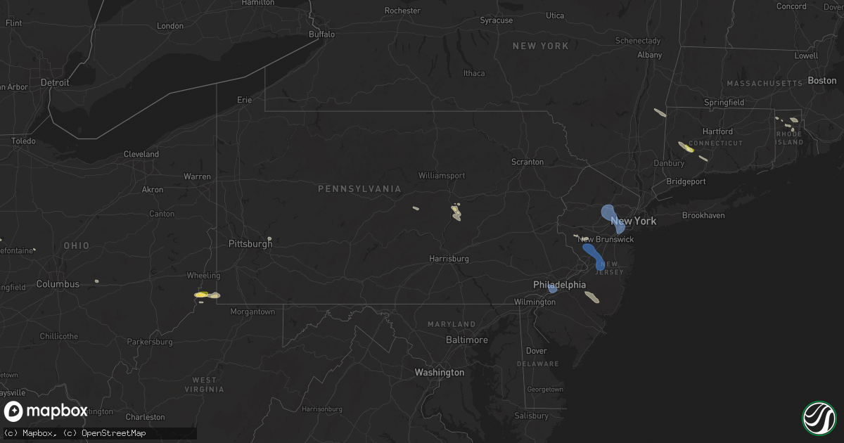
Hail Map in Pennsylvania on July 25, 2025
Get this storm
July 25 map
$229
one time, instant access
Download today. No call, no setup
Keep the $229
Bought the map and want the full workflow? Apply the entire $229 to a subscription within 7 days. None of it is wasted.
Every map, not just this one
This buys you this map. Subscription and you get every map we run, in the markets you choose from a few cities to whole states to nationwide. Plus real-time alerts the moment a storm fires.
Contact data
Name, contact info, occupancy, even credit band for addresses in the footprint. You go from where it hit to who to call.
Become the source they trust
Unlimited branding weather history reports on demand. You already have the documented answer ready for the property owner, and you are the one who showed up with it.
Property data and RoofTrace estimates
Pull up any address you have got, its value and the exact code rules for that jurisdiction, straight from One Click Code. Then RoofTrace estimates the squares, pitch, and roof value, priced the way you price.
Storm reports in Pennsylvania
Pennsylvania
| Date | Description |
|---|---|
| 07/25/20256:25 PM CDT | Multiple trees and communication lines down on and along new berlin highway in franklin township. |
| 07/25/20256:05 PM CDT | Downed tree at island park rd and berger rd. Time estimated by radar. |
| 07/25/20256:02 PM CDT | Powerlines downed causing live wire fire. Time estimated by radar. |
| 07/25/20255:50 PM CDT | Tree and wires down onto springwood road. |
| 07/25/20254:42 PM CDT | Trees down blocking the roadway. |
| 07/25/20254:38 PM CDT | Philadelphia international airport recorded a 54 kt wind gust. |
| 07/25/20254:38 PM CDT | Corrects previous tstm wnd dmg report from philadelphia international airport. Philadelphia international airport recorded a 54 kt wind gust. |
| 07/25/20254:24 PM CDT | Trees and wires down. Time estimated from radar. |
| 07/25/20254:24 PM CDT | *** 1 inj *** updated report from springfield. Trees and wires down. A large tree fell onto an occupied vehicle at bishop avenue and hawarden road. The injured driver w |
| 07/25/20254:19 PM CDT | Tree down blocking one lane of big spring road. |
| 07/25/20254:09 PM CDT | Tree down across railroad track crossing at aquetong rd blocking train and vehicle traffic. Time estimated from radar. |
| 07/25/20253:50 PM CDT | Multiple trees down in green lane. Time estimated from radar. |
| 07/25/20253:32 PM CDT | Trees and wires down. Time estimated from radar. |
| 07/25/20253:30 PM CDT | Trees down. Time estimated from radar. |
| 07/25/20253:27 PM CDT | Trees and wires down. Time estimated from radar. |
| 07/25/20253:25 PM CDT | Trees and wires down. Time estimated from radar. |
| 07/25/20253:22 PM CDT | Treed down blocking one lane of roadway on smith valley rd at boot hill lane. |
| 07/25/20253:20 PM CDT | Trees on wires. Time estimate |
| 07/25/20253:20 PM CDT | Trees on wires. Time estimated from radar. |
| 07/25/20253:20 PM CDT | Multiple trees snapped about part way up their trunks. Photo shared on social media. Time estimated from radar. |
| 07/25/20253:20 PM CDT | Mesonet station ew3190 reading. |
| 07/25/20253:17 PM CDT | Trees and wires down. Time estimated from radar. |
| 07/25/20253:15 PM CDT | Tree on wires with roadway blocked. Time estimated from radar. |
| 07/25/20253:10 PM CDT | Multiple trees and wires down in cornwall borough. |
| 07/25/20253:07 PM CDT | Trees and wires down. Time estimated from radar. |
| 07/25/20253:05 PM CDT | Trees down in centre twp. Time estimated from radar. |
| 07/25/20252:59 PM CDT | Tree down next to weis market. |
| 07/25/20252:58 PM CDT | Multiple trees and wires down in lebanon. |
| 07/25/20252:57 PM CDT | Tree down on south northkill road near the golf course. Time estimated from radar. |
| 07/25/20252:50 PM CDT | Multiple trees and wires down in north lebanon township. |
| 07/25/20252:42 PM CDT | Tree down blocking the roadway on dark hollow road. |
| 07/25/20251:58 PM CDT | Tree down on roadway at the 400 block of south main street in herndon. |
| 07/25/20251:35 PM CDT | Multiple trees down on new lancaster valley road east of milroy. |
| 07/25/20251:15 PM CDT | Tree down on long street near the intersection of cooper street. |
| 07/25/202512:54 PM CDT | Tree down into a house in bellefonte. No injuries reported. |
| 07/24/20257:01 PM CDT | Tree and wires down on forest drive near redners market. |
| 07/24/20257:00 PM CDT | Tree down into a house near the intersection of fearnot road and honey moon trail road. No injuries reported. |
All States Impacted by Hail Map on July 25, 2025
Cities Impacted by Hail Map on July 25, 2025
- South Lee, MA
- Stockbridge, MA
- Great Barrington, MA
- Monterey, MA
- Tyringham, MA
- Lee, MA
- Otis, MA
- Moundsville, WV
- Powhatan Point, OH
- Proctor, WV
- Clarington, OH
- Woodbury, CT
- Middlebury, CT
- Watertown, CT
- Waterbury, CT
- Glen Easton, WV
- Bethlehem, CT
- Washington, CT
- Wind Ridge, PA
- Aleppo, PA
- Cameron, WV
- Pine Plains, NY
- Coburn, PA
- Aaronsburg, PA
- Woodward, PA
- Ancramdale, NY
- Millerton, NY
- Ancram, NY
- Millmont, PA
- Milroy, PA
- Cheshire, CT
- Hamden, CT
- Prospect, CT
- Chepachet, RI
- Wallingford, CT
- North Haven, CT
- Lincoln, RI
- Cumberland, RI
- Providence, RI
- Smithfield, RI
- Bethany, CT
- Dornsife, PA
- Parsippany, NJ
- Mountain Lakes, NJ
- Mount Tabor, NJ
- Morristown, NJ
- Cedar Knolls, NJ
- Whippany, NJ
- Montville, NJ
- Lake Hiawatha, NJ
- Boonton, NJ
- Morris Plains, NJ
- Denville, NJ
- Florham Park, NJ
- Madison, NJ
- East Hanover, NJ
- Chatham, NJ
- Green Village, NJ
- Summit, NJ
- Short Hills, NJ
- Livingston, NJ
- Pine Brook, NJ
- Fairfield, NJ
- Roseland, NJ
- West Orange, NJ
- Essex Fells, NJ
- Caldwell, NJ
- Delaplane, VA
- Markham, VA
- Millburn, NJ
- Springfield, NJ
- Newark, NJ
- Union, NJ
- Vauxhall, NJ
- Maplewood, NJ
- South Orange, NJ
- Irvington, NJ
- Kenilworth, NJ
- Roselle Park, NJ
- Elizabeth, NJ
- Roselle, NJ
- Hillside, NJ
- Cranford, NJ
- Linden, NJ
- Carteret, NJ
- Rahway, NJ
- Avenel, NJ
- Port Reading, NJ
- Murrysville, PA
- Pittsburgh, PA
- New Kensington, PA
- Hagerstown, IN
- Cambridge City, IN
- North Scituate, RI
- Johnston, RI
- Cranston, RI
- Jackson Center, OH
- Huntsville, OH
- Lakeview, OH
- Sewaren, NJ
- Russells Point, OH
- Apollo, PA
- Elizabethport, NJ
- Staten Island, NY
- Bayonne, NJ
- Arcanum, OH
- Bell, FL
- Bradford, OH
- Versailles, OH
- Houston, OH
- Covington, OH
- Russia, OH
- Rixeyville, VA
- Amissville, VA
- Celina, OH
- Sidney, OH
- Piqua, OH
- Dryden, TX
- Cohagen, MT
- Osawatomie, KS
- Paola, KS
- Saint Marys, OH
- Angela, MT
- Fort Stockton, TX
- Madison, KS
- Logansport, IN
- Richwood, OH
- Marysville, OH
- Flemington, NJ
- Skillman, NJ
- Belle Mead, NJ
- Rocky Hill, NJ
- Hopewell, NJ
- Princeton, NJ
- Plainsboro, NJ
- Pennington, NJ
- Monmouth Junction, NJ
- Kingston, NJ
- Princeton Junction, NJ
- Hillsborough, NJ
- Cranbury, NJ
- Brockway, MT
- Neshanic Station, NJ
- Waverly, KS
- Williamsburg, KS
- Allentown, NJ
- Robbinsville, NJ
- Hightstown, NJ
- Cream Ridge, NJ
- Windsor, NJ
- Millstone Township, NJ
- Monroe Township, NJ
- Roosevelt, NJ
- Culbertson, MT
- Blairsden Graeagle, CA
- Kinsey, MT
- Louisburg, KS
- Peru, IN
- Wabash, IN
- Clio, CA
- Lansdowne, PA
- Holmes, PA
- Norwood, PA
- Springfield, PA
- Folcroft, PA
- Drexel Hill, PA
- Glenolden, PA
- Essington, PA
- Sharon Hill, PA
- Darby, PA
- Philadelphia, PA
- Clifton Heights, PA
- Prospect Park, PA
- Folsom, PA
- Ridley Park, PA
- Morton, PA
- Broxton, GA
- Vincentown, NJ
- Terry, MT
- Dagmar, MT
- Termo, CA
- Canyon Dam, CA
- Twain, CA
- Chatsworth, NJ
- Raton, NM
- Heath, OH
- Madeline, CA
- Cedarville, CA
- Bainville, MT
- Greenville, CA
- Jal, NM
- Cimarron, NM
- Williston, ND
- Waukomis, OK
- Enid, OK
- Alturas, CA
- Belden, CA
- Susanville, CA
- Eureka, KS
- Ozona, TX
- Fairview, MT
- Fallon, MT
- Carnelian Bay, CA
- Truckee, CA
- Canon City, CO
- Sunbury, PA
- Shamokin Dam, PA
- Selinsgrove, PA
- Northumberland, PA
- Medford, OK
- Rebuck, PA
- Brooksville, FL
- Paxinos, PA
- Ismay, MT
- Platina, CA
- Shamokin, PA
- Trevorton, PA
- Vernon, TX
- Epping, ND
- Lookout, CA
- Douglas City, CA
- Fall River Mills, CA
- Trenton, ND
- Matador, TX
- Flomot, TX
- Grenville, NM
- Livermore, CO
- Plevna, MT
- Baker, MT
- Ray, ND
- White Earth, ND
- Tioga, ND
- Caldwell, KS
- Sedalia, CO
- Elizabeth, CO
- Mayfield, KS
- Kiowa, CO
- Mulvane, KS
- Belle Plaine, KS
- Milan, KS
- Wellington, KS
- Winfield, PA
- Stanley, ND
- New Town, ND
- Ross, ND
- Watford City, ND
- Marmarth, ND
- Hat Creek, CA
- Cassel, CA
- Teague, TX
- Argonia, KS
- Trinity Center, CA
- Lewiston, CA
- Conway Springs, KS
- Bennett, CO
- Clearwater, KS
- Rhame, ND
- Palermo, ND
- Keene, ND
- Parshall, ND
- Wichita, KS
- Goddard, KS
- El Dorado, KS
- Burns, KS
- Strasburg, CO
- Potwin, KS
- Maize, KS
- McIntire, IA
- Stacyville, IA
- Bowman, ND
- Berthold, ND
- Plaza, ND
- Carpio, ND
- Donnybrook, ND
- Valley Center, KS
- Groesbeck, TX
- Colwich, KS
- Towanda, KS
- Streetman, TX
- Farmersville, IL
- Cassoday, KS
- Powers Lake, ND
- Economy, IN
- Greens Fork, IN
- Virden, IL
- Glenarm, IL
- Springfield, IL
- Medora, ND
- Riverton, IL
- Lansford, ND
- Dickinson, ND
- Lefor, ND
- New England, ND
- Regent, ND
- Taylor, ND
- Gladstone, ND
- Richardton, ND
- Mott, ND
- Hebron, ND
- Glen Ullin, ND
- New Leipzig, ND
- Elgin, ND
- Mason City, IL
- Middletown, IL
- Greenview, IL
- Souris, ND
- Pleasant Plains, IL
- Dawson, IL
- Girard, IL
- Sherman, IL
- Williamsville, IL
- Alexander, IL
- New Berlin, IL
- New Salem, ND
- Carson, ND
- Almont, ND
- Granville, ND
- Buffalo, IL
- Towner, ND
- Washburn, ND
- Lincoln, IL
- Elkhart, IL
- New Holland, IL
- Mercer, ND
- Underwood, ND
- Balfour, ND
- Hazen, ND
- Beulah, ND
- Stanton, ND
- Center, ND
- Flasher, ND
- Mcclusky, ND
- Weatherford, OK
- Rugby, ND
- Mount Sterling, IL
- Wapella, IL
- Lawndale, IL
- Atlanta, IL
- Goodrich, ND
- McLean, IL
- Willow City, ND
- Shirley, IL
- Bismarck, ND
- Mandan, ND
- Rolette, ND
- Bloomington, IL
- Downs, IL
- Towanda, IL
- Lexington, IL
- Delavan, IL
- Ellsworth, IL
- Emden, IL
- Minier, IL
- Heyworth, IL
- Beason, IL
- Hartsburg, IL
- Danvers, IL
- Hudson, IL
- Kenney, IL
- Mount Pulaski, IL
- Clinton, IL
- Normal, IL
- Stanford, IL
- Armington, IL
- Le Roy, IL
- Cooksville, IL
- Chestnut, IL
- Waynesville, IL
- Arrowsmith, IL
- Colfax, IL
- Baldwin, ND
- Mylo, ND
- Wolford, ND
- Hurdsfield, ND
- Denhoff, ND
- Anchor, IL
- Cropsey, IL
- Knox, ND
- Wing, ND
- Sibley, IL
- Bisbee, ND
- Perth, ND
- Max, ND
- Chaseley, ND
- Harvey, ND
- Rocklake, ND
- Minot, ND
- Sawyer, ND
- Benedict, ND
- Bowdon, ND
- Norwich, ND
- Pettibone, ND
- Munich, ND
- Robinson, ND
- Chandlerville, IL
- Fessenden, ND
- Langdon, ND
- Woodworth, ND
- Sykeston, ND
- Velva, ND
- Starkweather, ND
- York, ND
- Cathay, ND
- Egeland, ND
- New Rockford, ND
- Karlsruhe, ND
- Carrington, ND
- Pingree, ND
- Alexandria, MO
- Canton, MO
- Warsaw, IL
- Drake, ND
- Mchenry, ND
- Glenfield, ND
- Kensal, ND
- Jamestown, ND
- Buchanan, ND
- Athens, IL
- Montpelier, ND
- Binford, ND
- Butte, ND
- Anamoose, ND
- Park River, ND
- Courtenay, ND
- Pekin, ND
- Mcville, ND
- Yarmouth, IA
- Ypsilanti, ND
- Arbela, MO
- Princeton, MO
- Wimbledon, ND
- Cooperstown, ND
- Luray, MO
- Wyaconda, MO
- Spiritwood, ND
- Rogers, ND
- Dazey, ND
- Grace City, ND
- Sutton, ND
- Hannaford, ND
- Luverne, ND
- Marion, ND
- Sanborn, ND
- Litchville, ND
- Valley City, ND
- Hope, ND
- Page, ND
- Buffalo, ND
- Tower City, ND
- Oriska, ND
- Fingal, ND
- Kathryn, ND
- Ayr, ND
- Absaraka, ND
- Amenia, ND
- Wheatland, ND
- Enderlin, ND
- Mapleton, ND
- Arthur, ND
- Davenport, ND
- Casselton, ND
- Leonard, ND
- Horace, ND
- Fargo, ND
- West Fargo, ND
- Thornville, OH
- Barnesville, MN
- Hawley, MN
- Pelican Rapids, MN
- Burlington, ND


