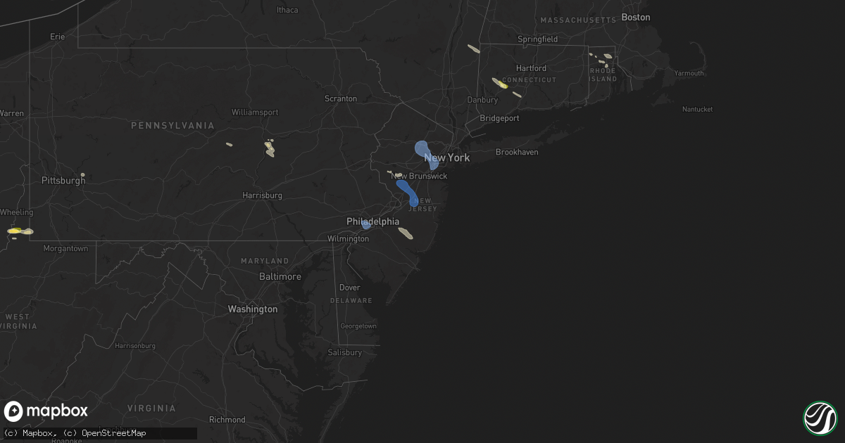
Hail Map in New Jersey on July 25, 2025
Get this storm
July 25 map
$229
one time, instant access
Download today. No call, no setup
Keep the $229
Bought the map and want the full workflow? Apply the entire $229 to a subscription within 7 days. None of it is wasted.
Every map, not just this one
This buys you this map. Subscription and you get every map we run, in the markets you choose from a few cities to whole states to nationwide. Plus real-time alerts the moment a storm fires.
Contact data
Name, contact info, occupancy, even credit band for addresses in the footprint. You go from where it hit to who to call.
Become the source they trust
Unlimited branding weather history reports on demand. You already have the documented answer ready for the property owner, and you are the one who showed up with it.
Property data and RoofTrace estimates
Pull up any address you have got, its value and the exact code rules for that jurisdiction, straight from One Click Code. Then RoofTrace estimates the squares, pitch, and roof value, priced the way you price.
Storm reports in New Jersey
New Jersey
| Date | Description |
|---|---|
| 07/25/20256:07 PM CDT | Damage to powerlines at radio rd and playhouse rd. Time estimated by radar. |
| 07/25/20256:05 PM CDT | Powerlines damaged on cr 539. Time estimated by radar. |
| 07/25/20255:28 PM CDT | Wires down along route 206 in shamong. Time estimated from radar. |
| 07/25/20255:28 PM CDT | Wires |
| 07/25/20255:20 PM CDT | Seaside park nj wxnet. |
| 07/25/20255:04 PM CDT | Wires down in springfield. Time estimated from radar. |
| 07/25/20255:04 PM CDT | Wires down in springfield. Tim |
| 07/25/20255:00 PM CDT | Downed tree on nj 70 near cr 539/whiting new egypt rd; all lanes closed. Time estimated by radar. |
| 07/25/20254:43 PM CDT | Trees and wires down. Time estimated from radar. |
| 07/25/20254:40 PM CDT | Trees and wires down. Time estimated from radar. |
| 07/25/20254:35 PM CDT | Trees and wires down. Time estimated from radar. |
| 07/25/20254:09 PM CDT | Several trees down around delaware township. Time estimated from radar. |
| 07/25/20254:08 PM CDT | Trees down on wires on upper creek road. Time estimated from radar. |
| 07/25/20254:06 PM CDT | Trees and wires down around montgomery township. Time estimated from radar. |
| 07/25/20254:03 PM CDT | Trees and wires down around hillsborough township. Time estimated from radar. |
| 07/25/20253:52 PM CDT | Tree down blocking the roadway in frenchtown. Time estimated from radar. |
| 07/25/20253:37 PM CDT | Trees and wires down with debris in the road way on alfalfa hill road. Time estimated from radar. |
| 07/25/20252:54 PM CDT | 63 mph gust at newark international airport. |
| 07/25/20252:50 PM CDT | Tree down on car on galloping hill road at east clay avenue. The car was not occupied. |
| 07/25/20252:49 PM CDT | Trees and wires down in watchung. Time estimated from radar. |
| 07/25/20252:47 PM CDT | 65 mph wind gust measured by a davis weather station at 10 meters. |
| 07/25/20252:45 PM CDT | Tree uprooted on crawford terrace. |
| 07/25/20252:45 PM CDT | Large tree branches down on maple street near west hudson park. |
| 07/25/20252:43 PM CDT | Live wires down on car on chestnut ave with people trapped inside. |
| 07/25/20252:40 PM CDT | Tree down on house on mount vernon road. |
| 07/25/20252:40 PM CDT | Tree down on wires on west northfield road. |
| 07/25/20252:35 PM CDT | Live wires down on northfield avenue. |
| 07/25/20252:35 PM CDT | 911 call center reporting trees down on both eisenhower parkway and livingston parkway near interstate 280. |
| 07/25/20252:26 PM CDT | Video showing a large tree falling in the backyard of a home. |
| 07/25/20252:21 PM CDT | Wires down along ball road and hawkins road in morris county. Time estimated from radar. |
| 07/25/20252:17 PM CDT | Trees and wires down around parsippany. Time estimated from radar. |
| 07/25/20252:15 PM CDT | Njtansit reported overhead wire issues due to a downed tree on the morris and essex line between the morristown and dover stations. Time estimated by radar. |
| 07/25/20252:13 PM CDT | Trees and wires down. Time estimated from radar. |
| 07/25/20252:09 PM CDT | Trees and wires down along cedar lake road. Time estimated from radar. |
| 07/25/20252:01 PM CDT | Trees and wires down. Time estimated from radar. |
| 07/25/20251:44 PM CDT | Trees down on wires blocking roadway along ridgeway avenue. Time estimated from radar. |
| 07/25/20251:36 PM CDT | Trees and wires down in blairstown twp. Time estimated from radar. |
All States Impacted by Hail Map on July 25, 2025
Cities Impacted by Hail Map on July 25, 2025
- South Lee, MA
- Stockbridge, MA
- Great Barrington, MA
- Monterey, MA
- Tyringham, MA
- Lee, MA
- Otis, MA
- Moundsville, WV
- Powhatan Point, OH
- Proctor, WV
- Clarington, OH
- Woodbury, CT
- Middlebury, CT
- Watertown, CT
- Waterbury, CT
- Glen Easton, WV
- Bethlehem, CT
- Washington, CT
- Wind Ridge, PA
- Aleppo, PA
- Cameron, WV
- Pine Plains, NY
- Coburn, PA
- Aaronsburg, PA
- Woodward, PA
- Ancramdale, NY
- Millerton, NY
- Ancram, NY
- Millmont, PA
- Milroy, PA
- Cheshire, CT
- Hamden, CT
- Prospect, CT
- Chepachet, RI
- Wallingford, CT
- North Haven, CT
- Lincoln, RI
- Cumberland, RI
- Providence, RI
- Smithfield, RI
- Bethany, CT
- Dornsife, PA
- Parsippany, NJ
- Mountain Lakes, NJ
- Mount Tabor, NJ
- Morristown, NJ
- Cedar Knolls, NJ
- Whippany, NJ
- Montville, NJ
- Lake Hiawatha, NJ
- Boonton, NJ
- Morris Plains, NJ
- Denville, NJ
- Florham Park, NJ
- Madison, NJ
- East Hanover, NJ
- Chatham, NJ
- Green Village, NJ
- Summit, NJ
- Short Hills, NJ
- Livingston, NJ
- Pine Brook, NJ
- Fairfield, NJ
- Roseland, NJ
- West Orange, NJ
- Essex Fells, NJ
- Caldwell, NJ
- Delaplane, VA
- Markham, VA
- Millburn, NJ
- Springfield, NJ
- Newark, NJ
- Union, NJ
- Vauxhall, NJ
- Maplewood, NJ
- South Orange, NJ
- Irvington, NJ
- Kenilworth, NJ
- Roselle Park, NJ
- Elizabeth, NJ
- Roselle, NJ
- Hillside, NJ
- Cranford, NJ
- Linden, NJ
- Carteret, NJ
- Rahway, NJ
- Avenel, NJ
- Port Reading, NJ
- Murrysville, PA
- Pittsburgh, PA
- New Kensington, PA
- Hagerstown, IN
- Cambridge City, IN
- North Scituate, RI
- Johnston, RI
- Cranston, RI
- Jackson Center, OH
- Huntsville, OH
- Lakeview, OH
- Sewaren, NJ
- Russells Point, OH
- Apollo, PA
- Elizabethport, NJ
- Staten Island, NY
- Bayonne, NJ
- Arcanum, OH
- Bell, FL
- Bradford, OH
- Versailles, OH
- Houston, OH
- Covington, OH
- Russia, OH
- Rixeyville, VA
- Amissville, VA
- Celina, OH
- Sidney, OH
- Piqua, OH
- Dryden, TX
- Cohagen, MT
- Osawatomie, KS
- Paola, KS
- Saint Marys, OH
- Angela, MT
- Fort Stockton, TX
- Madison, KS
- Logansport, IN
- Richwood, OH
- Marysville, OH
- Flemington, NJ
- Skillman, NJ
- Belle Mead, NJ
- Rocky Hill, NJ
- Hopewell, NJ
- Princeton, NJ
- Plainsboro, NJ
- Pennington, NJ
- Monmouth Junction, NJ
- Kingston, NJ
- Princeton Junction, NJ
- Hillsborough, NJ
- Cranbury, NJ
- Brockway, MT
- Neshanic Station, NJ
- Waverly, KS
- Williamsburg, KS
- Allentown, NJ
- Robbinsville, NJ
- Hightstown, NJ
- Cream Ridge, NJ
- Windsor, NJ
- Millstone Township, NJ
- Monroe Township, NJ
- Roosevelt, NJ
- Culbertson, MT
- Blairsden Graeagle, CA
- Kinsey, MT
- Louisburg, KS
- Peru, IN
- Wabash, IN
- Clio, CA
- Lansdowne, PA
- Holmes, PA
- Norwood, PA
- Springfield, PA
- Folcroft, PA
- Drexel Hill, PA
- Glenolden, PA
- Essington, PA
- Sharon Hill, PA
- Darby, PA
- Philadelphia, PA
- Clifton Heights, PA
- Prospect Park, PA
- Folsom, PA
- Ridley Park, PA
- Morton, PA
- Broxton, GA
- Vincentown, NJ
- Terry, MT
- Dagmar, MT
- Termo, CA
- Canyon Dam, CA
- Twain, CA
- Chatsworth, NJ
- Raton, NM
- Heath, OH
- Madeline, CA
- Cedarville, CA
- Bainville, MT
- Greenville, CA
- Jal, NM
- Cimarron, NM
- Williston, ND
- Waukomis, OK
- Enid, OK
- Alturas, CA
- Belden, CA
- Susanville, CA
- Eureka, KS
- Ozona, TX
- Fairview, MT
- Fallon, MT
- Carnelian Bay, CA
- Truckee, CA
- Canon City, CO
- Sunbury, PA
- Shamokin Dam, PA
- Selinsgrove, PA
- Northumberland, PA
- Medford, OK
- Rebuck, PA
- Brooksville, FL
- Paxinos, PA
- Ismay, MT
- Platina, CA
- Shamokin, PA
- Trevorton, PA
- Vernon, TX
- Epping, ND
- Lookout, CA
- Douglas City, CA
- Fall River Mills, CA
- Trenton, ND
- Matador, TX
- Flomot, TX
- Grenville, NM
- Livermore, CO
- Plevna, MT
- Baker, MT
- Ray, ND
- White Earth, ND
- Tioga, ND
- Caldwell, KS
- Sedalia, CO
- Elizabeth, CO
- Mayfield, KS
- Kiowa, CO
- Mulvane, KS
- Belle Plaine, KS
- Milan, KS
- Wellington, KS
- Winfield, PA
- Stanley, ND
- New Town, ND
- Ross, ND
- Watford City, ND
- Marmarth, ND
- Hat Creek, CA
- Cassel, CA
- Teague, TX
- Argonia, KS
- Trinity Center, CA
- Lewiston, CA
- Conway Springs, KS
- Bennett, CO
- Clearwater, KS
- Rhame, ND
- Palermo, ND
- Keene, ND
- Parshall, ND
- Wichita, KS
- Goddard, KS
- El Dorado, KS
- Burns, KS
- Strasburg, CO
- Potwin, KS
- Maize, KS
- McIntire, IA
- Stacyville, IA
- Bowman, ND
- Berthold, ND
- Plaza, ND
- Carpio, ND
- Donnybrook, ND
- Valley Center, KS
- Groesbeck, TX
- Colwich, KS
- Towanda, KS
- Streetman, TX
- Farmersville, IL
- Cassoday, KS
- Powers Lake, ND
- Economy, IN
- Greens Fork, IN
- Virden, IL
- Glenarm, IL
- Springfield, IL
- Medora, ND
- Riverton, IL
- Lansford, ND
- Dickinson, ND
- Lefor, ND
- New England, ND
- Regent, ND
- Taylor, ND
- Gladstone, ND
- Richardton, ND
- Mott, ND
- Hebron, ND
- Glen Ullin, ND
- New Leipzig, ND
- Elgin, ND
- Mason City, IL
- Middletown, IL
- Greenview, IL
- Souris, ND
- Pleasant Plains, IL
- Dawson, IL
- Girard, IL
- Sherman, IL
- Williamsville, IL
- Alexander, IL
- New Berlin, IL
- New Salem, ND
- Carson, ND
- Almont, ND
- Granville, ND
- Buffalo, IL
- Towner, ND
- Washburn, ND
- Lincoln, IL
- Elkhart, IL
- New Holland, IL
- Mercer, ND
- Underwood, ND
- Balfour, ND
- Hazen, ND
- Beulah, ND
- Stanton, ND
- Center, ND
- Flasher, ND
- Mcclusky, ND
- Weatherford, OK
- Rugby, ND
- Mount Sterling, IL
- Wapella, IL
- Lawndale, IL
- Atlanta, IL
- Goodrich, ND
- McLean, IL
- Willow City, ND
- Shirley, IL
- Bismarck, ND
- Mandan, ND
- Rolette, ND
- Bloomington, IL
- Downs, IL
- Towanda, IL
- Lexington, IL
- Delavan, IL
- Ellsworth, IL
- Emden, IL
- Minier, IL
- Heyworth, IL
- Beason, IL
- Hartsburg, IL
- Danvers, IL
- Hudson, IL
- Kenney, IL
- Mount Pulaski, IL
- Clinton, IL
- Normal, IL
- Stanford, IL
- Armington, IL
- Le Roy, IL
- Cooksville, IL
- Chestnut, IL
- Waynesville, IL
- Arrowsmith, IL
- Colfax, IL
- Baldwin, ND
- Mylo, ND
- Wolford, ND
- Hurdsfield, ND
- Denhoff, ND
- Anchor, IL
- Cropsey, IL
- Knox, ND
- Wing, ND
- Sibley, IL
- Bisbee, ND
- Perth, ND
- Max, ND
- Chaseley, ND
- Harvey, ND
- Rocklake, ND
- Minot, ND
- Sawyer, ND
- Benedict, ND
- Bowdon, ND
- Norwich, ND
- Pettibone, ND
- Munich, ND
- Robinson, ND
- Chandlerville, IL
- Fessenden, ND
- Langdon, ND
- Woodworth, ND
- Sykeston, ND
- Velva, ND
- Starkweather, ND
- York, ND
- Cathay, ND
- Egeland, ND
- New Rockford, ND
- Karlsruhe, ND
- Carrington, ND
- Pingree, ND
- Alexandria, MO
- Canton, MO
- Warsaw, IL
- Drake, ND
- Mchenry, ND
- Glenfield, ND
- Kensal, ND
- Jamestown, ND
- Buchanan, ND
- Athens, IL
- Montpelier, ND
- Binford, ND
- Butte, ND
- Anamoose, ND
- Park River, ND
- Courtenay, ND
- Pekin, ND
- Mcville, ND
- Yarmouth, IA
- Ypsilanti, ND
- Arbela, MO
- Princeton, MO
- Wimbledon, ND
- Cooperstown, ND
- Luray, MO
- Wyaconda, MO
- Spiritwood, ND
- Rogers, ND
- Dazey, ND
- Grace City, ND
- Sutton, ND
- Hannaford, ND
- Luverne, ND
- Marion, ND
- Sanborn, ND
- Litchville, ND
- Valley City, ND
- Hope, ND
- Page, ND
- Buffalo, ND
- Tower City, ND
- Oriska, ND
- Fingal, ND
- Kathryn, ND
- Ayr, ND
- Absaraka, ND
- Amenia, ND
- Wheatland, ND
- Enderlin, ND
- Mapleton, ND
- Arthur, ND
- Davenport, ND
- Casselton, ND
- Leonard, ND
- Horace, ND
- Fargo, ND
- West Fargo, ND
- Thornville, OH
- Barnesville, MN
- Hawley, MN
- Pelican Rapids, MN
- Burlington, ND


