Hail Map in Nevada on July 20, 2013
Get this storm
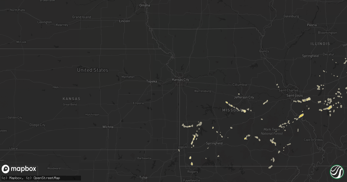
July 20 map
$229
one time, instant access
Download today. No call, no setup
Keep the $229
Bought the map and want the full workflow? Apply the entire $229 to a subscription within 7 days. None of it is wasted.
Every map, not just this one
This buys you this map. Subscription and you get every map we run, in the markets you choose from a few cities to whole states to nationwide. Plus real-time alerts the moment a storm fires.
Contact data
Name, contact info, occupancy, even credit band for addresses in the footprint. You go from where it hit to who to call.
Become the source they trust
Unlimited branding weather history reports on demand. You already have the documented answer ready for the property owner, and you are the one who showed up with it.
Property data and RoofTrace estimates
Pull up any address you have got, its value and the exact code rules for that jurisdiction, straight from One Click Code. Then RoofTrace estimates the squares, pitch, and roof value, priced the way you price.
Storm reports in Nevada
Nevada
| Date | Description |
|---|---|
| 07/20/201312:30 AM CDT | About 6300 nv energy customers lost power in the las vegas valley due to thunderstorm winds...this counts from 900 from friday nights thunderstorm. |
| 07/20/201312:13 AM CDT | A local report indicates 1.00 inch wind near 3 E SUMMERLIN |
| 07/19/201311:37 PM CDT | A local report indicates 69 MPH wind near 3 SE HENDERSON |
| 07/19/201311:34 PM CDT | A 62 mph gust from the northwest was measured at red rock canyon raws. |
| 07/19/201311:30 PM CDT | Thunderstorm winds tore a hanging street sign down from a traffic light at rampart and alta. |
| 07/19/201311:30 PM CDT | A local report indicates 1.75 inch wind near 2 SE HENDERSON |
| 07/19/201311:29 PM CDT | Two trees down at the intersection of college drive and boulder highway |
| 07/19/201311:25 PM CDT | A local report indicates 70 MPH wind near 2 ESE HENDERSON |
| 07/19/201311:24 PM CDT | A 64 mph wind gust was measured at the yucca gap mesonet site. |
| 07/19/201311:00 PM CDT | Palm tree down near ft apache and farm rd. Report via twitter. |
| 07/19/201311:00 PM CDT | A patio cover was blown off a home near west lake mead boulevard and jones. The event time is an estimate. |
| 07/19/201310:49 PM CDT | A local report indicates 59 MPH wind near 4 NW LAS VEGAS |
| 07/19/201310:45 PM CDT | Picnic table thrown over car. |
| 07/19/201310:40 PM CDT | The salvation army in pahrump had siding torn off the building near the roof of the building. |
| 07/19/201310:40 PM CDT | Thunderstorm winds knocked down a power line onto a palm tree at the best western in pahrump. This resulted in the tree catching on fire. |
| 07/19/201310:40 PM CDT | Public report through facebook of several power lines donwed by thunderstorm winds. The event time is an estimate. |
| 07/19/201310:36 PM CDT | A local report indicates 86 MPH wind near 4 SW PAHRUMP |
| 07/19/20139:15 PM CDT | A local report indicates 71 MPH wind near AREA 27 (NTS A27) |
| 07/19/20139:15 PM CDT | A local report indicates 71 MPH wind near SE AREA 27 (NTS A27) |
| 07/19/20138:01 PM CDT | At nws reno office |
| 07/19/20137:25 PM CDT | At nws reno office |
| 07/19/20137:21 PM CDT | At the reno airport |
| 07/19/20137:20 PM CDT | At nws reno office |
All States Impacted by Hail Map on July 20, 2013
Cities Impacted by Hail Map on July 20, 2013
- Keenesburg, CO
- Mullen, NE
- Henderson, NV
- Las Vegas, NV
- Calico Rock, AR
- Pineville, AR
- Rapid City, SD
- Circle, MT
- Vida, MT
- Bolivar, MO
- Clarksburg, MD
- Germantown, MD
- Boyds, MD
- Chino Valley, AZ
- Merriman, NE
- Whitman, NE
- Valentine, NE
- Agate, CO
- Garnett, KS
- Briggsdale, CO
- Grover, CO
- Fort Morgan, CO
- Weldona, CO
- Roggen, CO
- Wiggins, CO
- Union Center, SD
- Rio Verde, AZ
- Bennett, CO
- Harrison, NE
- Strasburg, CO
- Fort Pierre, SD
- Draper, SD
- Belle Fourche, SD
- Black Hawk, SD
- Harriet, AR
- Marshall, AR
- Stockton, MO
- Buffalo Gap, SD
- Robinson, IL
- Hutsonville, IL
- Palestine, IL
- Prairie City, SD
- Reva, SD
- Bison, SD
- Kiowa, CO
- Elizabeth, CO
- Brighton, CO
- Denver, CO
- Broomfield, CO
- Mechanicsburg, OH
- South Vienna, OH
- London, OH
- El Dorado Springs, MO
- Hay Springs, NE
- Byers, CO
- Elbert, CO
- Bartlett, KS
- Keystone, SD
- Buffalo, SD
- Wideman, AR
- Oxford, AR
- New Lebanon, OH
- West Alexandria, OH
- Farmersville, OH
- Sutherlin, VA
- Tampa, FL
- Wesley Chapel, FL
- Cabool, MO
- Bucyrus, MO
- Vincentown, NJ
- Modoc, IL
- Ellis Grove, IL
- Sainte Genevieve, MO
- Evansville, IL
- Wickenburg, AZ
- Louisville, IL
- Xenia, IL
- East Bridgewater, MA
- Hanson, MA
- Whitman, MA
- Rockland, MA
- Wasta, SD
- New Underwood, SD
- Enning, SD
- Peerless, MT
- Bloomfield, MT
- Glendive, MT
- Ismay, MT
- Lindsay, MT
- Richey, MT
- Wolf Point, MT
- Fallon, MT
- Neodesha, KS
- Sims, IL
- Ridgeville, IN
- Union City, IN
- Portland, IN
- Blue Mound, KS
- Porcupine, SD
- Stephan, SD
- Highmore, SD
- Gaithersburg, MD
- Montgomery Village, MD
- Barnesville, MD
- Kingman, AZ
- Chestertown, MD
- Pratt, KS
- Gordon, NE
- Lawrence, NE
- Guide Rock, NE
- Deer Trail, CO
- Dugger, IN
- Carlisle, IN
- Linton, IN
- Jasonville, IN
- Washburn, MO
- Powell, MO
- Seligman, MO
- Pineville, MO
- Beallsville, MD
- Dickerson, MD
- Dalton City, IL
- Baker, CA
- Union, IL
- Gilberts, IL
- Hampshire, IL
- Huntley, IL
- Marengo, IL
- Hudson, CO
- Ironton, MO
- Bismarck, MO
- Mammoth Spring, AR
- Hardy, AR
- Middletown, DE
- Chesapeake City, MD
- Eldon, MO
- Laramie, WY
- Bosler, WY
- Newell, SD
- White Owl, SD
- Howes, SD
- Wall, SD
- Congress, AZ
- Faber, VA
- Shipman, VA
- Schuyler, VA
- Parker, KS
- Shumway, IL
- Ravenden, AR
- Williford, AR
- Ravenden Springs, AR
- Lockwood, MO
- Golden City, MO
- Hernandez, NM
- Abiquiu, NM
- Quapaw, OK
- Miami, OK
- Lebanon, MO
- Billings, MO
- Sylvan Grove, KS
- Lincoln, KS
- Littlefield, AZ
- Huggins, MO
- Mount Vernon, IL
- Waltonville, IL
- Opdyke, IL
- Du Bois, IL
- Tamaroa, IL
- Pinckneyville, IL
- Belle Rive, IL
- Smith Center, KS
- Whitney, NE
- Wood, SD
- Avon, IN
- Indianapolis, IN
- Plainfield, IN
- Fairbanks, IN
- Merom, IN
- Sullivan, IN
- Worton, MD
- Aurora, CO
- Egg Harbor City, NJ
- Union City, OH
- Ansonia, OH
- Rossburg, OH
- Custer, SD
- Kilgore, NE
- Calhan, CO
- Milo, MO
- Sheldon, MO
- Freeburg, IL
- Belleville, IL
- Silva, MO
- Patterson, MO
- Greenville, MO
- Welch, OK
- Hiawatha, KS
- Pukwana, SD
- Chamberlain, SD
- Quenemo, KS
- Batesland, SD
- Sullivan, IL
- Nellysford, VA
- Harrold, SD
- Pocahontas, AR
- Warm Springs, AR
- Oral, SD
- Fairburn, SD
- Martin, SD
- Grandin, MO
- Ellsinore, MO
- Moundville, MO
- Vandalia, IL
- Onida, SD
- Pomona, KS
- Waxahachie, TX
- Brigantine, NJ
- Lower Brule, SD
- Mulberry Grove, IL
- Cheyenne, WY
- Danville, PA
- Bloomsburg, PA
- Steelville, MO
- Shelburn, IN
- Centerville, KS
- Rushville, NE
- Watkins, CO
- Frazer, MT
- Toronto, KS
- Lewis, IN
- Clay City, IN
- Elk City, KS
- Hawk Springs, WY
- Radnor, OH
- Richwood, OH
- Saint Onge, SD
- Spearfish, SD
- Wellington, KS
- North Las Vegas, NV
- Midland, OH
- Baltimore, MD
- Dundas, IL
- Hill City, SD
- Gothenburg, NE
- Algonquin, IL
- Lake In The Hills, IL
- Crystal Lake, IL
- Vinita, OK
- Meta, MO
- Iberia, MO
- Dixon, MO
- Saint Elizabeth, MO
- San Manuel, AZ
- La Rue, OH
- Oxford, KS
- Agar, SD
- Marshall, IL
- Rosamond, IL
- Pana, IL
- Ramah, CO
- Belvidere, SD
- Rocky Comfort, MO
- Tucson, AZ
- Presho, SD
- Box Elder, SD
- Hartshorn, MO
- Reeds, MO
- Carthage, MO
- Avilla, MO
- Lebanon, KS
- Middle Brook, MO
- Douglas, WY
- Park Hills, MO
- Tuscumbia, MO
- Esmont, VA
- Charlottesville, VA
- Wilmington, OH
- Melbourne, AR
- Millstadt, IL
- Smithton, IL
- Cody, NE
- Prescott, AZ
- Rutherfordton, NC
- Stoy, IL
- Oblong, IL
- Willow Hill, IL
- Sumner, IL
- Claremont, IL
- Flat Rock, IL
- Geuda Springs, KS
- Oacoma, SD
- Houston, MO
- Licking, MO
- Ellington, MO
- Greenville, OH
- Bloomsdale, MO
- Bassett, NE
- Long Pine, NE
- Lusk, WY
- Manville, WY
- Parker, CO
- La Place, LA
- Bartlesville, OK
- Pawhuska, OK
- South Elgin, IL
- Elgin, IL
- Saint Charles, IL
- Peyton, CO
- Kirkland, AZ
- Red Bud, IL
- Larslan, MT
- Nashua, MT
- Martinsville, IN
- Springview, NE
- Mound City, KS
- Nemo, SD
- Gettysburg, SD
- Eagle Butte, SD
- Hereford, CO
- Alma, KS
- Arcola, MO
- Drake, CO
- Glen Haven, CO
- Virgil, KS
- Olney, IL
- Ashley, IL
- Bonnie, IL
- Scheller, IL
- Keyesport, IL
- Smithboro, IL
- Greenville, IL
- Success, MO
- Barnett, MO
- Versailles, MO
- Brinktown, MO
- Rosebud, MO
- Owensville, MO
- North East, MD
- Brady, NE
- Paxton, NE
- Arthur, NE
- Polk, MO
- Kennebec, SD
- Wentzville, MO
- Moscow Mills, MO
- Osborne, KS
- Concord, VA
- Appomattox, VA
- West Liberty, IL
- Sainte Marie, IL
- Newton, IL
- Liberty, IN
- Atkinson, NE
- Stuart, NE
- Black, MO
- Mount Victory, OH
- Blue Hill, NE
- Superior, NE
- Nelson, NE
- Columbus, NC
- Wingina, VA
- Lovingston, VA
- Globe, AZ
- Brooksville, FL
- Bluford, IL
- Pine Ridge, SD
- Forsyth, MO
- Cook Sta, MO
- Stapleton, NE
- Lake Lure, NC
- Ellicott City, MD
- Catonsville, MD
- New Baden, IL
- Mascoutah, IL
- Blunt, SD
- Tuckerton, NJ
- Hammonton, NJ
- Woodlawn, IL
- Gerald, MO
- Marion, NC
- North Garden, VA
- Fort Scott, KS
- Cedar Vale, KS
- Raritan, NJ
- Bridgewater, NJ
- Cowden, IL
- Buffalo, KS
- Yates Center, KS
- Crown King, AZ
- Hoyleton, IL
- Garrett, WY
- Mill Spring, MO
- Marietta, GA
- Morgantown, IN
- Edna, KS
- Walnut Hill, IL
- Centralia, IL
- Crawford, NE
- Noble, IL
- Lucas, KS
- Mud Butte, SD
- Ainsworth, NE
- Swoope, VA
- Sarcoxie, MO
- La Russell, MO
- Nashville, IL
- Homer, IL
- Coal City, IN
- Collins, MO
- Beloit, KS
- Wayne, IL
- Aguila, AZ
- Long Valley, SD
- Florissant, CO
- Saint Paul, KS
- Erie, KS
- Elkland, MO
- Saint Francis, SD
- Crookston, NE
- Scottsdale, AZ
- Fredonia, KS
- Orchard, CO
- Elburn, IL
- Aurora, MO
- Stella, MO
- Centertown, MO
- Jefferson City, MO
- Hartsburg, MO
- Freedom, IN
- Caldwell, KS
- Camden, OH
- Somerville, OH
- Doniphan, MO
- Belleview, MO
- Caledonia, MO
- Eskridge, KS
- Paxico, KS
- Manhattan, KS
- Pomfret Center, CT
- Keenes, IL
- Wayne City, IL
- Dahlgren, IL
- Atlantic City, NJ
- Merino, CO
- Indian Springs, NV
- Staten Island, NY
- Peru, KS
- Warsaw, VA
- La Cygne, KS
- Vivian, SD
- Dobson, NC
- Boonville, NC
- Jonesville, NC
- Pueblo, CO
- Pea Ridge, AR
- Bella Vista, AR
- Bentonville, AR
- Colorado Springs, CO
- Lyman, NE
- Searchlight, NV
- Coffeyville, KS
- Harmony, NC
- Statesville, NC
- Beecher City, IL
- Toledo, IL
- Gosport, IN
- Ellettsville, IN
- Flora, IL
- Marshfield, MO
- Guilford, CT
- Durham, CT
- Northford, CT
- Jackson, TN
- Keene, VA
- Scottsville, VA
- Covesville, VA
- Trenton, IL
- Doe Run, MO
- Galena, KS
- Seneca, MO
- Midland, SD
- Overton, NV
- Earleville, MD
- Brookeville, MD
- Derwood, MD
- Rinard, IL
- Spencer, IN
- Worthington, IN
- Sparta, IL
- Marissa, IL
- Charleston, IL
- Ash Fork, AZ
- Osteen, FL
- Oak Hill, FL
- Dundee, IL
- Hoffman Estates, IL
- Ina, IL
- Columbia, IL
- Woodstock, IL
- Iuka, IL
- Bonne Terre, MO
- Farmington, MO
- Lagrange, WY
- Allen, KS
- Edgemont, AR
- Wimauma, FL
- Parrish, FL
- Germantown, IL
- Killingworth, CT
- Covington, IN
- Bloomington, IN
- Tecopa, CA
- New Haven, MO
- Williamsville, MO
- Unionville, IN
- New Vienna, OH
- Leesburg, OH
- Sabina, OH
- San Ygnacio, TX
- Troy, MO
- Castalian Springs, TN
- Bushnell, FL
- Rocky Mount, MO
- Longton, KS
- Urbana, OH
- Arcadia, MO
- Arcola, IL
- Sedan, KS
- Chautauqua, KS
- Montello, WI
- Nokomis, IL
- Humboldt, IL
- Vienna, MO
- Bronaugh, MO
- Barnard, KS
- Ordway, CO
- Olney Springs, CO
- Greenfield, MO
- Sloan, NV
- Lenzburg, IL
- Hamill, SD
- Ringgold, VA
- Minneapolis, KS
- Mayer, AZ
- Saint Joe, AR
- Irondale, MO
- Landrum, SC
- Ashmore, IL
- Oakland, IL
- Buffalo, MO
- Half Way, MO
- Chatsworth, NJ
- Whittington, IL
- Benton, IL
- Gatewood, MO
- Couch, MO
- Spring, TX
- Allen, SD
- Springfield, OH
- Terre Haute, IN
- Barnhill, IL
- Fairfield, IL
- Walkersville, WV
- Horner, WV
- West Terre Haute, IN
- Dennison, IL
- Clay Center, KS
- Sahuarita, AZ
- Chetopa, KS
- Cloverdale, IN
- Quincy, IN
- Farmersburg, IN
- Pimento, IN
- Morganton, NC
- Ridgeway, OH
- West Mansfield, OH
- Niangua, MO
- Afton, VA
- Blanchester, OH
- Reliance, SD
- Dix, IL
- Texico, IL
- Kell, IL
- Middletown, OH
- Germantown, OH
- Albin, WY
- West Salem, IL
- Brooklyn, CT
- Lamar, MO
- Eminence, MO
- Ingraham, IL
- Mount Erie, IL
- Oconee, IL
- Altoona, KS
- Alton, MO
- Mapleton, KS
- Patton, MO
- Perryville, MO
- Salem, MO
- Raymondville, MO
- Belle Center, OH
- Rushsylvania, OH
- Kyle, SD
- Guffey, CO
- Havana, KS
- Mims, FL
- Ellsworth Afb, SD
- Carpenter, WY


