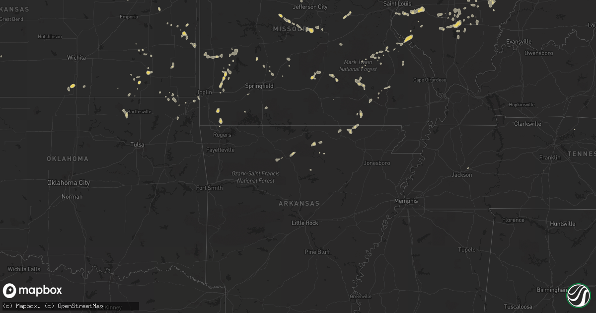
Hail Map on July 20, 2013
Get this storm
July 20 map
$229
one time, instant access
Download today. No call, no setup
Keep the $229
Bought the map and want the full workflow? Apply the entire $229 to a subscription within 7 days. None of it is wasted.
Every map, not just this one
This buys you this map. Subscription and you get every map we run, in the markets you choose from a few cities to whole states to nationwide. Plus real-time alerts the moment a storm fires.
Contact data
Name, contact info, occupancy, even credit band for addresses in the footprint. You go from where it hit to who to call.
Become the source they trust
Unlimited branding weather history reports on demand. You already have the documented answer ready for the property owner, and you are the one who showed up with it.
Property data and RoofTrace estimates
Pull up any address you have got, its value and the exact code rules for that jurisdiction, straight from One Click Code. Then RoofTrace estimates the squares, pitch, and roof value, priced the way you price.
States Impacted by Hail Map on July 20, 2013
Storm reports
Maine
| Date | Description |
|---|---|
| 07/20/20134:50 PM CDT | Several trees and power lines down. |
| 07/20/20134:45 PM CDT | A tree down in searsport on field road |
| 07/20/20134:45 PM CDT | Trees down |
| 07/20/20134:25 PM CDT | Waldo county sheriff reported trees down across the county |
| 07/20/20134:15 PM CDT | Trees down |
| 07/20/20134:10 PM CDT | Trees down |
| 07/20/20133:50 PM CDT | Trees down |
| 07/20/20133:50 PM CDT | Trees down |
| 07/20/20133:45 PM CDT | Multiple power poles down and dumpster slid across parking lot. |
| 07/20/20133:45 PM CDT | A local report indicates 60 MPH wind near 5 ESE MEDDYBEMPS |
| 07/20/20133:45 PM CDT | A local report indicates 60 MPH wind near PEMBROKE |
| 07/20/20133:40 PM CDT | Trees and wires down |
Ohio
| Date | Description |
|---|---|
| 07/20/20133:31 PM CDT | A local report indicates 60 MPH wind near NEWTOWN |
| 07/20/20133:13 PM CDT | 1 tree down |
| 07/20/20133:00 PM CDT | 1 tree down |
| 07/20/20132:57 PM CDT | Trees down between samantha and leesburg near the u.s. Highway 62. Time estimated from radar. |
| 07/20/20132:55 PM CDT | Trees down in highland. |
| 07/20/20132:36 PM CDT | One large branch down near the intersection of ohio sr 350 and highway u.s. 68. |
| 07/20/201311:31 AM CDT | 1 tree down |
| 07/20/201311:00 AM CDT | 1 tree down on snyder domer rd. |
| 07/20/201310:48 AM CDT | 1 tree down. |
| 07/20/201310:39 AM CDT | Several trees/branches down within city limits. |
| 07/20/201310:33 AM CDT | Several trees/branches down within city limits. |
| 07/20/20139:09 AM CDT | A local report indicates 65 MPH wind near RUSHSYLVANIA |
New Jersey
| Date | Description |
|---|---|
| 07/19/20138:05 PM CDT | Several trees down |
| 07/19/20138:05 PM CDT | Tree and wires down |
| 07/19/20138:05 PM CDT | Wires down on hessian ave |
| 07/19/20138:05 PM CDT | Tree down. |
Wyoming
| Date | Description |
|---|---|
| 07/20/20134:50 PM CDT | Penny to quarter size hail. |
| 07/20/20134:45 PM CDT | Penny to quarter size hail. |
| 07/20/20134:12 PM CDT | A local report indicates 1.00 inch wind near 7 NE CHEYENNE |
Virginia
| Date | Description |
|---|---|
| 07/20/20136:06 PM CDT | Three telephone poles down along hillcrest circle |
| 07/20/20135:06 PM CDT | One tree down in a field along stonewall road |
| 07/20/20135:06 PM CDT | One tree down at the intersection of route 608 and route 613 that brought down a light pole |
| 07/20/20134:01 PM CDT | One tree down along cape lane |
| 07/20/20133:50 PM CDT | Several trees down on rockfish river road blocking traffic. Numerous trees were also reported down on route 6. |
| 07/20/20133:45 PM CDT | One tree limb down along cliff street...picture submitted on twitter by the spotter |
| 07/20/20133:45 PM CDT | Tree down near the intersection of irish road and church lane. Crews have removed it from the road. |
| 07/20/20133:12 PM CDT | Two trees down on state hwy 20 near walton middle school |
| 07/20/201312:56 PM CDT | 18 inch diameter tree down blocking intersection of cross creek lane and blackberry road. |
Connecticut
| Date | Description |
|---|---|
| 07/20/20133:44 PM CDT | Trees and wires reported down on river road. |
| 07/20/20133:44 PM CDT | Trees and wires reported down on route 9 at exit 5. |
| 07/20/20133:40 PM CDT | Trees and wires reported down on route 9 between exits 6 and 7. |
| 07/20/20133:40 PM CDT | Trees and wires reported down on route 148. |
| 07/20/20133:32 PM CDT | Trees and wires were reported down on schnoor road. |
| 07/20/20133:30 PM CDT | Trees and wires reported down on route 81. |
| 07/20/20132:40 PM CDT | Trees and wires down on mashentuck road |
| 07/20/20132:30 PM CDT | Wires down on south street |
| 07/20/20132:24 PM CDT | Trees and wires down on putnum pike and also lake road |
| 07/20/20131:55 PM CDT | Trees and wires down on mashamoquet rd and hampton rd |
| 07/20/20131:37 PM CDT | Tree down on wires |
| 07/20/20131:22 PM CDT | Tree down on wires |
| 07/20/20131:20 PM CDT | Power lines down and burning. |
Florida
| Date | Description |
|---|---|
| 07/20/20134:00 PM CDT | A powerline was reported down in flagler beach area near south 28th street. |
Kansas
| Date | Description |
|---|---|
| 07/20/20133:18 PM CDT | Trained spotter estimates wind gusts of 60 to 70 mph with torrential rainfall on the russell and lincoln county lines on highway 18. |
| 07/20/20132:15 PM CDT | A local report indicates 60 MPH wind near FORT RILEY AIRFIELD |
| 07/20/20131:42 PM CDT | Delayed report of quarter size hail. |
Montana
| Date | Description |
|---|---|
| 07/20/20136:45 PM CDT | A local report indicates 1.00 inch wind near 4 N OSWEGO |
| 07/19/20139:45 PM CDT | Quarter to golf ball sized hail. |
| 07/19/20139:44 PM CDT | Quarter and half dollar sized hail. |
| 07/19/20139:30 PM CDT | A local report indicates 1.00 inch wind near 5 NE FALLON |
| 07/19/20139:15 PM CDT | Nickel to golf ball sized hail. |
| 07/19/20138:45 PM CDT | Pea to golf ball sized hail...heavy rain. |
| 07/19/20137:54 PM CDT | Golf ball to base ball sized hail with heavy rain. |
| 07/19/20137:50 PM CDT | Metal fencing twisted and blown different directions. |
| 07/19/20137:50 PM CDT | A local report indicates 78 MPH wind near 7 N CIRCLE |
| 07/19/20137:46 PM CDT | Cow creek dot weather station |
| 07/19/20137:37 PM CDT | Dime to quarter sized hail with 20 to 30 mph winds and moderate rain reducing visibility to one half mile. |
| 07/19/20137:15 PM CDT | Nickel to golf ball sized hail. |
South Dakota
| Date | Description |
|---|---|
| 07/20/20136:38 PM CDT | A local report indicates 2.00 inch wind near 18 NW UNION CENTER |
| 07/20/20136:35 PM CDT | A local report indicates 1.75 inch wind near 7 SE PRAIRIE CITY |
| 07/20/20136:30 PM CDT | A local report indicates 1.00 inch wind near 5 SE ENNING |
| 07/20/20136:30 PM CDT | A local report indicates 60 MPH wind near 1 SE ENNING |
| 07/20/20136:00 PM CDT | A local report indicates 1.00 inch wind near 1 S DOWNTOWN BELLE FOUR |
| 07/20/20135:50 PM CDT | A local report indicates 1.00 inch wind near 7 S HARDING |
| 07/20/20135:40 PM CDT | A local report indicates 1.00 inch wind near 4 NE DOWNTOWN CUSTER |
| 07/20/20135:20 PM CDT | A local report indicates 1.00 inch wind near 7 NNE HOOVER |
| 07/20/20135:15 PM CDT | A local report indicates 1.25 inch wind near 15 SSW REVA |
| 07/20/20135:10 PM CDT | A local report indicates 1.00 inch wind near 4 NE DOWNTOWN CUSTER |
| 07/20/20135:05 PM CDT | A local report indicates 60 MPH wind near 16 SW REVA |
| 07/20/20135:00 PM CDT | A local report indicates 1.00 inch wind near BOX ELDER |
| 07/20/20134:51 PM CDT | A local report indicates 1.75 inch wind near 1 E DOWNTOWN RAPID CITY |
| 07/20/20134:47 PM CDT | A local report indicates 1.50 inch wind near 2 SW DOWNTOWN RAPID CIT |
| 07/20/20134:45 PM CDT | A local report indicates 2.00 inch wind near 3 W DOWNTOWN RAPID CITY |
| 07/20/20134:45 PM CDT | Cracked window at residence. |
| 07/20/20134:45 PM CDT | At least 1.5 inch size hail on ground at canyon lake park |
| 07/20/20134:45 PM CDT | A local report indicates 2.00 inch wind near 2 NW DOWNTOWN RAPID CIT |
| 07/20/20134:44 PM CDT | A local report indicates 1.00 inch wind near 4 WSW DOWNTOWN RAPID CI |
| 07/20/20134:43 PM CDT | A local report indicates 1.00 inch wind near 1 E DOWNTOWN RAPID CITY |
| 07/20/20134:43 PM CDT | A local report indicates 1.25 inch wind near 2 SW DOWNTOWN RAPID CIT |
| 07/20/20134:31 PM CDT | A local report indicates 1.75 inch wind near HISEGA |
| 07/20/20134:26 PM CDT | Lasted 326 pm to 336 pm |
| 07/20/20134:20 PM CDT | A local report indicates 1.00 inch wind near 1 N HISEGA |
| 07/20/20133:30 PM CDT | A local report indicates 1.00 inch wind near 8 W FAIRBURN |
| 07/20/20133:30 PM CDT | A local report indicates 1.00 inch wind near 13 SE DOWNTOWN CUSTER |
| 07/20/20133:11 PM CDT | A local report indicates 1.00 inch wind near 7 SW DOWNTOWN RAPID CIT |
| 07/20/20132:34 PM CDT | A local report indicates 1.00 inch wind near HILL CITY |
| 07/20/20132:35 AM CDT | A local report indicates 1.00 inch wind near 5 NE BATESLAND |
| 07/19/201310:30 PM CDT | A local report indicates 61 MPH wind near CHAMBERLAIN |
| 07/19/201310:20 PM CDT | A local report indicates 67 MPH wind near 2 W OACOMA |
| 07/19/201310:10 PM CDT | A local report indicates 66 MPH wind near 3 SE RELIANCE |
| 07/19/20139:10 PM CDT | A local report indicates 61 MPH wind near 14 N VIVIAN |
| 07/19/20139:06 PM CDT | Small tree downed. |
| 07/19/20138:15 PM CDT | A local report indicates 1.00 inch wind near 1 N CASTLE ROCK |
| 07/19/20137:55 PM CDT | A local report indicates 1.00 inch wind near 5 ESE ELM SPRINGS |
| 07/19/20137:15 PM CDT | A local report indicates 60 MPH wind near 8 SSW UNION CENTER |
| 07/19/20137:15 PM CDT | Most of the hail was pea size with some quarters mixed in and lasted 10-15 minutes |
| 07/19/20137:15 PM CDT | A local report indicates 1.00 inch wind near 12 N WALL |
| 07/19/20137:10 PM CDT | A local report indicates 1.75 inch wind near UNION CENTER |
Colorado
| Date | Description |
|---|---|
| 07/20/20136:52 PM CDT | A local report indicates 1.75 inch wind near 7 E BRIGGSDALE |
| 07/20/20136:40 PM CDT | Inch to inch and a half tree limbs broken off. |
| 07/20/20136:11 PM CDT | A local report indicates 1.00 inch wind near 3 SW HEREFORD |
| 07/19/20138:53 PM CDT | A local report indicates 1.00 inch wind near KIOWA |
| 07/19/20138:16 PM CDT | A local report indicates 58 MPH wind near DENVER INTL AIRPORT |
| 07/19/20138:00 PM CDT | Fallen tree |
| 07/19/20137:15 PM CDT | A local report indicates 1.50 inch wind near BENNETT |
| 07/19/20137:05 PM CDT | A local report indicates 1.50 inch wind near BENNETT |
| 07/19/20137:00 PM CDT | A local report indicates 1.75 inch wind near 6 NE BRIGGSDALE |
Nebraska
| Date | Description |
|---|---|
| 07/20/20136:30 PM CDT | Several tree branches were also broken due to estimated 60 mph winds. |
| 07/20/20136:05 PM CDT | A local report indicates 1.00 inch wind near 6 S HAY SPRINGS |
| 07/20/201312:02 AM CDT | A local report indicates 63 MPH wind near MCCOOK |
| 07/19/201311:00 PM CDT | Estimated wind gust 60 mph at estimated time of 1100pm. 4 inch diamter branches down. |
| 07/19/201310:54 PM CDT | Spotter estimated 55 to 60 mph wind gusts from storm. |
| 07/19/201310:40 PM CDT | A local report indicates 74 MPH wind near BROKEN BOW |
| 07/19/20138:23 PM CDT | A local report indicates 1.00 inch wind near 1 W MULLEN |
| 07/19/20138:08 PM CDT | A local report indicates 60 MPH wind near 4 E BROWNLEE |
| 07/19/20138:08 PM CDT | A local report indicates 60 MPH wind near 8 N THEDFORD |
| 07/19/20138:03 PM CDT | A local report indicates 70 MPH wind near BROWNLEE |
| 07/19/20137:47 PM CDT | A local report indicates 65 MPH wind near 12 SW BROWNLEE |
| 07/19/20137:30 PM CDT | Damage to trees...with a large tree down. |
| 07/19/20137:30 PM CDT | Large tree down with several large limbs knocked off other trees. |
| 07/19/20137:18 PM CDT | A local report indicates 70 MPH wind near 11 S MERRITT RESERVOIR |
North Carolina
| Date | Description |
|---|---|
| 07/20/20133:30 PM CDT | Two trees down in the downtown area of waynesville caused power outage to portions of the city. Also minor flooding along east street and crymes cove road which receded |
| 07/20/201312:25 PM CDT | Several limbs down in a yard at a residence along johns river road with a few of them being at least 2 inches in diameter. |
| 07/20/201312:14 PM CDT | 1 tree down in lenoir |
Missouri
| Date | Description |
|---|---|
| 07/20/20134:40 PM CDT | A couple of large trees down across s 150th rd. |
| 07/20/20133:57 PM CDT | Trees and power lines down scattered about the towns of bismarck...bonne terre...and park hills. Time estimated from radar. |
| 07/20/20133:45 PM CDT | Several large limbs were blown down and a trampoline was blown about 100 yards away. Time was estimated by radar and pictures were on social media. Public estimated win |
| 07/20/20132:45 PM CDT | Several 12-18 inch diameter tree limbs down and a large 8-10 foot diameter tree down that fell ontu a residential home. Time estimated from radar. |
| 07/20/20132:30 PM CDT | Tree down across highway 137. |
| 07/19/20137:00 PM CDT | Large tree limb blocking w dade 92. Time of event estimated. |
Indiana
| Date | Description |
|---|---|
| 07/20/20133:01 PM CDT | Tree limbs and power lines down on us 41. Reports of high wind. No estimation on velocity. |
| 07/20/20131:40 PM CDT | Large tree down on us 27 at pottershop rd. |
| 07/20/201312:00 PM CDT | Trees reported down. Time estimated. Report recieved via twitter. |
| 07/20/201311:05 AM CDT | Tree down. Near dan jones road and 200s. Time estimated. Report via twitter. |
Texas
| Date | Description |
|---|---|
| 07/20/20132:34 PM CDT | A local report indicates 61 MPH wind near 2 SW CANADIAN |
South Carolina
| Date | Description |
|---|---|
| 07/20/20132:29 PM CDT | Trees down north shamrock rd and greenwood rd |
Pennsylvania
| Date | Description |
|---|---|
| 07/20/20131:25 PM CDT | A tree was reported to be down on the josiah hess covered bridge. |
| 07/20/20131:11 PM CDT | Tree down on wires in madison twp near shady rest campgrounds. |
| 07/19/20138:02 PM CDT | A local report indicates 66 MPH wind near PHILADELPHIA INTL AIRPO |
| 07/19/20137:45 PM CDT | A 65 mph thunderstorm wind gust reported in brookhaven. |
New York
| Date | Description |
|---|---|
| 07/20/20131:05 PM CDT | Wire down |
Nevada
| Date | Description |
|---|---|
| 07/20/201312:30 AM CDT | About 6300 nv energy customers lost power in the las vegas valley due to thunderstorm winds...this counts from 900 from friday nights thunderstorm. |
| 07/20/201312:13 AM CDT | A local report indicates 1.00 inch wind near 3 E SUMMERLIN |
| 07/19/201311:37 PM CDT | A local report indicates 69 MPH wind near 3 SE HENDERSON |
| 07/19/201311:34 PM CDT | A 62 mph gust from the northwest was measured at red rock canyon raws. |
| 07/19/201311:30 PM CDT | Thunderstorm winds tore a hanging street sign down from a traffic light at rampart and alta. |
| 07/19/201311:30 PM CDT | A local report indicates 1.75 inch wind near 2 SE HENDERSON |
| 07/19/201311:29 PM CDT | Two trees down at the intersection of college drive and boulder highway |
| 07/19/201311:25 PM CDT | A local report indicates 70 MPH wind near 2 ESE HENDERSON |
| 07/19/201311:24 PM CDT | A 64 mph wind gust was measured at the yucca gap mesonet site. |
| 07/19/201311:00 PM CDT | A patio cover was blown off a home near west lake mead boulevard and jones. The event time is an estimate. |
| 07/19/201311:00 PM CDT | Palm tree down near ft apache and farm rd. Report via twitter. |
| 07/19/201310:49 PM CDT | A local report indicates 59 MPH wind near 4 NW LAS VEGAS |
| 07/19/201310:45 PM CDT | Picnic table thrown over car. |
| 07/19/201310:40 PM CDT | Public report through facebook of several power lines donwed by thunderstorm winds. The event time is an estimate. |
| 07/19/201310:40 PM CDT | The salvation army in pahrump had siding torn off the building near the roof of the building. |
| 07/19/201310:40 PM CDT | Thunderstorm winds knocked down a power line onto a palm tree at the best western in pahrump. This resulted in the tree catching on fire. |
| 07/19/201310:36 PM CDT | A local report indicates 86 MPH wind near 4 SW PAHRUMP |
| 07/19/20139:15 PM CDT | A local report indicates 71 MPH wind near SE AREA 27 (NTS A27) |
| 07/19/20139:15 PM CDT | A local report indicates 71 MPH wind near AREA 27 (NTS A27) |
| 07/19/20138:01 PM CDT | At nws reno office |
| 07/19/20137:25 PM CDT | At nws reno office |
| 07/19/20137:21 PM CDT | At the reno airport |
| 07/19/20137:20 PM CDT | At nws reno office |
Arizona
| Date | Description |
|---|---|
| 07/20/20135:24 PM CDT | Large tree down at scott ave and congress street. Time estimated off of radar. |
| 07/20/20135:03 PM CDT | Large tree limbs and branches down...many greater than 2 inches in diameter...broke 3 inch branch off of a palo verde tree |
| 07/20/20134:33 PM CDT | Power lines down at irvington and houghton. Also report of a tree down at pantano christian church. |
| 07/19/201311:35 PM CDT | A local report indicates 60 MPH wind near 5 E NEW KINGMAN-BUTLER |
| 07/19/20137:30 PM CDT | Rainfall 0.38 inch in 10 minutes |
Oklahoma
| Date | Description |
|---|---|
| 07/19/20139:24 PM CDT | A local report indicates 73 MPH wind near BLACKWELL |
New Hampshire
| Date | Description |
|---|---|
| 07/20/20132:00 PM CDT | Large branches down in milan caused power outages |
Massachusetts
| Date | Description |
|---|---|
| 07/19/20139:23 PM CDT | Tree down on derrek road at route 3a |
| 07/19/20138:56 PM CDT | Tree down on wires on fuller shores road |
| 07/19/20138:30 PM CDT | Branches down on plain street |
Maryland
| Date | Description |
|---|---|
| 07/19/20139:22 PM CDT | Trees down |
| 07/19/20137:54 PM CDT | Tree down near truck weigh station on nb i-270 |
| 07/19/20137:35 PM CDT | Tree down near truck weigh station on nb i-270 |
Vermont
| Date | Description |
|---|---|
| 07/20/20131:00 PM CDT | Tree down on burke hill road |
| 07/20/201312:43 PM CDT | Numerous trees down |
Illinois
| Date | Description |
|---|---|
| 07/20/20133:11 PM CDT | Numerous power lines down and a few large trees snapped. Spotter had a measured wind gust of 61 mph. |
| 07/20/20132:05 PM CDT | Numerous tree limbs blown down...and power outages on the west side of mattoon...swop report. Time estimated from radar. |
| 07/19/20139:04 PM CDT | Tree down blocking westbound lanes of aurora ave near route 34. Time estimated based on radar. |
| 07/19/20138:40 PM CDT | Estimated 50 to 60 mph then dropped off to 35 mph. Very heavy rain and no hail. Via facebook. |
| 07/19/20138:28 PM CDT | A local report indicates 60 MPH wind near ST. CHARLES |
| 07/19/20138:27 PM CDT | Measured gusts between 50 to 60 mph. Some hail up to marble size. Power is out near randall rd and bowes rd. |
| 07/19/20138:25 PM CDT | Numerous 3 to 4 inch tree branches down. |
| 07/19/20138:08 PM CDT | A local report indicates 1.00 inch wind near PINGREE GROVE |
| 07/19/20138:04 PM CDT | 2 feet in diameter tree down on highway 20. Other trees down as well blocking westbound lane. |
| 07/19/20138:00 PM CDT | *** 1 inj *** at 8 pm a construction trailer was blown over on rockport road. |
| 07/19/20137:59 PM CDT | Tree damage also. |
| 07/19/20137:55 PM CDT | Near huntley. Trees down also. |
California
| Date | Description |
|---|---|
| 07/20/20132:25 AM CDT | Outflow from decaying thunderstorm near baker produced an east wind gust of 60 mph. |
Cities Impacted by Hail Map on July 20, 2013
- Keenesburg, CO
- Mullen, NE
- Henderson, NV
- Las Vegas, NV
- Calico Rock, AR
- Pineville, AR
- Rapid City, SD
- Circle, MT
- Vida, MT
- Bolivar, MO
- Clarksburg, MD
- Germantown, MD
- Boyds, MD
- Chino Valley, AZ
- Merriman, NE
- Whitman, NE
- Valentine, NE
- Agate, CO
- Garnett, KS
- Briggsdale, CO
- Grover, CO
- Fort Morgan, CO
- Weldona, CO
- Roggen, CO
- Wiggins, CO
- Union Center, SD
- Rio Verde, AZ
- Bennett, CO
- Harrison, NE
- Strasburg, CO
- Fort Pierre, SD
- Draper, SD
- Belle Fourche, SD
- Black Hawk, SD
- Harriet, AR
- Marshall, AR
- Stockton, MO
- Buffalo Gap, SD
- Robinson, IL
- Hutsonville, IL
- Palestine, IL
- Prairie City, SD
- Reva, SD
- Bison, SD
- Kiowa, CO
- Elizabeth, CO
- Brighton, CO
- Denver, CO
- Broomfield, CO
- Mechanicsburg, OH
- South Vienna, OH
- London, OH
- El Dorado Springs, MO
- Hay Springs, NE
- Byers, CO
- Elbert, CO
- Bartlett, KS
- Keystone, SD
- Buffalo, SD
- Wideman, AR
- Oxford, AR
- New Lebanon, OH
- West Alexandria, OH
- Farmersville, OH
- Sutherlin, VA
- Tampa, FL
- Wesley Chapel, FL
- Cabool, MO
- Bucyrus, MO
- Vincentown, NJ
- Modoc, IL
- Ellis Grove, IL
- Sainte Genevieve, MO
- Evansville, IL
- Wickenburg, AZ
- Louisville, IL
- Xenia, IL
- East Bridgewater, MA
- Hanson, MA
- Whitman, MA
- Rockland, MA
- Wasta, SD
- New Underwood, SD
- Enning, SD
- Peerless, MT
- Bloomfield, MT
- Glendive, MT
- Ismay, MT
- Lindsay, MT
- Richey, MT
- Wolf Point, MT
- Fallon, MT
- Neodesha, KS
- Sims, IL
- Ridgeville, IN
- Union City, IN
- Portland, IN
- Blue Mound, KS
- Porcupine, SD
- Stephan, SD
- Highmore, SD
- Gaithersburg, MD
- Montgomery Village, MD
- Barnesville, MD
- Kingman, AZ
- Chestertown, MD
- Pratt, KS
- Gordon, NE
- Lawrence, NE
- Guide Rock, NE
- Deer Trail, CO
- Dugger, IN
- Carlisle, IN
- Linton, IN
- Jasonville, IN
- Washburn, MO
- Powell, MO
- Seligman, MO
- Pineville, MO
- Beallsville, MD
- Dickerson, MD
- Dalton City, IL
- Baker, CA
- Union, IL
- Gilberts, IL
- Hampshire, IL
- Huntley, IL
- Marengo, IL
- Hudson, CO
- Ironton, MO
- Bismarck, MO
- Mammoth Spring, AR
- Hardy, AR
- Middletown, DE
- Chesapeake City, MD
- Eldon, MO
- Laramie, WY
- Bosler, WY
- Newell, SD
- White Owl, SD
- Howes, SD
- Wall, SD
- Congress, AZ
- Faber, VA
- Shipman, VA
- Schuyler, VA
- Parker, KS
- Shumway, IL
- Ravenden, AR
- Williford, AR
- Ravenden Springs, AR
- Lockwood, MO
- Golden City, MO
- Hernandez, NM
- Abiquiu, NM
- Quapaw, OK
- Miami, OK
- Lebanon, MO
- Billings, MO
- Sylvan Grove, KS
- Lincoln, KS
- Littlefield, AZ
- Huggins, MO
- Mount Vernon, IL
- Waltonville, IL
- Opdyke, IL
- Du Bois, IL
- Tamaroa, IL
- Pinckneyville, IL
- Belle Rive, IL
- Smith Center, KS
- Whitney, NE
- Wood, SD
- Avon, IN
- Indianapolis, IN
- Plainfield, IN
- Fairbanks, IN
- Merom, IN
- Sullivan, IN
- Worton, MD
- Aurora, CO
- Egg Harbor City, NJ
- Union City, OH
- Ansonia, OH
- Rossburg, OH
- Custer, SD
- Kilgore, NE
- Calhan, CO
- Milo, MO
- Sheldon, MO
- Freeburg, IL
- Belleville, IL
- Silva, MO
- Patterson, MO
- Greenville, MO
- Welch, OK
- Hiawatha, KS
- Pukwana, SD
- Chamberlain, SD
- Quenemo, KS
- Batesland, SD
- Sullivan, IL
- Nellysford, VA
- Harrold, SD
- Pocahontas, AR
- Warm Springs, AR
- Oral, SD
- Fairburn, SD
- Martin, SD
- Grandin, MO
- Ellsinore, MO
- Moundville, MO
- Vandalia, IL
- Onida, SD
- Pomona, KS
- Waxahachie, TX
- Brigantine, NJ
- Lower Brule, SD
- Mulberry Grove, IL
- Cheyenne, WY
- Danville, PA
- Bloomsburg, PA
- Steelville, MO
- Shelburn, IN
- Centerville, KS
- Rushville, NE
- Watkins, CO
- Frazer, MT
- Toronto, KS
- Lewis, IN
- Clay City, IN
- Elk City, KS
- Hawk Springs, WY
- Radnor, OH
- Richwood, OH
- Saint Onge, SD
- Spearfish, SD
- Wellington, KS
- North Las Vegas, NV
- Midland, OH
- Baltimore, MD
- Dundas, IL
- Hill City, SD
- Gothenburg, NE
- Algonquin, IL
- Lake In The Hills, IL
- Crystal Lake, IL
- Vinita, OK
- Meta, MO
- Iberia, MO
- Dixon, MO
- Saint Elizabeth, MO
- San Manuel, AZ
- La Rue, OH
- Oxford, KS
- Agar, SD
- Marshall, IL
- Rosamond, IL
- Pana, IL
- Ramah, CO
- Belvidere, SD
- Rocky Comfort, MO
- Tucson, AZ
- Presho, SD
- Box Elder, SD
- Hartshorn, MO
- Reeds, MO
- Carthage, MO
- Avilla, MO
- Lebanon, KS
- Middle Brook, MO
- Douglas, WY
- Park Hills, MO
- Tuscumbia, MO
- Esmont, VA
- Charlottesville, VA
- Wilmington, OH
- Melbourne, AR
- Millstadt, IL
- Smithton, IL
- Cody, NE
- Prescott, AZ
- Rutherfordton, NC
- Stoy, IL
- Oblong, IL
- Willow Hill, IL
- Sumner, IL
- Claremont, IL
- Flat Rock, IL
- Geuda Springs, KS
- Oacoma, SD
- Houston, MO
- Licking, MO
- Ellington, MO
- Greenville, OH
- Bloomsdale, MO
- Bassett, NE
- Long Pine, NE
- Lusk, WY
- Manville, WY
- Parker, CO
- La Place, LA
- Bartlesville, OK
- Pawhuska, OK
- South Elgin, IL
- Elgin, IL
- Saint Charles, IL
- Peyton, CO
- Kirkland, AZ
- Red Bud, IL
- Larslan, MT
- Nashua, MT
- Martinsville, IN
- Springview, NE
- Mound City, KS
- Nemo, SD
- Gettysburg, SD
- Eagle Butte, SD
- Hereford, CO
- Alma, KS
- Arcola, MO
- Drake, CO
- Glen Haven, CO
- Virgil, KS
- Olney, IL
- Ashley, IL
- Bonnie, IL
- Scheller, IL
- Keyesport, IL
- Smithboro, IL
- Greenville, IL
- Success, MO
- Barnett, MO
- Versailles, MO
- Brinktown, MO
- Rosebud, MO
- Owensville, MO
- North East, MD
- Brady, NE
- Paxton, NE
- Arthur, NE
- Polk, MO
- Kennebec, SD
- Wentzville, MO
- Moscow Mills, MO
- Osborne, KS
- Concord, VA
- Appomattox, VA
- West Liberty, IL
- Sainte Marie, IL
- Newton, IL
- Liberty, IN
- Atkinson, NE
- Stuart, NE
- Black, MO
- Mount Victory, OH
- Blue Hill, NE
- Superior, NE
- Nelson, NE
- Columbus, NC
- Wingina, VA
- Lovingston, VA
- Globe, AZ
- Brooksville, FL
- Bluford, IL
- Pine Ridge, SD
- Forsyth, MO
- Cook Sta, MO
- Stapleton, NE
- Lake Lure, NC
- Ellicott City, MD
- Catonsville, MD
- New Baden, IL
- Mascoutah, IL
- Blunt, SD
- Tuckerton, NJ
- Hammonton, NJ
- Woodlawn, IL
- Gerald, MO
- Marion, NC
- North Garden, VA
- Fort Scott, KS
- Cedar Vale, KS
- Raritan, NJ
- Bridgewater, NJ
- Cowden, IL
- Buffalo, KS
- Yates Center, KS
- Crown King, AZ
- Hoyleton, IL
- Garrett, WY
- Mill Spring, MO
- Marietta, GA
- Morgantown, IN
- Edna, KS
- Walnut Hill, IL
- Centralia, IL
- Crawford, NE
- Noble, IL
- Lucas, KS
- Mud Butte, SD
- Ainsworth, NE
- Swoope, VA
- Sarcoxie, MO
- La Russell, MO
- Nashville, IL
- Homer, IL
- Coal City, IN
- Collins, MO
- Beloit, KS
- Wayne, IL
- Aguila, AZ
- Long Valley, SD
- Florissant, CO
- Saint Paul, KS
- Erie, KS
- Elkland, MO
- Saint Francis, SD
- Crookston, NE
- Scottsdale, AZ
- Fredonia, KS
- Orchard, CO
- Elburn, IL
- Aurora, MO
- Stella, MO
- Centertown, MO
- Jefferson City, MO
- Hartsburg, MO
- Freedom, IN
- Caldwell, KS
- Camden, OH
- Somerville, OH
- Doniphan, MO
- Belleview, MO
- Caledonia, MO
- Eskridge, KS
- Paxico, KS
- Manhattan, KS
- Pomfret Center, CT
- Keenes, IL
- Wayne City, IL
- Dahlgren, IL
- Atlantic City, NJ
- Merino, CO
- Indian Springs, NV
- Staten Island, NY
- Peru, KS
- Warsaw, VA
- La Cygne, KS
- Vivian, SD
- Dobson, NC
- Boonville, NC
- Jonesville, NC
- Pueblo, CO
- Pea Ridge, AR
- Bella Vista, AR
- Bentonville, AR
- Colorado Springs, CO
- Lyman, NE
- Searchlight, NV
- Coffeyville, KS
- Harmony, NC
- Statesville, NC
- Beecher City, IL
- Toledo, IL
- Gosport, IN
- Ellettsville, IN
- Flora, IL
- Marshfield, MO
- Guilford, CT
- Durham, CT
- Northford, CT
- Jackson, TN
- Keene, VA
- Scottsville, VA
- Covesville, VA
- Trenton, IL
- Doe Run, MO
- Galena, KS
- Seneca, MO
- Midland, SD
- Overton, NV
- Earleville, MD
- Brookeville, MD
- Derwood, MD
- Rinard, IL
- Spencer, IN
- Worthington, IN
- Sparta, IL
- Marissa, IL
- Charleston, IL
- Ash Fork, AZ
- Osteen, FL
- Oak Hill, FL
- Dundee, IL
- Hoffman Estates, IL
- Ina, IL
- Columbia, IL
- Woodstock, IL
- Iuka, IL
- Bonne Terre, MO
- Farmington, MO
- Lagrange, WY
- Allen, KS
- Edgemont, AR
- Wimauma, FL
- Parrish, FL
- Germantown, IL
- Killingworth, CT
- Covington, IN
- Bloomington, IN
- Tecopa, CA
- New Haven, MO
- Williamsville, MO
- Unionville, IN
- New Vienna, OH
- Leesburg, OH
- Sabina, OH
- San Ygnacio, TX
- Troy, MO
- Castalian Springs, TN
- Bushnell, FL
- Rocky Mount, MO
- Longton, KS
- Urbana, OH
- Arcadia, MO
- Arcola, IL
- Sedan, KS
- Chautauqua, KS
- Montello, WI
- Nokomis, IL
- Humboldt, IL
- Vienna, MO
- Bronaugh, MO
- Barnard, KS
- Ordway, CO
- Olney Springs, CO
- Greenfield, MO
- Sloan, NV
- Lenzburg, IL
- Hamill, SD
- Ringgold, VA
- Minneapolis, KS
- Mayer, AZ
- Saint Joe, AR
- Irondale, MO
- Landrum, SC
- Ashmore, IL
- Oakland, IL
- Buffalo, MO
- Half Way, MO
- Chatsworth, NJ
- Whittington, IL
- Benton, IL
- Gatewood, MO
- Couch, MO
- Spring, TX
- Allen, SD
- Springfield, OH
- Terre Haute, IN
- Barnhill, IL
- Fairfield, IL
- Walkersville, WV
- Horner, WV
- West Terre Haute, IN
- Dennison, IL
- Clay Center, KS
- Sahuarita, AZ
- Chetopa, KS
- Cloverdale, IN
- Quincy, IN
- Farmersburg, IN
- Pimento, IN
- Morganton, NC
- Ridgeway, OH
- West Mansfield, OH
- Niangua, MO
- Afton, VA
- Blanchester, OH
- Reliance, SD
- Dix, IL
- Texico, IL
- Kell, IL
- Middletown, OH
- Germantown, OH
- Albin, WY
- West Salem, IL
- Brooklyn, CT
- Lamar, MO
- Eminence, MO
- Ingraham, IL
- Mount Erie, IL
- Oconee, IL
- Altoona, KS
- Alton, MO
- Mapleton, KS
- Patton, MO
- Perryville, MO
- Salem, MO
- Raymondville, MO
- Belle Center, OH
- Rushsylvania, OH
- Kyle, SD
- Guffey, CO
- Havana, KS
- Mims, FL
- Ellsworth Afb, SD
- Carpenter, WY