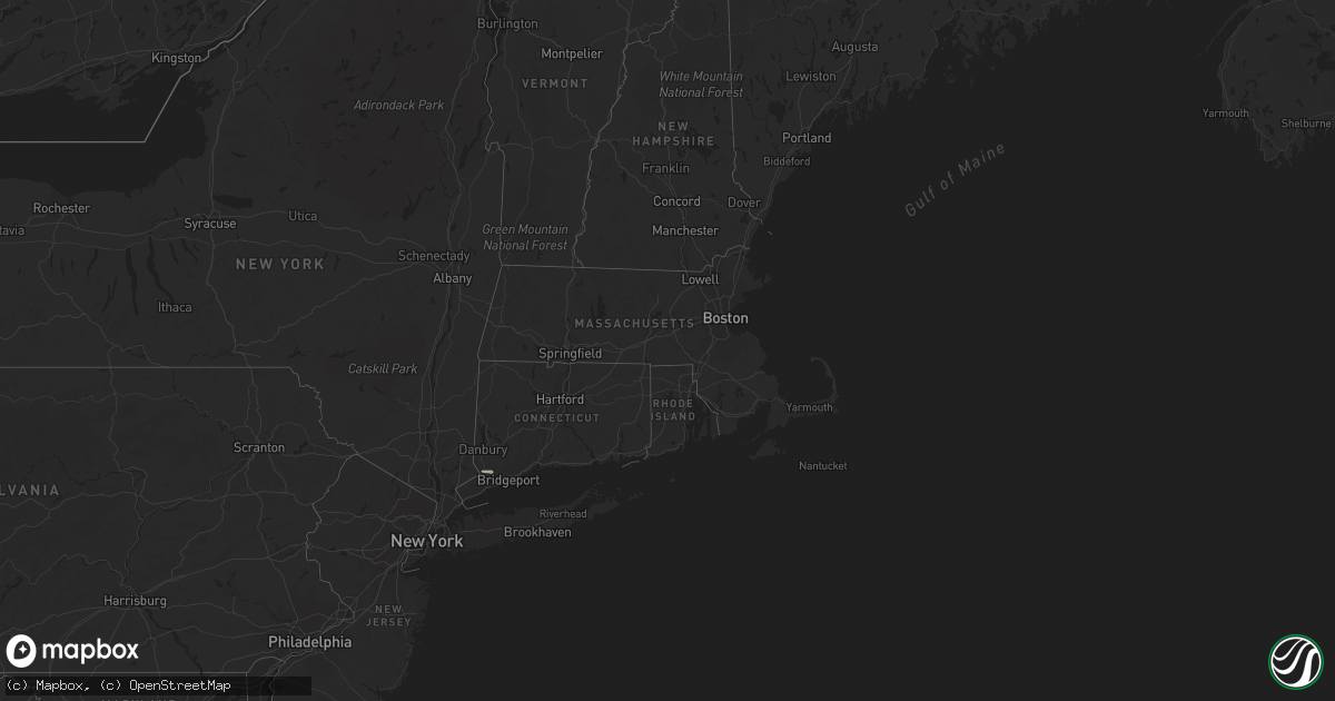
Hail Map in Connecticut on July 13, 2017
Get this storm
July 13 map
$229
one time, instant access
Download today. No call, no setup
Keep the $229
Bought the map and want the full workflow? Apply the entire $229 to a subscription within 7 days. None of it is wasted.
Every map, not just this one
This buys you this map. Subscription and you get every map we run, in the markets you choose from a few cities to whole states to nationwide. Plus real-time alerts the moment a storm fires.
Contact data
Name, contact info, occupancy, even credit band for addresses in the footprint. You go from where it hit to who to call.
Become the source they trust
Unlimited branding weather history reports on demand. You already have the documented answer ready for the property owner, and you are the one who showed up with it.
Property data and RoofTrace estimates
Pull up any address you have got, its value and the exact code rules for that jurisdiction, straight from One Click Code. Then RoofTrace estimates the squares, pitch, and roof value, priced the way you price.
Storm reports in Connecticut
Connecticut
| Date | Description |
|---|---|
| 07/13/20174:22 PM CDT | Two trees down at colonial drive and hartford turnpike |
| 07/13/20173:03 PM CDT | Trees and wires down |
| 07/13/20172:35 PM CDT | Tree down on congress street and long meadow road |
| 07/13/20172:25 PM CDT | Tree down on house on september lane |
| 07/13/20172:20 PM CDT | Tree down on mountain road in northern wilton. |
| 07/13/20172:10 PM CDT | Trees and wires down at the intersection of mcclave road and cobb city road |
| 07/13/20171:00 PM CDT | Multiple trees and wires down on prospect street and beaver street |
| 07/13/20171:00 PM CDT | Tree down on hickory lane |
All States Impacted by Hail Map on July 13, 2017
Cities Impacted by Hail Map on July 13, 2017
- Olney, IL
- Allen, KS
- Macedonia, IL
- McLeansboro, IL
- Marshall, IL
- Washington, MO
- Marthasville, MO
- Mcpherson, KS
- Inman, KS
- Benson, AZ
- Carterville, IL
- Poplar Bluff, MO
- Osage City, KS
- Burlingame, KS
- Carbondale, KS
- Scranton, KS
- Hot Springs National Park, AR
- Blacklick, OH
- Huachuca City, AZ
- Tickfaw, LA
- Hammond, LA
- Wilsey, KS
- Patterson, MO
- Sandoval, IL
- Patagonia, AZ
- New Iberia, LA
- Tallahassee, FL
- Tombstone, AZ
- Bourbon, MO
- Poughkeepsie, NY
- Pleasant Valley, NY
- Hyde Park, NY
- Pinckneyville, IL
- Sedgewickville, MO
- Friedheim, MO
- Perryville, MO
- Peridot, AZ
- Shelburn, IN
- Gibsonville, NC
- Browns Summit, NC
- Reidsville, NC
- Shongaloo, LA
- Bowling Green, IN
- Ottawa, KS
- Flat Rock, IL
- Bridgeport, IL
- Robinson, IL
- Metropolis, IL
- Iuka, KS
- St John, KS
- Turon, KS
- Stafford, KS
- Reading, KS
- Emerson, AR
- Berryton, KS
- Kingman, AZ
- Louisburg, KS
- Saint David, AZ
- West Salem, IL
- Mount Erie, IL
- Windom, KS
- Lyons, KS
- Little River, KS
- Overbrook, KS
- Peabody, KS
- Newton, KS
- Hillsboro, KS
- Centralia, IL
- Salem, IL
- Walnut Hill, IL
- Keenes, IL
- Iuka, IL
- Bluford, IL
- Johnsonville, IL
- Mount Airy, NC
- Lakeland, LA
- Erwinville, LA
- Sedalia, MO
- Harveyville, KS
- Topeka, KS
- Maple Hill, KS
- Pratt, KS
- Council Grove, KS
- Vergennes, IL
- Du Quoin, IL
- Poland, IN
- Spencer, IN
- Centerpoint, IN
- Brazil, IN
- Herington, KS
- Pimento, IN
- Lewis, IN
- Tecumseh, KS
- Union, KY
- Rising Sun, IN
- Burlington, KY
- Cedarville, NJ
- Sells, AZ
- Galva, KS
- Canton, KS
- Rantoul, KS
- Syracuse, KS
- Kismet, KS
- Oblong, IL
- Belle Rive, IL
- East Saint Louis, IL
- Tampa, KS
- Ramona, KS
- Ava, IL
- Odin, IL
- Kell, IL
- Xenia, IL
- Semora, NC
- McLeansville, NC
- Lost Springs, KS
- Greensburg, KS
- Hutsonville, IL
- Laquey, MO
- Waynesville, MO
- Richland, MO
- Mount Carmel, IL
- Moundridge, KS
- Weston, CT
- Wilton, CT
- Saint Louis, MO
- Oak Grove, MO
- Fort White, FL
- Raleigh, NC
- Knob Noster, MO
- Leslie, MO
- Spring Hill, KS
- Hesston, KS
- Manter, KS
- Holly, CO
- Magnolia, AR
- Marissa, IL
- Coulterville, IL
- Oakdale, IL
- Dix, IL
- Mount Vernon, IL
- Woodlawn, IL
- Silver Lake, KS
- Sterling, KS
- Quitman, GA
- Sims, IL
- Wirtz, VA
- Rocky Mount, VA
- Boones Mill, VA
- Elon, NC
- Greensboro, NC
- Whitsett, NC
- Fredericktown, MO
- Farmington, MO
- Moneta, VA
- Sonoita, AZ
- Eskridge, KS
- Alma, KS
- Auburn, KS
- Pride, LA
- Slaughter, LA
- Zachary, LA
- Hosford, FL
- Helena, MT
- Shawsville, VA
- Wingate, MD
- Toddville, MD
- Alta Vista, KS
- Burdick, KS
- Blanch, NC
- Dahlgren, IL
- Lebo, KS
- Marble Hill, MO
- Lodi, MO
- Silva, MO
- Clay City, IL
- Cisne, IL
- Noble, IL
- Mulkeytown, IL
- Monticello, FL
- Milton, NC
- Paola, KS
- Cleveland, MO
- Bucyrus, KS
- Pleasant Garden, NC
- Uvalde, TX
- Jasonville, IN
- Callaway, VA
- Pleasant Plain, OH
- Goshen, OH
- Blanchester, OH
- Ballwin, MO
- Chesterfield, MO
- Wildwood, MO
- Efland, NC
- Kingsville, MO
- Quenemo, KS
- Pomona, KS
- Burrton, KS
- South Solon, OH
- Preston, MD
- Denton, MD
- Clarksville, OH
- Tucson, AZ
- Franklinton, NC
- Cuba, MO
- Moultrie, GA
- Mena, AR
- Fairfield, IL
- Geff, IL
- Orma, WV
- Chloe, WV
- Osawatomie, KS
- Grosse Tete, LA
- Saint Martinville, LA
- Wayne City, IL
- Danbury, NC
- Sainte Genevieve, MO
- Columbus, OH
- Pataskala, OH
- Fairview Heights, IL
- Belleville, IL
- Westfield, NC
- Reelsville, IN
- Abilene, KS
- Benton, IL
- Whittington, IL
- Admire, KS
- Opp, AL
- Wapakoneta, OH
- Makanda, IL
- Terre Haute, IN
- West Union, IL
- Cloverdale, IN
- Salisbury, MD
- Eden, MD
- Raeford, NC
- Fort Bragg, NC
- Bates City, MO
- Perry, KS
- Olsburg, KS
- Greenville, MO
- Belle, MO
- Saint James, MO
- Gerald, MO
- Fletcher, NC
- Gainesville, MO
- Westphalia, MO
- Cory, IN
- Florissant, MO
- Steeleville, IL
- Chester, IL
- Sullivan, MO
- Ina, IL
- Ewing, IL
- Bonnie, IL
- Baldwin, IL
- Evansville, IL
- Flora, IL
- Red Boiling Springs, TN
- Spencer, VA
- Stuart, VA
- Macksville, KS
- Piedmont, MO
- Lecompton, KS
- Norman Park, GA
- Saint Marys, KS
- Paxico, KS
- Rossville, KS
- Church Creek, MD
- Fishing Creek, MD
- Crapo, MD
- Monroe City, IN
- Plains, KS
- Sandborn, IN
- Palestine, IL
- Strong City, KS
- Elmdale, KS
- Perry, FL
- Jeffersonville, OH
- London, OH
- Vichy, MO
- Greenwood, MO
- Browns, IL
- Ruffin, NC
- Vienna, MO
- Dixon, MO
- Hartsburg, MO
- Bland, MO
- Owensville, MO
- Beaumont, MS
- Drexel, MO
- Haviland, KS
- Animas, NM
- New Albany, OH
- McClure, PA
- Yanceyville, NC
- Lehigh, KS
- Marion, KS
- Goessel, KS
- California, MO
- Burlington, NC
- Durham, KS
- Loranger, LA
- Minden, LA
- Opdyke, IL
- Nickerson, KS
- Union, MO
- Beaufort, MO
- Connelly Springs, NC
- Hickory, NC


