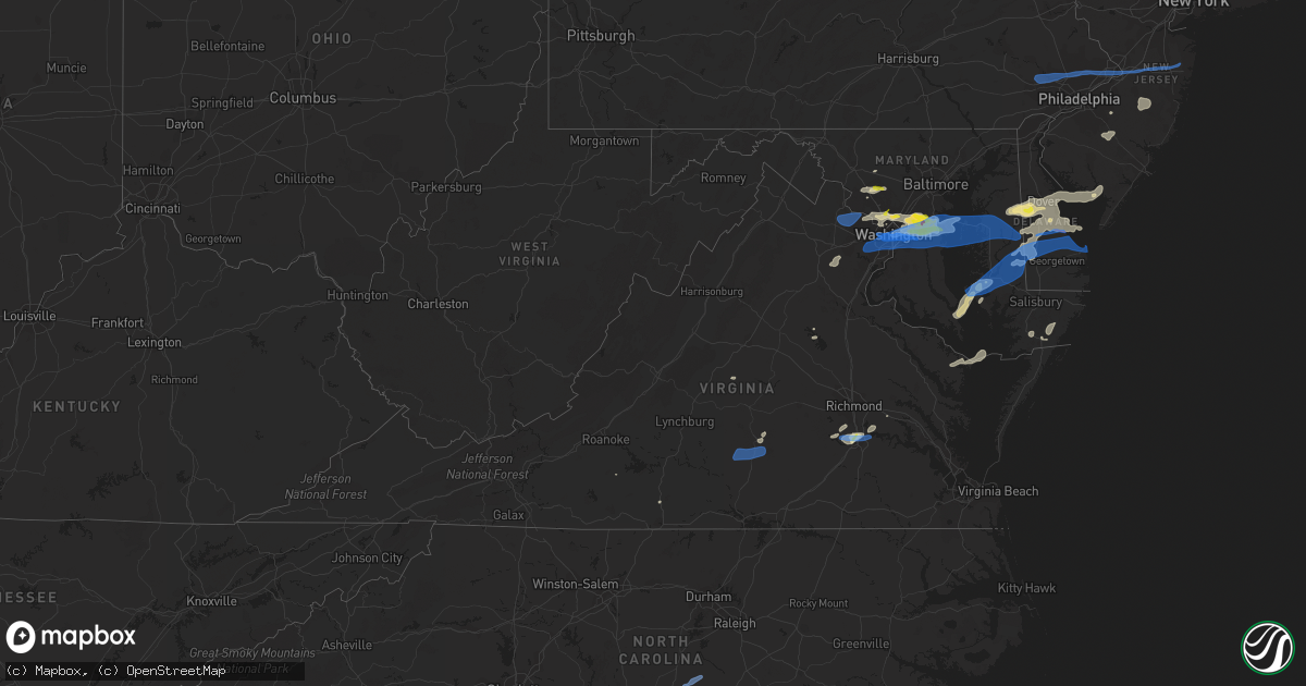
Hail Map in Virginia on July 1, 2021
Get this storm
July 1 map
$229
one time, instant access
Download today. No call, no setup
Keep the $229
Bought the map and want the full workflow? Apply the entire $229 to a subscription within 7 days. None of it is wasted.
Every map, not just this one
This buys you this map. Subscription and you get every map we run, in the markets you choose from a few cities to whole states to nationwide. Plus real-time alerts the moment a storm fires.
Contact data
Name, contact info, occupancy, even credit band for addresses in the footprint. You go from where it hit to who to call.
Become the source they trust
Unlimited branding weather history reports on demand. You already have the documented answer ready for the property owner, and you are the one who showed up with it.
Property data and RoofTrace estimates
Pull up any address you have got, its value and the exact code rules for that jurisdiction, straight from One Click Code. Then RoofTrace estimates the squares, pitch, and roof value, priced the way you price.
Storm reports in Virginia
Virginia
| Date | Description |
|---|---|
| 07/01/20216:24 PM CDT | Tree down. Time estimated from radar. |
| 07/01/20213:40 PM CDT | Tree down on a residence in morattico. |
| 07/01/20213:08 PM CDT | Several trees down along the glebe lane. Tiem estimated by radar. |
| 07/01/20212:48 PM CDT | Large trees snapped. |
| 07/01/20212:45 PM CDT | Tree down on walnut drive. |
| 07/01/20212:40 PM CDT | Numerous trees downed across roads in enon section of chesterfield county... Including enon church road... Point of rocks road and ruffin mill road. Time estimated by r |
| 07/01/20212:38 PM CDT | Large tree branch down across wilmont rd north of rangerwood blvd |
| 07/01/20212:35 PM CDT | Tree down on happy hill rd. |
| 07/01/20212:30 PM CDT | Tree down on treely rd. |
| 07/01/20212:30 PM CDT | Nws employee reported trees down near the intersection of branders bridge road and lakeview road. Time estimated from radar. |
| 07/01/20212:23 PM CDT | One tree down at the intersection of webster road and poplar creek road. |
| 07/01/20212:07 PM CDT | A large tree blew down on a fence on east raymond avenue near us-1 richmond highway. |
| 07/01/20212:00 PM CDT | There were about a half a dozen calls for wires down in arlington. |
| 07/01/20212:00 PM CDT | Canal road northwest was blocked by fallen trees between arizona avenue northwest and foxhall road northwest. |
| 07/01/20211:55 PM CDT | Several dozen trees down across southern portions of fairfax county. |
| 07/01/20211:53 PM CDT | Trees blew down near the intersection of va-645 burke lake road and va-620 braddock road. |
| 07/01/20211:46 PM CDT | A tree blew down on va-643 burke center parkway near va-286 fairfax county parkway. |
| 07/01/20211:45 PM CDT | Large tree limbs were blown down on spring oak court. |
| 07/01/20211:43 PM CDT | Trees blew down near the intersection of coach road and post road. |
| 07/01/20211:42 PM CDT | Trees blew down near the intersection of newman road and va-612 colchester road. |
| 07/01/20211:38 PM CDT | Large tree branch down across wilmont rd north of rangerwood blvd |
| 07/01/20211:37 PM CDT | Multiple reports of trees down on the south side of reston. |
| 07/01/20211:35 PM CDT | There were several calls for trees blown down in and around reston. |
| 07/01/20211:24 PM CDT | Trees down along route 17 between port royal and the county line. |
| 07/01/20211:22 PM CDT | A large tree was uprooted on cheltenham circle near alder lake. |
| 07/01/20211:22 PM CDT | Large branches and small trees down in ashburn village. |
| 07/01/20211:20 PM CDT | Two trees down across old auburn rd near kines rd |
| 07/01/20211:19 PM CDT | Tree down at a residence near near farmwell hunt plaza in ashburn. |
| 07/01/20211:13 PM CDT | A six inch diameter tree blew down near the intersection of va-901 claiborne parkway and val aosta drive/early light place. |
| 07/01/20211:09 PM CDT | Tree down near route 2119 at waxpool road. |
| 07/01/20211:00 PM CDT | Wires down in vicinity of smith station rd and blackstone blvd |
| 07/01/202112:24 PM CDT | Tree down on route 3829 at chesapeake drive. |
| 07/01/20218:55 AM CDT | Tree down blocking road. |
| 07/01/20215:24 AM CDT | At 1024 PM EDT, a severe thunderstorm was located over Leda, or near Nathalie, moving east at 45 mph. HAZARD...60 mph wind gusts. SOURCE...Radar indicated. IMPACT...Expect damage to roofs, siding, and trees. Locations impacted include... Keysville... Charlotte Court House... Phenix... Nathalie... Drakes Branch... Leda... and Abilene. |
| 07/01/20214:41 AM CDT | At 940 PM EDT, severe thunderstorms were located along a line extending from near Prospect to near Hampden Sydney College to near Keysville, moving east at 40 mph. HAZARD...60 mph wind gusts and penny size hail. SOURCE...Radar indicated. IMPACT...Expect damage to trees and powerlines. Severe thunderstorms will be near, Rice and Green Bay around 950 PM EDT. Burkeville around 955 PM EDT. Crewe, Nottoway and Jetersville around 1005 PM EDT. Blackstone, Amelia Courthouse, Morven and Tobaccoville around 1015 PM EDT. Spainville, Scotts Fork and Ballsville around 1020 PM EDT. Chula and Macon around 1025 PM EDT.Other locations impacted by these severe thunderstorms include RainesTavern, North Wellville, Tuggle, Prince Edward Station, Angola,Briery, Earls, Twin Lakes State Park, Winterham and Kingsville. |
| 07/01/20213:26 AM CDT | At 825 PM EDT, a severe thunderstorm was located near South Riding, moving east at 25 mph. HAZARD...60 mph wind gusts and quarter size hail. SOURCE...Radar indicated. IMPACT...Damaging winds will cause some trees and large branches to fall. This could injure those outdoors, as well as damage homes and vehicles. Roadways may become blocked by downed trees. Localized power outages are possible. Unsecured light objects may become projectiles. Locations impacted include... Centreville, Reston, Annandale, Springfield, South Riding, Herndon, Fairfax, Vienna, Mantua, Fort Belvoir, Pimmit Hills, Dulles International Airport, Burke, Linton Hall, Oakton, Chantilly, Tysons Corner, Franconia, Wolf Trap and Merrifield. |
| 07/01/202112:29 AM CDT | At 529 PM EDT, severe thunderstorms were located along a line extending from 6 miles east of Patuxent River Naval Air Station to 7 miles north of Tylerton to near Tangier, moving northeast at 35 mph. HAZARD...60 mph wind gusts and quarter size hail. SOURCE...Radar indicated. IMPACT...Minor damage to vehicles is possible. Expect wind damage to trees and powerlines. Severe thunderstorms will be near, Lawsonia around 545 PM EDT. Marion Station around 555 PM EDT. Westover around 600 PM EDT. Princess Anne around 605 PM EDT. University Of Maryland Eastern Shore around 610 PM EDT. Pocomoke City, Vienna and West Pocomoke around 615 PM EDT.Other locations impacted by these severe thunderstorms includeHorntown, Wetipquin, Trinity, Cokesbury, Eden, Kingston, Saxis,Shelltown, Sanford and Oak Hall. |
| 06/30/202110:49 PM CDT | At 349 PM EDT, a severe thunderstorm was located over Ruthville, or near Charles City, moving northeast at 25 mph. HAZARD...70 mph wind gusts and ping pong ball size hail. SOURCE...Radar indicated. IMPACT...People and animals outdoors will be injured. Expect hail damage to roofs, siding, windows, and vehicles. Expect considerable tree damage. Wind damage is also likely to mobile homes, roofs, and outbuildings. This severe thunderstorm will be near, Holdcroft around 355 PM EDT. New Kent and Toano around 410 PM EDT. Barhamsville around 415 PM EDT.Other locations impacted by this severe thunderstorm include HollyForks, Eltham, Chickahominy Shore, York River State Park, Croaker,Mountcastle, Lanexa, Colonial Downs, Sandybottom and Warren Mill. |
| 06/30/202110:29 PM CDT | At 329 PM EDT, a severe thunderstorm was located over Ettrick, or over Virginia State University, moving northeast at 30 mph. HAZARD...60 mph wind gusts and quarter size hail. SOURCE...Radar indicated. IMPACT...Minor damage to vehicles is possible. Expect wind damage to trees and powerlines. This severe thunderstorm will be near, Fort Lee around 340 PM EDT. Hopewell around 345 PM EDT. Jordans Point around 355 PM EDT. Roxbury around 415 PM EDT.Other locations impacted by this severe thunderstorm includeBarnetts, Jordan Point Country Club, Meadowville, Birchett Estate,Wayside and Petersburg National Battlefield. |
| 06/30/202110:18 PM CDT | At 318 PM EDT, a severe thunderstorm was located near Chesterfield Court House, or 8 miles west of Chester, moving northeast at 30 mph. HAZARD...60 mph wind gusts and quarter size hail. SOURCE...Radar indicated. IMPACT...Minor damage to vehicles is possible. Expect wind damage to trees and powerlines. This severe thunderstorm will be near, Chesterfield Court House around 330 PM EDT. Colonial Heights and Chester around 335 PM EDT. Hopewell, Bellwood and Bensley around 340 PM EDT.Other locations impacted by this severe thunderstorm include RichmondHeights, Wayside, Elko, Sandston, Glendale, Pocahontas State Park,Richmond International, Fair Oaks, Beach and Meadowville. |
| 06/30/20219:28 PM CDT | At 228 PM EDT, a severe thunderstorm was located over Sterling, or over Herndon, moving east at 30 mph. HAZARD...60 mph wind gusts. SOURCE...Radar indicated. IMPACT...Damaging winds will cause some trees and large branches to fall. This could injure those outdoors, as well as damage homes and vehicles. Roadways may become blocked by downed trees. Localized power outages are possible. Unsecured light objects may become projectiles. Locations impacted include... Rockville, Bethesda, Gaithersburg, Reston, Olney, Herndon, Lowes Island, American Legion Bridge, Mclean, Aspen Hill, Potomac, North Bethesda, Ashburn, Sterling, North Potomac, Tysons Corner, Redland, Wolf Trap, Great Falls and Countryside. |
| 06/30/20219:26 PM CDT | Tree down at 136 adams road. Time estimated from radar. |
| 06/30/20219:12 PM CDT | Multiple medium-sized branches down at 4014 stagecoach road. Largest estimated to be 3-4 inches in diameter. Time estimated from radar. |
| 06/30/20219:11 PM CDT | At 211 PM EDT, severe thunderstorms were located along a line extending from near The Plains to Warrenton to near Bealeton, moving east at 30 mph. HAZARD...60 mph wind gusts. SOURCE...Radar indicated. IMPACT...Damaging winds will cause some trees and large branches to fall. This could injure those outdoors, as well as damage homes and vehicles. Roadways may become blocked by downed trees. Localized power outages are possible. Unsecured light objects may become projectiles. Locations impacted include... Centreville, Dale City, Reston, South Riding, Warrenton, Lake Ridge, Linton Hall, Chantilly, Montclair, Bull Run, Bealeton, Haymarket, The Plains, Manassas, Sudley, Manassas Park, Fairfax Station, Gainesville, New Baltimore and Independent Hill. |
| 06/30/20219:00 PM CDT | Report of a tree down on river road. Time estimated from radar. |
| 06/30/20218:59 PM CDT | At 158 PM EDT, severe thunderstorms were located along a line extending from near Fredericksburg to near Ladysmith, moving east at 30 mph. HAZARD...60 mph wind gusts and penny size hail. SOURCE...Radar indicated. IMPACT...Expect damage to trees and powerlines. Severe thunderstorms will be near, Milford around 225 PM EDT. Bowling Green around 230 PM EDT. Fort A.p. Hill around 240 PM EDT.Other locations impacted by these severe thunderstorms includeChilesburg, Rappahannock Academy, Villboro, Nancy Wrights Corner,Guinea, Corbin, Ruther Glen, Woodford and Cedon. |
| 06/30/20218:53 PM CDT | At 153 PM EDT, a severe thunderstorm was located over Oatlands, or near Brambleton, moving east at 30 mph. HAZARD...60 mph wind gusts. SOURCE...Radar indicated. IMPACT...Damaging winds will cause some trees and large branches to fall. This could injure those outdoors, as well as damage homes and vehicles. Roadways may become blocked by downed trees. Localized power outages are possible. Unsecured light objects may become projectiles. Locations impacted include... Broadlands, Lansdowne, Lowes Island, Brambleton, Dulles International Airport, Ashburn, Sterling, Countryside, Arcola, Oatlands, Belmont, Gleedsville, Aldie and Sterling Park. |
| 06/30/20218:47 PM CDT | At 147 PM EDT, a severe thunderstorm was located 8 miles north of Bumpass, or 11 miles northeast of Mineral, moving east at 30 mph. HAZARD...60 mph wind gusts and quarter size hail. SOURCE...Radar indicated. IMPACT...Damaging winds will cause some trees and large branches to fall. This could injure those outdoors, as well as damage homes and vehicles. Roadways may become blocked by downed trees. Localized power outages are possible. Unsecured light objects may become projectiles. Locations impacted include... Glenora, Partlow and Gatewood. |
| 06/30/20218:40 PM CDT | Tree down at the intersection of martin lane and middle creek road. Time estimated by radar. |
| 06/30/20218:36 PM CDT | At 136 PM EDT, a severe thunderstorm was located 9 miles west of Spotsylvania, or 13 miles northeast of Mineral, moving east at 35 mph. HAZARD...60 mph wind gusts and quarter size hail. SOURCE...Radar indicated. IMPACT...Damaging winds will cause some trees and large branches to fall. This could injure those outdoors, as well as damage homes and vehicles. Roadways may become blocked by downed trees. Localized power outages are possible. Unsecured light objects may become projectiles. Locations impacted include... Fredericksburg, Massaponax, Spotsylvania, Logan, Brokenburg, Post Oak, Thornburg, Brookfield, Snell and Alsop. |
| 06/30/20218:32 PM CDT | 2 trees down on morehead road. Time estimated by radar. |
| 06/30/20218:26 PM CDT | Widespread damage has been reported in arlington. Numerous trees... Wires... And poles were blown down. In the 4300 block of 16 street north... A large tree fell onto a |
| 06/30/20218:16 PM CDT | Tree down blocking a.l. Philpott highway near summit road. |
| 06/30/20218:03 PM CDT | Tree down in the 1500 block of south clark street. |
| 06/30/20218:00 PM CDT | Tree blew down on washington blvd and route 50. |
| 06/30/20218:00 PM CDT | Tree down on spout run parkway at lorcom lane. |
| 06/30/20217:59 PM CDT | Tree blew down on columbia pike near south adams street. |
| 06/30/20217:59 PM CDT | Ef1 tornado. Path length: 4.4 miles. Path width: 125 yards. Cherrydale in arlington va to near 16th st nw and constitution ave nw dc. Max estimated wind: 90 mph. |
| 06/30/20217:59 PM CDT | Tree down on the lyon village community center on 20th street north. |
| 06/30/20217:58 PM CDT | *** 1 inj *** widespread damage has been reported in arlington. Numerous trees... Wires... And poles were blown down. In the 4300 block of 16 street north... A large tr |
| 06/30/20217:58 PM CDT | Tree blew down on north kirkwood road and 13th street north. |
| 06/30/20217:58 PM CDT | A local report indicates 62 MPH wind near BALLSTON |
| 06/30/20217:58 PM CDT | Tree blew down on 21st street north. |
| 06/30/20217:57 PM CDT | Tree blew down on north upton street near 22nd road north. |
| 06/30/20217:57 PM CDT | Tree blew down on north illinois street and 22nd street south. |
| 06/30/20217:56 PM CDT | Tree blew down on george mason drive near 22nd street. |
| 06/30/20217:56 PM CDT | Tree blew down on north utah street near 20th street north. |
| 06/30/20217:56 PM CDT | Tree blew down on north buchanan street near 20th street north. |
| 06/30/20217:55 PM CDT | Tree blew down on north mckinley road and 9th road north. |
| 06/30/20217:55 PM CDT | Tree blew down on north mckinley road and 9th road north. |
| 06/30/20217:53 PM CDT | A tree blew down onto wires and a car near the intersection of north roosevelt street and north tuckahoe street. |
| 06/30/20217:52 PM CDT | A large tree snapped in half in the 2200 block of beacon lane. |
| 06/30/20217:45 PM CDT | A tree blew down on va-243 nutley street southwest between courthouse road southwest and tapawingo road southwest. |
| 06/30/20217:40 PM CDT | Trees blew down near the intersection of va-654 popes head road and lewisham road. |
All States Impacted by Hail Map on July 1, 2021
Cities Impacted by Hail Map on July 1, 2021
- Roggen, CO
- Laramie, WY
- Hugoton, KS
- Manchester Township, NJ
- Vincentown, NJ
- Chatsworth, NJ
- Browns Mills, NJ
- Cheyenne, WY
- Greeley, CO
- Medford, NJ
- Cottonwood, ID
- Esmont, VA
- Howardsville, VA
- Pemberton, NJ
- Pocomoke City, MD
- Clarksburg, MD
- Damascus, MD
- Gaithersburg, MD
- Germantown, MD
- Elbert, CO
- Greenbelt, MD
- Crofton, MD
- Crownsville, MD
- Brentwood, MD
- Upper Marlboro, MD
- Capitol Heights, MD
- Hyattsville, MD
- Annapolis, MD
- Bowie, MD
- College Park, MD
- Davidsonville, MD
- Glenn Dale, MD
- Beltsville, MD
- Lanham, MD
- Riverdale, MD
- Odenton, MD
- Riva, MD
- Laurel, MD
- Edgewater, MD
- Bladensburg, MD
- Gambrills, MD
- Washington, DC
- Avondale, CO
- Boone, CO
- Pueblo, CO
- Kim, CO
- Rice, VA
- Farmville, VA
- Chesterfield, VA
- Chester, VA
- Petersburg, VA
- Colonial Heights, VA
- Great Falls, VA
- Garrett Park, MD
- Kensington, MD
- Potomac, MD
- Rockville, MD
- Silver Spring, MD
- Bethesda, MD
- Centreville, MD
- Ingleside, MD
- Magnolia, DE
- Goldsboro, MD
- Henderson, MD
- Camden Wyoming, DE
- Marydel, DE
- Hartly, DE
- Felton, DE
- Marydel, MD
- Barclay, MD
- Dover, DE
- Mclean, TX
- Dickerson, MD
- Boyds, MD
- Barnesville, MD
- Windsor, CO
- Kiowa, CO
- Turkey, TX
- Garrett, WY
- Watkins, CO
- Bennett, CO
- Casper, WY
- Hoffman, NC
- Wagram, NC
- Marston, NC
- Aberdeen, NC
- Chevy Chase, MD
- Grangeville, ID
- Polebridge, MT
- Fowler, CO
- Millville, NJ
- Fountain, CO
- Cambridge, MD
- Taylors Island, MD
- Lexington Park, MD
- Woolford, MD
- Church Creek, MD
- Patuxent River, MD
- Madison, MD
- Yoder, WY
- Calhan, CO
- Polson, MT
- Charles City, VA
- Haines, OR
- Corvallis, MT
- Raeford, NC
- Pinebluff, NC
- Frederica, DE
- Wheatland, WY
- Prairie City, OR
- Shawnee, OK
- Spotsylvania, VA
- Greenwood, DE
- Bridgeville, DE
- Mineral, VA
- Fort George G Meade, MD
- Delmont, NJ
- Cabin John, MD
- Glen Echo, MD
- Mount Rainier, MD
- Harwood, MD
- McLean, VA
- Arlington, VA
- Lake George, CO
- Viola, DE
- Woodside, DE
- Church Hill, MD
- Heislerville, NJ
- Leesburg, NJ
- Dover Afb, DE
- Port Norris, NJ
- Seaford, DE
- Federalsburg, MD
- Dorchester, NJ
- Harrington, DE
- Newport, NJ
- Houston, DE
- Denton, MD
- Milford, DE
- Greensboro, MD
- Waterford Works, NJ
- Williamstown, NJ
- Sicklerville, NJ
- Hammonton, NJ
- Bonner, MT
- Hopewell, VA
- Kalispell, MT
- Morral, OH
- Harpster, OH
- Upper Sandusky, OH
- Mount Airy, MD
- Okarche, OK
- Rocky Mount, VA
- Rocky Ford, CO
- Model, CO
- Heathsville, VA
- Burgess, VA
- Reedville, VA
- Kaycee, WY
- Clarendon, TX
- Hurlock, MD
- Providence Forge, VA
- Whitefish, MT
- Nokesville, VA
- Catlett, VA
- Westover, MD
- Dry Fork, VA
- Danville, VA
- Chatham, VA
- Agate, CO
- Deer Trail, CO
- Snow Hill, MD
- Vass, NC
- Broadway, NC
- Cameron, NC
- Sanford, NC
- Lillington, NC
- Leesburg, VA
- Sterling, VA
- Ashburn, VA
- Aldie, VA
- Queen Anne, MD
- Annandale, VA
- Mcdaniel, MD
- Alexandria, VA
- Fairfax, VA
- Arnold, MD
- Ridgely, MD
- Fairfax Station, VA
- Claiborne, MD
- Saint Michaels, MD
- Andrews Air Force Base, MD
- Queenstown, MD
- Severna Park, MD
- Grasonville, MD
- District Heights, MD
- Rock Hall, MD
- Clifton, VA
- Cordova, MD
- Springfield, VA
- Shady Side, MD
- Falls Church, VA
- Wye Mills, MD
- Galesville, MD
- Suitland, MD
- Hillsboro, MD
- Stevensville, MD
- West River, MD
- Lothian, MD
- Fort Washington, MD
- Burke, VA
- Easton, MD
- Naval Anacost Annex, DC
- Deale, MD
- Oxon Hill, MD
- Churchton, MD
- Temple Hills, MD
- Fort Myer, VA
- Chester, MD
- Prince George, VA
- Secretary, MD
- Rhodesdale, MD
- Lincoln, DE
- Milton, DE
- East New Market, MD
- Trappe, MD
- Preston, MD
- Linkwood, MD
- Ellendale, DE
- Lewes, DE
- Vienna, MD
- Cullen, VA
- Charlotte Court House, VA
- Pamplin, VA
- Green Bay, VA
- Keysville, VA
- Meherrin, VA
- Mont Clare, PA
- Chester Springs, PA
- Wayne, PA
- Collegeville, PA
- Hatboro, PA
- Levittown, PA
- Bensalem, PA
- Bordentown, NJ
- Howell, NJ
- Huntingdon Valley, PA
- Willow Grove, PA
- Millstone Township, NJ
- Oaks, PA
- Dresher, PA
- Bridgeport, PA
- King Of Prussia, PA
- Robbinsville, NJ
- Bryn Athyn, PA
- Norristown, PA
- Freehold, NJ
- Abington, PA
- Langhorne, PA
- Horsham, PA
- Plymouth Meeting, PA
- Trenton, NJ
- Blue Bell, PA
- Cream Ridge, NJ
- Chesterfield, NJ
- Farmingdale, NJ
- Allentown, NJ
- Phoenixville, PA
- Fort Washington, PA
- Morrisville, PA
- Feasterville Trevose, PA
- Bristol, PA
- Fairless Hills, PA
- Southampton, PA
- Malvern, PA
- Ambler, PA
- Flourtown, PA


