Hail Map on September 12, 2026
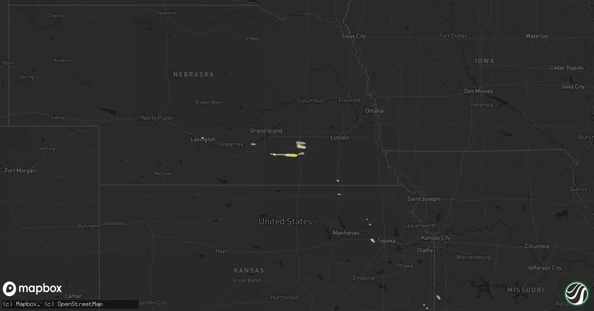
Get this storm
September 12 map
$229
one time, instant access
Download today. No call, no setup
Keep the $229
Bought the map and want the full workflow? Apply the entire $229 to a subscription within 7 days. None of it is wasted.
Every map, not just this one
This buys you this map. Subscription and you get every map we run, in the markets you choose from a few cities to whole states to nationwide. Plus real-time alerts the moment a storm fires.
Contact data
Name, contact info, occupancy, even credit band for addresses in the footprint. You go from where it hit to who to call.
Become the source they trust
Unlimited branding weather history reports on demand. You already have the documented answer ready for the property owner, and you are the one who showed up with it.
Property data and RoofTrace estimates
Pull up any address you have got, its value and the exact code rules for that jurisdiction, straight from One Click Code. Then RoofTrace estimates the squares, pitch, and roof value, priced the way you price.
States Impacted by Hail Map on September 12, 2026
Storm reports
Arizona
| Date | Description |
|---|---|
| 09/12/20266:38 PM CDT | Mesonet station up565 4.4 w gila bend |
Florida
| Date | Description |
|---|---|
| 09/12/20262:40 PM CDT | [landspout] video of a landspout on the ground was taken and shared to emergency management as it formed near us-1 and matanzas woods pkwy in nw section of palm coast. |
Kansas
| Date | Description |
|---|---|
| 09/12/20266:58 PM CDT | A local report indicates 60 MPH wind near Humboldt |
| 09/12/20266:52 PM CDT | Delayed report. Quarter-size hail reported from the public. Time estimated from radar. |
| 09/12/20266:50 PM CDT | Report of a tree down partially in the roadway on the south side of iola. |
| 09/12/20266:38 PM CDT | A local report indicates 1.75 inch wind near 4 NW Dwight |
| 09/12/20266:05 PM CDT | Report received from the kansas state mesonet. |
| 09/12/20266:00 PM CDT | Report received from kansas state mesonet. |
| 09/12/20265:38 PM CDT | A local report indicates 1.00 inch wind near 1 NE Grandview Plaza |
| 09/12/20265:24 PM CDT | A local report indicates 59 MPH wind near 1 SE Pauline |
| 09/12/20263:44 PM CDT | Pictures sent from em. |
| 09/12/20263:36 PM CDT | Mping report. |
| 09/12/20263:12 PM CDT | A local report indicates 1.75 inch wind near Randall |
| 09/12/20263:06 PM CDT | A local report indicates 59 MPH wind near 1 SSE Concordia |
| 09/12/20263:05 PM CDT | Roof of hangar collapsed. Time estimated from radar. |
| 09/12/20262:50 PM CDT | Time estimated from radar. |
| 09/12/20261:46 PM CDT | A local report indicates 1.00 inch wind near 2 SE Erie |
| 09/12/20261:13 AM CDT | Delayed report. Several trees branches down around the county. Additionally... A couple of utility poles were knocked down near galesburg. Time estimated by radar. |
| 09/12/202612:51 AM CDT | Local dispatch reported power outages and several tree branches down around town. |
| 09/12/202612:45 AM CDT | Asos station kcnu chanute martin johnson airport. |
| 09/11/202611:42 PM CDT | Photos of hail up to 1.5 inches in diameter at lake kahloa from lake manager... Relayed by local radio. Time estimated from radar. |
| 09/11/202611:17 PM CDT | Strong winds knocked down a large tree limb. |
| 09/11/202610:50 PM CDT | A local report indicates 61 MPH wind near Chanute Airport |
| 09/11/20268:15 PM CDT | West mineral fire dept reported 70 mph wind gusts. |
| 09/11/20268:15 PM CDT | A local report indicates 1.50 inch wind near Cairo |
| 09/11/20267:45 PM CDT | Delayed report from broadcast media of quarter sized hail. |
| 09/11/20267:15 PM CDT | A local report indicates 60 MPH wind near 7 E Petrolia |
| 09/11/20267:15 PM CDT | Mping report. Time was estimated based on radar data. |
| 09/11/20267:10 PM CDT | Pictures were shared on social media... And the largest stone pictured was roughly twice the diameter of a quarter used as a reference object. |
Alabama
| Date | Description |
|---|---|
| 09/12/20261:13 PM CDT | Store sign on hwy 31 entrance blown over and hit a car. Awning off of a nearby restaurant also hit a car. |
| 09/12/202611:04 AM CDT | Tree downed... Blocking portions of the road... Hwy 20 and county road 152. Time estimated from radar. |
Arkansas
| Date | Description |
|---|---|
| 09/12/20266:57 PM CDT | Report relayed of a tree down across morning star rd near el dorado... Ar. |
| 09/12/20266:11 PM CDT | Reports relayed of multiple trees down across nevada county... Including across ar hwy 332 west of prescott... Ar. |
| 09/12/20265:10 PM CDT | Reports relayed of a tree down across us hwy 70 just west of greens chapel rd. |
| 09/11/20267:29 PM CDT | A 61 mph wind gust was recorded at the south arkansas regional airport. |
| 09/11/20267:15 PM CDT | Report relayed of a tree down across shuler rd. Near el dorado... Ar. |
Virginia
| Date | Description |
|---|---|
| 09/12/20263:46 PM CDT | Storm survey conducted by nws employee found tornado damage consistent with an ef-0 along va-10 east of spring grove. Time is estimated based on radar. |
Texas
| Date | Description |
|---|---|
| 09/12/20265:45 PM CDT | A local report indicates 1.00 inch wind near 4 S Perryton |
| 09/12/20265:40 PM CDT | Powerline snapped in half on highway 83 south of perryton. |
| 09/12/20265:40 PM CDT | Update: powerline snapped in half on highway 83 south of perryton. Em called and noted that 6 to 8 power poles were snapped south of perryton. Also a grain auger was di |
| 09/12/20265:30 PM CDT | Picture received of metal farm outbuilding partially destroyed when a storm went through southeast of perryton. |
| 09/12/20265:20 PM CDT | Corrects previous non-tstm wnd dmg report from 2 wsw perryton. Image sent via social media displaying uprooted tree... Likely siberian elm... With a small and shallow r |
| 09/11/20269:20 PM CDT | A local report indicates 63 MPH wind near 1 W Claude |
| 09/11/20267:50 PM CDT | A local report indicates 64 MPH wind near 7 SSE Darrouzett |
Ohio
| Date | Description |
|---|---|
| 09/12/20266:18 AM CDT | Tree down at the intersection of sr 555 and sr 7. |
Pennsylvania
| Date | Description |
|---|---|
| 09/12/20265:00 PM CDT | Tree down on a house. |
| 09/12/20264:22 PM CDT | Trees down at washington church and davis roads. |
| 09/12/20263:57 PM CDT | Tree down blocking roadway. Reported near 1008 twin maples rd... Derry twp. Time estimate based on radar. |
| 09/12/20263:24 PM CDT | A tree was reported down over porter road near the town of porter. |
| 09/12/20262:35 PM CDT | Tree limbs down. |
| 09/12/20262:30 PM CDT | Power line down in yard. Reported near 118 hoge summit rd... Somerset twp. Time based on radar estimate. |
| 09/12/20262:26 PM CDT | Tree down blocking roadway. Reported near turkeyfoot rd and doubletree dr. Time based on radar estimate. |
| 09/12/20262:17 PM CDT | Tree came down... Blocking entire roadway. Brought 1 or more unk type wires down. Reported near 190 woodside drive... South strabane twp. Estimated time based on radar. |
Oklahoma
| Date | Description |
|---|---|
| 09/12/20265:39 PM CDT | Large tree blown down. |
| 09/12/20265:30 PM CDT | Reports relayed of a tree down across a power line near us hwy 70 west of eagletown... Ok. |
| 09/12/20265:00 PM CDT | Two wooden power poles snapped. |
| 09/12/20264:10 PM CDT | A local report indicates 1.00 inch wind near 1 NNW Oklahoma City |
| 09/12/20264:00 PM CDT | Personal weather stations in the area reported 60-70 mph wind gusts. |
| 09/12/202612:34 PM CDT | 58 mph wind gust recorded by oklahoma mesonet. |
| 09/12/202611:30 AM CDT | Shingles blow off house... Small branches broken and power outages in the vicinity of county line and 41st street. Time estimated from radar. |
| 09/11/20269:10 PM CDT | A local report indicates 59 MPH wind near 3 SSW Freedom |
Missouri
| Date | Description |
|---|---|
| 09/12/202610:30 AM CDT | Thunderstorm winds knocked down a tree onto a house in sheldon. A public weather station in sheldon measured a 48mph wind gust. Time estimated via radar. |
Mississippi
| Date | Description |
|---|---|
| 09/12/20266:52 PM CDT | A tree was downed near puckett town hall... Partially blocking the road. |
| 09/12/20263:50 PM CDT | Large tree limbs damaged a fence is the forestdale community. |
| 09/12/20263:47 PM CDT | A peak wind gust of 50 kts was measured from the northwest by site knjw. |
| 09/12/20263:43 PM CDT | A tree was downed across rd 757. Social media report with picture. |
| 09/12/20262:00 PM CDT | Large tree limbs were blown down in grenada. |
| 09/12/20261:44 PM CDT | A tree fell on a power line along jackson ave. |
Nebraska
| Date | Description |
|---|---|
| 09/12/202611:52 AM CDT | Video from x. Estimated largest hailstone was the size of a walnut. Exact time estimated from radar. |
| 09/12/202611:52 AM CDT | Picture from x. Time estimated from radar. |
| 09/12/202611:51 AM CDT | Picture from facebook. Time estimated from radar. |
| 09/12/202611:13 AM CDT | Trained spotter reported quarter sized hail in town. Time estimated based on radar. |
| 09/12/202610:56 AM CDT | Report from mping: quarter |
| 09/12/202610:55 AM CDT | Law enforcement reported quarter size and possibly larger hail on the northern side of beatrice. Time estimated based on radar. |
| 09/12/202610:54 AM CDT | Trained spotter reported golf ball sized hail in northern beatrice. |
| 09/12/202610:53 AM CDT | Delayed and relayed report of golf ball sized hail. |
Cities Impacted by Hail Map on September 12, 2026
- Lexington, NE
- Fort Scott, KS
- Redfield, KS
- Wood River, NE
- Kenesaw, NE
- Odell, NE
- Wymore, NE
- Emmett, KS
- Holly Springs, MS
- Waterford, MS
- Clay Center, NE
- Rich Hill, MO
- Hume, MO
- Inland, NE
- Harvard, NE
- Glenvil, NE
- Maple Hill, KS
- Geneva, NE
- Topeka, KS
- Sutton, NE
- Fairmont, NE
- McCool Junction, NE
- Shickley, NE
- Edgar, NE
- Marysville, KS
- Exeter, NE
- Milligan, NE
- Friend, NE
- Hallam, NE
- Wilber, NE
- Nevada, MO
- Crete, NE
- Moundville, MO
- Tonkawa, OK
- Denton, NE
- Lincoln, NE
- Martell, NE
- Hickman, NE
- Roca, NE
- Red Rock, OK
- Bennet, NE
- Sprague, NE
- Adams, NE
- Palmyra, NE
- Panama, NE
- Fredonia, KS
- De Witt, NE
- Beatrice, NE
- Cortland, NE
- Clatonia, NE
- Sheldon, MO
- Pickrell, NE
- Filley, NE
- Blue Springs, NE
- Virginia, NE
- Lamar, MO
- Liberal, MO
- Mannford, OK
- Liberty, NE
- Kearney, NE
- Bertrand, NE
- Loomis, NE
- Burchard, NE
- Bremen, KS
- Oketo, KS
- Hanover, KS
- Sand Springs, OK
- Kingston, AR
- Broken Arrow, OK
- Tulsa, OK
- Elk Creek, NE
- Steinauer, NE
- Jasper, MO
- Carthage, MO
- Mounds, OK
- Neodesha, KS
- Holdrege, NE
- Waterville, KS
- Table Rock, NE
- Pettigrew, AR
- Home, KS
- Funk, NE
- Deer, AR
- Hasty, AR
- Jasper, AR
- Harrison, AR
- Wilcox, NE
- Axtell, NE
- Hildreth, NE
- Saint Joe, AR
- Vendor, AR
- Western Grove, AR
- Gibbon, NE
- Thayer, KS
- Minden, NE
- Dennis, KS
- Mount Judea, AR
- Cherryvale, KS
- Haskell, OK
- Saronville, NE
- Cascilla, MS
- Charleston, MS
- Kilmichael, MS
- Welch, OK
- Wamego, KS
- Scobey, MS
- Tillatoba, MS
- Holcomb, MS
- Oakland, MS
- San Simon, AZ
- Witts Springs, AR
- Leslie, AR
- Grenada, MS
- Ong, NE
- Vinita, OK
- Afton, OK
- Berryville, AR
- Eureka Springs, AR
- Huntsville, AR
- Davenport, NE
- Riverton, NE
- Washington, PA
- Shirley, AR
- Erie, KS
- Saint Paul, KS
- Clarksdale, MS
- Frankfort, KS
- Vermillion, KS
- Barnes, KS
- Coffeeville, MS
- Eufaula, OK
- Checotah, OK
- Centralia, KS
- Parsons, KS
- Blue Rapids, KS
- Vail, AZ
- Elgin, AZ
- Burr Oak, KS
- Guide Rock, NE
- Tucson, AZ
- Onaga, KS
- Bloomington, NE
- Franklin, NE
- Smith Center, KS
- Lebanon, KS
- Corning, KS
- Huachuca City, AZ
- Canadian, OK
- Mcalester, OK
- McCune, KS
- Fort Lauderdale, FL
- Superior, NE
- Mankato, KS
- Havensville, KS
- Stigler, OK
- Sledge, MS
- Eighty Four, PA
- Marvell, AR
- Crowder, OK
- Mccurtain, OK
- Oswego, KS
- Keota, OK
- Hodgen, OK
- Canonsburg, PA
- Venetia, PA
- Esbon, KS
- Courtland, KS
- Formoso, KS
- Hardy, NE
- Republic, KS
- Webber, KS
- Elaine, AR
- Chanute, KS
- Benedict, KS
- Galesburg, KS
- Danville, AR
- Crenshaw, MS
- Witter, AR
- Jewell, KS
- Randall, KS
- Belleville, KS
- Scandia, KS
- Columbus, KS
- Westmoreland, KS
- Norway, KS
- Bokoshe, OK
- Finleyville, PA
- Concordia, KS
- Jamestown, KS
- Caulfield, MO
- Beloit, KS
- Mount Lemmon, AZ
- Helena, AR
- Wister, OK
- Bentleyville, PA
- Ganado, AZ
- Shady Point, OK
- Red Oak, OK
- Clyde, KS
- West Point, MS
- Lakeland, FL
- Chetopa, KS
- Heavener, OK
- Kingfisher, OK
- Cashion, OK
- Friars Point, MS
- Bakersfield, MO
- Morganville, KS
- Clifton, KS
- Aurora, KS
- Miltonvale, KS
- Clay Center, KS
- Prairie, MS
- Tecumseh, OK
- Maud, OK
- Fairview, OK
- Mellwood, AR
- Gamaliel, AR
- Lake Alfred, FL
- Auburndale, FL
- Rio Rico, AZ
- Greensburg, PA
- Crabtree, PA
- Hannastown, PA
- Ozone, AR
- Oark, AR
- Wakefield, KS
- Longford, KS
- Booneville, AR
- Oklahoma City, OK
- Green Valley, AZ
- Woodward, OK
- Okarche, OK
- Latrobe, PA
- Derry, PA
- New Alexandria, PA
- Luxor, PA
- Talihina, OK
- Hennessey, OK
- Waldron, AR
- Baxter Springs, KS
- Whitesboro, OK
- Mooreland, OK
- Roseland, NE
- Holstein, NE
- Paron, AR
- Columbus, MS
- Tumacacori, AZ
- Winkelman, AZ
- Patagonia, AZ
- Muse, OK
- Randolph, KS
- Preston, MS
- Milford, KS
- Riley, KS
- Junction City, KS
- Fort Riley, KS
- Ogden, KS
- Nogales, AZ
- Caledonia, MS
- Honobia, OK
- Wewoka, OK
- Seminole, OK
- Asher, OK
- Forest, MS
- Dierks, AR
- Laverne, OK
- Manhattan, KS
- Leonardville, KS
- Macomb, OK
- Mabelvale, AR
- Umpire, AR
- Dover, OK
- Mount Ida, AR
- Wickes, AR
- Malvern, AR
- Kirby, AR
- Wyandotte, OK
- Perryton, TX
- Dwight, KS
- Alma, KS
- White City, KS
- Alta Vista, KS
- Chester, OK
- Norman, AR
- Newhope, AR
- Newton, MS
- Lawrence, MS
- Broken Bow, OK
- Sims, AR
- Lauderdale, MS
- Buffalo, OK
- Amity, AR
- Toomsuba, MS
- Fairfield, NE
- Council Grove, KS
- Cuba, AL
- Rattan, OK
- De Queen, AR
- Delight, AR
- Pearcy, AR
- Bismarck, AR
- Hot Springs National Park, AR
- Fort Stockton, TX
- Allen, KS
- Eagletown, OK
- Pima, AZ
- Ringold, OK
- May, OK
- Eskridge, KS
- Chapman, KS
- Rosston, OK
- Okolona, AR
- Balko, OK
- Antlers, OK
- Emporia, KS
- Admire, KS
- Glenwood, AR
- Fargo, OK
- Stringtown, OK
- Beaver, OK
- Ashland, KS
- Abilene, KS
- Prescott, AR
- Lane, OK
- Carthage, AR
- Dewey, AZ
- Humboldt, AZ
- Solomon, KS
- Talmage, KS
- Spearman, TX
- Booker, TX
- Chidester, AR
- Atoka, OK
- Tavares, FL
- Rosston, AR
- Protection, KS
- Coldwater, KS
- El Reno, OK
- Burlington, KS
- Sharon, OK
- Tuba City, AZ
- Wilmore, KS
- Camden, AR
- Foreman, AR
- Neosho Falls, KS
- Colony, KS
- Le Roy, KS
- Hamburg, AR
- Piqua, KS
- Iola, KS
- Enterprise, KS
- Miami, TX
- Humboldt, KS
- Stephens, AR
- Flagstaff, AZ
- La Harpe, KS
- Savonburg, KS
- Elsmore, KS
- El Dorado, AR
- Haviland, KS
- Spring Grove, VA
- Harper, KS
- Iuka, KS
- Zenda, KS
- Stark, KS
- Sun City, KS
- Spivey, KS
- Coats, KS
- Mullinville, KS
- Attica, KS
- Turon, KS
- Walnut, KS
- Kingman, KS
- Pratt, KS
- Show Low, AZ
- Sawyer, KS
- Norwich, KS
- Girard, KS
- Reading, KS
- Americus, KS
- Cunningham, KS
- East Carbon, UT
- Medicine Lodge, KS
- West Mineral, KS
- Scammon, KS
- Nashville, KS
- Isabel, KS
- Green River, UT
- Pond Creek, OK
- Nash, OK
- Medford, OK
- Freeport, KS
- Claude, TX
- Neosho Rapids, KS
- Thompson, UT
- Danville, KS
- Hartford, KS
- Bluff City, KS
- Gridley, KS
- Yates Center, KS
- Arkansas City, KS
- Mcpherson, KS
- Dorrance, KS
- Wilson, KS
- Ellsworth, KS
- Geuda Springs, KS
- Ponca City, OK
- Kanopolis, KS
- Falun, KS
- Lindsborg, KS
- Brookville, KS
- Sylvan Grove, KS
- Lincoln, KS
- South Haven, KS
- Newkirk, OK
- Marion, KS
- Assaria, KS
- Salina, KS
- Buffalo, KS
- Gypsum, KS
- Lorraine, KS
- Marquette, KS
- Holyrood, KS
- Burbank, OK
- Lincolnville, KS
- Pawhuska, OK
- Strong City, KS
- Altoona, KS
- Kaw City, OK
- Wilsey, KS
- Otis, KS
- Albert, KS
- Pampa, TX
- Great Bend, KS
- Glasco, KS
- Delphos, KS
- Ralston, OK
- Bluejacket, OK
- Alton, KS
- Woodston, KS
- Cookson, OK
- Hedley, TX
- Clarendon, TX
- Catoosa, OK
- Cherokee, KS
- Moran, KS
- Weir, KS
- Pittsburg, KS
- Follett, TX