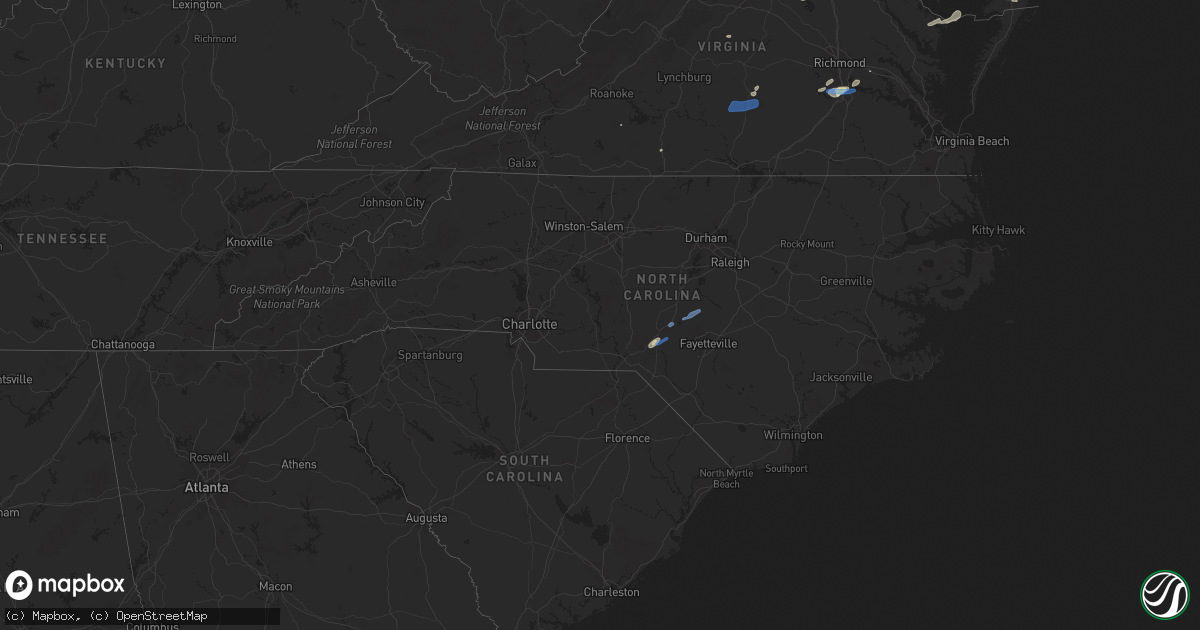
Hail Map in North Carolina on July 1, 2021
Get this storm
July 1 map
$229
one time, instant access
Download today. No call, no setup
Keep the $229
Bought the map and want the full workflow? Apply the entire $229 to a subscription within 7 days. None of it is wasted.
Every map, not just this one
This buys you this map. Subscription and you get every map we run, in the markets you choose from a few cities to whole states to nationwide. Plus real-time alerts the moment a storm fires.
Contact data
Name, contact info, occupancy, even credit band for addresses in the footprint. You go from where it hit to who to call.
Become the source they trust
Unlimited branding weather history reports on demand. You already have the documented answer ready for the property owner, and you are the one who showed up with it.
Property data and RoofTrace estimates
Pull up any address you have got, its value and the exact code rules for that jurisdiction, straight from One Click Code. Then RoofTrace estimates the squares, pitch, and roof value, priced the way you price.
Storm reports in North Carolina
North Carolina
| Date | Description |
|---|---|
| 07/01/20215:42 AM CDT | At 1041 PM EDT, severe thunderstorms were located along a line extending from Oxford to 7 miles northeast of Louisburg to Zebulon, moving northeast at 50 mph. HAZARD...60 mph wind gusts and nickel size hail. SOURCE...Radar indicated. IMPACT...Expect damage to roofs, siding, and trees. Locations impacted include... Henderson, Oxford, Louisburg, Warrenton, Norlina, Littleton, Kittrell, Bunn, Stem and Stovall. |
| 07/01/20215:01 AM CDT | At 1000 PM EDT, severe thunderstorms were located along a line extending from Durham to near Raleigh to 6 miles northwest of Benson, moving north at 80 mph. HAZARD...60 mph wind gusts and nickel size hail. SOURCE...Radar indicated. IMPACT...Expect damage to roofs, siding, and trees. Locations impacted include... Raleigh, Durham, Cary, Creedmoor, Louisburg, Wake Forest, Butner, Zebulon, Franklinton and Kittrell. |
| 07/01/20214:38 AM CDT | At 937 PM EDT, severe thunderstorms were located along a line extending from 10 miles southwest of Cary to near Lillington to Fayetteville, moving northeast at 60 mph. HAZARD...60 mph wind gusts and nickel size hail. SOURCE...Radar indicated. IMPACT...Expect damage to roofs, siding, and trees. Locations impacted include... Raleigh, Durham, Fayetteville, Cary, Smithfield, Lillington, Fort Bragg, Garner, Fuquay-Varina and Clayton. |
| 07/01/20214:09 AM CDT | At 909 PM EDT, severe thunderstorms were located along a line extending from near Sanford to 6 miles northwest of Pope AFB to near Raeford, moving northeast at 50 mph. HAZARD...60 mph wind gusts and nickel size hail. SOURCE...Radar indicated. IMPACT...Expect damage to roofs, siding, and trees. Locations impacted include... Fayetteville, Sanford, Raeford, Lillington, Fort Bragg, Fuquay-Varina, Dunn, Angier, Godwin and Pope AFB. |
| 06/30/20219:50 PM CDT | Two trees reported down near the intersection of oxford loop sw and nc highway 96 south. |
| 06/30/20219:45 PM CDT | One tree was reported down near the intersection of johnson mill rd and s lowell rd. |
| 06/30/20219:30 PM CDT | Trees fell down on power lines near the intersection of old franklinton rd and suitt store rd. |
| 06/30/20219:22 PM CDT | Tree fell across stony hill rd. |
| 06/30/20219:12 PM CDT | One tree down at the intersection of old horseman trail and kemp rd. |
| 06/30/20218:52 PM CDT | A tree fell down on power lines near the intersection of jackson-king rd and white memorial church rd. |
| 06/30/20218:45 PM CDT | Trees down on a house on pearson street in apex. Time estimated by radar. |
| 06/30/20218:43 PM CDT | Tree reported down near the intersection of fieldcrest ln and parker mill trail. |
| 06/30/20218:41 PM CDT | Em reports tree down |
| 06/30/20218:36 PM CDT | Multiple trees and powerlines reported down near nc 210 and the town of bunnlevel. |
| 06/30/20218:30 PM CDT | Tree down. Time estimated from radar. |
| 06/30/20218:17 PM CDT | A tree fell down on power lines near the 300 block of john rosser rd. |
| 06/30/20218:12 PM CDT | A tree fell on power lines near the intersection of henley rd and center church rd. |
| 06/30/20218:00 PM CDT | One tree down at the intersection of freedom road and south bethel rd. |
| 06/30/20217:52 PM CDT | A tree fell down near the intersection of james st and us-1. |
| 06/30/20217:43 PM CDT | One tree down near the intersection of sneads grove rd and old wire rd. |
| 06/30/20217:42 PM CDT | Trees reported down at the intersection of n may st and us-1. |
| 06/30/20217:42 PM CDT | Corrects previous tstm wnd dmg report from 1 ssw aberdeen. Multiple trees down near the town of aberdeen. One tree fell on power lines near the intersection of argyll a |
| 06/30/20217:34 PM CDT | Multiple trees down near the town of aberdeen. One tree fell on power lines near the intersection of argyll ave and glasgow st. Time estimated by radar. |
| 06/30/20217:28 PM CDT | A tree was reported down across the roadway near the intersection of marston rd and mcfarland rd. |
All States Impacted by Hail Map on July 1, 2021
Cities Impacted by Hail Map on July 1, 2021
- Roggen, CO
- Laramie, WY
- Hugoton, KS
- Manchester Township, NJ
- Vincentown, NJ
- Chatsworth, NJ
- Browns Mills, NJ
- Cheyenne, WY
- Greeley, CO
- Medford, NJ
- Cottonwood, ID
- Esmont, VA
- Howardsville, VA
- Pemberton, NJ
- Pocomoke City, MD
- Clarksburg, MD
- Damascus, MD
- Gaithersburg, MD
- Germantown, MD
- Elbert, CO
- Greenbelt, MD
- Crofton, MD
- Crownsville, MD
- Brentwood, MD
- Upper Marlboro, MD
- Capitol Heights, MD
- Hyattsville, MD
- Annapolis, MD
- Bowie, MD
- College Park, MD
- Davidsonville, MD
- Glenn Dale, MD
- Beltsville, MD
- Lanham, MD
- Riverdale, MD
- Odenton, MD
- Riva, MD
- Laurel, MD
- Edgewater, MD
- Bladensburg, MD
- Gambrills, MD
- Washington, DC
- Avondale, CO
- Boone, CO
- Pueblo, CO
- Kim, CO
- Rice, VA
- Farmville, VA
- Chesterfield, VA
- Chester, VA
- Petersburg, VA
- Colonial Heights, VA
- Great Falls, VA
- Garrett Park, MD
- Kensington, MD
- Potomac, MD
- Rockville, MD
- Silver Spring, MD
- Bethesda, MD
- Centreville, MD
- Ingleside, MD
- Magnolia, DE
- Goldsboro, MD
- Henderson, MD
- Camden Wyoming, DE
- Marydel, DE
- Hartly, DE
- Felton, DE
- Marydel, MD
- Barclay, MD
- Dover, DE
- Mclean, TX
- Dickerson, MD
- Boyds, MD
- Barnesville, MD
- Windsor, CO
- Kiowa, CO
- Turkey, TX
- Garrett, WY
- Watkins, CO
- Bennett, CO
- Casper, WY
- Hoffman, NC
- Wagram, NC
- Marston, NC
- Aberdeen, NC
- Chevy Chase, MD
- Grangeville, ID
- Polebridge, MT
- Fowler, CO
- Millville, NJ
- Fountain, CO
- Cambridge, MD
- Taylors Island, MD
- Lexington Park, MD
- Woolford, MD
- Church Creek, MD
- Patuxent River, MD
- Madison, MD
- Yoder, WY
- Calhan, CO
- Polson, MT
- Charles City, VA
- Haines, OR
- Corvallis, MT
- Raeford, NC
- Pinebluff, NC
- Frederica, DE
- Wheatland, WY
- Prairie City, OR
- Shawnee, OK
- Spotsylvania, VA
- Greenwood, DE
- Bridgeville, DE
- Mineral, VA
- Fort George G Meade, MD
- Delmont, NJ
- Cabin John, MD
- Glen Echo, MD
- Mount Rainier, MD
- Harwood, MD
- McLean, VA
- Arlington, VA
- Lake George, CO
- Viola, DE
- Woodside, DE
- Church Hill, MD
- Heislerville, NJ
- Leesburg, NJ
- Dover Afb, DE
- Port Norris, NJ
- Seaford, DE
- Federalsburg, MD
- Dorchester, NJ
- Harrington, DE
- Newport, NJ
- Houston, DE
- Denton, MD
- Milford, DE
- Greensboro, MD
- Waterford Works, NJ
- Williamstown, NJ
- Sicklerville, NJ
- Hammonton, NJ
- Bonner, MT
- Hopewell, VA
- Kalispell, MT
- Morral, OH
- Harpster, OH
- Upper Sandusky, OH
- Mount Airy, MD
- Okarche, OK
- Rocky Mount, VA
- Rocky Ford, CO
- Model, CO
- Heathsville, VA
- Burgess, VA
- Reedville, VA
- Kaycee, WY
- Clarendon, TX
- Hurlock, MD
- Providence Forge, VA
- Whitefish, MT
- Nokesville, VA
- Catlett, VA
- Westover, MD
- Dry Fork, VA
- Danville, VA
- Chatham, VA
- Agate, CO
- Deer Trail, CO
- Snow Hill, MD
- Vass, NC
- Broadway, NC
- Cameron, NC
- Sanford, NC
- Lillington, NC
- Leesburg, VA
- Sterling, VA
- Ashburn, VA
- Aldie, VA
- Queen Anne, MD
- Annandale, VA
- Mcdaniel, MD
- Alexandria, VA
- Fairfax, VA
- Arnold, MD
- Ridgely, MD
- Fairfax Station, VA
- Claiborne, MD
- Saint Michaels, MD
- Andrews Air Force Base, MD
- Queenstown, MD
- Severna Park, MD
- Grasonville, MD
- District Heights, MD
- Rock Hall, MD
- Clifton, VA
- Cordova, MD
- Springfield, VA
- Shady Side, MD
- Falls Church, VA
- Wye Mills, MD
- Galesville, MD
- Suitland, MD
- Hillsboro, MD
- Stevensville, MD
- West River, MD
- Lothian, MD
- Fort Washington, MD
- Burke, VA
- Easton, MD
- Naval Anacost Annex, DC
- Deale, MD
- Oxon Hill, MD
- Churchton, MD
- Temple Hills, MD
- Fort Myer, VA
- Chester, MD
- Prince George, VA
- Secretary, MD
- Rhodesdale, MD
- Lincoln, DE
- Milton, DE
- East New Market, MD
- Trappe, MD
- Preston, MD
- Linkwood, MD
- Ellendale, DE
- Lewes, DE
- Vienna, MD
- Cullen, VA
- Charlotte Court House, VA
- Pamplin, VA
- Green Bay, VA
- Keysville, VA
- Meherrin, VA
- Mont Clare, PA
- Chester Springs, PA
- Wayne, PA
- Collegeville, PA
- Hatboro, PA
- Levittown, PA
- Bensalem, PA
- Bordentown, NJ
- Howell, NJ
- Huntingdon Valley, PA
- Willow Grove, PA
- Millstone Township, NJ
- Oaks, PA
- Dresher, PA
- Bridgeport, PA
- King Of Prussia, PA
- Robbinsville, NJ
- Bryn Athyn, PA
- Norristown, PA
- Freehold, NJ
- Abington, PA
- Langhorne, PA
- Horsham, PA
- Plymouth Meeting, PA
- Trenton, NJ
- Blue Bell, PA
- Cream Ridge, NJ
- Chesterfield, NJ
- Farmingdale, NJ
- Allentown, NJ
- Phoenixville, PA
- Fort Washington, PA
- Morrisville, PA
- Feasterville Trevose, PA
- Bristol, PA
- Fairless Hills, PA
- Southampton, PA
- Malvern, PA
- Ambler, PA
- Flourtown, PA


