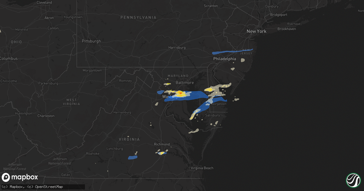
Hail Map on July 1, 2021
Get this storm
July 1 map
$229
one time, instant access
Download today. No call, no setup
Keep the $229
Bought the map and want the full workflow? Apply the entire $229 to a subscription within 7 days. None of it is wasted.
Every map, not just this one
This buys you this map. Subscription and you get every map we run, in the markets you choose from a few cities to whole states to nationwide. Plus real-time alerts the moment a storm fires.
Contact data
Name, contact info, occupancy, even credit band for addresses in the footprint. You go from where it hit to who to call.
Become the source they trust
Unlimited branding weather history reports on demand. You already have the documented answer ready for the property owner, and you are the one who showed up with it.
Property data and RoofTrace estimates
Pull up any address you have got, its value and the exact code rules for that jurisdiction, straight from One Click Code. Then RoofTrace estimates the squares, pitch, and roof value, priced the way you price.
States Impacted by Hail Map on July 1, 2021
Storm reports
Montana
| Date | Description |
|---|---|
| 07/01/20216:56 PM CDT | Corrects previous report of 64 mph wind gust measured at kmso asos with wind observation time of 556 pm mdt. |
| 07/01/20216:53 PM CDT | Tree down. |
| 07/01/20216:44 PM CDT | Tree damage. Time based on a nearby weather station. |
| 07/01/20216:40 PM CDT | Mdt reports downed trees blocking us highway 12 five miles west of lolo... Mt. Time of damage estimated using radar data. |
| 07/01/202112:56 AM CDT | At 555 PM MDT, a severe thunderstorm was located over Lolo, or near Missoula, moving north at 10 mph. HAZARD...60 mph wind gusts. SOURCE...Radar indicated. IMPACT...Expect damage to roofs, siding, and trees. Locations impacted include... Missoula, Lolo and Wye. |
| 06/30/20218:00 PM CDT | Mdt reports downed tree blocking mt-83 north of seeley lake. Time of damage estimated by radar data. |
| 06/30/20217:53 PM CDT | Asos station kmso missoula... Mt. |
| 06/30/20217:15 PM CDT | 176 customers lost power along the i-90 corridor due to downed powerlines. Time of damage estimated using radar data. Outage reported to utility webpage at 643 pm. |
| 06/30/20217:15 PM CDT | A 8-12 inch diameter tree branch was downed along mullan road in missoula. Report retrieved via social media. Time of damage estimated. |
| 06/30/20217:05 PM CDT | Photos of three downed trees along mullan trail road in missoula. |
| 06/30/20217:00 PM CDT | Broadcast media reports downed power lines and roof damage near bickford street and ronan street. Time of report estimated. |
| 06/30/20217:00 PM CDT | Nws employee reports downed powerlines on kent ave. A 10 to 12 inch diameter... 40 foot pine tree was snapped halfway up. Time of damage estimated. |
South Carolina
| Date | Description |
|---|---|
| 07/01/20216:53 PM CDT | Broadcast media reported trees down and patio furniture tossed |
| 07/01/20216:20 PM CDT | Lee co dispatch reported a tree down on kelly bridge rd between fountain grocery and the lynches river bridge. Time estimated. |
| 07/01/20216:10 PM CDT | Schp reported tree down blocking roadway at us hwy 1 and lee state park rd. Time estimated. |
| 07/01/20213:40 AM CDT | At 839 PM EDT, severe thunderstorms were located along a line extending from near Southern Pines to Laurinburg, moving northeast at 55 mph. HAZARD...60 mph wind gusts and quarter size hail. SOURCE...Radar indicated. IMPACT...Hail damage to vehicles is expected. Expect wind damage to roofs, siding, and trees. Locations impacted include... Sanford, Laurinburg, Southern Pines, Raeford, Carthage, Pinehurst, Aberdeen, Maxton, Hoffman and Antioch. |
Oklahoma
| Date | Description |
|---|---|
| 07/01/20211:15 PM CDT | Tree and utility pole damage mainly on west side of town |
Massachusetts
| Date | Description |
|---|---|
| 07/01/20213:37 PM CDT | Tree and wires down on sandwich road near post office |
New York
| Date | Description |
|---|---|
| 07/01/20212:49 AM CDT | At 749 AM EDT, a severe thunderstorm was located near Falconer, or near Jamestown and moving east at 25 mph. HAZARD...60 mph wind gusts and quarter size hail. SOURCE...Radar indicated. IMPACT...Minor damage to vehicles is possible. Expect wind damage to roofs, siding, and trees. Locations impacted include... Jamestown, Salamanca, Allegany State Park, Lakewood, Falconer, Jamestown West, Frewsburg, Gerry, Conewango and Ellington. This includes Interstate 86 between exits 11 and 20. |
Pennsylvania
| Date | Description |
|---|---|
| 07/01/20213:59 PM CDT | Several reports of downed power lines near fairless hills. Time estimated from radar. |
| 07/01/20213:53 PM CDT | Several reports of downed tree limbs and wires in levittown. Time estimated from radar. |
| 07/01/20213:50 PM CDT | Tree down on u.s. Route 1. |
| 07/01/20213:48 PM CDT | Mping report of wind damage near jackson street. Time estimated from radar. |
| 07/01/20213:30 PM CDT | Downed tree on wires near the intersection of washington lane and pepper road. Time estimated from radar. |
| 07/01/20213:19 PM CDT | Downed trees and wires near turk road in doylestown. Time estimated from radar. |
| 07/01/20213:12 PM CDT | Downed tree limbs on joshua road near cedar grove road. Time estimated from radar. |
| 07/01/20213:00 PM CDT | Downed trees and wires on marshall bridge road in kennett square. Time estimate from radar. |
| 07/01/20212:59 PM CDT | Downed trees and wires near garfield park in lansdale. |
| 07/01/20212:51 PM CDT | Several reports of downed tree limbs and wires near valley forge and phoenixville. Time estimated from radar. |
| 07/01/20212:47 PM CDT | Downed wires near paradise valley nature area in downingtown. Time estimated from radar. |
| 07/01/20212:31 PM CDT | Downed wires near horseshoe trail. Time estimated from radar. |
| 07/01/20212:27 PM CDT | Downed tree on beaver run road. Time estimated from radar. |
| 07/01/20212:26 PM CDT | Downed trees and wires near valley station road in coatesville. Time estimated from radar. |
| 07/01/20212:23 PM CDT | Mping report of downed tree limbs and power lines near route 100. Time estimated from radar. |
| 07/01/20212:21 PM CDT | Downed tree on fisherville road. Time estimated from radar. |
| 07/01/20212:21 PM CDT | Downed wires near elm road. Time estimated from radar. |
| 07/01/20212:13 PM CDT | Downed tree on lammey road. Time estimated from radar. |
| 07/01/202111:40 AM CDT | Tree down blocking road. |
| 07/01/20217:22 AM CDT | At 1221 PM EDT, a severe thunderstorm was located near Aspers, moving east at 30 mph. HAZARD...60 mph wind gusts. SOURCE...Radar indicated. IMPACT...Expect damage to roofs, siding, and trees. Locations impacted include... York, Weigelstown, Shiloh, West York, Dillsburg, Lake Meade, Mount Holly Springs, Dover, York Springs, Franklintown, Lewisberry, Wellsville, Idaville, Gardners, Newberrytown and Ski Roundtop Ski Area.This includes Interstate 83 from mile markers 25 to 32. |
| 06/30/202111:59 PM CDT | At 459 PM EDT, severe thunderstorms were located along a line extending from Pennington to near Woodstown, moving east at 30 mph. HAZARD...60 mph wind gusts. SOURCE...Radar indicated. IMPACT...Damage to roofs, siding, trees, and power lines is possible. Locations impacted include... Philadelphia, Trenton, Camden, Gloucester City, Cherry Hill, Old Bridge, Bensalem, East Brunswick, Evesham, South Brunswick, Mount Laurel, Ewing, Willingboro, Deptford, Voorhees, Medford, Glassboro, Lindenwold, Lumberton and Princeton.This includes the following highways... New Jersey Turnpike between exits 3 and 9. Pennsylvania Turnpike between mile markers 351 and 359. Interstate 95 in Pennsylvania between mile markers 29 and 40. Interstate 76 in New Jersey between mile markers 0 and 2. Interstate 195 in New Jersey between mile markers 0 and 12. Interstate 295 in New Jersey between mile markers 25 and 76. Interstate 676 in New Jersey near mile marker 0. Atlantic City Expressway between mile markers 30 and 44. |
| 06/30/202110:13 PM CDT | At 313 PM EDT, severe thunderstorms were located along a line extending from Bechtelsville to Glenmoore to near Quarryville, moving east at 35 mph. HAZARD...60 mph wind gusts. SOURCE...Radar indicated. IMPACT...Damage to roofs, siding, trees, and power lines is possible. Locations impacted include... West Chester, Pottstown, Phoenixville, Lansdale, West Norriton, East Norriton, Coatesville, Quakertown, Perkasie, Downingtown, Souderton, Bedminster, Kennett Square, Birdsboro, Collegeville, Oxford, Royersford, Parkesburg, Trappe and Hatfield.This includes the following highways... Pennsylvania Turnpike between mile markers 299 and 326. Northeast Extension between mile markers 25 and 47. |
| 06/30/20218:15 PM CDT | At 115 PM EDT, a severe thunderstorm was located over Manchester, moving east at 30 mph. HAZARD...60 mph wind gusts. SOURCE...Radar indicated. IMPACT...Expect damage to roofs, siding, and trees. This severe thunderstorm will be near... York, Mount Wolf, Manchester, Valley View and Grantley around 120 PM EDT. Bainbridge, Hallam, Yorklyn, Stonybrook-Wilshire, East York and Tyler Run-Queens Gate around 130 PM EDT. Mount Joy, Wrightsville, Marietta, Maytown, Yorkana and Rheems around 140 PM EDT. Columbia, Mountville and Salunga-Landisville around 150 PM EDT.Other locations impacted by this severe thunderstorm include YorkHaven, Washington Boro, East Prospect, Newberrytown, York College OfPennsylvania and Penn State York.This includes Interstate 83 from mile markers 14 to 32. |
Virginia
| Date | Description |
|---|---|
| 07/01/20216:24 PM CDT | Tree down. Time estimated from radar. |
| 07/01/20213:40 PM CDT | Tree down on a residence in morattico. |
| 07/01/20213:08 PM CDT | Several trees down along the glebe lane. Tiem estimated by radar. |
| 07/01/20212:48 PM CDT | Large trees snapped. |
| 07/01/20212:45 PM CDT | Tree down on walnut drive. |
| 07/01/20212:40 PM CDT | Numerous trees downed across roads in enon section of chesterfield county... Including enon church road... Point of rocks road and ruffin mill road. Time estimated by r |
| 07/01/20212:38 PM CDT | Large tree branch down across wilmont rd north of rangerwood blvd |
| 07/01/20212:35 PM CDT | Tree down on happy hill rd. |
| 07/01/20212:30 PM CDT | Nws employee reported trees down near the intersection of branders bridge road and lakeview road. Time estimated from radar. |
| 07/01/20212:30 PM CDT | Tree down on treely rd. |
| 07/01/20212:23 PM CDT | One tree down at the intersection of webster road and poplar creek road. |
| 07/01/20212:07 PM CDT | A large tree blew down on a fence on east raymond avenue near us-1 richmond highway. |
| 07/01/20212:00 PM CDT | Canal road northwest was blocked by fallen trees between arizona avenue northwest and foxhall road northwest. |
| 07/01/20212:00 PM CDT | There were about a half a dozen calls for wires down in arlington. |
| 07/01/20211:55 PM CDT | Several dozen trees down across southern portions of fairfax county. |
| 07/01/20211:53 PM CDT | Trees blew down near the intersection of va-645 burke lake road and va-620 braddock road. |
| 07/01/20211:46 PM CDT | A tree blew down on va-643 burke center parkway near va-286 fairfax county parkway. |
| 07/01/20211:45 PM CDT | Large tree limbs were blown down on spring oak court. |
| 07/01/20211:43 PM CDT | Trees blew down near the intersection of coach road and post road. |
| 07/01/20211:42 PM CDT | Trees blew down near the intersection of newman road and va-612 colchester road. |
| 07/01/20211:38 PM CDT | Large tree branch down across wilmont rd north of rangerwood blvd |
| 07/01/20211:37 PM CDT | Multiple reports of trees down on the south side of reston. |
| 07/01/20211:35 PM CDT | There were several calls for trees blown down in and around reston. |
| 07/01/20211:24 PM CDT | Trees down along route 17 between port royal and the county line. |
| 07/01/20211:22 PM CDT | Large branches and small trees down in ashburn village. |
| 07/01/20211:22 PM CDT | A large tree was uprooted on cheltenham circle near alder lake. |
| 07/01/20211:20 PM CDT | Two trees down across old auburn rd near kines rd |
| 07/01/20211:19 PM CDT | Tree down at a residence near near farmwell hunt plaza in ashburn. |
| 07/01/20211:13 PM CDT | A six inch diameter tree blew down near the intersection of va-901 claiborne parkway and val aosta drive/early light place. |
| 07/01/20211:09 PM CDT | Tree down near route 2119 at waxpool road. |
| 07/01/20211:00 PM CDT | Wires down in vicinity of smith station rd and blackstone blvd |
| 07/01/202112:24 PM CDT | Tree down on route 3829 at chesapeake drive. |
| 07/01/20218:55 AM CDT | Tree down blocking road. |
| 07/01/20215:24 AM CDT | At 1024 PM EDT, a severe thunderstorm was located over Leda, or near Nathalie, moving east at 45 mph. HAZARD...60 mph wind gusts. SOURCE...Radar indicated. IMPACT...Expect damage to roofs, siding, and trees. Locations impacted include... Keysville... Charlotte Court House... Phenix... Nathalie... Drakes Branch... Leda... and Abilene. |
| 07/01/20214:41 AM CDT | At 940 PM EDT, severe thunderstorms were located along a line extending from near Prospect to near Hampden Sydney College to near Keysville, moving east at 40 mph. HAZARD...60 mph wind gusts and penny size hail. SOURCE...Radar indicated. IMPACT...Expect damage to trees and powerlines. Severe thunderstorms will be near, Rice and Green Bay around 950 PM EDT. Burkeville around 955 PM EDT. Crewe, Nottoway and Jetersville around 1005 PM EDT. Blackstone, Amelia Courthouse, Morven and Tobaccoville around 1015 PM EDT. Spainville, Scotts Fork and Ballsville around 1020 PM EDT. Chula and Macon around 1025 PM EDT.Other locations impacted by these severe thunderstorms include RainesTavern, North Wellville, Tuggle, Prince Edward Station, Angola,Briery, Earls, Twin Lakes State Park, Winterham and Kingsville. |
| 07/01/20213:26 AM CDT | At 825 PM EDT, a severe thunderstorm was located near South Riding, moving east at 25 mph. HAZARD...60 mph wind gusts and quarter size hail. SOURCE...Radar indicated. IMPACT...Damaging winds will cause some trees and large branches to fall. This could injure those outdoors, as well as damage homes and vehicles. Roadways may become blocked by downed trees. Localized power outages are possible. Unsecured light objects may become projectiles. Locations impacted include... Centreville, Reston, Annandale, Springfield, South Riding, Herndon, Fairfax, Vienna, Mantua, Fort Belvoir, Pimmit Hills, Dulles International Airport, Burke, Linton Hall, Oakton, Chantilly, Tysons Corner, Franconia, Wolf Trap and Merrifield. |
| 07/01/202112:29 AM CDT | At 529 PM EDT, severe thunderstorms were located along a line extending from 6 miles east of Patuxent River Naval Air Station to 7 miles north of Tylerton to near Tangier, moving northeast at 35 mph. HAZARD...60 mph wind gusts and quarter size hail. SOURCE...Radar indicated. IMPACT...Minor damage to vehicles is possible. Expect wind damage to trees and powerlines. Severe thunderstorms will be near, Lawsonia around 545 PM EDT. Marion Station around 555 PM EDT. Westover around 600 PM EDT. Princess Anne around 605 PM EDT. University Of Maryland Eastern Shore around 610 PM EDT. Pocomoke City, Vienna and West Pocomoke around 615 PM EDT.Other locations impacted by these severe thunderstorms includeHorntown, Wetipquin, Trinity, Cokesbury, Eden, Kingston, Saxis,Shelltown, Sanford and Oak Hall. |
| 06/30/202110:49 PM CDT | At 349 PM EDT, a severe thunderstorm was located over Ruthville, or near Charles City, moving northeast at 25 mph. HAZARD...70 mph wind gusts and ping pong ball size hail. SOURCE...Radar indicated. IMPACT...People and animals outdoors will be injured. Expect hail damage to roofs, siding, windows, and vehicles. Expect considerable tree damage. Wind damage is also likely to mobile homes, roofs, and outbuildings. This severe thunderstorm will be near, Holdcroft around 355 PM EDT. New Kent and Toano around 410 PM EDT. Barhamsville around 415 PM EDT.Other locations impacted by this severe thunderstorm include HollyForks, Eltham, Chickahominy Shore, York River State Park, Croaker,Mountcastle, Lanexa, Colonial Downs, Sandybottom and Warren Mill. |
| 06/30/202110:29 PM CDT | At 329 PM EDT, a severe thunderstorm was located over Ettrick, or over Virginia State University, moving northeast at 30 mph. HAZARD...60 mph wind gusts and quarter size hail. SOURCE...Radar indicated. IMPACT...Minor damage to vehicles is possible. Expect wind damage to trees and powerlines. This severe thunderstorm will be near, Fort Lee around 340 PM EDT. Hopewell around 345 PM EDT. Jordans Point around 355 PM EDT. Roxbury around 415 PM EDT.Other locations impacted by this severe thunderstorm includeBarnetts, Jordan Point Country Club, Meadowville, Birchett Estate,Wayside and Petersburg National Battlefield. |
| 06/30/202110:18 PM CDT | At 318 PM EDT, a severe thunderstorm was located near Chesterfield Court House, or 8 miles west of Chester, moving northeast at 30 mph. HAZARD...60 mph wind gusts and quarter size hail. SOURCE...Radar indicated. IMPACT...Minor damage to vehicles is possible. Expect wind damage to trees and powerlines. This severe thunderstorm will be near, Chesterfield Court House around 330 PM EDT. Colonial Heights and Chester around 335 PM EDT. Hopewell, Bellwood and Bensley around 340 PM EDT.Other locations impacted by this severe thunderstorm include RichmondHeights, Wayside, Elko, Sandston, Glendale, Pocahontas State Park,Richmond International, Fair Oaks, Beach and Meadowville. |
| 06/30/20219:28 PM CDT | At 228 PM EDT, a severe thunderstorm was located over Sterling, or over Herndon, moving east at 30 mph. HAZARD...60 mph wind gusts. SOURCE...Radar indicated. IMPACT...Damaging winds will cause some trees and large branches to fall. This could injure those outdoors, as well as damage homes and vehicles. Roadways may become blocked by downed trees. Localized power outages are possible. Unsecured light objects may become projectiles. Locations impacted include... Rockville, Bethesda, Gaithersburg, Reston, Olney, Herndon, Lowes Island, American Legion Bridge, Mclean, Aspen Hill, Potomac, North Bethesda, Ashburn, Sterling, North Potomac, Tysons Corner, Redland, Wolf Trap, Great Falls and Countryside. |
| 06/30/20219:26 PM CDT | Tree down at 136 adams road. Time estimated from radar. |
| 06/30/20219:12 PM CDT | Multiple medium-sized branches down at 4014 stagecoach road. Largest estimated to be 3-4 inches in diameter. Time estimated from radar. |
| 06/30/20219:11 PM CDT | At 211 PM EDT, severe thunderstorms were located along a line extending from near The Plains to Warrenton to near Bealeton, moving east at 30 mph. HAZARD...60 mph wind gusts. SOURCE...Radar indicated. IMPACT...Damaging winds will cause some trees and large branches to fall. This could injure those outdoors, as well as damage homes and vehicles. Roadways may become blocked by downed trees. Localized power outages are possible. Unsecured light objects may become projectiles. Locations impacted include... Centreville, Dale City, Reston, South Riding, Warrenton, Lake Ridge, Linton Hall, Chantilly, Montclair, Bull Run, Bealeton, Haymarket, The Plains, Manassas, Sudley, Manassas Park, Fairfax Station, Gainesville, New Baltimore and Independent Hill. |
| 06/30/20219:00 PM CDT | Report of a tree down on river road. Time estimated from radar. |
| 06/30/20218:59 PM CDT | At 158 PM EDT, severe thunderstorms were located along a line extending from near Fredericksburg to near Ladysmith, moving east at 30 mph. HAZARD...60 mph wind gusts and penny size hail. SOURCE...Radar indicated. IMPACT...Expect damage to trees and powerlines. Severe thunderstorms will be near, Milford around 225 PM EDT. Bowling Green around 230 PM EDT. Fort A.p. Hill around 240 PM EDT.Other locations impacted by these severe thunderstorms includeChilesburg, Rappahannock Academy, Villboro, Nancy Wrights Corner,Guinea, Corbin, Ruther Glen, Woodford and Cedon. |
| 06/30/20218:53 PM CDT | At 153 PM EDT, a severe thunderstorm was located over Oatlands, or near Brambleton, moving east at 30 mph. HAZARD...60 mph wind gusts. SOURCE...Radar indicated. IMPACT...Damaging winds will cause some trees and large branches to fall. This could injure those outdoors, as well as damage homes and vehicles. Roadways may become blocked by downed trees. Localized power outages are possible. Unsecured light objects may become projectiles. Locations impacted include... Broadlands, Lansdowne, Lowes Island, Brambleton, Dulles International Airport, Ashburn, Sterling, Countryside, Arcola, Oatlands, Belmont, Gleedsville, Aldie and Sterling Park. |
| 06/30/20218:47 PM CDT | At 147 PM EDT, a severe thunderstorm was located 8 miles north of Bumpass, or 11 miles northeast of Mineral, moving east at 30 mph. HAZARD...60 mph wind gusts and quarter size hail. SOURCE...Radar indicated. IMPACT...Damaging winds will cause some trees and large branches to fall. This could injure those outdoors, as well as damage homes and vehicles. Roadways may become blocked by downed trees. Localized power outages are possible. Unsecured light objects may become projectiles. Locations impacted include... Glenora, Partlow and Gatewood. |
| 06/30/20218:40 PM CDT | Tree down at the intersection of martin lane and middle creek road. Time estimated by radar. |
| 06/30/20218:36 PM CDT | At 136 PM EDT, a severe thunderstorm was located 9 miles west of Spotsylvania, or 13 miles northeast of Mineral, moving east at 35 mph. HAZARD...60 mph wind gusts and quarter size hail. SOURCE...Radar indicated. IMPACT...Damaging winds will cause some trees and large branches to fall. This could injure those outdoors, as well as damage homes and vehicles. Roadways may become blocked by downed trees. Localized power outages are possible. Unsecured light objects may become projectiles. Locations impacted include... Fredericksburg, Massaponax, Spotsylvania, Logan, Brokenburg, Post Oak, Thornburg, Brookfield, Snell and Alsop. |
| 06/30/20218:32 PM CDT | 2 trees down on morehead road. Time estimated by radar. |
| 06/30/20218:26 PM CDT | Widespread damage has been reported in arlington. Numerous trees... Wires... And poles were blown down. In the 4300 block of 16 street north... A large tree fell onto a |
| 06/30/20218:16 PM CDT | Tree down blocking a.l. Philpott highway near summit road. |
| 06/30/20218:03 PM CDT | Tree down in the 1500 block of south clark street. |
| 06/30/20218:00 PM CDT | Tree blew down on washington blvd and route 50. |
| 06/30/20218:00 PM CDT | Tree down on spout run parkway at lorcom lane. |
| 06/30/20217:59 PM CDT | Ef1 tornado. Path length: 4.4 miles. Path width: 125 yards. Cherrydale in arlington va to near 16th st nw and constitution ave nw dc. Max estimated wind: 90 mph. |
| 06/30/20217:59 PM CDT | Tree blew down on columbia pike near south adams street. |
| 06/30/20217:59 PM CDT | Tree down on the lyon village community center on 20th street north. |
| 06/30/20217:58 PM CDT | *** 1 inj *** widespread damage has been reported in arlington. Numerous trees... Wires... And poles were blown down. In the 4300 block of 16 street north... A large tr |
| 06/30/20217:58 PM CDT | Tree blew down on 21st street north. |
| 06/30/20217:58 PM CDT | Tree blew down on north kirkwood road and 13th street north. |
| 06/30/20217:58 PM CDT | A local report indicates 62 MPH wind near BALLSTON |
| 06/30/20217:57 PM CDT | Tree blew down on north upton street near 22nd road north. |
| 06/30/20217:57 PM CDT | Tree blew down on north illinois street and 22nd street south. |
| 06/30/20217:56 PM CDT | Tree blew down on george mason drive near 22nd street. |
| 06/30/20217:56 PM CDT | Tree blew down on north buchanan street near 20th street north. |
| 06/30/20217:56 PM CDT | Tree blew down on north utah street near 20th street north. |
| 06/30/20217:55 PM CDT | Tree blew down on north mckinley road and 9th road north. |
| 06/30/20217:55 PM CDT | Tree blew down on north mckinley road and 9th road north. |
| 06/30/20217:53 PM CDT | A tree blew down onto wires and a car near the intersection of north roosevelt street and north tuckahoe street. |
| 06/30/20217:52 PM CDT | A large tree snapped in half in the 2200 block of beacon lane. |
| 06/30/20217:45 PM CDT | A tree blew down on va-243 nutley street southwest between courthouse road southwest and tapawingo road southwest. |
| 06/30/20217:40 PM CDT | Trees blew down near the intersection of va-654 popes head road and lewisham road. |
Kentucky
| Date | Description |
|---|---|
| 06/30/20218:14 PM CDT | At 113 AM EDT, a severe thunderstorm was located over Pongo, or 9 miles south of Mount Vernon, moving northeast at 25 mph. HAZARD...60 mph wind gusts. SOURCE...Radar indicated. IMPACT...Expect damage to roofs, siding, and trees. This severe thunderstorm will be near... Sand Hill around 125 AM EDT. Camp Wildcat around 130 AM EDT.Other locations in the path of this severe thunderstorm includeGauley, Templer, Carico and Middlefork. |
California
| Date | Description |
|---|---|
| 06/30/202111:45 PM CDT | At 444 PM PDT, a severe thunderstorm was located 7 miles southeast of Markleeville, or 9 miles west of Topaz Lake, moving south at 5 to 10 mph. HAZARD...60 mph wind gusts and quarter size hail. Outflow winds could impact Markleeville. SOURCE...Radar indicated. IMPACT...Hail damage to vehicles is expected. Expect wind damage to roofs, siding, fencing and trees. Hail will impact drivers headed up Highways 4 and 89. Locations impacted include... Markleeville and Junction CA 89 And CA 4. |
New Jersey
| Date | Description |
|---|---|
| 07/01/20215:25 PM CDT | Several reports of downed power lines in the wanamassa and deal areas. Time estimated from radar. |
| 07/01/20215:20 PM CDT | Several reports of downed wires in brick township and the leisure village east area. Time estimated from radar. |
| 07/01/20215:02 PM CDT | A few reports of downed trees and wires near dutch lane road and austen court. Time estimated from radar. |
| 07/01/20214:40 PM CDT | Downed wires near dennisville-petersburg road in petersburg. Time estimated from radar. |
| 07/01/20214:39 PM CDT | Downed wires on locust trail in browns mills. Time estimated from radar. |
| 07/01/20214:35 PM CDT | Several reports of downed power lines in the area. Time estimated from radar. |
| 07/01/20214:27 PM CDT | Wires down near crosswick creek stream valley in cream ridge. Time estimated from radar. |
| 07/01/20214:19 PM CDT | Downed wires on grand avenue. Time estimated from radar. |
| 07/01/20214:06 PM CDT | Downed power lines near alloway friesburg road. Time estimated from radar. |
| 07/01/20216:40 AM CDT | At 1139 PM EDT, a severe thunderstorm was located over Seabrook Farms, or near Bridgeton, moving east at 35 mph. HAZARD...60 mph wind gusts. SOURCE...Radar indicated. IMPACT...Damage to roofs, siding, trees, and power lines is possible. Locations impacted include... Vineland, Millville, Bridgeton, Hammonton, Buena, Weymouth, Estell Manor, Newfield, Elmer, Mays Landing, Elwood-Magnolia, Olivet, Malaga, Mizpah, Seabrook Farms, South Vineland, Rosenhayn, Folsom, Collings Lakes and Centerton.This includes Atlantic City Expressway between mile markers 18 and28. |
| 07/01/202112:27 AM CDT | At 527 PM EDT, severe thunderstorms were located along a line extending from Jamesburg to near Chesilhurst to near Newfield to near West Cape May, moving east at 45 mph. HAZARD...70 mph wind gusts. SOURCE...Radar indicated. IMPACT...Expect considerable tree damage. Damage is likely to mobile homes, roofs, and outbuildings. Locations impacted include... Toms River, Vineland, Atlantic City, Long Branch, Millville, Asbury Park, Ocean City, Cape May, Sandy Hook, Cumberland, Lakewood, Middletown, Old Bridge, Jackson, Howell, East Brunswick, Marlboro, Manalapan, Medford and Barnegat.This includes the following highways... New Jersey Turnpike between exits 8 and 9. Interstate 195 in New Jersey between mile markers 5 and 34. Garden State Parkway between mile markers 0 and 122. Atlantic City Expressway between mile markers 0 and 38. |
| 06/30/202110:25 PM CDT | A couple reports of downed tree limbs near hopewell twp. Time estimated from radar. |
| 06/30/202110:25 PM CDT | A couple reports of downed tree limbs into wires near hopewell twp. Time estimated from radar. |
Delaware
| Date | Description |
|---|---|
| 07/01/20216:05 PM CDT | Damage to shingles and siding of several houses. Time estimated from radar. |
| 07/01/20215:32 PM CDT | Several reports of trees and wires down near route 18 southeast of bridgeville. Time estimated from radar. |
| 07/01/20214:24 PM CDT | Nos gauge lwsd1. |
| 07/01/20214:19 PM CDT | Downed power poles and wires near morris mill road. Time estimated from radar. |
| 07/01/20214:18 PM CDT | Nos gauge lwsd1. |
| 07/01/20214:03 PM CDT | Several large trees downed. Time estimated from radar. |
| 07/01/20214:02 PM CDT | Significant tree damage with some trees into houses. |
| 07/01/20214:00 PM CDT | Updates previous tornado report from 3 ene milford to reflect storm survey results. Damage was first observed near residences at the cedar beach road and mccolley road |
| 07/01/20214:00 PM CDT | Roof damage to a mobile home on hunting quarter road near williamsville... De. Time estimated from radar. Social media report. |
| 07/01/20213:58 PM CDT | Downed trees and wires near thistlewood road. Time estimated from radar. |
| 07/01/20213:53 PM CDT | Several reports of downed trees and wires northeast of bridgeville. Time estimated from radar. |
| 07/01/20213:53 PM CDT | Downed wires on hall street... Alder lane... And near the intersection of neals school road and boyce road in seaford. Time estimated from radar. |
| 07/01/20213:52 PM CDT | Trees down and vehicles blown off the road along u.s route 13 around tower hill road. |
| 07/01/20213:52 PM CDT | Trees and utility lines down with debris in the roadway. |
| 07/01/20213:52 PM CDT | Wind damage was first observed near a residence on farmington road... Knocking down and snapping several trees in a narrow swath. The tornado then continued over railro |
| 07/01/20213:50 PM CDT | Downed tree limbs and wires near craigs mill road and woodland road. Time estimated from radar. |
| 07/01/20213:42 PM CDT | Downed trees and power lines near woodpecker road. Time estimated from radar. |
| 07/01/20213:42 PM CDT | Several reports of downed tree limbs and wires north of felton. Time estimated from radar. |
| 07/01/20213:26 PM CDT | Downed tree limbs and wires east of hartly. Time estimated from radar. |
| 07/01/20215:35 AM CDT | At 1035 PM EDT, a severe thunderstorm was located over Chestertown, or 12 miles north of Centerville, moving southeast at 20 mph. HAZARD...60 mph wind gusts and penny size hail. SOURCE...Radar indicated. IMPACT...Damage to roofs, siding, trees, and power lines is possible. Locations impacted include... Chestertown, Church Hill, Millington, Sudlersville, Morgnec, Crumpton, Langford, Barclay and Kingstown. |
| 06/30/202111:55 PM CDT | At 454 PM EDT, severe thunderstorms were located along a line extending from Quinton to 6 miles south of Woodland Beach to near Big Stone Beach, moving east at 25 mph. HAZARD...60 mph wind gusts and penny size hail. SOURCE...Radar indicated. IMPACT...Damage to roofs, siding, trees, and power lines is possible. Locations impacted include... Vineland, Millville, Bridgeton, Cape May, Cumberland, Pennsville, Salem, North Wildwood, Laurel Lake, Woodstown, Alloway, Wildwood Crest, Quinton, Woodbine, Sea Isle City, Elmer, Avalon, West Cape May, Stone Harbor and Greenwich.This includes Garden State Parkway between mile markers 0 and 19. |
| 06/30/202111:32 PM CDT | At 431 PM EDT, severe thunderstorms were located along a line extending from near Old Town to Greensboro to Federalsburg to near Sharptown, moving east at 45 mph. HAZARD...70 mph wind gusts and quarter size hail. SOURCE...Radar indicated. IMPACT...Minor damage to vehicles is possible. Expect considerable tree damage. Wind damage is also likely to mobile homes, roofs, and outbuildings. Locations impacted include... Dover, Georgetown, Centerville, Smyrna, Milford, Seaford, Chestertown, Denton, Centreville, Millsboro, Laurel, Harrington, Camden, Clayton, Lewes, Federalsburg, Milton, Selbyville, Bridgeville and Greensboro. |
| 06/30/202111:27 PM CDT | At 426 PM EDT, severe thunderstorms were located along a line extending from New Hope to Bryn Athyn to near Newtown Square to Delaware City, moving east at 25 mph. HAZARD...60 mph wind gusts. SOURCE...Law enforcement. IMPACT...Damage to roofs, siding, trees, and power lines is possible. Locations impacted include... Philadelphia, Trenton, Camden, Wilmington, Gloucester City, Bensalem, Ewing, Chester, Willingboro, Deptford, West Deptford, Glassboro, Pennsville, Princeton, Florence, Bellmawr, Yeadon, Woodbury, Burlington and Bristol.People at the Welcome America Events should seek safe shelterimmediately!This includes the following highways... New Jersey Turnpike between exits 1 and 3, and between exits 6 and6A. Pennsylvania Turnpike between mile markers 341 and 359. Interstate 95 in Pennsylvania between mile markers 0 and 40. Interstate 95 in Delaware between mile markers 11 and 23. Interstate 76 in Pennsylvania between mile markers 335 and 351. Interstate 76 in New Jersey between mile markers 0 and 3. Interstate 195 in New Jersey between mile markers 0 and 3. Interstate 295 in New Jersey between mile markers 0 and 30, andbetween mile markers 55 and 76. Interstate 676 in Pennsylvania between mile markers 0 and 1. Interstate 676 in New Jersey between mile markers 0 and 4. Interstate 476 in Pennsylvania between mile markers 0 and 11. |
| 06/30/202111:15 PM CDT | At 414 PM EDT, severe thunderstorms were located along a line extending from Trappe to Secretary to near Vienna, moving northeast at 55 mph. HAZARD...70 mph wind gusts and quarter size hail. SOURCE...Radar indicated. IMPACT...Minor damage to vehicles is possible. Expect considerable tree damage. Wind damage is also likely to mobile homes, roofs, and outbuildings. Severe thunderstorms will be near, Hurlock around 420 PM EDT.Other locations impacted by these severe thunderstorms includeGalestown, Brookview, East New Market and Eldorado. |
| 06/30/202111:08 PM CDT | At 407 PM EDT, a severe thunderstorm was located over Cambridge, moving northeast at 55 mph. HAZARD...70 mph wind gusts and nickel size hail. SOURCE...Radar indicated. IMPACT...Expect considerable tree damage. Damage is likely to mobile homes, roofs, and outbuildings. Locations impacted include... Easton, Seaford, Federalsburg, Trappe, Preston, Oxford, Tanyard, Harmony, Copperville, Agner, Matthews, Choptank, Hambleton, Windyhill, Cordova, Blades and Bethel. |
| 06/30/202110:51 PM CDT | At 351 PM EDT, severe thunderstorms were located along a line extending from near Breezy Point to 7 miles north of Deal Island, moving northeast at 35 mph. HAZARD...60 mph wind gusts and quarter size hail. SOURCE...Radar indicated. IMPACT...Minor damage to vehicles is possible. Expect wind damage to trees and powerlines. Severe thunderstorms will be near, Vienna around 420 PM EDT. Hebron around 430 PM EDT.Other locations impacted by these severe thunderstorms includeCatchpenny, Wetipquin, Brookview, Eldorado, Andrews, Hoopersville,Royal Oak, Hudson, Honga and Church Creek. |
Ohio
| Date | Description |
|---|---|
| 07/01/20216:00 PM CDT | Tree down at the intersection of cr115 and cr71. |
| 07/01/20212:18 AM CDT | At 718 PM EDT, a severe thunderstorm was located near Marion, moving southeast at 25 mph. HAZARD...60 mph wind gusts and quarter size hail. SOURCE...Radar indicated. IMPACT...Minor damage to vehicles is possible. Expect damage to trees and power lines. Locations impacted include... Marion, Prospect, Morral, Waldo, New Bloomington, Green Camp and State Route 229 at US Route 23. |
| 07/01/20211:31 AM CDT | At 630 PM EDT, a severe thunderstorm was located near Upper Sandusky, moving south at 20 mph. HAZARD...60 mph wind gusts and quarter size hail. SOURCE...Radar indicated. IMPACT...Minor damage to vehicles is possible. Expect damage to trees and power lines. Locations impacted include... Upper Sandusky, Forest, Morral, Marseilles, Carey, Wharton, Harpster and Kirby. |
Kansas
| Date | Description |
|---|---|
| 07/01/20217:40 AM CDT | At 1240 PM CDT, a severe thunderstorm was located 11 miles northwest of Hugoton, moving southeast at 10 mph. HAZARD...Quarter size hail. SOURCE...Radar indicated. IMPACT...Damage to vehicles is expected. Locations impacted include... Hugoton. |
Maryland
| Date | Description |
|---|---|
| 07/01/20214:12 PM CDT | A local report indicates 60 MPH wind near 8 E SMITH ISLAND |
| 07/01/20213:35 PM CDT | Trees and utility wires down with debris on the roadway along maryland route 213 near hatchett road. |
| 07/01/20213:35 PM CDT | 1-inch tree limbs broken; shingles blown off. |
| 07/01/20213:35 PM CDT | Trees and utility lines down with debris on the roadway along maryland route 404 and breeding road. |
| 07/01/20213:35 PM CDT | Downed wires in the denton area. Time estimated from radar. |
| 07/01/20213:30 PM CDT | Trees and utility wires down with debris on the roadway along maryland route 313 near old denton road. |
| 07/01/20213:24 PM CDT | Several reports of wires down near centreville. Time estimated from radar. |
| 07/01/20213:21 PM CDT | Several reports of power lines down and numerous power outages in the federalsburg area. Time estimated from radar. |
| 07/01/20213:20 PM CDT | A local report indicates 59 MPH wind near 23 NE COVE POINT |
| 07/01/20213:19 PM CDT | Several reports of downed tree limbs and wires between marydel and hartly. Time estimated from radar. |
| 07/01/20213:18 PM CDT | A local report indicates 60 MPH wind near CAMBRIDGE |
| 07/01/20213:16 PM CDT | Multiple trees and wires down in wye mills and between wye mills and easton. Time estimated from radar. |
| 07/01/20213:15 PM CDT | A local report indicates 60 MPH wind near 23 NE COVE POINT |
| 07/01/20213:15 PM CDT | Measured wind gust at kcge. |
| 07/01/20213:11 PM CDT | Large tree down in a field. Time estimated from radar. |
| 07/01/20213:07 PM CDT | A local report indicates 63 MPH wind near 3 S CAPE ST. CLAIRE |
| 07/01/20213:07 PM CDT | A tree blew down on md-222 bainbridge road near mount ararat farm road. |
| 07/01/20213:00 PM CDT | Trees and utility wires down with debris on the roadway along maryland route 8 south of kent manor drive. |
| 07/01/20212:58 PM CDT | Reports of multiple trees down and vehicles... Including campers... Overturned. Time estimated by radar. |
| 07/01/20212:52 PM CDT | A local report indicates 66 MPH wind near 1 NNW EASTPORT |
| 07/01/20212:48 PM CDT | Trees and wires blew down near the intersection of md-450 governor ritchie highway and brice road. |
| 07/01/20212:45 PM CDT | Trees blew down on us-50 near md-2 solomons island road. |
| 07/01/20212:45 PM CDT | Several dozen trees... Wires and poles were blown down in and around annapolis. |
| 07/01/20212:40 PM CDT | Trees blew down near the intersection of riva road and beards point road. |
| 07/01/20212:38 PM CDT | Several dozen trees... Wires and poles were blown down in and around riva. |
| 07/01/20212:38 PM CDT | Trees blew down near the intersection of md-450 defense highway and md-424 davidsonville road. |
| 07/01/20212:37 PM CDT | A large leyland cyprus tree was blown over at a residence near londontowne. |
| 07/01/20212:37 PM CDT | Trees blew down on md-424 davidsonville road near governor bridge road. |
| 07/01/20212:33 PM CDT | Numerous 100 foot tall trees snapped at a residence just east of bowie. |
| 07/01/20212:33 PM CDT | Numerous 100 foot tall trees snapped at a residence just east of bowie. |
| 07/01/20212:30 PM CDT | A tree was reported down on northbound us-301 crain highway near md-214 central avenue. |
| 07/01/20212:30 PM CDT | Trees blew down on md-165 baldwin mill road. |
| 07/01/20212:30 PM CDT | A tree blew down on md-197 collington road near tulip grove drive. |
| 07/01/20212:30 PM CDT | Multiple trees blew down near bowie... Including near the intersection of md-197 collington road and lyle lane... And md-197 collington road and gallant fox lane. |
| 07/01/20212:25 PM CDT | Trees blew down on md-193 enterprise road near lottsford road/woodmore road. |
| 07/01/20212:23 PM CDT | A large tree and multiple tree limbs were blown down in the 7700 block of hanover parkway. |
| 07/01/20212:23 PM CDT | A tree blew down near the intersection of md-223 woodyard road and welshire drive. |
| 07/01/20212:18 PM CDT | A tree blew down on md-704 martin luther king junior highway near sheriff road. |
| 07/01/20212:07 PM CDT | There were about half a dozen calls for trees blown down in western baltimore city. |
| 07/01/20211:40 PM CDT | A local report indicates 1.00 inch wind near 1 SSE CROFTON |
| 07/01/20211:40 PM CDT | A tree blew down on md-450 defense highway. |
| 07/01/20211:31 PM CDT | A local report indicates 1.25 inch wind near 1 S CROFTON |
| 07/01/20211:29 PM CDT | A local report indicates 1.00 inch wind near 2 N BOWIE |
| 07/01/20211:29 PM CDT | A local report indicates 1.00 inch wind near 2 N BOWIE |
| 07/01/20211:27 PM CDT | A local report indicates 1.00 inch wind near 1 SE GLENN DALE |
| 07/01/20211:27 PM CDT | A local report indicates 1.75 inch wind near 2 NNW BOWIE |
| 07/01/20211:21 PM CDT | A local report indicates 1.00 inch wind near 2 ENE GLENN DALE |
| 07/01/20211:15 PM CDT | A local report indicates 1.00 inch wind near 2 SSW DAMASCUS |
| 07/01/20211:10 PM CDT | A tree blew down on southbound md-295 baltimore-washington parkway past nasa goddard. |
| 07/01/202112:52 PM CDT | Tree down on apartment building on east west highway near rosemary hills drive. |
| 07/01/202112:50 PM CDT | A local report indicates 1.00 inch wind near 1 SSE GLENMONT |
| 07/01/202112:48 PM CDT | A local report indicates 1.00 inch wind near 1 W ASPEN HILL |
| 07/01/202112:47 PM CDT | A tree blew onto a house and wires were torn down in the 7000 block of meadow lane. |
| 07/01/202112:45 PM CDT | Md-191 bradley lane was closed due to fallen trees between md-355 wisconsin avenue and md-185 connecticut avenue. |
| 07/01/20214:11 AM CDT | At 911 PM EDT, severe thunderstorms were located along a line extending from Bladensburg to Coral Hills to National Harbor, moving east at 40 mph. HAZARD...70 mph wind gusts. SOURCE...Radar indicated. IMPACT...Damaging winds will cause some trees and large branches to fall. This could injure those outdoors, as well as damage homes and vehicles. Roadways may become blocked by downed trees. Localized power outages are possible. Unsecured light objects may become projectiles. Locations impacted include... Bowie, Annapolis, Clinton, Crofton, Greenbelt, Forestville, Largo, Mayo, Shady Side, Chesapeake Beach, Deale, Naval Academy, Upper Marlboro, Severn River, South River, Fedex Field, Rhode River, Andrews Air Force Base, Arnold and Landover. |
| 07/01/202112:21 AM CDT | At 521 PM EDT, a severe thunderstorm was located over West Pocomoke, or over Pocomoke City, moving east at 30 mph. HAZARD...60 mph wind gusts and quarter size hail. SOURCE...Radar indicated. IMPACT...Minor damage to vehicles is possible. Expect wind damage to trees and powerlines. This severe thunderstorm will be near, Snow Hill around 545 PM EDT. Newark around 555 PM EDT.Other locations impacted by this severe thunderstorm include Boxiron,Cedartown, Cokesbury, Goodwill, Public Landing, Mount Wesley, Whiton,Girdletree, Stockton and Whitesburg. |
| 07/01/202112:12 AM CDT | At 511 PM EDT, severe thunderstorms were located along a line extending from 8 miles northeast of Bowers to Gumboro, moving east at 35 mph. HAZARD...70 mph wind gusts. SOURCE...Law enforcement. Several reports of wind damage have been received from Kent and Sussex Counties. IMPACT...Expect considerable tree damage. Damage is likely to mobile homes, roofs, and outbuildings. Locations impacted include... Georgetown, Milford, Millsboro, Lewes, Milton, Selbyville, Dagsboro, Millville, Ellendale, Bowers, Henlopen Acres, Gumboro, Cape Henlopen State Park, Sycamore, Big Stone Beach, Long Neck, Ocean View, Frankford, South Bethany and Dewey Beach. |
| 06/30/202111:28 PM CDT | At 427 PM EDT, severe thunderstorms were located along a line extending from near Little Plymouth to Barhamsville, moving east at 30 mph. HAZARD...60 mph wind gusts and quarter size hail. SOURCE...Radar indicated. IMPACT...Minor damage to vehicles is possible. Expect wind damage to trees and powerlines. Locations impacted include... Gloucester Courthouse, West Point, Kilmarnock, Urbanna, Fair Port, Norge, Robley, King And Queen Court House, Deltaville, Toano, Lancaster, White Stone, Saluda, Jamaica, Hartfield, Blakes, Morattico, Wicomico Church, Gwynn and Church View. |
| 06/30/202110:56 PM CDT | At 356 PM EDT, a severe thunderstorm was located over Severn River, moving east at 35 mph. HAZARD...70 mph wind gusts and nickel size hail. SOURCE...Radar indicated. IMPACT...Expect considerable tree damage. Damage is likely to mobile homes, roofs, and outbuildings. Locations impacted include... Easton, Centerville, Talbot, Chestertown, Centreville, Romancoke, Ridgely, Rock Hall, St. Michaels, Church Hill, Queen Anne, Old Town, Grasonville, Starr, Copperville, Jumptown, Morgnec, Tanyard, Harmony and Stevensville. |
| 06/30/202110:50 PM CDT | At 350 PM EDT, severe thunderstorms were located along a line extending from Perkasie to near Valley Forge to near Pleasant Hill, moving east at 30 mph. HAZARD...60 mph wind gusts. SOURCE...Law enforcement. IMPACT...Damage to roofs, siding, trees, and power lines is possible. Locations impacted include... Philadelphia, Wilmington, Newark, West Chester, Norristown, Chester, Phoenixville, Lansdale, West Norriton, East Norriton, Pennsville, Yeadon, Westtown, Perkasie, Doylestown, Conshohocken, Hatboro, Souderton, Folcroft and Ambler.This includes the following highways... Pennsylvania Turnpike between mile markers 319 and 348. Northeast Extension between mile markers 21 and 36. Interstate 95 in Pennsylvania between mile markers 0 and 10. Interstate 95 in Delaware between mile markers 1 and 23. Interstate 76 in Pennsylvania between mile markers 327 and 343. Interstate 295 in New Jersey near mile marker 0. Interstate 476 in Pennsylvania between mile markers 0 and 19. |
| 06/30/202110:26 PM CDT | At 326 PM EDT, severe thunderstorms were located along a line extending from near Fallston to near White Marsh to Essex, moving east at 50 mph. HAZARD...60 mph wind gusts. SOURCE...Radar indicated. IMPACT...Damaging winds will cause some trees and large branches to fall. This could injure those outdoors, as well as damage homes and vehicles. Roadways may become blocked by downed trees. Localized power outages are possible. Unsecured light objects may become projectiles. Locations impacted include... Middle River, Aberdeen, Havre De Grace, Aberdeen Proving Ground, Dundalk, Bel Air South, Essex, Bel Air North, Perry Hall, Rossville, White Marsh, Fallston, Bowleys Quarters, Riverside, Kingsville, Pleasant Hills, Perryman, Edgewood, Joppatowne and Glen Arm. |
| 06/30/202110:20 PM CDT | At 320 PM EDT, severe thunderstorms were located along a line extending from Greenbelt to Forestville to Clinton, moving east at 35 mph. HAZARD...70 mph wind gusts and quarter size hail. SOURCE...Radar indicated. IMPACT...Damaging winds will cause some trees and large branches to fall. This could injure those outdoors, as well as damage homes and vehicles. Roadways may become blocked by downed trees. Localized power outages are possible. Unsecured light objects may become projectiles. Locations impacted include... Bowie, Severn, Annapolis, Clinton, College Park, Crofton, Greenbelt, Beltsville, Forestville, Largo, Mayo, Shady Side, Deale, Naval Academy, Upper Marlboro, Severn River, South River, Gibson Island, Sillery Bay and Bodkin Point. |
| 06/30/202110:12 PM CDT | At 312 PM EDT, a severe thunderstorm was located near Stevensville, or near Severn River, moving east at 30 mph. HAZARD...60 mph wind gusts and penny size hail. SOURCE...Radar indicated. IMPACT...Damage to roofs, siding, trees, and power lines is possible. Locations impacted include... Easton, Centerville, Centreville, Romancoke, Church Hill, Queen Anne, Grasonville, Starr, Stevensville, Skipton, Copperville, Chester, Overton, Starkey Corner, Wye Mills, Cordova, Carville, Hope, Queenstown and Stevensville South. |
| 06/30/202110:06 PM CDT | At 305 PM EDT, a severe thunderstorm was located over Hillandale, or over Langley Park, moving east at 40 mph. HAZARD...60 mph wind gusts. SOURCE...Radar indicated. IMPACT...Damaging winds will cause some trees and large branches to fall. This could injure those outdoors, as well as damage homes and vehicles. Roadways may become blocked by downed trees. Localized power outages are possible. Unsecured light objects may become projectiles. Locations impacted include... Bethesda, College Park, Greenbelt, Langley Park, Beltsville, University of Maryland, Laurel, Fairland, White Oak, Takoma Park, Adelphi, Colesville, Kemp Mill, Chevy Chase, North Kensington, South Kensington, Forest Glen, Hillandale, North Chevy Chase and Wheaton-Glenmont. |
| 06/30/20219:50 PM CDT | Multiple trees were reported down near sudlersville. Time estimated from radar. |
| 06/30/20219:41 PM CDT | At 241 PM EDT, a severe thunderstorm was located near Ellicott City, or near Historic Ellicott City, moving east at 35 mph. HAZARD...60 mph wind gusts and quarter size hail. SOURCE...Radar indicated. IMPACT...Damaging winds will cause some trees and large branches to fall. This could injure those outdoors, as well as damage homes and vehicles. Roadways may become blocked by downed trees. Localized power outages are possible. Unsecured light objects may become projectiles. Locations impacted include... Baltimore, Columbia, Pikesville, Middle River, Elkridge, Sparrows Point, Back River, Historic Ellicott City, Glen Burnie, Ellicott City, Dundalk, Towson, Catonsville, Essex, Woodlawn, Randallstown, Parkville, Carney, Milford Mill and Perry Hall. |
| 06/30/20219:40 PM CDT | At 240 PM EDT, a severe thunderstorm was located over Poolesville, moving east at 20 mph. HAZARD...60 mph wind gusts and quarter size hail. SOURCE...Radar indicated. IMPACT...Damaging winds will cause some trees and large branches to fall. This could injure those outdoors, as well as damage homes and vehicles. Roadways may become blocked by downed trees. Localized power outages are possible. Unsecured light objects may become projectiles. Locations impacted include... Germantown, Gaithersburg, Olney, Damascus, Poolesville, Montgomery Village, North Potomac, Redland, Boyds, Clarksburg, Darnestown, Derwood, Washington Grove, Laytonsville, Barnesville, Beallsville and Dawsonville. |
| 06/30/20219:37 PM CDT | At 236 PM EDT, a severe thunderstorm was located near Leedstown, or 7 miles southwest of Colonial Beach, moving northeast at 40 mph. HAZARD...60 mph wind gusts and quarter size hail. SOURCE...Radar indicated. IMPACT...Minor damage to vehicles is possible. Expect wind damage to trees and powerlines. This severe thunderstorm will be near, Colonial Beach around 245 PM EDT.Other locations impacted by this severe thunderstorm include Lerty,Oak Grove, Potomac Beach, Potomac Mills and Westmoreland State. |
| 06/30/20219:25 PM CDT | At 224 PM EDT, a severe thunderstorm was located near Fort A.p. Hill, or 8 miles southwest of King George, moving east at 30 mph. HAZARD...60 mph wind gusts. SOURCE...Radar indicated. IMPACT...Damaging winds will cause some trees and large branches to fall. This could injure those outdoors, as well as damage homes and vehicles. Roadways may become blocked by downed trees. Localized power outages are possible. Unsecured light objects may become projectiles. Locations impacted include... King George, Dahlgren, Potomac Beach, Rollins Fork, Weedonville, Ninde, Lambs Creek, Jersey, Shiloh and Dogue. |
| 06/30/20219:18 PM CDT | At 218 PM EDT, a severe thunderstorm was located near Bowie, moving east at 35 mph. HAZARD...Ping pong ball size hail and 60 mph wind gusts. SOURCE...Radar indicated. IMPACT...Damaging winds will cause some trees and large branches to fall. This could injure those outdoors, as well as damage homes and vehicles. Roadways may become blocked by downed trees. Localized power outages are possible. Unsecured light objects may become projectiles. Locations impacted include... Bowie, Severn, Annapolis, Crofton, Mayo, Naval Academy, Magothy River, Dobbins Island, Severn River, South River, Pinehurst, Gibson Island, Sillery Bay, Severna Park, Odenton, Arnold, Lake Shore, Parole, Millersville and Londontowne. |
| 06/30/20219:10 PM CDT | At 210 PM EDT, a severe thunderstorm was located near Boyds, or near Germantown, moving east at 35 mph. HAZARD...60 mph wind gusts and quarter size hail. SOURCE...Radar indicated. IMPACT...Damaging winds will cause some trees and large branches to fall. This could injure those outdoors, as well as damage homes and vehicles. Roadways may become blocked by downed trees. Localized power outages are possible. Unsecured light objects may become projectiles. Locations impacted include... Germantown, Damascus, Montgomery Village, Clarksburg, Highland, Laytonsville, Brookeville, Roxbury Mills, Glenwood, Glenelg and Dayton. |
| 06/30/20218:14 PM CDT | Two trees blew down in the 900 block of rollins avenue. Numerous large tree branches down in the area. |
| 06/30/20218:14 PM CDT | Widespread... Numerous large tree limbs snapped in the 5700 block of falkland place and on adjacent rollins avenue north of walker mill road. A tree blew down onto a ho |
| 06/30/20218:13 PM CDT | Tree down on a house on highview place near hillview court. Several large branches down nearby. |
| 06/30/20218:07 PM CDT | Tree and wires down on sherman ave near maple ave. |
Colorado
| Date | Description |
|---|---|
| 07/01/20216:12 PM CDT | Power poles knocked completely over... With excessive tree damage in the area. |
| 07/01/20215:45 PM CDT | 5 empty rail cars flipped. Power lines downed. Time of damage estimated. |
| 07/01/20215:45 PM CDT | Golf ball to baseball size hail lasted through around 515 pm. |
| 07/01/20215:33 PM CDT | A local report indicates 67 MPH wind near 5 NE BLENDE |
| 07/01/20215:32 PM CDT | A local report indicates 61 MPH wind near 5 NE BLENDE |
| 07/01/20213:55 PM CDT | A local report indicates 58 MPH wind near BENNETT |
| 07/01/20213:30 PM CDT | A local report indicates 1.00 inch wind near 1 SSW ELLICOTT |
| 07/01/20213:02 PM CDT | A local report indicates 1.00 inch wind near GREELEY |
| 07/01/20212:39 PM CDT | Report from mping: half dollar |
| 07/01/20211:56 AM CDT | At 655 PM MDT, a severe thunderstorm was located 7 miles southwest of Rocky Ford, or 13 miles west of La Junta, moving north at 20 mph. HAZARD...70 mph wind gusts and ping pong ball size hail. SOURCE...Radar indicated. IMPACT...People and animals outdoors will be injured. Expect hail damage to roofs, siding, windows, and vehicles. Expect considerable tree damage. Wind damage is also likely to mobile homes, roofs, and outbuildings. Locations impacted include... Rocky Ford, Swink, Manzanola and Timpas. |
| 07/01/202112:38 AM CDT | At 538 PM MDT, a severe thunderstorm was located 20 miles northwest of Delhi, or 34 miles southeast of Pueblo, moving north at 10 mph. HAZARD...60 mph wind gusts and half dollar size hail. SOURCE...Radar indicated. IMPACT...Hail damage to vehicles is expected. Expect wind damage to roofs, siding, and trees. This severe thunderstorm will remain over mainly rural areas of southeastern Pueblo County. |
| 07/01/202112:35 AM CDT | At 535 PM MDT, a severe thunderstorm was located 14 miles south of Higbee, or 29 miles south of North La Junta, moving north at 10 mph. HAZARD...Two inch hail and 60 mph wind gusts. SOURCE...Radar indicated. IMPACT...People and animals outdoors will be injured. Expect hail damage to roofs, siding, windows, and vehicles. Expect wind damage to roofs, siding, and trees. This severe thunderstorm will remain over mainly rural areas of southeastern Otero, northeastern Las Animas and southwestern Bent Counties. |
| 07/01/202112:06 AM CDT | At 506 PM MDT, a severe thunderstorm was located over Boone, or 21 miles east of Pueblo, moving southeast at 20 mph. This is a very dangerous storm. HAZARD...Three inch hail and 70 mph wind gusts. SOURCE...Radar indicated. IMPACT...People and animals outdoors will be severely injured. Expect shattered windows, extensive damage to roofs, siding, and vehicles. Locations impacted include... Fowler, Olney Springs, Boone, Avondale and Pueblo Depot. |
| 06/30/202111:30 PM CDT | At 429 PM MDT, a severe thunderstorm was located near Pueblo Depot, or 10 miles northeast of Pueblo, moving southeast at 20 mph. HAZARD...60 mph wind gusts and half dollar size hail. SOURCE...Radar indicated. IMPACT...Hail damage to vehicles is expected. Expect wind damage to roofs, siding, and trees. Locations impacted include... Eastern Pueblo, Boone, Avondale and Pueblo Depot. |
| 06/30/202111:09 PM CDT | At 408 PM MDT, a severe thunderstorm was located near Pinon, or 11 miles northeast of Pueblo, and is nearly stationary. HAZARD...60 mph wind gusts and quarter size hail. SOURCE...Radar indicated. IMPACT...Hail damage to vehicles is expected. Expect wind damage to roofs, siding, and trees. Locations impacted include... Northern Pueblo and Pueblo Depot. |
| 06/30/202110:47 PM CDT | At 347 PM MDT, a severe thunderstorm was located near Pinon, or 13 miles northeast of Pueblo, moving south at 15 mph. HAZARD...60 mph wind gusts and quarter size hail. SOURCE...Radar indicated. IMPACT...Hail damage to vehicles is expected. Expect wind damage to roofs, siding, and trees. Locations impacted include... Northern Pueblo and Pueblo Depot. |
| 06/30/20219:42 PM CDT | At 242 PM MDT, a severe thunderstorm was located near Hanover, or 22 miles southeast of Colorado Springs, moving southeast at 10 mph. HAZARD...60 mph wind gusts and quarter size hail. SOURCE...Radar indicated. IMPACT...Hail damage to vehicles is expected. Expect wind damage to roofs, siding, and trees. Locations impacted include... Hanover. |
| 06/30/20219:34 PM CDT | At 234 PM MDT, a severe thunderstorm was located over Ellicott, or 25 miles east of Colorado Springs, moving southeast at 10 mph. HAZARD...60 mph wind gusts and quarter size hail. SOURCE...Trained weather spotters. IMPACT...Hail damage to vehicles is expected. Expect wind damage to roofs, siding, and trees. Locations impacted include... Yoder and Ellicott. |
| 06/30/20219:33 PM CDT | At 232 PM MDT, a severe thunderstorm was located near Calhan, or 32 miles northeast of Colorado Springs, moving east at 15 mph. HAZARD...60 mph wind gusts and quarter size hail. SOURCE...Radar indicated. IMPACT...Hail damage to vehicles is expected. Expect wind damage to roofs, siding, and trees. Locations impacted include... Calhan and Ramah. |
| 06/30/20219:26 PM CDT | At 226 PM MDT, a severe thunderstorm was located 4 miles south of Manila Village, or 22 miles east of Denver, moving south at 5 mph. HAZARD...60 mph wind gusts. SOURCE...Radar indicated. IMPACT...Expect damage to roofs, siding, and trees. This severe thunderstorm will remain over mainly rural areas of central Arapahoe County. |
Florida
| Date | Description |
|---|---|
| 06/30/20219:43 PM CDT | At 243 PM EDT, a severe thunderstorm was located near Montura, moving north at 5 mph. HAZARD...60 mph wind gusts and penny size hail. SOURCE...Radar indicated. IMPACT...Expect damage to roofs, siding, and trees. Locations impacted include... Clewiston, Montura, Devils Garden, Lake Hicpochee and Harlem. |
North Carolina
| Date | Description |
|---|---|
| 07/01/20215:42 AM CDT | At 1041 PM EDT, severe thunderstorms were located along a line extending from Oxford to 7 miles northeast of Louisburg to Zebulon, moving northeast at 50 mph. HAZARD...60 mph wind gusts and nickel size hail. SOURCE...Radar indicated. IMPACT...Expect damage to roofs, siding, and trees. Locations impacted include... Henderson, Oxford, Louisburg, Warrenton, Norlina, Littleton, Kittrell, Bunn, Stem and Stovall. |
| 07/01/20215:01 AM CDT | At 1000 PM EDT, severe thunderstorms were located along a line extending from Durham to near Raleigh to 6 miles northwest of Benson, moving north at 80 mph. HAZARD...60 mph wind gusts and nickel size hail. SOURCE...Radar indicated. IMPACT...Expect damage to roofs, siding, and trees. Locations impacted include... Raleigh, Durham, Cary, Creedmoor, Louisburg, Wake Forest, Butner, Zebulon, Franklinton and Kittrell. |
| 07/01/20214:38 AM CDT | At 937 PM EDT, severe thunderstorms were located along a line extending from 10 miles southwest of Cary to near Lillington to Fayetteville, moving northeast at 60 mph. HAZARD...60 mph wind gusts and nickel size hail. SOURCE...Radar indicated. IMPACT...Expect damage to roofs, siding, and trees. Locations impacted include... Raleigh, Durham, Fayetteville, Cary, Smithfield, Lillington, Fort Bragg, Garner, Fuquay-Varina and Clayton. |
| 07/01/20214:09 AM CDT | At 909 PM EDT, severe thunderstorms were located along a line extending from near Sanford to 6 miles northwest of Pope AFB to near Raeford, moving northeast at 50 mph. HAZARD...60 mph wind gusts and nickel size hail. SOURCE...Radar indicated. IMPACT...Expect damage to roofs, siding, and trees. Locations impacted include... Fayetteville, Sanford, Raeford, Lillington, Fort Bragg, Fuquay-Varina, Dunn, Angier, Godwin and Pope AFB. |
| 06/30/20219:50 PM CDT | Two trees reported down near the intersection of oxford loop sw and nc highway 96 south. |
| 06/30/20219:45 PM CDT | One tree was reported down near the intersection of johnson mill rd and s lowell rd. |
| 06/30/20219:30 PM CDT | Trees fell down on power lines near the intersection of old franklinton rd and suitt store rd. |
| 06/30/20219:22 PM CDT | Tree fell across stony hill rd. |
| 06/30/20219:12 PM CDT | One tree down at the intersection of old horseman trail and kemp rd. |
| 06/30/20218:52 PM CDT | A tree fell down on power lines near the intersection of jackson-king rd and white memorial church rd. |
| 06/30/20218:45 PM CDT | Trees down on a house on pearson street in apex. Time estimated by radar. |
| 06/30/20218:43 PM CDT | Tree reported down near the intersection of fieldcrest ln and parker mill trail. |
| 06/30/20218:41 PM CDT | Em reports tree down |
| 06/30/20218:36 PM CDT | Multiple trees and powerlines reported down near nc 210 and the town of bunnlevel. |
| 06/30/20218:30 PM CDT | Tree down. Time estimated from radar. |
| 06/30/20218:17 PM CDT | A tree fell down on power lines near the 300 block of john rosser rd. |
| 06/30/20218:12 PM CDT | A tree fell on power lines near the intersection of henley rd and center church rd. |
| 06/30/20218:00 PM CDT | One tree down at the intersection of freedom road and south bethel rd. |
| 06/30/20217:52 PM CDT | A tree fell down near the intersection of james st and us-1. |
| 06/30/20217:43 PM CDT | One tree down near the intersection of sneads grove rd and old wire rd. |
| 06/30/20217:42 PM CDT | Corrects previous tstm wnd dmg report from 1 ssw aberdeen. Multiple trees down near the town of aberdeen. One tree fell on power lines near the intersection of argyll a |
| 06/30/20217:42 PM CDT | Trees reported down at the intersection of n may st and us-1. |
| 06/30/20217:34 PM CDT | Multiple trees down near the town of aberdeen. One tree fell on power lines near the intersection of argyll ave and glasgow st. Time estimated by radar. |
| 06/30/20217:28 PM CDT | A tree was reported down across the roadway near the intersection of marston rd and mcfarland rd. |
Nevada
| Date | Description |
|---|---|
| 07/01/20215:39 PM CDT | Mesonet station comn2 combs canyon raws... Elevation 6589 feet. |
| 07/01/20212:58 AM CDT | At 758 PM PDT, a severe thunderstorm was located over Silver Springs, or 8 miles southwest of Lahontan Reservoir, moving south at 5 mph. HAZARD...60 mph wind gusts and quarter size hail. SOURCE...Radar indicated. IMPACT...Hail damage to vehicles is expected. Expect wind damage to roofs, siding, fencing and trees. Locations impacted include... Silver Springs, Fort Churchill Station and Lahontan Reservoir. |
| 06/30/20219:27 PM CDT | Mesonet station pann2 pancake raws... Elevation 5165 feet. |
West Virginia
| Date | Description |
|---|---|
| 07/01/20216:38 PM CDT | Tree down blocking lanes at 4005 washington street w... Dunbar. |
| 07/01/202111:44 AM CDT | Several trees down along auto road. |
| 07/01/20217:20 AM CDT | At 1220 PM EDT, severe thunderstorms were located along a line extending from near Williamsburg to Elton, moving east at 25 mph. HAZARD...60 mph wind gusts. SOURCE...Radar indicated. IMPACT...Expect damage to roofs, siding, and trees. Locations impacted include... Lewisburg... White Sulphur Springs... Ronceverte... Renick... Falling Spring... Asbury... and Greenbrier River Trail.This includes The following Location The West Virginia StateFairgrounds. |
District of Columbia
| Date | Description |
|---|---|
| 07/01/20212:10 PM CDT | A tree blew down onto eastbound massachusetts avenue northeast near 10th street northeast. |
| 07/01/20212:10 PM CDT | *** 5 inj *** a building under construction collapsed in the 900 block of kennedy street northwest. One person was trapped and later freed... And several others were in |
| 07/01/20212:07 PM CDT | A 50-knot |
| 07/01/20212:05 PM CDT | There were a few dozen calls for trees blown down in dc. |
| 07/01/20213:47 AM CDT | At 846 PM EDT, severe thunderstorms were located along a line extending from Wolf Trap to Fairfax to near Burke, moving east at 35 mph. HAZARD...60 mph wind gusts. SOURCE...Radar indicated. IMPACT...Damaging winds will cause some trees and large branches to fall. This could injure those outdoors, as well as damage homes and vehicles. Roadways may become blocked by downed trees. Localized power outages are possible. Unsecured light objects may become projectiles. Locations impacted include... Arlington, Alexandria, Bethesda, Annandale, Clinton, Springfield, College Park, Fort Washington, Greenbelt, Langley Park, Fort Hunt, Vienna, Groveton, Forestville, Falls Church, Huntington, Largo, Coral Hills, Bladensburg and Fort Belvoir. |
| 06/30/20219:43 PM CDT | At 242 PM EDT, severe thunderstorms were located along a line extending from near Chantilly to near Burke to 6 miles west of Dale City, moving east at 35 mph. HAZARD...60 mph wind gusts and quarter size hail. SOURCE...Radar indicated. IMPACT...Damaging winds will cause some trees and large branches to fall. This could injure those outdoors, as well as damage homes and vehicles. Roadways may become blocked by downed trees. Localized power outages are possible. Unsecured light objects may become projectiles. Locations impacted include... Arlington, Alexandria, Centreville, Waldorf, Dale City, Bethesda, Reston, Annandale, Clinton, Springfield, College Park, Fort Washington, Greenbelt, Fairfax, Langley Park, Fort Hunt, Vienna, Groveton, Forestville and Falls Church. |
| 06/30/20218:44 PM CDT | At 143 PM EDT, a severe thunderstorm was located over South Kensington, or over Bethesda, moving east at 30 mph. HAZARD...60 mph wind gusts and quarter size hail. SOURCE...Radar indicated. IMPACT...Damaging winds will cause some trees and large branches to fall. This could injure those outdoors, as well as damage homes and vehicles. Roadways may become blocked by downed trees. Localized power outages are possible. Unsecured light objects may become projectiles. Locations impacted include... Rockville, Bethesda, Bowie, Severn, College Park, Crofton, Greenbelt, Langley Park, Beltsville, Bladensburg, University of Maryland, Aspen Hill, North Bethesda, Odenton, Laurel, Fairland, Hyattsville, White Oak, Takoma Park and East Riverdale. |
| 06/30/20218:11 PM CDT | Tree blew down on 14th street northeast near monroe street. |
| 06/30/20218:08 PM CDT | Ef0 tornado. Path length: 0.75 miles. Path width: 75 yards. H street ne corridor into kingman park. Max estimated wind: 80 mph. |
| 06/30/20218:05 PM CDT | Numerous trees were toppled in downtown dc near the national mall. |
| 06/30/20218:03 PM CDT | At 103 PM EDT, a severe thunderstorm was located over Ashburn, or near Broadlands, moving east at 25 mph. HAZARD...60 mph wind gusts and quarter size hail. SOURCE...Radar indicated. IMPACT...Damaging winds will cause some trees and large branches to fall. This could injure those outdoors, as well as damage homes and vehicles. Roadways may become blocked by downed trees. Localized power outages are possible. Unsecured light objects may become projectiles. Locations impacted include... Rockville, Bethesda, Gaithersburg, Reston, Olney, Herndon, Broadlands, Lansdowne, Lowes Island, Brambleton, American Legion Bridge, Aspen Hill, Potomac, North Bethesda, Ashburn, Sterling, North Potomac, Redland, Wolf Trap and Great Falls. |
| 06/30/20217:59 PM CDT | Ef0 tornado. Path length: 0.75 miles. Path width: 75 yards. H street ne corridor into kingman park. Max estimated wind: 80 mph. |
Cities Impacted by Hail Map on July 1, 2021
- Roggen, CO
- Laramie, WY
- Hugoton, KS
- Manchester Township, NJ
- Vincentown, NJ
- Chatsworth, NJ
- Browns Mills, NJ
- Cheyenne, WY
- Greeley, CO
- Medford, NJ
- Cottonwood, ID
- Esmont, VA
- Howardsville, VA
- Pemberton, NJ
- Pocomoke City, MD
- Clarksburg, MD
- Damascus, MD
- Gaithersburg, MD
- Germantown, MD
- Elbert, CO
- Greenbelt, MD
- Crofton, MD
- Crownsville, MD
- Brentwood, MD
- Upper Marlboro, MD
- Capitol Heights, MD
- Hyattsville, MD
- Annapolis, MD
- Bowie, MD
- College Park, MD
- Davidsonville, MD
- Glenn Dale, MD
- Beltsville, MD
- Lanham, MD
- Riverdale, MD
- Odenton, MD
- Riva, MD
- Laurel, MD
- Edgewater, MD
- Bladensburg, MD
- Gambrills, MD
- Washington, DC
- Avondale, CO
- Boone, CO
- Pueblo, CO
- Kim, CO
- Rice, VA
- Farmville, VA
- Chesterfield, VA
- Chester, VA
- Petersburg, VA
- Colonial Heights, VA
- Great Falls, VA
- Garrett Park, MD
- Kensington, MD
- Potomac, MD
- Rockville, MD
- Silver Spring, MD
- Bethesda, MD
- Centreville, MD
- Ingleside, MD
- Magnolia, DE
- Goldsboro, MD
- Henderson, MD
- Camden Wyoming, DE
- Marydel, DE
- Hartly, DE
- Felton, DE
- Marydel, MD
- Barclay, MD
- Dover, DE
- Mclean, TX
- Dickerson, MD
- Boyds, MD
- Barnesville, MD
- Windsor, CO
- Kiowa, CO
- Turkey, TX
- Garrett, WY
- Watkins, CO
- Bennett, CO
- Casper, WY
- Hoffman, NC
- Wagram, NC
- Marston, NC
- Aberdeen, NC
- Chevy Chase, MD
- Grangeville, ID
- Polebridge, MT
- Fowler, CO
- Millville, NJ
- Fountain, CO
- Cambridge, MD
- Taylors Island, MD
- Lexington Park, MD
- Woolford, MD
- Church Creek, MD
- Patuxent River, MD
- Madison, MD
- Yoder, WY
- Calhan, CO
- Polson, MT
- Charles City, VA
- Haines, OR
- Corvallis, MT
- Raeford, NC
- Pinebluff, NC
- Frederica, DE
- Wheatland, WY
- Prairie City, OR
- Shawnee, OK
- Spotsylvania, VA
- Greenwood, DE
- Bridgeville, DE
- Mineral, VA
- Fort George G Meade, MD
- Delmont, NJ
- Cabin John, MD
- Glen Echo, MD
- Mount Rainier, MD
- Harwood, MD
- McLean, VA
- Arlington, VA
- Lake George, CO
- Viola, DE
- Woodside, DE
- Church Hill, MD
- Heislerville, NJ
- Leesburg, NJ
- Dover Afb, DE
- Port Norris, NJ
- Seaford, DE
- Federalsburg, MD
- Dorchester, NJ
- Harrington, DE
- Newport, NJ
- Houston, DE
- Denton, MD
- Milford, DE
- Greensboro, MD
- Waterford Works, NJ
- Williamstown, NJ
- Sicklerville, NJ
- Hammonton, NJ
- Bonner, MT
- Hopewell, VA
- Kalispell, MT
- Morral, OH
- Harpster, OH
- Upper Sandusky, OH
- Mount Airy, MD
- Okarche, OK
- Rocky Mount, VA
- Rocky Ford, CO
- Model, CO
- Heathsville, VA
- Burgess, VA
- Reedville, VA
- Kaycee, WY
- Clarendon, TX
- Hurlock, MD
- Providence Forge, VA
- Whitefish, MT
- Nokesville, VA
- Catlett, VA
- Westover, MD
- Dry Fork, VA
- Danville, VA
- Chatham, VA
- Agate, CO
- Deer Trail, CO
- Snow Hill, MD
- Vass, NC
- Broadway, NC
- Cameron, NC
- Sanford, NC
- Lillington, NC
- Leesburg, VA
- Sterling, VA
- Ashburn, VA
- Aldie, VA
- Queen Anne, MD
- Annandale, VA
- Mcdaniel, MD
- Alexandria, VA
- Fairfax, VA
- Arnold, MD
- Ridgely, MD
- Fairfax Station, VA
- Claiborne, MD
- Saint Michaels, MD
- Andrews Air Force Base, MD
- Queenstown, MD
- Severna Park, MD
- Grasonville, MD
- District Heights, MD
- Rock Hall, MD
- Clifton, VA
- Cordova, MD
- Springfield, VA
- Shady Side, MD
- Falls Church, VA
- Wye Mills, MD
- Galesville, MD
- Suitland, MD
- Hillsboro, MD
- Stevensville, MD
- West River, MD
- Lothian, MD
- Fort Washington, MD
- Burke, VA
- Easton, MD
- Naval Anacost Annex, DC
- Deale, MD
- Oxon Hill, MD
- Churchton, MD
- Temple Hills, MD
- Fort Myer, VA
- Chester, MD
- Prince George, VA
- Secretary, MD
- Rhodesdale, MD
- Lincoln, DE
- Milton, DE
- East New Market, MD
- Trappe, MD
- Preston, MD
- Linkwood, MD
- Ellendale, DE
- Lewes, DE
- Vienna, MD
- Cullen, VA
- Charlotte Court House, VA
- Pamplin, VA
- Green Bay, VA
- Keysville, VA
- Meherrin, VA
- Mont Clare, PA
- Chester Springs, PA
- Wayne, PA
- Collegeville, PA
- Hatboro, PA
- Levittown, PA
- Bensalem, PA
- Bordentown, NJ
- Howell, NJ
- Huntingdon Valley, PA
- Willow Grove, PA
- Millstone Township, NJ
- Oaks, PA
- Dresher, PA
- Bridgeport, PA
- King Of Prussia, PA
- Robbinsville, NJ
- Bryn Athyn, PA
- Norristown, PA
- Freehold, NJ
- Abington, PA
- Langhorne, PA
- Horsham, PA
- Plymouth Meeting, PA
- Trenton, NJ
- Blue Bell, PA
- Cream Ridge, NJ
- Chesterfield, NJ
- Farmingdale, NJ
- Allentown, NJ
- Phoenixville, PA
- Fort Washington, PA
- Morrisville, PA
- Feasterville Trevose, PA
- Bristol, PA
- Fairless Hills, PA
- Southampton, PA
- Malvern, PA
- Ambler, PA
- Flourtown, PA