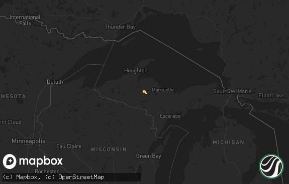
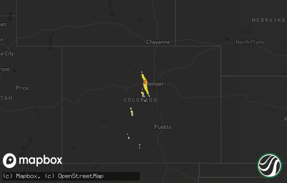
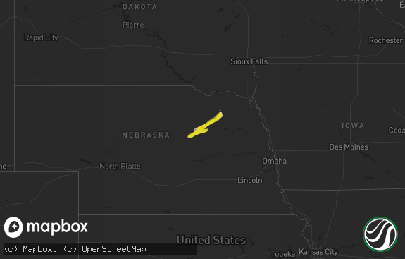
Hail Map in Michigan on June 30, 2014
The weather event in Michigan on June 30, 2014 includes Hail map. 17 states and 758 cities were impacted and suffered possible damage. The total estimated number of properties impacted is 5,872.

Hail
5,872
Estimated number of impacted properties by a 1.00" hail or larger0
Estimated number of impacted properties by a 1.75" hail or larger0
Estimated number of impacted properties by a 2.50" hail or largerStorm reports in Michigan
Michigan
| Date | Description |
|---|---|
| 06/30/20143:21 AM CDT | Downed wires near the intersection of st clair hwy and bree rd. Time estimated per radar. |
| 06/30/20143:21 AM CDT | 12 inch diameter tree limb down. Time estimated per radar. |
| 06/30/20143:05 AM CDT | Downed wires at 770 hewitt rd. Time estimated per radar. |
| 06/30/20142:59 AM CDT | Downed tree on rose rd. Time estimated per radar. |
| 06/30/20142:53 AM CDT | Downed tree on grange street. Time estimated per radar. |
| 06/30/20142:51 AM CDT | Downed wires and transformer at linne and dale allen streets. Time estimated per radar. |
| 06/30/20142:45 AM CDT | Large tree limbs downed blocking road |
| 06/30/20142:42 AM CDT | Three large trees down in several subdivisions with one vehicle damaged by fallen tree. Time estimated per radar. |
| 06/30/20142:35 AM CDT | Large tree downed on house |
| 06/30/20142:16 AM CDT | Downed power lines. Time estimated per radar. |
| 06/30/20142:15 AM CDT | Two 12 inch diamter tree limbs down. Time estimated per radar. |
| 06/30/20142:15 AM CDT | Large willow tree downed and one large tree uprooted. Time estimated per radar. |
| 06/30/20142:15 AM CDT | Numerous large tree limbs downed |
| 06/30/20142:14 AM CDT | 4 inch diameter tree limbs downed on ellis road near us-12 |
| 06/30/20142:14 AM CDT | Intersection of carpenter and ellsworth rds |
| 06/30/20142:14 AM CDT | Large tree down. Time estimated per radar. |
| 06/30/20142:14 AM CDT | Also quarter-sized hail |
| 06/30/20142:12 AM CDT | 4 ft diameter tree down |
| 06/30/20142:12 AM CDT | Multiple 4 to 6 inch limbs down |
| 06/30/20142:10 AM CDT | A local report indicates 74 MPH wind near 1 S WIXOM |
| 06/30/20142:10 AM CDT | Multiple trees down |
| 06/30/20142:10 AM CDT | 40 inch diameter tree uprooted near the intersection of huron st and general motors rd. Time estimated per radar. |
| 06/30/20142:10 AM CDT | Numerous trees and wires downed |
| 06/30/20142:10 AM CDT | Downed wires along hill rd between us 23 and morrish rd. Time estimated per radar. |
| 06/30/20142:10 AM CDT | Two 24 inch trees down blocking road. Time estimated per radar. |
| 06/30/20142:10 AM CDT | Numerous large tree limbs downed |
| 06/30/20142:00 AM CDT | Downed trees and powers lines. Time estimated per radar. |
| 06/30/20142:00 AM CDT | Downed tree across road near intersection of duffield and silver lake roads. Time estimted per radar. |
| 06/30/20142:00 AM CDT | Downed trees and power lines along strawberry lake rd. Time estimated per radar. |
| 06/30/20142:00 AM CDT | Downed trees and power lines. Time estimated per radar. |
| 06/30/20141:50 AM CDT | Downed power lines and trees relayed via media. Time estimated per radar. |
| 06/30/20141:45 AM CDT | Numerous large limbs down across jerusalem rd just west of m52. Time estimated per radar. |
| 06/30/20141:45 AM CDT | A local report indicates 65 MPH wind near 2 S CHELSEA |
| 06/30/20141:30 AM CDT | 5 to 6 inch diameter tree limbs downed throughout the city. Time estimated per radar. |
| 06/30/20141:20 AM CDT | Trees down |
| 06/30/20141:15 AM CDT | Trees down. Scattered power outages |
| 06/30/20141:13 AM CDT | Top third of a 154 foot tall 911 comms tower blown over |
| 06/30/20141:10 AM CDT | Numerous trees down across northern half of the county. |
| 06/30/20141:00 AM CDT | Large tree limbs and branches downed...greater than 2 inches in diameter. |
| 06/30/201412:58 AM CDT | A local report indicates 74 MPH wind near 1 SSE MARSHALL |
| 06/30/201412:48 AM CDT | Limbs down. Some larger dead tree damage and isolated areas of roads blocked by large trees down. Time estimated from radar |
| 06/30/201412:48 AM CDT | Report received via social media |
| 06/30/201412:47 AM CDT | Additional gust recorded at btl asos |
| 06/30/201412:36 AM CDT | Power line down |
| 06/30/201412:35 AM CDT | Numerous reports of trees and power lines down across northern part of the county |
| 06/30/201412:30 AM CDT | Wind gusts at least 65 mph. |
| 06/30/201412:25 AM CDT | A local report indicates 60 MPH wind near VICKSBURG |
| 06/30/201412:22 AM CDT | Spotter witnessed several trees come down along with power flashes in the area. |
| 06/30/201412:20 AM CDT | Spotter is reporting extensive tree damage throughout the area. Many roads have been blocked due to downed trees around vicksburg and portage areas. Winds started aroun |
| 06/30/201412:20 AM CDT | A local report indicates 66 MPH wind near 3 NE PORTAGE |
| 06/30/201412:19 AM CDT | A local report indicates 70 MPH wind near 1 E FLOWERFIELD |
| 06/30/201412:10 AM CDT | Tree down onto house |
| 06/30/201412:10 AM CDT | Spotter reported power surges. Neighbors lost power and are currently without power. |
| 06/30/201412:00 AM CDT | A local report indicates 75 MPH wind near 2 SE MARCELLUS |
| 06/29/201411:55 PM CDT | 12 trees down from berrien springs to stevensville. Time estimated. |
| 06/29/201411:32 PM CDT | A local report indicates 58 MPH wind near BUCHANAN |
| 06/29/201411:18 PM CDT | Numerous trees down up to 36 inches in diameter across much of berrien county. |
| 06/29/20149:30 PM CDT | Spoke to kalamazoo dispatch. They are receiving several reports of tree and power lines down at the time. A house fire was called in possibly due to wires/blown transfo |
| 06/29/20149:26 PM CDT | Tree down on a house. |
| 06/29/20148:55 PM CDT | Reports of trees down blocking some streets |
| 06/29/20148:36 PM CDT | Handful of trees and power lines down. Also dime size hail |
| 06/29/20148:26 PM CDT | Reports of branches down |
| 06/29/20148:19 PM CDT | A few trees have been reported down along with some power lines just south of town. |
| 06/29/20148:06 PM CDT | Power lines have been reported down in the area of branch twp |
| 06/29/20148:01 PM CDT | Central dispatch stated that reports have been received of trees down on custer road. Time estimated by radar. |
All States Impacted by Hail Map on June 30, 2014
Cities Impacted by Hail Map on June 30, 2014
- Jolley, IA
- Pomeroy, IA
- Manson, IA
- Humboldt, IA
- Rockwell City, IA
- Clare, IA
- Panama, IA
- Hutchinson, KS
- Partridge, KS
- Nickerson, KS
- Iowa Falls, IA
- Shamrock, TX
- Goodwell, OK
- Kirksville, MO
- Novinger, MO
- Greentop, MO
- Fort Dodge, IA
- Guthrie Center, IA
- Fort Stockton, TX
- Neola, IA
- Underwood, IA
- Pierce, NE
- Wayne, NE
- Carroll, NE
- Hoskins, NE
- Mclean, TX
- Sloan, IA
- Whiting, IA
- Fort Davis, TX
- Monrovia, IN
- Stilesville, IN
- Martinsville, IN
- Des Moines, IA
- Hartford, IA
- Ackworth, IA
- Carlisle, IA
- Indianola, IA
- Pleasantville, IA
- Norwalk, IA
- Milo, IA
- Swan, IA
- Runnells, IA
- Logan, IA
- Persia, IA
- Harlan, IA
- Portsmouth, IA
- Blair, NE
- Herman, NE
- Ogden, IA
- Wall Lake, IA
- Battle Creek, IA
- Breda, IA
- Jewell, IA
- Scranton, IA
- Farnhamville, IA
- Harcourt, IA
- Paton, IA
- Dana, IA
- Danbury, IA
- Correctionville, IA
- Glidden, IA
- Ellsworth, IA
- Hornick, IA
- Carroll, IA
- Lytton, IA
- Kiron, IA
- Rodney, IA
- Radcliffe, IA
- Smithland, IA
- Lake View, IA
- Castana, IA
- Anthon, IA
- Ute, IA
- Schaller, IA
- Beaver, IA
- Pilot Mound, IA
- Ida Grove, IA
- Rippey, IA
- Story City, IA
- Sac City, IA
- Odebolt, IA
- Nemaha, IA
- McCallsburg, IA
- Jefferson, IA
- Lake City, IA
- Denison, IA
- Hubbard, IA
- Schleswig, IA
- Galva, IA
- Gowrie, IA
- Stanhope, IA
- Boone, IA
- Boxholm, IA
- Garden City, IA
- Grand Junction, IA
- Auburn, IA
- Mapleton, IA
- Fonda, IA
- Randall, IA
- Churdan, IA
- Oto, IA
- Charter Oak, IA
- Stratford, IA
- Somers, IA
- Vail, IA
- Dayton, IA
- Early, IA
- Arthur, IA
- Lohrville, IA
- Pampa, TX
- Coon Rapids, IA
- Moorland, IA
- Badger, IA
- Springfield, CO
- Orient, IA
- Greenfield, IA
- Exira, IA
- Audubon, IA
- Hamlin, IA
- Vincent, IA
- Duncombe, IA
- Cumming, IA
- Arlington, KS
- Turon, KS
- Peabody, KS
- Walton, KS
- Plains, KS
- Menlo, IA
- Adair, IA
- Anita, IA
- Casey, IA
- Texhoma, OK
- Loraine, IL
- Mendon, IL
- West Point, IL
- Mobeetie, TX
- Battle Creek, MI
- Centerville, KS
- Parker, KS
- Chesterton, IN
- Morton, TX
- Fontanelle, IA
- Climax Springs, MO
- La Porte, IN
- New Carlisle, IN
- Rolling Prairie, IN
- Richmond, MO
- Campo, CO
- West Point, NE
- Bancroft, NE
- Benton Harbor, MI
- Green City, MO
- Worthington, MO
- Green Castle, MO
- Adel, IA
- Dexter, IA
- Minden, IA
- Earlham, IA
- Elk Horn, IA
- Marne, IA
- Walnut, IA
- Van Meter, IA
- Stuart, IA
- De Soto, IA
- Brayton, IA
- Waukee, IA
- Redfield, IA
- Shelby, IA
- Hancock, IA
- Atlantic, IA
- Avoca, IA
- Denver, MO
- Blythedale, MO
- Milan, MO
- Harris, MO
- Unionville, MO
- Albany, MO
- Martinsville, MO
- Newtown, MO
- Cainsville, MO
- Ridgeway, MO
- Bethany, MO
- Gentry, MO
- Pollock, MO
- Queen City, MO
- Eagleville, MO
- Baring, MO
- Downing, MO
- Princeton, MO
- Worth, MO
- Brashear, MO
- Lucerne, MO
- Independence, MO
- Blue Springs, MO
- Liberty, MO
- Camden Point, MO
- Dearborn, MO
- Platte City, MO
- Kearney, MO
- Smithville, MO
- Holt, MO
- Trimble, MO
- Lathrop, MO
- Plattsburg, MO
- Gower, MO
- Edgerton, MO
- Defiance, IA
- Kirkman, IA
- Westphalia, IA
- Earling, IA
- Paxton, IL
- Ludlow, IL
- Brewster, NE
- Winslow, NE
- Arlington, NE
- Hooper, NE
- Sioux City, IA
- Lawton, IA
- Akron, IA
- Bennington, NE
- Omaha, NE
- Fort Calhoun, NE
- Crescent, IA
- Waldron, MO
- Farley, MO
- Bates City, MO
- Kansas City, MO
- Grain Valley, MO
- Kansas City, KS
- Orrick, MO
- Sibley, MO
- Kingsville, MO
- Holden, MO
- Oak Grove, MO
- Leavenworth, KS
- Buckner, MO
- Riverside, MO
- Lees Summit, MO
- Pleasant Hill, MO
- Lansing, KS
- Lone Jack, MO
- Centerview, MO
- Greenwood, MO
- Woodbine, IA
- Dunlap, IA
- Irwin, IA
- Kimballton, IA
- Cushing, IA
- Plainview, NE
- Winside, NE
- Wisner, NE
- Lyons, NE
- Salix, IA
- Macy, NE
- Lanesboro, IA
- Onawa, IA
- Climbing Hill, IA
- Westside, IA
- Laurel, NE
- Palmer, IA
- Hubbard, NE
- Jamaica, IA
- New Providence, IA
- Rosalie, NE
- Bagley, IA
- Sergeant Bluff, IA
- Decatur, NE
- Osmond, NE
- Concord, NE
- Beemer, NE
- Walthill, NE
- Mclean, NE
- Ricketts, IA
- Randolph, NE
- Norfolk, NE
- Pender, NE
- Homer, NE
- Wakefield, NE
- Moville, IA
- Eagle Grove, IA
- Barnum, IA
- Thurston, NE
- Waterbury, NE
- Bronson, IA
- Emerson, NE
- Winnebago, NE
- Allen, NE
- Kahoka, MO
- Luray, MO
- Brazil, IN
- Greenfield, IL
- Ford, KS
- Minneola, KS
- Liberal, KS
- Macon, GA
- Lizella, GA
- Humansville, MO
- Weaubleau, MO
- Madison, NE
- Stanton, NE
- Stratford, TX
- Terre Haute, IN
- Rosedale, IN
- Conway Springs, KS
- Davis City, IA
- Lamoni, IA
- Atkinson, NE
- Amelia, NE
- Burwell, NE
- San Jon, NM
- Centerville, IA
- Moulton, IA
- Clinton, IN
- Paris, IL
- Chrisman, IL
- Pleasant Hill, IA
- Gilmore City, IA
- Gate, OK
- Laverne, OK
- Clayton, IN
- Coatesville, IN
- Missouri Valley, IA
- Howells, NE
- Pilger, NE
- Oneill, NE
- Kim, CO
- Fayette, OH
- West Unity, OH
- Orchard, NE
- Page, NE
- La Cygne, KS
- Storm Lake, IA
- Moundridge, KS
- Newton, KS
- Hesston, KS
- Hugoton, KS
- Villa Grove, IL
- Livingston, WI
- Guttenberg, IA
- Glen Haven, WI
- Elkader, IA
- Fennimore, WI
- Montfort, WI
- Strawberry Point, IA
- Bloomington, WI
- Garnavillo, IA
- Edgewood, IA
- Prairie Du Chien, WI
- Bagley, WI
- Stitzer, WI
- Lancaster, WI
- Garber, IA
- Elkport, IA
- Wyaconda, MO
- Royal, NE
- Brunswick, NE
- Abbyville, KS
- Arbela, MO
- Memphis, MO
- Tatum, NM
- Gruver, TX
- Sunray, TX
- Bassett, NE
- Zearing, IA
- Guymon, OK
- Ainsworth, NE
- Lincoln, MO
- Ionia, MO
- Cole Camp, MO
- Valparaiso, IN
- Rea, MO
- Rosendale, MO
- Bolckow, MO
- South Bend, IN
- Burrton, KS
- Halstead, KS
- Moorhead, IA
- Pisgah, IA
- Longview, IL
- Philo, IL
- Grundy Center, IA
- Tilden, NE
- Battle Creek, NE
- Meadow Grove, NE
- New Troy, MI
- Michigan City, IN
- Stevensville, MI
- New Buffalo, MI
- Lakeside, MI
- Sawyer, MI
- Bridgman, MI
- Harbert, MI
- Buchanan, MI
- Union Pier, MI
- Galien, MI
- Three Oaks, MI
- Keyes, OK
- Boise City, OK
- Walsh, CO
- Rolla, KS
- Elkhart, KS
- Waterloo, IA
- Janesville, IA
- Denver, IA
- Cedar Falls, IA
- Melbourne, IA
- State Center, IA
- Marshalltown, IA
- Dalhart, TX
- Universal, IN
- Tekamah, NE
- Craig, NE
- Oakland, NE
- West Des Moines, IA
- Mokane, MO
- New Bloomfield, MO
- Fulton, MO
- Westfield, IA
- Hinton, IA
- Jefferson, SD
- Jacksonville, AL
- Piedmont, AL
- Elkland, MO
- Polk, MO
- Bolivar, MO
- Berrien Springs, MI
- Morse, TX
- Lacona, IA
- Augusta, MI
- Climax, MI
- Galesburg, MI
- Edgar Springs, MO
- Manilla, IA
- Windsor Heights, IA
- Patterson, IA
- Grimes, IA
- Linden, IA
- Modale, IA
- Manning, IA
- Prole, IA
- Valley, NE
- Dallas Center, IA
- Saint Charles, IA
- Martensdale, IA
- Scribner, NE
- Bridgewater, IA
- Clive, IA
- Panora, IA
- Mondamin, IA
- Elkhorn, NE
- Monroe, IA
- Urbandale, IA
- Massena, IA
- Knoxville, IA
- Kennard, NE
- Otley, IA
- Honey Creek, IA
- Magnolia, IA
- Oakland, IA
- Bevington, IA
- Winterset, IA
- Wiota, IA
- Minburn, IA
- Prairie City, IA
- Washington, NE
- Grant Park, IL
- Momence, IL
- Bourbonnais, IL
- Kankakee, IL
- Bartlett, NE
- Chambers, NE
- Ames, IA
- Leigh, NE
- Albion, IA
- Clarion, IA
- Beaman, IA
- Stuart, NE
- Saint Anthony, IA
- Lehigh, IA
- Clemons, IA
- Oakdale, NE
- Ewing, NE
- South Sioux City, NE
- Pierson, IA
- Newell, IA
- Callender, IA
- Elgin, NE
- Clarkson, NE
- Winnetoon, NE
- Jackson, NE
- Perry, IA
- Deloit, IA
- Clearwater, NE
- Nevada, IA
- Neligh, NE
- Holstein, IA
- Whitten, IA
- Eldora, IA
- Arcadia, IA
- Purdum, NE
- Dawson, IA
- North Sioux City, SD
- Roland, IA
- Union, IA
- Dakota City, NE
- Conrad, IA
- Webster City, IA
- Liscomb, IA
- Ponca, NE
- Creighton, NE
- Woolstock, IA
- Dodge, NE
- Taylor, NE
- Gadsden, AL
- Derby, KS
- Rose Hill, KS
- Andover, KS
- Wichita, KS
- Lenexa, KS
- Overland Park, KS
- Miami, TX
- Osceola, MO
- Harwood, MO
- El Dorado Springs, MO
- Skokie, IL
- Wilmette, IL
- Glenview, IL
- Pella, IA
- Sylvia, KS
- Plevna, KS
- Little Sioux, IA
- Holts Summit, MO
- Chicago, IL
- Pretty Prairie, KS
- Newton, IA
- Stover, MO
- Tolono, IL
- Bouton, IA
- Madrid, IA
- Woodward, IA
- Granger, IA
- Eads, CO
- Haswell, CO
- Macks Creek, MO
- Roach, MO
- Potomac, IL
- Penfield, IL
- Treynor, IA
- Council Bluffs, IA
- Tucumcari, NM
- Springfield, IL
- Columbia, IA
- Melcher Dallas, IA
- Elk Point, SD
- Burbank, SD
- Ireton, IA
- Rockville, IN
- Saint Joseph, MO
- Newcastle, NE
- Berrien Center, MI
- Dowagiac, MI
- Eau Claire, MI
- Griffith, IN
- Dyer, IN
- Schererville, IN
- Cedar Lake, IN
- Merrillville, IN
- Crete, IL
- Saint John, IN
- Crown Point, IN
- Monticello, IL
- Le Roy, KS
- New Virginia, IA
- Osceola, IA
- North Newton, KS
- Fox Lake, WI
- Randolph, WI
- Dixon, NE
- Hartington, NE
- Coleridge, NE
- Belden, NE
- Manteno, IL
- Eldon, MO
- Tuscumbia, MO
- Eugene, MO
- Flemington, MO
- St John, KS
- Macksville, KS
- Marshall, MI
- Bellevue, MI
- Booneville, IA
- Lawson, MO
- Rayville, MO
- Polo, MO
- Beaver Dam, WI
- Pesotum, IL
- Sadorus, IL
- Tebbetts, MO
- Union Star, MO
- Savannah, MO
- Beecher, IL
- Lowell, IN
- La Plata, MO
- Steedman, MO
- Poland, IN
- Bowling Green, IN
- Hebron, IN
- Knox City, MO
- Edina, MO
- Dodge City, KS
- Cisco, IL
- Niles, MI
- Hatfield, MO
- Tuscola, IL
- Garnett, KS
- Blue Mound, KS
- Greeley, KS
- Kincaid, KS
- Welda, KS
- Mound City, KS
- Cunningham, KS
- Sawyer, KS
- Coats, KS
- Pratt, KS
- Ann Arbor, MI
- South Lyon, MI
- Walker, MO
- Schell City, MO
- Karval, CO
- Colfax, IA
- Lewis, IA
- Mentone, TX
- Reelsville, IN
- Urbana, MO
- Louisburg, MO
- Granada, CO
- Excelsior Springs, MO
- Bonner Springs, KS
- Shawnee, KS
- Middleton, WI
- Madison, WI
- Camp Point, IL
- Golden, IL
- Greenville, FL
- Kaiser, MO
- Brumley, MO
- Perryton, TX
- Ravenwood, MO
- Parnell, MO
- Maryville, MO
- Sheridan, MO
- Pickering, MO
- Kismet, KS
- Hooker, OK
- Otho, IA
- Mulvane, KS
- Mount Hope, WI
- Lake Station, IN
- Portage, IN
- Gary, IN
- Weldon, IA
- Mount Ayr, IA
- Redding, IA
- Grant City, MO
- Bonfield, IL
- Easton, MO
- Stewartsville, MO
- Newburg, MO
- Bradford, IA
- Hampton, IA
- Bloomfield, IA
- Hardin, MO
- Henrietta, MO
- Camden, MO
- Argonia, KS
- Linden, WI
- Augusta, KS
- Hurdland, MO
- Munford, AL
- Dennison, IL
- West Terre Haute, IN
- Goddard, KS
- Palmetto, FL
- Bradenton, FL
- Washta, IA
- Adrian, MO
- Rutledge, MO
- Gorin, MO
- La Belle, MO
- Stafford, KS
- Wellington, TX
- Harmony, IN
- Carbon, IN
- Oxford, AL
- Anniston, AL
- Carrollton, MO
- Norborne, MO
- Pocahontas, IA
- Monticello, FL
- Carthage, IL
- Hamilton, IL
- Atlanta, KS
- Douglass, KS
- Leon, KS
- Alpine, TX
- Galt, IA
- Buhler, KS
- Cowgill, MO
- Mcconnell Afb, KS
- Argyle, IA
- Revere, MO
- Wayland, MO
- Lamar, MO
- Knob Noster, MO
- Nauvoo, IL
- Keokuk, IA
- Montrose, IA
- Fall River, WI
- Rio, WI
- Cambria, WI
- Emmet, NE
- Florence, KS
- East Chicago, IN
- Hammond, IN
- Wellington, MO
- Haven, KS
- Chanute, KS
- Warsaw, MO
- Lucas, IA
- Quimby, IA
- Aurelia, IA
- Yale, IA
- Arcola, IL
- Champaign, IL
- Bayard, IA
- Monee, IL
- University Park, IL
- Park Forest, IL
- Richton Park, IL
- Peotone, IL
- Chicago Heights, IL
- Steger, IL
- Knightsville, IN
- Hillsdale, IN
- Montezuma, IN
- New Hampton, MO
- Spencer, IN
- Spearman, TX
- Lincolnwood, IL
- Evanston, IL
- Alta, IA
- Centertown, MO
- Williamstown, MO
- Plains, TX
- Hubertus, WI
- Colgate, WI
- Blencoe, IA
- Knierim, IA


