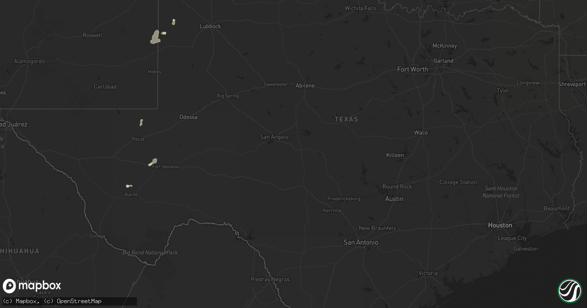
Hail Map in Texas on June 30, 2014
Get this storm
June 30 map
$229
one time, instant access
Download today. No call, no setup
Keep the $229
Bought the map and want the full workflow? Apply the entire $229 to a subscription within 7 days. None of it is wasted.
Every map, not just this one
This buys you this map. Subscription and you get every map we run, in the markets you choose from a few cities to whole states to nationwide. Plus real-time alerts the moment a storm fires.
Contact data
Name, contact info, occupancy, even credit band for addresses in the footprint. You go from where it hit to who to call.
Become the source they trust
Unlimited branding weather history reports on demand. You already have the documented answer ready for the property owner, and you are the one who showed up with it.
Property data and RoofTrace estimates
Pull up any address you have got, its value and the exact code rules for that jurisdiction, straight from One Click Code. Then RoofTrace estimates the squares, pitch, and roof value, priced the way you price.
Storm reports in Texas
Texas
| Date | Description |
|---|---|
| 06/30/20144:45 PM CDT | Reported off fm 1776...4 miles north of us 285 |
| 06/30/201412:11 AM CDT | A local report indicates 64 MPH wind near 6 E CANADIAN |
| 06/30/201412:10 AM CDT | Fallen tree blocking highway 33 between county roads 17 and 18. |
| 06/30/201412:00 AM CDT | Powerlines down at 3rd street and elsie avenue. One powerline caused a fire. |
| 06/29/201411:47 PM CDT | Via kvii schoolnet |
| 06/29/201411:46 PM CDT | Via kvii schoolnet |
| 06/29/201411:26 PM CDT | A local report indicates 60 MPH wind near LIPSCOMB |
| 06/29/201411:25 PM CDT | Report of house being shook by high thunderstorm winds in fritch. |
| 06/29/201411:25 PM CDT | A metal car port was destroyed by thunderstorm winds. |
| 06/29/201411:02 PM CDT | Schoolnet site. |
| 06/29/201410:55 PM CDT | A local report indicates 60 MPH wind near MORSE |
| 06/29/201410:53 PM CDT | A local report indicates 1.00 inch wind near 6 S GRUVER |
| 06/29/201410:35 PM CDT | A local report indicates 66 MPH wind near 3 W DUMAS |
| 06/29/20149:40 PM CDT | A local report indicates 75 MPH wind near 20 N DALHART |
All States Impacted by Hail Map on June 30, 2014
Cities Impacted by Hail Map on June 30, 2014
- Jolley, IA
- Pomeroy, IA
- Manson, IA
- Humboldt, IA
- Rockwell City, IA
- Clare, IA
- Panama, IA
- Hutchinson, KS
- Partridge, KS
- Nickerson, KS
- Iowa Falls, IA
- Shamrock, TX
- Goodwell, OK
- Kirksville, MO
- Novinger, MO
- Greentop, MO
- Fort Dodge, IA
- Guthrie Center, IA
- Fort Stockton, TX
- Neola, IA
- Underwood, IA
- Pierce, NE
- Wayne, NE
- Carroll, NE
- Hoskins, NE
- Mclean, TX
- Sloan, IA
- Whiting, IA
- Fort Davis, TX
- Monrovia, IN
- Stilesville, IN
- Martinsville, IN
- Des Moines, IA
- Hartford, IA
- Ackworth, IA
- Carlisle, IA
- Indianola, IA
- Pleasantville, IA
- Norwalk, IA
- Milo, IA
- Swan, IA
- Runnells, IA
- Logan, IA
- Persia, IA
- Harlan, IA
- Portsmouth, IA
- Blair, NE
- Herman, NE
- Ogden, IA
- Wall Lake, IA
- Battle Creek, IA
- Breda, IA
- Jewell, IA
- Scranton, IA
- Farnhamville, IA
- Harcourt, IA
- Paton, IA
- Dana, IA
- Danbury, IA
- Correctionville, IA
- Glidden, IA
- Ellsworth, IA
- Hornick, IA
- Carroll, IA
- Lytton, IA
- Kiron, IA
- Rodney, IA
- Radcliffe, IA
- Smithland, IA
- Lake View, IA
- Castana, IA
- Anthon, IA
- Ute, IA
- Schaller, IA
- Beaver, IA
- Pilot Mound, IA
- Ida Grove, IA
- Rippey, IA
- Story City, IA
- Sac City, IA
- Odebolt, IA
- Nemaha, IA
- McCallsburg, IA
- Jefferson, IA
- Lake City, IA
- Denison, IA
- Hubbard, IA
- Schleswig, IA
- Galva, IA
- Gowrie, IA
- Stanhope, IA
- Boone, IA
- Boxholm, IA
- Garden City, IA
- Grand Junction, IA
- Auburn, IA
- Mapleton, IA
- Fonda, IA
- Randall, IA
- Churdan, IA
- Oto, IA
- Charter Oak, IA
- Stratford, IA
- Somers, IA
- Vail, IA
- Dayton, IA
- Early, IA
- Arthur, IA
- Lohrville, IA
- Pampa, TX
- Coon Rapids, IA
- Moorland, IA
- Badger, IA
- Springfield, CO
- Orient, IA
- Greenfield, IA
- Exira, IA
- Audubon, IA
- Hamlin, IA
- Vincent, IA
- Duncombe, IA
- Cumming, IA
- Arlington, KS
- Turon, KS
- Peabody, KS
- Walton, KS
- Plains, KS
- Menlo, IA
- Adair, IA
- Anita, IA
- Casey, IA
- Texhoma, OK
- Loraine, IL
- Mendon, IL
- West Point, IL
- Mobeetie, TX
- Battle Creek, MI
- Centerville, KS
- Parker, KS
- Chesterton, IN
- Morton, TX
- Fontanelle, IA
- Climax Springs, MO
- La Porte, IN
- New Carlisle, IN
- Rolling Prairie, IN
- Richmond, MO
- Campo, CO
- West Point, NE
- Bancroft, NE
- Benton Harbor, MI
- Green City, MO
- Worthington, MO
- Green Castle, MO
- Adel, IA
- Dexter, IA
- Minden, IA
- Earlham, IA
- Elk Horn, IA
- Marne, IA
- Walnut, IA
- Van Meter, IA
- Stuart, IA
- De Soto, IA
- Brayton, IA
- Waukee, IA
- Redfield, IA
- Shelby, IA
- Hancock, IA
- Atlantic, IA
- Avoca, IA
- Denver, MO
- Blythedale, MO
- Milan, MO
- Harris, MO
- Unionville, MO
- Albany, MO
- Martinsville, MO
- Newtown, MO
- Cainsville, MO
- Ridgeway, MO
- Bethany, MO
- Gentry, MO
- Pollock, MO
- Queen City, MO
- Eagleville, MO
- Baring, MO
- Downing, MO
- Princeton, MO
- Worth, MO
- Brashear, MO
- Lucerne, MO
- Independence, MO
- Blue Springs, MO
- Liberty, MO
- Camden Point, MO
- Dearborn, MO
- Platte City, MO
- Kearney, MO
- Smithville, MO
- Holt, MO
- Trimble, MO
- Lathrop, MO
- Plattsburg, MO
- Gower, MO
- Edgerton, MO
- Defiance, IA
- Kirkman, IA
- Westphalia, IA
- Earling, IA
- Paxton, IL
- Ludlow, IL
- Brewster, NE
- Winslow, NE
- Arlington, NE
- Hooper, NE
- Sioux City, IA
- Lawton, IA
- Akron, IA
- Bennington, NE
- Omaha, NE
- Fort Calhoun, NE
- Crescent, IA
- Waldron, MO
- Farley, MO
- Bates City, MO
- Kansas City, MO
- Grain Valley, MO
- Kansas City, KS
- Orrick, MO
- Sibley, MO
- Kingsville, MO
- Holden, MO
- Oak Grove, MO
- Leavenworth, KS
- Buckner, MO
- Riverside, MO
- Lees Summit, MO
- Pleasant Hill, MO
- Lansing, KS
- Lone Jack, MO
- Centerview, MO
- Greenwood, MO
- Woodbine, IA
- Dunlap, IA
- Irwin, IA
- Kimballton, IA
- Cushing, IA
- Plainview, NE
- Winside, NE
- Wisner, NE
- Lyons, NE
- Salix, IA
- Macy, NE
- Lanesboro, IA
- Onawa, IA
- Climbing Hill, IA
- Westside, IA
- Laurel, NE
- Palmer, IA
- Hubbard, NE
- Jamaica, IA
- New Providence, IA
- Rosalie, NE
- Bagley, IA
- Sergeant Bluff, IA
- Decatur, NE
- Osmond, NE
- Concord, NE
- Beemer, NE
- Walthill, NE
- Mclean, NE
- Ricketts, IA
- Randolph, NE
- Norfolk, NE
- Pender, NE
- Homer, NE
- Wakefield, NE
- Moville, IA
- Eagle Grove, IA
- Barnum, IA
- Thurston, NE
- Waterbury, NE
- Bronson, IA
- Emerson, NE
- Winnebago, NE
- Allen, NE
- Kahoka, MO
- Luray, MO
- Brazil, IN
- Greenfield, IL
- Ford, KS
- Minneola, KS
- Liberal, KS
- Macon, GA
- Lizella, GA
- Humansville, MO
- Weaubleau, MO
- Madison, NE
- Stanton, NE
- Stratford, TX
- Terre Haute, IN
- Rosedale, IN
- Conway Springs, KS
- Davis City, IA
- Lamoni, IA
- Atkinson, NE
- Amelia, NE
- Burwell, NE
- San Jon, NM
- Centerville, IA
- Moulton, IA
- Clinton, IN
- Paris, IL
- Chrisman, IL
- Pleasant Hill, IA
- Gilmore City, IA
- Gate, OK
- Laverne, OK
- Clayton, IN
- Coatesville, IN
- Missouri Valley, IA
- Howells, NE
- Pilger, NE
- Oneill, NE
- Kim, CO
- Fayette, OH
- West Unity, OH
- Orchard, NE
- Page, NE
- La Cygne, KS
- Storm Lake, IA
- Moundridge, KS
- Newton, KS
- Hesston, KS
- Hugoton, KS
- Villa Grove, IL
- Livingston, WI
- Guttenberg, IA
- Glen Haven, WI
- Elkader, IA
- Fennimore, WI
- Montfort, WI
- Strawberry Point, IA
- Bloomington, WI
- Garnavillo, IA
- Edgewood, IA
- Prairie Du Chien, WI
- Bagley, WI
- Stitzer, WI
- Lancaster, WI
- Garber, IA
- Elkport, IA
- Wyaconda, MO
- Royal, NE
- Brunswick, NE
- Abbyville, KS
- Arbela, MO
- Memphis, MO
- Tatum, NM
- Gruver, TX
- Sunray, TX
- Bassett, NE
- Zearing, IA
- Guymon, OK
- Ainsworth, NE
- Lincoln, MO
- Ionia, MO
- Cole Camp, MO
- Valparaiso, IN
- Rea, MO
- Rosendale, MO
- Bolckow, MO
- South Bend, IN
- Burrton, KS
- Halstead, KS
- Moorhead, IA
- Pisgah, IA
- Longview, IL
- Philo, IL
- Grundy Center, IA
- Tilden, NE
- Battle Creek, NE
- Meadow Grove, NE
- New Troy, MI
- Michigan City, IN
- Stevensville, MI
- New Buffalo, MI
- Lakeside, MI
- Sawyer, MI
- Bridgman, MI
- Harbert, MI
- Buchanan, MI
- Union Pier, MI
- Galien, MI
- Three Oaks, MI
- Keyes, OK
- Boise City, OK
- Walsh, CO
- Rolla, KS
- Elkhart, KS
- Waterloo, IA
- Janesville, IA
- Denver, IA
- Cedar Falls, IA
- Melbourne, IA
- State Center, IA
- Marshalltown, IA
- Dalhart, TX
- Universal, IN
- Tekamah, NE
- Craig, NE
- Oakland, NE
- West Des Moines, IA
- Mokane, MO
- New Bloomfield, MO
- Fulton, MO
- Westfield, IA
- Hinton, IA
- Jefferson, SD
- Jacksonville, AL
- Piedmont, AL
- Elkland, MO
- Polk, MO
- Bolivar, MO
- Berrien Springs, MI
- Morse, TX
- Lacona, IA
- Augusta, MI
- Climax, MI
- Galesburg, MI
- Edgar Springs, MO
- Manilla, IA
- Windsor Heights, IA
- Patterson, IA
- Grimes, IA
- Linden, IA
- Modale, IA
- Manning, IA
- Prole, IA
- Valley, NE
- Dallas Center, IA
- Saint Charles, IA
- Martensdale, IA
- Scribner, NE
- Bridgewater, IA
- Clive, IA
- Panora, IA
- Mondamin, IA
- Elkhorn, NE
- Monroe, IA
- Urbandale, IA
- Massena, IA
- Knoxville, IA
- Kennard, NE
- Otley, IA
- Honey Creek, IA
- Magnolia, IA
- Oakland, IA
- Bevington, IA
- Winterset, IA
- Wiota, IA
- Minburn, IA
- Prairie City, IA
- Washington, NE
- Grant Park, IL
- Momence, IL
- Bourbonnais, IL
- Kankakee, IL
- Bartlett, NE
- Chambers, NE
- Ames, IA
- Leigh, NE
- Albion, IA
- Clarion, IA
- Beaman, IA
- Stuart, NE
- Saint Anthony, IA
- Lehigh, IA
- Clemons, IA
- Oakdale, NE
- Ewing, NE
- South Sioux City, NE
- Pierson, IA
- Newell, IA
- Callender, IA
- Elgin, NE
- Clarkson, NE
- Winnetoon, NE
- Jackson, NE
- Perry, IA
- Deloit, IA
- Clearwater, NE
- Nevada, IA
- Neligh, NE
- Holstein, IA
- Whitten, IA
- Eldora, IA
- Arcadia, IA
- Purdum, NE
- Dawson, IA
- North Sioux City, SD
- Roland, IA
- Union, IA
- Dakota City, NE
- Conrad, IA
- Webster City, IA
- Liscomb, IA
- Ponca, NE
- Creighton, NE
- Woolstock, IA
- Dodge, NE
- Taylor, NE
- Gadsden, AL
- Derby, KS
- Rose Hill, KS
- Andover, KS
- Wichita, KS
- Lenexa, KS
- Overland Park, KS
- Miami, TX
- Osceola, MO
- Harwood, MO
- El Dorado Springs, MO
- Skokie, IL
- Wilmette, IL
- Glenview, IL
- Pella, IA
- Sylvia, KS
- Plevna, KS
- Little Sioux, IA
- Holts Summit, MO
- Chicago, IL
- Pretty Prairie, KS
- Newton, IA
- Stover, MO
- Tolono, IL
- Bouton, IA
- Madrid, IA
- Woodward, IA
- Granger, IA
- Eads, CO
- Haswell, CO
- Macks Creek, MO
- Roach, MO
- Potomac, IL
- Penfield, IL
- Treynor, IA
- Council Bluffs, IA
- Tucumcari, NM
- Springfield, IL
- Columbia, IA
- Melcher Dallas, IA
- Elk Point, SD
- Burbank, SD
- Ireton, IA
- Rockville, IN
- Saint Joseph, MO
- Newcastle, NE
- Berrien Center, MI
- Dowagiac, MI
- Eau Claire, MI
- Griffith, IN
- Dyer, IN
- Schererville, IN
- Cedar Lake, IN
- Merrillville, IN
- Crete, IL
- Saint John, IN
- Crown Point, IN
- Monticello, IL
- Le Roy, KS
- New Virginia, IA
- Osceola, IA
- North Newton, KS
- Fox Lake, WI
- Randolph, WI
- Dixon, NE
- Hartington, NE
- Coleridge, NE
- Belden, NE
- Manteno, IL
- Eldon, MO
- Tuscumbia, MO
- Eugene, MO
- Flemington, MO
- St John, KS
- Macksville, KS
- Marshall, MI
- Bellevue, MI
- Booneville, IA
- Lawson, MO
- Rayville, MO
- Polo, MO
- Beaver Dam, WI
- Pesotum, IL
- Sadorus, IL
- Tebbetts, MO
- Union Star, MO
- Savannah, MO
- Beecher, IL
- Lowell, IN
- La Plata, MO
- Steedman, MO
- Poland, IN
- Bowling Green, IN
- Hebron, IN
- Knox City, MO
- Edina, MO
- Dodge City, KS
- Cisco, IL
- Niles, MI
- Hatfield, MO
- Tuscola, IL
- Garnett, KS
- Blue Mound, KS
- Greeley, KS
- Kincaid, KS
- Welda, KS
- Mound City, KS
- Cunningham, KS
- Sawyer, KS
- Coats, KS
- Pratt, KS
- Ann Arbor, MI
- South Lyon, MI
- Walker, MO
- Schell City, MO
- Karval, CO
- Colfax, IA
- Lewis, IA
- Mentone, TX
- Reelsville, IN
- Urbana, MO
- Louisburg, MO
- Granada, CO
- Excelsior Springs, MO
- Bonner Springs, KS
- Shawnee, KS
- Middleton, WI
- Madison, WI
- Camp Point, IL
- Golden, IL
- Greenville, FL
- Kaiser, MO
- Brumley, MO
- Perryton, TX
- Ravenwood, MO
- Parnell, MO
- Maryville, MO
- Sheridan, MO
- Pickering, MO
- Kismet, KS
- Hooker, OK
- Otho, IA
- Mulvane, KS
- Mount Hope, WI
- Lake Station, IN
- Portage, IN
- Gary, IN
- Weldon, IA
- Mount Ayr, IA
- Redding, IA
- Grant City, MO
- Bonfield, IL
- Easton, MO
- Stewartsville, MO
- Newburg, MO
- Bradford, IA
- Hampton, IA
- Bloomfield, IA
- Hardin, MO
- Henrietta, MO
- Camden, MO
- Argonia, KS
- Linden, WI
- Augusta, KS
- Hurdland, MO
- Munford, AL
- Dennison, IL
- West Terre Haute, IN
- Goddard, KS
- Palmetto, FL
- Bradenton, FL
- Washta, IA
- Adrian, MO
- Rutledge, MO
- Gorin, MO
- La Belle, MO
- Stafford, KS
- Wellington, TX
- Harmony, IN
- Carbon, IN
- Oxford, AL
- Anniston, AL
- Carrollton, MO
- Norborne, MO
- Pocahontas, IA
- Monticello, FL
- Carthage, IL
- Hamilton, IL
- Atlanta, KS
- Douglass, KS
- Leon, KS
- Alpine, TX
- Galt, IA
- Buhler, KS
- Cowgill, MO
- Mcconnell Afb, KS
- Argyle, IA
- Revere, MO
- Wayland, MO
- Lamar, MO
- Knob Noster, MO
- Nauvoo, IL
- Keokuk, IA
- Montrose, IA
- Fall River, WI
- Rio, WI
- Cambria, WI
- Emmet, NE
- Florence, KS
- East Chicago, IN
- Hammond, IN
- Wellington, MO
- Haven, KS
- Chanute, KS
- Warsaw, MO
- Lucas, IA
- Quimby, IA
- Aurelia, IA
- Yale, IA
- Arcola, IL
- Champaign, IL
- Bayard, IA
- Monee, IL
- University Park, IL
- Park Forest, IL
- Richton Park, IL
- Peotone, IL
- Chicago Heights, IL
- Steger, IL
- Knightsville, IN
- Hillsdale, IN
- Montezuma, IN
- New Hampton, MO
- Spencer, IN
- Spearman, TX
- Lincolnwood, IL
- Evanston, IL
- Alta, IA
- Centertown, MO
- Williamstown, MO
- Plains, TX
- Hubertus, WI
- Colgate, WI
- Blencoe, IA
- Knierim, IA


