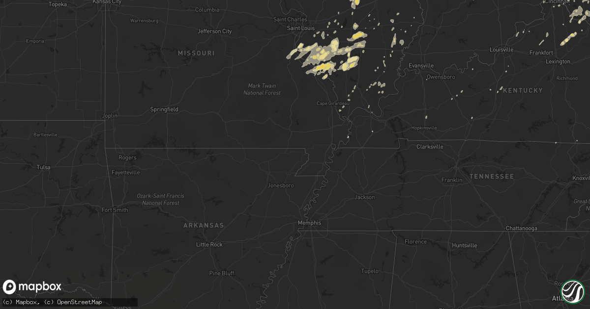
Hail Map in North Carolina on June 21, 2011
Get this storm
June 21 map
$229
one time, instant access
Download today. No call, no setup
Keep the $229
Bought the map and want the full workflow? Apply the entire $229 to a subscription within 7 days. None of it is wasted.
Every map, not just this one
This buys you this map. Subscription and you get every map we run, in the markets you choose from a few cities to whole states to nationwide. Plus real-time alerts the moment a storm fires.
Contact data
Name, contact info, occupancy, even credit band for addresses in the footprint. You go from where it hit to who to call.
Become the source they trust
Unlimited branding weather history reports on demand. You already have the documented answer ready for the property owner, and you are the one who showed up with it.
Property data and RoofTrace estimates
Pull up any address you have got, its value and the exact code rules for that jurisdiction, straight from One Click Code. Then RoofTrace estimates the squares, pitch, and roof value, priced the way you price.
Storm reports in North Carolina
North Carolina
| Date | Description |
|---|---|
| 06/21/20116:58 PM CDT | Golf ball size hail was reported by a motorist along the all american freeway betweeen santa fe drive and raeford road. The hail was covering the ground. |
| 06/21/20116:56 PM CDT | Trees down on cherry grove road. |
| 06/21/20116:56 PM CDT | Trees down on bethlehem church road near the dan river. |
| 06/21/20116:55 PM CDT | Public reports quarter size hail at hay street and ft. Bragg road |
| 06/21/20116:53 PM CDT | Trees down on price road near shady grove road. |
| 06/21/20116:53 PM CDT | Public reported quarter size hail on ft. Bragg road. |
| 06/21/20116:45 PM CDT | Quarter sized hail was reported along west woodall street near south mclamb street. |
| 06/21/20116:43 PM CDT | Trees down on settle bridge road near river road. |
| 06/21/20116:40 PM CDT | Quarter size hail reported at filter plant road and bragg blvd |
| 06/21/20116:38 PM CDT | A local report indicates 1.50 inch wind near 5 SE STONEVILLE |
| 06/21/20116:38 PM CDT | A local report indicates 1.00 inch wind near 3 SE STONEVILLE |
| 06/21/20116:35 PM CDT | Nickel to quarter size hail in benson |
| 06/21/20116:30 PM CDT | A local report indicates 1.00 inch wind near 6 ENE MADISON |
| 06/21/20116:30 PM CDT | Public reported quarter size hail |
| 06/21/20116:26 PM CDT | Tree blown down on a power line. The power line fell on a house causing a structural fire. |
| 06/21/20116:22 PM CDT | Trees down on puckett road near highway 704 |
| 06/21/20116:20 PM CDT | A local report indicates 1.75 inch wind near VANDER |
| 06/21/20116:20 PM CDT | Trees down on robin road. |
| 06/21/20115:50 PM CDT | Multiple 3-4 inch diameter limbs down on hwy 18 going into shelby. |
| 06/21/20115:40 PM CDT | Tree down at the intersection of highway 268 and quaker church road. |
| 06/21/20115:28 PM CDT | Tree down on copeland church road. |
| 06/21/20115:24 PM CDT | Public reports quarter hail east of fort bragg |
| 06/21/20115:20 PM CDT | 911 dispatcher drove through quarter size hail north of salemburg |
| 06/21/20115:02 PM CDT | Tree down on liberty grove road. |
| 06/21/20115:00 PM CDT | Bradford pear down on fishing creek arbor road. |
| 06/21/20115:00 PM CDT | Public reported up to golf ball size hail north of salemburg |
| 06/21/20114:48 PM CDT | Bradford pear blown down. |
| 06/21/20114:30 PM CDT | Two trees down on parsonsville road. |
| 06/21/20114:30 PM CDT | Tree down on shingle gap road. |
| 06/21/20114:11 PM CDT | Large tree down on a fence. |
| 06/21/20114:10 PM CDT | Large limbs down along maplebrook drive. |
| 06/21/20114:00 PM CDT | Hail quarter to half dollar sized. |
| 06/21/20113:55 PM CDT | A local report indicates 1.00 inch wind near 2 ESE ASHLAND |
| 06/21/20113:08 PM CDT | Numerous trees down including apple trees and the top half of other trees. |
| 06/21/20113:00 PM CDT | Spotter from fire dept reported nickel to quarter size hail. Time estimated from radar. Extreme northeast mcdowell county. |
| 06/21/20112:50 PM CDT | Spotter from fire dept reported nickel to quarter size hail. |
| 06/21/20112:44 PM CDT | A local report indicates 1.00 inch wind near BOONE |
| 06/21/20112:30 PM CDT | Tree down on bearwallow mtn. Tree down in edneyville area on lamb mtn. Road. Tree down near bat cave. Time estimated dy radar. |
| 06/21/20111:32 PM CDT | Hail fell on owl rest lane. |
| 06/21/20111:30 PM CDT | Trees reported down on hwy 276 ne of brevard. Time estimated from radar. |
| 06/21/20111:26 PM CDT | Quarter size hail 2 miles northeast of marshall. |
| 06/21/20111:25 PM CDT | Emergency management reported quarter size hail in the big pine community. |
| 06/21/20111:02 PM CDT | Quarter size hail reported at brevard road and i-40. |
| 06/21/20111:00 PM CDT | Quarter size hail. |
| 06/21/201112:56 PM CDT | Ncdc employee reports dime to half dollar sized hail in the bent creek subdivision. |
| 06/21/201110:37 AM CDT | Trees down along skyline drive in rockingham |
| 06/21/201110:37 AM CDT | Trees down on east washington street in rockingham |
| 06/21/20118:05 AM CDT | Nickel to quarter size hail on apex barbecue road |
| 06/21/201112:05 AM CDT | Powerlines down 500 block of homeland avenue. |
| 06/21/201112:05 AM CDT | Powerlines down 800 block of gregory st. |
| 06/20/201111:38 PM CDT | 911 center reported tree down across the road at nursery road and highway 27 |
| 06/20/201111:30 PM CDT | One tree was reported down across cemetery road near west frazier drive |
| 06/20/201111:30 PM CDT | One tree was reported down across kendale drive near cemetery road. |
| 06/20/201111:21 PM CDT | 3-4 large tree branches down on 300 block of ashwood circle. |
| 06/20/201110:37 PM CDT | 911 center reported trees down along ardsley road |
| 06/20/201110:37 PM CDT | Trees down along skyline drive in rockingham |
| 06/20/201110:37 PM CDT | Power lines down near ellerbe springs inn on highway 220 |
| 06/20/201110:37 PM CDT | Trees down on mill road in rockingham |
| 06/20/201110:22 PM CDT | 911 center reported multiple trees down in the mcfarlan area |
| 06/20/201110:14 PM CDT | Trees down in west and east concord. |
| 06/20/201110:12 PM CDT | 911 center reported multiple power lines down in polkton |
| 06/20/201110:07 PM CDT | Tree down near allen pond road |
| 06/20/201110:05 PM CDT | Tree down on cold springs road |
| 06/20/20119:45 PM CDT | Media relayed report of a tree on a house on dundeen st. |
| 06/20/20119:30 PM CDT | Several reports of wind damage throughout the city...a tree on a home on joyce dr...tree on a car on harris bvd...a large tree down across sharon lane...power lines dow |
| 06/20/20119:30 PM CDT | Multiple trees down. |
| 06/20/20119:29 PM CDT | Tree down on first st |
| 06/20/20119:22 PM CDT | Tree down near rob currie road and 109 s |
| 06/20/20119:19 PM CDT | Tree down on mccallum road |
| 06/20/20119:12 PM CDT | Tree down on warner road |
| 06/20/20118:59 PM CDT | Trees down along highway 62. |
| 06/20/20118:45 PM CDT | Quarter size hail reported in west end. |
| 06/20/20118:36 PM CDT | Multiple trees down at 1818 mcgougan road in fayetteville |
| 06/20/20118:10 PM CDT | Public reported quarter size hail in spring lake at 910 pm |
| 06/20/20118:05 PM CDT | Tree down along rex road |
| 06/20/20118:05 PM CDT | Nickel to quarter size hail on apex barbecue road. Corrected time. |
| 06/20/20117:47 PM CDT | Trees down on allison road. |
| 06/20/20117:42 PM CDT | Off duty police officer reported quarter size hail in downtown aberdeen |
| 06/20/20117:40 PM CDT | Lawndale post office employee reported large limbs down on fallston-waco road south of fallston. Time estimated from radar. |
| 06/20/20117:35 PM CDT | Quarter size hail on lower moncure road |
| 06/20/20117:05 PM CDT | Nickel to quarter size hail near route 210. Report from the elevation fire department. |
| 06/20/20117:00 PM CDT | Several trees were reported down across avent ferry road near birdie lane. |
| 06/20/20117:00 PM CDT | Hoke co dot reported numerous trees down across roads in the rockfish area... Occurred around 8pm. |
| 06/20/20117:00 PM CDT | Quarter size hail in downtown fayetteville |
| 06/20/20117:00 PM CDT | Several large trees down |
All States Impacted by Hail Map on June 21, 2011
Cities Impacted by Hail Map on June 21, 2011
- Elberton, GA
- Tignall, GA
- Raleigh, MS
- Lake, MS
- Forest, MS
- Willard, OH
- Elsie, MI
- Fort Gratiot, MI
- Laurinburg, NC
- Taylorsville, NC
- Moravian Falls, NC
- Oakdale, LA
- Elmore, AL
- Wetumpka, AL
- Burnet, TX
- Hopedale, IL
- Leakey, TX
- Aberdeen, NC
- Youngstown, OH
- East Palestine, OH
- New Middletown, OH
- New Springfield, OH
- Petersburg, OH
- Garden City, TX
- Shelby, MI
- Hart, MI
- Waterloo, IL
- Valmeyer, IL
- Waycross, GA
- Hamilton, TX
- Jonesboro, TX
- Hico, TX
- Nacogdoches, TX
- Cushing, TX
- Chesnee, SC
- Madison, NC
- Versailles, IL
- Chambersburg, IL
- Louisville, OH
- Mansfield, OH
- Keshena, WI
- Pelion, SC
- West Columbia, SC
- Gaston, SC
- Wagener, SC
- Columbia, SC
- Leesville, SC
- Swansea, SC
- Lexington, SC
- Neeses, SC
- Gilbert, SC
- Hopkins, SC
- Salley, SC
- North, SC
- Saint Matthews, SC
- Eastover, SC
- Yeaddiss, KY
- Wooton, KY
- Smilax, KY
- Canton, TX
- Ben Wheeler, TX
- Trappe, MD
- Brownwood, TX
- Cross Plains, TX
- Rising Star, TX
- Parkersburg, WV
- Williamstown, WV
- Looneyville, WV
- Spencer, WV
- Walton, WV
- Clendenin, WV
- Amma, WV
- Left Hand, WV
- Gandeeville, WV
- Midkiff, TX
- Midland, TX
- Corsicana, TX
- Barry, TX
- Alderson, WV
- Waupaca, WI
- Amherst, WI
- Trivoli, IL
- Farmington, IL
- New Castle, VA
- Pembroke, VA
- Waiteville, WV
- Stoneboro, PA
- Fort Worth, TX
- Rowena, TX
- Rocky Mount, VA
- Glade Hill, VA
- Bonne Terre, MO
- French Village, MO
- Amelia, OH
- Goldsboro, TX
- Coleman, TX
- Ware Shoals, SC
- Bokeelia, FL
- Jackson, MI
- D Hanis, TX
- Batesburg, SC
- Portsmouth, OH
- Metropolis, IL
- Carbon, TX
- Eastland, TX
- Cisco, TX
- Pennville, IN
- Keystone, IN
- Montpelier, IN
- Graford, TX
- Ozona, TX
- Cynthiana, KY
- Robert Lee, TX
- Sterling City, TX
- Zeeland, MI
- Hudsonville, MI
- Paint Rock, TX
- Voss, TX
- Mulkeytown, IL
- Du Quoin, IL
- Scheller, IL
- Tamaroa, IL
- Sesser, IL
- Grapeland, TX
- Crockett, TX
- Palo Pinto, TX
- Mineral Wells, TX
- Menard, TX
- Eden, TX
- Catlettsburg, KY
- Louisa, KY
- Decatur, TX
- Dallas, TX
- Ferguson, NC
- Purlear, NC
- Croton, OH
- Reynoldsburg, OH
- Pataskala, OH
- Blacklick, OH
- Johnstown, OH
- New Albany, OH
- Columbus, OH
- Pickerington, OH
- Waterford, PA
- Julian, WV
- Manchester, KY
- Society Hill, SC
- Lucasville, OH
- Ramsey, IL
- Broadway, NC
- Terrell, TX
- Charleston, WV
- Newberry, SC
- Silverstreet, SC
- Chappells, SC
- Mabank, TX
- Kemp, TX
- Ennis, TX
- Laurens, SC
- Neshkoro, WI
- Berlin, WI
- Chapin, SC
- Cuba, IL
- Ipava, IL
- Lewistown, IL
- Royalton, IL
- Christopher, IL
- Troup, TX
- Macy, IN
- Akron, IN
- Baird, TX
- Rayle, GA
- Shepherd, MI
- Alma, MI
- Saint Louis, MI
- Millsap, TX
- Ranger, TX
- Bangor, MI
- Lawrence, MI
- Allegan, MI
- Pullman, MI
- Paw Paw, MI
- Grand Junction, MI
- Bloomingdale, MI
- Southern Pines, NC
- Ragland, AL
- Rockville, IN
- Iraan, TX
- Mertzon, TX
- Barnhart, TX
- Santa Anna, TX
- Bangs, TX
- Broken Bow, OK
- Vestaburg, MI
- Miles, TX
- Eola, TX
- Martinsburg, WV
- South Webster, OH
- Oak Hill, OH
- Garrison, TX
- Mount Enterprise, TX
- Princeton, LA
- Haughton, LA
- Frisco City, AL
- Danville, VA
- Rock Hill, SC
- Breckenridge, TX
- Strawn, TX
- South Charleston, WV
- Varney, KY
- Pikeville, KY
- Sainte Genevieve, MO
- Saint Mary, MO
- York, SC
- Charlotte, NC
- Clover, SC
- Italy, TX
- Roseboro, NC
- Canton, IL
- Cassopolis, MI
- Niles, MI
- Edwardsburg, MI
- Collettsville, NC
- Herod, IL
- Harrisburg, IL
- Blountsville, AL
- Penn Laird, VA
- Shenandoah, VA
- Keezletown, VA
- McGaheysville, VA
- Harrisonburg, VA
- Elkton, VA
- Holton, MI
- Twin Lake, MI
- Hopkins, MI
- Wayland, MI
- Caledonia, MI
- Byron Center, MI
- Dorr, MI
- Ohio, IL
- Fresno, OH
- Kimbolton, OH
- Coshocton, OH
- Plainfield, OH
- West Lafayette, OH
- Newcomerstown, OH
- Medina, TX
- Rural Retreat, VA
- Sugar Grove, VA
- Speedwell, VA
- Steubenville, OH
- New Manchester, WV
- Toronto, OH
- Chester, WV
- New Cumberland, WV
- Weirton, WV
- Beecher City, IL
- Brownstown, IL
- Cowden, IL
- Java, VA
- Ithaca, MI
- Gray Court, SC
- Logan, OH
- Glenmora, LA
- Red Bud, IL
- Hecker, IL
- Fults, IL
- New Athens, IL
- Durand, MI
- Fort Bragg, NC
- Raeford, NC
- Blooming Grove, TX
- Alto, TX
- Genesee, PA
- Bronte, TX
- Norton, TX
- Winters, TX
- Annapolis, MO
- Rockford, MI
- Cedar Springs, MI
- Enoree, SC
- Woodruff, SC
- Pauline, SC
- North Street, MI
- Hughes Springs, TX
- Avinger, TX
- Douglassville, TX
- Linden, TX
- Marietta, TX
- Milam, TX
- Bronson, TX
- Daphne, AL
- Lilesville, NC
- Dobson, NC
- Ohatchee, AL
- Blanchard, MI
- Riverdale, MI
- Milton, NC
- Sutherlin, VA
- Semora, NC
- Ringgold, VA
- Alton, VA
- Blanch, NC
- Wadsworth, IL
- Saluda, SC
- Genoa City, WI
- Conway, SC
- Muskegon, MI
- Austinville, VA
- Woodlawn, VA
- Celina, OH
- Red Springs, NC
- Lumber Bridge, NC
- Shannon, NC
- Clinton, NC
- Stevens Point, WI
- Highland, IL
- Aviston, IL
- Trenton, IL
- Shawano, WI
- Boones Mill, VA
- Hardy, VA
- Ashley, IL
- Waltonville, IL
- Du Bois, IL
- Forney, TX
- Pineville, LA
- Glen Saint Mary, FL
- Macclenny, FL
- Palestine, TX
- Covington, VA
- Krotz Springs, LA
- Clio, SC
- Blenheim, SC
- Big Lake, TX
- Waverly, WV
- Newport, OH
- Marietta, OH
- Reno, OH
- San Saba, TX
- Easton, MD
- Americus, GA
- Ellaville, GA
- Aiken, SC
- Perryville, MO
- Bowling Green, OH
- Malone, TX
- Potosi, MO
- South Bend, IN
- Hunt, TX
- Edgefield, SC
- Woodstock, VA
- Lowndesboro, AL
- Selma, AL
- Hayneville, AL
- Tyler, AL
- Bancroft, WI
- Freetown, IN
- Uvalde, TX
- Pittsburg, TX
- Gilmer, TX
- Winnsboro, TX
- Johnston, SC
- Rhome, TX
- Justin, TX
- Argyle, TX
- Axton, VA
- Cascade, VA
- Melissa, TX
- Prosper, TX
- Mckinney, TX
- Celina, TX
- Elkview, WV
- Blackville, SC
- Springfield, SC
- Spring Creek, PA
- Pittsfield, PA
- Tennessee Colony, TX
- Montalba, TX
- Iva, SC
- Starr, SC
- Anderson, SC
- Clifton, TX
- Valley Mills, TX
- Lillington, NC
- Sanford, NC
- Baltimore, OH
- Everett, PA
- Rosedale, IN
- Montezuma, IN
- Mecca, IN
- Carlsbad, TX
- Reidsville, NC
- Utopia, TX
- Lawndale, NC
- Shelby, NC
- Pollok, TX
- Frohna, MO
- Rockwood, IL
- Jeffersonville, GA
- Belfry, KY
- Forest Hills, KY
- Canada, KY
- South Williamson, KY
- Sidney, KY
- Hot Springs, VA
- Etna Green, IN
- Bourbon, IN
- Montello, WI
- Rembert, SC
- Sumter, SC
- Dalzell, SC
- Huntington, IN
- Union Grove, WI
- Crothersville, IN
- Paris Crossing, IN
- Cincinnati, OH
- Brookeland, TX
- Delbarton, WV
- San Augustine, TX
- Princeton, WI
- Max Meadows, VA
- Wytheville, VA
- Leander, TX
- Marble Falls, TX
- Sandersville, GA
- Warthen, GA
- Sparta, GA
- Bannister, MI
- Freeland, MI
- Ava, IL
- Campbell Hill, IL
- Percy, IL
- Steeleville, IL
- Cutler, IL
- Chester, IL
- Waterford, WI
- Pandora, OH
- Wapakoneta, OH
- Granville, IL
- Mark, IL
- San Angelo, TX
- Ballinger, TX
- Rochelle, TX
- Brookesmith, TX
- Christiansburg, VA
- Shawsville, VA
- Fayetteville, NC
- Stedman, NC
- Indianola, MS
- Shaw, MS
- Athens, WI
- Hartford, MI
- Decatur, MI
- Dewy Rose, GA
- Collins, NY
- Springville, NY
- Lawtons, NY
- Anna, IL
- Dongola, IL
- White Mills, KY
- Sonora, KY
- Glendale, KY
- Blackwell, TX
- Indianapolis, IN
- Greenwood, IN
- Mount Croghan, SC
- Jefferson, SC
- Continental, OH
- Marshall, NC
- Chandler, TX
- Brownsboro, TX
- Murchison, TX
- Hernshaw, WV
- Oak Harbor, OH
- Breaux Bridge, LA
- Arnaudville, LA
- Byron, MI
- Fowlerville, MI
- White Cloud, MI
- Leopolis, WI
- Tigerton, WI
- Bowler, WI
- Bandera, TX
- Hondo, TX
- Midland, PA
- Battle Creek, MI
- Chesterfield, SC
- Cheraw, SC
- Patrick, SC
- Ovalo, TX
- Bedford, KY
- Stanfield, NC
- Oakboro, NC
- Marshville, NC
- Monroe, NC
- Tremont, IL
- Paradise, TX
- Springtown, TX
- Boyd, TX
- Purdon, TX
- Foster, WV
- Danville, WV
- Madison, WV
- Downers Grove, IL
- Glen Ellyn, IL
- Woodridge, IL
- Lisle, IL
- Waco, TX
- Elm Mott, TX
- West, TX
- North Augusta, SC
- Trenton, SC
- Benton, IL
- Weatherford, TX
- Poolville, TX
- Massillon, OH
- Lakemore, OH
- North Canton, OH
- Akron, OH
- Clinton, OH
- Uniontown, OH
- Fishersville, VA
- Waynesboro, VA
- Staunton, VA
- Howard City, MI
- Pierson, MI
- Morley, MI
- Newaygo, MI
- Sand Lake, MI
- Gallatin, TN
- Townville, PA
- Titusville, PA
- Centerville, PA
- Landenberg, PA
- Newark, DE
- West Grove, PA
- Avondale, PA
- Scottsburg, IN
- Jefferson, TX
- Vivian, LA
- Caddo Mills, TX
- Franklinville, NY
- Mount Olivet, KY
- Boston, NY
- Pitkin, LA
- West Plains, MO
- Pottersville, MO
- Lucas, OH
- Stilesville, IN
- Tyler, TX
- Iuka, IL
- Woodlawn, IL
- Centralia, IL
- Walnut Hill, IL
- Irvington, IL
- Dix, IL
- Salem, IL
- Kell, IL
- Texico, IL
- Richview, IL
- Coatesville, IN
- Bainbridge, IN
- Wautoma, WI
- Rusk, TX
- Wirtz, VA
- Avilla, IN
- Venedocia, OH
- Spencerville, OH
- Spring Lake, NC
- Chillicothe, IL
- Magnolia, IL
- Hennepin, IL
- Lacon, IL
- Dalzell, IL
- Henry, IL
- Putnam, IL
- Spring Valley, IL
- McNabb, IL
- Sparland, IL
- Washburn, IL
- Ladd, IL
- Lebanon Junction, KY
- Shepherdsville, KY
- Dexter, GA
- Dudley, GA
- Chester, GA
- Browns Summit, NC
- Penhook, VA
- Moneta, VA
- Sandy Level, VA
- Huddleston, VA
- Union Hall, VA
- Climax, MI
- East Leroy, MI
- Union City, MI
- Fulton, MI
- Colon, MI
- Sherwood, MI
- Athens, MI
- Vicksburg, MI
- Leonidas, MI
- Sugarcreek, OH
- Dundee, OH
- Mount Gilead, NC
- Candor, NC
- Santo, TX
- Apple Springs, TX
- Carroll, OH
- Canal Winchester, OH
- Millersport, OH
- Etna, OH
- Stout, OH
- Blue Creek, OH
- White Sulphur Springs, WV
- Wade, NC
- Harrod, OH
- Lima, OH
- Bluffton, OH
- Flora, IL
- Andover, NY
- Canisteo, NY
- Charles Town, WV
- Harpers Ferry, WV
- Morton, IL
- Catawba, VA
- Spruce Pine, NC
- Marion, NC
- Fort Jennings, OH
- Delphos, OH
- Hinton, WV
- Salem, VA
- Roanoke, VA
- Table Grove, IL
- Elmwood, IL
- Smithfield, IL
- Kenosha, WI
- Dawson, TX
- Morven, NC
- Alexandria, LA
- Fremont, OH
- Bailey, MI
- Grant, MI
- Ravenna, MI
- Oberlin, LA
- Greer, SC
- Duncan, SC
- Moore, SC
- Spartanburg, SC
- Blowing Rock, NC
- Del Rio, TN
- Newport, TN
- Parrottsville, TN
- Hot Springs, NC
- Lincolnton, GA
- Washington, GA
- Salem, IN
- Mena, AR
- Crane, TX
- Coulterville, IL
- Deer Creek, IL
- Mackinaw, IL
- Clintonville, WI
- Westfield, PA
- New Market, AL
- Gurley, AL
- Four Oaks, NC
- Benson, NC
- Polkton, NC
- Peachland, NC
- Doole, TX
- Millersview, TX
- Seymour, IN
- Aurora, IN
- Rising Sun, IN
- Fort Stockton, TX
- Boaz, AL
- Altoona, AL
- Saginaw, MI
- Richland, TX
- Piketon, OH
- McDermott, OH
- Antioch, IL
- Bristol, WI
- Crossville, TN
- Pikeville, TN
- Goldthwaite, TX
- Kaufman, TX
- Wedgefield, SC
- Branchland, WV
- West Hamlin, WV
- Gretna, VA
- Pittsville, VA
- Fremont, MI
- Carlyle, IL
- North Vernon, IN
- Hendersonville, NC
- Dry Creek, LA
- Sugartown, LA
- Deridder, LA
- Jackson Springs, NC
- Parsons, WV
- Montrose, WV
- Lynx, OH
- West Union, OH
- Manchester, OH
- Fox Lake, WI
- Brandon, WI
- Waupun, WI
- Fairwater, WI
- Markesan, WI
- Knoxville, PA
- Hephzibah, GA
- Augusta, GA
- Blythe, GA
- Gouldbusk, TX
- Long Branch, TX
- Richland Springs, TX
- Watervliet, MI
- White Pine, TN
- Early, TX
- Sand Fork, WV
- Burnsville, WV
- Butlerville, IN
- Scurry, TX
- Spring Lake, MI
- Fruitport, MI
- South Portsmouth, KY
- Vale, NC
- Grand Cane, LA
- Mansfield, LA
- Belpre, OH
- Washington, WV
- Quinlan, TX
- Cumby, TX
- Point, TX
- Lone Oak, TX
- Greenville, TX
- Festus, MO
- Crystal City, MO
- Clyde, TX
- Burkett, TX
- Kirbyville, TX
- Fredericktown, MO
- Erie, MI
- Silsbee, TX
- New Madrid, MO
- Grand Haven, MI
- Allendale, MI
- Coopersville, MI
- Calera, AL
- Ada, MI
- Lawton, MI
- Mattawan, MI
- Schoolcraft, MI
- Bellville, OH
- Gorman, TX
- Wortham, TX
- Ruby, SC
- Wadesboro, NC
- Kerens, TX
- Trinidad, TX
- Aubrey, TX
- Troutville, VA
- Baltic, OH
- Bay City, MI
- Auburn, MI
- Sabinsville, PA
- Danville, OH
- Glenmont, OH
- Reston, VA
- Asheville, NC
- Ladonia, TX
- Pecan Gap, TX
- West End, NC
- Rosedale, WV
- Orma, WV
- Lawn, TX
- Chillicothe, OH
- Frankfort, OH
- Neopit, WI
- Diana, TX
- Harleton, TX
- Center, TX
- Perrin, TX
- Whitt, TX
- Eden, NC
- North Springfield, PA
- De Soto, MO
- Alvord, TX
- Merryville, LA
- Canton, NC
- Chatham, VA
- Grand Valley, PA
- Buchanan Dam, TX
- Bluffton, TX
- Pinebluff, NC
- Hoffman, NC
- Normantown, WV
- Webberville, MI
- De Berry, TX
- Marshall, TX
- Stoneville, NC
- Cranesville, PA
- Girard, PA
- Clearville, PA
- Seaford, DE
- Eldorado, IL
- Huntington, TX
- Iowa, LA
- Seneca, IL
- Marseilles, IL
- Fowler, OH
- Burghill, OH
- Brookfield, OH
- Tatum, TX
- Clear Brook, VA
- Berryville, VA
- Summit Point, WV
- Kearneysville, WV
- Liberty Hill, TX
- Bertram, TX
- Crossett, AR
- Ashley, IN
- Waterloo, IN
- Auburn, IN
- East Lynn, WV
- Novice, TX
- Opelousas, LA
- Scandinavia, WI
- Amherst Junction, WI
- Royse City, TX
- Kings Mountain, NC
- Cherryville, NC
- Wolfe City, TX
- White Hall, IL
- Roodhouse, IL
- Grand Rapids, MI
- Edmore, MI
- Commerce, TX
- Spartansburg, PA
- Stone, KY
- Malakoff, TX
- Prosperity, SC
- Milledgeville, IL
- Wooster, OH
- Shock, WV
- Nashville, IL
- Addieville, IL
- Oakdale, IL
- Hanna City, IL
- Brimfield, IL
- Timpson, TX
- Gary, TX
- Hartwell, GA
- Parkton, NC
- Hope Mills, NC
- Whiteville, NC
- Nakina, NC
- Ash, NC
- Ponder, TX
- Bedford, PA
- Springville, AL
- Sabinal, TX
- Lowellville, OH
- Enon Valley, PA
- Campbell, OH
- Hubbard, OH
- New Waterford, OH
- Struthers, OH
- Noble, IL
- Olney, IL
- Mount Erie, IL
- Hedgesville, WV
- Mayfield, KY
- Cape Coral, FL
- Tenaha, TX
- Kingsville, OH
- Conneaut, OH
- Boone, NC
- Deep Gap, NC
- Acme, LA
- Ashville, AL
- Pell City, AL
- Odin, IL
- Ashland, KY
- Kenova, WV
- Huntington, WV
- Chesapeake, OH
- Ceredo, WV
- South Point, OH
- Middleton, MI
- Sumner, MI
- De Kalb, TX
- South Shore, KY
- New Hill, NC
- Moncure, NC
- Sanger, TX
- Huntsville, AL
- Owens Cross Roads, AL
- Churubusco, IN
- Laotto, IN
- Lenoir, NC
- Mingus, TX
- Pageland, SC
- New Carlisle, IN
- Coushatta, LA
- Cygnet, OH
- Pemberville, OH
- Portage, OH
- Belgrade, MO
- Astoria, IL
- Caddo, TX
- Emerson, KY
- Carlton, GA
- Lexington, GA
- Kimper, KY
- Huddy, KY
- Williamson, WV
- McAndrews, KY
- Commiskey, IN
- Smiths Creek, MI
- Goodells, MI
- Stanardsville, VA
- Union, WV
- Pinsonfork, KY
- Hardy, KY
- Lenzburg, IL
- Marissa, IL
- Prattville, AL
- Kiahsville, WV
- Dunlow, WV
- Aynor, SC
- Petersburg, KY
- Burlington, KY
- Barboursville, WV
- Ft Mitchell, KY
- Erlanger, KY
- Flower Mound, TX
- Lewisville, TX
- Mingo Junction, OH
- Mineral Point, MO
- Bedford, IN
- Orleans, MI
- Ionia, MI
- Belding, MI
- Fenwick, MI
- Rattan, OK
- Golconda, IL
- Wheelersburg, OH
- Belle, WV
- Tad, WV
- Ripplemead, VA
- Lampasas, TX
- North Salem, IN
- Albion, MI
- Verbena, AL
- Marbury, AL
- Ragley, LA
- Waxhaw, NC
- Letohatchee, AL
- Shreveport, LA
- Maxwelton, WV
- Lewisburg, WV
- Renick, WV
- Caldwell, WV
- Frankford, WV
- Asbury, WV
- Ronceverte, WV
- Cabin Creek, WV
- Belvidere, TN
- Winchester, TN
- Mishawaka, IN
- Varna, IL
- Lowpoint, IL
- Moscow, OH
- Bethel, OH
- Morgan, TX
- Gordon, GA
- Hinckley, IL
- Blanket, TX
- Zephyr, TX
- Atlanta, LA
- Dry Prong, LA
- Georgetown, LA
- Winnfield, LA
- Bullard, TX
- Morrice, MI
- Bancroft, MI
- Quincy, KY
- Cuba, NY
- Olean, NY
- Lindside, WV
- Henderson, TX
- Montague, MI
- Marne, MI
- Jenison, MI
- Ward, SC
- Maryneal, TX
- Dalton, OH
- Addison, IL
- Villa Park, IL
- Hilham, TN
- Columbia, LA
- Charlottesville, VA
- Afton, VA
- North Garden, VA
- Crozet, VA
- Greenwood, VA
- Carmi, IL
- Grantsville, WV
- Mount Zion, WV
- Natchitoches, LA
- Carthage, TX
- Prairie Hill, TX
- Ozark, IL
- Cross Hill, SC
- Greenwood, SC
- Ninety Six, SC
- Mountville, SC
- Middletown, VA
- Stephens City, VA
- Hallsville, TX
- Howard, OH
- Glenville, WV
- Cedarville, WV
- Burlington, WI
- Walsh, IL
- Sparta, IL
- Tilden, IL
- Ellis Grove, IL
- Baldwin, IL
- Okawville, IL
- Evansville, IL
- Oxford, PA
- Deputy, IN
- Knippa, TX
- Dowagiac, MI
- Lohn, TX
- Talpa, TX
- Rockwood, TX
- Mullin, TX
- Mereta, TX
- Valera, TX
- Washington, IL
- Wolf Point, MT
- Nicholls, GA
- Plymouth, IN
- Monticello, AR
- Wells, TX
- Holland, MI
- West Olive, MI
- Wyoming, MI
- Nunica, MI
- Bogata, TX
- Wingate, TX
- Tuscola, TX
- Eldred, IL
- Albion, IN
- Greensboro, NC
- Cadet, MO
- Grayville, IL
- Bone Gap, IL
- Browns, IL
- Mount Carmel, IL
- Grayson, LA
- Lakeland, FL
- Austin, IN
- Vancourt, TX
- Bridgeport, TX
- Leipsic, OH
- Ottawa, OH
- Perrinton, MI
- Corry, PA
- Garland, PA
- West Union, WV
- New Milton, WV
- Auburn, WV
- Troy, WV
- Coxs Mills, WV
- Greenville, IL
- Batavia, OH
- Prairie Du Rocher, IL
- Robbins, NC
- Genoa, WV
- Fort Gay, WV
- Pinehurst, NC
- Autryville, NC
- Vass, NC
- Carthage, NC
- Salemburg, NC
- Moorefield, WV
- Bend, TX
- Lometa, TX
- Elkville, IL
- Vergennes, IL
- Chloe, WV
- Ferris, TX
- Kentwood, LA
- Mount Hermon, LA
- Asheboro, NC
- Franksville, WI
- Heavener, OK
- Waldron, AR
- Minier, IL
- Eureka, IL
- Columbus, TX
- Garwood, TX
- Zavalla, TX
- Upton, KY
- Kent City, MI
- Mexia, TX
- Sadieville, KY
- Madison, IN
- Joaquin, TX
- Pineland, TX
- Chireno, TX
- Douglass, TX
- Wiergate, TX
- Jasper, TX
- Broaddus, TX
- Kennard, TX
- Beckville, TX
- Groveton, TX
- Pleasant Prairie, WI
- Fillmore, IN
- Danville, IN
- Berkeley Springs, WV
- Crockett, VA
- Wakarusa, IN
- Deforest, WI
- Rio, WI
- Arlington, WI
- Spicewood, TX
- Trussville, AL
- Pinson, AL
- Remlap, AL
- Oneonta, AL
- Wayne, WV
- Howe, IN
- Lagrange, IN
- Victoria, TX
- Salamanca, NY
- Little Valley, NY
- Carrollton, TX
- Empire, OH
- Stratton, OH
- Sparta, MI
- Shelbyville, MI
- Whitehall, MI
- Rothbury, MI
- Fennville, MI
- Grandville, MI
- Gobles, MI
- Comstock Park, MI
- Middleville, MI
- Conklin, MI
- Hamilton, MI
- Vinton, VA
- Hooks, TX
- Hodgenville, KY
- Wallace, SC
- Hamlet, NC
- Dingess, WV
- Chapmanville, WV
- Hartsville, SC
- Horton, AL
- Dupont, IN
- Cochran, GA
- Atlanta, TX
- Naples, TX
- Cochecton, NY
- Narrowsburg, NY
- Lake Huntington, NY
- Pottsville, TX
- Comanche, TX
- Bryan, OH
- Ney, OH
- Scottsville, VA
- Milford, OH
- Kempner, TX
- Hawkinsville, GA
- Damascus, AR
- Bee Branch, AR
- Corunna, MI
- Owosso, MI
- Allegany, NY
- Hastings, MI
- Nashville, MI
- Dowling, MI
- Ottawa, IL
- Brenton, WV
- Rockford, AL
- Jackson, OH
- Vallonia, IN
- Campbellsburg, IN
- Taylor, AR
- Orange, TX
- Athens, TX
- Tamms, IL
- Pearisburg, VA
- Olaton, KY
- Caneyville, KY
- Peterstown, WV
- Mulga, AL
- Broadview Heights, OH
- North Royalton, OH
- Rohwer, AR
- Gap Mills, WV
- East Peoria, IL
- Belington, WV
- Felton, DE
- Shongaloo, LA
- Fort Myers, FL
- Saint Charles, IL
- Geneva, IL
- Clayton, GA
- Sod, WV
- Lancaster, PA
- Lititz, PA
- East Petersburg, PA
- Marshall, IN
- Pinckneyville, IL
- Milwaukee, WI
- Kalamazoo, MI
- Portage, MI
- Fairview, IL
- Ladoga, IN
- New Haven, MI
- Casco, MI
- Albers, IL
- New Baden, IL
- Randleman, NC
- McLeansboro, IL
- Ellery, IL
- Golden Gate, IL
- Albion, IL
- Waynesboro, GA
- Lanark, IL
- Mount Orab, OH
- Donalds, SC
- Hodges, SC
- Canton, OH
- Canal Fulton, OH
- Keysville, GA
- Wrens, GA
- Frametown, WV
- Gassaway, WV
- Hancock, WI
- Coloma, WI
- Iredell, TX
- Brookfield, WI
- New Berlin, WI
- Elm Grove, WI
- South Pittsburg, TN
- Beulah, MS
- McDavid, FL
- Saint Albans, WV
- Greencastle, IN
- Cammal, PA
- Pomaria, SC
- Little Mountain, SC
- Van, TX
- West Salem, IL
- Moores Hill, IN
- Newton, TX
- Bon Wier, TX
- Call, TX
- Maumee, OH
- Lambertville, MI
- Northwood, OH
- North Baltimore, OH
- Perrysburg, OH
- Temperance, MI
- Wayne, OH
- Rossford, OH
- Toledo, OH
- Ottawa Lake, MI
- Sheridan, MI
- Carson City, MI
- Pleasureville, KY
- Owenton, KY
- Frankfort, KY
- Mayslick, KY
- Germantown, KY
- Guntersville, AL
- Albertville, AL
- Hemphill, TX
- Montgomery, AL
- Blairs, VA
- Mentone, IN
- Tippecanoe, IN
- Rochester, IN
- Caulfield, MO
- Summit Argo, IL
- La Grange, IL
- Coolidge, TX
- Groesbeck, TX
- Mart, TX
- Streetman, TX
- Waukesha, WI
- Enfield, IL
- Coloma, MI
- Clymer, NY
- Mayodan, NC
- Sandy Ridge, NC
- Fred, TX
- Spurger, TX
- Dunn, NC
- Godwin, NC
- Muskego, WI
- Kansasville, WI
- Reeves, LA
- Limestone, NY
- Great Valley, NY
- Hinsdale, NY
- Xenia, IL
- Center Point, LA
- Deville, LA
- Minford, OH
- Big Creek, WV
- Webster, KY
- Dowell, IL
- Creston, NC
- Todd, NC
- Wharncliffe, WV
- Matewan, WV
- Scott Air Force Base, IL
- Mascoutah, IL
- Lebanon, IL
- Ceresco, MI
- Elgin, SC
- Lugoff, SC
- Medina, TN
- Milan, TN
- Marshall, MI
- Homer, MI
- Anniston, AL
- Fort Meade, FL
- Cheshire, OH
- Middleport, OH
- Pomeroy, OH
- Mason, WV
- Belleville, IL
- Hollytree, AL
- West Liberty, IL
- Ingleside, IL
- Round Lake, IL
- Lake Villa, IL
- Telford, TN
- Limestone, TN
- Lynchburg, TN
- Otway, OH
- Peebles, OH
- Marston, NC
- Three Rivers, MI
- Oneida, TN
- Lecompte, LA
- Valliant, OK
- Hesperia, MI
- Cross Plains, IN
- Versailles, IN
- Beach City, OH
- New Boston, TX
- Robertsdale, AL
- May, TX
- Ringold, OK
- Tow, TX
- Jacksonville, TX
- Pocahontas, IL
- Navarre, OH
- Tiskilwa, IL
- Perrysville, OH
- Lodi, OH
- Spencer, OH
- Denton, MD
- Rarden, OH
- Eagle, MI
- Grand Ledge, MI
- Pilot Point, TX
- Gaffney, SC
- Theodore, AL
- Bennettsville, SC
- Naples, FL
- Lamar, SC
- Dayton, OH
- Dillsboro, IN
- Homerville, OH
- Sheridan, IL
- Abbeville, SC
- Due West, SC
- Secondcreekx, WV
- Marion, LA
- Lincoln University, PA
- Hockessin, DE
- Wilmington, DE
- Elkton, MD
- Coudersport, PA
- Prestonsburg, KY
- Stanville, KY
- Lebanon, IN
- Houston, MS
- Atlanta, IL
- Forest Hill, LA
- Smithfield, NC
- McCamey, TX
- Patoka, IL
- Sardinia, OH
- Georgetown, OH
- Winchester, OH
- Russellville, OH
- Ripley, OH
- Old Fields, WV
- Eau Claire, MI
- Benton Harbor, MI
- Rockingham, NC
- Oconomowoc, WI
- Longview, TX
- Guys Mills, PA
- Cochranton, PA
- Cooperstown, PA
- Larue, TX
- Frankston, TX
- Preston, MD
- Oxford, MD
- Toney, AL
- Lenore, WV
- Logan, WV
- Harts, WV
- Holden, WV
- Jefferson, OH
- Rome, OH
- Rockwall, TX
- China Spring, TX
- Crawford, TX
- Calhoun, IL
- Naval Air Station Jrb, TX
- Mount Vernon, IL
- Modoc, IL
- Freeburg, IL
- Bluford, IL
- Buckner, IL
- Opdyke, IL
- Bloomsdale, MO
- Franklin Furnace, OH
- Cleburne, TX
- Burleson, TX
- Loudonville, OH
- Equality, IL
- Monroe, LA
- Mount Gilead, OH
- Mulberry, FL
- Lancaster, TX
- Desoto, TX
- Aquilla, TX
- Elmore, OH
- Ridgeway, VA
- Martinsville, VA
- Norwood, NC
- Albemarle, NC
- Augusta, KY
- Brooksville, KY
- State Road, NC
- Elkin, NC
- Lake, WV
- Arab, AL
- Holly Pond, AL
- Pedro, OH
- Axson, GA
- Millwood, GA
- Montgomery, LA
- Jackson, SC
- Gordon, TX
- Huntland, TN
- Bradford, IL
- Jackson Center, PA
- Wolcottville, IN
- North Richland Hills, TX
- Haslet, TX
- Azle, TX
- Haltom City, TX
- Erie, PA
- Sandy Hook, KY
- Webbville, KY
- Herculaneum, MO
- Krum, TX
- Boyce, LA
- Dundee, IL
- Smyrna, SC
- Millers Creek, NC
- Apex, NC
- Lynchburg, OH
- Hillsboro, OH
- Walker, WV
- Pulaski, VA
- Henderson, KY
- Boomer, NC
- North Judson, IN
- Bowling Green, FL
- Stonefort, IL
- Sinclairville, NY
- Cherry Creek, NY
- Jackson, AL
- Lake Panasoffkee, FL
- Hope Hull, AL
- Wingett Run, OH
- New Matamoras, OH
- Leland, MS
- Wild Rose, WI
- McGregor, TX
- Whitwell, TN
- Sequatchie, TN
- Chatfield, TX
- Keeling, VA
- Raccoon, KY
- Ransom, KY
- Phyllis, KY
- Foster, KY
- Felicity, OH
- Falmouth, KY
- Williamsburg, OH
- New Richmond, OH
- Hamersville, OH
- Fountain Inn, SC
- Sumner, IL
- Saint Pauls, NC
- Sheffield, TX
- Barberton, OH
- South Haven, MI
- Woodworth, LA
- Greenville, MI
- Independence, OH
- Cleveland, OH
- Meridian, TX
- Cross Fork, PA
- Gaines, PA
- Hurricane, WV
- Carrollton, IL
- Fort McKavett, TX
- Plain Dealing, LA
- Curtice, OH
- Medora, IN
- Norman, IN
- Orland Park, IL
- Norris City, IL
- Broughton, IL
- Gatesville, TX
- London, OH
- Iola, WI
- Rosholt, WI
- Mercer, PA
- Zionsville, IN
- Waverly, NY
- Rosiclare, IL
- Llano, TX
- North Collins, NY
- Kershaw, SC
- Middleburg, PA
- Winfield, PA
- Verona, IL
- Ransom, IL
- Morris, IL
- Grand Ridge, IL
- Streator, IL
- Elliston, VA
- Pilot, VA
- McKean, PA
- Fairview, PA
- Edinboro, PA
- Deatsville, AL
- Cordova, NC
- Garland, NC
- Ellerbe, NC
- Wagram, NC
- Eagle Springs, NC
- Kinder, LA
- Russellville, IN
- Friendship, NY
- Melvin, TX
- Rosine, KY
- Horse Branch, KY
- Cromwell, KY
- Seth, WV
- Shelbyville, TX
- Marathon, TX
- Elkhart, IN
- Bridgeport, IL
- Farmersville, TX
- Nevada, TX
- West Portsmouth, OH
- Waverly, OH
- Monticello, MS
- Campbell, TX
- Belton, SC
- Honea Path, SC
- Pelzer, SC
- Simpsonville, SC
- Westport, KY
- La Grange, KY
- Pendleton, KY
- Millboro, VA
- Buncombe, IL
- Greenville, PA
- Grand Prairie, TX
- Tiffin, OH
- Cambridge, MD
- Grayson, KY
- Williston, SC
- Saranac, MI
- Gowanda, NY
- Anna, OH
- Valley Head, WV
- Exchange, WV
- Copen, WV
- Lake Village, AR
- Sharon, SC
- Etoile, TX
- Leopold, IN
- Saint Marys, OH
- Buckland, OH
- Wilkesboro, NC
- Fairview, NC
- Eustace, TX
- Elwell, MI
- Inwood, WV
- Bunker Hill, WV
- Butler, OH
- Fredericktown, OH
- Ramseur, NC
- Staley, NC
- Liberty, NC
- Whipple, OH
- Lower Salem, OH
- Crandall, TX
- Frost, TX
- Hubbard, TX
- Brecksville, OH
- Bedford, OH
- Maple Heights, OH
- Newport, KY
- Latonia, KY
- Hebron, KY
- North Bend, OH
- Addyston, OH
- Alva, FL
- Dunkirk, IN
- Hartford City, IN
- Virgie, KY
- Jenkins, KY
- Ona, FL
- Parrish, FL
- Brownstown, IN
- Greenville, WV
- Wolfcreek, WV
- Bonnie, IL
- Belle Rive, IL
- Burr Oak, MI
- Bronson, MI
- Waterloo, OH
- Blanchester, OH
- Pleasant Plain, OH
- Troupsburg, NY
- Woodhull, NY
- Harrison Valley, PA
- Grant, AL
- New Hope, AL
- Marion, WI
- Transfer, PA
- Washington Boro, PA
- Millersville, PA
- Conestoga, PA
- Bridgeport, AL
- Lakeville, IN
- Dublin, TX
- Gustine, TX
- Dorset, OH
- Doe Hill, VA
- Warm Springs, VA
- Woodway, TX
- Fayetteville, OH
- Kermit, WV
- Pilgrim, KY
- Lovely, KY
- Culloden, WV
- Geneva, OH
- Hurlock, MD
- East New Market, MD
- Royal Oak, MD
- Callands, VA
- Merigold, MS
- Cleveland, MS
- Cedar Run, PA
- Clarks Mills, PA
- Youngsville, PA
- Norman Park, GA
- Alabaster, AL
- Eskdale, WV
- Orgas, WV
- Gunter, TX
- Van Alstyne, TX
- Cheneyville, LA
- Ville Platte, LA
- Henderson, MD
- Vandalia, IL
- Shobonier, IL
- Racine, WI
- Garrison, KY
- Greenup, KY
- Providence, NC
- Yanceyville, NC
- Carrier Mills, IL
- Deer Lodge, TN
- Lehigh Acres, FL
- Nappanee, IN
- Lake Charles, LA
- Pineville, NC
- Gowen, MI
- Lowell, MI
- Polk, OH
- West Salem, OH
- Ashland, OH
- Roebuck, SC
- Pollock, LA
- Blacksburg, SC
- Valley View, TX
- South Elgin, IL
- Elgin, IL
- Lufkin, TX
- Longville, LA
- Gainestown, AL
- Balsam Grove, NC
- East Liverpool, OH
- Beaver Dam, KY
- Celeste, TX
- Austin, PA
- Brookport, IL
- Sturtevant, WI
- Vincent, AL
- Lafayette, IN
- Delphi, IN
- East Prairie, MO
- Salt Rock, WV
- Hamlin, WV
- Medina, OH
- Litchfield, OH
- Bowling Green, KY
- Olivet, MI
- New Era, MI
- Irving, TX
- Addison, TX
- Rushville, IL
- Jeromesville, OH
- Pekin, IL
- Alkol, WV
- Raleigh, IL
- Galatia, IL
- Port Republic, VA
- Broadway, VA
- Scottville, MI
- Monetta, SC
- Springboro, OH
- Stryker, OH
- Defiance, OH
- Sherwood, OH
- Tuscola, IL
- Arenzville, IL
- Meredosia, IL
- Beardstown, IL
- Redgranite, WI
- Cloverdale, OH
- Lancaster, SC
- Delhi, LA
- Crofton, KY
- Evans, LA
- Flat Rock, IL
- Winfield, WV
- Nitro, WV
- Poca, WV
- Kenna, WV
- Rush, KY
- Prichard, WV
- Warrensville, NC
- Valparaiso, IN
- Portage, IN
- Hobart, IN
- Goreville, IL
- Carbondale, IL
- Marion, IL
- Black Mountain, NC
- Big Prairie, OH
- Killbuck, OH
- Talladega, AL
- Farina, IL
- Edgewood, IL
- Darlington, PA
- Williamsburg, KY
- Ashford, WV
- Alum Creek, WV
- Ridgeview, WV
- Sumerco, WV
- Nellis, WV
- Aledo, TX
- Calhoun Falls, SC
- Farmerville, LA
- Algonquin, IL
- Carpentersville, IL
- Smoot, WV
- Crawfordsville, IN
- Maud, TX
- Blacksburg, VA
- Cardington, OH
- Kerrville, TX
- Maurertown, VA
- Kinsman, OH
- Farmdale, OH
- Turners Station, KY
- Callaway, VA
- Bent Mountain, VA
- Marcellus, MI
- Clifton Forge, VA
- Lewisville, AR
- Negley, OH
- Rogers, OH
- Mooresboro, NC
- Sunbright, TN
- Tioga, TX
- Bogue Chitto, MS
- Cameron, NC
- Rootstown, OH
- Kent, OH
- Ravenna, OH
- Mogadore, OH
- Camp Wood, TX
- Jeffersonville, OH
- Lyon, MS
- Newton, WV
- Clarksdale, MS
- Thurmond, NC
- Liverpool, IL
- Fort Mill, SC
- Ruffin, NC
- Pelham, NC
- Louisville, IL
- Eutaw, AL
- Wills Point, TX
- Edgewood, TX
- Grand Saline, TX
- Hales Corners, WI
- Franklin, WI
- Greenwood, NY
- Wellsville, NY
- Alfred Station, NY
- Hornell, NY
- Breeden, WV
- Roachdale, IN
- Airville, PA
- Brogue, PA
- McColl, SC
- Sidney, TX
- Black Creek, NY
- Pisgah Forest, NC
- Millersburg, OH
- Shreve, OH
- Scio, NY
- Clear Spring, MD
- Falling Waters, WV
- Columbia City, IN
- Mohawk, WV
- Panther, WV
- Denton, TX
- Banner Elk, NC
- Princeton, AL
- Estillfork, AL
- Roanoke, TX
- Keller, TX
- Botkins, OH
- Green Mountain, NC
- Bakersville, NC
- Waveland, IN
- Yancey, TX
- Lizton, IN
- Comfort, WV
- Cartersville, VA
- Hartford, TN
- Green Springs, OH
- Clyde, OH
- Vevay, IN
- Bennington, IN
- Almond, WI
- Richmond, IL
- Elora, TN
- Fordoche, LA
- Paoli, IN
- Hardinsburg, IN
- Orleans, IN
- Bartelso, IL
- Olive Branch, IL
- Thebes, IL
- Sterling, IL
- Chadwick, IL
- Wellsville, OH
- Rio Frio, TX
- Madison, WI
- Barton, NY
- Nichols, NY
- Linn, WV
- Elliott, SC
- Lynchburg, SC
- Timmonsville, SC
- Glenwood, WV
- Lanesville, IN
- Twinsburg, OH
- Ooltewah, TN
- Chattanooga, TN
- Argenta, IL


