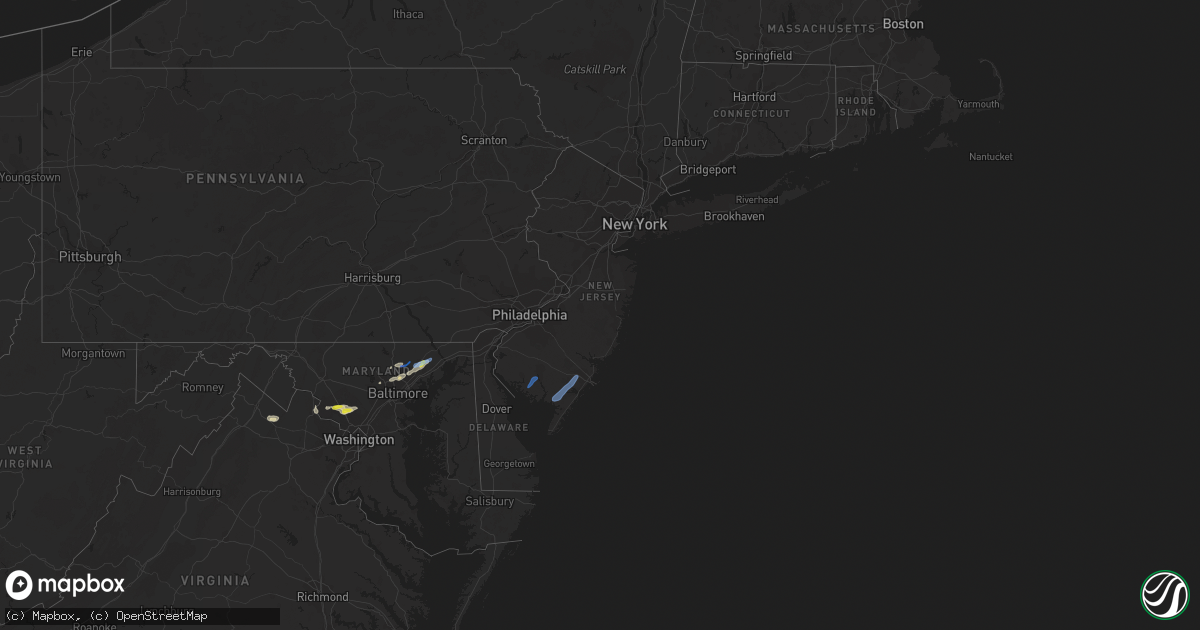
Hail Map in New Jersey on June 3, 2021
Get this storm
June 3 map
$229
one time, instant access
Download today. No call, no setup
Keep the $229
Bought the map and want the full workflow? Apply the entire $229 to a subscription within 7 days. None of it is wasted.
Every map, not just this one
This buys you this map. Subscription and you get every map we run, in the markets you choose from a few cities to whole states to nationwide. Plus real-time alerts the moment a storm fires.
Contact data
Name, contact info, occupancy, even credit band for addresses in the footprint. You go from where it hit to who to call.
Become the source they trust
Unlimited branding weather history reports on demand. You already have the documented answer ready for the property owner, and you are the one who showed up with it.
Property data and RoofTrace estimates
Pull up any address you have got, its value and the exact code rules for that jurisdiction, straight from One Click Code. Then RoofTrace estimates the squares, pitch, and roof value, priced the way you price.
Storm reports in New Jersey
New Jersey
| Date | Description |
|---|---|
| 06/03/20216:36 PM CDT | Downed tree limbs and wires near leigh avenue. Time estimated from radar. |
| 06/03/20216:22 PM CDT | Downed wires near queens lane. Time estimated from radar. |
| 06/03/20216:12 PM CDT | Social media and utility reports of downed power lines and numerous power outages in egg harbor twp and vicinity. Time based on radar and dispatch reports. |
| 06/03/20216:04 PM CDT | Downed wires near somers point road. Time estimated from radar. |
| 06/03/20215:55 PM CDT | Corrects previous tstm wnd dmg report from 4 w millville municipal airport. Few trees and wires down on ramah road between boston street and monroe street. Time estimat |
| 06/03/20213:55 AM CDT | At 854 PM EDT, a severe thunderstorm was located over Keansburg, or near Huguenot, moving east at 40 mph. HAZARD...60 mph wind gusts and penny size hail. SOURCE...Radar indicated. IMPACT...Damage to roofs, siding, trees, and power lines is possible. Locations impacted include... Sandy Hook, Middletown, Keansburg, Matawan, Highlands, Navesink, Keyport, North Middletown, Strathmore, Laurence Harbor and Madison Park.This includes Garden State Parkway between mile markers 117 and 123. |
| 06/03/20213:14 AM CDT | At 811 PM EDT, a severe thunderstorm was located over Lakehurst, or 8 miles west of Toms River, moving northeast at 40 mph. HAZARD...60 mph wind gusts. SOURCE...Radar indicated. IMPACT...Damage to roofs, siding, trees, and power lines is possible. Locations impacted include... Toms River, Long Branch, Asbury Park, Lakewood, Middletown, Old Bridge, Jackson, Howell, Marlboro, Tinton Falls, Holmdel, Red Bank, Matawan, Manasquan, Lakehurst, Farmingdale, Allenwood, Brownville, East Freehold and Six Flags Theme Park.This includes the following highways... Interstate 195 in New Jersey between mile markers 16 and 34. Garden State Parkway between mile markers 84 and 123. |
| 06/03/20212:52 AM CDT | At 752 PM EDT, a severe thunderstorm was located over Old Halfway, or 17 miles southwest of Toms River, moving northeast at 55 mph. HAZARD...60 mph wind gusts and penny size hail. SOURCE...Radar indicated. IMPACT...Damage to roofs, siding, trees, and power lines is possible. Locations impacted include... Toms River, Barnegat, Beachwood, Tabernacle, Presidential Lakes Estates, Lakehurst, Wrightstown, Holiday City South, Warren Grove, Chatsworth, Presidential Lakes, Holiday City-Berkeley, Bamber Lake, Cedar Glen Lakes, Whiting, Brookville, Pine Ridge At Crestwood, Browns Mills, Old Halfway and Leisuretowne.This includes Garden State Parkway between mile markers 63 and 82. |
| 06/03/20212:07 AM CDT | At 707 PM EDT, a severe thunderstorm was located near Dorothy, or 12 miles east of Vineland, moving northeast at 70 mph. HAZARD...60 mph wind gusts and quarter size hail. SOURCE...Radar indicated. IMPACT...Minor damage to vehicles is possible. Wind damage to roofs, siding, trees, and power lines is possible. Locations impacted include... Vineland, Atlantic City, Millville, Ocean City, Cumberland, Pleasantville, Hammonton, Somers Point, Ventnor City, Brigantine, Northfield, Absecon, Berlin, Margate City, Buena, Egg Harbor City, Laurel Lake, Tuckerton, Weymouth and Estell Manor.People at the Atlantic County Mega Site should seek safe shelterimmediately!This includes the following highways... Garden State Parkway between mile markers 22 and 57. Atlantic City Expressway between mile markers 0 and 39. |
All States Impacted by Hail Map on June 3, 2021
Cities Impacted by Hail Map on June 3, 2021
- Canon, GA
- Bowersville, GA
- Hartwell, GA
- Princeton, OR
- Jennings, LA
- Roanoke, LA
- Welsh, LA
- Somerville, TX
- Kirbyville, TX
- Cuero, TX
- Whitley City, KY
- Manchester, TN
- Rio Grande City, TX
- Fort Stockton, TX
- Hereford, OR
- Heflin, AL
- Muscadine, AL
- Hastings, FL
- East Palatka, FL
- Dryden, TX
- Woodstock, MD
- Randallstown, MD
- Windsor Mill, MD
- Boyds, MD
- Prosperity, SC
- Leesville, SC
- Batesburg, SC
- Williamsburg, KY
- Billingsley, AL
- Verbena, AL
- Montgomery Village, MD
- Derwood, MD
- Germantown, MD
- Gaithersburg, MD
- Washington Grove, MD
- Rockville, MD
- Lutherville Timonium, MD
- Glen Arm, MD
- Towson, MD
- Parkville, MD
- Baltimore, MD
- Pikesville, MD
- Burns, OR
- Bluemont, VA
- Paris, VA
- Boyce, VA
- Black Eagle, MT
- Great Falls, MT
- Moody, AL
- Yoakum, TX
- Bel Air, MD
- Fallston, MD
- Stonewall, TX
- Leesburg, VA
- Dickerson, MD
- Anderson, SC
- Starr, SC
- Parkers Lake, KY
- Camden, AL
- Sand Coulee, MT
- Belt, MT
- Deridder, LA
- Poolesville, MD
- Deatsville, AL
- Marbury, AL
- Springer, NM
- Odenville, AL
- Kingsville, MD
- Fork, MD
- Hydes, MD
- Churchville, MD
- Baldwin, MD
- Joppa, MD
- Cockeysville, MD
- Saluda, SC
- Johnston, SC
- Hallettsville, TX
- Rockholds, KY
- Stockett, MT
- Sterrett, AL
- Brookeville, MD
- Olney, MD
- Sweeny, TX
- Phoenix, MD
- Mayhill, NM
- Cambridge, ID
- Guyton, GA
- Warren, TX
- Pine Knot, KY
- Stearns, KY
- Strunk, KY
- Waco, GA
- Fruithurst, AL
- Tallapoosa, GA
- Oakdale, LA
- Chickamauga, GA
- Rock Spring, GA
- La Fayette, GA
- Ringgold, GA
- Berryville, VA
- Barbourville, KY
- Egg Harbor Township, NJ
- Mays Landing, NJ
- Woodbine, NJ
- Cedarville, NJ
- Millville, NJ
- Bridgeton, NJ
- Mullins, SC


