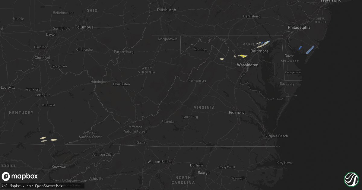
Hail Map in Virginia on June 3, 2021
Get this storm
June 3 map
$229
one time, instant access
Download today. No call, no setup
Keep the $229
Bought the map and want the full workflow? Apply the entire $229 to a subscription within 7 days. None of it is wasted.
Every map, not just this one
This buys you this map. Subscription and you get every map we run, in the markets you choose from a few cities to whole states to nationwide. Plus real-time alerts the moment a storm fires.
Contact data
Name, contact info, occupancy, even credit band for addresses in the footprint. You go from where it hit to who to call.
Become the source they trust
Unlimited branding weather history reports on demand. You already have the documented answer ready for the property owner, and you are the one who showed up with it.
Property data and RoofTrace estimates
Pull up any address you have got, its value and the exact code rules for that jurisdiction, straight from One Click Code. Then RoofTrace estimates the squares, pitch, and roof value, priced the way you price.
Storm reports in Virginia
Virginia
| Date | Description |
|---|---|
| 06/03/20215:46 PM CDT | Report from mping: shingles blown off structure along snakepath road. |
| 06/03/20215:02 PM CDT | Multiple trees reported down on constituion highway near germanna highway. |
| 06/03/20214:50 PM CDT | Tree reported down on the 24000 block of lahore road. |
| 06/03/20214:33 PM CDT | Tree reported down on the 13100 block of elk run road. |
| 06/03/20213:54 PM CDT | Tree down in road near the intersection of rapidan road and hardy lane |
| 06/03/20213:49 PM CDT | Tree reported down on woodroof road near carey town road. |
| 06/03/20213:20 AM CDT | Thunderstorm winds blew down pieces of a tin roof and wooden posts used as a porch for a homestead and also tore up grapevines and pushed a small camper thirty feet. |
| 06/03/20212:22 AM CDT | Trees down along greenwich circle. |
| 06/03/202112:32 AM CDT | At 532 PM EDT, severe thunderstorms were located along a line extending from near Orange to near Boswells Tavern, moving east at 25 mph. HAZARD...60 mph wind gusts. SOURCE...Radar indicated. IMPACT...Damaging winds will cause some trees and large branches to fall. This could injure those outdoors, as well as damage homes and vehicles. Roadways may become blocked by downed trees. Localized power outages are possible. Unsecured light objects may become projectiles. Locations impacted include... Gold Dale, Thornhill, Mine Run, Logan, Rhoadesville, Parker, Lahore, Glenora, Verdiersville, Cookstown and Locust Grove. |
| 06/03/202112:28 AM CDT | At 528 PM EDT, a severe thunderstorm was located near Boswells Tavern, or 10 miles west of Louisa, moving east at 25 mph. HAZARD...60 mph wind gusts. SOURCE...Radar indicated. IMPACT...Expect damage to trees and powerlines. This severe thunderstorm will be near, Ferncliff around 535 PM EDT. Louisa around 555 PM EDT. Mineral around 605 PM EDT.Other locations impacted by this severe thunderstorm include Bybee,Yanceyville, Louisa Airport, Waldrop, Green Springs, Byrd Mill,Trevilians, Wares Crossroads, Zion Crossroads and Vawter Corner. |
| 06/03/202112:19 AM CDT | At 519 PM EDT, severe thunderstorms were located along a line extending from near Bealeton to 16 miles northwest of Spotsylvania to 12 miles southeast of Culpeper, moving east at 25 mph. HAZARD...60 mph wind gusts. SOURCE...Radar indicated. IMPACT...Damaging winds will cause some trees and large branches to fall. This could injure those outdoors, as well as damage homes and vehicles. Roadways may become blocked by downed trees. Localized power outages are possible. Unsecured light objects may become projectiles. Locations impacted include... Bealeton, Falmouth, Remington, Midland, Roseville, Garrisonville, Flat Run, Ramoth, Heflin, Dunavant, Lake Of The Woods, Morrisville, Ruby, Somerville, Goldvein, Leeland, Lois, Burr Hill, Lignum and Storck. |
| 06/02/202111:45 PM CDT | At 445 PM EDT, severe thunderstorms were located along a line extending from 6 miles east of Madison to near Orange to 10 miles northwest of Boswells Tavern, moving east at 30 mph. HAZARD...60 mph wind gusts and quarter size hail. SOURCE...Radar indicated. IMPACT...Damaging winds will cause some trees and large branches to fall. This could injure those outdoors, as well as damage homes and vehicles. Roadways may become blocked by downed trees. Localized power outages are possible. Unsecured light objects may become projectiles. Locations impacted include... Culpeper, Orange, Brightwood, Remington, Mine Run, Elkwood, Stevensburg, Brandy Station, Oakpark, Barboursville, Everona, Verdiersville, Montpelier Station, Locust Grove, Flat Run, Nasons, Winston, Madison Mills, Montford and Mitchells. |
| 06/02/202110:56 PM CDT | At 356 PM EDT, severe thunderstorms were located along a line extending from 6 miles south of Big Meadows to near Free Union, moving northeast at 35 mph. HAZARD...60 mph wind gusts. SOURCE...Radar indicated. IMPACT...Damaging winds will cause some trees and large branches to fall. This could injure those outdoors, as well as damage homes and vehicles. Roadways may become blocked by downed trees. Localized power outages are possible. Unsecured light objects may become projectiles. Locations impacted include... Culpeper, Orange, Madison, Crozet, Stanardsville, Free Union, Hollymead, Ruckersville, Brightwood, Ivy, Castleton, Eheart, Oakpark, Barboursville, Haywood, Montpelier Station, Syria, Madison Mills, Montford and Cardova. |
| 06/02/20219:07 PM CDT | At 206 PM EDT, a severe thunderstorm was located 9 miles northwest of Newsoms, or 9 miles west of Courtland, moving east at 25 mph. HAZARD...60 mph wind gusts and quarter size hail. SOURCE...Radar indicated. IMPACT...Minor damage to vehicles is possible. Expect wind damage to trees and powerlines. This severe thunderstorm will be near, Courtland around 225 PM EDT. Sedley around 245 PM EDT.Other locations impacted by this severe thunderstorm includeVicksville, Dory, Berlin, Sebrell, Burdette, Drewryville, Manry,Joyner, Story and Worrell. |
All States Impacted by Hail Map on June 3, 2021
Cities Impacted by Hail Map on June 3, 2021
- Canon, GA
- Bowersville, GA
- Hartwell, GA
- Princeton, OR
- Jennings, LA
- Roanoke, LA
- Welsh, LA
- Somerville, TX
- Kirbyville, TX
- Cuero, TX
- Whitley City, KY
- Manchester, TN
- Rio Grande City, TX
- Fort Stockton, TX
- Hereford, OR
- Heflin, AL
- Muscadine, AL
- Hastings, FL
- East Palatka, FL
- Dryden, TX
- Woodstock, MD
- Randallstown, MD
- Windsor Mill, MD
- Boyds, MD
- Prosperity, SC
- Leesville, SC
- Batesburg, SC
- Williamsburg, KY
- Billingsley, AL
- Verbena, AL
- Montgomery Village, MD
- Derwood, MD
- Germantown, MD
- Gaithersburg, MD
- Washington Grove, MD
- Rockville, MD
- Lutherville Timonium, MD
- Glen Arm, MD
- Towson, MD
- Parkville, MD
- Baltimore, MD
- Pikesville, MD
- Burns, OR
- Bluemont, VA
- Paris, VA
- Boyce, VA
- Black Eagle, MT
- Great Falls, MT
- Moody, AL
- Yoakum, TX
- Bel Air, MD
- Fallston, MD
- Stonewall, TX
- Leesburg, VA
- Dickerson, MD
- Anderson, SC
- Starr, SC
- Parkers Lake, KY
- Camden, AL
- Sand Coulee, MT
- Belt, MT
- Deridder, LA
- Poolesville, MD
- Deatsville, AL
- Marbury, AL
- Springer, NM
- Odenville, AL
- Kingsville, MD
- Fork, MD
- Hydes, MD
- Churchville, MD
- Baldwin, MD
- Joppa, MD
- Cockeysville, MD
- Saluda, SC
- Johnston, SC
- Hallettsville, TX
- Rockholds, KY
- Stockett, MT
- Sterrett, AL
- Brookeville, MD
- Olney, MD
- Sweeny, TX
- Phoenix, MD
- Mayhill, NM
- Cambridge, ID
- Guyton, GA
- Warren, TX
- Pine Knot, KY
- Stearns, KY
- Strunk, KY
- Waco, GA
- Fruithurst, AL
- Tallapoosa, GA
- Oakdale, LA
- Chickamauga, GA
- Rock Spring, GA
- La Fayette, GA
- Ringgold, GA
- Berryville, VA
- Barbourville, KY
- Egg Harbor Township, NJ
- Mays Landing, NJ
- Woodbine, NJ
- Cedarville, NJ
- Millville, NJ
- Bridgeton, NJ
- Mullins, SC


