Hail Map on June 3, 2021
Get this storm
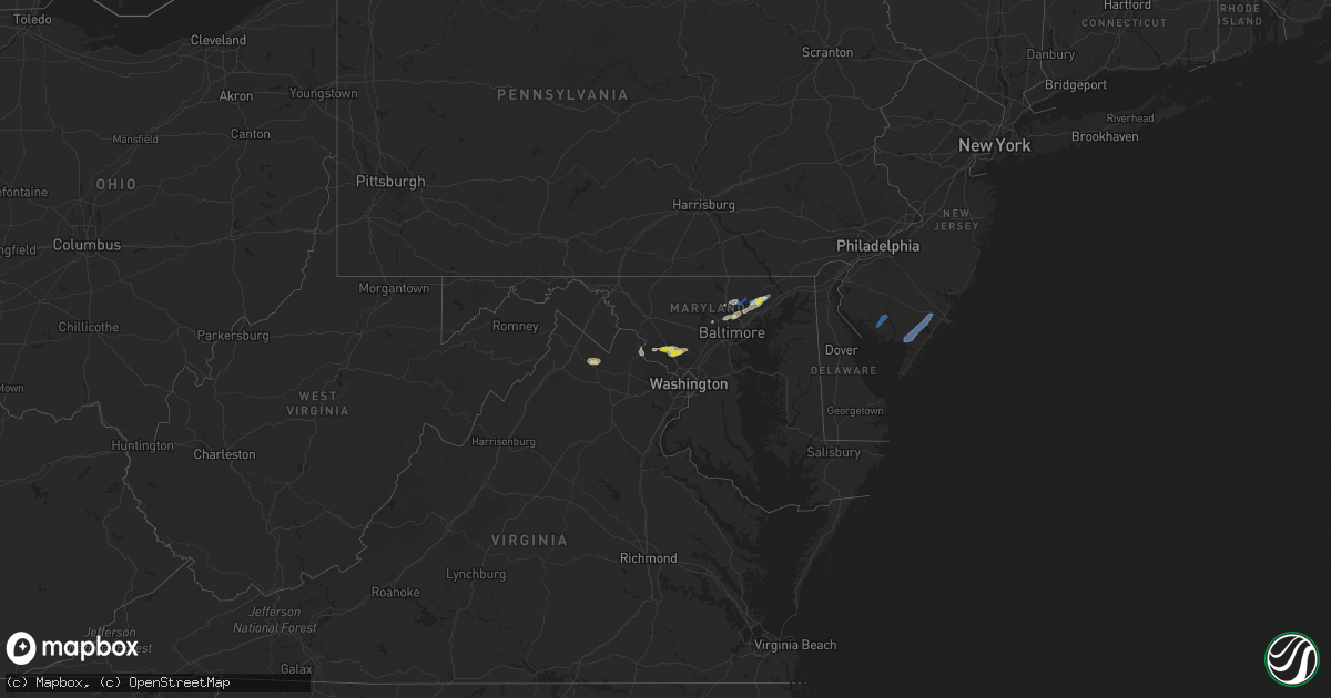
June 3 map
$229
one time, instant access
Download today. No call, no setup
Keep the $229
Bought the map and want the full workflow? Apply the entire $229 to a subscription within 7 days. None of it is wasted.
Every map, not just this one
This buys you this map. Subscription and you get every map we run, in the markets you choose from a few cities to whole states to nationwide. Plus real-time alerts the moment a storm fires.
Contact data
Name, contact info, occupancy, even credit band for addresses in the footprint. You go from where it hit to who to call.
Become the source they trust
Unlimited branding weather history reports on demand. You already have the documented answer ready for the property owner, and you are the one who showed up with it.
Property data and RoofTrace estimates
Pull up any address you have got, its value and the exact code rules for that jurisdiction, straight from One Click Code. Then RoofTrace estimates the squares, pitch, and roof value, priced the way you price.
States Impacted by Hail Map on June 3, 2021
Storm reports
Oregon
| Date | Description |
|---|---|
| 06/03/20211:14 AM CDT | At 613 PM MDT/513 PM PDT/, a severe thunderstorm was located near Dooley Summit, or 18 miles south of Baker City, moving east at 25 mph. HAZARD...60 mph wind gusts and quarter size hail. SOURCE...Radar indicated. IMPACT...Hail damage to vehicles is expected. Expect wind damage to roofs, siding, and trees. This severe thunderstorm will be near... Dooley Summit around 520 PM PDT. Bridgeport around 530 PM PDT. Pleasant Valley, Rye Valley and Durkee around 540 PM PDT. |
| 06/02/202111:06 PM CDT | At 405 PM PDT, a severe thunderstorm was located near Barton Lake, or 32 miles southeast of Burns, moving northeast at 20 mph. HAZARD...60 mph wind gusts and quarter size hail. SOURCE...Radar indicated. IMPACT...Hail damage to vehicles is expected. Expect wind damage to roofs, siding, and trees. This severe thunderstorm will be near... New Princeton around 420 PM PDT. |
| 06/02/202110:49 PM CDT | At 348 PM PDT, a severe thunderstorm was located over northeastern Malheur Lake, or 23 miles southeast of Burns, moving northeast at 30 mph. HAZARD...70 mph wind gusts and quarter size hail. SOURCE...Radar indicated. IMPACT...Hail damage to vehicles is expected. Expect considerable tree damage. Wind damage is also likely to mobile homes, roofs, and outbuildings. This severe thunderstorm will be near... Lawen around 400 PM PDT. Crane around 410 PM PDT. |
| 06/02/202110:00 PM CDT | At 259 PM PDT, a severe thunderstorm was located near Butler Hill, or 55 miles south of Burns, moving north at 25 mph. HAZARD...60 mph wind gusts and quarter size hail. SOURCE...Radar indicated. IMPACT...Hail damage to vehicles is expected. Expect wind damage to roofs, siding, and trees. This severe thunderstorm will be near... Frenchglen and Walls Lake Reservoir around 310 PM PDT. Baca Lake around 330 PM PDT. Buena Vista Field Station around 340 PM PDT. |
| 06/02/20218:40 PM CDT | Large branches knocked off tree. |
Kentucky
| Date | Description |
|---|---|
| 06/03/20214:17 PM CDT | Tree down on rice st. In williamsburg. |
| 06/03/20213:00 PM CDT | Multiple trees down along highway 1045. |
| 06/03/202112:47 AM CDT | At 546 PM EDT, a severe thunderstorm was located over Ingram, or near Pineville, moving east at 30 mph. HAZARD...60 mph wind gusts and penny size hail. SOURCE...Radar indicated. IMPACT...Expect damage to roofs, siding, and trees. This severe thunderstorm will be near... Fourmile around 555 PM EDT. Pineville around 600 PM EDT. Straight Creek around 605 PM EDT.Other locations in the path of this severe thunderstorm includeMiracle, Callaway and Black Snake. |
| 06/03/202112:09 AM CDT | At 508 PM EDT, a severe thunderstorm was located over Bon, or over Williamsburg, moving east at 25 mph. HAZARD...60 mph wind gusts and quarter size hail. SOURCE...Radar indicated. IMPACT...Hail damage to vehicles is expected. Expect wind damage to roofs, siding, and trees. Locations impacted include... Williamsburg, Julip, Gatliff, Emlyn, Hubbs, Clate, Birdseye, Verne, Gausdale, Pleasant View, King and Louden. |
| 06/02/202110:53 PM CDT | At 352 PM EDT, a severe thunderstorm was located over Beulah Heights, moving east at 40 mph. HAZARD...60 mph wind gusts and quarter size hail. SOURCE...Radar indicated. IMPACT...Hail damage to vehicles is expected. Expect wind damage to roofs, siding, and trees. Locations impacted include... Honeybee, Perkins, Greenwood, Parkers Lake, Beulah Heights, Cumberland Falls S.P., Barton, Grove, Clio, Goldbug, Deering and Walden. |
| 06/02/20219:42 PM CDT | At 242 PM EDT, a severe thunderstorm was located over Highlands, moving east at 35 mph. HAZARD...60 mph wind gusts. SOURCE...Radar indicated. IMPACT...Expect damage to roofs, siding, and trees. This severe thunderstorm will be near... Thoroughbred Acres around 245 PM EDT. Bryan Station around 250 PM EDT.Other locations in the path of this severe thunderstorm includeParis. |
| 06/02/20218:25 PM CDT | At 125 PM EDT, a severe thunderstorm was located 8 miles south of Taylorsville, moving east at 35 mph. HAZARD...60 mph wind gusts. SOURCE...Radar indicated. IMPACT...Expect damage to roofs, siding, and trees. This severe thunderstorm will remain over mainly rural areas of southeastern Spencer, northeastern Nelson and western Anderson Counties, including the following locations... Sinai, Bloomfield, Wayside, Gee, Anderson City, Birdie, Glensboro, Johnsonville, Fox Creek and Ashbrook. |
South Carolina
| Date | Description |
|---|---|
| 06/03/20216:50 PM CDT | Minor damage to two unkown structures and a swimming pool. Possible tornado. Time estimated by radar. |
Delaware
| Date | Description |
|---|---|
| 06/03/20211:33 AM CDT | At 633 PM EDT, a severe thunderstorm was located near Bivalve, or 14 miles south of Millville, moving northeast at 70 mph. HAZARD...60 mph wind gusts and penny size hail. SOURCE...Radar indicated. IMPACT...Damage to roofs, siding, trees, and power lines is possible. Locations impacted include... Vineland, Millville, Bridgeton, Ocean City, Cumberland, Somers Point, Buena, Laurel Lake, Woodbine, Estell Manor, Newfield, Elmer, Shiloh, Corbin City, Newport, Leesburg, Beesleys Point, Dorothy, Dennisville and Bricksboro.This includes Garden State Parkway between mile markers 26 and 32. |
Idaho
| Date | Description |
|---|---|
| 06/02/20218:42 PM CDT | Branches knocked down with photo. Personal weather station said 58 mph gust. |
| 06/02/20218:40 PM CDT | Wind tipped over a semi on westbound i-84 just before the sand hollow exit. Both lanes completely blocked for 2 hours. |
Florida
| Date | Description |
|---|---|
| 06/03/20213:45 PM CDT | 911 call center reported tree down on north first street in hastings. |
| 06/02/202111:30 PM CDT | At 429 PM EDT, a severe thunderstorm was located near Hastings, moving northeast at 10 mph. HAZARD...60 mph wind gusts and half dollar size hail. SOURCE...Radar indicated. IMPACT...Hail damage to vehicles is expected. Expect wind damage to roofs, siding, and trees. Locations impacted include... Hastings, East Palatka, Orange Mills, Spuds and Elkton. |
Texas
| Date | Description |
|---|---|
| 06/03/20213:33 PM CDT | Social media post of tree down on a house off trout street near kirbyville. |
| 06/03/20213:33 PM CDT | Mobile home sustained roof damage with pieces of sheet metal laying around the yard. Two trees around a foot in diameter snapped at this location. |
| 06/03/202112:54 PM CDT | Roof at nelson chiropractor on e. 8th street in deer park damaged. Time is estimated based on radar. |
| 06/03/20217:10 AM CDT | At 1210 AM CDT, a severe thunderstorm was located near Bellville, moving southeast at 30 mph. HAZARD...Quarter size hail. SOURCE...Radar indicated. IMPACT...Damage to vehicles is expected. Locations impacted include... Sealy, Bellville, San Felipe, Pattison and Monaville. |
| 06/03/20213:03 AM CDT | At 803 PM CDT, National Weather Service Doppler radar indicated severe thunderstorms located along a line extending from near Viboras to La Rosita, moving southeast at 10 mph. HAZARD...60 mph wind gusts and penny size hail. SOURCE...Radar indicated. IMPACT...Expect damage to roofs, siding, and trees. Locations impacted include... Rio Grande City, Roma, Escobares, El Sauz, Viboras, Garciasville, La Rosita, La Victoria, Los Alvarez and Fort Ringgold County Park.This includes US Highway 83 between Mile Markers 808 and 832. |
| 06/03/20212:07 AM CDT | At 706 PM CDT, a severe thunderstorm was located near La Victoria, moving north at 10 mph. HAZARD...60 mph wind gusts and quarter size hail. SOURCE...Radar indicated. IMPACT...Hail damage to vehicles is expected. Expect wind damage to roofs, siding, and trees. Locations impacted include... La Victoria. |
| 06/02/202110:30 PM CDT | At 329 PM CDT, a severe thunderstorm was located over Mt. Union, or near Kirbyville, moving northwest at 5 mph. HAZARD...60 mph wind gusts and quarter size hail. SOURCE...Radar indicated. IMPACT...Hail damage to vehicles is expected. Expect wind damage to roofs, siding, and trees. Locations impacted include... Jasper, Kirbyville, Spurger, Magnolia Springs and Mt. Union. |
North Carolina
| Date | Description |
|---|---|
| 06/03/20214:15 PM CDT | Mcdowell county emergency management reports a carport roof blown off along highway 226 in nebo... With several small trees down. |
| 06/03/20211:08 AM CDT | At 608 PM EDT, severe thunderstorms were located along a line extending from near Hodges to Sandy Level, moving east at 20 mph. HAZARD...60 mph wind gusts. SOURCE...Radar indicated. IMPACT...Expect damage to roofs, siding, and trees. Locations impacted include... Danville... Chatham... Gretna... Brookneal... Phenix... Ingram... and Mt Airy.This includes The following Location Danville Airport. |
| 06/02/20218:04 PM CDT | At 104 PM EDT, a severe thunderstorm was located over Benton, moving northeast at 40 mph. HAZARD...60 mph wind gusts and nickel size hail. SOURCE...Radar indicated. IMPACT...Expect damage to roofs, siding, and trees. Locations impacted include... Benton, Reliance, Archville, Hiwassee Ocoee State Park, Parksville and Turtletown. |
Georgia
| Date | Description |
|---|---|
| 06/03/20214:08 PM CDT | Trees and a few power lines were blown down across north central hart county late thursday afternoon including along ridge road. Also reports of hail but no hail size w |
| 06/03/202112:06 AM CDT | At 506 PM EDT, a severe thunderstorm was located 5 miles northeast of Hartwell, or 4 miles southeast of Reed Creek, moving east at 25 mph. HAZARD...60 mph wind gusts and quarter size hail. SOURCE...Radar indicated. IMPACT...Minor hail damage to vehicles is expected. Expect wind damage to trees and power lines. Locations impacted include... Anderson, Hartwell, Homeland Park, Reed Creek, Starr, Anderson Airport, Lake Hartwell, Broadway Lake, Sadlers Creek State Park and Iva. |
| 06/02/202111:31 PM CDT | At 429 PM EDT, a severe thunderstorm was located 7 miles east of Carnesville, or near Bowersville, moving east at 20 mph. HAZARD...60 mph wind gusts and quarter size hail. SOURCE...Radar indicated. IMPACT...Minor hail damage to vehicles is expected. Expect wind damage to trees and power lines. Locations impacted include... Hartwell, Royston, Reed Creek, Lavonia, Canon, Franklin Springs, Bowersville, Lake Hartwell, Victoria Bryant State Park and Sadlers Creek State Park. |
| 06/02/20218:39 PM CDT | At 139 PM EDT, a severe thunderstorm was located over Noble, or near Lafayette, moving east at 20 mph. HAZARD...60 mph wind gusts and quarter size hail. SOURCE...Radar indicated. IMPACT...Hail damage to vehicles is expected. Expect wind damage to roofs, siding, and trees. Locations impacted include... Dalton, Ringgold, Varnell, Tunnel Hill, Mill Creek, Beaumont, Noble, Wood Station, Rocky Face and Rock Spring. |
Montana
| Date | Description |
|---|---|
| 06/02/20217:50 PM CDT | Video posted on facebook shows a tree getting blown down on skyline drive ne. Some area weather underground stations reported peak gusts in the 50-55mph range. |
| 06/02/20217:50 PM CDT | Off-duty nws employee reports some trees down in the stone meadows neighborhood on the north side of great falls. |
Tennessee
| Date | Description |
|---|---|
| 06/03/20214:58 PM CDT | Several trees were blown down on riddle road near keele road and on harper road |
| 06/03/202112:23 AM CDT | At 522 AM CDT, a severe thunderstorm was located 7 miles southeast of Cookeville, moving northeast at 40 mph. HAZARD...60 mph wind gusts. SOURCE...Radar indicated. IMPACT...Expect damage to roofs, siding, and trees. Locations impacted include... Cookeville, Algood, Monterey, Allardt, Grimsley, Clarkrange, Crawford and Rickman.This includes Interstate 40 between mile markers 287 and 308. |
| 06/02/202111:58 PM CDT | At 457 AM CDT, a severe thunderstorm was located 7 miles east of Smithville, moving northeast at 55 mph. HAZARD...60 mph wind gusts. SOURCE...Radar indicated. IMPACT...Expect damage to roofs, siding, and trees. Locations impacted include... Cookeville, Sparta, Smithville, Algood, Baxter, Doyle, Hamptons Crossroads, Bakers Crossroads and Burgess Falls State Park.This includes Interstate 40 between mile markers 271 and 299. |
| 06/02/202111:34 PM CDT | At 434 AM CDT, a severe thunderstorm was located 7 miles west of McMinnville, moving northeast at 55 mph. HAZARD...60 mph wind gusts. SOURCE...Radar indicated. IMPACT...Expect damage to roofs, siding, and trees. Locations impacted include... McMinnville, Smithville, Woodbury, Morrison, Dowelltown, Centertown and Rock Island State Park. |
| 06/02/20219:37 PM CDT | At 237 AM CDT, a severe thunderstorm was located near Rogersville, or 16 miles east of Muscle Shoals, moving east at 40 mph. HAZARD...60 mph wind gusts and quarter size hail. SOURCE...Radar indicated. IMPACT...Hail damage to vehicles is expected. Expect wind damage to roofs, siding, and trees. Locations impacted include... Rogersville, Anderson, Lester, Good Springs, Cartwright, Coxey, Oliver, Mt Rozell, Ripley and Center Star. |
Virginia
| Date | Description |
|---|---|
| 06/03/20215:46 PM CDT | Report from mping: shingles blown off structure along snakepath road. |
| 06/03/20215:02 PM CDT | Multiple trees reported down on constituion highway near germanna highway. |
| 06/03/20214:50 PM CDT | Tree reported down on the 24000 block of lahore road. |
| 06/03/20214:33 PM CDT | Tree reported down on the 13100 block of elk run road. |
| 06/03/20213:54 PM CDT | Tree down in road near the intersection of rapidan road and hardy lane |
| 06/03/20213:49 PM CDT | Tree reported down on woodroof road near carey town road. |
| 06/03/20213:20 AM CDT | Thunderstorm winds blew down pieces of a tin roof and wooden posts used as a porch for a homestead and also tore up grapevines and pushed a small camper thirty feet. |
| 06/03/20212:22 AM CDT | Trees down along greenwich circle. |
| 06/03/202112:32 AM CDT | At 532 PM EDT, severe thunderstorms were located along a line extending from near Orange to near Boswells Tavern, moving east at 25 mph. HAZARD...60 mph wind gusts. SOURCE...Radar indicated. IMPACT...Damaging winds will cause some trees and large branches to fall. This could injure those outdoors, as well as damage homes and vehicles. Roadways may become blocked by downed trees. Localized power outages are possible. Unsecured light objects may become projectiles. Locations impacted include... Gold Dale, Thornhill, Mine Run, Logan, Rhoadesville, Parker, Lahore, Glenora, Verdiersville, Cookstown and Locust Grove. |
| 06/03/202112:28 AM CDT | At 528 PM EDT, a severe thunderstorm was located near Boswells Tavern, or 10 miles west of Louisa, moving east at 25 mph. HAZARD...60 mph wind gusts. SOURCE...Radar indicated. IMPACT...Expect damage to trees and powerlines. This severe thunderstorm will be near, Ferncliff around 535 PM EDT. Louisa around 555 PM EDT. Mineral around 605 PM EDT.Other locations impacted by this severe thunderstorm include Bybee,Yanceyville, Louisa Airport, Waldrop, Green Springs, Byrd Mill,Trevilians, Wares Crossroads, Zion Crossroads and Vawter Corner. |
| 06/03/202112:19 AM CDT | At 519 PM EDT, severe thunderstorms were located along a line extending from near Bealeton to 16 miles northwest of Spotsylvania to 12 miles southeast of Culpeper, moving east at 25 mph. HAZARD...60 mph wind gusts. SOURCE...Radar indicated. IMPACT...Damaging winds will cause some trees and large branches to fall. This could injure those outdoors, as well as damage homes and vehicles. Roadways may become blocked by downed trees. Localized power outages are possible. Unsecured light objects may become projectiles. Locations impacted include... Bealeton, Falmouth, Remington, Midland, Roseville, Garrisonville, Flat Run, Ramoth, Heflin, Dunavant, Lake Of The Woods, Morrisville, Ruby, Somerville, Goldvein, Leeland, Lois, Burr Hill, Lignum and Storck. |
| 06/02/202111:45 PM CDT | At 445 PM EDT, severe thunderstorms were located along a line extending from 6 miles east of Madison to near Orange to 10 miles northwest of Boswells Tavern, moving east at 30 mph. HAZARD...60 mph wind gusts and quarter size hail. SOURCE...Radar indicated. IMPACT...Damaging winds will cause some trees and large branches to fall. This could injure those outdoors, as well as damage homes and vehicles. Roadways may become blocked by downed trees. Localized power outages are possible. Unsecured light objects may become projectiles. Locations impacted include... Culpeper, Orange, Brightwood, Remington, Mine Run, Elkwood, Stevensburg, Brandy Station, Oakpark, Barboursville, Everona, Verdiersville, Montpelier Station, Locust Grove, Flat Run, Nasons, Winston, Madison Mills, Montford and Mitchells. |
| 06/02/202110:56 PM CDT | At 356 PM EDT, severe thunderstorms were located along a line extending from 6 miles south of Big Meadows to near Free Union, moving northeast at 35 mph. HAZARD...60 mph wind gusts. SOURCE...Radar indicated. IMPACT...Damaging winds will cause some trees and large branches to fall. This could injure those outdoors, as well as damage homes and vehicles. Roadways may become blocked by downed trees. Localized power outages are possible. Unsecured light objects may become projectiles. Locations impacted include... Culpeper, Orange, Madison, Crozet, Stanardsville, Free Union, Hollymead, Ruckersville, Brightwood, Ivy, Castleton, Eheart, Oakpark, Barboursville, Haywood, Montpelier Station, Syria, Madison Mills, Montford and Cardova. |
| 06/02/20219:07 PM CDT | At 206 PM EDT, a severe thunderstorm was located 9 miles northwest of Newsoms, or 9 miles west of Courtland, moving east at 25 mph. HAZARD...60 mph wind gusts and quarter size hail. SOURCE...Radar indicated. IMPACT...Minor damage to vehicles is possible. Expect wind damage to trees and powerlines. This severe thunderstorm will be near, Courtland around 225 PM EDT. Sedley around 245 PM EDT.Other locations impacted by this severe thunderstorm includeVicksville, Dory, Berlin, Sebrell, Burdette, Drewryville, Manry,Joyner, Story and Worrell. |
West Virginia
| Date | Description |
|---|---|
| 06/03/20213:40 PM CDT | Tree in roadway on us-340 nb at chestnut hill |
| 06/03/20213:15 PM CDT | Tree reported down on rt. 340 between shenandoah street and chestnut hill road. |
| 06/02/202111:08 PM CDT | At 408 PM EDT, severe thunderstorms were located along a line extending from 7 miles west of Charles Town to Berryville to 9 miles southeast of Millwood Pike, moving east at 25 mph. HAZARD...60 mph wind gusts and quarter size hail. SOURCE...Radar indicated. IMPACT...Damaging winds will cause some trees and large branches to fall. This could injure those outdoors, as well as damage homes and vehicles. Roadways may become blocked by downed trees. Localized power outages are possible. Unsecured light objects may become projectiles. Locations impacted include... Purcellville, Berryville, Middleburg, Round Hill, Bluemont, Boyce, Hamilton, Hillsboro, Saint Louis, Paeonian Springs, Waterford, Gaylord, Briggs, Wickliffe, Millwood, Upperville, Philomont, Bethel, Lincoln and Stringtown. |
| 06/02/202110:10 PM CDT | At 309 PM EDT, a severe thunderstorm was located near Winchester, moving east at 25 mph. HAZARD...60 mph wind gusts and quarter size hail. SOURCE...Radar indicated. IMPACT...Damaging winds will cause some trees and large branches to fall. This could injure those outdoors, as well as damage homes and vehicles. Roadways may become blocked by downed trees. Localized power outages are possible. Unsecured light objects may become projectiles. Locations impacted include... Winchester, Inwood, Middleway, Brucetown, High View Manor, Gainesboro, Cedar Grove, Gaylord, Vanville, Clear Brook, Ridgeway, Bunker Hill, Stephenson, Wadesville, Summit Point, Cedar Hill, Albin, Martinsburg Airport, Stringtown and Rippon. |
| 06/02/20218:20 PM CDT | Tree down on kanawha blvd e at clendenin st in charleston. The eastbound lanes of kanawha blvd e are reported blocked. Time estimated from radar. |
| 06/02/20218:17 PM CDT | Several to numerous medium to large healthy trees downed in the weberwood subdivision... Eastward to just south of fort hill. Aep reported several hundred customers wit |
| 06/02/20218:15 PM CDT | Several reports of trees down near 4200 block maccorkle ave sw... Some blocking eastbound lane. Time estimated from radar. |
Pennsylvania
| Date | Description |
|---|---|
| 06/03/20216:36 PM CDT | A couple of reports of downed tree limbs and wires in the wayne area... Including near watch hill road. Time estimated from radar. |
| 06/03/20214:28 PM CDT | Downed trees and wires near armorcrast road. Time estimated from radar. |
| 06/03/20214:18 PM CDT | A few reports of tree limbs and power lines down north and northeast of new morgan. Time estimated from radar. |
| 06/03/20213:44 AM CDT | At 843 PM EDT, a severe thunderstorm was located over Hightstown, or 12 miles east of Trenton, moving east at 40 mph. HAZARD...60 mph wind gusts and penny size hail. SOURCE...Radar indicated. IMPACT...Damage to roofs, siding, trees, and power lines is possible. Locations impacted include... Trenton, Old Bridge, East Brunswick, South Brunswick, Sayreville, Manalapan, Princeton, Florence, Jamesburg, Hightstown, Bordentown, Cranbury, Allentown, Roosevelt, Florence-Roebling, Brownville, West Freehold, Adelphia, Clarksburg and White Horse.This includes the following highways... New Jersey Turnpike between exits 6 and 9. Interstate 195 in New Jersey between mile markers 0 and 16. Interstate 295 in New Jersey between mile markers 54 and 68. Garden State Parkway between mile markers 124 and 125. |
| 06/03/202112:14 AM CDT | At 513 PM EDT, a severe thunderstorm was located near Elverson, or 12 miles east of New Holland, moving east at 20 mph. HAZARD...60 mph wind gusts and penny size hail. SOURCE...Radar indicated. IMPACT...Damage to roofs, siding, trees, and power lines is possible. Locations impacted include... Honey Brook, Elverson, New Morgan, Glenmoore, Chester Springs, Pughtown, Lionville, Cedarville, Lionville-Marchwood, Stowe, South Pottstown, Kenilworth and Exton.This includes the following highways... Pennsylvania Turnpike between mile markers 296 and 316. Interstate 176 in Pennsylvania between mile markers 1 and 2. |
New Jersey
| Date | Description |
|---|---|
| 06/03/20216:36 PM CDT | Downed tree limbs and wires near leigh avenue. Time estimated from radar. |
| 06/03/20216:22 PM CDT | Downed wires near queens lane. Time estimated from radar. |
| 06/03/20216:12 PM CDT | Social media and utility reports of downed power lines and numerous power outages in egg harbor twp and vicinity. Time based on radar and dispatch reports. |
| 06/03/20216:04 PM CDT | Downed wires near somers point road. Time estimated from radar. |
| 06/03/20215:55 PM CDT | Corrects previous tstm wnd dmg report from 4 w millville municipal airport. Few trees and wires down on ramah road between boston street and monroe street. Time estimat |
| 06/03/20213:55 AM CDT | At 854 PM EDT, a severe thunderstorm was located over Keansburg, or near Huguenot, moving east at 40 mph. HAZARD...60 mph wind gusts and penny size hail. SOURCE...Radar indicated. IMPACT...Damage to roofs, siding, trees, and power lines is possible. Locations impacted include... Sandy Hook, Middletown, Keansburg, Matawan, Highlands, Navesink, Keyport, North Middletown, Strathmore, Laurence Harbor and Madison Park.This includes Garden State Parkway between mile markers 117 and 123. |
| 06/03/20213:14 AM CDT | At 811 PM EDT, a severe thunderstorm was located over Lakehurst, or 8 miles west of Toms River, moving northeast at 40 mph. HAZARD...60 mph wind gusts. SOURCE...Radar indicated. IMPACT...Damage to roofs, siding, trees, and power lines is possible. Locations impacted include... Toms River, Long Branch, Asbury Park, Lakewood, Middletown, Old Bridge, Jackson, Howell, Marlboro, Tinton Falls, Holmdel, Red Bank, Matawan, Manasquan, Lakehurst, Farmingdale, Allenwood, Brownville, East Freehold and Six Flags Theme Park.This includes the following highways... Interstate 195 in New Jersey between mile markers 16 and 34. Garden State Parkway between mile markers 84 and 123. |
| 06/03/20212:52 AM CDT | At 752 PM EDT, a severe thunderstorm was located over Old Halfway, or 17 miles southwest of Toms River, moving northeast at 55 mph. HAZARD...60 mph wind gusts and penny size hail. SOURCE...Radar indicated. IMPACT...Damage to roofs, siding, trees, and power lines is possible. Locations impacted include... Toms River, Barnegat, Beachwood, Tabernacle, Presidential Lakes Estates, Lakehurst, Wrightstown, Holiday City South, Warren Grove, Chatsworth, Presidential Lakes, Holiday City-Berkeley, Bamber Lake, Cedar Glen Lakes, Whiting, Brookville, Pine Ridge At Crestwood, Browns Mills, Old Halfway and Leisuretowne.This includes Garden State Parkway between mile markers 63 and 82. |
| 06/03/20212:07 AM CDT | At 707 PM EDT, a severe thunderstorm was located near Dorothy, or 12 miles east of Vineland, moving northeast at 70 mph. HAZARD...60 mph wind gusts and quarter size hail. SOURCE...Radar indicated. IMPACT...Minor damage to vehicles is possible. Wind damage to roofs, siding, trees, and power lines is possible. Locations impacted include... Vineland, Atlantic City, Millville, Ocean City, Cumberland, Pleasantville, Hammonton, Somers Point, Ventnor City, Brigantine, Northfield, Absecon, Berlin, Margate City, Buena, Egg Harbor City, Laurel Lake, Tuckerton, Weymouth and Estell Manor.People at the Atlantic County Mega Site should seek safe shelterimmediately!This includes the following highways... Garden State Parkway between mile markers 22 and 57. Atlantic City Expressway between mile markers 0 and 39. |
New York
| Date | Description |
|---|---|
| 06/03/20214:15 PM CDT | Large tree fell on a house near intersection of neal road and rt 26 |
| 06/03/20212:43 PM CDT | Twitter photos of a barn destroyed and a large tree snapped west of route 26 in lee center. Location and time estimated from radar... But exact location and time is unk |
| 06/03/20212:32 PM CDT | Corrects previous tstm wnd dmg report from 2 ene lee. Twitter photos of a barn destroyed and a large tree snapped west of route 26 in lee center. Location and time esti |
| 06/03/20212:26 PM CDT | An ef-1 tornado with max winds of 95 mph struck a barn off of sulphur springs road and moved into west branch state forest before lifting along harris road. |
| 06/03/20211:17 AM CDT | At 617 PM EDT, a severe thunderstorm was located over Verona Beach, or 8 miles north of Oneida, moving east at 25 mph. HAZARD...60 mph wind gusts. SOURCE...Radar indicated. IMPACT...Expect damage to roofs, siding, and trees. Locations impacted include... Rome, Oneida, Lee, Verona, Westmoreland, Vienna, Floyd, Whitesboro, New York Mills and Oriskany. |
| 06/03/202112:31 AM CDT | At 530 PM EDT, a severe thunderstorm was located near Plymouth, or 10 miles northwest of Norwich, moving east at 25 mph. HAZARD...60 mph wind gusts. SOURCE...Radar indicated. IMPACT...Expect damage to roofs, siding, and trees. Locations impacted include... Plymouth, North Norwich, Sherburne, Earlville and Smyrna. |
| 06/03/202112:05 AM CDT | At 505 PM EDT, a severe thunderstorm was located over Taylor, or 15 miles northeast of Marathon, moving east at 20 mph. HAZARD...60 mph wind gusts. SOURCE...Radar indicated. IMPACT...Expect damage to roofs, siding, and trees. Locations impacted include... Otselic, Taylor, Lincklaen, South Otselic and Union Valley. |
Maryland
| Date | Description |
|---|---|
| 06/03/20216:03 PM CDT | Structural damage to a garage and five trees down in the 2000 block of churchville road. |
| 06/03/20215:57 PM CDT | A few trees blew down on cherokee lane. |
| 06/03/20215:54 PM CDT | A couple trees blew down on patterson mill road. |
| 06/03/20215:54 PM CDT | Concentration of tree damage along prospect mill road and thomas run road. Corrected time. |
| 06/03/20215:33 PM CDT | Tree reported down on ivy terrace near cozy lane |
| 06/03/20215:13 PM CDT | Tree and wires down near the intersection of germantown road and clarksburg road |
| 06/03/20215:05 PM CDT | Several trees blew down on ebenezer church road. |
| 06/03/20214:58 PM CDT | Tree down near the intersection of md-117 and clopper road |
| 06/03/20214:54 PM CDT | Concentration of tree damage along prospect mill road and thomas run road |
| 06/03/20214:53 PM CDT | Tree blew down on burlin road near dr. Jack road. |
| 06/03/20214:50 PM CDT | Two trees blew down on rock run road near the intersection of rolling hills ranch lane. |
| 06/03/20214:40 PM CDT | A local report indicates 1.00 inch wind near 3 E GAITHERSBURG |
| 06/03/20214:33 PM CDT | Tree down blocking both directions of route 28 just west of cattail road |
| 06/03/20214:04 PM CDT | Powerline wires down near the intersection of kincaid road and manor road |
| 06/03/20214:04 PM CDT | Numerous trees down off hillendale heights road across from jacksonville elementary |
| 06/03/20214:01 PM CDT | Tree down near rt 145 and greene rd |
| 06/03/20213:58 PM CDT | Numerous trees down near the intersection of sweet air road and manor road |
| 06/03/20213:58 PM CDT | Concentration of tree damage along overshot court. County 911 estimates dozens of trees damaged. |
| 06/03/20213:54 PM CDT | Tree down near the intersection of church lane and greenwood road |
| 06/03/20213:51 PM CDT | Nws storm survey team confirms ef-1 tornado in jacksonville... Md... On thursday june 3... 2021. Time 451-455 pm edt... Estimated peak winds 95 mph... Path length 2.0 m |
| 06/03/20213:50 PM CDT | Tree down on house on the 14000 block of robcaste road |
| 06/03/20213:49 PM CDT | Tree down in road near intersection of woodholme avenue and reisterstown road |
| 06/03/20213:45 PM CDT | A local report indicates 1.00 inch wind near 2 ENE LOCHEARN |
| 06/03/20213:27 PM CDT | Tree reported down 1300 block raincliffe road. |
| 06/03/20213:27 PM CDT | Tree reported down on cherry tree lane near bartholow road. |
| 06/03/20213:24 PM CDT | Tree reported down on the 600 block of river road. |
| 06/03/20213:12 PM CDT | Tree reported down on the 7500 block of john pickett road. |
| 06/03/20211:36 AM CDT | At 636 PM EDT, a severe thunderstorm was located over Kingsville, or 8 miles north of Middle River, moving northeast at 20 mph. HAZARD...60 mph wind gusts and quarter size hail. SOURCE...Radar indicated. IMPACT...Damaging winds will cause some trees and large branches to fall. This could injure those outdoors, as well as damage homes and vehicles. Roadways may become blocked by downed trees. Localized power outages are possible. Unsecured light objects may become projectiles. Locations impacted include... Bel Air South, Bel Air North, Fallston, Riverside, Kingsville, Pleasant Hills, Fork, Benson, Baldwin, Bynum, Harford Furnace, Upper Falls, Hickory and Churchville. |
| 06/03/20211:14 AM CDT | At 614 PM EDT, a severe thunderstorm was located near Bel Air South, or 7 miles northwest of Aberdeen, moving northeast at 25 mph. HAZARD...60 mph wind gusts and quarter size hail. SOURCE...Radar indicated. IMPACT...Damaging winds will cause some trees and large branches to fall. This could injure those outdoors, as well as damage homes and vehicles. Roadways may become blocked by downed trees. Localized power outages are possible. Unsecured light objects may become projectiles. Locations impacted include... Calvert, Bel Air South, Bel Air North, Rising Sun, Zion, Blake, Lombard, Richardsmere, Woodlawn, West Nottingham, Octoraro, Conowingo, Rock Springs, Fair Hill, Farmington, Port Deposit, Darlington, Churchville, Carsins and Hickory. |
| 06/03/20211:03 AM CDT | At 603 PM EDT, a severe thunderstorm was located near Olney, moving east at 30 mph. HAZARD...60 mph wind gusts. SOURCE...Radar indicated. IMPACT...Damaging winds will cause some trees and large branches to fall. This could injure those outdoors, as well as damage homes and vehicles. Roadways may become blocked by downed trees. Localized power outages are possible. Unsecured light objects may become projectiles. Locations impacted include... Columbia, Bowie, Severn, Olney, Crofton, Beltsville, Elkridge, Baltimore-Washington Airport, Glen Burnie, Aspen Hill, Odenton, Laurel, Fairland, Ferndale, Colesville, Fort Meade, Millersville, Savage-guilford, South Gate and Rossmoor. |
| 06/03/202112:27 AM CDT | At 526 PM EDT, a severe thunderstorm was located over Germantown, moving east at 35 mph. HAZARD...60 mph wind gusts and quarter size hail. SOURCE...Radar indicated. IMPACT...Damaging winds will cause some trees and large branches to fall. This could injure those outdoors, as well as damage homes and vehicles. Roadways may become blocked by downed trees. Localized power outages are possible. Unsecured light objects may become projectiles. Locations impacted include... Columbia, Germantown, Rockville, Gaithersburg, Olney, Damascus, Ellicott City, Aspen Hill, Montgomery Village, North Potomac, Fairland, Redland, Boyds, Rossmoor, Scaggsville, Cloverly, Clarksburg, Burtonsville, Darnestown and Derwood. |
| 06/03/202112:26 AM CDT | At 525 PM EDT, severe thunderstorms were located along a line extending from near Octoraro to near Bel Air South to Kingsville, moving east at 25 mph. HAZARD...60 mph wind gusts and quarter size hail. SOURCE...Radar indicated. IMPACT...Damaging winds will cause some trees and large branches to fall. This could injure those outdoors, as well as damage homes and vehicles. Roadways may become blocked by downed trees. Localized power outages are possible. Unsecured light objects may become projectiles. Locations impacted include... Aberdeen, Havre De Grace, Aberdeen Proving Ground, Calvert, Bel Air South, Bel Air North, White Marsh, Riverside, Kingsville, North East, Pleasant Hills, Rising Sun, Perryman, Charlestown, Zion, Blake, West Nottingham, Octoraro, Fair Hill and Bay View. |
| 06/02/202111:54 PM CDT | At 454 PM EDT, severe thunderstorms were located along a line extending from near Point Of Rocks to near Leesburg to near Oatlands, moving east at 25 mph. HAZARD...60 mph wind gusts and quarter size hail. SOURCE...Radar indicated. IMPACT...Damaging winds will cause some trees and large branches to fall. This could injure those outdoors, as well as damage homes and vehicles. Roadways may become blocked by downed trees. Localized power outages are possible. Unsecured light objects may become projectiles. Locations impacted include... Germantown, Leesburg, Lansdowne, Lowes Island, Poolesville, Ashburn, Great Falls, Countryside, Boyds, Clarksburg, Darnestown, Belmont, Barnesville, Paeonian Springs, Waterford, Lucketts, Dickerson, Beallsville, Dawsonville and Tuscarora. |
| 06/02/202111:43 PM CDT | At 443 PM EDT, severe thunderstorms were located along a line extending from near Jarrettsville to Cockeysville to Randallstown, moving east at 20 mph. HAZARD...60 mph wind gusts and quarter size hail. SOURCE...Radar indicated. IMPACT...Damaging winds will cause some trees and large branches to fall. This could injure those outdoors, as well as damage homes and vehicles. Roadways may become blocked by downed trees. Localized power outages are possible. Unsecured light objects may become projectiles. Locations impacted include... Baltimore, Pikesville, Middle River, Cockeysville, Towson, Bel Air South, Parkville, Bel Air North, Carney, Milford Mill, Perry Hall, Lochearn, Rosedale, Rossville, Mays Chapel, Timonium, White Marsh, Fallston, Hampton and Kingsville. |
| 06/02/202111:20 PM CDT | At 420 PM EDT, a severe thunderstorm was located over Sykesville, or 11 miles northwest of Historic Ellicott City, moving east at 30 mph. HAZARD...60 mph wind gusts and quarter size hail. SOURCE...Radar indicated. IMPACT...Damaging winds will cause some trees and large branches to fall. This could injure those outdoors, as well as damage homes and vehicles. Roadways may become blocked by downed trees. Localized power outages are possible. Unsecured light objects may become projectiles. Locations impacted include... Baltimore, Pikesville, Cockeysville, Ellicott City, Towson, Woodlawn, Randallstown, Owings Mills, Eldersburg, Milford Mill, Reisterstown, Lochearn, Mays Chapel, Timonium, Sykesville, Oakland, Lutherville-Timonium, Garrison, Lutherville and Henryton. |
| 06/02/202111:12 PM CDT | At 411 PM EDT, a severe thunderstorm was located over Reisterstown, or near Pikesville, moving northeast at 20 mph. HAZARD...60 mph wind gusts and quarter size hail. SOURCE...Radar indicated. IMPACT...Damaging winds will cause some trees and large branches to fall. This could injure those outdoors, as well as damage homes and vehicles. Roadways may become blocked by downed trees. Localized power outages are possible. Unsecured light objects may become projectiles. Locations impacted include... Cockeysville, Owings Mills, Reisterstown, Mays Chapel, Timonium, Lutherville-Timonium, Garrison, Glencoe, Hunt Valley, Glyndon, Sparks, Boring, Bentley Springs, Parkton, Phoenix, Hereford, Jacksonville, Butler and Monkton. |
| 06/02/202110:50 PM CDT | At 349 PM EDT, a severe thunderstorm was located near Charles Town, moving east at 30 mph. HAZARD...60 mph wind gusts and quarter size hail. SOURCE...Radar indicated. IMPACT...Damaging winds will cause some trees and large branches to fall. This could injure those outdoors, as well as damage homes and vehicles. Roadways may become blocked by downed trees. Localized power outages are possible. Unsecured light objects may become projectiles. Locations impacted include... Charles Town, Shepherdstown, Brunswick, Ranson, Boonsboro, Harpers Ferry, Kearneysville, Corporation Of Ranson, Lovettsville, Keedysville, Bolivar, Sharpsburg, Shenandoah Junction, Middleway, Rosemont, Rohrersville, Burkittsville, Gapland, Brownsville and Antietam. |
| 06/02/202110:47 PM CDT | At 347 PM EDT, a severe thunderstorm was located near Damascus, moving east at 25 mph. HAZARD...60 mph wind gusts and quarter size hail. SOURCE...Radar indicated. IMPACT...Damaging winds will cause some trees and large branches to fall. This could injure those outdoors, as well as damage homes and vehicles. Roadways may become blocked by downed trees. Localized power outages are possible. Unsecured light objects may become projectiles. Locations impacted include... Columbia, Germantown, Damascus, Eldersburg, Mount Airy, Sykesville, Green Valley, Clarksburg, Monrovia, Laytonsville, Clarksville, West Friendship, Winfield, Lisbon, Glenwood, Dayton, Gaither, Watersville, Poplar Springs and Roxbury Mills. |
| 06/02/202110:14 PM CDT | At 314 PM EDT, a severe thunderstorm was located near Point Of Rocks, or near Poolesville, moving east at 25 mph. HAZARD...60 mph wind gusts and quarter size hail. SOURCE...Radar indicated. IMPACT...Damaging winds will cause some trees and large branches to fall. This could injure those outdoors, as well as damage homes and vehicles. Roadways may become blocked by downed trees. Localized power outages are possible. Unsecured light objects may become projectiles. Locations impacted include... Germantown, Boyds, Clarksburg, Adamstown, Monrovia, Barnesville, Dickerson, Beallsville, Tuscarora, Lucketts and Park Mills. |
Nevada
| Date | Description |
|---|---|
| 06/03/20215:09 PM CDT | Measured from wlknv us-95 walker lake |
| 06/02/20218:47 PM CDT | Measured at the majuba raws. |
| 06/02/20218:20 PM CDT | A local report indicates 58 MPH wind near TOULON |
New Mexico
| Date | Description |
|---|---|
| 06/03/20211:24 AM CDT | At 624 PM MDT, a severe thunderstorm was located 9 miles west of Abbott, or 12 miles southeast of Springer, moving south at 20 mph. HAZARD...60 mph wind gusts and quarter size hail. SOURCE...Radar indicated. IMPACT...Hail damage to vehicles is expected. Expect wind damage to roofs, siding, and trees. Locations impacted include... Mills and Chicosa Lake State Park. |
Cities Impacted by Hail Map on June 3, 2021
- Canon, GA
- Bowersville, GA
- Hartwell, GA
- Princeton, OR
- Jennings, LA
- Roanoke, LA
- Welsh, LA
- Somerville, TX
- Kirbyville, TX
- Cuero, TX
- Whitley City, KY
- Manchester, TN
- Rio Grande City, TX
- Fort Stockton, TX
- Hereford, OR
- Heflin, AL
- Muscadine, AL
- Hastings, FL
- East Palatka, FL
- Dryden, TX
- Woodstock, MD
- Randallstown, MD
- Windsor Mill, MD
- Boyds, MD
- Prosperity, SC
- Leesville, SC
- Batesburg, SC
- Williamsburg, KY
- Billingsley, AL
- Verbena, AL
- Montgomery Village, MD
- Derwood, MD
- Germantown, MD
- Gaithersburg, MD
- Washington Grove, MD
- Rockville, MD
- Lutherville Timonium, MD
- Glen Arm, MD
- Towson, MD
- Parkville, MD
- Baltimore, MD
- Pikesville, MD
- Burns, OR
- Bluemont, VA
- Paris, VA
- Boyce, VA
- Black Eagle, MT
- Great Falls, MT
- Moody, AL
- Yoakum, TX
- Bel Air, MD
- Fallston, MD
- Stonewall, TX
- Leesburg, VA
- Dickerson, MD
- Anderson, SC
- Starr, SC
- Parkers Lake, KY
- Camden, AL
- Sand Coulee, MT
- Belt, MT
- Deridder, LA
- Poolesville, MD
- Deatsville, AL
- Marbury, AL
- Springer, NM
- Odenville, AL
- Kingsville, MD
- Fork, MD
- Hydes, MD
- Churchville, MD
- Baldwin, MD
- Joppa, MD
- Cockeysville, MD
- Saluda, SC
- Johnston, SC
- Hallettsville, TX
- Rockholds, KY
- Stockett, MT
- Sterrett, AL
- Brookeville, MD
- Olney, MD
- Sweeny, TX
- Phoenix, MD
- Mayhill, NM
- Cambridge, ID
- Guyton, GA
- Warren, TX
- Pine Knot, KY
- Stearns, KY
- Strunk, KY
- Waco, GA
- Fruithurst, AL
- Tallapoosa, GA
- Oakdale, LA
- Chickamauga, GA
- Rock Spring, GA
- La Fayette, GA
- Ringgold, GA
- Berryville, VA
- Barbourville, KY
- Egg Harbor Township, NJ
- Mays Landing, NJ
- Woodbine, NJ
- Cedarville, NJ
- Millville, NJ
- Bridgeton, NJ
- Mullins, SC