Hail Map in Mississippi on May 17, 2015
Get this storm
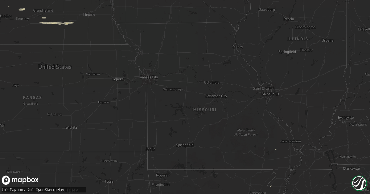
May 17 map
$229
one time, instant access
Download today. No call, no setup
Keep the $229
Bought the map and want the full workflow? Apply the entire $229 to a subscription within 7 days. None of it is wasted.
Every map, not just this one
This buys you this map. Subscription and you get every map we run, in the markets you choose from a few cities to whole states to nationwide. Plus real-time alerts the moment a storm fires.
Contact data
Name, contact info, occupancy, even credit band for addresses in the footprint. You go from where it hit to who to call.
Become the source they trust
Unlimited branding weather history reports on demand. You already have the documented answer ready for the property owner, and you are the one who showed up with it.
Property data and RoofTrace estimates
Pull up any address you have got, its value and the exact code rules for that jurisdiction, straight from One Click Code. Then RoofTrace estimates the squares, pitch, and roof value, priced the way you price.
Storm reports in Mississippi
Mississippi
| Date | Description |
|---|---|
| 05/17/20153:10 PM CDT | Multiple trees down in the road. Small limbs scattered everywhere. |
| 05/17/20151:55 PM CDT | Numerous large limbs down. |
| 05/17/20152:40 AM CDT | Two commercial buildings and several convenience stores got some wind damage. The convenience stores got some awning damage. The first commercial att building had the c |
| 05/17/201512:40 AM CDT | A couple trees down...large oak across lebanon pinegrove rd. |
| 05/16/201511:58 PM CDT | A couple trees down along hwy 547. |
| 05/16/201511:50 PM CDT | A few trees down in se part of county. |
| 05/16/201511:45 PM CDT | Trees and power lines down across jefferson county |
| 05/16/201511:30 PM CDT | The roof was blown off a bank |
| 05/16/20158:25 PM CDT | Trees and powerlines downed in the morgantown area. Delayed report. |
All States Impacted by Hail Map on May 17, 2015
Cities Impacted by Hail Map on May 17, 2015
- Fayetteville, TX
- Ellinger, TX
- Livingston, TX
- Warrior, AL
- Sutton, NE
- Harvard, NE
- Inland, NE
- Saronville, NE
- Monroe, LA
- West Monroe, LA
- Wrightsboro, TX
- Gonzales, TX
- Smiley, TX
- Cost, TX
- Orange, TX
- Keatchie, LA
- Logansport, LA
- Brenham, TX
- Winnfield, LA
- Natchitoches, LA
- Goldonna, LA
- Cotton Plant, AR
- Saline, LA
- Tatum, TX
- Dequincy, LA
- Castor, LA
- Willis, TX
- Conroe, TX
- Vaughan, MS
- Noble, LA
- Zwolle, LA
- Rayville, LA
- Yazoo City, MS
- Parkdale, AR
- Wilmot, AR
- Pleasanton, NE
- Cook, MN
- Navasota, TX
- Washington, TX
- Friend, NE
- Columbia, LA
- Riverdale, NE
- Ravenna, NE
- New Waverly, TX
- Kenesaw, NE
- Bienville, LA
- Shorter, AL
- Newellton, LA
- Grayson, LA
- Hastings, NE
- Waelder, TX
- Milligan, NE
- Exeter, NE
- Fairmont, NE
- Geneva, NE
- Benton, MS
- Doniphan, NE
- Kelly, LA
- Olla, LA
- Arbyrd, MO
- Ord, NE
- Sargent, NE
- Comstock, NE
- Burwell, NE
- Clay Center, NE
- Houston, TX
- Deville, LA
- Glenmora, LA
- Chatham, LA
- Sikes, LA
- Liberty, TX
- Shelbyville, TX
- Eros, LA
- Dodson, LA
- Essex, IA
- Imogene, IA
- Sumner, NE
- Longville, LA
- Flatonia, TX
- Oak Grove, LA
- Montgomery, AL
- Muldoon, TX
- La Grange, TX
- Itta Bena, MS
- Jonesboro, LA
- Eudora, AR
- Mangham, LA
- San Antonio, TX
- Atascosa, TX
- Grafton, NE
- Hope Hull, AL
- Angora, MN
- Hempstead, TX
- Trumbull, NE
- Bryan, TX
- Ville Platte, LA
- Palestine, AR
- Goodwin, AR
- Chester, TX
- Cleveland, TX
- Dayton, TX
- Letohatchee, AL
- Vidor, TX
- Porter, TX
- Kingwood, TX
- Florien, LA
- Chappell Hill, TX
- Campti, LA
- Coushatta, LA
- Bleiblerville, TX
- Bellville, TX
- Saint Landry, LA
- Beaumont, TX
- Schulenburg, TX
- North Platte, NE
- Mansfield, LA
- Grand Cane, LA
- Trinity, TX
- Bridge City, TX
- New Caney, TX
- Splendora, TX
- Sturdivant, MO
- Clinton, MS
- Epps, LA
- Hanceville, AL
- Pelican, LA
- Converse, LA
- Tuskegee, AL
- Robeline, LA
- Marthaville, LA
- Vicksburg, MS
- Castroville, TX
- Jena, LA
- New Ulm, TX
- Moro, AR
- Wheatley, AR
- Hot Springs National Park, AR
- Weimar, TX
- Columbus, TX
- Pleasant Hill, LA
- Des Arc, AR
- Tomball, TX
- Spring, TX
- Magnolia, TX
- Huntington, TX
- Kountze, TX
- Blue Earth, MN
- Round Top, TX
- Portland, AR
- Devine, TX
- Moorhead, MS
- San Augustine, TX
- Many, LA
- Juniata, NE
- Giltner, NE
- Frierson, LA
- Cedar Rapids, NE
- Hemphill, TX


