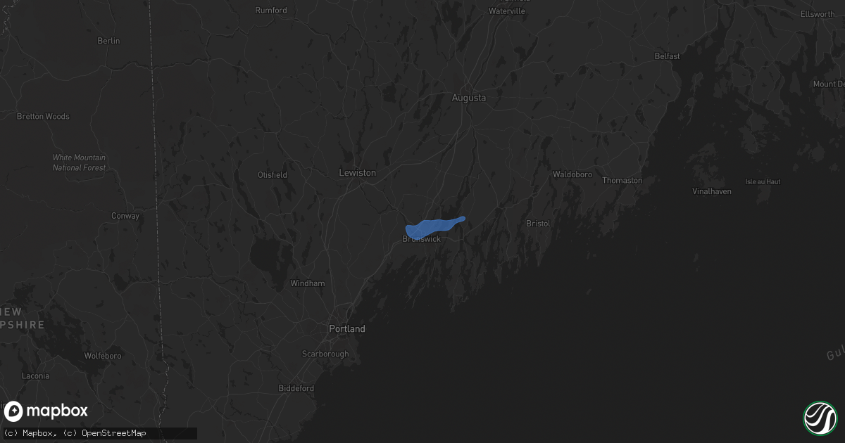
Hail Map in Topsham, ME on September 6, 2021
Get this storm
September 6 map
$229
one time, instant access
Download today. No call, no setup
Keep the $229
Bought the map and want the full workflow? Apply the entire $229 to a subscription within 7 days. None of it is wasted.
Every map, not just this one
This buys you this map. Subscription and you get every map we run, in the markets you choose from a few cities to whole states to nationwide. Plus real-time alerts the moment a storm fires.
Contact data
Name, contact info, occupancy, even credit band for addresses in the footprint. You go from where it hit to who to call.
Become the source they trust
Unlimited branding weather history reports on demand. You already have the documented answer ready for the property owner, and you are the one who showed up with it.
Property data and RoofTrace estimates
Pull up any address you have got, its value and the exact code rules for that jurisdiction, straight from One Click Code. Then RoofTrace estimates the squares, pitch, and roof value, priced the way you price.
Storm reports in Topsham, ME
Topsham, ME
| Date | Description |
|---|---|
| 09/06/20213:40 PM CDT | Large tree down on a house on route 196 in topsham. Time estimated based on radar. |
| 09/06/20213:40 PM CDT | Large tree down on wires on route 201 in topsham. Time estimated based on radar. |
| 09/06/20213:39 PM CDT | Numerous trees down on wires... Homes... And vehicles east side of topsham. |
| 09/06/20213:39 PM CDT | Power pole snapped along with downed trees in the vicinity of andrea street. |
All States Impacted by Hail Map on September 6, 2021
All Cities Impacted by Hail Map on September 6, 2021
- Ogema, MN
- Wagon Mound, NM
- Park Rapids, MN
- Ponsford, MN
- Hayward, WI
- Spooner, WI
- Stone Lake, WI
- Springbrook, WI
- Crystal Falls, MI
- Junction, TX
- Ada, MN
- Gary, MN
- Marenisco, MI
- San Saba, TX
- Buda, TX
- Leander, TX
- Twin Valley, MN
- Grasston, MN
- Pine City, MN
- Richland Springs, TX
- Merrifield, MN
- Pequot Lakes, MN
- Waubun, MN
- Bastrop, TX
- Webster, WI
- Danbury, WI
- Bruce Crossing, MI
- Cherokee, TX
- Johnson City, TX
- Lockhart, TX
- Kyle, TX
- Osage, MN
- Brook Park, MN
- Mora, MN
- Iron River, MI
- Trout Creek, MI
- Comfort, TX
- Boerne, TX
- Dunbar, WI
- Park Falls, WI
- Ulen, MN
- Borup, MN
- Austin, TX
- Blackduck, MN
- Tenstrike, MN
- Hines, MN
- Menominee, MI
- Vernon, TX
- Burnham, ME
- Troy, ME
- Wallace, MI
- Stephenson, MI
- White Earth, MN
- Iron Belt, WI
- Iron Mountain, MI
- Florence, WI
- Rhinelander, WI
- Tomahawk, WI
- Irma, WI
- Fayetteville, TX
- Hackensack, MN
- Mason, TX
- Green Bay, WI
- Columbus, TX
- Solano, NM
- Trementina, NM
- Weimar, TX
- Clayton, NM
- Del Valle, TX
- Schulenburg, TX
- Sister Bay, WI
- Baileys Harbor, WI
- Hallettsville, TX
- Santa Anna, TX
- Mercer, WI
- Lac Du Flambeau, WI
- Flatonia, TX
- Fish Creek, WI
- Gleason, WI
- Ephraim, WI
- Ellison Bay, WI
- Ewen, MI
- Deerbrook, WI
- Georgetown, TX
- San Antonio, TX
- Harshaw, WI
- Couderay, WI
- Hinckley, MN
- Trego, WI
- Glidden, WI
- Butternut, WI
- Blanco, TX
- Manchaca, TX
- West Point, TX
- Texline, TX
- Paint Rock, TX
- Dale, TX
- Waelder, TX
- Pound, WI
- Crivitz, WI
- Coleman, TX
- Gouldbusk, TX
- Muldoon, TX
- Roy, NM
- Westwego, LA
- Unity, ME
- Rochelle, TX
- Driftwood, TX
- Wimberley, TX
- Christoval, TX
- Lanse, MI
- Lawn, TX
- Braham, MN
- Niagara, WI
- San Marcos, TX
- Mahnomen, MN
- Bath, ME
- Topsham, ME
- Brunswick, ME
- Woolwich, ME
- Palmyra, ME
- Pittsfield, ME
- Clinton, ME
- Canaan, ME
- Detroit, ME
- Plymouth, ME
- Dixmont, ME
- Winter, WI
- Baraga, MI
- Pelkie, MI
- Michigamme, MI
- Lorraine, NY
- Pulaski, NY
- Sandy Creek, NY
- Mannsville, NY
- Lacona, NY
- Poland, NY
- Utica, NY
- Marcy, NY
- Little Falls, NY
- Barneveld, NY
- Salisbury Center, NY
- Holland Patent, NY
- Newport, NY
- Rome, NY
- Stittville, NY


