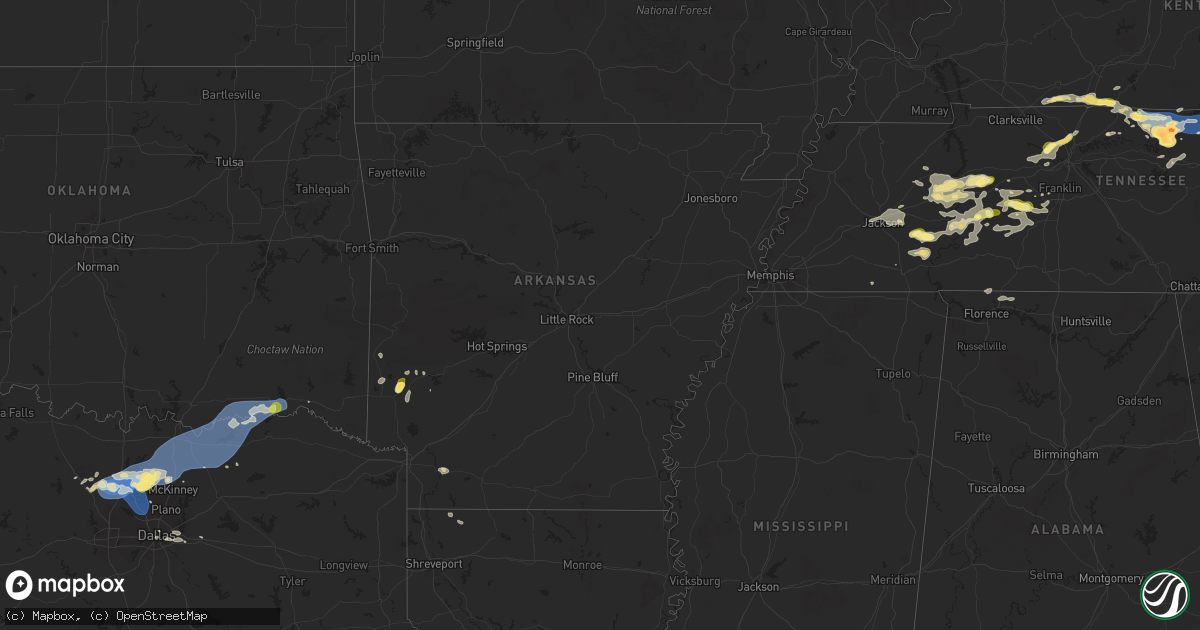
Hail Map in Arkansas on September 5, 2025
Get this storm
September 5 map
$229
one time, instant access
Download today. No call, no setup
Keep the $229
Bought the map and want the full workflow? Apply the entire $229 to a subscription within 7 days. None of it is wasted.
Every map, not just this one
This buys you this map. Subscription and you get every map we run, in the markets you choose from a few cities to whole states to nationwide. Plus real-time alerts the moment a storm fires.
Contact data
Name, contact info, occupancy, even credit band for addresses in the footprint. You go from where it hit to who to call.
Become the source they trust
Unlimited branding weather history reports on demand. You already have the documented answer ready for the property owner, and you are the one who showed up with it.
Property data and RoofTrace estimates
Pull up any address you have got, its value and the exact code rules for that jurisdiction, straight from One Click Code. Then RoofTrace estimates the squares, pitch, and roof value, priced the way you price.
Storm reports in Arkansas
Arkansas
| Date | Description |
|---|---|
| 09/05/202512:50 AM CDT | Report of trees down near hilltop drive on the north side of stamps. |
| 09/05/202512:48 AM CDT | Report of a powerline down on county road 27 north of stamps. |
| 09/05/202512:48 AM CDT | Report of a powerline down |
| 09/05/202512:48 AM CDT | Rep |
| 09/05/202512:48 AM CDT | Report of a powerline down on county road 27 north of stam |
| 09/04/202511:27 PM CDT | Corrects previous tstm wnd dmg report from 3 wnw dierks. Report of tree down on dierks lake road. |
| 09/04/202511:02 PM CDT | Corrects previous tstm wnd dmg report from 2 sse de queen. Report of trees down on east red bridge road just to the south of highway 41. |
| 09/04/202511:02 PM CDT | Corrects previous tstm wnd dmg report from 1 wnw de queen. Reports of trees down on johnson bridge road just off of highway 70 w. |
| 09/04/202511:02 PM CDT | Corrects previous tstm wnd dmg report from 1 wnw de queen. Reports of trees down on johnson bridge road just off of highway 70 w. |
| 09/04/202511:02 PM CDT | Received several photos on our social media page of downed trees... With some on power lines and buildings... Across the town of gillham. |
| 09/04/202511:00 PM CDT | Corrects previous tstm wnd dmg report from 1 s gillham. Report of tree down along highway 71 south of gillham. |
All States Impacted by Hail Map on September 5, 2025
Cities Impacted by Hail Map on September 5, 2025
- Holladay, TN
- Jackson, TN
- Waverly, TN
- Finger, TN
- Beech Bluff, TN
- Scotts Hill, TN
- Decaturville, TN
- Adamsville, TN
- Bethel Springs, TN
- Russellville, KY
- Adairville, KY
- Huron, TN
- Middleton, TN
- Reagan, TN
- Luray, TN
- Morris Chapel, TN
- Milledgeville, TN
- Enville, TN
- Lexington, TN
- Jacks Creek, TN
- Sardis, TN
- Olmstead, KY
- Linden, TN
- Allensville, KY
- Franklin, KY
- Parsons, TN
- Centerville, TN
- Paintsville, KY
- River, KY
- Scottsville, KY
- Lobelville, TN
- Duck River, TN
- Lyles, TN
- Primm Springs, TN
- Williamsport, TN
- Clifton, TN
- Belleville, WV
- Louisa, KY
- McKee, KY
- Inez, KY
- Waynesboro, TN
- Decatur, TX
- Washington, WV
- Mineral Wells, WV
- Rhome, TX
- Crum, WV
- Fort Gay, WV
- Dunlow, WV
- Tomahawk, KY
- Adolphus, KY
- Santa Fe, TN
- Harts, WV
- Krum, TX
- Ponder, TX
- Kermit, WV
- Warfield, KY
- Campton, KY
- Salyersville, KY
- Lovely, KY
- Searchlight, NV
- Portland, TN
- Lenore, WV
- Williamson, WV
- Dingess, WV
- Jackson, KY
- Vancleve, KY
- Somerset, KY
- Science Hill, KY
- Chapmanville, WV
- Mount Pleasant, TN
- Hampshire, TN
- Eubank, KY
- Westmoreland, TN
- Pioche, NV
- Columbia, TN
- Hagerhill, KY
- Justin, TX
- Sanger, TX
- Denton, TX
- Argyle, TX
- Aubrey, TX
- Lafayette, TN
- Caliente, NV
- Delbarton, WV
- Ulysses, KY
- Hartsville, TN
- Valley View, TX
- Pilot Point, TX
- Tutor Key, KY
- Castalian Springs, TN
- Gallatin, TN
- Pecks Mill, WV
- Logan, WV
- Royalton, KY
- Macfarlan, WV
- Harrisville, WV
- Smithville, WV
- Rousseau, KY
- East Point, KY
- Dixon Springs, TN
- Little Elm, TX
- Red Boiling Springs, TN
- Moss, TN
- Whitleyville, TN
- Prosper, TX
- Frisco, TX
- Celina, TX
- Tioga, TX
- Gunter, TX
- Mckinney, TX
- Bethpage, TN
- Rome, GA
- Taylorsville, GA
- Gunlock, KY
- Auxier, KY
- Pleasant Shade, TN
- Collinsville, TX
- Melissa, TX
- Howe, TX
- Celina, TN
- Gainesboro, TN
- Hilham, TN
- White Bluff, TN
- Ashland City, TN
- Richmond, KY
- Carthage, TN
- Only, TN
- David, KY
- Nashville, TN
- Kingston Springs, TN
- Pilgrim, KY
- Belfry, KY
- Beauty, KY
- Anna Maria, FL
- Hurricane Mills, TN
- Anna, TX
- Sherman, TX
- Van Alstyne, TX
- Allons, TN
- Monroe, TN
- Byrdstown, TN
- Livingston, TN
- Granville, TN
- McEwen, TN
- Joelton, TN
- Nunnelly, TN
- Hollow Rock, TN
- Huntingdon, TN
- Winchester, KY
- Pegram, TN
- Bays, KY
- Bradenton Beach, FL
- Prestonsburg, KY
- Hueysville, KY
- Langley, KY
- Lavalette, WV
- Huntington, WV
- Whites Creek, TN
- Goodlettsville, TN
- Matewan, WV
- Bruceton, TN
- Buena Vista, TN
- Denison, TX
- Whitewright, TX
- Bells, TX
- Tom Bean, TX
- Ravenna, TX
- Savoy, TX
- Hendrix, OK
- Bonham, TX
- Blue Ridge, TX
- Trenton, TX
- Ector, TX
- Yuma, TN
- Westport, TN
- Paint Lick, KY
- Camden, TN
- Jamestown, TN
- Berea, KY
- Lancaster, KY
- Ivanhoe, TX
- Randolph, TX
- Leonard, TX
- Ladonia, TX
- Dodd City, TX
- Wolfe City, TX
- Bailey, TX
- Waynesburg, KY
- Winfield, WV
- Poca, WV
- Red House, WV
- Irvine, KY
- New Johnsonville, TN
- Sugar Tree, TN
- White House, TN
- Hustonville, KY
- Middleburg, KY
- Wharncliffe, WV
- Gilbert, WV
- Waco, KY
- Bennington, OK
- Bokchito, OK
- Telephone, TX
- Sumner, TX
- Windom, TX
- Brookston, TX
- Honey Grove, TX
- Baxter, TN
- Silver Point, TN
- Big Springs, WV
- Kings Mountain, KY
- Auburn, WV
- Bloomington Springs, TN
- Baisden, WV
- Stanford, KY
- Mount Sterling, KY
- Owingsville, KY
- Hillsboro, KY
- Cookeville, TN
- Glenville, WV
- Coxs Mills, WV
- Buffalo Valley, TN
- Crab Orchard, KY
- Arthur City, TX
- Alvord, TX
- Brodhead, KY
- Sandgap, KY
- Ravenna, KY
- Thompsons Station, TN
- Van Lear, KY
- Boswell, OK
- Hugo, OK
- Boons Camp, KY
- Beattyville, KY
- Cooper, TX
- Powderly, TX
- Paris, TX
- Grant, OK
- Stanton, KY
- Rogers, KY
- Slade, KY
- Sparta, TN
- Vincent, KY
- Hendersonville, TN
- Fort Towson, OK
- Sawyer, OK
- Zoe, KY
- Hestand, KY
- Hohenwald, TN
- Spring Hill, TN
- Cove, AR
- Wickes, AR
- Bon Aqua, TN
- Gillham, AR
- Tyner, KY
- Wayne, WV
- De Queen, AR
- Booneville, KY
- Valliant, OK
- Lockesburg, AR
- Vandervoort, AR
- Grannis, AR
- Wildersville, TN
- Dierks, AR
- Clayhole, KY
- Lake Dallas, TX
- Lewisville, TX
- The Colony, TX
- Carrollton, TX
- Coppell, TX
- Grapevine, TX
- Flower Mound, TX
- Barboursville, WV
- Newhope, AR
- Langley, AR
- Dallas, TX
- Overton, NV
- Plano, TX
- Balch Springs, TX
- Nashville, AR
- Mesquite, TX
- Florence, AL
- Iron City, TN
- Sunnyvale, TX
- Forney, TX
- Terrell, TX
- Chauncey, WV
- Omar, WV
- Killen, AL
- Lewisville, AR
- Garland City, AR
- Lexington, AL
- Rogersville, AL
- Amargosa Valley, NV
- Willow Beach, AZ
- Oliver Springs, TN
- Indian Springs, NV
- Pahrump, NV
- Cotton Valley, LA
- Sarepta, LA
- Franklin, TN
- Plain Dealing, LA
- Oakfield, TN
- Medina, TN
- Eugene, OR
- Cottage Grove, OR
- Creswell, OR
- North Las Vegas, NV
- Las Vegas, NV
- Meadview, AZ
- Kingman, AZ
- Dickson, TN
- Summertown, TN
- Peach Springs, AZ
- Dolan Springs, AZ


