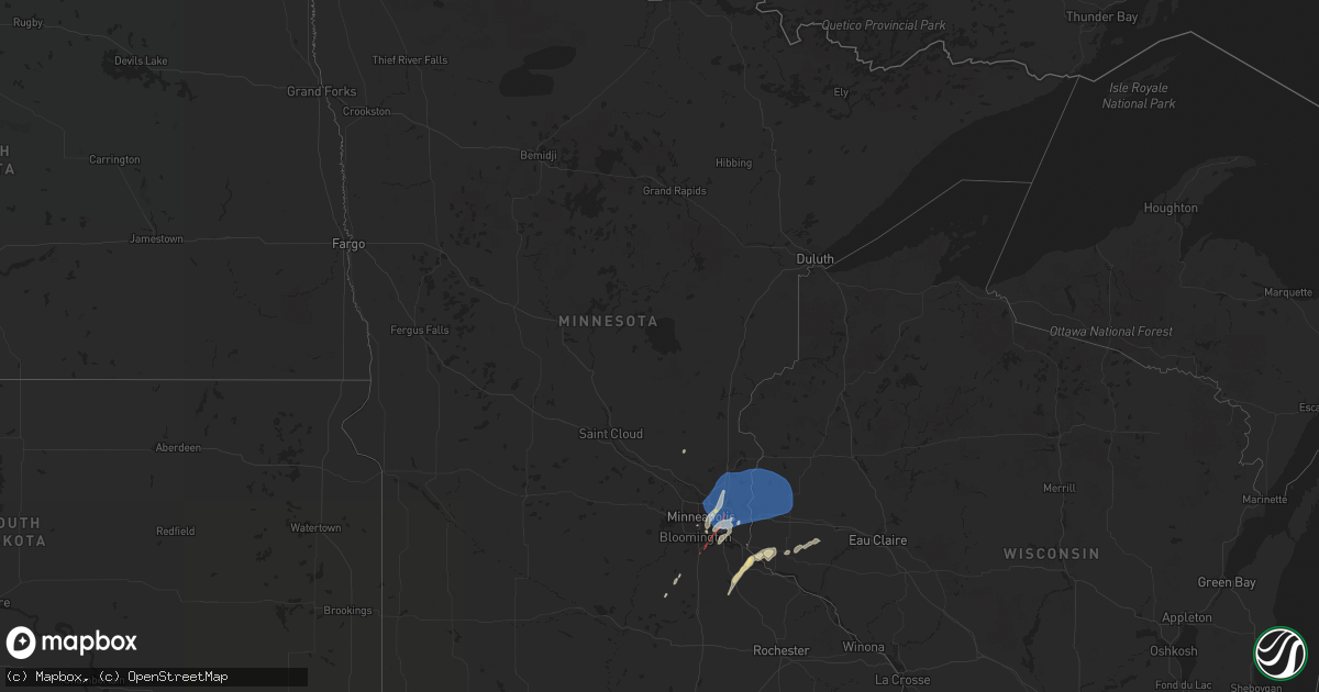
Hail Map in Minnesota on August 27, 2022
Get this storm
August 27 map
$229
one time, instant access
Download today. No call, no setup
Keep the $229
Bought the map and want the full workflow? Apply the entire $229 to a subscription within 7 days. None of it is wasted.
Every map, not just this one
This buys you this map. Subscription and you get every map we run, in the markets you choose from a few cities to whole states to nationwide. Plus real-time alerts the moment a storm fires.
Contact data
Name, contact info, occupancy, even credit band for addresses in the footprint. You go from where it hit to who to call.
Become the source they trust
Unlimited branding weather history reports on demand. You already have the documented answer ready for the property owner, and you are the one who showed up with it.
Property data and RoofTrace estimates
Pull up any address you have got, its value and the exact code rules for that jurisdiction, straight from One Click Code. Then RoofTrace estimates the squares, pitch, and roof value, priced the way you price.
Storm reports in Minnesota
Minnesota
| Date | Description |
|---|---|
| 08/27/20223:54 AM CDT | At 854 PM CDT, severe thunderstorms were located along a line extending from Medford to 7 miles northwest of Blooming Prairie, moving northeast at 40 mph. HAZARD...60 mph wind gusts. SOURCE...Radar indicated. IMPACT...Expect damage to roofs, siding, and trees. Severe thunderstorms will be near... Claremont around 910 PM CDT. Dodge Center around 915 PM CDT. West Concord around 920 PM CDT. Mantorville and Kasson around 925 PM CDT.Other locations impacted by these severe thunderstorms include CountyRoads 20 And 5, Concord, Eden, Highway 57 And 570th Street, CountyRoads 5 And 6, Wasioja and County Roads 1 And 24. |
| 08/27/20223:07 AM CDT | At 807 PM CDT, a severe thunderstorm was located near Montgomery, or 13 miles west of Faribault, moving northeast at 55 mph. HAZARD...60 mph wind gusts. SOURCE...Radar indicated. IMPACT...Expect damage to roofs, siding, and trees. This severe thunderstorm will be near... Lonsdale around 815 PM CDT. Webster and Elko New Market around 825 PM CDT.Other locations in the path of this severe thunderstorm includeLakeville and Farmington. |
| 08/27/20221:11 AM CDT | At 610 PM CDT, a severe thunderstorm was located near Superior, or 7 miles west of Estherville, moving northeast at 45 mph. HAZARD...60 mph wind gusts. SOURCE...Radar indicated. IMPACT...Expect damage to roofs, siding, and trees. This severe thunderstorm will be near... Superior around 615 PM CDT. |
| 08/27/202212:47 AM CDT | At 546 PM CDT, a severe thunderstorm was located 6 miles southeast of Prescott, or 11 miles northwest of Red Wing, moving northeast at 25 mph. HAZARD...60 mph wind gusts and quarter size hail. SOURCE...Radar indicated. IMPACT...Hail damage to vehicles is expected. Expect wind damage to roofs, siding, and trees. Locations impacted include... Ellsworth and River Falls. |
| 08/26/20229:40 PM CDT | Large tree uprooted. Picture via twitter. Time estimated. |
| 08/26/20229:12 PM CDT | Boat on lift overturned. Large trees broken approximately 5-6 feet up from their base. Time approximated via radar. |
| 08/26/20229:06 PM CDT | A local report indicates 1.25 inch wind near 2 SW LITTLE CANADA |
| 08/26/20229:05 PM CDT | Asos station kstp st. Paul dwtn ap. |
| 08/26/20229:05 PM CDT | Branches to 2 inches in diameter down. Small tree & yard debris thrown about. |
| 08/26/20229:00 PM CDT | Large tree fell on mobile home. Video on twitter. Time estimated. |
| 08/26/20229:00 PM CDT | Trees down... Branches down in central eagan. Time estimated. |
| 08/26/20228:58 PM CDT | 61 mph gust measured at the minnesota state fair grandstand. |
| 08/26/20228:55 PM CDT | Trees blocking roadway in narrow swath of damage. Street impassable. Time estimated by radar. |
| 08/26/20228:40 PM CDT | 6 inch branches down along county road 46 & ipava ave. |
| 08/26/20227:25 PM CDT | Report from mping: 3-inch tree limbs broken; power poles broken. |
All States Impacted by Hail Map on August 27, 2022
Cities Impacted by Hail Map on August 27, 2022
- Minneapolis, MN
- Agency, MO
- Saint Joseph, MO
- South Saint Paul, MN
- Cottage Grove, MN
- Newport, MN
- Inver Grove Heights, MN
- Saint Paul Park, MN
- Lake Elmo, MN
- Saint Paul, MN
- Prescott, WI
- Grinnell, IA
- Chandler, AZ
- Nevada, IA
- Maxwell, IA
- Colo, IA
- Hastings, MN
- Ness City, KS
- Spearman, TX
- Brandon, FL
- Meeker, CO
- Marshalltown, IA
- Edgemoor, SC
- Perryton, TX
- Boone, IA
- Ames, IA
- Saint Francis, MN
- Isanti, MN
- Hager City, WI
- Ellsworth, WI
- Tampa, FL
- Riverview, FL
- Kellogg, IA
- Woden, IA
- Hugo, MN
- Jetmore, KS
- Maricopa, AZ
- Millsboro, DE
- Lilesville, NC
- Suffolk, VA
- Spring Valley, WI
- Elmwood, WI
- Menomonie, WI
- State Center, IA
- Albion, IA
- Gold Canyon, AZ
- Lynnville, IA
- Sully, IA
- Ellis, KS
- Plainville, KS
- West Point, VA
- Tucker, GA
- Stone Mountain, GA
- Lilburn, GA
- Laurel, DE
- Georgetown, DE
- Sharpsburg, IA
- Bedford, IA
- Lenox, IA
- Clearfield, IA
- New Prague, MN
- Duluth, GA
- New Smyrna Beach, FL
- Sublette, KS
- Collins, IA
- Mingo, IA
- Decorah, IA
- Ossian, IA
- Rhodes, IA
- Zearing, IA
- McCallsburg, IA
- Douglas, AZ
- Welch, MN
- Randolph, MN
- Hampton, MN
- Cannon Falls, MN
- Dennison, MN
- Lithia, FL
- Valrico, FL
- Webster, MN
- Montgomery, MN
- Melbourne, IA
- Conrad, IA
- Liscomb, IA
- Hardesty, OK
- Orlando, FL
- Lawrenceville, GA
- Rose Hill, IA
- New Sharon, IA
- Morven, NC
- Rockingham, NC
- Hooker, OK
- Union Star, MO
- Afton, MN
- Shafer, MN
- Glenwood City, WI
- New Richmond, WI
- Houlton, WI
- Stillwater, MN
- Forest Lake, MN
- Willernie, MN
- Hammond, WI
- Circle Pines, MN
- Osceola, WI
- Roberts, WI
- Baldwin, WI
- Somerset, WI
- Star Prairie, WI
- Lakeland, MN
- Deer Park, WI
- Lindstrom, MN
- Bayport, MN
- Scandia, MN
- Amery, WI
- Marine On Saint Croix, MN
- Hudson, WI
- Lakeville, MN
- Burnsville, MN


