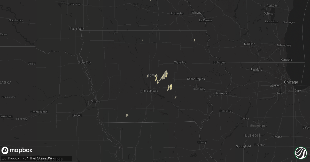
Hail Map in Iowa on August 27, 2022
Get this storm
August 27 map
$229
one time, instant access
Download today. No call, no setup
Keep the $229
Bought the map and want the full workflow? Apply the entire $229 to a subscription within 7 days. None of it is wasted.
Every map, not just this one
This buys you this map. Subscription and you get every map we run, in the markets you choose from a few cities to whole states to nationwide. Plus real-time alerts the moment a storm fires.
Contact data
Name, contact info, occupancy, even credit band for addresses in the footprint. You go from where it hit to who to call.
Become the source they trust
Unlimited branding weather history reports on demand. You already have the documented answer ready for the property owner, and you are the one who showed up with it.
Property data and RoofTrace estimates
Pull up any address you have got, its value and the exact code rules for that jurisdiction, straight from One Click Code. Then RoofTrace estimates the squares, pitch, and roof value, priced the way you price.
Storm reports in Iowa
Iowa
| Date | Description |
|---|---|
| 08/27/20226:29 PM CDT | Awos gusted to 55 mph. Photo of tree damage on social media. |
| 08/27/20226:20 PM CDT | Some tree branches down in his yard... And neighbors shingles were flapping in the strong winds and very heavy... Nearly horizontal... Rain. |
| 08/27/20226:11 PM CDT | Large 100 year old tree blown down. Gutter taken off house. |
| 08/27/20225:55 PM CDT | Asos station kspw spencer municipal airport. |
| 08/27/20225:52 PM CDT | Corrects time from previous tstm wnd gst report from 4 wnw spencer. Asos station kspw spencer municipal airport. |
| 08/27/20225:44 PM CDT | Delayed report of branches downed around town along with one large older tree. |
| 08/27/20225:30 PM CDT | Extensive wind damage to machine sheds and cattle buildings south of primghar. |
| 08/27/20224:32 PM CDT | Report from mping: quarter hail. |
| 08/27/20224:06 AM CDT | At 906 PM CDT, a severe thunderstorm was located near Albert City, or 14 miles northeast of Storm Lake, moving northeast at 30 mph. HAZARD...60 mph wind gusts. SOURCE...Radar indicated. IMPACT...Expect damage to roofs, siding, and trees. This severe thunderstorm will be near... Laurens around 925 PM CDT.Other locations in the path of this severe thunderstorm includeHavelock, Rush Lake, Mallard, Ayrshire and Curlew. |
| 08/27/20224:05 AM CDT | At 905 PM CDT, a severe thunderstorm was located near Marathon, or 14 miles northeast of Storm Lake, moving northeast at 25 mph. HAZARD...60 mph wind gusts. SOURCE...Radar indicated. IMPACT...Expect damage to roofs, siding, and trees. This severe thunderstorm will be near... Marathon around 915 PM CDT. Webb around 930 PM CDT. |
| 08/27/20223:34 AM CDT | At 833 PM CDT, severe thunderstorms were located along a line extending from 9 miles northeast of Lake Icaria to near Creston to 8 miles west of Mount Ayr, moving northeast at 50 mph. HAZARD...60 mph wind gusts. SOURCE...Radar indicated. IMPACT...Expect damage to roofs, siding, and trees. Severe thunderstorms will be near... Creston, Green Valley Lake and Creston Municipal Airport around 840 PM CDT. Orient, Nodaway Park and Green Valley Lake State Park around 845 PM CDT. Greenfield, Tingley and Greenfield Municipal Airport around 850 PM CDT.Other locations in the path of these severe thunderstorms includeArispe, Afton, Macksburg, Thayer, Murray, Lorimor, Murray RoadsideRest Area, Winterset and Winterset-Madison County Airport.This includes Interstate 80 between mile markers 97 and 98. |
| 08/27/20222:35 AM CDT | At 735 PM CDT, a severe thunderstorm was located over Ossian, or 10 miles south of Decorah, moving north at 15 mph. HAZARD...60 mph wind gusts and quarter size hail. SOURCE...Radar indicated. IMPACT...Hail damage to vehicles is expected. Expect wind damage to roofs, siding, and trees. This severe thunderstorm will be near... Decorah around 810 PM CDT.Other locations impacted by this severe thunderstorm include Hanover,County Roads A 52 And W 60, State Road 9 And County X 20, State Road76 And County X 16, Frankville, State Road 9 And Frankville Road andNordness. |
| 08/27/20222:26 AM CDT | At 725 PM CDT, a severe thunderstorm was located near Tripoli, or 11 miles south of New Hampton, moving northeast at 35 mph. HAZARD...60 mph wind gusts and penny size hail. SOURCE...Radar indicated. IMPACT...Expect damage to roofs, siding, and trees. This severe thunderstorm will be near... Fredericksburg around 735 PM CDT. Lawler around 745 PM CDT. Waucoma around 755 PM CDT. Fort Atkinson around 805 PM CDT. Spillville around 810 PM CDT.Other locations impacted by this severe thunderstorm include Festina,Eldorado, Boyd, Williamstown, Richfield, St. Lucas and County Roads B54 And V 56. |
| 08/27/20221:16 AM CDT | At 616 PM CDT, a severe thunderstorm was located over Terril, or 8 miles southeast of Spirit Lake, moving northeast at 45 mph. HAZARD...60 mph wind gusts. SOURCE...Radar indicated. IMPACT...Expect damage to roofs, siding, and trees. This severe thunderstorm will be near... Estherville and Fort Defiance State Park around 630 PM CDT. |
| 08/26/202211:51 PM CDT | At 451 PM CDT, a severe thunderstorm was located over Grinnell, moving north at 10 mph. HAZARD...Quarter size hail. SOURCE...Radar indicated. IMPACT...Damage to vehicles is expected. This severe thunderstorm will remain over mainly rural areas of northwestern Poweshiek, southwestern Tama and northeastern Jasper Counties, including the following locations... Montour. |
| 08/26/20228:24 PM CDT | An outbuilding was destroyed with walls of the structure falling on the adjacent home. Images relayed by broadcast media via social media. Delayed report... Time estima |
| 08/26/20227:46 PM CDT | Delayed report. Trees down over the road. No other details known. Time estimated from radar. |
| 08/26/20227:12 PM CDT | Medium sized trees down. |
All States Impacted by Hail Map on August 27, 2022
Cities Impacted by Hail Map on August 27, 2022
- Minneapolis, MN
- Agency, MO
- Saint Joseph, MO
- South Saint Paul, MN
- Cottage Grove, MN
- Newport, MN
- Inver Grove Heights, MN
- Saint Paul Park, MN
- Lake Elmo, MN
- Saint Paul, MN
- Prescott, WI
- Grinnell, IA
- Chandler, AZ
- Nevada, IA
- Maxwell, IA
- Colo, IA
- Hastings, MN
- Ness City, KS
- Spearman, TX
- Brandon, FL
- Meeker, CO
- Marshalltown, IA
- Edgemoor, SC
- Perryton, TX
- Boone, IA
- Ames, IA
- Saint Francis, MN
- Isanti, MN
- Hager City, WI
- Ellsworth, WI
- Tampa, FL
- Riverview, FL
- Kellogg, IA
- Woden, IA
- Hugo, MN
- Jetmore, KS
- Maricopa, AZ
- Millsboro, DE
- Lilesville, NC
- Suffolk, VA
- Spring Valley, WI
- Elmwood, WI
- Menomonie, WI
- State Center, IA
- Albion, IA
- Gold Canyon, AZ
- Lynnville, IA
- Sully, IA
- Ellis, KS
- Plainville, KS
- West Point, VA
- Tucker, GA
- Stone Mountain, GA
- Lilburn, GA
- Laurel, DE
- Georgetown, DE
- Sharpsburg, IA
- Bedford, IA
- Lenox, IA
- Clearfield, IA
- New Prague, MN
- Duluth, GA
- New Smyrna Beach, FL
- Sublette, KS
- Collins, IA
- Mingo, IA
- Decorah, IA
- Ossian, IA
- Rhodes, IA
- Zearing, IA
- McCallsburg, IA
- Douglas, AZ
- Welch, MN
- Randolph, MN
- Hampton, MN
- Cannon Falls, MN
- Dennison, MN
- Lithia, FL
- Valrico, FL
- Webster, MN
- Montgomery, MN
- Melbourne, IA
- Conrad, IA
- Liscomb, IA
- Hardesty, OK
- Orlando, FL
- Lawrenceville, GA
- Rose Hill, IA
- New Sharon, IA
- Morven, NC
- Rockingham, NC
- Hooker, OK
- Union Star, MO
- Afton, MN
- Shafer, MN
- Glenwood City, WI
- New Richmond, WI
- Houlton, WI
- Stillwater, MN
- Forest Lake, MN
- Willernie, MN
- Hammond, WI
- Circle Pines, MN
- Osceola, WI
- Roberts, WI
- Baldwin, WI
- Somerset, WI
- Star Prairie, WI
- Lakeland, MN
- Deer Park, WI
- Lindstrom, MN
- Bayport, MN
- Scandia, MN
- Amery, WI
- Marine On Saint Croix, MN
- Hudson, WI
- Lakeville, MN
- Burnsville, MN


