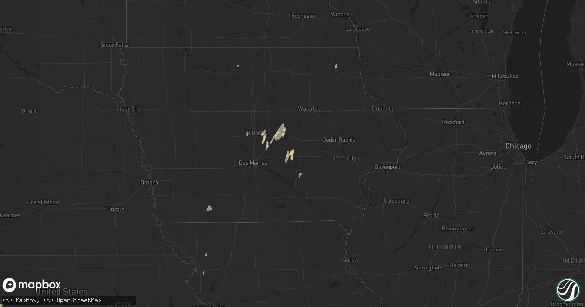
Hail Map on August 27, 2022
Get this storm
August 27 map
$229
one time, instant access
Download today. No call, no setup
Keep the $229
Bought the map and want the full workflow? Apply the entire $229 to a subscription within 7 days. None of it is wasted.
Every map, not just this one
This buys you this map. Subscription and you get every map we run, in the markets you choose from a few cities to whole states to nationwide. Plus real-time alerts the moment a storm fires.
Contact data
Name, contact info, occupancy, even credit band for addresses in the footprint. You go from where it hit to who to call.
Become the source they trust
Unlimited branding weather history reports on demand. You already have the documented answer ready for the property owner, and you are the one who showed up with it.
Property data and RoofTrace estimates
Pull up any address you have got, its value and the exact code rules for that jurisdiction, straight from One Click Code. Then RoofTrace estimates the squares, pitch, and roof value, priced the way you price.
States Impacted by Hail Map on August 27, 2022
Storm reports
Montana
| Date | Description |
|---|---|
| 08/27/20225:25 PM CDT | A local report indicates 63 MPH wind near 3 NW BILLINGS |
| 08/27/20225:00 PM CDT | A local report indicates 63 MPH wind near 9 WNW ABSAROKEE |
Iowa
| Date | Description |
|---|---|
| 08/27/20226:29 PM CDT | Awos gusted to 55 mph. Photo of tree damage on social media. |
| 08/27/20226:20 PM CDT | Some tree branches down in his yard... And neighbors shingles were flapping in the strong winds and very heavy... Nearly horizontal... Rain. |
| 08/27/20226:11 PM CDT | Large 100 year old tree blown down. Gutter taken off house. |
| 08/27/20225:55 PM CDT | Asos station kspw spencer municipal airport. |
| 08/27/20225:52 PM CDT | Corrects time from previous tstm wnd gst report from 4 wnw spencer. Asos station kspw spencer municipal airport. |
| 08/27/20225:44 PM CDT | Delayed report of branches downed around town along with one large older tree. |
| 08/27/20225:30 PM CDT | Extensive wind damage to machine sheds and cattle buildings south of primghar. |
| 08/27/20224:32 PM CDT | Report from mping: quarter hail. |
| 08/27/20224:06 AM CDT | At 906 PM CDT, a severe thunderstorm was located near Albert City, or 14 miles northeast of Storm Lake, moving northeast at 30 mph. HAZARD...60 mph wind gusts. SOURCE...Radar indicated. IMPACT...Expect damage to roofs, siding, and trees. This severe thunderstorm will be near... Laurens around 925 PM CDT.Other locations in the path of this severe thunderstorm includeHavelock, Rush Lake, Mallard, Ayrshire and Curlew. |
| 08/27/20224:05 AM CDT | At 905 PM CDT, a severe thunderstorm was located near Marathon, or 14 miles northeast of Storm Lake, moving northeast at 25 mph. HAZARD...60 mph wind gusts. SOURCE...Radar indicated. IMPACT...Expect damage to roofs, siding, and trees. This severe thunderstorm will be near... Marathon around 915 PM CDT. Webb around 930 PM CDT. |
| 08/27/20223:34 AM CDT | At 833 PM CDT, severe thunderstorms were located along a line extending from 9 miles northeast of Lake Icaria to near Creston to 8 miles west of Mount Ayr, moving northeast at 50 mph. HAZARD...60 mph wind gusts. SOURCE...Radar indicated. IMPACT...Expect damage to roofs, siding, and trees. Severe thunderstorms will be near... Creston, Green Valley Lake and Creston Municipal Airport around 840 PM CDT. Orient, Nodaway Park and Green Valley Lake State Park around 845 PM CDT. Greenfield, Tingley and Greenfield Municipal Airport around 850 PM CDT.Other locations in the path of these severe thunderstorms includeArispe, Afton, Macksburg, Thayer, Murray, Lorimor, Murray RoadsideRest Area, Winterset and Winterset-Madison County Airport.This includes Interstate 80 between mile markers 97 and 98. |
| 08/27/20222:35 AM CDT | At 735 PM CDT, a severe thunderstorm was located over Ossian, or 10 miles south of Decorah, moving north at 15 mph. HAZARD...60 mph wind gusts and quarter size hail. SOURCE...Radar indicated. IMPACT...Hail damage to vehicles is expected. Expect wind damage to roofs, siding, and trees. This severe thunderstorm will be near... Decorah around 810 PM CDT.Other locations impacted by this severe thunderstorm include Hanover,County Roads A 52 And W 60, State Road 9 And County X 20, State Road76 And County X 16, Frankville, State Road 9 And Frankville Road andNordness. |
| 08/27/20222:26 AM CDT | At 725 PM CDT, a severe thunderstorm was located near Tripoli, or 11 miles south of New Hampton, moving northeast at 35 mph. HAZARD...60 mph wind gusts and penny size hail. SOURCE...Radar indicated. IMPACT...Expect damage to roofs, siding, and trees. This severe thunderstorm will be near... Fredericksburg around 735 PM CDT. Lawler around 745 PM CDT. Waucoma around 755 PM CDT. Fort Atkinson around 805 PM CDT. Spillville around 810 PM CDT.Other locations impacted by this severe thunderstorm include Festina,Eldorado, Boyd, Williamstown, Richfield, St. Lucas and County Roads B54 And V 56. |
| 08/27/20221:16 AM CDT | At 616 PM CDT, a severe thunderstorm was located over Terril, or 8 miles southeast of Spirit Lake, moving northeast at 45 mph. HAZARD...60 mph wind gusts. SOURCE...Radar indicated. IMPACT...Expect damage to roofs, siding, and trees. This severe thunderstorm will be near... Estherville and Fort Defiance State Park around 630 PM CDT. |
| 08/26/202211:51 PM CDT | At 451 PM CDT, a severe thunderstorm was located over Grinnell, moving north at 10 mph. HAZARD...Quarter size hail. SOURCE...Radar indicated. IMPACT...Damage to vehicles is expected. This severe thunderstorm will remain over mainly rural areas of northwestern Poweshiek, southwestern Tama and northeastern Jasper Counties, including the following locations... Montour. |
| 08/26/20228:24 PM CDT | An outbuilding was destroyed with walls of the structure falling on the adjacent home. Images relayed by broadcast media via social media. Delayed report... Time estima |
| 08/26/20227:46 PM CDT | Delayed report. Trees down over the road. No other details known. Time estimated from radar. |
| 08/26/20227:12 PM CDT | Medium sized trees down. |
Missouri
| Date | Description |
|---|---|
| 08/27/20223:09 AM CDT | At 808 PM CDT, severe thunderstorms were located along a line extending from near Corning to 8 miles west of Lenox to 6 miles south of Bedford, moving northeast at 30 mph. HAZARD...60 mph wind gusts. SOURCE...Radar indicated. IMPACT...Expect damage to roofs, siding, and trees. Severe thunderstorms will be near... Corning, Sharpsburg and Corning Municipal Airport around 815 PM CDT. Lake Of Three Fires State Park around 820 PM CDT. Lenox, Lake Icaria and Lake Icaria State Park around 825 PM CDT.Other locations in the path of these severe thunderstorms includePrescott, Blockton, Conway, Kent, Maloy, Clearfield, Cromwell, Bentonand Creston Municipal Airport. |
| 08/27/20221:56 AM CDT | At 655 PM CDT, a severe thunderstorm was located 7 miles northwest of Clarksdale, or 8 miles east of Country Club Villa, moving north at 40 mph. HAZARD...60 mph wind gusts and penny size hail. SOURCE...Radar indicated. IMPACT...Expect damage to roofs, siding, and trees. Locations impacted include... St. Joseph, Stanberry, King City, Union Star, Clarksdale, Cosby, Guilford, Rea, Ford City, Helena and Conception. |
Florida
| Date | Description |
|---|---|
| 08/27/202212:50 AM CDT | At 550 PM EDT, a severe thunderstorm was located over Brandon, and is nearly stationary. HAZARD...60 mph wind gusts and nickel size hail. SOURCE...Radar indicated. IMPACT...Expect damage to roofs, siding, and trees. Locations impacted include... Tampa, Valrico, Brandon, Riverview, Progress Village, Palm River-Clair Mel, Orient Park, Lithia Springs State Park, East Lake-Orient Park and Bloomingdale. |
South Carolina
| Date | Description |
|---|---|
| 08/27/202212:32 AM CDT | At 531 PM EDT, a severe thunderstorm was located 8 miles east of Wadesboro, moving southwest at 5 mph. HAZARD...60 mph wind gusts and penny size hail. SOURCE...Radar indicated. IMPACT...Expect damage to roofs, siding, and trees. Locations impacted include... Wadesboro, Lilesville, Morven, McFarlan and Diggs. |
Delaware
| Date | Description |
|---|---|
| 08/26/202210:29 PM CDT | At 328 PM EDT, a severe thunderstorm was located over Sycamore, or 7 miles southwest of Georgetown, and is nearly stationary. HAZARD...60 mph wind gusts and quarter size hail. SOURCE...Radar indicated. IMPACT...Minor damage to vehicles is possible. Wind damage to roofs, siding, trees, and power lines is possible. Locations impacted include... Georgetown and Sycamore. |
Minnesota
| Date | Description |
|---|---|
| 08/27/20223:54 AM CDT | At 854 PM CDT, severe thunderstorms were located along a line extending from Medford to 7 miles northwest of Blooming Prairie, moving northeast at 40 mph. HAZARD...60 mph wind gusts. SOURCE...Radar indicated. IMPACT...Expect damage to roofs, siding, and trees. Severe thunderstorms will be near... Claremont around 910 PM CDT. Dodge Center around 915 PM CDT. West Concord around 920 PM CDT. Mantorville and Kasson around 925 PM CDT.Other locations impacted by these severe thunderstorms include CountyRoads 20 And 5, Concord, Eden, Highway 57 And 570th Street, CountyRoads 5 And 6, Wasioja and County Roads 1 And 24. |
| 08/27/20223:07 AM CDT | At 807 PM CDT, a severe thunderstorm was located near Montgomery, or 13 miles west of Faribault, moving northeast at 55 mph. HAZARD...60 mph wind gusts. SOURCE...Radar indicated. IMPACT...Expect damage to roofs, siding, and trees. This severe thunderstorm will be near... Lonsdale around 815 PM CDT. Webster and Elko New Market around 825 PM CDT.Other locations in the path of this severe thunderstorm includeLakeville and Farmington. |
| 08/27/20221:11 AM CDT | At 610 PM CDT, a severe thunderstorm was located near Superior, or 7 miles west of Estherville, moving northeast at 45 mph. HAZARD...60 mph wind gusts. SOURCE...Radar indicated. IMPACT...Expect damage to roofs, siding, and trees. This severe thunderstorm will be near... Superior around 615 PM CDT. |
| 08/27/202212:47 AM CDT | At 546 PM CDT, a severe thunderstorm was located 6 miles southeast of Prescott, or 11 miles northwest of Red Wing, moving northeast at 25 mph. HAZARD...60 mph wind gusts and quarter size hail. SOURCE...Radar indicated. IMPACT...Hail damage to vehicles is expected. Expect wind damage to roofs, siding, and trees. Locations impacted include... Ellsworth and River Falls. |
| 08/26/20229:40 PM CDT | Large tree uprooted. Picture via twitter. Time estimated. |
| 08/26/20229:12 PM CDT | Boat on lift overturned. Large trees broken approximately 5-6 feet up from their base. Time approximated via radar. |
| 08/26/20229:06 PM CDT | A local report indicates 1.25 inch wind near 2 SW LITTLE CANADA |
| 08/26/20229:05 PM CDT | Branches to 2 inches in diameter down. Small tree & yard debris thrown about. |
| 08/26/20229:05 PM CDT | Asos station kstp st. Paul dwtn ap. |
| 08/26/20229:00 PM CDT | Trees down... Branches down in central eagan. Time estimated. |
| 08/26/20229:00 PM CDT | Large tree fell on mobile home. Video on twitter. Time estimated. |
| 08/26/20228:58 PM CDT | 61 mph gust measured at the minnesota state fair grandstand. |
| 08/26/20228:55 PM CDT | Trees blocking roadway in narrow swath of damage. Street impassable. Time estimated by radar. |
| 08/26/20228:40 PM CDT | 6 inch branches down along county road 46 & ipava ave. |
| 08/26/20227:25 PM CDT | Report from mping: 3-inch tree limbs broken; power poles broken. |
Wyoming
| Date | Description |
|---|---|
| 08/27/20224:49 PM CDT | Cwop site measured a downburst wind gust of 69 mph. |
| 08/26/20228:53 PM CDT | Asos station kbyg buffalo airport. This was from a strong outflow boundary. |
Utah
| Date | Description |
|---|---|
| 08/27/20224:30 PM CDT | Measured at dpg14. |
Wisconsin
| Date | Description |
|---|---|
| 08/27/20224:35 AM CDT | At 935 PM CDT, severe thunderstorms were located along a line extending from 5 miles southwest of Welch to near Goodhue to Zumbrota, moving northeast at 45 mph. HAZARD...60 mph wind gusts. SOURCE...Radar indicated. IMPACT...Expect damage to roofs, siding, and trees. Severe thunderstorms will be near... Welch around 940 PM CDT. Red Wing around 945 PM CDT. Bay City around 950 PM CDT.Other locations in the path of these severe thunderstorms includeEllsworth, Elmwood and Plum City. |
| 08/27/20224:08 AM CDT | At 907 PM CDT, severe thunderstorms were located along a line extending from Vadnais Heights to Oakdale to near Cottage Grove, moving northeast at 45 mph. HAZARD...60 mph wind gusts. SOURCE...Radar indicated. IMPACT...Expect damage to roofs, siding, and trees. Severe thunderstorms will be near... Stillwater, Hugo and Bayport around 920 PM CDT. Hudson and North Hudson around 925 PM CDT.Other locations in the path of these severe thunderstorms includeForest Lake, Somerset, Roberts, Scandia, New Richmond, Chisago City,Lindstrom, Osceola, Center City, Taylors Falls, Dresser and StarPrairie. |
| 08/27/20223:38 AM CDT | At 837 PM CDT, severe thunderstorms were located along a line extending from Savage to Lakeville to 5 miles south of Farmington, moving northeast at 45 mph. HAZARD...60 mph wind gusts. SOURCE...Radar indicated. IMPACT...Expect damage to roofs, siding, and trees. Severe thunderstorms will be near... Rosemount around 845 PM CDT. Richfield and MSP International Airport around 850 PM CDT. Eagan and Inver Grove Heights around 855 PM CDT.Other locations in the path of these severe thunderstorms includeCottage Grove, South St. Paul, West St. Paul, Mendota Heights, St.Paul Park, St. Paul, Roseville, Hastings, Woodbury, Maplewood,Oakdale, White Bear Lake, Vadnais Heights, Lake Elmo and Mahtomedi.Those attending the Minnesota State Fair are in the path of these storms and should prepare for IMMINENT DANGEROUS WEATHER CONDITIONS. SEEK SHELTER NOW! |
| 08/27/20221:29 AM CDT | At 629 PM CDT, a severe thunderstorm was located over Ellsworth, or 10 miles north of Red Wing, moving northeast at 20 mph. HAZARD...Ping pong ball size hail and 60 mph wind gusts. SOURCE...Radar indicated. IMPACT...People and animals outdoors will be injured. Expect hail damage to roofs, siding, windows, and vehicles. Expect wind damage to roofs, siding, and trees. This severe thunderstorm will remain over mainly rural areas of central Pierce County, including the following locations... Beldenville, El Paso, Martel and Esdaile. |
Arizona
| Date | Description |
|---|---|
| 08/27/20225:48 PM CDT | Social media post of 10+ trees down on higley road between germann and queen creek road. |
| 08/27/20223:15 PM CDT | Numerous trees downed across the sun city festival area. |
| 08/27/20221:56 AM CDT | At 656 PM MST, a severe thunderstorm was located 11 miles west of Gila Bend Auxiliary Field, or 15 miles southwest of Gila Bend, moving east at 15 mph. HAZARD...60 mph wind gusts. SOURCE...Radar indicated. IMPACT...Expect damage to roofs, siding, and trees. Locations impacted include... Gila Bend Auxiliary Field.This includes AZ Route 85 between mile markers 5 and 16. |
| 08/26/202211:52 PM CDT | At 452 PM MST, a severe thunderstorm was located near Kings Ranch, or near Gold Canyon, moving southeast at 20 mph. HAZARD...60 mph wind gusts. SOURCE...Radar indicated. IMPACT...Expect damage to roofs, siding, and trees. Locations impacted include... Superior, Gold Canyon, Queen Valley, Superstition Mountains, Gold Camp, Kings Ranch and Boyce Thompson Arboretum.This includes the following highways...US Highway 60 between mile markers 202 and 211, and between milemarkers 213 and 228.AZ Route 177 near mile marker 167. |
| 08/26/202210:21 PM CDT | At 321 PM MST, a severe thunderstorm was located over Sun Lakes, moving east at 15 mph. HAZARD...60 mph wind gusts. SOURCE...Radar indicated. IMPACT...Expect damage to roofs, siding, and trees. Locations impacted include... Mesa, Chandler, Gilbert, Sun Lakes, Queen Creek, Chandler Heights, Tumbleweed Park, Chandler City Hall, San Tan Village Mall, Seville, Bapchule, Chandler Fashion Center Mall, Phoenix Mesa Gateway Airport, San Tan Mountain Park and Firebird Lake.This includes the following highways...AZ Interstate 10 between mile markers 162 and 177.AZ Route 87 between mile markers 148 and 166.AZ Route 202 between mile markers 34 and 54. |
| 08/26/20228:28 PM CDT | At 128 PM MST, a severe thunderstorm was located near White Tank Mountain Park, or 8 miles west of Sun City West, moving southeast at 15 mph. HAZARD...60 mph wind gusts. SOURCE...Radar indicated. IMPACT...Expect damage to roofs, siding, and trees. Locations impacted include... Glendale, Surprise, Avondale, Goodyear, Buckeye, El Mirage, Youngtown, Sun City West, Sun City, Waddell, Wittmann, Litchfield Park, White Tank Mountain Park, Luke AFB and Beardsley.This includes the following highways...AZ Interstate 10 between mile markers 124 and 131.US Highway 60 between mile markers 127 and 148.AZ Route 303 between mile markers 105 and 130. |
| 08/26/20228:07 PM CDT | At 107 PM MST, a severe thunderstorm was located 9 miles northwest of White Tank Mountain Park, or 11 miles southwest of Wittmann, moving southeast at 10 mph. HAZARD...60 mph wind gusts. SOURCE...Radar indicated. IMPACT...Expect damage to roofs, siding, and trees. Locations impacted include... Surprise, Wittmann and White Tank Mountain Park. This includes US Highway 60 between mile markers 126 and 137. |
North Dakota
| Date | Description |
|---|---|
| 08/27/20224:03 AM CDT | At 902 PM MDT, severe thunderstorms were located along a line extending from 3 miles west of Mud Buttes to 9 miles northeast of Camp Crook to 7 miles west of Gustave, moving east at 45 mph. HAZARD...60 mph wind gusts. SOURCE...Radar indicated. IMPACT...Expect damage to roofs, siding, and trees. Severe thunderstorms will be near... Buffalo and Lake Gardner around 920 PM MDT.Other locations in the path of these severe thunderstorms includeSouth Cave Hills, East Short Pines, Redig, Crow Buttes, Slim Buttes,Ralph and Sheep Buttes. |
Cities Impacted by Hail Map on August 27, 2022
- Minneapolis, MN
- Agency, MO
- Saint Joseph, MO
- South Saint Paul, MN
- Cottage Grove, MN
- Newport, MN
- Inver Grove Heights, MN
- Saint Paul Park, MN
- Lake Elmo, MN
- Saint Paul, MN
- Prescott, WI
- Grinnell, IA
- Chandler, AZ
- Nevada, IA
- Maxwell, IA
- Colo, IA
- Hastings, MN
- Ness City, KS
- Spearman, TX
- Brandon, FL
- Meeker, CO
- Marshalltown, IA
- Edgemoor, SC
- Perryton, TX
- Boone, IA
- Ames, IA
- Saint Francis, MN
- Isanti, MN
- Hager City, WI
- Ellsworth, WI
- Tampa, FL
- Riverview, FL
- Kellogg, IA
- Woden, IA
- Hugo, MN
- Jetmore, KS
- Maricopa, AZ
- Millsboro, DE
- Lilesville, NC
- Suffolk, VA
- Spring Valley, WI
- Elmwood, WI
- Menomonie, WI
- State Center, IA
- Albion, IA
- Gold Canyon, AZ
- Lynnville, IA
- Sully, IA
- Ellis, KS
- Plainville, KS
- West Point, VA
- Tucker, GA
- Stone Mountain, GA
- Lilburn, GA
- Laurel, DE
- Georgetown, DE
- Sharpsburg, IA
- Bedford, IA
- Lenox, IA
- Clearfield, IA
- New Prague, MN
- Duluth, GA
- New Smyrna Beach, FL
- Sublette, KS
- Collins, IA
- Mingo, IA
- Decorah, IA
- Ossian, IA
- Rhodes, IA
- Zearing, IA
- McCallsburg, IA
- Douglas, AZ
- Welch, MN
- Randolph, MN
- Hampton, MN
- Cannon Falls, MN
- Dennison, MN
- Lithia, FL
- Valrico, FL
- Webster, MN
- Montgomery, MN
- Melbourne, IA
- Conrad, IA
- Liscomb, IA
- Hardesty, OK
- Orlando, FL
- Lawrenceville, GA
- Rose Hill, IA
- New Sharon, IA
- Morven, NC
- Rockingham, NC
- Hooker, OK
- Union Star, MO
- Afton, MN
- Shafer, MN
- Glenwood City, WI
- New Richmond, WI
- Houlton, WI
- Stillwater, MN
- Forest Lake, MN
- Willernie, MN
- Hammond, WI
- Circle Pines, MN
- Osceola, WI
- Roberts, WI
- Baldwin, WI
- Somerset, WI
- Star Prairie, WI
- Lakeland, MN
- Deer Park, WI
- Lindstrom, MN
- Bayport, MN
- Scandia, MN
- Amery, WI
- Marine On Saint Croix, MN
- Hudson, WI
- Lakeville, MN
- Burnsville, MN