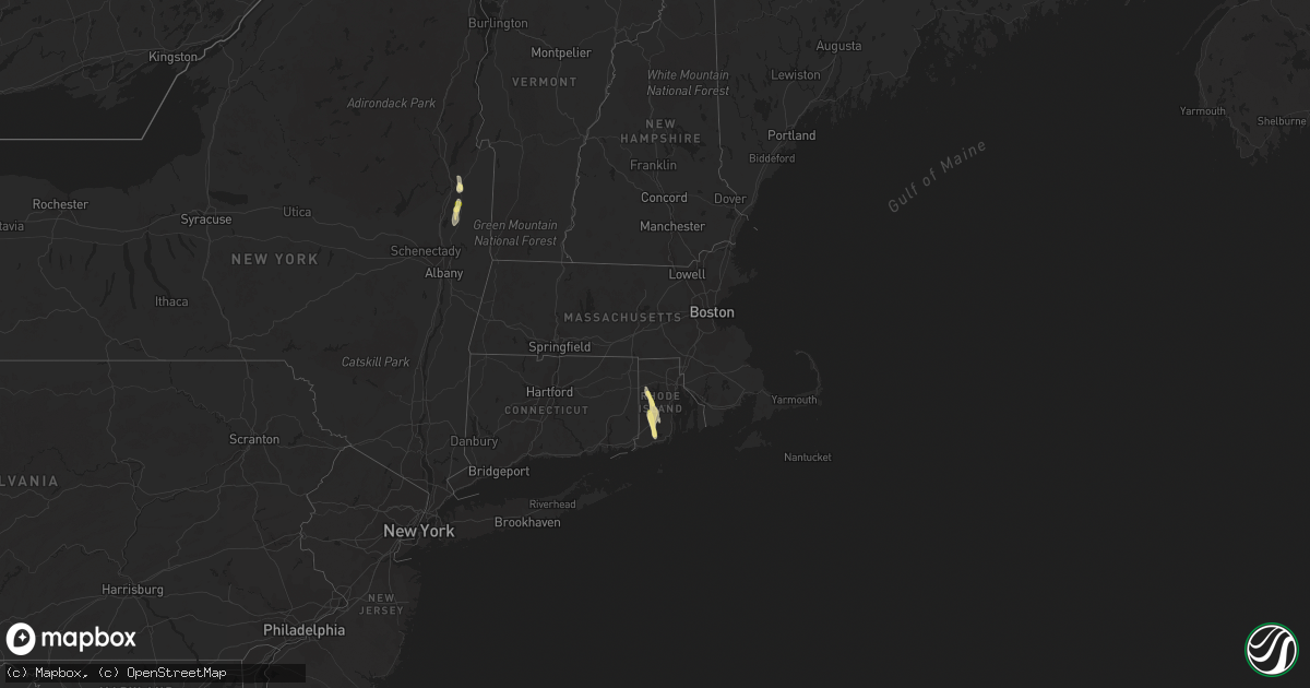
Hail Map in Rhode Island on July 24, 2015
Get this storm
July 24 map
$229
one time, instant access
Download today. No call, no setup
Keep the $229
Bought the map and want the full workflow? Apply the entire $229 to a subscription within 7 days. None of it is wasted.
Every map, not just this one
This buys you this map. Subscription and you get every map we run, in the markets you choose from a few cities to whole states to nationwide. Plus real-time alerts the moment a storm fires.
Contact data
Name, contact info, occupancy, even credit band for addresses in the footprint. You go from where it hit to who to call.
Become the source they trust
Unlimited branding weather history reports on demand. You already have the documented answer ready for the property owner, and you are the one who showed up with it.
Property data and RoofTrace estimates
Pull up any address you have got, its value and the exact code rules for that jurisdiction, straight from One Click Code. Then RoofTrace estimates the squares, pitch, and roof value, priced the way you price.
Storm reports in Rhode Island
Rhode Island
| Date | Description |
|---|---|
| 07/24/20155:40 PM CDT | Trees down with several roads closed across town. |
| 07/24/20155:30 PM CDT | Tree down on wires on carolina and nooseneck road. |
| 07/24/20155:30 PM CDT | A local report indicates 1.00 inch wind near RICHMOND |
| 07/24/20155:10 PM CDT | A local report indicates 1.00 inch wind near WEST GREENWICH |
All States Impacted by Hail Map on July 24, 2015
Cities Impacted by Hail Map on July 24, 2015
- Newell, SD
- Belle Fourche, SD
- Nisland, SD
- Bascom, FL
- Weeping Water, NE
- Louisville, NE
- Murdock, NE
- Custer, SD
- Kyle, SD
- Upton, WY
- Fairburn, SD
- Pine Ridge, SD
- Hermosa, SD
- Newcastle, WY
- Pocatello, ID
- Hoven, SD
- Gettysburg, SD
- Dupree, SD
- Kirwin, KS
- Maywood, NE
- Wellfleet, NE
- Wall, SD
- Saint Francis, KS
- Aladdin, WY
- Alva, WY
- Hulett, WY
- Bird City, KS
- Goodland, KS
- Keytesville, MO
- Portales, NM
- Olean, MO
- Eldon, MO
- Eugene, MO
- Stockton, KS
- Marshall, MO
- Norcatur, KS
- Drakesville, IA
- Ottumwa, IA
- Blakesburg, IA
- Bellevue, NE
- Plattsmouth, NE
- Princeton, MO
- Spickard, MO
- Boonville, MO
- Blackwater, MO
- Kearney, NE
- Grand River, IA
- Macon, MO
- Oconto, NE
- Basco, IL
- New Sharon, IA
- Bloomer, WI
- Chippewa Falls, WI
- Dixon, MO
- Saint Robert, MO
- Miami, MO
- California, MO
- Eagle Butte, SD
- Seymour, MO
- Marianna, FL
- Edgar, NE
- Emerson, IA
- Imogene, IA
- Edwards, MO
- Pleasantville, IA
- Everest, KS
- Hiawatha, KS
- Union Center, SD
- White Owl, SD
- Enning, SD
- Nebraska City, NE
- Mountain Home, AR
- Huntsville, MO
- Moberly, MO
- Salisbury, MO
- Clifton Hill, MO
- Callaway, NE
- Elk Creek, NE
- Table Rock, NE
- Pawnee City, NE
- Steinauer, NE
- Webb, AL
- Cowarts, AL
- McFall, MO
- Pattonsburg, MO
- Opp, AL
- Sheridan, MO
- Albany, MO
- Conception Junction, MO
- Ravenwood, MO
- New Hampton, MO
- Guilford, MO
- Hopkins, MO
- Stanberry, MO
- Darlington, MO
- Worth, MO
- Gentry, MO
- King City, MO
- Bethany, MO
- Parnell, MO
- Pickering, MO
- Bedford, IA
- Barnard, MO
- North Platte, NE
- Maxwell, NE
- Willacoochee, GA
- Parks, NE
- Benkelman, NE
- Elm Creek, NE
- Overton, NE
- Weskan, KS
- Sturgis, SD
- Salem, IA
- West Point, IA
- Mansfield, MO
- Lorimor, IA
- Wellsburg, IA
- Eldora, IA
- Iowa Falls, IA
- Ackley, IA
- Grundy Center, IA
- Steamboat Rock, IA
- Sharon Springs, KS
- Bethune, CO
- Texhoma, OK
- Keyes, OK
- Boise City, OK
- Cozad, NE
- Brady, NE
- Moorefield, NE
- Gothenburg, NE
- Burlington, CO
- Atwood, KS
- Clarinda, IA
- New Market, IA
- Braddyville, IA
- Shambaugh, IA
- Humboldt, NE
- Auburn, NE
- Keosauqua, IA
- Milton, IA
- Cantril, IA
- Mount Sterling, IA
- Birmingham, IA
- Douds, IA
- Roach, MO
- Camdenton, MO
- Macks Creek, MO
- Climax Springs, MO
- Knoxville, IA
- Robertsdale, AL
- Summerdale, AL
- Weston, WY
- Gillette, WY
- Rozet, WY
- Glade, KS
- Curtis, NE
- Atchison, KS
- Lancaster, KS
- Farnam, NE
- Moorcroft, WY
- Dickens, NE
- Phillipsburg, MO
- Forest City, MO
- Oregon, MO
- Penokee, KS
- Selden, KS
- Hoxie, KS
- Morland, KS
- Hill City, KS
- Shenandoah, IA
- Essex, IA
- Marshalltown, IA
- Gladbrook, IA
- Bloomfield, IA
- Moulton, IA
- Eldridge, MO
- Lebanon, MO
- Bern, KS
- Sabetha, KS
- Morrill, KS
- Fort Meade, SD
- Laurel, MS
- Vale, SD
- Woodston, KS
- Browning, MO
- Winigan, MO
- Sterling, NE
- Bunceton, MO
- Davenport, NE
- Ong, NE
- Oak, NE
- Shickley, NE
- Burr, NE
- Syracuse, NE
- Bennet, NE
- Unadilla, NE
- Palmyra, NE
- Coventry, RI
- Lantry, SD
- Swaledale, IA
- Rockwell, IA
- Sheffield, IA
- Fairfax, MO
- Craig, MO
- Higbee, MO
- Atlantic, IA
- Anita, IA
- Wymore, NE
- Oketo, KS
- Sutton, NE
- Idalia, CO
- Percival, IA
- Tunas, MO
- Geneva, IA
- Villisca, IA
- Loup City, NE
- Rapid City, SD
- Stover, MO
- Weatherby, MO
- Winston, MO
- Lincoln, NE
- Devils Tower, WY
- Mountain Grove, MO
- Norwood, MO
- Rapid River, MI
- Rock, MI
- Perkins, MI
- Leslie, AR
- Marshall, AR
- Gainesville, MO
- Norfork, AR
- Windyville, MO
- Buffalo, MO
- Long Lane, MO
- Marceline, MO
- Brookfield, MO
- Bucklin, MO
- Rothville, MO
- Gilliam, MO
- Glasgow, MO
- Slater, MO
- Gibbon, NE
- Oakland, IA
- Avoca, IA
- Hancock, IA
- Cincinnati, IA
- Gilman City, MO
- Red Oak, IA
- Bonifay, FL
- Leakesville, MS
- Hillsboro, IA
- Donnellson, IA
- Farmington, IA
- De Valls Bluff, AR
- Seward, NE
- Milford, NE
- Wasta, SD
- Peterman, AL
- Monroeville, AL
- Bradleyville, MO
- Savannah, MO
- Elmer, MO
- Ethel, MO
- Mineola, IA
- Glenwood, IA
- Silver City, IA
- Beatrice, NE
- Johnson, NE
- Lower Peach Tree, AL
- Pine Hill, AL
- Davis City, IA
- McClelland, IA
- Council Bluffs, IA
- Beaver Crossing, NE
- York, NE
- Exeter, NE
- Texline, TX
- Dalhart, TX
- Faith, SD
- Geneva, NE
- Fairmont, NE
- Cairo, NE
- Oneida, KS
- Salem, NE
- Heartwell, NE
- Minden, NE
- Hallam, NE
- Pacific Junction, IA
- Piedmont, SD
- Howes, SD
- Mud Butte, SD
- Nemo, SD
- Deadwood, SD
- Eddyville, NE
- Lexington, NE
- Kenesaw, NE
- Philip, SD
- Richton, MS
- Ovett, MS
- Philipp, MS
- Lead, SD
- Cook, NE
- Brock, NE
- Mason City, NE
- Litchfield, NE
- Fairfield, IA
- Brighton, IA
- Conrad, IA
- Beaman, IA
- Holland, IA
- Damascus, GA
- Leary, GA
- Spearfish, SD
- Saint Onge, SD
- Cummings, KS
- Effingham, KS
- Shelton, NE
- Doniphan, NE
- Wood River, NE
- Juniata, NE
- McDonald, KS
- Ravenna, NE
- Tecumseh, MO
- Sully, IA
- Lynnville, IA
- Kirksville, MO
- Worthington, MO
- Green City, MO
- New Boston, MO
- Unionville, MO
- Novinger, MO
- Green Castle, MO
- Livonia, MO
- Pilot Grove, MO
- Pachuta, MS
- Kensington, KS
- Manley, NE
- Springfield, NE
- Nelson, NE
- Superior, NE
- Saint Paul, NE
- Martell, NE
- Barneston, NE
- Liberty, NE
- Saint Libory, NE
- Grand Island, NE
- Muscotah, KS
- Milan, MO
- Martinsville, MO
- Kadoka, SD
- Malcom, IA
- Grinnell, IA
- Maysville, MO
- San Simon, AZ
- Horton, KS
- Atlanta, MO
- Lincoln, IA
- Reinbeck, IA
- Bradford, IA
- Garwin, IA
- Morrison, IA
- Parkersburg, IA
- Dumont, IA
- Aplington, IA
- Gordon, AL
- Pansey, AL
- Trenton, MO
- Chillicothe, MO
- Meadville, MO
- Laclede, MO
- Sumner, MO
- Wheeling, MO
- Kenmare, ND
- Tolley, ND
- Hartville, MO
- Edson, KS
- Foster, RI
- Hastings, NE
- Colby, KS
- Grenville, NM
- Jameson, MO
- Gallatin, MO
- Barronett, WI
- Hampton, IA
- Ansley, NE
- Arcadia, NE
- Sidney, IA
- Carson, IA
- Stratton, CO
- Nodaway, IA
- Central City, NE
- Dallas, WI
- New Auburn, WI
- Chetek, WI
- Ridgeland, WI
- Colfax, WI
- Milligan, NE
- Cordova, NE
- Dorchester, NE
- McCool Junction, NE
- Pleasant Dale, NE
- Waco, NE
- Friend, NE
- Calico Rock, AR
- Felt, OK
- Chapin, IA
- Mason City, IA
- Dougherty, IA
- Thornton, IA
- Ord, NE
- Ocilla, GA
- Walnut, IA
- Waynesboro, MS
- Philadelphia, MS
- Walton, NE
- Osceola, MO
- Saint Patrick, MO
- Smithton, MO
- Dannebrog, NE
- Jamesport, MO
- Ludell, KS
- Hudson Falls, NY
- Fort Edward, NY
- South Glens Falls, NY
- Queensbury, NY
- Leonard, MO
- Clarence, MO
- Nemaha, NE
- Arapahoe, CO
- Hope Valley, RI
- West Kingston, RI
- Greene, RI
- West Greenwich, RI
- Charlestown, RI
- Kenyon, RI
- Wyoming, RI
- Exeter, RI
- Carolina, RI
- Shannock, RI
- Russellville, MO
- Marquette, NE
- Niangua, MO
- Grovespring, MO
- Conway, MO
- Aurora, NE
- Climax, GA
- Wayland, MO
- Kahoka, MO
- Hill City, SD
- Irvington, AL
- Chula, MO
- Schuylerville, NY
- Saratoga Springs, NY
- Harvard, NE
- Saronville, NE
- Clay Center, NE
- Fairfield, NE
- Malone, FL
- Greenwood, FL
- Quinn, SD
- Clearmont, WY
- Preston, MS
- Fordland, MO
- Buffalo, WY
- Exline, IA
- Carthage, IL
- Rocheport, MO
- Harrisburg, MO
- Columbia, MO
- Cainsville, MO
- Lamoni, IA
- Clark, MO
- Carrollton, MO
- Ridgeview, SD
- Vanzant, MO
- Sundance, WY
- Loxley, AL
- Coin, IA
- Yorktown, IA
- Rea, MO
- Quitman, MS
- Giltner, NE
- Denton, NE
- Griswold, IA
- Cumberland, IA
- Hamburg, IA
- Rock Port, MO
- Carrollton, MS
- Farragut, IA
- Dows, IA
- Keystone, SD
- Blanchard, IA
- College Springs, IA
- Pittsburg, MO
- Hermitage, MO
- Zanoni, MO
- Brixey, MO
- Lewis, IA
- Elmo, MO
- Clearmont, MO
- Burlington Junction, MO
- Bolivar, MO
- Polk, MO
- Sullivan, NH
- Boelus, NE
- Northboro, IA
- Oldfield, MO
- Ava, MO
- Agra, KS
- Gaylord, KS
- Athol, KS
- Phillipsburg, KS
- Crete, NE
- Fayette, MO
- Chapman, NE
- Grafton, NE
- Inland, NE
- Cabool, MO
- Ellisville, MS
- Hurtsboro, AL
- Oxford, GA
- Covington, GA
- Roca, NE
- Eagle, NE
- Breckenridge, MO
- Altamont, MO
- Kidder, MO
- Hamilton, MO
- Leon, IA
- Jennings, KS
- Oberlin, KS
- Broken Bow, NE
- Belvidere, SD
- Rushville, MO
- Belmond, IA
- Alexander, IA
- Dothan, AL
- Clayville, RI
- Preston, MO
- Tuscumbia, MO
- Bonaparte, IA
- Malvern, IA
- Ponce De Leon, FL
- Ebro, FL
- Panama City Beach, FL
- Ashland, NE
- South Bend, NE
- Eustis, NE
- Norton, KS
- Alapaha, GA
- Westboro, MO
- Versailles, MO
- Randolph, IA
- Hickman, NE
- Vancleave, MS
- Lincoln, MO
- Blue Springs, NE
- Sturgeon, MO
- Cole Camp, MO
- Tuskegee, AL
- Union Springs, AL
- De Witt, NE
- Pickrell, NE
- Alden, IA
- New Cambria, MO
- Riverton, IA
- Biscoe, AR
- Malta Bend, MO
- Elliott, IA
- Sedalia, MO
- Clarks, NE
- Elfrida, AZ
- Coila, MS
- Pep, NM
- Firth, NE
- Adams, NE
- Dunbar, NE
- Clear Lake, IA
- Meservey, IA
- Latimer, IA
- Casey, IA
- Menlo, IA
- Stuart, IA
- Tipton, MO
- Clarksburg, MO
- Clarkridge, AR
- Brunswick, MO
- Arrow Rock, MO
- Mendon, MO
- Armstrong, MO
- Nelson, MO
- Dalton, MO
- Bradshaw, NE
- Hampton, NE
- Adair, IA
- Alda, NE
- Fairhope, AL
- Kellerton, IA
- Mount Ayr, IA
- Robinson, KS
- New Virginia, IA
- De Kalb, MS
- Wiota, IA
- Decatur, IA
- Silver Creek, NE
- Osceola, NE
- Half Way, MO
- Madison, MO
- Pontiac, MO
- Cottonwood, AL
- Campbellton, FL
- Sweet Water, AL
- Lacona, IA
- Melcher Dallas, IA
- De Kalb, MO
- Stromsburg, NE
- Carrabelle, FL
- Avoca, NE
- Nehawka, NE
- Wallace, KS
- Shubuta, MS
- Keokuk, IA
- Dawson, NE
- Phillips, NE
- Kanorado, KS
- Alvo, NE
- Elmwood, NE
- Douglas, NE
- Panama, NE
- Chunky, MS
- Kaycee, WY
- Kissee Mills, MO
- Libertyville, IA
- Dora, MO
- Jackpot, NV
- Greentop, MO
- Sumner, NE
- Whiting, KS
- Denton, KS
- Troy, KS
- Coulter, IA
- Tabor, IA
- Corning, IA
- Gretna, NE
- Malcolm, NE
- Loganville, GA
- Bruneau, ID
- Drury, MO
- Holstein, NE
- Trumbull, NE
- Hastings, IA
- White Cloud, KS
- Stillwater, NY
- Gansevoort, NY
- Greenwich, NY
- Centerville, IA
- Union, IA
- Denver, MO
- Revere, MO
- La Plata, MO
- Bevier, MO
- Callao, MO
- Peru, NE
- Indianola, IA
- Milo, IA
- Weston, MO
- Rose Hill, IA
- Delta, IA
- Osceola, IA
- Wyaconda, MO
- Mohall, ND
- Falcon, MO
- Dresden, KS
- Truro, IA
- Shelbyville, MO
- Union, NE


