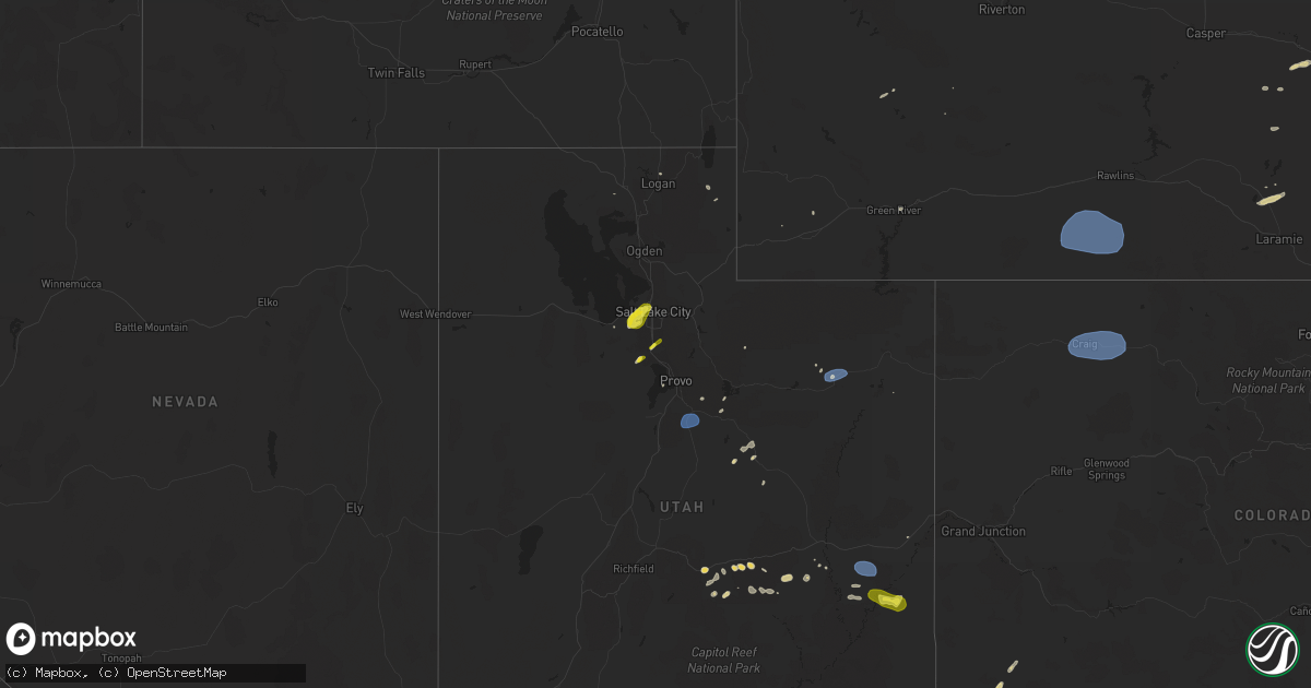
Hail Map on June 21, 2024
Get this storm
June 21 map
$229
one time, instant access
Download today. No call, no setup
Keep the $229
Bought the map and want the full workflow? Apply the entire $229 to a subscription within 7 days. None of it is wasted.
Every map, not just this one
This buys you this map. Subscription and you get every map we run, in the markets you choose from a few cities to whole states to nationwide. Plus real-time alerts the moment a storm fires.
Contact data
Name, contact info, occupancy, even credit band for addresses in the footprint. You go from where it hit to who to call.
Become the source they trust
Unlimited branding weather history reports on demand. You already have the documented answer ready for the property owner, and you are the one who showed up with it.
Property data and RoofTrace estimates
Pull up any address you have got, its value and the exact code rules for that jurisdiction, straight from One Click Code. Then RoofTrace estimates the squares, pitch, and roof value, priced the way you price.
States Impacted by Hail Map on June 21, 2024
Storm reports
Colorado
| Date | Description |
|---|---|
| 06/21/20246:01 PM CDT | Report from mping: half dollar |
| 06/21/20245:20 PM CDT | A local report indicates 60 MPH wind near 3 NE Pawnee Buttes |
| 06/21/20245:20 PM CDT | Hail was slightly smaller than a ping pong ball and took out their screens. |
| 06/21/20245:15 PM CDT | Largest stones fell at the beginning of the storm. Shredded a few window screens. Time estimated by radar. |
| 06/21/20244:41 PM CDT | A local report indicates 1.00 inch wind near Hereford |
| 06/21/20244:41 PM CDT | A local report indicates 60 MPH wind near Hereford |
| 06/20/20249:51 PM CDT | Large tree blown down blocking maple street. Police dept. Reports 1 car smashed by tree as per social media post. |
| 06/20/20247:30 PM CDT | 4 inch limbs and smaller branches downed. Vendor tents blown away and porta potties blown down during whittle the wood event as reported on social media. |
| 06/20/20247:19 PM CDT | Direction was west. |
New Mexico
| Date | Description |
|---|---|
| 06/21/20245:08 PM CDT | Heavy rain. |
| 06/21/20245:05 PM CDT | Large twenty year old live tree downed by outflow winds. Report forwarded by local media. |
| 06/21/20244:50 PM CDT | Single wide mobile home pushed off its blocks. Photos show minor damage. Time estimated. |
| 06/21/20244:42 PM CDT | A local report indicates 1.75 inch wind near 4 WSW Bloomfield |
| 06/21/20244:42 PM CDT | Tstm wind gusts estimated between 70 to 80mph. |
| 06/21/20244:41 PM CDT | Updates previous tstm wnd dmg report from 1 sw flora vista. Power lines down and at least 2 poles broken on the road off old aztec highway |
| 06/21/20244:41 PM CDT | Power lines down on the road off old aztec highway |
| 06/21/20244:36 PM CDT | Delayed report. |
| 06/21/20244:35 PM CDT | Delayed report. Aluminum outbuilding destroyed and tossed onto mobile home. |
| 06/21/20244:30 PM CDT | Tstm wind gusts estimated to 50 mph. |
South Dakota
| Date | Description |
|---|---|
| 06/21/20245:27 PM CDT | Strong |
| 06/21/20245:27 PM CDT | Strong wind gusts for about 5 minutes ahead of the storm estimated at 60 to 70 mph. Blew sticks and branches all over the yard. |
Connecticut
| Date | Description |
|---|---|
| 06/21/20246:02 PM CDT | Spotter reports tree down... Six inches in diameter... On al harvey rd near the intersection of rt 201. Time estimated from radar. |
| 06/21/20244:12 PM CDT | Trees down. |
| 06/21/20243:54 PM CDT | Trees down on birge park rd rte 4. Possible tornado. |
| 06/21/20243:32 PM CDT | Tree down near south road and phelps road. Utility pole and wires down at intersection of phelps road and route 5. Relayed by amateur radio. |
| 06/21/20243:22 PM CDT | Police report trees and wires down on south highland street and tree and wires down on quaker lane. Relayed by amateur radio. |
| 06/21/20243:22 PM CDT | Tree down on overlook road and on beverly road. Relayed by amateur radio. |
| 06/21/20243:20 PM CDT | Trees down. |
| 06/20/20248:43 PM CDT | 3-inch tree limbs br |
| 06/20/20248:43 PM CDT | 3-inch tree limbs broken; power poles broken. |
Arizona
| Date | Description |
|---|---|
| 06/21/20245:00 PM CDT | Tree damage near the intersection of 6th st and n arizona ave. Time estimated by radar. |
| 06/21/20244:42 PM CDT | Asos station ktus tucson international airport. |
| 06/21/20244:37 PM CDT | Corrects previous non-tstm wnd gst report from 6 sw tucson. Asos station ktus tucson international airport. |
| 06/21/20244:37 PM CDT | Corrects previous non-tstm wnd gst report from 6 |
Montana
| Date | Description |
|---|---|
| 06/21/20246:51 PM CDT | 70 mph wind gust. Location is estimated. |
| 06/21/20246:02 PM CDT | 2.50 inch hail size estimated from a photo and damage to a vehicle windshield. Time estimated from radar. |
| 06/21/20245:20 PM CDT | Golf balls reported on the s curve east of brady on brady road |
| 06/21/20245:00 PM CDT | Public reported golf ball sized hail. It was hailing long and hard enough with low enough visibility that all the cars along i-15 had to pull over. |
| 06/21/20243:36 PM CDT | Estimated hail up to 1 inch in diameter. Time of event is estimated via radar. |
| 06/21/20243:03 PM CDT | Hail up to half dollar size falling at showdown ski area. |
| 06/21/20242:47 PM CDT | Trained spotter reported 1 to 2 inch sized hail with torrential rainfall. The hail was completely covering the ground and making it white. |
| 06/20/20247:25 PM CDT | Time and location estimated. Hailstones between 1 and 1.5 inches. |
Michigan
| Date | Description |
|---|---|
| 06/21/20245:36 PM CDT | Four large tree limbs down around 8 inches in diameter |
Illinois
| Date | Description |
|---|---|
| 06/21/20241:00 AM CDT | Awos station kfep freeport arpt. Nws lot was dialed into the site at the time of the report. |
Iowa
| Date | Description |
|---|---|
| 06/21/20245:47 PM CDT | In addition to a few dime sized hail stones... 1.35 inch of rain occurred in 22 minutes as the storm pushed through. |
| 06/21/20245:16 PM CDT | Asos station kspw spencer municipal airport. |
| 06/21/20244:50 PM CDT | Report from mping: quarter |
| 06/20/202411:13 PM CDT | Spotter reported gusts in spencer of 60+ mph. |
| 06/20/202411:02 PM CDT | Report from mping: 1-inch tree limbs broken; shingles blown off. Time estimated via radar. |
| 06/20/20249:22 PM CDT | Storm damage on east side of sheldon. Campers tossed and damaged... Building and tree damage reported... Including to fireworks stand. Time estimated via radar. |
| 06/20/20249:15 PM CDT | Power outages and trees down in sibley. Time estimated via radar. |
New York
| Date | Description |
|---|---|
| 06/21/20246:23 PM CDT | Tree down blocking 1 of 3 lanes on i-684 southbound... North of exit 8. |
| 06/21/20245:29 PM CDT | Large uprooted tree. |
| 06/21/20245:26 PM CDT | Wires down over roadway. |
| 06/21/20245:26 PM CDT | Tree and wires down on roadway. |
| 06/21/20245:25 PM CDT | Tree down on ny 129 west of batten rd... All of 2 lanes closed. |
| 06/21/20245:13 PM CDT | Trees reported down across the roadway. |
| 06/21/20244:28 PM CDT | Corrects previous tstm wnd dmg report from 1 wnw otego. Trees and wires down over wayman drive in otego ny. |
| 06/21/20244:28 PM CDT | Trees and wires down over road. |
| 06/21/20244:28 PM CDT | Trees down blocking road. |
| 06/21/20244:15 PM CDT | Tress down on wires near the intersection of cross road and state route 14. |
| 06/21/20244:08 PM CDT | Time estimated based on radar. Multiple instances of wires down near county route 20a between elm tree road and the bristol valley mobil park. |
| 06/21/20244:08 PM CDT | Time estimated based on radar. Tree downed onto property which caused a meter to be ripped from a home. |
| 06/21/20244:03 PM CDT | Trees and wires down. |
| 06/21/20244:01 PM CDT | Latta brook road from sandys lane to burns road in horseheads ny closed & impassable due to tree down in roadway. |
| 06/21/20244:01 PM CDT | Tree limbs broken; shingles blown off. |
| 06/21/20243:57 PM CDT | Wires down across road. |
| 06/21/20243:25 PM CDT | Trees and wires down over road. |
| 06/21/20243:02 PM CDT | Tree down across hoxie road near millbrook. |
| 06/21/20242:22 PM CDT | Tree on wires on harwich street in kingston. |
| 06/21/20242:15 PM CDT | A couple of wires were reported down in the vicinity of north troy and brunswick. |
| 06/21/20242:10 PM CDT | Photos relayed of downed trees. Timed estimated by radar. |
| 06/21/20241:50 PM CDT | Wires down along stockton court in clifton park. |
| 06/21/20241:49 PM CDT | Medium to large branch down near the corner of chillmark turn and tisdale lane in clifton park. |
| 06/21/20241:45 PM CDT | Wires down along mac elroy road near jonesville. |
| 06/21/20241:42 PM CDT | Wires down on round lake road near ballston lake. |
| 06/21/20241:37 PM CDT | Tree down on house |
| 06/21/20241:33 PM CDT | Time estimated based on radar. Tree leaning on wires. |
| 06/21/20241:10 PM CDT | Time estimated based on radar. Tree down on a power line which was smoking. |
| 06/21/202412:44 PM CDT | Trees down on route 9w in the town of esopus. |
| 06/21/202412:44 PM CDT | Trees down on route 9w in the town of esopus. |
| 06/21/202412:40 PM CDT | Tree down blocking union center road in ulster park. |
| 06/21/202412:40 PM CDT | Tree and wires down on carney road near ulster park. |
| 06/21/202411:45 AM CDT | Trees down near cr-8 and cr-10 in town of butternuts. Time estimated by radar. |
Utah
| Date | Description |
|---|---|
| 06/21/20246:57 PM CDT | A local report indicates 1.00 inch wind near 3 SE Moab |
| 06/21/20246:52 PM CDT | Brief heavy rain. |
| 06/21/20246:27 PM CDT | Northwest wind direction. |
| 06/21/20245:12 PM CDT | Asos station kvel vernal rgnl airport. |
| 06/21/20244:35 PM CDT | Awos station k74v roosevelt airport. |
| 06/21/20243:50 PM CDT | Mesonet station uttp6 us-89 at pole creek bs. |
| 06/21/20242:50 PM CDT | Golf ball size hail reported at amangiri resort. |
| 06/21/20242:38 PM CDT | A local report indicates 1.00 inch wind near 2 W Draper |
| 06/21/20242:15 PM CDT | Social media photographs of hailstones ranging from approximately quarter to half dollar size in diameter. |
| 06/21/20242:00 PM CDT | Follow-up public social media picture showing a hailstone near half dollar size in diameter. |
| 06/21/20242:00 PM CDT | Photo of quarter sized hail forwarded by broadcast media. |
| 06/21/202410:50 AM CDT | A local report indicates 1.00 inch wind near 4 SW La Sal |
Wisconsin
| Date | Description |
|---|---|
| 06/21/20244:08 PM CDT | Report of multiple 2 to 3 inch branches down in downtown waterloo on madison st. |
| 06/21/20243:47 PM CDT | A few reports of trees down. |
Wyoming
| Date | Description |
|---|---|
| 06/21/20246:43 PM CDT | Mesonet station coww4 21 nne baggs - cow creek raws - cow. |
| 06/21/20243:44 PM CDT | Fire department responding to vehicle crash. |
| 06/20/20249:30 PM CDT | A local report indicates 60 MPH wind near 6 N North Cheyenne |
| 06/20/20248:11 PM CDT | A local report indicates 67 MPH wind near 5 NNW Dwtn Gillette |
Pennsylvania
| Date | Description |
|---|---|
| 06/21/20246:54 PM CDT | Trees and wires down over shoemaker avenue. |
| 06/21/20246:52 PM CDT | Trees |
| 06/21/20246:52 PM CDT | Trees and wires down on roadway. |
| 06/21/20246:20 PM CDT | Tree limbs broken; shingles blown off. |
Nebraska
| Date | Description |
|---|---|
| 06/21/20244:06 PM CDT | A local report indicates 59 MPH wind near 4 E North Platte |
| 06/21/20243:56 AM CDT | Pea size hail also. |
| 06/21/20243:07 AM CDT | Lee bird field north platte. Several hanger doors bent. One removed. 2 dumpsters moved about 40 feet. |
| 06/21/20243:07 AM CDT | Klbf asos. |
| 06/21/20243:00 AM CDT | Roof collapsed at tj maxx north platte mall. |
| 06/20/20249:45 PM CDT | A local report indicates 58 MPH wind near 4 NE Clarks |
| 06/20/20248:38 PM CDT | Tree blown over laying across hwy 183. |
Massachusetts
| Date | Description |
|---|---|
| 06/21/20244:25 PM CDT | Police report tree down on road... Blocking traffic along pine street. Trained spotter reports tree down along suffield street. Relayed by amateur radio. |
| 06/21/20243:25 PM CDT | A local report indicates 1.00 inch wind near Northfield |
| 06/21/20243:19 PM CDT | Police report tree down along the 60 block of hinsdale road. Relayed by amateur radio. |
| 06/21/20242:59 PM CDT | Trees and wires down along east street in lee. |
| 06/21/20242:54 PM CDT | Trees down on lee road near stockbridge. |
| 06/21/20242:53 PM CDT | Tree down blocking church street in stockbridge. |
| 06/21/20242:49 PM CDT | Tree down blocking great barrington road. |
Cities Impacted by Hail Map on June 21, 2024
- Rudyard, MT
- Egnar, CO
- Williamsfield, OH
- Orwell, OH
- Kinsman, OH
- Farmdale, OH
- Hobson, MT
- Geddes, SD
- Platte, SD
- Rosendale, NY
- Lake Andes, SD
- Armour, SD
- Stanford, MT
- Cedar Valley, UT
- Highland, NY
- Ulster Park, NY
- New Paltz, NY
- Eagle Mountain, UT
- Bosler, WY
- Magna, UT
- Kanab, UT
- Green River, WY
- Draper, UT
- Riverton, UT
- Glenrock, WY
- West Valley City, UT
- Salt Lake City, UT
- Sandy, UT
- Marble Canyon, AZ
- Douglas, WY
- Meeteetse, WY
- Moore, MT
- Cheyenne, WY
- West Greenwich, RI
- Houston, MN
- White Sulphur Springs, MT
- Neihart, MT
- Moosup, CT
- Shawnee, WY
- Thermopolis, WY
- Buffalo, WY
- Northfield, MA
- Vernon, VT
- Lewistown, MT
- Helper, UT
- Price, UT
- Sterling, CT
- Windsor, WI
- Deforest, WI
- Waunakee, WI
- Chambers, AZ
- Alamosa, CO
- Wingdale, NY
- Pawling, NY
- Dover Plains, NY
- Page, AZ
- Monument Valley, UT
- Tohatchi, NM
- Plainfield, CT
- Shiprock, NM
- Mosca, CO
- Sun Prairie, WI
- Madison, WI
- Readstown, WI
- Viroqua, WI
- Chugwater, WY
- Salina, UT
- Lake Powell, UT
- Ganado, AZ
- Stapleton, NE
- Winchester, NH
- Hinsdale, NH
- Farmington, NM
- Sanborn, IA
- Marshall, WI
- Waterloo, WI
- Lander, WY
- Bainbridge, NY
- Mount Upton, NY
- Hartley, IA
- Melvin, IA
- Duchesne, UT
- Sahuarita, AZ
- Lake Mills, WI
- Bluebell, UT
- Altamont, UT
- Wells Bridge, NY
- Unadilla, NY
- Roosevelt, UT
- Huntington, UT
- Bloomfield, NM
- Grover, CO
- Hereford, CO
- Everly, IA
- Mexican Hat, UT
- Tucson, AZ
- Brady, MT
- Conrad, MT
- Gallup, NM
- Ferron, UT
- Towaoc, CO
- Nunn, CO
- Grants, NM
- Riverton, WY
- Cortez, CO
- Otego, NY
- Watertown, WI
- Johnson Creek, WI
- Choteau, MT
- Big Sandy, MT
- Dutton, MT
- Ashford, CT
- Stafford Springs, CT
- North Platte, NE
- Spanish Fork, UT
- Fairview, UT
- Santaquin, UT
- Aztec, NM
- Flora Vista, NM
- Jay Em, WY
- Green River, UT
- Lewis, CO
- Carpenter, WY
- Box Elder, MT
- Spencer, IA
- Milford, IA
- Myton, UT
- Blanding, UT
- Pleasant View, CO
- Dolores, CO
- Cahone, CO
- Torrington, WY
- Vernal, UT
- Dickens, IA
- Ruthven, IA
- Eastford, CT
- Harwinton, CT
- Burlington, CT
- Carter, MT
- Salem, SD
- Canova, SD
- Floweree, MT
- New Raymer, CO
- Monticello, UT
- Winfred, SD
- Terril, IA
- Power, MT
- Norwood, CO
- Lloyd, MT
- Hooper, CO
- Emmetsburg, IA
- Madison, SD
- Montrose, SD
- Fairfield, MT
- Gregory, SD
- Dove Creek, CO
- Colton, SD
- Fort Benton, MT
- Hyde Park, UT
- Thompson, UT
- Moab, UT
- Great Falls, MT
- Highwood, MT
- Mitchell, SD
- Mount Vernon, SD
- Cubero, NM
- Letcher, SD
- Logan, UT
- Dell Rapids, SD
- Garrett, WY
- Utica, SD
- Harrison, SD
- Corsica, SD
- Belt, MT
- Browning, MT
- Pueblo Of Acoma, NM
- Pipestone, MN
- New Holland, SD
- Garretson, SD
- Plankinton, SD
- Geyser, MT
- Geraldine, MT
- Cozad, NE
- Hays, MT
- Wellfleet, NE
- Hayes Center, NE
- Wallace, NE
- Dickens, NE
- Volin, SD
- Alexandria, SD
- Lexington, NE
- Encampment, WY
- Rawlins, WY
- Saratoga, WY
- Gillette, WY
- Denton, MT
- Hilger, MT
- Raynesford, MT
- Palmer, NE
- Sumner, NE
- Miller, NE
- Sheridan, WY
- Dallas, PA
- Craig, CO
- Hayden, CO
- Hamilton, CO
- Steamboat Springs, CO
- Emery, SD
- Central City, NE
- Fullerton, NE
- New Haven, MI
- Columbus, MI
- Goodells, MI
- Buffalo, MT
- Amherst, NE
- Harris, IA
- Lake Park, IA
- Clarks, NE
- Osceola, NE
- Silver Creek, NE
- Spirit Lake, IA
- Payson, AZ
- Garryowen, MT
- Moccasin, MT
- Lodge Grass, MT
- Judith Gap, MT
- Tooele, UT
- Bridgeport, NE
- Bayard, NE
- Winnett, MT
- Ryegate, MT
- Lavina, MT
- Musselshell, MT
- Roundup, MT
- Ingomar, MT
- Broadwater, NE
- Sand Springs, MT
- Lisco, NE
- West Jordan, UT
- Forsyth, MT
- Oshkosh, NE
- Cohagen, MT
- Sedgwick, CO
- Chappell, NE
- Lewellen, NE
- Rosebud, MT
- Hathaway, MT
- Volborg, MT
- Maxwell, NE
- Brady, NE
- Gothenburg, NE
- Callaway, NE
- Ekalaka, MT
- Buffalo, SD