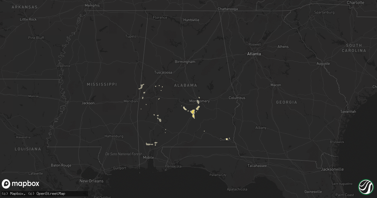
Hail Map in Alabama on July 21, 2017
Get this storm
July 21 map
$229
one time, instant access
Download today. No call, no setup
Keep the $229
Bought the map and want the full workflow? Apply the entire $229 to a subscription within 7 days. None of it is wasted.
Every map, not just this one
This buys you this map. Subscription and you get every map we run, in the markets you choose from a few cities to whole states to nationwide. Plus real-time alerts the moment a storm fires.
Contact data
Name, contact info, occupancy, even credit band for addresses in the footprint. You go from where it hit to who to call.
Become the source they trust
Unlimited branding weather history reports on demand. You already have the documented answer ready for the property owner, and you are the one who showed up with it.
Property data and RoofTrace estimates
Pull up any address you have got, its value and the exact code rules for that jurisdiction, straight from One Click Code. Then RoofTrace estimates the squares, pitch, and roof value, priced the way you price.
Storm reports in Alabama
Alabama
| Date | Description |
|---|---|
| 07/21/20176:43 PM CDT | Several trees down in and around coosada. Winds estimated at 40 mph. |
| 07/21/20175:25 PM CDT | Business sign blown down... Onto powerlines. Winds estimated at 40mph. |
| 07/21/20175:21 PM CDT | Tree down along hwy 80. Winds est at 50mph. |
| 07/21/20175:19 PM CDT | Tree fell through a tractor trailer along highway 80... Near mile marker 6. |
| 07/21/20174:46 PM CDT | Trees down on hwy 17... 3 miles south of cr 12. Additional trees down on cr 12. Winds estimated at 45mph. *corrected for source. |
| 07/21/20173:56 PM CDT | Several trees reported down in kinsey and webb. |
All States Impacted by Hail Map on July 21, 2017
Cities Impacted by Hail Map on July 21, 2017
- Faulkton, SD
- Roscoe, SD
- Charles City, IA
- Ionia, IA
- Nashua, IA
- Bena, MN
- Cass Lake, MN
- Stuart, NE
- Duluth, MN
- Saginaw, MN
- Deering, ND
- Maxbass, ND
- Devils Lake, ND
- Esmond, ND
- Knox, ND
- Penn, ND
- York, ND
- Glenburn, ND
- Newburg, ND
- Minnewaukan, ND
- Churchs Ferry, ND
- Oberon, ND
- Leeds, ND
- Towner, ND
- Granville, ND
- Upham, ND
- Bantry, ND
- Rugby, ND
- Nome, ND
- Alcester, SD
- Hawarden, IA
- Mohall, ND
- Baileyville, IL
- Freeport, IL
- Forreston, IL
- Iowa City, IA
- Riverside, IA
- Grygla, MN
- Middle River, MN
- Gatzke, MN
- Mandan, ND
- Bagley, MN
- Palisade, MN
- Aitkin, MN
- Pearl City, IL
- Lena, IL
- Wadena, MN
- Deer Creek, MN
- Bluffton, MN
- Letohatchee, AL
- Fort Deposit, AL
- Eureka, SD
- Hosmer, SD
- Elm Creek, NE
- Dothan, AL
- Sabin, MN
- Moorhead, MN
- Barnesville, MN
- Horace, ND
- Oxford, IA
- Parnell, IA
- Kalona, IA
- Wellman, IA
- Williamsburg, IA
- Tallahassee, FL
- New York Mills, MN
- Marion, ND
- Decatur, IN
- Willshire, OH
- Monroe, IN
- Rockford, OH
- Wells, MN
- Alden, MN
- Freeborn, MN
- Albert Lea, MN
- Hartland, MN
- Ericson, NE
- Ord, NE
- Bartlett, NE
- Burwell, NE
- Maddock, ND
- Bottineau, ND
- Brazil, IN
- Selfridge, ND
- Shields, ND
- Carson, ND
- Kintyre, ND
- Stanton, ND
- Washburn, ND
- Center, ND
- Pleasureville, KY
- Eminence, KY
- Vermillion, SD
- Rochester, IN
- Stockholm, ME
- Rock City, IL
- Pecatonica, IL
- Davis, IL
- Jessie, ND
- Cooperstown, ND
- Binford, ND
- New Richland, MN
- Wakefield, NE
- Hillsdale, IN
- Clinton, IN
- Groveland, FL
- Gladbrook, IA
- Reinbeck, IA
- Lincoln, IA
- Traer, IA
- Cascade, IA
- Milan, IL
- Trilla, IL
- Louisville, IL
- Johnsonville, IL
- Red Lake Falls, MN
- Hackensack, MN
- Elba, AL
- Luana, IA
- Postville, IA
- Elgin, IA
- Clermont, IA
- Rockton, IL
- Durand, IL
- Winnebago, IL
- Rockford, IL
- Panama City, FL
- Ebro, FL
- Vernon, FL
- Gackle, ND
- Fredonia, ND
- Napoleon, ND
- Wishek, ND
- Fort Atkinson, IA
- Calmar, IA
- Somonauk, IL
- Leland, IL
- Sandwich, IL
- Monticello, IA
- Onslow, IA
- Thomasville, AL
- Clinton, IA
- Sabula, IA
- Arapahoe, NE
- Holbrook, NE
- Longville, MN
- Remer, MN
- Federal Dam, MN
- Selma, AL
- Peosta, IA
- Bismarck, ND
- Sheldon, ND
- Enderlin, ND
- Templeton, IN
- Otterbein, IN
- Fosston, MN
- Westhope, ND
- Walker, MN
- Erhard, MN
- Pelican Rapids, MN
- Wolsey, SD
- Sherwood, ND
- Mercer, ND
- Peyton, CO
- Colorado Springs, CO
- Verona, ND
- Lafayette, IN
- Drake, ND
- Anamoose, ND
- Martin, ND
- Eagle Lake, ME
- Bowdon, ND
- Sykeston, ND
- Jud, ND
- Lehr, ND
- Carrington, ND
- Fessenden, ND
- Cathay, ND
- Grace City, ND
- Mchenry, ND
- Hannaford, ND
- Hurdsfield, ND
- Harvey, ND
- Sutton, ND
- Glenfield, ND
- New Rockford, ND
- Forbes, ND
- Jackson, NE
- North Sioux City, SD
- South Sioux City, NE
- Sioux City, IA
- Alexandria, KY
- Streamwood, IL
- Elgin, IL
- Douglas, ND
- Ryder, ND
- Max, ND
- Manteno, IL
- Grant Park, IL
- Linton, ND
- Strasburg, ND
- Hague, ND
- Hazelton, ND
- Morocco, IN
- Momence, IL
- Lake Village, IN
- Pembroke Township, IL
- Lawler, IA
- New Hampton, IA
- Elizabeth, IL
- Rock Falls, IL
- Sterling, IL
- Dixon, IL
- Naytahwaush, MN
- Ogema, MN
- Waubun, MN
- Mahnomen, MN
- Lamont, IA
- Arlington, IA
- Wewahitchka, FL
- Blountstown, FL
- Buckingham, IL
- Wamsutter, WY
- Parker, SD
- Marion, SD
- Primrose, NE
- Spalding, NE
- Albion, NE
- Crystal Lake, IL
- Barrington, IL
- Cary, IL
- Tabiona, UT
- Strathcona, MN
- Langdon, ND
- Canton, SD
- Fairview, SD
- Akron, AL
- Erskine, MN
- Rochert, MN
- Detroit Lakes, MN
- Yuma, CO
- Sherrill, IA
- Dubuque, IA
- Mcgregor, MN
- Fort Pierre, SD
- Spencer, SD
- Serena, IL
- Millington, IL
- Newark, IL
- Seneca, IL
- Sheridan, IL
- Beaverville, IL
- Alexandria, SD
- Greeley, NE
- Elyria, NE
- Glyndon, MN
- Willow City, ND
- Tulare, SD
- Cresbard, SD
- Rockham, SD
- Saint Anne, IL
- Chebanse, IL
- Kankakee, IL
- Swisher, IA
- Solon, IA
- North Liberty, IA
- Mcintosh, MN
- Attapulgus, GA
- Lebanon, SD
- Onida, SD
- Bogalusa, LA
- Babson Park, FL
- Frostproof, FL
- Aneta, ND
- Kathryn, ND
- Litchville, ND
- Ypsilanti, ND
- Montpelier, ND
- Cassville, WI
- Baldwin, ND
- Wilton, ND
- Yoder, CO
- Medinah, IL
- Itasca, IL
- Hanover Park, IL
- Wood Dale, IL
- Schaumburg, IL
- Roselle, IL
- Akron, CO
- Backus, MN
- Ree Heights, SD
- Liberty, MS
- Greensburg, LA
- Dade City, FL
- Zephyrhills, FL
- Kathleen, FL
- Lakeland, FL
- Brandon, MN
- Evansville, MN
- Elbow Lake, MN
- Ashby, MN
- Sumner, IA
- Smithfield, NE
- Bertrand, NE
- Lone Tree, IA
- Flaxton, ND
- Beecher, IL
- Cedar Lake, IN
- Benedict, ND
- Ruso, ND
- Garrison, ND
- Pekin, ND
- Mcville, ND
- Honoraville, AL
- Greenville, AL
- West Liberty, IA
- Letts, IA
- Nichols, IA
- Hills, IA
- Muscatine, IA
- Emily, MN
- Morrison, IL
- Fulton, IL
- Greensboro, AL
- Highmore, SD
- Hopkinton, IA
- Ponemah, MN
- De Witt, IA
- Westpoint, IN
- New Richmond, IN
- Greenfield, OH
- Lakota, ND
- Tolna, ND
- Latonia, KY
- Ft Mitchell, KY
- Independence, KY
- Keystone, IA
- Van Horne, IA
- Limestone, ME
- Walton, KY
- Clifton, IL
- Emington, IL
- Dwight, IL
- Campus, IL
- Herscher, IL
- Cabery, IL
- Reddick, IL
- Union Hill, IL
- Camanche, IA
- Donalsonville, GA
- Breckenridge, MN
- Springfield, OH
- Northome, MN
- Blackduck, MN
- Squaw Lake, MN
- Max, MN
- Kelliher, MN
- Hankinson, ND
- Canyon, MN
- Turtle Lake, ND
- Fenton, IL
- Morton, MS
- Lowell, IN
- Superior, AZ
- Thonotosassa, FL
- Mount Carroll, IL
- Holy Cross, IA
- Shullsburg, WI
- Potosi, WI
- Polo, IL
- Benton, WI
- Leaf River, IL
- New Vienna, IA
- Lanark, IL
- Savanna, IL
- East Dubuque, IL
- Loves Park, IL
- McConnell, IL
- Guttenberg, IA
- Machesney Park, IL
- Colesburg, IA
- Winslow, IL
- Shannon, IL
- Warren, IL
- Apple River, IL
- Durango, IA
- Belmont, WI
- Bellevue, IA
- Glen Haven, WI
- Cuba City, WI
- Brodhead, WI
- Juda, WI
- Cedarville, IL
- Platteville, WI
- Hanover, IL
- Garber, IA
- Galena, IL
- Kent, IL
- Mount Morris, IL
- Garnavillo, IA
- Chadwick, IL
- Earlville, IA
- Lancaster, WI
- Dakota, IL
- Ridott, IL
- Greeley, IA
- Orangeville, IL
- Stockton, IL
- Scales Mound, IL
- Hazel Green, WI
- German Valley, IL
- Kieler, WI
- Dyersville, IA
- North Buena Vista, IA
- Atkinson, NE
- Wapakoneta, OH
- Saint Marys, OH
- Hampshire, IL
- Gilberts, IL
- Cresco, IA
- Montgomery, AL
- Hope Hull, AL
- West Palm Beach, FL
- Covington, IN
- Wadena, IA
- Edgewood, IA
- Strawberry Point, IA
- Volga, IA
- Illinois City, IL
- Taylor Ridge, IL
- Reynolds, IL
- Woodstock, IL
- Mchenry, IL
- Harvard, NE
- Epworth, IA
- McLaughlin, SD
- West Terre Haute, IN
- Redfield, SD
- Bruce, SD
- Moffit, ND
- Braddock, ND
- Hudson, IA
- Wakpala, SD
- Gonvick, MN
- Bridgewater, SD
- Lowgap, NC
- Winger, MN
- Spillville, IA
- Waucoma, IA
- Protivin, IA
- Hazel, SD
- Quitman, MS
- Gettysburg, SD
- Lancaster, OH
- Marble Rock, IA
- Rockford, IA
- Bloomingdale, IL
- Schiller Park, IL
- Melrose Park, IL
- Bensenville, IL
- Dundee, IL
- Franklin Park, IL
- Addison, IL
- South Elgin, IL
- Garden Prairie, IL
- Chicago, IL
- Elmhurst, IL
- Huntley, IL
- Elk Grove Village, IL
- Marengo, IL
- Hoffman Estates, IL
- Belvidere, IL
- River Grove, IL
- Genoa, IL
- Elmwood Park, IL
- Bartlett, IL
- Franklin, LA
- Iowa Falls, IA
- Hosford, FL
- Rothsay, MN
- Elwood, NE
- Menoken, ND
- Lucedale, MS
- Malcom, IA
- Grinnell, IA
- Conde, SD
- Audubon, MN
- Lake Park, MN
- Warwick, ND
- Saint Michael, ND
- Fair Oaks, IN
- Donovan, IL
- Forbes, MN
- Boynton Beach, FL
- Delray Beach, FL
- Barney, ND
- Antler, ND
- Herreid, SD
- Culbertson, NE
- Ramah, CO
- Webb, AL
- Ashford, AL
- Janesville, WI
- Beloit, WI
- Fayette, IA
- Maynard, IA
- Princeton, IL
- Walnut, IL
- Wyanet, IL
- Ada, MN
- Salem, SD
- Webster, ND
- Collins, IA
- Peru, IN
- Peridot, AZ
- Meadowlands, MN
- Cotton, MN
- Mulberry, IN
- Canova, SD
- Fountain, FL
- Youngstown, FL
- Clifford, ND
- Albion, IA
- Estelline, SD
- Courtenay, ND
- Quitman, GA
- Morven, GA
- Mentor, MN
- Frankfort, IN
- Clarks Hill, IN
- Dayton, IN
- Nora, IL
- Fingal, ND
- Aplington, IA
- Wellsburg, IA
- Ackley, IA
- Plainfield, IA
- Westgate, IA
- Tripoli, IA
- Battle Lake, MN
- Richville, MN
- Ottertail, MN
- Souris, ND
- Toledo, IA
- Woodville, MS
- Dazey, ND
- Rogers, ND
- Dent, MN
- Fulton, SD
- Humboldt, SD
- Lennox, SD
- Worthing, SD
- Montrose, SD
- Fedora, SD
- Artesian, SD
- Beresford, SD
- Hudson, SD
- Mitchell, SD
- Canistota, SD
- Chancellor, SD
- Letcher, SD
- Monroe, SD
- Palisade, NE
- Ellendale, ND
- Edgeley, ND
- Wimbledon, ND
- Kramer, ND
- Elkader, IA
- Holland, MN
- Idalia, CO
- Funk, NE
- Spencerville, OH
- Mendon, OH
- Hamilton, ND
- Washington Court House, OH
- Newport, NE
- Fergus Falls, MN
- Elizabeth, MN
- Stanley, IA
- Aurora, IA
- Flandreau, SD
- Frazee, MN
- Ward, AL
- Jachin, AL
- Tampico, IL
- Elbert, CO
- Earl Park, IN
- Fowler, IN
- Tolstoy, SD
- Bowdle, SD
- Somerset, OH
- Laurel, IA
- Saint Helena, NE
- Claire City, SD
- Covington, OH
- Puposky, MN
- Palatine, IL
- Rosedale, IN
- Dana, IN
- Rockville, IN
- Montezuma, IN
- Auburndale, FL
- Goodridge, MN
- Comstock, MN
- Wolverton, MN
- Livingston, AL
- Hurley, SD
- Seneca, SD
- Bernard, IA
- Hahira, GA
- Boca Raton, FL
- Frankfort, OH
- Anamosa, IA
- Milledgeville, IL
- Wahpeton, ND
- Lengby, MN
- Shevlin, MN
- Bemidji, MN
- Solway, MN
- Farmersburg, IA
- Portsmouth, IA
- Hope, ND
- Dickey, ND
- Akeley, MN
- Stratford, SD
- Amboy, MN
- Bryant, IA
- Woodstock, MN
- Joliet, IL
- Minooka, IL
- Shorewood, IL
- Yorkville, IL
- Plainfield, IL
- Bluffton, IN
- Anderson, IN
- Denhoff, ND
- Goodrich, ND
- Monticello, IN
- Giltner, NE
- Trumbull, NE
- Doniphan, NE
- Hensel, ND
- Palos Park, IL
- Willow Springs, IL
- Hickory Hills, IL
- Palos Hills, IL
- Lisbon, ND
- Milnor, ND
- Hayneville, AL
- Minter, AL
- Tyler, AL
- Axtell, NE
- Swatara, MN
- Thomson, IL
- Randalia, IA
- Clearbrook, MN
- Otis, CO
- Lake George, MN
- Trail, MN
- Laporte, MN
- Ruthton, MN
- Elkton, SD
- Stockton, AL
- Cory, IN
- Centerpoint, IN
- Oxford, IN
- Fairmont, WV
- Emelle, AL
- Fredericksburg, IA
- Maquoketa, IA
- Baldwin, IA
- Lake Wilson, MN
- Sisseton, SD
- New Effington, SD
- Chillicothe, OH
- Macy, IN
- Roann, IN
- Yale, SD
- Raleigh, MS
- Anthon, IA
- Lyndon, IL
- Erie, IL
- Steamboat Rock, IA
- Bonfield, IL
- Sleepy Eye, MN
- Hitterdal, MN
- Hawley, MN
- New Knoxville, OH
- New Bremen, OH
- Hebron, IN
- Crary, ND
- Davenport, IA
- Oregon, IL
- Chana, IL
- Lidgerwood, ND
- Rush, CO
- Genoa, CO
- Limon, CO
- Rhodes, IA
- Marion, IN
- Warren, IN
- Attica, IN
- Goose Lake, IA
- Janesville, IA
- Selby, SD
- Java, SD
- Orient, SD
- Utica, SD
- Bradley, IL
- Bourbonnais, IL
- Leola, SD
- Long Lake, SD
- Centerburg, OH
- Sunbury, OH
- Marengo, OH
- New Iberia, LA
- Lecompte, LA
- Cheneyville, LA
- Vinton, IA
- Newhall, IA
- Celina, OH
- Kenton, OH
- Morris, IL
- Greene, IA
- Clarks Grove, MN
- Underwood, MN
- Pipestone, MN
- Mondamin, IA
- Portal, ND
- Theriot, LA
- Gaston, IN
- Yorktown, IN
- Alexandria, IN
- Cowarts, AL
- Highland Home, AL
- Callaway, MN
- Orient, ME
- Hobe Sound, FL
- Tolley, ND
- Farley, IA
- Ridgeway, OH
- Elwood, IL
- Channahon, IL
- Creole, LA
- Minster, OH
- Mccomb, MS
- Summit, MS
- Oakes, ND
- Fullerton, ND
- Lamoure, ND
- Stratton, NE
- Raleigh, ND
- Helper, UT
- Pompano Beach, FL
- Picayune, MS
- Sheyenne, ND
- Austin, MN
- Chaseley, ND
- Miami, IN
- Bunker Hill, IN
- Smithdale, MS
- Frisco City, AL
- Strasburg, CO
- Croton, OH
- Johnstown, OH
- Hibbing, MN
- Dundee, IA
- Byromville, GA
- Centerville, SD
- Tiffin, IA
- Ely, IA
- Cedar Rapids, IA
- Homestead, IA
- Beaman, IA
- Kewanna, IN
- Osyka, MS
- Mazon, IL
- Gardner, IL
- North Judson, IN
- Cedar Rapids, NE
- Ashley, ND
- Valley City, ND
- Cayuga, ND
- Butler, AL
- Miller, SD
- Greenville, OH
- New Madison, OH
- Converse, IN
- Watseka, IL
- Sneads, FL
- Butte, ND
- Brook, IN
- Kentland, IN
- Vergas, MN
- Clutier, IA
- Morning View, KY
- Mount Vernon, AL
- Mokena, IL
- New Lenox, IL
- Wyndmere, ND
- Hitchcock, SD
- Jefferson, SD
- Emerson, NE
- Union, IA
- Eldora, IA
- Conrad, IA
- Lemont, IL
- Justice, IL
- Alsip, IL
- Oak Lawn, IL
- Bridgeview, IL
- Homer Glen, IL
- Chicago Ridge, IL
- Berwyn, IL
- Palos Heights, IL
- Burbank, IL
- Worth, IL
- Summit Argo, IL
- Orland Park, IL
- La Grange, IL
- Worthington, IA
- Ohio City, OH
- Berne, IN
- Saint Lawrence, SD
- Wessington, SD
- Romney, IN
- Dickinson, AL
- Lansford, ND
- Gallion, AL
- Allison, IA
- Gayville, SD
- Foxworth, MS
- Onaka, SD
- Quincy, FL
- Westerville, OH
- Galena, OH
- Ohio, IL
- Clarksville, FL
- Idaville, IN
- New Lexington, OH
- Crooksville, OH
- Elk Point, SD
- Zwingle, IA
- Henry, SD
- Mellette, SD
- Chipley, FL
- Chatham, VA
- Fairbank, IA
- Oelwein, IA
- Lake Worth, FL
- Viborg, SD
- Newcastle, NE
- Burbank, SD
- Ponca, NE
- Wabash, IN
- Demotte, IN
- Brookings, SD
- Aurora, SD
- Grundy Center, IA
- Saint Agatha, ME
- Hoven, SD
- Frankfort, SD
- Cairo, GA
- Holland, IA
- Grand Mound, IA
- Saint Thomas, ND
- Mount Airy, NC
- Elberon, IA
- Dysart, IA
- Rensselaer, IN
- Goodland, IN
- Greenwell Springs, LA
- Freeman, SD
- Citronelle, AL
- New Sweden, ME
- Spiritwood, ND
- Sharon, ND
- Preston, IA
- Charlotte, IA
- Russia, OH
- West Union, IA
- Veedersburg, IN
- Delphi, IN
- Battle Ground, IN
- Prophetstown, IL
- Baton Rouge, LA
- Prairieville, LA
- La Motte, IA
- Carpenter, SD
- Akron, IN
- Denver, IN
- Hazen, ND
- Price, UT
- Finley, ND
- Economy, IN
- Modoc, IN
- Williamsburg, IN
- Elma, IA
- Alta Vista, IA
- Clarksville, IA
- Frederika, IA
- Hawkeye, IA
- Waverly, IA
- York, AL
- Saucier, MS
- Vancleave, MS
- Fort Ransom, ND
- Calhan, CO
- Coal City, IL
- Anna, OH
- Sidney, OH
- Fort Loramie, OH
- Boulder, UT
- Rose Hill, MS
- Louin, MS
- Crittenden, KY
- Union, KY
- Verona, KY
- Madawaska, ME
- Sinclair, ME
- Wales, ND
- Hannah, ND


