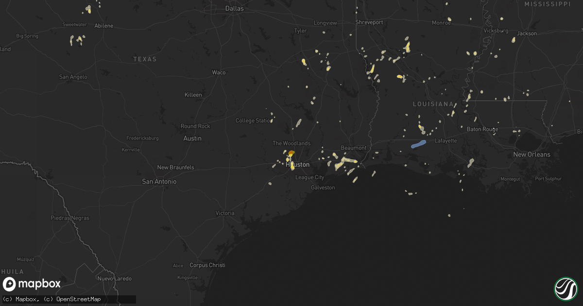
Hail Map on August 18, 2025
Get this storm
August 18 map
$229
one time, instant access
Download today. No call, no setup
Keep the $229
Bought the map and want the full workflow? Apply the entire $229 to a subscription within 7 days. None of it is wasted.
Every map, not just this one
This buys you this map. Subscription and you get every map we run, in the markets you choose from a few cities to whole states to nationwide. Plus real-time alerts the moment a storm fires.
Contact data
Name, contact info, occupancy, even credit band for addresses in the footprint. You go from where it hit to who to call.
Become the source they trust
Unlimited branding weather history reports on demand. You already have the documented answer ready for the property owner, and you are the one who showed up with it.
Property data and RoofTrace estimates
Pull up any address you have got, its value and the exact code rules for that jurisdiction, straight from One Click Code. Then RoofTrace estimates the squares, pitch, and roof value, priced the way you price.
States Impacted by Hail Map on August 18, 2025
Storm reports
Nebraska
| Date | Description |
|---|---|
| 08/18/20256:34 PM CDT | A local report indicates 63 MPH wind near 5 SE Alliance |
Alabama
| Date | Description |
|---|---|
| 08/18/20255:19 PM CDT | Jackson county ema reported a tree down along cr 102. |
| 08/18/20255:18 PM CDT | Large tree down along cr 21 reported by jackson county ema. |
Minnesota
| Date | Description |
|---|---|
| 08/17/20258:39 PM CDT | Ndawn 10 meter |
| 08/17/20258:39 PM CDT | Ndawn 10 meter wind gust measured 62 mph at 2039lt. |
Louisiana
| Date | Description |
|---|---|
| 08/18/20256:58 PM CDT | Very large tree uprooted on desoto road. Also... Reports of trees and branches down on nearby roadways. |
| 08/18/20256:45 PM CDT | Trees and power lines down along highway 6 east near highway 486 near grand ecore. Trees and power lines were also downed on tauzin island road near grand ecore. |
| 08/18/20255:53 PM CDT | A tree fell onto a house on ed edelen road. A tree was also downed on stubbs vinson road. |
| 08/18/20254:30 PM CDT | 2 powerpoles broken... Shed moved... And partial roof damage in the estherwood area. |
| 08/18/20254:25 PM CDT | 3 power poles broken near crowley. 1...976 customers with out power in slemco's area. |
| 08/18/20252:35 PM CDT | A few trees and powerlines reported down along chenal road. |
| 08/17/202510:00 PM CDT | As of 10 pm over 3000 customers were without power across natchitoches parish from thunderstorms causing down trees and power lines in several locations across the pari |
| 08/17/20257:25 PM CDT | Trees and power lines down on robeline provencal road near provencal. |
Illinois
| Date | Description |
|---|---|
| 08/18/20256:20 PM CDT | Several 6 to 7 inch diameter tree limbs were knocked down with some blocking a street in southern freeport for a time. Time estimated by radar. |
| 08/18/20256:11 PM CDT | Report of several small branches generally between 1 to 2 inches in diameter down in freeport. |
| 08/18/20255:50 PM CDT | Tree down at stewart and wells streets. |
| 08/18/20255:45 PM CDT | Trees and power lines down with some roads blocked. |
| 08/18/20255:30 PM CDT | Tree down blocking the intersection of u.s. 6 and highway 84. |
| 08/18/20255:26 PM CDT | 2-4 inch diameter branch down just south of 36th avenue court. |
| 08/18/20255:25 PM CDT | Trees and power lines down in town. |
| 08/18/20255:18 PM CDT | Power lines down in coal valley. |
| 08/18/20254:06 PM CDT | Three power poles down on old state road between five points road and church rd west of sycamore. Time estimated from radar. |
| 08/18/20253:52 PM CDT | Large tree across the whole road... Illinois 23 north of illinois 72... Northeast of genoa. Time estimated from radar. |
| 08/18/20253:50 PM CDT | Many trees down northeast of genoa along ash road between north state and illinois route 23. Damage includes poles... Trees and wires. Time estimated from radar. |
| 08/18/20253:48 PM CDT | Tree damage around genoa... North and south of town. Time estimated from radar. |
| 08/18/20253:45 AM CDT | Delayed report. Part of a metal roof blown off a building at south farms uiuc. Time estimated from radar. |
| 08/18/20253:15 AM CDT | Delayed report. Two trees were blown down in monticello. Time estimated from radar. |
| 08/18/20253:11 AM CDT | Delayed report. Damage to trees and cornfields south of of argenta. Time estimated from radar. |
| 08/18/20253:07 AM CDT | Delayed report. Extensive damage was reported across maroa. Township building roof on south wood street was blown off. Approx 100 trees were blown down across town. Cam |
| 08/18/20253:06 AM CDT | Delayed report. Extensive tree damage on a property in forsyth. Video of numerous large branches down. Via social media. Time estimated via radar. |
| 08/17/20259:05 PM CDT | North side of peoria. |
| 08/17/20258:58 PM CDT | Large tree branch broken off near the intersection of s. 8th st. And prince st. |
| 08/17/20258:18 PM CDT | A local report indicates 58 MPH wind near 3 NNW Plainfield |
| 08/17/20257:52 PM CDT | Severe winds lasted 2-3 minu |
| 08/17/20257:52 PM CDT | Severe winds lasted 2-3 minutes. |
| 08/17/20257:50 PM CDT | Estimated 50 to 60 mph w |
| 08/17/20257:50 PM CDT | Estimated 50 to 60 mph wind gusts. |
| 08/17/20257:30 PM CDT | Six inch tree branches down. Time estimated from radar data. |
Colorado
| Date | Description |
|---|---|
| 08/18/20256:01 PM CDT | Awos station kako akron. |
| 08/18/20255:33 PM CDT | Trained spotter reported hail ranging in size from pea to quarters in size. |
| 08/18/20255:33 PM CDT | Trained spotter reported hail |
| 08/18/20255:13 PM CDT | Site livingston ag seibert measured 61 mph wind gust. |
| 08/18/20254:54 PM CDT | Corrects previous tstm wnd gst report from 7 nnw flagler. Kcoflagl13 on wunderground reported the wind gust. |
| 08/18/20254:38 PM CDT | Site kcoflagl13 measured 60 mph wind gust. |
| 08/18/20253:47 PM CDT | Asos station klic limon. |
| 08/18/20253:22 PM CDT | Pws-kcowatki13. |
South Dakota
| Date | Description |
|---|---|
| 08/18/20256:21 PM CDT | Per pws. |
| 08/18/20255:26 PM CDT | A local report indicates 1.50 inch wind near 7 ESE Hermosa |
| 08/18/20255:22 PM CDT | Damage to flags. |
| 08/18/20255:20 PM CDT | A local report indicates 59 MPH wind near 4 NW Lantry |
| 08/18/20255:15 PM CDT | Sdsu mesonet |
| 08/18/20254:37 PM CDT | Mping report |
| 08/18/20254:27 PM CDT | Mping report |
| 08/18/20254:10 PM CDT | Rear window of vehicle has several holes in it. |
| 08/18/20254:00 PM CDT | Mping report |
| 08/18/20253:55 PM CDT | A local report indicates 3.25 inch wind near 1 ESE Pactola Res |
| 08/18/20253:40 PM CDT | Measured 2 to 3 inch hail stones. |
| 08/18/20253:15 PM CDT | 1/2 inch to 1 inch hail |
Kansas
| Date | Description |
|---|---|
| 08/18/20256:41 PM CDT | Site kgld measured 64 mph wind gust. |
| 08/18/20256:36 PM CDT | Site kgld measured 60 mph wind gust. |
| 08/18/20255:57 PM CDT | Up to 3.5 inch diameter tree limbs were blown down in town. Estimated time of report. |
| 08/18/20255:57 PM CDT | Picture of at least 1 power pole blown over along highway 83 and cr c. Time estimated by radar. |
| 08/18/20255:40 PM CDT | Emergency manager relayed a report |
| 08/18/20255:30 PM CDT | A local report indicates 1.50 inch wind near 3 E Codell |
| 08/18/20255:48 AM CDT | Tree limbs down. Time estimated from radar |
| 08/18/20255:48 AM CDT | Tree limbs down. Time estim |
| 08/18/20255:48 AM CDT | Tree limbs down. Time estimated from radar. |
| 08/18/20255:15 AM CDT | Power lines and poles downed. Damage to roofs and trees also reported. Time estimated from radar. (top |
| 08/18/20255:15 AM CDT | Power lines and poles downed. Damage to roofs and trees also reported. Time estimated from radar. |
| 08/18/20254:08 AM CDT | Roof blown off of shed and fencing blown down at a local co-op. Time estimated radar. |
| 08/17/20258:18 PM CDT | Up840 reported the wind gust. |
Mississippi
| Date | Description |
|---|---|
| 08/18/20254:03 PM CDT | A mobile home was destroyed. |
| 08/18/20253:47 PM CDT | Scattered trees and powerlines were blown down between raymond and utica. |
| 08/18/20253:21 PM CDT | Two trees and powerlines were blown down on dana road. |
| 08/18/20252:45 PM CDT | A tree was blown onto a house on overby road. Several other trees were also blown down. |
| 08/18/20252:45 PM CDT | Several trees were blown down on niven road. |
| 08/18/20252:45 PM CDT | Several power poles were snapped on moorehead road. |
Texas
| Date | Description |
|---|---|
| 08/18/20255:26 PM CDT | West texas mesonet. |
| 08/18/20254:04 PM CDT | Report of a tree down on the 1200 block of woodbine street. |
| 08/18/20254:00 PM CDT | Report of trees down in the 2200 block of north pecan street. |
| 08/17/20259:00 PM CDT | Multiple reports were received from the public of approximately 10 power poles broken just above the base along hwy 285 between pecos and mentone. All poles were laying |
| 08/17/20258:36 PM CDT | Report from mping: half dollar |
| 08/17/20258:08 PM CDT | Report from mping: half dollar |
| 08/17/20257:40 PM CDT | Fort bend emergency manager reported golf ball size hail in champions forest. |
| 08/17/20257:40 PM CDT | Storm spotter reported marble to quarter size hail near fm 1960 and veterans memorial drive. |
Missouri
| Date | Description |
|---|---|
| 08/18/20255:08 PM CDT | 10-12 inch diameter tree limb down along george street. |
| 08/18/20255:05 PM CDT | Multiple trees down along spring bluff rd and hwy 185. |
| 08/18/20255:05 PM CDT | 8 inch tree limb down along karen ann circle. |
| 08/18/20254:58 PM CDT | A large tree was reported down blocking the east bound lane of highway ff near the intersection of bell ford road. |
| 08/18/20254:50 PM CDT | A car port was rolled and damaged and large limbs up to 8 inches in diameter were reported down. |
| 08/18/20254:12 PM CDT | Trees were down due to downburst winds across goff creek road. Time was estimated via radar. |
| 08/18/20254:00 PM CDT | A tree fell down on a home in dixon. |
| 08/18/20259:05 AM CDT | Many tree limbs blown down... Taking down power lines. Roof damage to two buildings. |
| 08/18/20256:52 AM CDT | Large tree down at 58th and wornall as reported by kmbc. |
| 08/18/20255:52 AM CDT | Corrects previous tstm wnd dmg report from 5 s kansas city. Large tree down at 58th and wornall as reported by kmbc. |
| 08/18/20255:52 AM CDT | Corrects previous tstm wnd dmg report from 5 s kansas city. Large tree down at 58th and wornall as reported by kmbc. (eax |
| 08/18/20255:52 AM CDT | Corrects previous tstm wnd dmg report from 5 s kansas city. Large tr |
| 08/18/20255:52 AM CDT | Corrects p |
Oklahoma
| Date | Description |
|---|---|
| 08/18/20256:30 PM CDT | Multiple metal transmission poles were snapped along cleveland road. Time estimated by radar. |
| 08/18/20256:20 PM CDT | Approximately 20 power poles were snapped between wheatridge road and imo road. Time estimated by radar. |
| 08/18/20255:36 PM CDT | Kgag. |
| 08/17/20258:00 PM CDT | Estimated wind gust. |
Iowa
| Date | Description |
|---|---|
| 08/18/20255:18 PM CDT | Several tree limbs are down... 6 to 10 inches across... Around town. Power lines are also down; no power in leclaire. The house at 12th and jones had power lines ripped |
| 08/18/20254:55 PM CDT | Photo relayed via social media of a large branch of a tree snapped off. Time estimated by radar. |
North Dakota
| Date | Description |
|---|---|
| 08/18/20254:40 PM CDT | Nddot sensor. Time estimated from radar. |
| 08/17/20257:20 PM CDT | Ndawn station marion 2s. Report at 10 meters... 55 mph observed at the surface. |
Cities Impacted by Hail Map on August 18, 2025
- Lemmon, SD
- Auburn, NE
- Centralia, KS
- Sedgwick, CO
- Dalton, NE
- Seneca, KS
- Goff, KS
- Corning, KS
- Riley, KS
- Woodville, MS
- Stamford, TX
- Roscoe, IL
- Centreville, MS
- Caledonia, IL
- Poplar Grove, IL
- Kaplan, LA
- Sylvester, TX
- Anson, TX
- Gloster, MS
- Capron, IL
- Saint Francisville, LA
- Hamlin, TX
- Harvard, IL
- Bell City, LA
- Maringouin, LA
- Batchelor, LA
- Liberty, MS
- Colorado Springs, CO
- Grand Chenier, LA
- Satartia, MS
- Deadwood, SD
- Lindenwood, IL
- Florissant, CO
- Lettsworth, LA
- Conifer, CO
- Etoile, TX
- Polk City, FL
- Sedalia, CO
- Ponchatoula, LA
- Palmetto, LA
- Plaucheville, LA
- Lincoln, NM
- Capitan, NM
- Simmesport, LA
- Nemo, SD
- Piedmont, SD
- Deville, LA
- Glynn, LA
- Rougon, LA
- Jarreau, LA
- Childress, TX
- Limon, CO
- Groveland, FL
- Troy, MO
- Wright City, MO
- Montreal, MO
- Linn Creek, MO
- Saint Elizabeth, MO
- Tuscumbia, MO
- Esmond, IL
- Roscoe, TX
- Blackwell, TX
- Maryneal, TX
- Nacogdoches, TX
- Sturgis, SD
- Rapid City, SD
- Ramah, CO
- Washington, LA
- Western Grove, AR
- Harrison, AR
- Vendor, AR
- Hill City, SD
- Owensville, MO
- Hermann, MO
- Dry Creek, LA
- Kirkland, IL
- Rochelle, IL
- New Haven, MO
- Meadow, SD
- Carrington, ND
- Iowa, LA
- Burns, WY
- Lebanon, MO
- Genoa, CO
- Oakdale, LA
- Arriba, CO
- Deer Trail, CO
- Leslie, MO
- Gerald, MO
- Wentzville, MO
- Mittie, LA
- West Brooklyn, IL
- Calhan, CO
- Crocker, MO
- Rush, CO
- Hermanville, MS
- Byers, CO
- Sycamore, IL
- Kingston, IL
- Clare, IL
- Woodrow, CO
- Picayune, MS
- Bison, SD
- Opelousas, LA
- Dupree, SD
- Hampshire, IL
- Ocala, FL
- Pine Bluffs, WY
- Dixon, MO
- Pingree, ND
- Raymond, MS
- Burlington, IL
- Rosston, OK
- Maple Park, IL
- Pattison, MS
- Malta, IL
- Kensal, ND
- Utica, MS
- Strasburg, CO
- Kinder, LA
- Mount Enterprise, TX
- Compton, IL
- Dunnellon, FL
- Elgin, IL
- Shabbona, IL
- Dekalb, IL
- Lee, IL
- Waterman, IL
- Hinckley, IL
- Cedar Key, FL
- Inglis, FL
- Spokane, MO
- Oberlin, LA
- Hugo, CO
- Waynesville, MO
- Berryville, AR
- Hammond, LA
- Canadian, TX
- Lake Saint Louis, MO
- Basile, LA
- O'Fallon, MO
- Port Gibson, MS
- Genoa, IL
- Gilberts, IL
- Dundee, IL
- Elburn, IL
- Big Rock, IL
- Flagler, CO
- Laneville, TX
- Henderson, TX
- Reklaw, TX
- Rosebud, MO
- Cushing, TX
- Wiggins, CO
- Saint Joseph, LA
- Kilgore, TX
- Fordland, MO
- Marshfield, MO
- Glenfield, ND
- Epps, LA
- Sullivan, MO
- Bourbon, MO
- Saint Robert, MO
- Alto, TX
- Eunice, LA
- Bushnell, NE
- Branch, LA
- Crowley, LA
- Highlandville, MO
- Cuba, MO
- Buffalo, OK
- Church Point, LA
- Walker, LA
- Iota, LA
- Hermosa, SD
- Seibert, CO
- Sublette, IL
- Mendota, IL
- Gilbert, LA
- Laverne, OK
- Rayne, LA
- Buchanan, ND
- Fort Leonard Wood, MO
- Fort Morgan, CO
- Rogersville, MO
- Rusk, TX
- Sugar Grove, IL
- Atwood, KS
- Caputa, SD
- Ellis, KS
- Lubbock, TX
- New Waverly, TX
- Baton Rouge, LA
- Natoma, KS
- Plainville, KS
- Licking, MO
- Salem, MO
- Fargo, OK
- Provencal, LA
- Robertsville, MO
- Lonedell, MO
- Denham Springs, LA
- Branson, MO
- Collyer, KS
- Prairieville, LA
- Webster, FL
- Warren, TX
- Vona, CO
- Aurora, IL
- Batavia, IL
- Paradise, KS
- Catharine, KS
- Victoria, KS
- Eagle Butte, SD
- Lantry, SD
- Eunice, NM
- Winona, KS
- Seymour, MO
- Quinter, KS
- Bryant, IA
- Clinton, IA
- Goose Lake, IA
- Wharton, TX
- East Bernard, TX
- Bedias, TX
- Clayton, LA
- Medford, OK
- Franklin, LA
- Jeanerette, LA
- Richards, TX
- Bushnell, FL
- Morriston, FL
- Wildwood, FL
- Grovespring, MO
- Stratton, CO
- Edson, KS
- Goodland, KS
- Gorham, KS
- Kennard, TX
- De Berry, TX
- Beloit, WI
- Oakley, KS
- Liberty, TX
- Willis, TX
- Anderson, TX
- Cope, CO
- Houston, TX
- Bethune, CO
- Shattuck, OK
- Dacoma, OK
- Alva, OK
- May, OK
- Logansport, LA
- Grand Cane, LA
- Kanorado, KS
- Tonkawa, OK
- Dayton, TX
- Clinton, WI
- Wakeeney, KS
- Goldonna, LA
- Williston, FL
- Earlville, IL
- Paw Paw, IL
- Sykeston, ND
- Burlington, CO
- Gage, OK
- Hunter, OK
- Pond Creek, OK
- Lamont, OK
- New Raymer, CO
- Crockett, TX
- Nardin, OK
- Morgan City, LA
- Devers, TX
- Mansfield, LA
- Mount Carroll, IL
- Lanark, IL
- Milledgeville, IL
- Shannon, IL
- Forreston, IL
- Baileyville, IL
- Freeport, IL
- Weskan, KS
- Mount Morris, IL
- Leaf River, IL
- German Valley, IL
- Ridott, IL
- Palco, KS
- Ypsilanti, ND
- Ogallah, KS
- Gate, OK
- Hackberry, LA
- Jamestown, ND
- Spiritwood, ND
- Colby, KS
- Morland, KS
- Monroe, LA
- Grace City, ND
- Anahuac, TX
- Anton, CO
- Grubville, MO
- Baytown, TX
- Beaumont, TX
- Port Arthur, TX
- Katy, TX
- Vivian, LA
- Mooringsport, LA
- Sterling, CO
- Hayes, SD
- Fort Pierre, SD
- Akron, CO
- Alliance, NE
- Steward, IL
- Cypress, TX
- Stoneham, CO
- Hays, KS
- Hamshire, TX
- Venus, FL
- Bienville, LA
- Saline, LA
- Tomball, TX
- Wimbledon, ND
- Osyka, MS
- Winnie, TX
- Woodworth, ND
- Levant, KS
- Amboy, IL
- Mooreland, OK
- Chester, OK
- Winnfield, LA
- Carrier, OK
- Grainfield, KS
- Hoxie, KS
- Robeline, LA
- Courtenay, ND
- Magnolia, MS
- Groom, TX
- Pampa, TX
- Franklin Grove, IL
- Gove, KS
- Fulshear, TX
- Brookshire, TX
- Park, KS
- Natchitoches, LA
- Campti, LA
- Pelican, LA
- Enid, OK
- Lahoma, OK
- Sanborn, ND
- Hill City, KS
- Bogue, KS
- Sharon Springs, KS
- Marion, ND
- Hartford, AR
- Pleasant Hill, LA
- Brewster, KS
- Punta Gorda, FL
- Isabella, OK
- Dickey, ND
- Litchville, ND
- Lamoure, ND
- Montpelier, ND
- Walnut, IL
- Ohio, IL
- La Moille, IL
- Van Orin, IL
- Arlington, IL
- Triumph, IL
- Berlin, ND
- Verona, ND
- North Zulch, TX
- Clarendon, TX
- Taloga, OK
- Goodrich, TX
- Waukomis, OK
- Dazey, ND
- Mokena, IL
- Orland Park, IL
- Hemphill, TX
- Gettysburg, SD
- Converse, LA
- Fort Ransom, ND
- Spring, TX
- Cherry Creek, SD
- De Witt, IA
- Wanblee, SD
- Hartville, MO
- Ball, LA
- Pineville, LA
- Milam, TX
- Utica, IL
- Ottawa, IL
- Marseilles, IL
- Serena, IL
- Leland, IL
- Sheridan, IL
- Plano, IL
- Yorkville, IL
- Millington, IL
- Millbrook, IL
- Wedron, IL
- Sandwich, IL
- Somonauk, IL
- Newark, IL
- Troy Grove, IL
- La Salle, IL
- Grand Ridge, IL
- Lisbon, ND
- Bellaire, TX
- Seiling, OK
- Okeene, OK
- Noble, LA
- Zwolle, LA
- Oakwood, OK
- Cloutierville, LA
- Grinnell, KS
- Streator, IL
- Seneca, IL
- Morris, IL
- Ransom, IL
- Verona, IL
- Minooka, IL
- Plainfield, IL
- Joliet, IL
- Shorewood, IL
- Channahon, IL
- Crest Hill, IL
- Roseville, IL
- Berwick, IL
- Avon, IL
- Saint Augustine, IL
- London Mills, IL
- Fairview, IL
- Farmington, IL
- Oakes, ND
- Lostant, IL
- Wenona, IL
- Oshkosh, NE
- Tylertown, MS
- Fairview, OK
- Mora, LA
- Toluca, IL
- Wellington, TX
- Happy, TX
- Many, LA
- Canton, IL
- Norris, IL
- Elmwood, IL
- Kinsman, IL
- Lockport, IL
- Rutland, IL
- Kentwood, LA
- Longdale, OK
- Canton, OK
- Lomax, IL
- Stronghurst, IL
- Tinley Park, IL
- Florien, LA
- Healy, KS
- Glasford, IL
- Trivoli, IL
- New Lenox, IL
- Manhattan, IL
- Wilmington, IL
- Elwood, IL
- Homer Glen, IL
- Monee, IL
- Frankfort, IL
- Chesterton, IN
- Gary, IN
- Hobart, IN
- Portage, IN
- Lake Station, IN
- Valparaiso, IN
- East Chicago, IN
- Hanna City, IL
- Mapleton, IL
- Raritan, IL
- Media, IL
- Dana, IL
- Smithshire, IL
- Akron, AL
- Lebanon, SD
- Long Point, IL
- La Harpe, IL
- Michigan City, IN
- Pekin, IL
- Kingston Mines, IL
- Manito, IL
- South Pekin, IL
- Green Valley, IL
- Peotone, IL
- Manteno, IL
- Grant Park, IL
- Momence, IL
- Matteson, IL
- University Park, IL
- Beecher, IL
- Crete, IL
- Arcadia, FL
- Hennessey, OK
- Fairmont, OK
- Dixon, IL
- Bison, OK
- Schneider, IN
- Lake Village, IN
- Lowell, IN
- Cedar Lake, IN
- Dyer, IN
- Steger, IL
- Park Forest, IL
- Saint John, IN
- Chicago Heights, IL
- Richton Park, IL
- Schererville, IN
- Crown Point, IN
- Griffith, IN
- Munster, IN
- Highland, IN
- Olympia Fields, IL
- Glenwood, IL
- Lansing, IL
- Flossmoor, IL
- Thornton, IL
- Hammond, IN
- Homewood, IL
- Merrillville, IN
- Hebron, IN
- Demotte, IN
- Shelby, IN
- Peoria, IL
- Pecatonica, IL
- Fingal, ND
- Enderlin, ND
- Britton, SD
- Hoven, SD
- Marksville, LA
- Peru, IL
- Butler, OK
- Kingfisher, OK
- Oglesby, IL
- Holcomb, KS
- Blandinsville, IL
- Perkinston, MS
- Tonica, IL
- Lake City, SD
- Varna, IL
- Putnam, OK
- Milnor, ND
- Rio, IL
- Thomas, OK
- Custer City, OK
- Boone Grove, IN
- Wheatfield, IN
- Kouts, IN
- Thayer, IN
- Walkerton, IN
- Westville, IN
- Wanatah, IN
- Knox, IN
- North Judson, IN
- La Porte, IN
- San Pierre, IN
- Hamlet, IN
- Union Mills, IN
- Kingsford Heights, IN
- La Crosse, IN
- Hanna, IN
- Mishawaka, IN
- South Bend, IN
- Lakeville, IN
- North Liberty, IN
- Bremen, IN
- Mill Creek, IN
- Rolling Prairie, IN
- Grovertown, IN
- New Carlisle, IN
- Penokee, KS
- Rensselaer, IN
- Fair Oaks, IN
- Ransom, KS
- Culbertson, NE
- Levelland, TX
- Egan, LA
- Estherwood, LA
- Morse, LA
- Mermentau, LA
- Jennings, LA
- Lake Arthur, LA
- Romeoville, IL
- Oswego, IL
- Maquon, IL
- Lucas, KS
- Luray, KS
- Dorrance, KS
- Watkins, CO
- Aurora, CO
- Bennett, CO
- Mchenry, ND
- Sutton, ND
- Binford, ND
- Dolton, IL
- South Holland, IL
- Beverly Shores, IN
- Calumet City, IL
- Elkhart, IL
- Lincoln, IL
- Maroa, IL
- Argenta, IL
- Monticello, IL
- Cisco, IL
- Weldon, IL
- Clinton, IL
- De Land, IL
- Mansfield, IL
- White Heath, IL
- Decatur, IL
- Oreana, IL
- Forsyth, IL
- Cerro Gordo, IL
- Delia, KS
- Mayetta, KS
- Milmine, IL
- Hammond, IL
- La Place, IL
- Bement, IL
- Ivesdale, IL
- Sadorus, IL
- Tolono, IL
- Hoyt, KS
- Champaign, IL
- Topeka, KS
- Meriden, KS
- Emporia, KS
- Bartlesville, OK
- Waverly, KS
- Grantville, KS
- Wann, OK
- Groveton, TX
- Ochelata, OK
- Ramona, OK
- Barnsdall, OK
- Dewey, OK
- Kansas City, MO
- Kansas City, KS