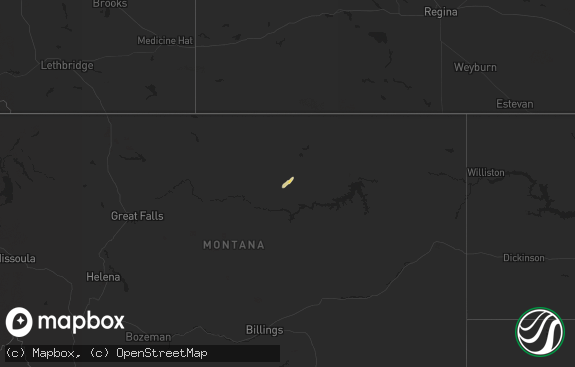
Hail Map in Montana on June 25, 2018
The weather event in Montana on June 25, 2018 includes Hail map. 13 states and 566 cities were impacted and suffered possible damage. The total estimated number of properties impacted is 41.

Hail
41
Estimated number of impacted properties by a 1.00" hail or larger0
Estimated number of impacted properties by a 1.75" hail or larger0
Estimated number of impacted properties by a 2.50" hail or largerStorm reports in Montana
Montana
| Date | Description |
|---|---|
| 06/25/20183:49 AM CDT | At 849 PM MDT, a severe thunderstorm was located 12 miles southwest of The Knees, or 24 miles north of Great Falls, moving northeast at 40 mph. HAZARD...60 mph wind gusts and quarter size hail. SOURCE...Radar indicated. IMPACT...Hail damage to vehicles is expected. Expect wind damage to roofs, siding, and trees. Locations impacted include... The Knees. |
| 06/25/20183:42 AM CDT | At 842 PM MDT, a severe thunderstorm was located 9 miles south of Geraldine, or 21 miles north of Stanford, moving east at 20 mph. HAZARD...70 mph wind gusts and quarter size hail. SOURCE...Radar indicated. IMPACT...Hail damage to vehicles is expected. Expect considerable tree damage. Wind damage is also likely to mobile homes, roofs, and outbuildings. Locations impacted include... Square Butte. |
| 06/25/20183:22 AM CDT | At 822 PM MDT, a severe thunderstorm was located 12 miles north of Geyser, or 22 miles northwest of Stanford, moving east at 30 mph. HAZARD...60 mph wind gusts and quarter size hail. SOURCE...Radar indicated. IMPACT...Hail damage to vehicles is expected. Expect wind damage to roofs, siding, and trees. Locations impacted include... Square Butte. |
| 06/25/20182:17 AM CDT | At 717 PM MDT, severe thunderstorms were located along a line extending from 11 miles north of Black Eagle to 9 miles west of Belt, moving east at 45 mph. HAZARD...60 mph wind gusts and penny size hail. SOURCE...Radar indicated. IMPACT...Expect damage to roofs, siding, and trees. Locations impacted include... Great Falls, Belt, Black Eagle, Highwood, Carter, Floweree, Portage, Malmstrom Afb, Stockett, Tracy, Centerville, Shonkin, Armington and Sand Coulee. |
| 06/25/20182:04 AM CDT | At 703 PM MDT, a severe thunderstorm was located near Power, or 19 miles northwest of Great Falls, moving northeast at 35 mph. HAZARD...60 mph wind gusts and quarter size hail. SOURCE...Radar indicated. IMPACT...Hail damage to vehicles is expected. Expect wind damage to roofs, siding, and trees. Locations impacted include... Power. |
| 06/24/20188:05 PM CDT | Reports a lot of wind and a lot of pea sized hail. Hail covering the ground. Power went out. Window screens destroyed with some minor glass damage. Paint on house sidin |
| 06/24/20188:05 PM CDT | Facebook report of downed trees... Small hail... And no electricity south of power. Also reports 2 inches of rain. |
| 06/24/20187:30 PM CDT | Good sized cottonwood tree branches down. Estimated to be the size of fence posts. |
All States Impacted by Hail Map on June 25, 2018
Cities Impacted by Hail Map on June 25, 2018
- New Florence, MO
- Montgomery City, MO
- Rhineland, MO
- Portland, MO
- Marthasville, MO
- Du Quoin, IL
- Tamaroa, IL
- Pinckneyville, IL
- Mulkeytown, IL
- Sesser, IL
- Benton, IL
- Christopher, IL
- Campobello, SC
- Wellford, SC
- Inman, SC
- Landrum, SC
- Society Hill, SC
- Patrick, SC
- Effingham, SC
- Florence, SC
- Mount Croghan, SC
- Jefferson, SC
- Pageland, SC
- Greer, SC
- Duncan, SC
- Lyman, SC
- Hemingway, SC
- Nesmith, SC
- Kingstree, SC
- Pauline, SC
- Roebuck, SC
- Spartanburg, SC
- Gaston, SC
- Swansea, SC
- West Columbia, SC
- Lexington, SC
- Raeford, NC
- Lumber Bridge, NC
- Fayetteville, NC
- Aberdeen, NC
- Fort Bragg, NC
- Maxton, NC
- Clarkton, NC
- Whiteville, NC
- Chadbourn, NC
- Clarendon, NC
- Tabor City, NC
- Leland, NC
- Charlotte, NC
- Highwood, MT
- Geraldine, MT
- Geyser, MT
- Loudon, TN
- Livingston, TN
- Rickman, TN
- Monterey, TN
- Crossville, TN
- Chatsworth, GA
- Loganville, GA
- Ferguson, NC
- Hope Mills, NC
- Belvidere, TN
- Fitzgerald, GA
- Rhine, GA
- Strafford, MO
- Springfield, MO
- Fair Grove, MO
- Surrency, GA
- Bristol, GA
- Pooler, GA
- Savannah, GA
- Pitts, GA
- Mountain Home, AR
- Oakland, AR
- Philadelphia, TN
- Leicester, NC
- Eastover, SC
- Clarkesville, GA
- Moore, SC
- Lake Waccamaw, NC
- Hallsboro, NC
- Tignall, GA
- Fairmont, NC
- Orrum, NC
- Dobson, NC
- Elkin, NC
- Carlyle, IL
- Midway, AL
- Statesboro, GA
- Hardaway, AL
- Breese, IL
- Bishopville, SC
- Hartsville, SC
- Eva, AL
- Falkville, AL
- Lenoir, NC
- Morganton, NC
- Mullins, SC
- Marion, SC
- East Dublin, GA
- Dublin, GA
- Johnsonville, SC
- Roanoke, AL
- Columbia, IL
- Saluda, NC
- Mill Spring, NC
- Ten Mile, TN
- Lancaster, SC
- Waxhaw, NC
- Fort Mill, SC
- Tuskegee, AL
- Kershaw, SC
- Round O, SC
- Blackstock, SC
- Pembroke, GA
- Scranton, SC
- Timmonsville, SC
- Olanta, SC
- Brooklet, GA
- Burnsville, NC
- Spruce Pine, NC
- Fort Shaw, MT
- Sainte Genevieve, MO
- Harrison, GA
- Davisboro, GA
- Franklin, NC
- Washington, GA
- Carlton, GA
- New Zion, SC
- Hopkins, SC
- Saint Matthews, SC
- North, SC
- Bonne Terre, MO
- Catlin, IL
- Fairmount, IL
- Appling, GA
- Eastman, GA
- Cabool, MO
- Belt, MT
- De Soto, MO
- Valles Mines, MO
- South Greenfield, MO
- Everton, MO
- Green Mountain, NC
- Wallace, SC
- Cheraw, SC
- Chesterfield, SC
- Sunbright, TN
- Science Hill, KY
- Preston, GA
- Richland, GA
- Adrian, GA
- Taylors, SC
- O'Brien, FL
- Branford, FL
- Nicholls, GA
- Lynchburg, SC
- Georgetown, SC
- Richburg, SC
- Grovespring, MO
- Grovetown, GA
- Harlem, GA
- Dayton, TN
- Darlington, SC
- Adams Run, SC
- Power, MT
- Sun River, MT
- Vaughn, MT
- Laurinburg, NC
- Stoutland, MO
- Richland, MO
- Lebanon, MO
- Boaz, AL
- Albertville, AL
- Ash, NC
- Gadsden, SC
- Summerville, SC
- Carrollton, GA
- Marshfield, MO
- Solo, MO
- Mountain Grove, MO
- Woodruff, SC
- Great Falls, SC
- Holly Ridge, NC
- McBee, SC
- Abbeville, GA
- Rochelle, GA
- Cordele, GA
- Arabi, GA
- Whitesburg, GA
- Marissa, IL
- Lenzburg, IL
- New Athens, IL
- Claxton, GA
- Register, GA
- Coulterville, IL
- Lyons, GA
- Collins, GA
- Danville, IL
- Oakwood, IL
- Westville, IL
- Buckner, IL
- Nashville, IL
- Gresham, SC
- Lula, GA
- Wetumpka, AL
- Port Wentworth, GA
- Goose Creek, SC
- Damascus, GA
- Etowah, TN
- La Fayette, GA
- Guntersville, AL
- Keysville, GA
- Louisville, GA
- Waynesboro, GA
- Wrens, GA
- Licking, MO
- Mayesville, SC
- Cascade, MT
- Bennettsville, SC
- Evensville, TN
- Linn, MO
- Bonnots Mill, MO
- Steedman, MO
- Blackwell, MO
- Park Hills, MO
- Irondale, MO
- Festus, MO
- French Village, MO
- Mineral Point, MO
- Cadet, MO
- Belgrade, MO
- Potosi, MO
- Bixby, MO
- Belleview, MO
- Half Way, MO
- Athens, TN
- Riceville, TN
- Ellington, MO
- Somerset, KY
- Bucyrus, MO
- Seymour, TN
- Marion, NC
- Old Fort, NC
- Hickory Grove, SC
- Chester, SC
- Winnsboro, SC
- Dalton, GA
- Anniston, AL
- Jacksonville, AL
- Cottageville, SC
- Heflin, AL
- Fruithurst, AL
- Roswell, GA
- Rome, GA
- Wadley, AL
- Ellaville, GA
- Salem, AL
- Opelika, AL
- Cusseta, AL
- Valley, AL
- Fort Stewart, GA
- Hamilton, GA
- Cataula, GA
- Moultrie, GA
- Pavo, GA
- Houston, TX
- Berlin, GA
- Trenton, IL
- Pocahontas, IL
- Highland, IL
- Aviston, IL
- Crocker, MO
- Vienna, MO
- Newburg, MO
- Keyesport, IL
- Beckemeyer, IL
- Caledonia, MO
- Conway, MO
- Phillipsburg, MO
- Miller, MO
- Walnut Grove, MO
- Lockwood, MO
- Greenfield, MO
- Elkland, MO
- Bolivar, MO
- Bois D Arc, MO
- Mount Vernon, MO
- Republic, MO
- Ash Grove, MO
- Marionville, MO
- Willard, MO
- Brighton, MO
- Pleasant Hope, MO
- Billings, MO
- Halltown, MO
- Buffalo, MO
- Pomona, MO
- West Plains, MO
- Seymour, MO
- Sweetwater, TN
- Niota, TN
- Stanford, KY
- Asheville, NC
- Ruby, SC
- Resaca, GA
- Horton, AL
- Calhoun, GA
- Lamar, SC
- Elizabethtown, NC
- Kingston, GA
- Sumter, SC
- Elliott, SC
- Rockmart, GA
- Coward, SC
- Turbeville, SC
- Islandton, SC
- Oglethorpe, GA
- Ridgeville, SC
- Tyrone, GA
- Union City, GA
- Palmetto, GA
- Douglasville, GA
- Fairburn, GA
- Atlanta, GA
- Green Pond, SC
- Yemassee, SC
- Union Springs, AL
- Fort Davis, AL
- Rincon, GA
- Guyton, GA
- Ashburn, GA
- Casey, IL
- Stotts City, MO
- Sarcoxie, MO
- Pierce City, MO
- Wentworth, MO
- Rolla, MO
- Bismarck, MO
- Farmington, MO
- Koeltztown, MO
- Argyle, MO
- Freeburg, MO
- Boss, MO
- Salem, MO
- Plato, MO
- Henderson, AR
- New Haven, MO
- Edgar Springs, MO
- Graff, MO
- Tellico Plains, TN
- Vonore, TN
- State Road, NC
- Madisonville, TN
- Rutherfordton, NC
- Lake Lure, NC
- Gillsville, GA
- Blenheim, SC
- Gaylesville, AL
- Brookwood, AL
- Andersonville, GA
- Ravenel, SC
- Ladson, SC
- Chamois, MO
- Sparta, IL
- Urbana, IL
- Saint Joseph, IL
- Fenton, MO
- Eureka, MO
- High Ridge, MO
- Black, MO
- Gravel Switch, KY
- Robbins, TN
- Midway, AR
- Gassville, AR
- Flippin, AR
- Hartville, MO
- Mills River, NC
- Horse Shoe, NC
- Travelers Rest, SC
- Sherwood, TN
- Jonesville, SC
- Evergreen, NC
- Ellijay, GA
- Talking Rock, GA
- Valhermoso Springs, AL
- Laceys Spring, AL
- Lumberton, NC
- Lake City, SC
- Gray, GA
- Macon, GA
- Andrews, SC
- Cades, SC
- Auburn, AL
- Tallassee, AL
- Americus, GA
- Reynolds, GA
- Cuthbert, GA
- Odum, GA
- Lenox, GA
- Marianna, FL
- Millwood, GA
- Oakdale, IL
- Dixon, MO
- Jerome, MO
- Long Lane, MO
- Success, MO
- Valdese, NC
- Whitesburg, KY
- Decatur, TN
- Bryant, AL
- Bryson City, NC
- Ranger, GA
- Chickamauga, GA
- Menlo, GA
- Arab, AL
- Sellers, SC
- Buchanan, GA
- Tucker, GA
- Decatur, GA
- Bartow, GA
- Woodland, AL
- Wedowee, AL
- Williston, SC
- Windsor, SC
- Reidsville, GA
- Notasulga, AL
- Eufaula, AL
- Clinton, MO
- Urich, MO
- Iberia, MO
- Clinton, IL
- Foley, MO
- Saint Louis, MO
- Windyville, MO
- Prairie Du Rocher, IL
- Nancy, KY
- Crawford, TN
- Rock Island, TN
- Laurel Hill, NC
- Marston, NC
- Red Springs, NC
- Hamlet, NC
- Pacolet, SC
- Rocky Face, GA
- Rocky Point, NC
- Galivants Ferry, SC
- Ohatchee, AL
- Matthews, GA
- Bowdon, GA
- Jacksonboro, SC
- Walterboro, SC
- Forsyth, GA
- Culloden, GA
- Altha, FL
- Hardeeville, SC
- Plains, GA
- Coolidge, GA
- Tilton, IL
- Augusta, MO
- Vichy, MO
- Red Bud, IL
- Bloomsdale, MO
- Bunker, MO
- Davisville, MO
- Aldrich, MO
- Dadeville, MO
- Annapolis, MO
- Ironton, MO
- Piedmont, MO
- Coeburn, VA
- Parkers Lake, KY
- Elk Creek, MO
- Houston, MO
- Millers Creek, NC
- North Wilkesboro, NC
- Allons, TN
- Hilham, TN
- Taylorsville, NC
- Kingston, TN
- Hoffman, NC
- Wagram, NC
- Fountain Inn, SC
- Simpsonville, SC
- Crandall, GA
- Old Fort, TN
- Heath Springs, SC
- Valley Head, AL
- Mentone, AL
- Sugar Valley, GA
- Bolton, NC
- Gainesville, GA
- Dallas, GA
- Loris, SC
- Acworth, GA
- Columbia, SC
- Orangeburg, SC
- Salley, SC
- Wedgefield, SC
- Manning, SC
- Snellville, GA
- Newnan, GA
- Munford, AL
- Musella, GA
- Grand Ridge, FL
- Loxley, AL
- Georgetown, FL
- Belle, MO
- Westphalia, MO
- Meta, MO
- Steelville, MO
- Knoxville, TN
- Niangua, MO
- Murphy, NC
- Robbinsville, NC
- Tiger, GA
- Pamplico, SC
- Bethune, SC
- Burgaw, NC
- Alcolu, SC
- Tallapoosa, GA
- Weaver, AL
- Covington, GA
- Social Circle, GA
- Pawleys Island, SC
- Hollywood, SC
- Eclectic, AL
- Ideal, GA
- Trenton, FL
- Ochlocknee, GA
- Fitzpatrick, AL
- Buena Vista, GA
- Simms, MT
- West Frankfort, IL
- Mcminnville, TN
- Union Mills, NC
- Ellsinore, MO
- Ocoee, TN
- Marietta, SC
- Cleveland, SC
- Cameron, NC
- Vass, NC
- Wilmington, NC
- Currie, NC
- Fyffe, AL
- Green Sea, SC
- Norcross, GA
- Peachtree Corners, GA
- Wrightsville, GA
- Chester, GA
- Cochran, GA
- Hurtsboro, AL
- Alma, GA
- Cutler, IL
- Scheller, IL
- Monett, MO
- Gibson, NC
- Hendersonville, NC
- Columbus, NC
- Eldridge, MO
- Camdenton, MO
- Tamassee, SC
- Council, NC
- Bladenboro, NC
- Conway, SC
- Huntsville, AL


