Hail Map on June 4, 2026
Get this storm
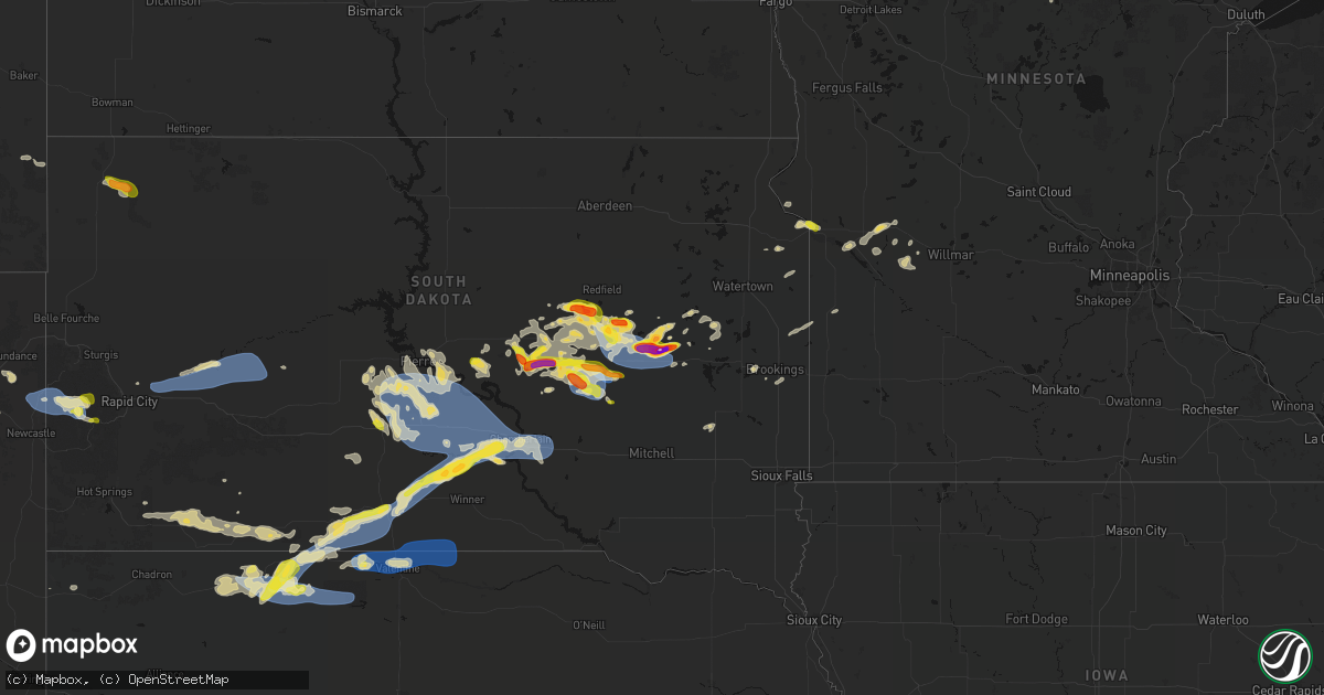
June 4 map
$229
one time, instant access
Download today. No call, no setup
Keep the $229
Bought the map and want the full workflow? Apply the entire $229 to a subscription within 7 days. None of it is wasted.
Every map, not just this one
This buys you this map. Subscription and you get every map we run, in the markets you choose from a few cities to whole states to nationwide. Plus real-time alerts the moment a storm fires.
Contact data
Name, contact info, occupancy, even credit band for addresses in the footprint. You go from where it hit to who to call.
Become the source they trust
Unlimited branding weather history reports on demand. You already have the documented answer ready for the property owner, and you are the one who showed up with it.
Property data and RoofTrace estimates
Pull up any address you have got, its value and the exact code rules for that jurisdiction, straight from One Click Code. Then RoofTrace estimates the squares, pitch, and roof value, priced the way you price.
States Impacted by Hail Map on June 4, 2026
Storm reports
Wyoming
| Date | Description |
|---|---|
| 06/04/20264:32 PM CDT | A local report indicates 1.25 inch wind near Pine Haven |
| 06/04/20264:05 PM CDT | [landspout] brief landspout spin-up with photo captured by emergency manager. |
Minnesota
| Date | Description |
|---|---|
| 06/03/20269:00 PM CDT | Size estimated from photos. |
| 06/03/20268:55 PM CDT | Relayed through the coop observer. Golf ball hail near the airport. Time estimated. |
| 06/03/20268:55 PM CDT | Awos station kvvv ortonville muni ap. |
| 06/03/20268:55 PM CDT | Delayed report: resident of ortonville submitted photos of approximately 1 inch hail. Time estimated. |
South Dakota
| Date | Description |
|---|---|
| 06/04/20266:59 PM CDT | A local report indicates 1.00 inch wind near 1 E Hill City |
| 06/04/20266:52 PM CDT | Report from mping: ping pong ball |
| 06/04/20266:50 PM CDT | A local report indicates 1.75 inch wind near 9 SE Tulare |
| 06/04/20266:28 PM CDT | Time estimated. |
| 06/04/20266:26 PM CDT | A local report indicates 1.00 inch wind near 3 SE Deerfield |
| 06/04/20266:25 PM CDT | Sent via social media picture. |
| 06/04/20262:50 PM CDT | A local report indicates 1.50 inch wind near 5 WSW Bancroft |
| 06/04/20262:47 PM CDT | A local report indicates 1.50 inch wind near 6 WSW Bancroft |
| 06/04/20262:39 PM CDT | Various hail size from golf ball to baseball via photo. |
| 06/04/20262:31 PM CDT | A local report indicates 2.00 inch wind near Yale |
| 06/03/202611:28 PM CDT | A local report indicates 62 MPH wind near 3 S Chamberlain |
| 06/03/202611:24 PM CDT | Mesonet station 54 reliance |
| 06/03/202611:05 PM CDT | Mesonet station 285 lower brule 14 w |
| 06/03/202610:45 PM CDT | Mesonet station vvms2 vivian 12s |
| 06/03/202610:36 PM CDT | Mesonet station 13 vivian |
| 06/03/202610:31 PM CDT | Mesonet station 13 vivian |
| 06/03/202610:15 PM CDT | Estimated 50mph wind gusts associated with numerous hailstones. |
| 06/03/202610:07 PM CDT | Report from mping: quarter |
| 06/03/20269:55 PM CDT | A local report indicates 72 MPH wind near 7 ESE Rosebud |
| 06/03/20269:53 PM CDT | Measured on private weather station. |
| 06/03/20269:31 PM CDT | Em report of quarter sized hail just north of lane... Sd. Timing confirmed with radar. |
| 06/03/20268:34 PM CDT | Mesonet station rhus2 danforth 5 e. Time estimated by radar. |
| 06/03/20268:00 PM CDT | A local report indicates 60 MPH wind near 2 E Elm Springs |
| 06/03/20267:55 PM CDT | A local report indicates 62 MPH wind near 2 E Elm Springs |
| 06/03/20267:51 PM CDT | A local report indicates 61 MPH wind near 3 NW Wasta |
| 06/03/20267:39 PM CDT | A local report indicates 1.00 inch wind near 10 S Wessington |
| 06/03/20267:33 PM CDT | Asos station khon huron regional airport. |
| 06/03/20267:31 PM CDT | Report from mping: quarter |
| 06/03/20267:27 PM CDT | Time estimated. Also came with brief 50 to 60 mph gusts. |
| 06/03/20267:04 PM CDT | Mesonet station 164 sd rwis wolsey. |
Missouri
| Date | Description |
|---|---|
| 06/04/20266:57 PM CDT | Social media report. Time estimated from radar. |
| 06/04/20266:57 PM CDT | Report relayed via em. |
| 06/04/20266:57 PM CDT | Law enforcement reported 50-60 mph wind gusts in king city. Report relayed by em. |
| 06/04/20266:49 PM CDT | Social media report of quarter size hail covering the ground and roads west of king city. Time estimated from radar. |
| 06/04/20266:18 PM CDT | A few reports of downed limbs and wires west of savannah. Time estimated from radar. |
| 06/04/20266:14 PM CDT | Private weather sensor. |
| 06/04/202612:52 AM CDT | A few reports of downed limbs and wires south of st. Joseph. Time estimated from radar. |
| 06/03/20269:25 PM CDT | Multiple reports of downed wires and power outages west of darlington. Time estimated from radar. |
| 06/03/20269:04 PM CDT | Downed wires and power outages near route uu. Time confirmed from radar. |
| 06/03/20267:40 PM CDT | Trees down and small sheds blown over. Report relayed by em. Time estimated by radar. |
| 06/03/20267:38 PM CDT | Several trees uprooted or snapped and a wooden power pole leaning. Time estimated by radar. |
| 06/03/20267:26 PM CDT | 2 ft diameter tree broken. Report relayed by em. Time estimated from radar. |
| 06/03/20267:05 PM CDT | Social media report. Trees down on queen street. Time estimated from radar. |
| 06/03/20267:02 PM CDT | Social media report. Time confirmed from radar. |
| 06/03/20267:02 PM CDT | Several trees downed near king city reservoir. Time estimated from radar. |
Texas
| Date | Description |
|---|---|
| 06/04/20266:45 PM CDT | Quarter size and slightly larger hail with the 1st wave... Then second wave was about dime sized. |
| 06/04/20261:27 PM CDT | First severe wind gust of 63 mph at 1:27 pm. Peak wind gust of 67 mph was measured at 1:30 pm. |
| 06/04/202612:46 PM CDT | Gusts of 58 to 65 mph from 12:38 to 12:48 pm. Measured by the west texas mesonet. |
Kansas
| Date | Description |
|---|---|
| 06/04/20264:57 PM CDT | Report of wind damage to homestead. Em was going to check out damage. |
| 06/04/20263:55 PM CDT | Tree limb down on power line causing down line. |
| 06/04/20263:12 PM CDT | Gusts estimated 50 to 60 mph. |
| 06/04/20262:59 PM CDT | Corrects previous tstm wnd dmg report from 4 wsw mulvane. Several large tree limbs down near 140th ave and hydraulic in mulvane. |
| 06/04/20262:59 PM CDT | Several large tree limbs down at 1016 e 140th ave in mulvane. |
| 06/04/20262:59 PM CDT | Report from facebook. Time estimated based on radar. |
| 06/04/20261:44 PM CDT | Storm chaser report on spotter network and on x with a picture and short video. Mainly over southwest portion of waconda lake. No damage reported. |
| 06/04/20261:05 PM CDT | 50 to 60 mph gusts. |
| 06/04/202612:46 PM CDT | Power poles down with lines down across i-235. I-235 closed both directions. 7000+ customers without power. Time estimated based on radar. Report from broadcast media a |
Nebraska
| Date | Description |
|---|---|
| 06/03/202610:57 PM CDT | A local report indicates 72 MPH wind near 4 NE Sparks |
| 06/03/202610:51 PM CDT | A local report indicates 66 MPH wind near 4 NE Sparks |
| 06/03/202610:35 PM CDT | A local report indicates 60 MPH wind near 1 NE Valentine |
| 06/03/202610:15 PM CDT | A local report indicates 71 MPH wind near 5 W Crookston |
| 06/03/20269:02 PM CDT | Corrects previous tstm wnd gst report from 6 wsw eli. |
| 06/03/20268:42 PM CDT | Corrects previous hail report from 7 s merriman. |
| 06/03/20268:02 PM CDT | A local report indicates 63 MPH wind near 6 WSW Eli |
| 06/03/20267:42 PM CDT | A local report indicates 1.00 inch wind near 7 S Merriman |
Cities Impacted by Hail Map on June 4, 2026
- Lake Arthur, NM
- Haddam, KS
- Morrowville, KS
- Mahaska, KS
- Lakeview, TX
- Washington, KS
- Wichita, KS
- Kechi, KS
- Wolsey, SD
- Burchard, NE
- Clarendon, TX
- Shamrock, TX
- Mclean, TX
- Solomon, KS
- Minneapolis, KS
- Manhattan, KS
- Olsburg, KS
- Seneca, KS
- Wheeler, TX
- Huron, SD
- Du Bois, NE
- Humboldt, NE
- Bryant, SD
- Lahoma, OK
- Helena, OK
- Yale, SD
- Cavour, SD
- Iroquois, SD
- Willow Lake, SD
- Canova, SD
- Mayfield, KS
- Argonia, KS
- Milan, KS
- Conway Springs, KS
- Wellington, KS
- Dawson, NE
- Forsyth, MT
- Carpenter, SD
- Erwin, SD
- Clearwater, KS
- Stella, NE
- Peck, KS
- Haysville, KS
- Lame Deer, MT
- Verdon, NE
- Council Grove, KS
- Mulvane, KS
- Belle Plaine, KS
- Ashland, MT
- Derby, KS
- Mcconnell Afb, KS
- Rose Hill, KS
- Andover, KS
- South Haven, KS
- Fort Stockton, TX
- Otter, MT
- Lake Preston, SD
- De Smet, SD
- Weston, WY
- Hulett, WY
- Moorcroft, WY
- Revillo, SD
- Strandburg, SD
- Labolt, SD
- Saint Marys, KS
- Delia, KS
- Havensville, KS
- Onaga, KS
- Soldier, KS
- Emmett, KS
- Picacho, NM
- Madison, MN
- Appleton, MN
- Stockholm, SD
- Twin Brooks, SD
- Brookings, SD
- Tinnie, NM
- Ekalaka, MT
- Clay Center, KS
- Green, KS
- Danvers, MN
- Volga, SD
- Toronto, SD
- Astoria, SD
- Devils Tower, WY
- Hope, KS
- Holloway, MN
- Benson, MN
- Van Horn, TX
- Brandt, SD
- Canby, MN
- Longford, KS
- Sundance, WY
- Milan, MN
- Porter, MN
- Salt Flat, TX
- Barnes, KS
- Randolph, KS
- Greenleaf, KS
- Waterville, KS
- Blue Rapids, KS
- Marysville, KS
- Bremen, KS
- Hanover, KS
- Upton, WY
- Wakefield, KS
- Gillette, WY
- Rozet, WY
- Oacoma, SD
- Frankfort, KS
- Home, KS
- Maynard, MN
- Montevideo, MN
- Murdock, MN
- Leonardville, KS
- Riley, KS
- Chamberlain, SD
- Horton, KS
- Clara City, MN
- Mule Creek, NM
- Kerkhoven, MN
- Highland, KS
- Troy, KS
- Buffalo, SD
- Reva, SD
- Miller, SD
- Tulare, SD
- Redfield, SD
- Rockham, SD
- Oregon, MO
- Sidney, NE
- Boyes, MT
- Newcastle, WY
- Hill City, SD
- Lead, SD
- Savannah, MO
- Amazonia, MO
- Ree Heights, SD
- Lodgepole, NE
- Dalton, NE
- Mason, TX
- Hitchcock, SD
- Oneida, KS
- Saint Lawrence, SD
- Harrison, NE
- Rea, MO
- Rosendale, MO
- Union Star, MO
- King City, MO
- Wessington, SD
- Hamill, SD
- Rapid City, SD
- Frankfort, SD
- Orient, SD
- McFall, MO
- Albany, MO
- Gregory, SD
- Piedmont, SD
- Virgil, SD
- Fluvanna, TX
- Vienna, SD
- Post, TX
- Douglas, WY
- Darlington, MO
- Saint George, KS
- New Underwood, SD
- Wamego, KS
- Justiceburg, TX
- Box Elder, SD
- Owanka, SD
- Wasta, SD
- Wall, SD
- Merriman, NE
- Alpena, SD
- Outing, MN
- Remer, MN
- Belvue, KS
- Philip, SD
- Milesville, SD
- Clinton, MN
- Rushville, NE
- Gordon, NE
- Mayetta, KS
- Santa Rosa, NM
- Wessington Springs, SD
- Big Stone City, SD
- Ortonville, MN
- Beardsley, MN
- Corona, SD
- Holton, KS
- Tuthill, SD
- Odessa, MN
- Gann Valley, SD
- Saint Francis, SD
- Martin, SD
- Cody, NE
- Highmore, SD
- Rosebud, SD
- Fort Pierre, SD
- Woonsocket, SD
- Hackensack, MN
- Walker, MN
- Murdo, SD
- Okaton, SD
- Circleville, KS
- Mission, SD
- Centralia, KS
- Parmelee, SD
- Pierre, SD
- Valentine, NE
- Draper, SD
- Wetmore, KS
- Wood, SD
- Kilgore, NE
- Nenzel, NE
- Longville, MN
- Crookston, NE
- Vivian, SD
- Winner, SD
- Harrold, SD
- Netawaka, KS
- Corning, KS
- Muleshoe, TX
- Ideal, SD
- Witten, SD
- Presho, SD
- Pine Ridge, SD
- Goff, KS
- Holabird, SD
- Bern, KS
- Whiting, KS
- Kennebec, SD
- Wounded Knee, SD
- Manderson, SD
- Reliance, SD
- Porcupine, SD
- Batesland, SD
- Sabetha, KS
- Pukwana, SD
- Baileyville, KS
- Platte, SD
- Kimball, SD
- Floodwood, MN
- Salem, NE
- Morrill, KS
- White River, SD
- Lower Brule, SD
- Okreek, SD
- Sparks, NE
- Helena, MO
- Amity, MO
- Springview, NE
- Cosby, MO