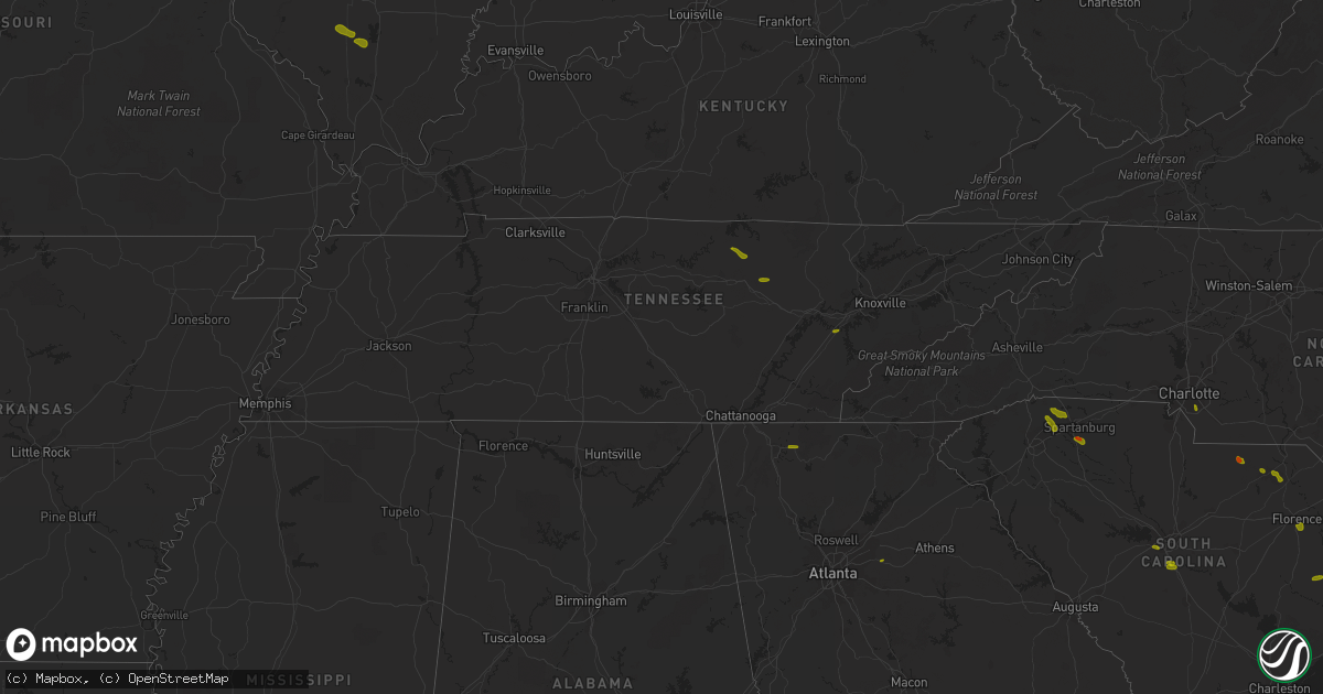
Hail Map in Tennessee on June 25, 2018
Get this storm
June 25 map
$229
one time, instant access
Download today. No call, no setup
Keep the $229
Bought the map and want the full workflow? Apply the entire $229 to a subscription within 7 days. None of it is wasted.
Every map, not just this one
This buys you this map. Subscription and you get every map we run, in the markets you choose from a few cities to whole states to nationwide. Plus real-time alerts the moment a storm fires.
Contact data
Name, contact info, occupancy, even credit band for addresses in the footprint. You go from where it hit to who to call.
Become the source they trust
Unlimited branding weather history reports on demand. You already have the documented answer ready for the property owner, and you are the one who showed up with it.
Property data and RoofTrace estimates
Pull up any address you have got, its value and the exact code rules for that jurisdiction, straight from One Click Code. Then RoofTrace estimates the squares, pitch, and roof value, priced the way you price.
Storm reports in Tennessee
Tennessee
| Date | Description |
|---|---|
| 06/25/20185:49 PM CDT | Overton sheriff's office reported a tree blown down on highway 85/hilham rd near livingston. Dime size hail also reported with the same storm. |
| 06/25/20181:26 PM CDT | Numerous trees were reported down in madisonville. |
| 06/25/20181:15 PM CDT | Trees were reported down two miles south of chestnut hill. |
| 06/25/20181:10 PM CDT | Numerous trees and power lines were reported down... And there was a partial collapse of a building near the intersection of old washington highway and shipley lane two |
| 06/25/20181:09 PM CDT | Trees were reported down in oneida. |
| 06/25/20181:00 PM CDT | Trees were reported down in oneida. |
| 06/25/201812:55 PM CDT | Numerous trees were reported down with many homes damaged by falling limbs. One home was destroyed by the combination of falling trees and limbs. |
| 06/25/201812:30 PM CDT | Trees and power lines were reported down in the eastern part of knoxville. |
| 06/25/201812:25 PM CDT | Two trees were reported down five miles northeast of philadelphia. |
| 06/25/201812:15 PM CDT | A local report indicates 1.00 inch wind near LOUDON |
| 06/25/201810:40 AM CDT | A few trees down. |
| 06/25/20187:31 AM CDT | At 1231 PM EDT, a severe thunderstorm was located near Fairview, or 7 miles west of Loudon, moving east at 20 mph. HAZARD...60 mph wind gusts and quarter size hail. SOURCE...Radar indicated. IMPACT...Hail damage to vehicles is expected. Expect wind damage to roofs, siding, and trees. Locations impacted include... Oak Ridge, Lenoir City, Kingston, Rockwood, Loudon, Fairview, Midtown, Harriman, Philadelphia, Paint Rock, Bradbury and Tellico Village. |
| 06/25/20186:27 AM CDT | At 1127 AM EDT/1027 AM CDT/, a severe thunderstorm was located 9 miles west of Spring City, or 12 miles northeast of Pikeville, moving east at 15 mph. HAZARD...60 mph wind gusts and quarter size hail. SOURCE...Radar indicated. IMPACT...Hail damage to vehicles is expected. Expect wind damage to roofs, siding, and trees. Locations impacted include... Spring City, Grandview, Piney Falls State Park, Melvine and Stinging Fork Falls State Park. |
| 06/25/20181:32 AM CDT | At 632 PM CDT, a severe thunderstorm was located 8 miles east of Monterey, or 11 miles north of Crossville, moving east at 25 mph. HAZARD...60 mph wind gusts and quarter size hail. SOURCE...Radar indicated. IMPACT...Hail damage to vehicles is expected. Expect wind damage to roofs, siding, and trees. Locations impacted include... Crossville, Fairfield Glade, Slate Springs and Clarkrange. This includes Interstate 40 between mile markers 308 and 318. |
| 06/25/201812:51 AM CDT | At 551 PM CDT, a severe thunderstorm was located near Livingston, moving southeast at 20 mph. HAZARD...60 mph wind gusts and quarter size hail. SOURCE...Radar indicated. IMPACT...Hail damage to vehicles is expected. Expect wind damage to roofs, siding, and trees. Locations impacted include... Livingston. |
| 06/24/201811:13 PM CDT | At 413 PM EDT, a severe thunderstorm was located over Rominger, moving east at 30 mph. HAZARD...60 mph wind gusts and quarter size hail. SOURCE...Radar indicated. IMPACT...Hail damage to vehicles is expected. Expect wind damage to roofs, siding, and trees. Locations impacted include... Boone... Blowing Rock... Beech Mountain... Foscoe... and Sugar Grove.This includes The following Location Appalachian State University. |
| 06/24/201811:00 PM CDT | At 359 PM EDT, severe thunderstorms were located along a line extending from 4 miles north of Beech Mountain to 11 miles northwest of Marion to 6 miles south of Marshall, moving east at 35 mph. HAZARD...60 mph wind gusts and quarter size hail. SOURCE...Radar indicated. IMPACT...Minor hail damage to vehicles is expected. Expect wind damage to trees and power lines. Locations impacted include... Downtown Asheville, Marion, Spruce Pine, Burnsville, Newland, East Asheville, West Asheville, North Asheville, Black Mountain and Woodfin. |
| 06/24/201810:45 PM CDT | At 345 PM EDT, severe thunderstorms were located along a line extending from 5 miles south of Bryson City to 4 miles southwest of Hayesville, moving east at 15 mph. HAZARD...60 mph wind gusts and quarter size hail. SOURCE...Radar indicated. IMPACT...Minor hail damage to vehicles is expected. Expect wind damage to trees and power lines. Locations impacted include... Franklin, Bryson City, Robbinsville, Cherokee, Town Of Santeetlah, Smoky Mountains-Newfound Gap, Smoky Mountains-Fontana Area, Lake Santeetlah, Fontana Lake and Nantahala Lake. |
| 06/24/20189:02 PM CDT | At 201 PM EDT, severe thunderstorms were located along a line extending from near Rockcastle Springs to near Zion Hill, moving east at 45 mph. HAZARD...60 mph wind gusts. SOURCE...Radar indicated. IMPACT...Expect damage to roofs, siding, and trees. Locations impacted include... Williamsburg, Barbourville, Pineville, Middlesboro, Fariston, Brightshade, Varilla, Swan Lake, Cumberland Falls S.P., Goose Rock, Mount Victory and Bush. |
| 06/24/20188:55 PM CDT | At 155 PM EDT, severe thunderstorms were located along a line extending from 6 miles west of Rockwood to near Decatur to near Dayton, moving east at 35 mph. HAZARD...60 mph wind gusts and penny size hail. SOURCE...Radar indicated. IMPACT...Expect damage to roofs, siding, and trees. Locations impacted include... Athens, Lenoir City, Dayton, Kingston, Sweetwater, Rockwood, Loudon, Madisonville, Decatur, Farragut, Fairview, Etowah, Spring City, Midtown, Englewood, Graysville, Vonore, Greenback, Friendsville and Tellico Plains. |
| 06/24/20188:45 PM CDT | At 145 PM EDT, a severe thunderstorm was located near Sevierville, moving east at 35 mph. HAZARD...60 mph wind gusts and penny size hail. SOURCE...Radar indicated. IMPACT...Expect damage to roofs, siding, and trees. Locations impacted include... Knoxville, Maryville, Sevierville, Alcoa, Jefferson City, Newport, Gatlinburg, Dandridge, Pigeon Forge, New Market, Rockford, Baneberry, Parrottsville, Eagleton Village, Strawberry Plains, Greenback, Pittman Center, Townsend, Del Rio and Walland. |
| 06/24/20188:05 PM CDT | At 105 PM EDT, a severe thunderstorm was located over Loudon, moving east at 25 mph. HAZARD...60 mph wind gusts and quarter size hail. SOURCE...Radar indicated. IMPACT...Hail damage to vehicles is expected. Expect wind damage to roofs, siding, and trees. Locations impacted include... Maryville, Lenoir City, Alcoa, Loudon, Louisville, Rockford, Eagleton Village, Vonore, Greenback, Friendsville, Philadelphia, Happy Valley, Clover Hill and Tellico Village. |
| 06/24/20188:01 PM CDT | At 101 PM EDT, a severe thunderstorm was located near Farragut, or 8 miles east of Oak Ridge, moving east at 30 mph. HAZARD...60 mph wind gusts and quarter size hail. SOURCE...Radar indicated. IMPACT...Hail damage to vehicles is expected. Expect wind damage to roofs, siding, and trees. Locations impacted include... Knoxville, Oak Ridge, Sevierville, Alcoa, Farragut, Louisville, Rockford, Karns, Kimberlin Heights, McMahan, Lake Forest, Bearden, Powell, Seymour, Kodak and Mascot. |
All States Impacted by Hail Map on June 25, 2018
Cities Impacted by Hail Map on June 25, 2018
- New Florence, MO
- Montgomery City, MO
- Rhineland, MO
- Portland, MO
- Marthasville, MO
- Du Quoin, IL
- Tamaroa, IL
- Pinckneyville, IL
- Mulkeytown, IL
- Sesser, IL
- Benton, IL
- Christopher, IL
- Campobello, SC
- Wellford, SC
- Inman, SC
- Landrum, SC
- Society Hill, SC
- Patrick, SC
- Effingham, SC
- Florence, SC
- Mount Croghan, SC
- Jefferson, SC
- Pageland, SC
- Greer, SC
- Duncan, SC
- Lyman, SC
- Hemingway, SC
- Nesmith, SC
- Kingstree, SC
- Pauline, SC
- Roebuck, SC
- Spartanburg, SC
- Gaston, SC
- Swansea, SC
- West Columbia, SC
- Lexington, SC
- Raeford, NC
- Lumber Bridge, NC
- Fayetteville, NC
- Aberdeen, NC
- Fort Bragg, NC
- Maxton, NC
- Clarkton, NC
- Whiteville, NC
- Chadbourn, NC
- Clarendon, NC
- Tabor City, NC
- Leland, NC
- Charlotte, NC
- Highwood, MT
- Geraldine, MT
- Geyser, MT
- Loudon, TN
- Livingston, TN
- Rickman, TN
- Monterey, TN
- Crossville, TN
- Chatsworth, GA
- Loganville, GA
- Ferguson, NC
- Hope Mills, NC
- Belvidere, TN
- Fitzgerald, GA
- Rhine, GA
- Strafford, MO
- Springfield, MO
- Fair Grove, MO
- Surrency, GA
- Bristol, GA
- Pooler, GA
- Savannah, GA
- Pitts, GA
- Mountain Home, AR
- Oakland, AR
- Philadelphia, TN
- Leicester, NC
- Eastover, SC
- Clarkesville, GA
- Moore, SC
- Lake Waccamaw, NC
- Hallsboro, NC
- Tignall, GA
- Fairmont, NC
- Orrum, NC
- Dobson, NC
- Elkin, NC
- Carlyle, IL
- Midway, AL
- Statesboro, GA
- Hardaway, AL
- Breese, IL
- Bishopville, SC
- Hartsville, SC
- Eva, AL
- Falkville, AL
- Lenoir, NC
- Morganton, NC
- Mullins, SC
- Marion, SC
- East Dublin, GA
- Dublin, GA
- Johnsonville, SC
- Roanoke, AL
- Columbia, IL
- Saluda, NC
- Mill Spring, NC
- Ten Mile, TN
- Lancaster, SC
- Waxhaw, NC
- Fort Mill, SC
- Tuskegee, AL
- Kershaw, SC
- Round O, SC
- Blackstock, SC
- Pembroke, GA
- Scranton, SC
- Timmonsville, SC
- Olanta, SC
- Brooklet, GA
- Burnsville, NC
- Spruce Pine, NC
- Fort Shaw, MT
- Sainte Genevieve, MO
- Harrison, GA
- Davisboro, GA
- Franklin, NC
- Washington, GA
- Carlton, GA
- New Zion, SC
- Hopkins, SC
- Saint Matthews, SC
- North, SC
- Bonne Terre, MO
- Catlin, IL
- Fairmount, IL
- Appling, GA
- Eastman, GA
- Cabool, MO
- Belt, MT
- De Soto, MO
- Valles Mines, MO
- South Greenfield, MO
- Everton, MO
- Green Mountain, NC
- Wallace, SC
- Cheraw, SC
- Chesterfield, SC
- Sunbright, TN
- Science Hill, KY
- Preston, GA
- Richland, GA
- Adrian, GA
- Taylors, SC
- O'Brien, FL
- Branford, FL
- Nicholls, GA
- Lynchburg, SC
- Georgetown, SC
- Richburg, SC
- Grovespring, MO
- Grovetown, GA
- Harlem, GA
- Dayton, TN
- Darlington, SC
- Adams Run, SC
- Power, MT
- Sun River, MT
- Vaughn, MT
- Laurinburg, NC
- Stoutland, MO
- Richland, MO
- Lebanon, MO
- Boaz, AL
- Albertville, AL
- Ash, NC
- Gadsden, SC
- Summerville, SC
- Carrollton, GA
- Marshfield, MO
- Solo, MO
- Mountain Grove, MO
- Woodruff, SC
- Great Falls, SC
- Holly Ridge, NC
- McBee, SC
- Abbeville, GA
- Rochelle, GA
- Cordele, GA
- Arabi, GA
- Whitesburg, GA
- Marissa, IL
- Lenzburg, IL
- New Athens, IL
- Claxton, GA
- Register, GA
- Coulterville, IL
- Lyons, GA
- Collins, GA
- Danville, IL
- Oakwood, IL
- Westville, IL
- Buckner, IL
- Nashville, IL
- Gresham, SC
- Lula, GA
- Wetumpka, AL
- Port Wentworth, GA
- Goose Creek, SC
- Damascus, GA
- Etowah, TN
- La Fayette, GA
- Guntersville, AL
- Keysville, GA
- Louisville, GA
- Waynesboro, GA
- Wrens, GA
- Licking, MO
- Mayesville, SC
- Cascade, MT
- Bennettsville, SC
- Evensville, TN
- Linn, MO
- Bonnots Mill, MO
- Steedman, MO
- Blackwell, MO
- Park Hills, MO
- Irondale, MO
- Festus, MO
- French Village, MO
- Mineral Point, MO
- Cadet, MO
- Belgrade, MO
- Potosi, MO
- Bixby, MO
- Belleview, MO
- Half Way, MO
- Athens, TN
- Riceville, TN
- Ellington, MO
- Somerset, KY
- Bucyrus, MO
- Seymour, TN
- Marion, NC
- Old Fort, NC
- Hickory Grove, SC
- Chester, SC
- Winnsboro, SC
- Dalton, GA
- Anniston, AL
- Jacksonville, AL
- Cottageville, SC
- Heflin, AL
- Fruithurst, AL
- Roswell, GA
- Rome, GA
- Wadley, AL
- Ellaville, GA
- Salem, AL
- Opelika, AL
- Cusseta, AL
- Valley, AL
- Fort Stewart, GA
- Hamilton, GA
- Cataula, GA
- Moultrie, GA
- Pavo, GA
- Houston, TX
- Berlin, GA
- Trenton, IL
- Pocahontas, IL
- Highland, IL
- Aviston, IL
- Crocker, MO
- Vienna, MO
- Newburg, MO
- Keyesport, IL
- Beckemeyer, IL
- Caledonia, MO
- Conway, MO
- Phillipsburg, MO
- Miller, MO
- Walnut Grove, MO
- Lockwood, MO
- Greenfield, MO
- Elkland, MO
- Bolivar, MO
- Bois D Arc, MO
- Mount Vernon, MO
- Republic, MO
- Ash Grove, MO
- Marionville, MO
- Willard, MO
- Brighton, MO
- Pleasant Hope, MO
- Billings, MO
- Halltown, MO
- Buffalo, MO
- Pomona, MO
- West Plains, MO
- Seymour, MO
- Sweetwater, TN
- Niota, TN
- Stanford, KY
- Asheville, NC
- Ruby, SC
- Resaca, GA
- Horton, AL
- Calhoun, GA
- Lamar, SC
- Elizabethtown, NC
- Kingston, GA
- Sumter, SC
- Elliott, SC
- Rockmart, GA
- Coward, SC
- Turbeville, SC
- Islandton, SC
- Oglethorpe, GA
- Ridgeville, SC
- Tyrone, GA
- Union City, GA
- Palmetto, GA
- Douglasville, GA
- Fairburn, GA
- Atlanta, GA
- Green Pond, SC
- Yemassee, SC
- Union Springs, AL
- Fort Davis, AL
- Rincon, GA
- Guyton, GA
- Ashburn, GA
- Casey, IL
- Stotts City, MO
- Sarcoxie, MO
- Pierce City, MO
- Wentworth, MO
- Rolla, MO
- Bismarck, MO
- Farmington, MO
- Koeltztown, MO
- Argyle, MO
- Freeburg, MO
- Boss, MO
- Salem, MO
- Plato, MO
- Henderson, AR
- New Haven, MO
- Edgar Springs, MO
- Graff, MO
- Tellico Plains, TN
- Vonore, TN
- State Road, NC
- Madisonville, TN
- Rutherfordton, NC
- Lake Lure, NC
- Gillsville, GA
- Blenheim, SC
- Gaylesville, AL
- Brookwood, AL
- Andersonville, GA
- Ravenel, SC
- Ladson, SC
- Chamois, MO
- Sparta, IL
- Urbana, IL
- Saint Joseph, IL
- Fenton, MO
- Eureka, MO
- High Ridge, MO
- Black, MO
- Gravel Switch, KY
- Robbins, TN
- Midway, AR
- Gassville, AR
- Flippin, AR
- Hartville, MO
- Mills River, NC
- Horse Shoe, NC
- Travelers Rest, SC
- Sherwood, TN
- Jonesville, SC
- Evergreen, NC
- Ellijay, GA
- Talking Rock, GA
- Valhermoso Springs, AL
- Laceys Spring, AL
- Lumberton, NC
- Lake City, SC
- Gray, GA
- Macon, GA
- Andrews, SC
- Cades, SC
- Auburn, AL
- Tallassee, AL
- Americus, GA
- Reynolds, GA
- Cuthbert, GA
- Odum, GA
- Lenox, GA
- Marianna, FL
- Millwood, GA
- Oakdale, IL
- Dixon, MO
- Jerome, MO
- Long Lane, MO
- Success, MO
- Valdese, NC
- Whitesburg, KY
- Decatur, TN
- Bryant, AL
- Bryson City, NC
- Ranger, GA
- Chickamauga, GA
- Menlo, GA
- Arab, AL
- Sellers, SC
- Buchanan, GA
- Tucker, GA
- Decatur, GA
- Bartow, GA
- Woodland, AL
- Wedowee, AL
- Williston, SC
- Windsor, SC
- Reidsville, GA
- Notasulga, AL
- Eufaula, AL
- Clinton, MO
- Urich, MO
- Iberia, MO
- Clinton, IL
- Foley, MO
- Saint Louis, MO
- Windyville, MO
- Prairie Du Rocher, IL
- Nancy, KY
- Crawford, TN
- Rock Island, TN
- Laurel Hill, NC
- Marston, NC
- Red Springs, NC
- Hamlet, NC
- Pacolet, SC
- Rocky Face, GA
- Rocky Point, NC
- Galivants Ferry, SC
- Ohatchee, AL
- Matthews, GA
- Bowdon, GA
- Jacksonboro, SC
- Walterboro, SC
- Forsyth, GA
- Culloden, GA
- Altha, FL
- Hardeeville, SC
- Plains, GA
- Coolidge, GA
- Tilton, IL
- Augusta, MO
- Vichy, MO
- Red Bud, IL
- Bloomsdale, MO
- Bunker, MO
- Davisville, MO
- Aldrich, MO
- Dadeville, MO
- Annapolis, MO
- Ironton, MO
- Piedmont, MO
- Coeburn, VA
- Parkers Lake, KY
- Elk Creek, MO
- Houston, MO
- Millers Creek, NC
- North Wilkesboro, NC
- Allons, TN
- Hilham, TN
- Taylorsville, NC
- Kingston, TN
- Hoffman, NC
- Wagram, NC
- Fountain Inn, SC
- Simpsonville, SC
- Crandall, GA
- Old Fort, TN
- Heath Springs, SC
- Valley Head, AL
- Mentone, AL
- Sugar Valley, GA
- Bolton, NC
- Gainesville, GA
- Dallas, GA
- Loris, SC
- Acworth, GA
- Columbia, SC
- Orangeburg, SC
- Salley, SC
- Wedgefield, SC
- Manning, SC
- Snellville, GA
- Newnan, GA
- Munford, AL
- Musella, GA
- Grand Ridge, FL
- Loxley, AL
- Georgetown, FL
- Belle, MO
- Westphalia, MO
- Meta, MO
- Steelville, MO
- Knoxville, TN
- Niangua, MO
- Murphy, NC
- Robbinsville, NC
- Tiger, GA
- Pamplico, SC
- Bethune, SC
- Burgaw, NC
- Alcolu, SC
- Tallapoosa, GA
- Weaver, AL
- Covington, GA
- Social Circle, GA
- Pawleys Island, SC
- Hollywood, SC
- Eclectic, AL
- Ideal, GA
- Trenton, FL
- Ochlocknee, GA
- Fitzpatrick, AL
- Buena Vista, GA
- Simms, MT
- West Frankfort, IL
- Mcminnville, TN
- Union Mills, NC
- Ellsinore, MO
- Ocoee, TN
- Marietta, SC
- Cleveland, SC
- Cameron, NC
- Vass, NC
- Wilmington, NC
- Currie, NC
- Fyffe, AL
- Green Sea, SC
- Norcross, GA
- Peachtree Corners, GA
- Wrightsville, GA
- Chester, GA
- Cochran, GA
- Hurtsboro, AL
- Alma, GA
- Cutler, IL
- Scheller, IL
- Monett, MO
- Gibson, NC
- Hendersonville, NC
- Columbus, NC
- Eldridge, MO
- Camdenton, MO
- Tamassee, SC
- Council, NC
- Bladenboro, NC
- Conway, SC
- Huntsville, AL


