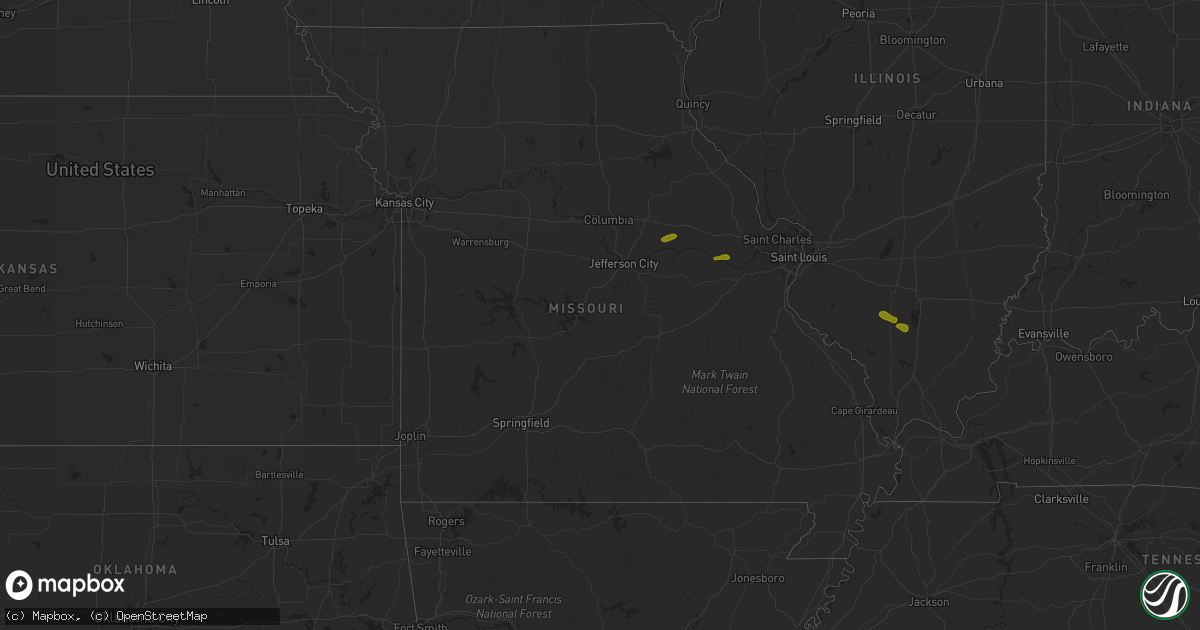
Hail Map in Missouri on June 25, 2018
Get this storm
June 25 map
$229
one time, instant access
Download today. No call, no setup
Keep the $229
Bought the map and want the full workflow? Apply the entire $229 to a subscription within 7 days. None of it is wasted.
Every map, not just this one
This buys you this map. Subscription and you get every map we run, in the markets you choose from a few cities to whole states to nationwide. Plus real-time alerts the moment a storm fires.
Contact data
Name, contact info, occupancy, even credit band for addresses in the footprint. You go from where it hit to who to call.
Become the source they trust
Unlimited branding weather history reports on demand. You already have the documented answer ready for the property owner, and you are the one who showed up with it.
Property data and RoofTrace estimates
Pull up any address you have got, its value and the exact code rules for that jurisdiction, straight from One Click Code. Then RoofTrace estimates the squares, pitch, and roof value, priced the way you price.
Storm reports in Missouri
Missouri
| Date | Description |
|---|---|
| 06/25/20186:58 PM CDT | Photo of 1.25 inch hail from public via social media. Time estimated from radar. |
| 06/25/20185:45 AM CDT | At 1045 PM CDT, a severe thunderstorm was located over Fawn Park, or near Mountain Home, moving northeast at 25 mph. HAZARD...60 mph wind gusts and quarter size hail. SOURCE...Radar indicated. IMPACT...Hail damage to vehicles is expected. Expect wind damage to roofs, siding, and trees. Locations impacted include... Mountain Home... Lakeview in Baxter County... Arkawana... Ott... Ozark Regional Airport... Gamaliel Landing... Fawn Park... Midway in Baxter County... Vidette... Clarkridge... Gamaliel... Three Brothers... Henderson... Norfork Lake... |
| 06/25/20185:05 AM CDT | At 1005 PM CDT, a severe thunderstorm was located near Price Place, or near Bull Shoals, moving east at 20 mph. HAZARD...60 mph wind gusts and quarter size hail. SOURCE...Radar indicated. IMPACT...Hail damage to vehicles is expected. Expect wind damage to roofs, siding, and trees. Locations impacted include... Bull Shoals... Lakeview in Baxter County... Arkawana... Price Place... Gamaliel Landing... Ozark Isle... Fawn Park... Bull Shoals State Park... Ozark Regional Airport... Midway in Baxter County... Clarkridge... Gamaliel... Oakland... Three Brothers... Norfork Lake... Bull Shoals Lake... |
| 06/25/20185:02 AM CDT | At 1002 PM CDT, a severe thunderstorm was located near Gainesville, or 14 miles northeast of Bull Shoals, moving northeast at 50 mph. HAZARD...60 mph wind gusts and quarter size hail. SOURCE...Radar indicated. IMPACT...Hail damage to vehicles is expected. Expect wind damage to roofs, siding, and trees. Locations impacted include... Bull Shoals Lake... Norfork Lake... Gainesville... Bakersfield... Pontiac... Hardenville... Brixey... Sycamore... Tecumseh... Dora... Zanoni... Udall... |
| 06/25/20183:50 AM CDT | 4 inch limbs down. |
| 06/25/20183:30 AM CDT | Public reported several trees uprooted around the fellows lake. |
| 06/25/20182:48 AM CDT | At 748 PM CDT, a severe thunderstorm was located over Oakville, moving east at 15 mph. HAZARD...Quarter size hail. SOURCE...Radar indicated. IMPACT...Damage to vehicles is expected. Locations impacted include... Columbia, Dupo, Millstadt, Oakville, Mehlville and New Hanover. |
| 06/25/20182:12 AM CDT | At 712 PM CDT, a severe thunderstorm was located near Augusta, moving east at 30 mph. HAZARD...60 mph wind gusts and quarter size hail. SOURCE...Radar indicated. IMPACT...Hail damage to vehicles is expected. Expect wind damage to roofs, siding, and trees. Locations impacted include... Chesterfield, Wildwood, Spirit of St. Louis Airport, Augusta, Defiance and Matson.This also includes Babler Memorial State Park. |
| 06/25/20182:04 AM CDT | At 704 PM CDT, a severe thunderstorm was located over Westwood, moving east at 15 mph. HAZARD...60 mph wind gusts and half dollar size hail. SOURCE...Radar indicated. IMPACT...Hail damage to vehicles is expected. Expect wind damage to roofs, siding, and trees. Locations impacted include... St. Louis, Chesterfield, University City, Maryland Heights, Creve Coeur, Overland, Clayton, Jennings, Town and Country, Richmond Heights, Ladue, Brentwood, Maplewood, Olivette, St. John, Normandy, Northwoods, Frontenac, Bel-Ridge and Hillsdale. |
| 06/25/20182:00 AM CDT | Four trees snapped. |
| 06/25/20181:52 AM CDT | Time estimated by radar. |
| 06/25/20181:48 AM CDT | At 648 PM CDT, a severe thunderstorm was located over Treloar, moving east at 15 mph. HAZARD...Ping pong ball size hail and 60 mph wind gusts. SOURCE...Radar indicated. IMPACT...People and animals outdoors will be injured. Expect hail damage to roofs, siding, windows, and vehicles. Expect wind damage to roofs, siding, and trees. Locations impacted include... Washington, New Haven, Marthasville, Treloar, Dutzow and Holstein. |
| 06/25/20181:13 AM CDT | At 613 PM CDT, a severe thunderstorm was located near Hermann, moving east at 15 mph. HAZARD...60 mph wind gusts and quarter size hail. SOURCE...Radar indicated. IMPACT...Hail damage to vehicles is expected. Expect wind damage to roofs, siding, and trees. Locations impacted include... Hermann, Big Spring, Treloar, Berger, Rhineland and McKittrick. This also includes Deutschheim Historic Site. |
| 06/25/201812:09 AM CDT | At 509 PM CDT, a severe thunderstorm was located 8 miles northeast of Chamois, moving northeast at 15 mph. HAZARD...60 mph wind gusts and quarter size hail. SOURCE...Radar indicated. IMPACT...Hail damage to vehicles is expected. Expect wind damage to roofs, siding, and trees. Locations impacted include... Montgomery City, New Florence, Mineola, Big Spring, Rhineland, McKittrick, Danville, Portland, Americus and Reform.This includes Interstate 70 in Missouri between exits 170 and 175. This also includes Graham Cave State Park. |
All States Impacted by Hail Map on June 25, 2018
Cities Impacted by Hail Map on June 25, 2018
- New Florence, MO
- Montgomery City, MO
- Rhineland, MO
- Portland, MO
- Marthasville, MO
- Du Quoin, IL
- Tamaroa, IL
- Pinckneyville, IL
- Mulkeytown, IL
- Sesser, IL
- Benton, IL
- Christopher, IL
- Campobello, SC
- Wellford, SC
- Inman, SC
- Landrum, SC
- Society Hill, SC
- Patrick, SC
- Effingham, SC
- Florence, SC
- Mount Croghan, SC
- Jefferson, SC
- Pageland, SC
- Greer, SC
- Duncan, SC
- Lyman, SC
- Hemingway, SC
- Nesmith, SC
- Kingstree, SC
- Pauline, SC
- Roebuck, SC
- Spartanburg, SC
- Gaston, SC
- Swansea, SC
- West Columbia, SC
- Lexington, SC
- Raeford, NC
- Lumber Bridge, NC
- Fayetteville, NC
- Aberdeen, NC
- Fort Bragg, NC
- Maxton, NC
- Clarkton, NC
- Whiteville, NC
- Chadbourn, NC
- Clarendon, NC
- Tabor City, NC
- Leland, NC
- Charlotte, NC
- Highwood, MT
- Geraldine, MT
- Geyser, MT
- Loudon, TN
- Livingston, TN
- Rickman, TN
- Monterey, TN
- Crossville, TN
- Chatsworth, GA
- Loganville, GA
- Ferguson, NC
- Hope Mills, NC
- Belvidere, TN
- Fitzgerald, GA
- Rhine, GA
- Strafford, MO
- Springfield, MO
- Fair Grove, MO
- Surrency, GA
- Bristol, GA
- Pooler, GA
- Savannah, GA
- Pitts, GA
- Mountain Home, AR
- Oakland, AR
- Philadelphia, TN
- Leicester, NC
- Eastover, SC
- Clarkesville, GA
- Moore, SC
- Lake Waccamaw, NC
- Hallsboro, NC
- Tignall, GA
- Fairmont, NC
- Orrum, NC
- Dobson, NC
- Elkin, NC
- Carlyle, IL
- Midway, AL
- Statesboro, GA
- Hardaway, AL
- Breese, IL
- Bishopville, SC
- Hartsville, SC
- Eva, AL
- Falkville, AL
- Lenoir, NC
- Morganton, NC
- Mullins, SC
- Marion, SC
- East Dublin, GA
- Dublin, GA
- Johnsonville, SC
- Roanoke, AL
- Columbia, IL
- Saluda, NC
- Mill Spring, NC
- Ten Mile, TN
- Lancaster, SC
- Waxhaw, NC
- Fort Mill, SC
- Tuskegee, AL
- Kershaw, SC
- Round O, SC
- Blackstock, SC
- Pembroke, GA
- Scranton, SC
- Timmonsville, SC
- Olanta, SC
- Brooklet, GA
- Burnsville, NC
- Spruce Pine, NC
- Fort Shaw, MT
- Sainte Genevieve, MO
- Harrison, GA
- Davisboro, GA
- Franklin, NC
- Washington, GA
- Carlton, GA
- New Zion, SC
- Hopkins, SC
- Saint Matthews, SC
- North, SC
- Bonne Terre, MO
- Catlin, IL
- Fairmount, IL
- Appling, GA
- Eastman, GA
- Cabool, MO
- Belt, MT
- De Soto, MO
- Valles Mines, MO
- South Greenfield, MO
- Everton, MO
- Green Mountain, NC
- Wallace, SC
- Cheraw, SC
- Chesterfield, SC
- Sunbright, TN
- Science Hill, KY
- Preston, GA
- Richland, GA
- Adrian, GA
- Taylors, SC
- O'Brien, FL
- Branford, FL
- Nicholls, GA
- Lynchburg, SC
- Georgetown, SC
- Richburg, SC
- Grovespring, MO
- Grovetown, GA
- Harlem, GA
- Dayton, TN
- Darlington, SC
- Adams Run, SC
- Power, MT
- Sun River, MT
- Vaughn, MT
- Laurinburg, NC
- Stoutland, MO
- Richland, MO
- Lebanon, MO
- Boaz, AL
- Albertville, AL
- Ash, NC
- Gadsden, SC
- Summerville, SC
- Carrollton, GA
- Marshfield, MO
- Solo, MO
- Mountain Grove, MO
- Woodruff, SC
- Great Falls, SC
- Holly Ridge, NC
- McBee, SC
- Abbeville, GA
- Rochelle, GA
- Cordele, GA
- Arabi, GA
- Whitesburg, GA
- Marissa, IL
- Lenzburg, IL
- New Athens, IL
- Claxton, GA
- Register, GA
- Coulterville, IL
- Lyons, GA
- Collins, GA
- Danville, IL
- Oakwood, IL
- Westville, IL
- Buckner, IL
- Nashville, IL
- Gresham, SC
- Lula, GA
- Wetumpka, AL
- Port Wentworth, GA
- Goose Creek, SC
- Damascus, GA
- Etowah, TN
- La Fayette, GA
- Guntersville, AL
- Keysville, GA
- Louisville, GA
- Waynesboro, GA
- Wrens, GA
- Licking, MO
- Mayesville, SC
- Cascade, MT
- Bennettsville, SC
- Evensville, TN
- Linn, MO
- Bonnots Mill, MO
- Steedman, MO
- Blackwell, MO
- Park Hills, MO
- Irondale, MO
- Festus, MO
- French Village, MO
- Mineral Point, MO
- Cadet, MO
- Belgrade, MO
- Potosi, MO
- Bixby, MO
- Belleview, MO
- Half Way, MO
- Athens, TN
- Riceville, TN
- Ellington, MO
- Somerset, KY
- Bucyrus, MO
- Seymour, TN
- Marion, NC
- Old Fort, NC
- Hickory Grove, SC
- Chester, SC
- Winnsboro, SC
- Dalton, GA
- Anniston, AL
- Jacksonville, AL
- Cottageville, SC
- Heflin, AL
- Fruithurst, AL
- Roswell, GA
- Rome, GA
- Wadley, AL
- Ellaville, GA
- Salem, AL
- Opelika, AL
- Cusseta, AL
- Valley, AL
- Fort Stewart, GA
- Hamilton, GA
- Cataula, GA
- Moultrie, GA
- Pavo, GA
- Houston, TX
- Berlin, GA
- Trenton, IL
- Pocahontas, IL
- Highland, IL
- Aviston, IL
- Crocker, MO
- Vienna, MO
- Newburg, MO
- Keyesport, IL
- Beckemeyer, IL
- Caledonia, MO
- Conway, MO
- Phillipsburg, MO
- Miller, MO
- Walnut Grove, MO
- Lockwood, MO
- Greenfield, MO
- Elkland, MO
- Bolivar, MO
- Bois D Arc, MO
- Mount Vernon, MO
- Republic, MO
- Ash Grove, MO
- Marionville, MO
- Willard, MO
- Brighton, MO
- Pleasant Hope, MO
- Billings, MO
- Halltown, MO
- Buffalo, MO
- Pomona, MO
- West Plains, MO
- Seymour, MO
- Sweetwater, TN
- Niota, TN
- Stanford, KY
- Asheville, NC
- Ruby, SC
- Resaca, GA
- Horton, AL
- Calhoun, GA
- Lamar, SC
- Elizabethtown, NC
- Kingston, GA
- Sumter, SC
- Elliott, SC
- Rockmart, GA
- Coward, SC
- Turbeville, SC
- Islandton, SC
- Oglethorpe, GA
- Ridgeville, SC
- Tyrone, GA
- Union City, GA
- Palmetto, GA
- Douglasville, GA
- Fairburn, GA
- Atlanta, GA
- Green Pond, SC
- Yemassee, SC
- Union Springs, AL
- Fort Davis, AL
- Rincon, GA
- Guyton, GA
- Ashburn, GA
- Casey, IL
- Stotts City, MO
- Sarcoxie, MO
- Pierce City, MO
- Wentworth, MO
- Rolla, MO
- Bismarck, MO
- Farmington, MO
- Koeltztown, MO
- Argyle, MO
- Freeburg, MO
- Boss, MO
- Salem, MO
- Plato, MO
- Henderson, AR
- New Haven, MO
- Edgar Springs, MO
- Graff, MO
- Tellico Plains, TN
- Vonore, TN
- State Road, NC
- Madisonville, TN
- Rutherfordton, NC
- Lake Lure, NC
- Gillsville, GA
- Blenheim, SC
- Gaylesville, AL
- Brookwood, AL
- Andersonville, GA
- Ravenel, SC
- Ladson, SC
- Chamois, MO
- Sparta, IL
- Urbana, IL
- Saint Joseph, IL
- Fenton, MO
- Eureka, MO
- High Ridge, MO
- Black, MO
- Gravel Switch, KY
- Robbins, TN
- Midway, AR
- Gassville, AR
- Flippin, AR
- Hartville, MO
- Mills River, NC
- Horse Shoe, NC
- Travelers Rest, SC
- Sherwood, TN
- Jonesville, SC
- Evergreen, NC
- Ellijay, GA
- Talking Rock, GA
- Valhermoso Springs, AL
- Laceys Spring, AL
- Lumberton, NC
- Lake City, SC
- Gray, GA
- Macon, GA
- Andrews, SC
- Cades, SC
- Auburn, AL
- Tallassee, AL
- Americus, GA
- Reynolds, GA
- Cuthbert, GA
- Odum, GA
- Lenox, GA
- Marianna, FL
- Millwood, GA
- Oakdale, IL
- Dixon, MO
- Jerome, MO
- Long Lane, MO
- Success, MO
- Valdese, NC
- Whitesburg, KY
- Decatur, TN
- Bryant, AL
- Bryson City, NC
- Ranger, GA
- Chickamauga, GA
- Menlo, GA
- Arab, AL
- Sellers, SC
- Buchanan, GA
- Tucker, GA
- Decatur, GA
- Bartow, GA
- Woodland, AL
- Wedowee, AL
- Williston, SC
- Windsor, SC
- Reidsville, GA
- Notasulga, AL
- Eufaula, AL
- Clinton, MO
- Urich, MO
- Iberia, MO
- Clinton, IL
- Foley, MO
- Saint Louis, MO
- Windyville, MO
- Prairie Du Rocher, IL
- Nancy, KY
- Crawford, TN
- Rock Island, TN
- Laurel Hill, NC
- Marston, NC
- Red Springs, NC
- Hamlet, NC
- Pacolet, SC
- Rocky Face, GA
- Rocky Point, NC
- Galivants Ferry, SC
- Ohatchee, AL
- Matthews, GA
- Bowdon, GA
- Jacksonboro, SC
- Walterboro, SC
- Forsyth, GA
- Culloden, GA
- Altha, FL
- Hardeeville, SC
- Plains, GA
- Coolidge, GA
- Tilton, IL
- Augusta, MO
- Vichy, MO
- Red Bud, IL
- Bloomsdale, MO
- Bunker, MO
- Davisville, MO
- Aldrich, MO
- Dadeville, MO
- Annapolis, MO
- Ironton, MO
- Piedmont, MO
- Coeburn, VA
- Parkers Lake, KY
- Elk Creek, MO
- Houston, MO
- Millers Creek, NC
- North Wilkesboro, NC
- Allons, TN
- Hilham, TN
- Taylorsville, NC
- Kingston, TN
- Hoffman, NC
- Wagram, NC
- Fountain Inn, SC
- Simpsonville, SC
- Crandall, GA
- Old Fort, TN
- Heath Springs, SC
- Valley Head, AL
- Mentone, AL
- Sugar Valley, GA
- Bolton, NC
- Gainesville, GA
- Dallas, GA
- Loris, SC
- Acworth, GA
- Columbia, SC
- Orangeburg, SC
- Salley, SC
- Wedgefield, SC
- Manning, SC
- Snellville, GA
- Newnan, GA
- Munford, AL
- Musella, GA
- Grand Ridge, FL
- Loxley, AL
- Georgetown, FL
- Belle, MO
- Westphalia, MO
- Meta, MO
- Steelville, MO
- Knoxville, TN
- Niangua, MO
- Murphy, NC
- Robbinsville, NC
- Tiger, GA
- Pamplico, SC
- Bethune, SC
- Burgaw, NC
- Alcolu, SC
- Tallapoosa, GA
- Weaver, AL
- Covington, GA
- Social Circle, GA
- Pawleys Island, SC
- Hollywood, SC
- Eclectic, AL
- Ideal, GA
- Trenton, FL
- Ochlocknee, GA
- Fitzpatrick, AL
- Buena Vista, GA
- Simms, MT
- West Frankfort, IL
- Mcminnville, TN
- Union Mills, NC
- Ellsinore, MO
- Ocoee, TN
- Marietta, SC
- Cleveland, SC
- Cameron, NC
- Vass, NC
- Wilmington, NC
- Currie, NC
- Fyffe, AL
- Green Sea, SC
- Norcross, GA
- Peachtree Corners, GA
- Wrightsville, GA
- Chester, GA
- Cochran, GA
- Hurtsboro, AL
- Alma, GA
- Cutler, IL
- Scheller, IL
- Monett, MO
- Gibson, NC
- Hendersonville, NC
- Columbus, NC
- Eldridge, MO
- Camdenton, MO
- Tamassee, SC
- Council, NC
- Bladenboro, NC
- Conway, SC
- Huntsville, AL


