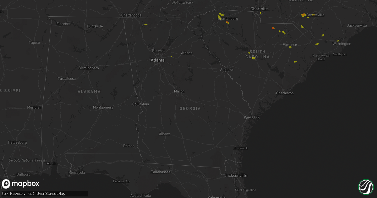
Hail Map in Georgia on June 25, 2018
Get this storm
June 25 map
$229
one time, instant access
Download today. No call, no setup
Keep the $229
Bought the map and want the full workflow? Apply the entire $229 to a subscription within 7 days. None of it is wasted.
Every map, not just this one
This buys you this map. Subscription and you get every map we run, in the markets you choose from a few cities to whole states to nationwide. Plus real-time alerts the moment a storm fires.
Contact data
Name, contact info, occupancy, even credit band for addresses in the footprint. You go from where it hit to who to call.
Become the source they trust
Unlimited branding weather history reports on demand. You already have the documented answer ready for the property owner, and you are the one who showed up with it.
Property data and RoofTrace estimates
Pull up any address you have got, its value and the exact code rules for that jurisdiction, straight from One Click Code. Then RoofTrace estimates the squares, pitch, and roof value, priced the way you price.
Storm reports in Georgia
Georgia
| Date | Description |
|---|---|
| 06/25/20186:54 PM CDT | Several trees reported down at the intersection of hwy 86 and orianna rd. |
| 06/25/20186:47 PM CDT | Several trees reported down on american legion rd near the intersection with hwy 129. |
| 06/25/20186:37 PM CDT | Irrigation system overturned on dewey warnock rd. Several trees down on dewey warnock rd as well. |
| 06/25/20186:35 PM CDT | Damage to the roof of a parsonage. About one-quarter of the roof was removed by strong winds. |
| 06/25/20186:35 PM CDT | Screven county 911 reported a couple of trees down on highwy 301 near dover. |
| 06/25/20186:34 PM CDT | Sheriffs dispatch reported multiple trees down across the county. Hail of unknown size was reported in the town of grovetown. |
| 06/25/20186:30 PM CDT | Wind equipment at lake thurmond dam reported a wind gust to 59 mph at 730 pm. |
| 06/25/20186:15 PM CDT | Gust of 59 mph reported at eastman awos. |
| 06/25/20186:08 PM CDT | Emergency manager estimated wind gusts to be at least 60 mph near lincolnton. |
| 06/25/20186:07 PM CDT | Tree down at the intersection of hoody harris rd and mulberry grove rd. |
| 06/25/20186:07 PM CDT | Three trees down near highway 80 in statesboro...including near burkhalter road... N parker ave... And cambridge road. |
| 06/25/20185:50 PM CDT | A viewer reported multiple trees and large limbs down near 2500 potter lynn road in collins. |
| 06/25/20185:37 PM CDT | Several reports of single-tree down around the oglethorpe area... Mainly north and west of town. Time estimated from radar. |
| 06/25/20185:28 PM CDT | Report of a tree down at hwy 90w and loblolly road. Time estimated from radar. |
| 06/25/20185:19 PM CDT | Warning point reported trees down in and around brooklet. |
| 06/25/20185:19 PM CDT | Three trees down near highway 80...including near burkhalter road... N parker ave... And cambridge road. |
| 06/25/20185:18 PM CDT | Report of power lines down at the intersection of hwy 117 and pine crest drive in eastman... Ga. |
| 06/25/20185:08 PM CDT | Several trees down on roadways scattered throughout clayton county. Trees have since been cleared from roads. |
| 06/25/20184:53 PM CDT | Tree down across the road on the 1900 block of hwy 16. |
| 06/25/20184:48 PM CDT | Tree down in the emergency lane of i-85 southbound between the exit ramp and hwy 29 overpass. |
| 06/25/20184:45 PM CDT | Tree reported down on south ridge near intersection with piedmont dr in senoia. |
| 06/25/20184:43 PM CDT | Power line down in the road on the 800 block of gary summers rd. Tree also down in this area which caused damage to a utility pole. |
| 06/25/20184:43 PM CDT | Tree down at the intersection of hwy 129 and etheridge rd. |
| 06/25/20184:30 PM CDT | Tree and power lines down on the 400 block of lake cir. |
| 06/25/20184:30 PM CDT | Tree reported down on a home on the 200 block of woodland st near homer. No significant damage to home. |
| 06/25/20184:27 PM CDT | Tree down on power lines on the 300 block of macedonia rd. |
| 06/25/20184:23 PM CDT | Tree reported down on a house near the intersection of old carrollton rd and hwy 27. |
| 06/25/20184:18 PM CDT | Tree reported down on a car at the intersection of hwy 5 and macintosh circle. |
| 06/25/20184:15 PM CDT | Tree reported down at the intersection of county line rd and sims harris rd. |
| 06/25/20184:15 PM CDT | Tree reported down at the intersection of enon rd and old corellia rd. |
| 06/25/20184:12 PM CDT | Several trees down along hwy 16 between the intersection with clem lowell rd and little new york rd. |
| 06/25/20184:07 PM CDT | County reports numerous trees down across the county. |
| 06/25/20184:05 PM CDT | Power lines reported down on hwy 80 at the bibb/crawford county line. |
| 06/25/20183:58 PM CDT | Power lines reported down on hwy 80 at the bibb/crawford county line. |
| 06/25/20183:55 PM CDT | Tree reported down at the intersection of price rd and belvedere rd. |
| 06/25/20183:35 PM CDT | Tree reported down at the intersection of russellville rd and hwy 42. |
| 06/25/20183:30 PM CDT | Six to seven large trees down... One tree through a house at jacksonville rd and pleasant hill church rd. |
| 06/25/20183:17 PM CDT | Multiple trees and power lines reported down along s dixie rd south of dalton. Time and location estimated from radar. |
| 06/25/20183:11 PM CDT | Tree down across the roadway near the intersection of lower dowda mill rd and carlisle rd. |
| 06/25/20183:06 PM CDT | Tree and power lines reported down on the 2800 block of dug gap rd. |
| 06/25/20182:45 PM CDT | Tree reported down on the 500 block of browning shoals rd. |
| 06/25/20182:40 PM CDT | Emergency manager reported multiple trees down...a couple uprooted near the intersection of south 6th street and runnymede road. A small barn was destroyed in this area |
| 06/25/20182:32 PM CDT | Tree and power lines reported down on the 1200 block of pine st in trion. |
| 06/25/20182:26 PM CDT | Tree reported down on alcova dr near the intersection with county line rd. |
| 06/25/20182:18 PM CDT | *** 1 fatal *** a tree fell on a tent at the bert adams boy scount camp. There was one fatality. There were reports of multiple trees down in that area as ems responded |
| 06/25/20182:08 PM CDT | Emergency manager reported multiple medium-sized trees down near the intersection of hwy 162 and lovers lane. Nickel-sized hail also reported. Time estimated from radar |
| 06/25/20181:54 PM CDT | Report of a tree down on dennis mill road between rock creek bridge and old federal highway south. |
| 06/25/20181:54 PM CDT | Report of a tree down at the 824 block of carters road. |
| 06/25/20181:50 PM CDT | Tree down on cr 22 near the ga state line. Time estimated from radar. |
| 06/25/20181:32 PM CDT | Public reported quarter-sized hail between eton and chatsworth. Time estimated from radar. |
| 06/25/20184:55 AM CDT | At 955 PM EDT, a severe thunderstorm was located over Alma, moving southeast at 15 mph. HAZARD...60 mph wind gusts and nickel size hail. SOURCE...Radar indicated. IMPACT...Expect damage to roofs, siding, and trees. Locations impacted include... Alma, Nicholls, Dixie Union, Bristol and New Lacy. |
| 06/25/20183:28 AM CDT | At 827 PM EDT, severe thunderstorms were located along a line extending from 13 miles north of Williston to near Jackson, moving east at 60 mph. HAZARD...60 mph wind gusts and penny size hail. SOURCE...Radar indicated. IMPACT...Expect damage to roofs, siding, and trees. Locations impacted include... Barnwell, Bamberg, Denmark, Savannah River Site, Williston, Blackville, Branchville, Bowman, Ehrhardt, Springfield, Hilda, Neeses, Norway, Rowesville, Snelling, Olar, Kline, Elko, Cordova and Cope.This includes Interstate 95 near mile marker 85.These storms have a history of producing wind damage. |
| 06/25/20183:14 AM CDT | At 813 PM EDT, severe thunderstorms were located along a line extending from 7 miles northeast of Fitzgerald to Ocilla, moving east at 10 mph. HAZARD...60 mph wind gusts. SOURCE...Radar indicated. IMPACT...Expect damage to roofs, siding, and trees. Locations impacted include... Fitzgerald, Ocilla, Mystic, Lulaville, Osierfield, Pinetta, Ashton, Irwinville, Fitzgerald Municipal A/P, Wray, Bowens Mill, Red Bluff, Abba and Queensland. |
| 06/25/20182:29 AM CDT | At 729 PM EDT, severe thunderstorms were located along a line extending from near Pitts to near Abbeville, moving southeast at 15 mph. HAZARD...60 mph wind gusts and quarter size hail. SOURCE...Radar indicated. IMPACT...Hail damage to vehicles is expected. Expect wind damage to roofs, siding, and trees. Locations impacted include... Rochelle, Pitts, Browning, Double Run, Antioch Church, Owensboro and Seville. |
| 06/25/20182:22 AM CDT | At 721 PM EDT, a severe thunderstorm was centered 2 miles north of Dublin, moving east at 10 mph. HAZARD...60 mph wind gusts and quarter size hail. SOURCE...Radar indicated. IMPACT...Hail damage to vehicles is expected. Expect wind damage to roofs, siding, and trees. Locations impacted include... Dublin, East Dublin, Lovett, Rockledge, Brewton and Minter. |
| 06/25/20182:09 AM CDT | At 709 PM EDT, a severe thunderstorm was located over Wenona, or near Cordele, moving southeast at 20 mph. HAZARD...60 mph wind gusts and quarter size hail. SOURCE...Radar indicated. IMPACT...Hail damage to vehicles is expected. Expect wind damage to roofs, siding, and trees. Locations impacted include... Cordele, Arabi, East Crisp, Tremont, Wenona, Hatley and Raines. |
| 06/25/20182:01 AM CDT | At 701 PM EDT, a severe thunderstorm was located near Eastman, moving southeast at 20 mph. HAZARD...60 mph wind gusts and quarter size hail. SOURCE...Radar indicated. IMPACT...Hail damage to vehicles is expected. Expect wind damage to roofs, siding, and trees. Locations impacted include... Eastman, Chester, Rhine, Chauncey, Union, Dubois, Gresston, Plainfield, Yonkers, Roddy, Rowland, Jay Bird Springs, Five Points, Achord and Godwinsville. |
| 06/25/20181:58 AM CDT | At 658 PM EDT, severe thunderstorms were located along a line extending from 10 miles southeast of Gaffney to 10 miles southeast of Abbeville, moving east at 45 mph. HAZARD...60 mph wind gusts and quarter size hail. SOURCE...Radar indicated. IMPACT...Minor hail damage to vehicles is expected. Expect wind damage to trees and power lines. Locations impacted include... Rock Hill, Spartanburg, Greenwood, Laurens, Union, York, Chester, Abbeville, Clinton and Woodruff. |
| 06/25/20181:42 AM CDT | At 641 PM CDT, a severe thunderstorm was located 11 miles west of Chattahoochee, or 12 miles east of Marianna, and is nearly stationary. HAZARD...60 mph wind gusts. SOURCE...Radar indicated. IMPACT...Expect damage to roofs, siding, and trees. Locations impacted include... Sneads, Grand Ridge, Dellwood, Star, Two Egg, Cypress, Alliance and Blue Spring. |
| 06/25/20181:30 AM CDT | At 630 PM EDT, severe thunderstorms were located along a line extending from 5 miles south of Spartanburg to 14 miles north of Abbeville to 7 miles south of Elberton, moving southeast at 40 mph. HAZARD...60 mph wind gusts and quarter size hail. SOURCE...Radar indicated. IMPACT...Minor hail damage to vehicles is expected. Expect wind damage to trees and power lines. Locations impacted include... Laurens, Abbeville, Elberton, Simpsonville, Five Forks, Fountain Inn, Belton, Woodruff, Honea Path and Ware Shoals. |
| 06/25/20181:19 AM CDT | At 618 PM EDT, a severe thunderstorm was located 8 miles northwest of Bay, moving southeast at 10 mph. HAZARD...60 mph wind gusts and quarter size hail. SOURCE...Radar indicated. IMPACT...Minor hail damage to vehicles is possible. Expect wind damage to trees and powerlines. Locations impacted include... Brooklet, Denmark, Leefield, Nevils and Stilson. This warning includes I-16 between mile markers 121 and 129. |
| 06/25/20181:14 AM CDT | At 614 PM EDT, a severe thunderstorm was located over Norman, or 11 miles south of Middleton, moving east at 5 mph. HAZARD...60 mph wind gusts and half dollar size hail. SOURCE...Radar indicated. IMPACT...Hail damage to vehicles is expected. Expect wind damage to roofs, siding, and trees. Locations impacted include... Tignall, Jacksons Crossroads, Mallorysville, Delhi, Norman and Danburg. |
| 06/25/201812:59 AM CDT | At 558 PM EDT, severe thunderstorms were located along a line extending from 8 miles northeast of Greenville Downtown to 3 miles northwest of Anderson to 5 miles southeast of Carnesville, moving southeast at 45 mph. HAZARD...60 mph wind gusts and quarter size hail. SOURCE...Radar indicated. IMPACT...Minor hail damage to vehicles is expected. Expect wind damage to trees and power lines. Locations impacted include... Greenville Downtown, Spartanburg, Anderson, Easley, Clemson, Seneca, Elberton, Hartwell, Pickens and Carnesville. |
| 06/25/201812:50 AM CDT | At 549 PM EDT, a severe thunderstorm was located over Riverdale, or near Jonesboro, moving east at 30 mph. HAZARD...60 mph wind gusts and quarter size hail. SOURCE...Radar indicated. IMPACT...Hail damage to vehicles is expected. Expect wind damage to roofs, siding, and trees. Locations impacted include... Atlanta, Fayetteville, Jonesboro, East Point, Stockbridge, Union City, Forest Park, Riverdale, College Park, Fairburn, Morrow, Lovejoy, Hapeville, Lake City, Hartsfield-Jackson Airport, Lake Spivey, Rex, Hidden Valley Park, Jw Smith Reservoir and Conley. |
| 06/25/201812:40 AM CDT | At 539 PM EDT, severe thunderstorms were located along a line extending from 6 miles southwest of Carnesville to near Jefferson, moving east at 20 mph. HAZARD...60 mph wind gusts. SOURCE...Radar indicated. IMPACT...Expect damage to roofs, siding, and trees. Locations impacted include... Jefferson, Commerce, Danielsville, Maysville, Arcade, Nicholson, Ila, Pocataligo, Peach State Speedway, Diamond Hill, Apple Valley, Neese and Banks Crossing. |
| 06/25/201812:29 AM CDT | At 529 PM EDT, a severe thunderstorm was located over Newnan, moving southeast at 35 mph. HAZARD...60 mph wind gusts and penny size hail. SOURCE...Radar indicated. IMPACT...Expect damage to roofs, siding, and trees. Locations impacted include... Newnan, Fayetteville, Peachtree City, Fairburn, Tyrone, Palmetto, Senoia, Grantville, Luthersville, Moreland, Sharpsburg, Turin, East Newnan, Arnco-Sargent, Cannongate, Sandy Creek, Thomas Crossroads and Madras. |
| 06/25/201812:14 AM CDT | At 514 PM EDT, a severe thunderstorm was located over Clem, or near Carrollton, moving southeast at 15 mph. HAZARD...60 mph wind gusts and half dollar size hail. SOURCE...Radar indicated. IMPACT...Hail damage to vehicles is expected. Expect wind damage to roofs, siding, and trees. Locations impacted include... Newnan, Carrollton, Whitesburg, Dunaway Gardens, Clem, Plant Yates, Byers Crossroads, Lowell, Arnco-Sargent, Roscoe, Handy and Seaton Lake. |
| 06/25/201812:12 AM CDT | At 512 PM EDT, a severe thunderstorm was centered03 7 miles east of Gainesville, moving southeast at 10 mph. HAZARD...60 mph wind gusts and half dollar size hail. SOURCE...Radar indicated. IMPACT...Hail damage to vehicles is expected. Expect wind damage to roofs, siding, and trees. Locations impacted include... Gainesville, Jefferson, Homer, Lula, Maysville, Pendergrass, Gillsville, Talmo and Candler. |
| 06/25/201812:09 AM CDT | At 508 PM EDT, a severe thunderstorm was located near Cuthbert, and is nearly stationary. HAZARD...60 mph wind gusts. SOURCE...Radar indicated. IMPACT...Expect damage to roofs, siding, and trees. Locations impacted include... Cuthbert, White House, Brooksville, Benevolence, Springvale and Wades. |
| 06/25/201812:00 AM CDT | At 500 PM EDT, a severe thunderstorm was located near Lizella, or 10 miles northeast of Roberta, moving southeast at 15 mph. HAZARD...60 mph wind gusts. SOURCE...Radar indicated. IMPACT...Expect damage to roofs, siding, and trees. Locations impacted include... Macon, Payne, Payne City, Wesleyan, Lizella, Lake Tobesofkee, Jack Brown Estates, Skipperton, Rutland, Franklinton, Sandy Point and Arkwright. |
| 06/24/201811:40 PM CDT | At 440 PM EDT, a severe thunderstorm was located over Seaton Lake, or 7 miles east of Carrollton, moving east at 20 mph. HAZARD...60 mph wind gusts and quarter size hail. SOURCE...Radar indicated. IMPACT...Hail damage to vehicles is expected. Expect wind damage to roofs, siding, and trees. Locations impacted include... Carrollton, Whitesburg, Clem, Plant Yates, Byers Crossroads, Abilene, Treasure Lake, Hannah, Arnco-Sargent, Roscoe, Seaton Lake and Fairplay. |
| 06/24/201811:31 PM CDT | At 431 PM EDT, a severe thunderstorm was located near Musella, or 8 miles north of Roberta, moving southeast at 25 mph. HAZARD...60 mph wind gusts and quarter size hail. SOURCE...Radar indicated. IMPACT...Hail damage to vehicles is expected. Expect wind damage to roofs, siding, and trees. Locations impacted include... Culloden, Lizella, Lake Tobesofkee, Sandy Point, Russellville, Brent and Musella. |
| 06/24/201810:59 PM CDT | At 359 PM EDT, a severe thunderstorm was located over Mill Creek, or near Dalton, moving east at 30 mph. HAZARD...60 mph wind gusts. SOURCE...Radar indicated. IMPACT...Expect damage to roofs, siding, and trees. Locations impacted include... Dalton, Mill Creek, Tilton and North Georgia Speedway. |
| 06/24/201810:58 PM CDT | At 357 PM EDT, a severe thunderstorm was located over Eudora, or 10 miles north of Monticello, moving southeast at 15 mph. HAZARD...60 mph wind gusts and quarter size hail. SOURCE...Radar indicated. IMPACT...Hail damage to vehicles is expected. Expect wind damage to roofs, siding, and trees. Locations impacted include... Newborn, Mansfield, Shady Dale, Stewart, Calvin, Farrar, Eudora and North Alcovy. |
| 06/24/201810:24 PM CDT | At 324 PM EDT, a severe thunderstorm was located over Social Circle, or 8 miles south of Monroe, moving east at 25 mph. HAZARD...60 mph wind gusts and quarter size hail. SOURCE...Radar indicated. IMPACT...Hail damage to vehicles is expected. Expect wind damage to roofs, siding, and trees. Locations impacted include... Monroe, Covington, Social Circle, Good Hope, Jersey, Herndonville, Ebenezer, Brick Store and Pannell. |
| 06/24/201810:01 PM CDT | At 301 PM EDT, severe thunderstorms were located along a line extending from near Maryville to 11 miles west of Smoky Mountains-Twentymile Creek to 8 miles east of Etowah to 8 miles north of Ducktown, moving southeast at 30 mph. HAZARD...60 mph wind gusts and quarter size hail. SOURCE...Radar indicated. IMPACT...Hail damage to vehicles is expected. Expect wind damage to roofs, siding, and trees. Locations impacted include... Maryville, Madisonville, Andrews, Murphy, Ducktown, Etowah, Vonore, Greenback, Friendsville, Tellico Plains, Townsend, William L. Davenport Refuge, Big Frog Mountain, McGee Carson Peninsula, Copperhill, Bullet Creek, Archville, Culberson, Mount Vernon and Clover Hill. |
| 06/24/20189:30 PM CDT | At 230 PM EDT, a severe thunderstorm was located near Chatsworth, moving east at 10 mph. HAZARD...60 mph wind gusts and quarter size hail. SOURCE...Radar indicated. IMPACT...Hail damage to vehicles is expected. Expect wind damage to roofs, siding, and trees. Locations impacted include... Chatsworth and Fort Mountain State Park. |
| 06/24/20187:50 PM CDT | Burke county dispatch reported trees down on drone road at hwy 24. |
| 06/24/20187:45 PM CDT | Tree down on a power line resulting in a power outage on the southwest side of ocilla during the monday evening storm. Reported via georgia power website. |
| 06/24/20187:15 PM CDT | Tree and powerline down at the intersection of lee st and sultana dr. |
| 06/24/20187:12 PM CDT | Sheriff dispatch reported a tree down along farmers bridge road just north of brier creek. |
| 06/24/20187:10 PM CDT | Sheriff dispatch reported a tree down just south of keysville on highway 88. |
All States Impacted by Hail Map on June 25, 2018
Cities Impacted by Hail Map on June 25, 2018
- New Florence, MO
- Montgomery City, MO
- Rhineland, MO
- Portland, MO
- Marthasville, MO
- Du Quoin, IL
- Tamaroa, IL
- Pinckneyville, IL
- Mulkeytown, IL
- Sesser, IL
- Benton, IL
- Christopher, IL
- Campobello, SC
- Wellford, SC
- Inman, SC
- Landrum, SC
- Society Hill, SC
- Patrick, SC
- Effingham, SC
- Florence, SC
- Mount Croghan, SC
- Jefferson, SC
- Pageland, SC
- Greer, SC
- Duncan, SC
- Lyman, SC
- Hemingway, SC
- Nesmith, SC
- Kingstree, SC
- Pauline, SC
- Roebuck, SC
- Spartanburg, SC
- Gaston, SC
- Swansea, SC
- West Columbia, SC
- Lexington, SC
- Raeford, NC
- Lumber Bridge, NC
- Fayetteville, NC
- Aberdeen, NC
- Fort Bragg, NC
- Maxton, NC
- Clarkton, NC
- Whiteville, NC
- Chadbourn, NC
- Clarendon, NC
- Tabor City, NC
- Leland, NC
- Charlotte, NC
- Highwood, MT
- Geraldine, MT
- Geyser, MT
- Loudon, TN
- Livingston, TN
- Rickman, TN
- Monterey, TN
- Crossville, TN
- Chatsworth, GA
- Loganville, GA
- Ferguson, NC
- Hope Mills, NC
- Belvidere, TN
- Fitzgerald, GA
- Rhine, GA
- Strafford, MO
- Springfield, MO
- Fair Grove, MO
- Surrency, GA
- Bristol, GA
- Pooler, GA
- Savannah, GA
- Pitts, GA
- Mountain Home, AR
- Oakland, AR
- Philadelphia, TN
- Leicester, NC
- Eastover, SC
- Clarkesville, GA
- Moore, SC
- Lake Waccamaw, NC
- Hallsboro, NC
- Tignall, GA
- Fairmont, NC
- Orrum, NC
- Dobson, NC
- Elkin, NC
- Carlyle, IL
- Midway, AL
- Statesboro, GA
- Hardaway, AL
- Breese, IL
- Bishopville, SC
- Hartsville, SC
- Eva, AL
- Falkville, AL
- Lenoir, NC
- Morganton, NC
- Mullins, SC
- Marion, SC
- East Dublin, GA
- Dublin, GA
- Johnsonville, SC
- Roanoke, AL
- Columbia, IL
- Saluda, NC
- Mill Spring, NC
- Ten Mile, TN
- Lancaster, SC
- Waxhaw, NC
- Fort Mill, SC
- Tuskegee, AL
- Kershaw, SC
- Round O, SC
- Blackstock, SC
- Pembroke, GA
- Scranton, SC
- Timmonsville, SC
- Olanta, SC
- Brooklet, GA
- Burnsville, NC
- Spruce Pine, NC
- Fort Shaw, MT
- Sainte Genevieve, MO
- Harrison, GA
- Davisboro, GA
- Franklin, NC
- Washington, GA
- Carlton, GA
- New Zion, SC
- Hopkins, SC
- Saint Matthews, SC
- North, SC
- Bonne Terre, MO
- Catlin, IL
- Fairmount, IL
- Appling, GA
- Eastman, GA
- Cabool, MO
- Belt, MT
- De Soto, MO
- Valles Mines, MO
- South Greenfield, MO
- Everton, MO
- Green Mountain, NC
- Wallace, SC
- Cheraw, SC
- Chesterfield, SC
- Sunbright, TN
- Science Hill, KY
- Preston, GA
- Richland, GA
- Adrian, GA
- Taylors, SC
- O'Brien, FL
- Branford, FL
- Nicholls, GA
- Lynchburg, SC
- Georgetown, SC
- Richburg, SC
- Grovespring, MO
- Grovetown, GA
- Harlem, GA
- Dayton, TN
- Darlington, SC
- Adams Run, SC
- Power, MT
- Sun River, MT
- Vaughn, MT
- Laurinburg, NC
- Stoutland, MO
- Richland, MO
- Lebanon, MO
- Boaz, AL
- Albertville, AL
- Ash, NC
- Gadsden, SC
- Summerville, SC
- Carrollton, GA
- Marshfield, MO
- Solo, MO
- Mountain Grove, MO
- Woodruff, SC
- Great Falls, SC
- Holly Ridge, NC
- McBee, SC
- Abbeville, GA
- Rochelle, GA
- Cordele, GA
- Arabi, GA
- Whitesburg, GA
- Marissa, IL
- Lenzburg, IL
- New Athens, IL
- Claxton, GA
- Register, GA
- Coulterville, IL
- Lyons, GA
- Collins, GA
- Danville, IL
- Oakwood, IL
- Westville, IL
- Buckner, IL
- Nashville, IL
- Gresham, SC
- Lula, GA
- Wetumpka, AL
- Port Wentworth, GA
- Goose Creek, SC
- Damascus, GA
- Etowah, TN
- La Fayette, GA
- Guntersville, AL
- Keysville, GA
- Louisville, GA
- Waynesboro, GA
- Wrens, GA
- Licking, MO
- Mayesville, SC
- Cascade, MT
- Bennettsville, SC
- Evensville, TN
- Linn, MO
- Bonnots Mill, MO
- Steedman, MO
- Blackwell, MO
- Park Hills, MO
- Irondale, MO
- Festus, MO
- French Village, MO
- Mineral Point, MO
- Cadet, MO
- Belgrade, MO
- Potosi, MO
- Bixby, MO
- Belleview, MO
- Half Way, MO
- Athens, TN
- Riceville, TN
- Ellington, MO
- Somerset, KY
- Bucyrus, MO
- Seymour, TN
- Marion, NC
- Old Fort, NC
- Hickory Grove, SC
- Chester, SC
- Winnsboro, SC
- Dalton, GA
- Anniston, AL
- Jacksonville, AL
- Cottageville, SC
- Heflin, AL
- Fruithurst, AL
- Roswell, GA
- Rome, GA
- Wadley, AL
- Ellaville, GA
- Salem, AL
- Opelika, AL
- Cusseta, AL
- Valley, AL
- Fort Stewart, GA
- Hamilton, GA
- Cataula, GA
- Moultrie, GA
- Pavo, GA
- Houston, TX
- Berlin, GA
- Trenton, IL
- Pocahontas, IL
- Highland, IL
- Aviston, IL
- Crocker, MO
- Vienna, MO
- Newburg, MO
- Keyesport, IL
- Beckemeyer, IL
- Caledonia, MO
- Conway, MO
- Phillipsburg, MO
- Miller, MO
- Walnut Grove, MO
- Lockwood, MO
- Greenfield, MO
- Elkland, MO
- Bolivar, MO
- Bois D Arc, MO
- Mount Vernon, MO
- Republic, MO
- Ash Grove, MO
- Marionville, MO
- Willard, MO
- Brighton, MO
- Pleasant Hope, MO
- Billings, MO
- Halltown, MO
- Buffalo, MO
- Pomona, MO
- West Plains, MO
- Seymour, MO
- Sweetwater, TN
- Niota, TN
- Stanford, KY
- Asheville, NC
- Ruby, SC
- Resaca, GA
- Horton, AL
- Calhoun, GA
- Lamar, SC
- Elizabethtown, NC
- Kingston, GA
- Sumter, SC
- Elliott, SC
- Rockmart, GA
- Coward, SC
- Turbeville, SC
- Islandton, SC
- Oglethorpe, GA
- Ridgeville, SC
- Tyrone, GA
- Union City, GA
- Palmetto, GA
- Douglasville, GA
- Fairburn, GA
- Atlanta, GA
- Green Pond, SC
- Yemassee, SC
- Union Springs, AL
- Fort Davis, AL
- Rincon, GA
- Guyton, GA
- Ashburn, GA
- Casey, IL
- Stotts City, MO
- Sarcoxie, MO
- Pierce City, MO
- Wentworth, MO
- Rolla, MO
- Bismarck, MO
- Farmington, MO
- Koeltztown, MO
- Argyle, MO
- Freeburg, MO
- Boss, MO
- Salem, MO
- Plato, MO
- Henderson, AR
- New Haven, MO
- Edgar Springs, MO
- Graff, MO
- Tellico Plains, TN
- Vonore, TN
- State Road, NC
- Madisonville, TN
- Rutherfordton, NC
- Lake Lure, NC
- Gillsville, GA
- Blenheim, SC
- Gaylesville, AL
- Brookwood, AL
- Andersonville, GA
- Ravenel, SC
- Ladson, SC
- Chamois, MO
- Sparta, IL
- Urbana, IL
- Saint Joseph, IL
- Fenton, MO
- Eureka, MO
- High Ridge, MO
- Black, MO
- Gravel Switch, KY
- Robbins, TN
- Midway, AR
- Gassville, AR
- Flippin, AR
- Hartville, MO
- Mills River, NC
- Horse Shoe, NC
- Travelers Rest, SC
- Sherwood, TN
- Jonesville, SC
- Evergreen, NC
- Ellijay, GA
- Talking Rock, GA
- Valhermoso Springs, AL
- Laceys Spring, AL
- Lumberton, NC
- Lake City, SC
- Gray, GA
- Macon, GA
- Andrews, SC
- Cades, SC
- Auburn, AL
- Tallassee, AL
- Americus, GA
- Reynolds, GA
- Cuthbert, GA
- Odum, GA
- Lenox, GA
- Marianna, FL
- Millwood, GA
- Oakdale, IL
- Dixon, MO
- Jerome, MO
- Long Lane, MO
- Success, MO
- Valdese, NC
- Whitesburg, KY
- Decatur, TN
- Bryant, AL
- Bryson City, NC
- Ranger, GA
- Chickamauga, GA
- Menlo, GA
- Arab, AL
- Sellers, SC
- Buchanan, GA
- Tucker, GA
- Decatur, GA
- Bartow, GA
- Woodland, AL
- Wedowee, AL
- Williston, SC
- Windsor, SC
- Reidsville, GA
- Notasulga, AL
- Eufaula, AL
- Clinton, MO
- Urich, MO
- Iberia, MO
- Clinton, IL
- Foley, MO
- Saint Louis, MO
- Windyville, MO
- Prairie Du Rocher, IL
- Nancy, KY
- Crawford, TN
- Rock Island, TN
- Laurel Hill, NC
- Marston, NC
- Red Springs, NC
- Hamlet, NC
- Pacolet, SC
- Rocky Face, GA
- Rocky Point, NC
- Galivants Ferry, SC
- Ohatchee, AL
- Matthews, GA
- Bowdon, GA
- Jacksonboro, SC
- Walterboro, SC
- Forsyth, GA
- Culloden, GA
- Altha, FL
- Hardeeville, SC
- Plains, GA
- Coolidge, GA
- Tilton, IL
- Augusta, MO
- Vichy, MO
- Red Bud, IL
- Bloomsdale, MO
- Bunker, MO
- Davisville, MO
- Aldrich, MO
- Dadeville, MO
- Annapolis, MO
- Ironton, MO
- Piedmont, MO
- Coeburn, VA
- Parkers Lake, KY
- Elk Creek, MO
- Houston, MO
- Millers Creek, NC
- North Wilkesboro, NC
- Allons, TN
- Hilham, TN
- Taylorsville, NC
- Kingston, TN
- Hoffman, NC
- Wagram, NC
- Fountain Inn, SC
- Simpsonville, SC
- Crandall, GA
- Old Fort, TN
- Heath Springs, SC
- Valley Head, AL
- Mentone, AL
- Sugar Valley, GA
- Bolton, NC
- Gainesville, GA
- Dallas, GA
- Loris, SC
- Acworth, GA
- Columbia, SC
- Orangeburg, SC
- Salley, SC
- Wedgefield, SC
- Manning, SC
- Snellville, GA
- Newnan, GA
- Munford, AL
- Musella, GA
- Grand Ridge, FL
- Loxley, AL
- Georgetown, FL
- Belle, MO
- Westphalia, MO
- Meta, MO
- Steelville, MO
- Knoxville, TN
- Niangua, MO
- Murphy, NC
- Robbinsville, NC
- Tiger, GA
- Pamplico, SC
- Bethune, SC
- Burgaw, NC
- Alcolu, SC
- Tallapoosa, GA
- Weaver, AL
- Covington, GA
- Social Circle, GA
- Pawleys Island, SC
- Hollywood, SC
- Eclectic, AL
- Ideal, GA
- Trenton, FL
- Ochlocknee, GA
- Fitzpatrick, AL
- Buena Vista, GA
- Simms, MT
- West Frankfort, IL
- Mcminnville, TN
- Union Mills, NC
- Ellsinore, MO
- Ocoee, TN
- Marietta, SC
- Cleveland, SC
- Cameron, NC
- Vass, NC
- Wilmington, NC
- Currie, NC
- Fyffe, AL
- Green Sea, SC
- Norcross, GA
- Peachtree Corners, GA
- Wrightsville, GA
- Chester, GA
- Cochran, GA
- Hurtsboro, AL
- Alma, GA
- Cutler, IL
- Scheller, IL
- Monett, MO
- Gibson, NC
- Hendersonville, NC
- Columbus, NC
- Eldridge, MO
- Camdenton, MO
- Tamassee, SC
- Council, NC
- Bladenboro, NC
- Conway, SC
- Huntsville, AL


