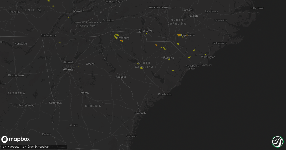
Hail Map in South Carolina on June 25, 2018
Get this storm
June 25 map
$229
one time, instant access
Download today. No call, no setup
Keep the $229
Bought the map and want the full workflow? Apply the entire $229 to a subscription within 7 days. None of it is wasted.
Every map, not just this one
This buys you this map. Subscription and you get every map we run, in the markets you choose from a few cities to whole states to nationwide. Plus real-time alerts the moment a storm fires.
Contact data
Name, contact info, occupancy, even credit band for addresses in the footprint. You go from where it hit to who to call.
Become the source they trust
Unlimited branding weather history reports on demand. You already have the documented answer ready for the property owner, and you are the one who showed up with it.
Property data and RoofTrace estimates
Pull up any address you have got, its value and the exact code rules for that jurisdiction, straight from One Click Code. Then RoofTrace estimates the squares, pitch, and roof value, priced the way you price.
Storm reports in South Carolina
South Carolina
| Date | Description |
|---|---|
| 06/25/20186:57 PM CDT | Reported trees and power lines down along wash lever road. |
| 06/25/20186:52 PM CDT | Reported strong winds that downed several trees in the area. |
| 06/25/20186:48 PM CDT | Sheriff dispatch reported multiple trees down across the county. |
| 06/25/20186:37 PM CDT | Sc highway patrol reported trees down on walker road at sc 283. |
| 06/25/20186:33 PM CDT | One tree down across parkins road. |
| 06/25/20186:30 PM CDT | Sheriff dispatch reported multiple trees down across the central and eastern portion of the county. |
| 06/25/20186:20 PM CDT | Schp reported a tree down at brickyard rd and dyson rd |
| 06/25/20186:20 PM CDT | Schp reported a tree down at highway 248 and louden rd |
| 06/25/20186:20 PM CDT | Reported numerous trees down in the sandy run community in the northern part of the county. |
| 06/25/20186:15 PM CDT | Schp reported a tree down at apache dr and fairforest dr |
| 06/25/20186:15 PM CDT | Schp reported a tree down at tedards store rd and scotch cross rd e |
| 06/25/20186:15 PM CDT | Schp reported a tree down at wilson bridge rd and daniel heights rd |
| 06/25/20186:10 PM CDT | County reports widespread trees and power lines down across the county with a few trees blown down on houses in union. |
| 06/25/20186:10 PM CDT | Schp reported a couple of trees blown down on highway 10 near morton rd |
| 06/25/20186:10 PM CDT | Schp reported a tree down on tillman territory rd |
| 06/25/20186:05 PM CDT | Schp reported a tree down at highway 72 and renno rd |
| 06/25/20186:04 PM CDT | Sheriff dispatch reported multiple trees down across the northern portion of the county. |
| 06/25/20186:00 PM CDT | Tree down along salem road. |
| 06/25/20186:00 PM CDT | Schp reported a tree down at highway 221 and highway 127 |
| 06/25/20185:59 PM CDT | Quarter size hail reported along emanuel church road just west of the airport. |
| 06/25/20185:55 PM CDT | Schp reported a tree down at highway 56 and musgrove mill rd |
| 06/25/20185:55 PM CDT | Law enforcement reported a tree down on ranch road |
| 06/25/20185:55 PM CDT | The congaree national park reported several trees down within the park. A portion of the lower boardwalk was damaged due to fallen trees. |
| 06/25/20185:55 PM CDT | Schp reported a tree down on bellview church rd |
| 06/25/20185:55 PM CDT | Schp reported a tree down at bethany church rd and highway 308 |
| 06/25/20185:55 PM CDT | Schp reported a tree down at torrington rd and leesville church rd |
| 06/25/20185:50 PM CDT | Large tree limbs down. Winds estimated at 60 mph. |
| 06/25/20185:47 PM CDT | Spotter reports tree down on hwy 76. |
| 06/25/20185:36 PM CDT | Trees down blocking roadway. |
| 06/25/20185:36 PM CDT | Highway patrol reported trees down at the intersection of highway 341 and highway 76 near lynchburg. |
| 06/25/20185:35 PM CDT | Schp reported a tree down on beacon light rd |
| 06/25/20185:35 PM CDT | Schp reported a tree down on derrick rd |
| 06/25/20185:35 PM CDT | Schp reported a tree down at old blackstock rd and lincoln school rd |
| 06/25/20185:35 PM CDT | Tree reported down on park ave. At the southern edge of the town limit in olanta... Sc. Large tree was reported down. Call came in at 7:56pm but reporter suggested the |
| 06/25/20185:30 PM CDT | Golf ball size hail. |
| 06/25/20185:25 PM CDT | Schp reported a tree down on dorchester rd |
| 06/25/20185:25 PM CDT | Schp reported a tree down at old georgia rd and i-26 |
| 06/25/20185:25 PM CDT | Tree down on creek rd. |
| 06/25/20185:22 PM CDT | Report of quarter size hail. |
| 06/25/20185:22 PM CDT | A few trees blown down on scuffletown road near jonesville road. |
| 06/25/20185:20 PM CDT | Schp reported a tree down at dillard rd and s batesville rd |
| 06/25/20185:20 PM CDT | Schp reported a tree down at dillard dr and gibbs shoals rd |
| 06/25/20185:20 PM CDT | Schp reported a tree down at griffin rd and highway 29 |
| 06/25/20185:15 PM CDT | Schp reported a tree down at s spencer st and duncan-reidville rd |
| 06/25/20185:15 PM CDT | Schp reported a tree down at robins st and gap creek rd |
| 06/25/20185:15 PM CDT | Schp reported a tree down at highway 81 and white horse rd. |
| 06/25/20185:06 PM CDT | Structual damage to gas station canopy. Also...a large tree blown over in the same area. |
| 06/25/20185:02 PM CDT | Lee county dispatch reported trees down on raccoon road. Time estimated based on radar. |
| 06/25/20185:02 PM CDT | Quarter size hail at hwy 14 and old wagon road. |
| 06/25/20185:00 PM CDT | Amateur radio reported a 40 foot tall mimosa tree fell onto a barn at 201 piney road. Time estimated from radar. |
| 06/25/20185:00 PM CDT | Amateur radio reported a 6-inch diameter tree limb fell onto moving vehicle on sc 253 just south of mountain creek church rd. Time estimated from radar. |
| 06/25/20184:59 PM CDT | Tree down on 5360 pleasant drive. |
| 06/25/20184:55 PM CDT | South carolina highway patrol reported a tree down on bethel road near bethel church. The tree was blown down by thunderstorm outflow. |
| 06/25/20184:55 PM CDT | South carolina highway patrol reported a tree down on highway 321 between robertville and highway 601. |
| 06/25/20184:54 PM CDT | Tree blown down on farrs rd. |
| 06/25/20184:50 PM CDT | Schp reported a tree down at old white horse rd and keeler mill rd. |
| 06/25/20184:50 PM CDT | Schp reported a tree down at first ave and roundtree ln |
| 06/25/20184:50 PM CDT | Schp reported a tree down at fews bridge rd and gum springs rd |
| 06/25/20184:50 PM CDT | Schp reported power lines down at highway 24 and little league dr |
| 06/25/20184:50 PM CDT | Schp reported a tree down at skyland dr and long shoals rd |
| 06/25/20184:50 PM CDT | Schp reported a tree down on jordan rd |
| 06/25/20184:45 PM CDT | Schp reported multiple trees blown down in the blue ridge community |
| 06/25/20184:45 PM CDT | Public reported multiple trees blown down in and around pendleton. |
| 06/25/20184:39 PM CDT | Reported a couple of trees down along highway 15 near the lee county and darlington county line. Also reports of pea size hail in the area. |
| 06/25/20184:35 PM CDT | Schp reported a tree down at pumpkintown rd and highway 276 |
| 06/25/20184:35 PM CDT | South carolina highway patrol reported a tree down on i-26 near mile marker 179 eastbound. The tree was blown down by thunderstorm outflow. |
| 06/25/20184:35 PM CDT | Schp reported a tree down at asbury dr and hagood rd |
| 06/25/20184:35 PM CDT | Schp reported power lines down at highway 276 and geer highway |
| 06/25/20184:35 PM CDT | Schp reported a tree down on geer highway |
| 06/25/20184:30 PM CDT | Schp reported a tree down at highway 11 and n retreat rd |
| 06/25/20184:30 PM CDT | South carolina highway patrol reported a tree down on edward road near the intersection with black creek road. The tree was blown down by thunderstorm outflow. |
| 06/25/20184:25 PM CDT | Sheriff department relayed numerous reports of trees and power lines down across the county. |
| 06/25/20184:20 PM CDT | Trees reported down on jacksonboro road between round o road and parkers ferry road. |
| 06/25/20184:16 PM CDT | Tree down on bridle circle and trilly lane. |
| 06/25/20184:10 PM CDT | Reported golf ball size hail just east of the town of jefferson. |
| 06/25/20184:05 PM CDT | Two large trees down on bridle circle. |
| 06/25/20183:54 PM CDT | Corrects previous tstm wnd dmg report from 12 n winnsboro. Reported several large limbs down along dawkinsville road near the blackstock community. |
| 06/25/20183:42 PM CDT | South carolina highway patrol reported a tree down on mallard road near the intersection with orangeburg road. |
| 06/25/20183:40 PM CDT | Tree reported down near the intersection of butternut road with orangeburg road. |
| 06/25/20183:34 PM CDT | Tree down on holly street in winnsboro mills. |
| 06/25/20183:26 PM CDT | Tree reported down near the intersection of highway 27 with bridlewood farms parkway. |
| 06/25/20183:25 PM CDT | Trees reported down near the intersection of highway 61 with highway 27. |
| 06/25/20183:14 PM CDT | Nws cooperative observer along with highway department reported a tree across river road. |
| 06/25/20183:07 PM CDT | Tree reported down on rose dhu creek plantation. |
| 06/25/20183:05 PM CDT | Report of a couple trees blown down. |
| 06/25/20183:04 PM CDT | Tree reported down along sc highway 9 at clio country club. |
| 06/25/20183:00 PM CDT | Public reported quarter size hail 7 miles se of patrick lasting 5 to 6 minutes via facebook. |
| 06/25/20182:53 PM CDT | Emergency manager reported a tree down just south of patrick along highway 1. |
| 06/25/20182:52 PM CDT | Reported tree limbs down on power lines and a broken power line pole along old swamp road in the sandy run community. |
| 06/25/20182:52 PM CDT | Sheriffs dispatch reported trees down near the intersection of bbb circle and highway 1. |
| 06/25/20182:15 PM CDT | Reported a tree down in the eastbound side of i-26 near mile marker 133. |
| 06/25/20181:55 PM CDT | 1.25 inch hail reported at new cut road and gowan road. |
| 06/25/20181:52 PM CDT | Utility reported tree limbs down on lines along with a broken power pole on old swamp road in the sandy run community. |
| 06/25/20181:50 PM CDT | Public reported trees snapped or uprooted on turning leaf circle |
| 06/25/20181:45 PM CDT | Social media report of a tree down on a wooden fence in the wellford area. |
| 06/25/20181:40 PM CDT | A local report indicates 1.00 inch wind near INMAN |
| 06/25/20181:35 PM CDT | Schp reported a tree down at h st and church ave |
| 06/25/20181:30 PM CDT | Social media report of quarter |
| 06/25/20187:58 AM CDT | At 1257 AM EDT, severe thunderstorms were located along a line extending from 7 miles west of Edisto Beach to 8 miles northwest of Bellinger Hill Area, moving southeast at 35 mph. HAZARD...60 mph wind gusts. SOURCE...Radar indicated. IMPACT...Expect damage to trees and powerlines. Locations impacted include... Hilton Head Island, Bluffton, Beaufort, Port Royal, Edisto Beach, Bellinger Hill Area, Fort Pulaski National Monument and Clarendon.This warning includes I-95 in South Carolina between mile markers 3and 15. |
| 06/25/20184:14 AM CDT | At 914 PM EDT, severe thunderstorms were located along a line extending from near St. Matthews to near Ulmer, moving southeast at 25 mph. HAZARD...60 mph wind gusts. SOURCE...Radar indicated. IMPACT...Expect damage to roofs, siding, and trees. Locations impacted include... Orangeburg, Bamberg, Brookdale, Holly Hill, Branchville, Summerton, Bowman, Elloree, Santee, Ehrhardt, Cameron, Eutawville, Rowesville, Olar, Vance, Cordova, Cope, Govan, Wilkinson Heights and Edisto.This includes the following highways... Interstate 26 between mile markers 144 and 169. Interstate 95 between mile markers 85 and 113. |
| 06/25/20183:57 AM CDT | At 856 PM EDT, severe thunderstorms were located along a line extending from near Pinehurst to 7 miles northwest of Hoffman to 8 miles southwest of Wadesboro, moving southeast at 35 mph. This storm has a history of producing wind damage. HAZARD...60 mph wind gusts and penny size hail. SOURCE...Radar indicated. IMPACT...Expect damage to roofs, siding, and trees. Locations impacted include... Laurinburg, Rockingham, Raeford, Hamlet, Maxton, Hoffman, Antioch, Ellerbe, Dobbins Heights and Wagram. |
| 06/25/20183:52 AM CDT | At 851 PM EDT, severe thunderstorms were located along a line extending from 12 miles northwest of Barnwell to near Mount Vernon, moving east at 45 mph. HAZARD...60 mph wind gusts and penny size hail. SOURCE...Law enforcement reports. Multiple reports of trees blown down. IMPACT...Expect damage to trees and powerlines. Locations impacted include... Statesboro, Reidsville, Metter, Allendale, Millen, Sylvania, Hampton and Claxton.This warning includes... I-16 between mile markers 96 and 130. I-95 in South Carolina near mile marker 68. |
| 06/25/20183:46 AM CDT | At 844 PM EDT, a severe thunderstorm was located near Waynesboro, moving east at 20 mph. HAZARD...60 mph wind gusts and nickel size hail. SOURCE...Radar indicated. Burke County Dispatch reported multiple trees down across the county associated with this storm. IMPACT...Expect damage to roofs, siding, and trees. Locations impacted include... Waynesboro, Sardis, Midville, Girard and Vidette. |
| 06/25/20183:45 AM CDT | At 845 PM EDT, severe thunderstorms were located along a line extending from 8 miles west of Wadesboro to near Kershaw, moving east at 25 mph. HAZARD...60 mph wind gusts. SOURCE...Radar indicated. IMPACT...Expect damage to roofs, siding, and trees. Locations impacted include... Cheraw, Pageland, Kershaw, Chesterfield, Mcbee, Jefferson, Ruby, Patrick, Bethune and Mount Croghan. |
| 06/25/20183:43 AM CDT | At 843 PM EDT, severe thunderstorms were located along a line extending from 9 miles north of Camden to near Forest Acres, moving east at 40 mph. HAZARD...60 mph wind gusts. SOURCE...Radar indicated. IMPACT...Expect damage to roofs, siding, and trees. Locations impacted include... Sumter, Camden, Bishopville, South Sumter, St. Matthews, Eastover, Lugoff, Oakland, Mulberry, Fort Jackson, Millwood, Mayesville, Pinewood, Bethune, Paxville, Cane Savannah, Dalzell, Wedgewood, Cherryvale and Stateburg.This includes the following highways... Interstate 20 in South Carolina between mile markers 78 and 125. Interstate 26 between mile markers 123 and 127, and between milemarkers 131 and 136. Interstate 77 between mile markers 7 and 8. |
| 06/25/20183:14 AM CDT | At 813 PM EDT, severe thunderstorms were located along a line extending from near Manning to near Elloree to 10 miles south of Gaston, moving southeast at 20 mph. HAZARD...70 mph wind gusts and quarter size hail. SOURCE...Radar indicated. IMPACT...Hail damage to vehicles is expected. Expect considerable tree damage. Wind damage is also likely to mobile homes, roofs, and outbuildings. Locations impacted include... Orangeburg, Manning, Brookdale, South Sumter, St. Matthews, Holly Hill, Summerton, Bowman, Elloree, Santee, North, Pinewood, Cameron, Neeses, Eutawville, Paxville, Woodford, Vance, Cordova and Livingston.This includes the following highways... Interstate 26 between mile markers 135 and 169. Interstate 95 between mile markers 85 and 130. |
| 06/25/20183:06 AM CDT | At 806 PM EDT, a severe thunderstorm was located 10 miles southeast of Wrens, or 13 miles west of Waynesboro, moving east at 20 mph. HAZARD...60 mph wind gusts and quarter size hail. SOURCE...Radar indicated. IMPACT...Hail damage to vehicles is expected. Expect wind damage to roofs, siding, and trees. Locations impacted include... Aiken, North Augusta, Lexington, West Columbia, Cayce, Irmo, Waynesboro, Springdale, Fort Gordon, Red Bank, Augusta, Clearwater, Oak Grove, Belvedere, Martinez, Batesburg-Leesville, Hephzibah, South Congaree, Pine Ridge and New Ellenton.This includes the following highways... Interstate 20 in Georgia between mile markers 195 and 201. Interstate 20 in South Carolina between mile markers 0 and 63. Interstate 26 between mile markers 109 and 120, and between milemarkers 128 and 130. Interstate 520 in Georgia between mile markers 1 and 15. Interstate 520 in South Carolina between mile markers 16 and 23. Interstate 77 between mile markers 0 and 2. |
| 06/25/20183:05 AM CDT | At 804 PM EDT, severe thunderstorms were located along a line extending from near Mineral Springs to 7 miles northeast of Irmo, moving southeast at 50 mph. HAZARD...60 mph wind gusts and penny size hail. SOURCE...Radar indicated. IMPACT...Expect damage to roofs, siding, and trees. Locations impacted include... Columbia, Irmo, Forest Acres, Lancaster, Camden, Winnsboro, St. Andrews, Dentsville, Woodfields, Pageland, Kershaw, Elgin, Arcadia Lakes, Eastover, Heath Springs, Lugoff, Irwin, Woodfield, Fort Jackson and Five Points.This includes the following highways... Interstate 126 near mile marker 3. Interstate 20 in South Carolina between mile markers 65 and 105. Interstate 26 between mile markers 96 and 103. Interstate 77 between mile markers 3 and 50. |
| 06/25/20182:59 AM CDT | At 758 PM EDT, a severe thunderstorm was located 12 miles northeast of Monroe, or 6 miles north of Marshville, moving east at 25 mph. HAZARD...60 mph wind gusts and quarter size hail. SOURCE...Radar indicated. IMPACT...Minor hail damage to vehicles is expected. Expect wind damage to trees and power lines. Locations impacted include... Monroe, Indian Trail, Weddington, Stallings, Unionville, Wesley Chapel, Wingate, Waxhaw, Marshville and Lake Park. |
| 06/25/20182:41 AM CDT | At 740 PM EDT, severe thunderstorms were located along a line extending from near Badin Lake through Albemarle to 6 miles east of Unionville, moving southeast at 30 mph. HAZARD...60 mph wind gusts and nickel size hail. SOURCE...Radar indicated. IMPACT...Expect damage to roofs, siding, and trees. Locations impacted include... Rockingham, Wadesboro, Hamlet, Ansonville, Hoffman, Polkton, Ellerbe, Dobbins Heights, Candor and Lilesville. |
| 06/25/20182:41 AM CDT | At 741 PM EDT, severe thunderstorms were located along a line extending from 11 miles west of Hebron to 12 miles north of Elloree to near Gaston, moving south at 20 mph. HAZARD...60 mph wind gusts and quarter size hail. SOURCE...Radar indicated. IMPACT...Hail damage to vehicles is expected. Expect wind damage to roofs, siding, and trees. Locations impacted include... Manning, South Sumter, Brookdale, St. Matthews, Gaston, Summerton, Eastover, Elloree, Millwood, Swansea, North, Pinewood, Cameron, Paxville, Woodford, Cane Savannah, Lakewood, Privateer and Wedgewood.This includes the following highways... Interstate 26 between mile markers 121 and 148. Interstate 95 between mile markers 101 and 131. |
| 06/25/20182:39 AM CDT | At 739 PM EDT, a severe thunderstorm was located near Prosperity, or 10 miles southeast of Newberry, moving east at 10 mph. HAZARD...60 mph wind gusts and quarter size hail. SOURCE...Radar indicated. IMPACT...Hail damage to vehicles is expected. Expect wind damage to roofs, siding, and trees. Locations impacted include... Newberry, Winnsboro, Batesburg, Batesburg-Leesville, Saluda, Whitmire, Prosperity, Ridge Spring, Leesville, Blythewood, Chapin, Ridgeway, Little Mountain, Monetta, Pomaria, Silverstreet, Ward, Peak, Lake Murray Of Richland and Winnsboro Mills.This includes the following highways... Interstate 26 between mile markers 62 and 99. Interstate 77 between mile markers 27 and 50. |
| 06/25/20182:24 AM CDT | At 724 PM EDT, a severe thunderstorm was located near Evans, moving east at 15 mph. HAZARD...60 mph wind gusts and quarter size hail. SOURCE...Radar indicated. IMPACT...Hail damage to vehicles is expected. Expect wind damage to roofs, siding, and trees. Locations impacted include... Grovetown, Evans, Martinez, Fort Gordon, Edgefield, Johnston, Trenton, Parksville, Modoc, Murphys Estates and Clarks Hill.This includes the following highways... Interstate 20 in Georgia between mile markers 181 and 201. Interstate 20 in South Carolina near mile marker 0. Interstate 520 in Georgia between mile markers 1 and 5. |
| 06/25/20182:21 AM CDT | At 721 PM EDT, a severe thunderstorm was located 10 miles northwest of Monroe, or near Hemby Bridge, moving east at 25 mph. HAZARD...60 mph wind gusts and quarter size hail. SOURCE...Radar indicated. IMPACT...Minor hail damage to vehicles is expected. Expect wind damage to trees and power lines. Locations impacted include... Monroe, South Charlotte, East Charlotte, Matthews, Mint Hill, Indian Trail, Weddington, Stallings, Unionville and Pineville. |
| 06/25/20182:13 AM CDT | At 713 PM EDT, severe thunderstorms were located along a line extending from near Gaston to 7 miles southeast of Eastover, moving southeast at 25 mph. HAZARD...60 mph wind gusts and quarter size hail. SOURCE...Radar indicated. IMPACT...Hail damage to vehicles is expected. Expect wind damage to roofs, siding, and trees. Locations impacted include... Orangeburg, Brookdale, St. Matthews, Gaston, Swansea, North, Pelion, Cameron, Neeses, Woodford, Livingston and Wilkinson Heights.This includes the following highways... Interstate 20 in South Carolina near mile marker 47. Interstate 26 between mile markers 120 and 151. |
| 06/25/20181:57 AM CDT | At 657 PM EDT, severe thunderstorms were located along a line extending from near Hebron to near St. Matthews, moving southeast at 15 mph. HAZARD...60 mph wind gusts and quarter size hail. SOURCE...Radar indicated. IMPACT...Hail damage to vehicles is expected. Expect wind damage to roofs, siding, and trees. Locations impacted include... Manning, Summerton, Turbeville, Pinewood, Cameron and Paxville. This includes Interstate 95 between mile markers 100 and 132. |
| 06/25/20181:43 AM CDT | At 643 PM EDT, a severe thunderstorm was located 11 miles east of Gaston, or 13 miles southeast of Cayce, moving southeast at 15 mph. HAZARD...60 mph wind gusts and quarter size hail. SOURCE...Radar indicated. IMPACT...Hail damage to vehicles is expected. Expect wind damage to roofs, siding, and trees. Locations impacted include... St. Matthews.This includes Interstate 26 near mile marker 131. |
| 06/25/20181:38 AM CDT | At 638 PM EDT, a severe thunderstorm was located over Sidney, or 10 miles southwest of Whiteville, moving east at 25 mph. HAZARD...60 mph wind gusts and quarter size hail. SOURCE...Radar indicated. IMPACT...Minor hail damage to vehicles is possible. Expect wind damage to trees and power lines. Locations impacted include... Tabor City, Bethel, Lake Waccamaw, Makatoka, Freeland, Honey Island, Nakina, Old Dock, Exum, Mollie, Bughill, Sidney, Clarendon, Williams, Ash, Crusoe Island and Brunswick. |
| 06/25/20181:22 AM CDT | At 621 PM EDT, severe thunderstorms were located along a line extending from 6 miles northwest of Gastonia to 4 miles northwest of Spartanburg, moving east at 35 mph. HAZARD...60 mph wind gusts and quarter size hail. SOURCE...Radar indicated. IMPACT...Minor hail damage to vehicles is expected. Expect wind damage to trees and power lines. Locations impacted include... Gastonia, Spartanburg, Shelby, Gaffney, Greer, Taylors, Kings Mountain, Mt Holly, Cherryville and Bessemer City. |
| 06/25/20181:10 AM CDT | At 609 PM EDT, severe thunderstorms were located along a line extending from near Sardis to near Brittons Neck, moving south at 15 mph. HAZARD...60 mph wind gusts and penny size hail. SOURCE...Radar indicated. IMPACT...Expect damage trees and power lines. Locations impacted include... Lake City, Kingstree, Johnsonville, Pamplico, Hemingway, Sardis, Hannah, Cades, Poston, Nesmith, Brittons Neck, Indiantown, Gresham, Hebron, Friendfield, Henry, Kingsburg, Scranton, Coward and Olanta.This includes Interstate 95 IN South Carolina near mile marker 147. |
| 06/25/20181:07 AM CDT | At 607 PM EDT, a severe thunderstorm was located over Oatland, or 9 miles north of Georgetown, moving south at 15 mph. HAZARD...60 mph wind gusts and nickel size hail. SOURCE...Radar indicated. IMPACT...Expect damage trees and power lines. Locations impacted include... Georgetown, Jackson, Sampit, Plantersville, Graves, Oatland and Georgetown Memorial Hospital. |
| 06/25/201812:57 AM CDT | At 557 PM EDT, severe thunderstorms were located along a line extending from near Sardis to 7 miles northwest of Oakland, moving east at 40 mph. HAZARD...60 mph wind gusts and quarter size hail. SOURCE...Radar indicated. IMPACT...Hail damage to vehicles is expected. Expect wind damage to roofs, siding, and trees. Locations impacted include... Sumter, South Sumter, Mulberry, Oakland, Millwood, Turbeville, Mayesville, Lynchburg, Cane Savannah, Oswego, Dalzell, Wedgewood, East Sumter, Cherryvale, Rembert, Shiloh and Stateburg.This includes the following highways... Interstate 20 in South Carolina between mile markers 91 and 93, andbetween mile markers 117 and 122. Interstate 95 between mile markers 132 and 146. |
| 06/25/201812:45 AM CDT | At 545 PM EDT, severe thunderstorms were located along a line extending from 9 miles northwest of Shelby to 9 miles northeast of Greenville Downtown, moving southeast at 25 mph. HAZARD...60 mph wind gusts and quarter size hail. SOURCE...Radar indicated. IMPACT...Minor hail damage to vehicles is expected. Expect wind damage to trees and power lines. Locations impacted include... Shelby, Forest City, Cherryville, Boiling Springs SC, Boiling Springs NC, Landrum, Cowpens, Inman, Mayo and Chesnee. |
| 06/25/201812:38 AM CDT | At 537 PM EDT, a severe thunderstorm was located near Marion, moving southeast at 25 mph. HAZARD...60 mph wind gusts and quarter size hail. SOURCE...Radar indicated. IMPACT...Minor hail damage to vehicles is possible. Expect wind damage to trees and power lines. Locations impacted include... Marion, Mullins, Horry, Loris, Galivants Ferry, Zion, Gapway, Brittons Neck, Rains, Gresham, Smithboro, Bayboro, Green Sea, Aynor, Nichols, Carolinas Hospital System - Marion and Loris Community Hospital. |
| 06/25/201812:34 AM CDT | At 533 PM EDT, a severe thunderstorm was located near Kellytown, or near Bishopville, moving east at 10 mph. HAZARD...60 mph wind gusts and quarter size hail. SOURCE...Radar indicated. IMPACT...Hail damage to vehicles is expected. Expect wind damage to roofs, siding, and trees. This severe thunderstorm will remain over mainly rural areas of north central Lee County. |
| 06/25/201812:15 AM CDT | At 515 PM EDT, a severe thunderstorm was located 11 miles southeast of Walterboro, moving east at 10 mph. HAZARD...60 mph wind gusts and penny size hail. SOURCE...Radar indicated. IMPACT...Expect damage to trees and powerlines. Locations impacted include... Charleston, North Charleston, Middleton Place, Magnolia Gardens, I-26/I-526 Interchange, Archdale, Hollywood and Ravenel.This warning includes... I-26 between mile markers 213 and 216. I-526 between mile markers 11 and 19. |
| 06/25/201812:09 AM CDT | At 508 PM EDT, a severe thunderstorm was located near Columbus, moving southeast at 15 mph. HAZARD...60 mph wind gusts and quarter size hail. SOURCE...Radar indicated. IMPACT...Minor hail damage to vehicles is expected. Expect wind damage to trees and power lines. Locations impacted include... Hendersonville, Forest City, Rutherfordton, Columbus, Spindale, Flat Rock, Landrum, Laurel Park, Tryon and Campobello. |
| 06/25/201812:09 AM CDT | At 509 PM EDT, a severe thunderstorm was located near Yauhannah, or 11 miles west of Socastee, moving southeast at 15 mph. HAZARD...60 mph wind gusts and quarter size hail. SOURCE...Radar indicated. IMPACT...Minor hail damage to vehicles is possible. Expect wind damage to trees and power lines. Locations impacted include... Surfside Beach, Garden City, Murrells Inlet, Socastee, Jackson, Plantersville, Burgess, Yauhannah, Bucksville, Bucksport and Waccamaw Community Hospital. |
| 06/24/201811:56 PM CDT | At 455 PM EDT, a severe thunderstorm was located 7 miles south of Pageland, or 23 miles east of Lancaster, moving east at 25 mph. HAZARD...60 mph wind gusts and quarter size hail. SOURCE...Radar indicated. IMPACT...Hail damage to vehicles is expected. Expect wind damage to roofs, siding, and trees. Locations impacted include... Pageland, Chesterfield, Jefferson, Ruby, Patrick and Mount Croghan. |
| 06/24/201811:55 PM CDT | At 455 PM EDT, a severe thunderstorm was located near Pooler, moving northeast at 15 mph. HAZARD...60 mph wind gusts and penny size hail. SOURCE...Radar indicated. IMPACT...Expect damage to trees and powerlines. Locations impacted include... Savannah, Pooler, Bluffton, Bellinger Hill Area, I-16/I-95 Interchange, Wilmington Island, Montgomery and Rincon.This warning includes... I-16 between mile markers 157 and 168. I-516 between mile markers 3 and 9. I-95 in South Carolina between mile markers 2 and 15. I-95 in Georgia between mile markers 98 and 112. |
| 06/24/201811:53 PM CDT | At 453 PM EDT, severe thunderstorms were located along a line extending from 11 miles west of Downtown Asheville to 11 miles northeast of Clayton, moving east at 25 mph. HAZARD...60 mph wind gusts and quarter size hail. SOURCE...Radar indicated. IMPACT...Minor hail damage to vehicles is expected. Expect wind damage to trees and power lines. Locations impacted include... Brevard, Arden, Mills River, Fletcher, Canton, Etowah, Mountain Home, Bent Creek, Clyde and Highlands. |
| 06/24/201811:38 PM CDT | At 438 PM EDT, a severe thunderstorm was located over Slands Bridge, moving east at 10 mph. HAZARD...60 mph wind gusts and penny size hail. SOURCE...Radar indicated. IMPACT...Expect damage to trees and powerlines. Locations impacted include... North Charleston, Summerville, Goose Creek, Hanahan, Middleton Place, Archdale, Slands Bridge and Ladson.This warning includes... I-26 between mile markers 190 and 213. I-526 between mile markers 19 and 21. |
| 06/24/201811:24 PM CDT | At 424 PM EDT, a severe thunderstorm was located 7 miles southeast of Blackstock, or 9 miles north of Winnsboro, moving east at 20 mph. HAZARD...60 mph wind gusts and quarter size hail. SOURCE...Radar indicated. IMPACT...Hail damage to vehicles is expected. Expect wind damage to roofs, siding, and trees. Locations impacted include... Winnsboro and Winnsboro Mills. This includes Interstate 77 between mile markers 36 and 50. |
| 06/24/201811:19 PM CDT | At 419 PM EDT, severe thunderstorms were located along a line extending from 4 miles northwest of Waynesville to 6 miles east of Hiawassee, moving east at 15 mph. HAZARD...60 mph wind gusts and quarter size hail. SOURCE...Radar indicated. IMPACT...Minor hail damage to vehicles is expected. Expect wind damage to trees and power lines. Locations impacted include... Franklin, Sylva, Waynesville, Canton, Cullowhee, Lake Junaluska, Clyde, Highlands, Maggie Valley and Balsam. |
| 06/24/201811:16 PM CDT | At 416 PM EDT, a severe thunderstorm was located 11 miles southwest of Lancaster, or over Great Falls, moving east at 15 mph. HAZARD...60 mph wind gusts and quarter size hail. SOURCE...Radar indicated. IMPACT...Minor hail damage to vehicles is expected. Expect wind damage to trees and power lines. Locations impacted include... Great Falls and Fishing Creek Reservoir. |
| 06/24/201810:52 PM CDT | At 351 PM EDT, a severe thunderstorm was located near Elloree, or 18 miles west of Manning, moving east at 15 mph. HAZARD...60 mph wind gusts and nickel size hail. SOURCE...Radar indicated. IMPACT...Expect damage to roofs, siding, and trees. Locations impacted include... Summerton, Elloree, Santee and Vance. This includes Interstate 95 between mile markers 97 and 111. |
| 06/24/201810:51 PM CDT | At 351 PM EDT, a severe thunderstorm was located 9 miles southwest of Cheraw, moving east at 10 mph. HAZARD...60 mph wind gusts and quarter size hail. SOURCE...Radar indicated. IMPACT...Hail damage to vehicles is expected. Expect wind damage to roofs, siding, and trees. Locations impacted include... Patrick. |
| 06/24/201810:50 PM CDT | At 349 PM EDT, a severe thunderstorm was located 14 miles southeast of Chester, or 5 miles west of Great Falls, moving east at 30 mph. HAZARD...60 mph wind gusts and quarter size hail. SOURCE...Radar indicated. IMPACT...Minor hail damage to vehicles is expected. Expect wind damage to trees and power lines. Locations impacted include... Great Falls and Fishing Creek Reservoir. |
| 06/24/201810:48 PM CDT | At 347 PM EDT, a severe thunderstorm was located over Great Falls, or 14 miles northeast of Winnsboro, moving east at 10 mph. HAZARD...60 mph wind gusts and quarter size hail. SOURCE...Radar indicated. IMPACT...Hail damage to vehicles is expected. Expect wind damage to roofs, siding, and trees. This severe thunderstorm will remain over mainly rural areas of northeastern Fairfield...southwestern Lancaster and northwestern Kershaw Counties.This includes Interstate 77 between mile markers 44 and 50. |
| 06/24/201810:45 PM CDT | At 345 PM EDT, a severe thunderstorm was located over Bluffton, moving northeast at 15 mph. HAZARD...60 mph wind gusts and penny size hail. SOURCE...Radar indicated. IMPACT...Expect damage to trees and powerlines. Locations impacted include... Hilton Head Island, Bluffton, Lemon Island, Rose Hill, Sun City, Calawassie Island, Hilton Head Airport and Pritchardville. |
| 06/24/20189:47 PM CDT | At 247 PM EDT, a severe thunderstorm was located 11 miles southwest of York, or 4 miles southwest of Sharon, moving east at 20 mph. HAZARD...60 mph wind gusts and quarter size hail. SOURCE...Radar indicated. IMPACT...Minor hail damage to vehicles is expected. Expect wind damage to trees and power lines. Locations impacted include... York, Newport, Sharon, Hickory Grove, Mcconnells, Lowrys, Saratt, Bullock Creek and Rock Hill. |
| 06/24/20189:44 PM CDT | At 243 PM EDT, a severe thunderstorm was located 8 miles northwest of Spartanburg, or near Inman, moving east at 15 mph. HAZARD...60 mph wind gusts and half dollar size hail. SOURCE...Radar indicated. IMPACT...Minor hail damage to vehicles is expected. Expect wind damage to trees and power lines. Locations impacted include... Spartanburg, Boiling Springs SC, Wellford, Inman, Mayo, Lake Bowen, USC Upstate, Cedar Springs, Roebuck and Lyman. |
| 06/24/20189:43 PM CDT | At 243 PM EDT, a severe thunderstorm was located 9 miles east of Gaston, or 11 miles southeast of Cayce, moving east at 15 mph. HAZARD...60 mph wind gusts and quarter size hail. SOURCE...Radar indicated. IMPACT...Hail damage to vehicles is expected. Expect wind damage to roofs, siding, and trees. Locations impacted include... St. Matthews.This includes Interstate 26 between mile markers 124 and 127, andbetween mile markers 131 and 134. |
| 06/24/20189:05 PM CDT | At 204 PM EDT, a severe thunderstorm was located 11 miles south of Columbus, or 5 miles southwest of Campobello, moving southeast at 20 mph. HAZARD...60 mph wind gusts and quarter size hail. SOURCE...Radar indicated. IMPACT...Minor hail damage to vehicles is expected. Expect wind damage to trees and power lines. Locations impacted include... Spartanburg, Greer, Boiling Springs SC, Duncan, Lyman, Wellford, Inman, Roebuck, Campobello and Reidville. |
| 06/24/20188:27 PM CDT | The cordova post office reported trees down in the town of cordova. |
| 06/24/20188:23 PM CDT | Corrects previous tstm wnd dmg report from 2 e chesterfield. Sheriffs dispatch reported trees down along zoar road near the town of chesterfield. |
| 06/24/20188:22 PM CDT | Tree reported down on highway 321 near the intersection with main street in sycamore. |
| 06/24/20188:22 PM CDT | Sc highway patrol reported trees down on riverbank drive at summer creek drive. Time estimated based on radar. |
| 06/24/20188:18 PM CDT | Sc highway department reported trees down on guess rd. In denmark. Time estimated based on radar. |
| 06/24/20188:15 PM CDT | Tree reported down on highway 321 in the town of ulmer. |
| 06/24/20188:01 PM CDT | Sc highway patrol reported trees down on wannaridge road at big beaver creek road. Time estimated based on radar. |
| 06/24/20187:56 PM CDT | Sc department of highways reported multiple trees down in barnwell county between barnwell and the south fork of the edisto river including magnolia lane... Hwy 3... Hw |
| 06/24/20187:51 PM CDT | Trees down along salley road near north. |
| 06/24/20187:40 PM CDT | Sc highway patrol reported trees down on fairview road at everett lane. Time estimated based on radar. |
| 06/24/20187:32 PM CDT | Reported a tree on the roadway blocking the intersection of beltline boulevard and cross hill road. |
| 06/24/20187:18 PM CDT | Highway patrol reported trees down along i-20 near mile marker 41. |
| 06/24/20187:15 PM CDT | Highway patrol reported tree down at the intersection of highway 378 and wise ferry road. |
| 06/24/20187:15 PM CDT | Sheriffs dispatch reported multiple trees down across the county. |
| 06/24/20187:10 PM CDT | Reported shady lane blocked due to a tree. Near gaillard street and kinley road. |
| 06/24/20187:10 PM CDT | Newberry county dispatch reported at least 20 trees down across the county. |
| 06/24/20187:10 PM CDT | Reported numerous trees and penny size hail in the sandy run community. |
| 06/24/20187:10 PM CDT | Fairfield county dispatch reported trees and powerlines down throughout the county. |
All States Impacted by Hail Map on June 25, 2018
Cities Impacted by Hail Map on June 25, 2018
- New Florence, MO
- Montgomery City, MO
- Rhineland, MO
- Portland, MO
- Marthasville, MO
- Du Quoin, IL
- Tamaroa, IL
- Pinckneyville, IL
- Mulkeytown, IL
- Sesser, IL
- Benton, IL
- Christopher, IL
- Campobello, SC
- Wellford, SC
- Inman, SC
- Landrum, SC
- Society Hill, SC
- Patrick, SC
- Effingham, SC
- Florence, SC
- Mount Croghan, SC
- Jefferson, SC
- Pageland, SC
- Greer, SC
- Duncan, SC
- Lyman, SC
- Hemingway, SC
- Nesmith, SC
- Kingstree, SC
- Pauline, SC
- Roebuck, SC
- Spartanburg, SC
- Gaston, SC
- Swansea, SC
- West Columbia, SC
- Lexington, SC
- Raeford, NC
- Lumber Bridge, NC
- Fayetteville, NC
- Aberdeen, NC
- Fort Bragg, NC
- Maxton, NC
- Clarkton, NC
- Whiteville, NC
- Chadbourn, NC
- Clarendon, NC
- Tabor City, NC
- Leland, NC
- Charlotte, NC
- Highwood, MT
- Geraldine, MT
- Geyser, MT
- Loudon, TN
- Livingston, TN
- Rickman, TN
- Monterey, TN
- Crossville, TN
- Chatsworth, GA
- Loganville, GA
- Ferguson, NC
- Hope Mills, NC
- Belvidere, TN
- Fitzgerald, GA
- Rhine, GA
- Strafford, MO
- Springfield, MO
- Fair Grove, MO
- Surrency, GA
- Bristol, GA
- Pooler, GA
- Savannah, GA
- Pitts, GA
- Mountain Home, AR
- Oakland, AR
- Philadelphia, TN
- Leicester, NC
- Eastover, SC
- Clarkesville, GA
- Moore, SC
- Lake Waccamaw, NC
- Hallsboro, NC
- Tignall, GA
- Fairmont, NC
- Orrum, NC
- Dobson, NC
- Elkin, NC
- Carlyle, IL
- Midway, AL
- Statesboro, GA
- Hardaway, AL
- Breese, IL
- Bishopville, SC
- Hartsville, SC
- Eva, AL
- Falkville, AL
- Lenoir, NC
- Morganton, NC
- Mullins, SC
- Marion, SC
- East Dublin, GA
- Dublin, GA
- Johnsonville, SC
- Roanoke, AL
- Columbia, IL
- Saluda, NC
- Mill Spring, NC
- Ten Mile, TN
- Lancaster, SC
- Waxhaw, NC
- Fort Mill, SC
- Tuskegee, AL
- Kershaw, SC
- Round O, SC
- Blackstock, SC
- Pembroke, GA
- Scranton, SC
- Timmonsville, SC
- Olanta, SC
- Brooklet, GA
- Burnsville, NC
- Spruce Pine, NC
- Fort Shaw, MT
- Sainte Genevieve, MO
- Harrison, GA
- Davisboro, GA
- Franklin, NC
- Washington, GA
- Carlton, GA
- New Zion, SC
- Hopkins, SC
- Saint Matthews, SC
- North, SC
- Bonne Terre, MO
- Catlin, IL
- Fairmount, IL
- Appling, GA
- Eastman, GA
- Cabool, MO
- Belt, MT
- De Soto, MO
- Valles Mines, MO
- South Greenfield, MO
- Everton, MO
- Green Mountain, NC
- Wallace, SC
- Cheraw, SC
- Chesterfield, SC
- Sunbright, TN
- Science Hill, KY
- Preston, GA
- Richland, GA
- Adrian, GA
- Taylors, SC
- O'Brien, FL
- Branford, FL
- Nicholls, GA
- Lynchburg, SC
- Georgetown, SC
- Richburg, SC
- Grovespring, MO
- Grovetown, GA
- Harlem, GA
- Dayton, TN
- Darlington, SC
- Adams Run, SC
- Power, MT
- Sun River, MT
- Vaughn, MT
- Laurinburg, NC
- Stoutland, MO
- Richland, MO
- Lebanon, MO
- Boaz, AL
- Albertville, AL
- Ash, NC
- Gadsden, SC
- Summerville, SC
- Carrollton, GA
- Marshfield, MO
- Solo, MO
- Mountain Grove, MO
- Woodruff, SC
- Great Falls, SC
- Holly Ridge, NC
- McBee, SC
- Abbeville, GA
- Rochelle, GA
- Cordele, GA
- Arabi, GA
- Whitesburg, GA
- Marissa, IL
- Lenzburg, IL
- New Athens, IL
- Claxton, GA
- Register, GA
- Coulterville, IL
- Lyons, GA
- Collins, GA
- Danville, IL
- Oakwood, IL
- Westville, IL
- Buckner, IL
- Nashville, IL
- Gresham, SC
- Lula, GA
- Wetumpka, AL
- Port Wentworth, GA
- Goose Creek, SC
- Damascus, GA
- Etowah, TN
- La Fayette, GA
- Guntersville, AL
- Keysville, GA
- Louisville, GA
- Waynesboro, GA
- Wrens, GA
- Licking, MO
- Mayesville, SC
- Cascade, MT
- Bennettsville, SC
- Evensville, TN
- Linn, MO
- Bonnots Mill, MO
- Steedman, MO
- Blackwell, MO
- Park Hills, MO
- Irondale, MO
- Festus, MO
- French Village, MO
- Mineral Point, MO
- Cadet, MO
- Belgrade, MO
- Potosi, MO
- Bixby, MO
- Belleview, MO
- Half Way, MO
- Athens, TN
- Riceville, TN
- Ellington, MO
- Somerset, KY
- Bucyrus, MO
- Seymour, TN
- Marion, NC
- Old Fort, NC
- Hickory Grove, SC
- Chester, SC
- Winnsboro, SC
- Dalton, GA
- Anniston, AL
- Jacksonville, AL
- Cottageville, SC
- Heflin, AL
- Fruithurst, AL
- Roswell, GA
- Rome, GA
- Wadley, AL
- Ellaville, GA
- Salem, AL
- Opelika, AL
- Cusseta, AL
- Valley, AL
- Fort Stewart, GA
- Hamilton, GA
- Cataula, GA
- Moultrie, GA
- Pavo, GA
- Houston, TX
- Berlin, GA
- Trenton, IL
- Pocahontas, IL
- Highland, IL
- Aviston, IL
- Crocker, MO
- Vienna, MO
- Newburg, MO
- Keyesport, IL
- Beckemeyer, IL
- Caledonia, MO
- Conway, MO
- Phillipsburg, MO
- Miller, MO
- Walnut Grove, MO
- Lockwood, MO
- Greenfield, MO
- Elkland, MO
- Bolivar, MO
- Bois D Arc, MO
- Mount Vernon, MO
- Republic, MO
- Ash Grove, MO
- Marionville, MO
- Willard, MO
- Brighton, MO
- Pleasant Hope, MO
- Billings, MO
- Halltown, MO
- Buffalo, MO
- Pomona, MO
- West Plains, MO
- Seymour, MO
- Sweetwater, TN
- Niota, TN
- Stanford, KY
- Asheville, NC
- Ruby, SC
- Resaca, GA
- Horton, AL
- Calhoun, GA
- Lamar, SC
- Elizabethtown, NC
- Kingston, GA
- Sumter, SC
- Elliott, SC
- Rockmart, GA
- Coward, SC
- Turbeville, SC
- Islandton, SC
- Oglethorpe, GA
- Ridgeville, SC
- Tyrone, GA
- Union City, GA
- Palmetto, GA
- Douglasville, GA
- Fairburn, GA
- Atlanta, GA
- Green Pond, SC
- Yemassee, SC
- Union Springs, AL
- Fort Davis, AL
- Rincon, GA
- Guyton, GA
- Ashburn, GA
- Casey, IL
- Stotts City, MO
- Sarcoxie, MO
- Pierce City, MO
- Wentworth, MO
- Rolla, MO
- Bismarck, MO
- Farmington, MO
- Koeltztown, MO
- Argyle, MO
- Freeburg, MO
- Boss, MO
- Salem, MO
- Plato, MO
- Henderson, AR
- New Haven, MO
- Edgar Springs, MO
- Graff, MO
- Tellico Plains, TN
- Vonore, TN
- State Road, NC
- Madisonville, TN
- Rutherfordton, NC
- Lake Lure, NC
- Gillsville, GA
- Blenheim, SC
- Gaylesville, AL
- Brookwood, AL
- Andersonville, GA
- Ravenel, SC
- Ladson, SC
- Chamois, MO
- Sparta, IL
- Urbana, IL
- Saint Joseph, IL
- Fenton, MO
- Eureka, MO
- High Ridge, MO
- Black, MO
- Gravel Switch, KY
- Robbins, TN
- Midway, AR
- Gassville, AR
- Flippin, AR
- Hartville, MO
- Mills River, NC
- Horse Shoe, NC
- Travelers Rest, SC
- Sherwood, TN
- Jonesville, SC
- Evergreen, NC
- Ellijay, GA
- Talking Rock, GA
- Valhermoso Springs, AL
- Laceys Spring, AL
- Lumberton, NC
- Lake City, SC
- Gray, GA
- Macon, GA
- Andrews, SC
- Cades, SC
- Auburn, AL
- Tallassee, AL
- Americus, GA
- Reynolds, GA
- Cuthbert, GA
- Odum, GA
- Lenox, GA
- Marianna, FL
- Millwood, GA
- Oakdale, IL
- Dixon, MO
- Jerome, MO
- Long Lane, MO
- Success, MO
- Valdese, NC
- Whitesburg, KY
- Decatur, TN
- Bryant, AL
- Bryson City, NC
- Ranger, GA
- Chickamauga, GA
- Menlo, GA
- Arab, AL
- Sellers, SC
- Buchanan, GA
- Tucker, GA
- Decatur, GA
- Bartow, GA
- Woodland, AL
- Wedowee, AL
- Williston, SC
- Windsor, SC
- Reidsville, GA
- Notasulga, AL
- Eufaula, AL
- Clinton, MO
- Urich, MO
- Iberia, MO
- Clinton, IL
- Foley, MO
- Saint Louis, MO
- Windyville, MO
- Prairie Du Rocher, IL
- Nancy, KY
- Crawford, TN
- Rock Island, TN
- Laurel Hill, NC
- Marston, NC
- Red Springs, NC
- Hamlet, NC
- Pacolet, SC
- Rocky Face, GA
- Rocky Point, NC
- Galivants Ferry, SC
- Ohatchee, AL
- Matthews, GA
- Bowdon, GA
- Jacksonboro, SC
- Walterboro, SC
- Forsyth, GA
- Culloden, GA
- Altha, FL
- Hardeeville, SC
- Plains, GA
- Coolidge, GA
- Tilton, IL
- Augusta, MO
- Vichy, MO
- Red Bud, IL
- Bloomsdale, MO
- Bunker, MO
- Davisville, MO
- Aldrich, MO
- Dadeville, MO
- Annapolis, MO
- Ironton, MO
- Piedmont, MO
- Coeburn, VA
- Parkers Lake, KY
- Elk Creek, MO
- Houston, MO
- Millers Creek, NC
- North Wilkesboro, NC
- Allons, TN
- Hilham, TN
- Taylorsville, NC
- Kingston, TN
- Hoffman, NC
- Wagram, NC
- Fountain Inn, SC
- Simpsonville, SC
- Crandall, GA
- Old Fort, TN
- Heath Springs, SC
- Valley Head, AL
- Mentone, AL
- Sugar Valley, GA
- Bolton, NC
- Gainesville, GA
- Dallas, GA
- Loris, SC
- Acworth, GA
- Columbia, SC
- Orangeburg, SC
- Salley, SC
- Wedgefield, SC
- Manning, SC
- Snellville, GA
- Newnan, GA
- Munford, AL
- Musella, GA
- Grand Ridge, FL
- Loxley, AL
- Georgetown, FL
- Belle, MO
- Westphalia, MO
- Meta, MO
- Steelville, MO
- Knoxville, TN
- Niangua, MO
- Murphy, NC
- Robbinsville, NC
- Tiger, GA
- Pamplico, SC
- Bethune, SC
- Burgaw, NC
- Alcolu, SC
- Tallapoosa, GA
- Weaver, AL
- Covington, GA
- Social Circle, GA
- Pawleys Island, SC
- Hollywood, SC
- Eclectic, AL
- Ideal, GA
- Trenton, FL
- Ochlocknee, GA
- Fitzpatrick, AL
- Buena Vista, GA
- Simms, MT
- West Frankfort, IL
- Mcminnville, TN
- Union Mills, NC
- Ellsinore, MO
- Ocoee, TN
- Marietta, SC
- Cleveland, SC
- Cameron, NC
- Vass, NC
- Wilmington, NC
- Currie, NC
- Fyffe, AL
- Green Sea, SC
- Norcross, GA
- Peachtree Corners, GA
- Wrightsville, GA
- Chester, GA
- Cochran, GA
- Hurtsboro, AL
- Alma, GA
- Cutler, IL
- Scheller, IL
- Monett, MO
- Gibson, NC
- Hendersonville, NC
- Columbus, NC
- Eldridge, MO
- Camdenton, MO
- Tamassee, SC
- Council, NC
- Bladenboro, NC
- Conway, SC
- Huntsville, AL


