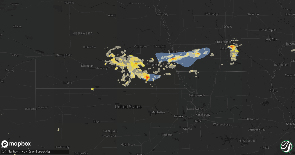
Hail Map on June 5, 2026
Get this storm
June 5 map
$229
one time, instant access
Download today. No call, no setup
Keep the $229
Bought the map and want the full workflow? Apply the entire $229 to a subscription within 7 days. None of it is wasted.
Every map, not just this one
This buys you this map. Subscription and you get every map we run, in the markets you choose from a few cities to whole states to nationwide. Plus real-time alerts the moment a storm fires.
Contact data
Name, contact info, occupancy, even credit band for addresses in the footprint. You go from where it hit to who to call.
Become the source they trust
Unlimited branding weather history reports on demand. You already have the documented answer ready for the property owner, and you are the one who showed up with it.
Property data and RoofTrace estimates
Pull up any address you have got, its value and the exact code rules for that jurisdiction, straight from One Click Code. Then RoofTrace estimates the squares, pitch, and roof value, priced the way you price.
States Impacted by Hail Map on June 5, 2026
Storm reports
New Mexico
| Date | Description |
|---|---|
| 06/04/20268:35 PM CDT | Awos station k0a0 spaceport america. |
Oklahoma
| Date | Description |
|---|---|
| 06/05/20263:50 PM CDT | Fairview mesonet. |
| 06/05/20263:45 PM CDT | Fairview mesonet. |
Wisconsin
| Date | Description |
|---|---|
| 06/05/20263:28 PM CDT | Large pine tree snapped. Trunk was approximately 2 feet in diameter and the total length of the tree was estimated to be 20 feet. Picture and report relayed via social |
| 06/04/20269:35 PM CDT | Tree down. The time of this report is an estimate based on radar data. |
| 06/04/20269:30 PM CDT | Tree down. The time of this report is an estimate based on radar data. |
| 06/04/20269:25 PM CDT | Tree down. The time of this report is an estimate based on radar data. |
| 06/04/20269:20 PM CDT | Trees down and power outages. 112 customers are without power. |
| 06/04/20269:10 PM CDT | Time estimated from radar. |
| 06/04/20269:00 PM CDT | Barn had a wall blown down. This barn was not in good shape and it was already missing its roof. |
| 06/04/20268:55 PM CDT | Barn flattened. Time estimated. |
| 06/04/20268:52 PM CDT | Trees on powerlines. Time estimated from radar. |
| 06/04/20268:50 PM CDT | Trees on powerlines. |
| 06/04/20268:46 PM CDT | Tree down on power line in kendall. |
| 06/04/20268:45 PM CDT | Power line down. |
| 06/04/20268:41 PM CDT | Power line down. |
| 06/04/20268:35 PM CDT | Tree down. The time of this report is an estimate based on radar data. |
| 06/04/20268:30 PM CDT | Power line down. |
| 06/04/20268:30 PM CDT | Power line down. |
| 06/04/20267:49 PM CDT | Trees and power lines down. |
| 06/04/20267:46 PM CDT | A local report indicates 1.50 inch wind near 1 NW Fountain City |
| 06/04/20267:33 PM CDT | Report from mping: quarter |
| 06/04/20267:08 PM CDT | Also nickel size hail. |
Texas
| Date | Description |
|---|---|
| 06/05/20266:10 PM CDT | Odell texas mesonet. |
| 06/05/20265:55 PM CDT | Picture received from trained spotter of quarter size hail and also reported leaves knocked off trees from hail in the area. |
| 06/05/20265:40 PM CDT | Several downed tree limbs 3 inches in diameter or larger... And minor structural damage within town. Several thousand were without power across del rio. Time estimated |
| 06/04/20267:40 PM CDT | Received pictures of hail stones up against a soda can... Which appeared to be slightly less wide than the top of the can which is 2 inches in diameter. Location was 2 |
Missouri
| Date | Description |
|---|---|
| 06/05/20263:12 PM CDT | Social media report of a large tree down at a residence near lathrop. Time estimated from radar. |
Michigan
| Date | Description |
|---|---|
| 06/05/20264:45 PM CDT | Hail between 3/4 to 1 inch. |
| 06/05/202612:00 AM CDT | Two large trees down on property. Health of trees is unknown. |
Iowa
| Date | Description |
|---|---|
| 06/04/202611:59 PM CDT | Measured from personal weather station. |
| 06/04/202611:58 PM CDT | Measured from personal weather station. |
| 06/04/202611:40 PM CDT | Report from mping: quarter |
| 06/04/202611:39 PM CDT | Report from mping: quarter |
| 06/04/202611:35 PM CDT | 1-2 inch tree limbs down. |
| 06/04/202611:29 PM CDT | A local report indicates 60 MPH wind near 5.6 WSW Grant |
| 06/04/202611:18 PM CDT | Reports of power flashes and ping pong ball sized hail south of massena. |
| 06/04/202611:18 PM CDT | Measured from personal weather station. |
| 06/04/202611:10 PM CDT | Trees uprooted. |
| 06/04/202611:10 PM CDT | Measured from personal weather station. |
| 06/04/202611:01 PM CDT | Measured from personal weather station. |
| 06/04/202611:00 PM CDT | A local report indicates 60 MPH wind near 4 SE Malvern |
| 06/04/202611:00 PM CDT | Report of tree on house in pleasantville. Time estimated from radar. |
| 06/04/202611:00 PM CDT | Report of quarter size hail south of massena relayed via chat. |
| 06/04/202610:58 PM CDT | Em reported flattened corn east of thurman. Time is estimated from radar. |
| 06/04/202610:56 PM CDT | Em reported the department of roads was working on clearing trees from roads in the thurman area. Time is estimated from radar. |
| 06/04/202610:56 PM CDT | Delayed report - received hail photo from social media. |
| 06/04/202610:54 PM CDT | A local report indicates 59 MPH wind near 7.8 NE Emerson |
| 06/04/202610:50 PM CDT | Several large tree limbs down. |
| 06/04/202610:48 PM CDT | A local report indicates 69 MPH wind near 5.9 W Macedonia |
| 06/04/202610:45 PM CDT | A local report indicates 60 MPH wind near 1.9 NW Henderson |
| 06/04/202610:44 PM CDT | Photo of mature walnut tree uprooted west of macedonia. Time is estimated from radar. |
| 06/04/202610:40 PM CDT | A local report indicates 59 MPH wind near 3 NW Silver City |
| 06/04/202610:34 PM CDT | A local report indicates 59 MPH wind near 2.0 S Silver City |
| 06/04/202610:19 PM CDT | Personal weather station. |
| 06/04/202610:18 PM CDT | Report of no power at truckstop near glenwood exit. Winds were estimated to have been between 60-70 mph. |
| 06/04/202610:18 PM CDT | Report of quarter size hail near glenwood exit. |
| 06/04/202610:11 PM CDT | Received text message from trained spotter of 63mph gust on pws. |
| 06/04/202610:02 PM CDT | Received photo from media of golf ball sized hail. |
| 06/04/202610:02 PM CDT | Received phone call from trained spotter reporting golf ball sized hail in pleasantville. |
| 06/04/202610:00 PM CDT | Delayed report - relayed from broadcast media. Time estimated from radar. |
| 06/04/20269:59 PM CDT | Received phone call of tree branches down north of sandyville. |
| 06/04/20269:55 PM CDT | Received phone call from trained spotter reporting quarter sized hail falling in pleasantville. |
Illinois
| Date | Description |
|---|---|
| 06/05/20266:05 AM CDT | Siding ripped of a home. Time estimated based on radar. |
| 06/05/20265:15 AM CDT | Reports of a tree down. Time estimated by radar. |
| 06/05/20265:00 AM CDT | Power pole downed onto a manufactured home along n 1800 e road between pontiac and fairbury. Tree damage also reported in the area. Time estimated from radar. |
| 06/05/20264:53 AM CDT | Wires and trees down reported. Time estimated by radar. |
Minnesota
| Date | Description |
|---|---|
| 06/05/20264:15 PM CDT | A local report indicates 1.50 inch wind near 2 W De Graff |
| 06/05/20263:40 PM CDT | Chandler field asos in alexandria... Mn reported a severe wind gust of 64 mph. |
| 06/05/20263:40 PM CDT | Alexandria law enforcement relayed a 1 inch |
| 06/05/20261:09 PM CDT | Delayed report. Several pictures showing several large broken pine trees. Public report noted a multitude of large trees snapped off at 20 to 30 feet above the ground. |
| 06/04/20268:14 PM CDT | Emergency management reported ping pong ball sized hail. |
| 06/04/20268:03 PM CDT | A local report indicates 1.75 inch wind near 2 ENE Goodview |
Nebraska
| Date | Description |
|---|---|
| 06/05/20261:41 AM CDT | Corrects previous non-tstm wnd dmg report from 1 nnw strang. A delayed social media report of a blown over tractor trailer with image. |
| 06/05/20261:30 AM CDT | Via personal weather station. May have had a gust as high as 76 mph a few minutes earlier... But considering this preliminary until other ground truth arrives from the |
| 06/05/20261:30 AM CDT | Via personal weather station. |
| 06/05/20261:24 AM CDT | Via personal weather station. |
| 06/04/202611:52 PM CDT | Corrects previous tstm wnd dmg report from 2 sse western. Flattened crops on both sides of highway 15 near western. Updated radar estimated time. |
| 06/04/202611:51 PM CDT | Mesonet station ne057 auburn nebraska city. |
| 06/04/202611:17 PM CDT | Flattened crops on both sides of highway 15 near western. |
| 06/04/202610:31 PM CDT | Report of ping pong ball sized hail in york. |
| 06/04/202610:29 PM CDT | Report of quarter sized hail in york. |
| 06/04/202610:29 PM CDT | A local report indicates 67 MPH wind near 0.6 ESE Plymouth |
| 06/04/202610:16 PM CDT | Em shared photos of damage to a farm. Damage included a destroyed sheet metal outbuilding... Overturned irrigation pivot... Crop damage... And down trees in the area. T |
| 06/04/202610:15 PM CDT | A local report indicates 68 MPH wind near 2.7 WNW Plymouth |
| 06/04/202610:08 PM CDT | Personal weather station. |
| 06/04/202610:05 PM CDT | Personal weather station. |
| 06/04/202610:04 PM CDT | Personal weather station. |
| 06/04/202610:02 PM CDT | A local report indicates 1.75 inch wind near 2 WNW Plattsmouth |
| 06/04/202610:02 PM CDT | Damage to metal siding and a broken window at a residence as a result of wind-driven large hail. Location is approximate. |
| 06/04/20269:54 PM CDT | Personal weather station. |
| 06/04/20269:52 PM CDT | Report of large hail between union and murray... Ne using a tape measure. Time is estimated from radar. Location is approximate. |
| 06/04/20268:56 PM CDT | Personal weather station. |
| 06/04/20268:30 PM CDT | A local report indicates 1.00 inch wind near 1 SW Swanton |
| 06/04/20268:00 PM CDT | A local report indicates 1.75 inch wind near 3 S Swanton |
| 06/04/20267:58 PM CDT | Report from em relayed via nwschat. |
Cities Impacted by Hail Map on June 5, 2026
- Long Prairie, MN
- Sauk Centre, MN
- Osakis, MN
- Mora, MN
- Altus, OK
- Headrick, OK
- Mountain Park, OK
- Brook Park, MN
- Grasston, MN
- Pine City, MN
- Gail, TX
- Hinckley, MN
- McCaulley, TX
- Hamlin, TX
- Danbury, WI
- Cleo Springs, OK
- Morton, TX
- Pecos, TX
- Coyanosa, TX
- Rogers, NM
- Canute, OK
- Pep, NM
- Barstow, TX
- Madison, MN
- Ames, OK
- Isabella, OK
- Ringwood, OK
- Morris, MN
- Hancock, MN
- Dawson, MN
- Sudan, TX
- Fairview, OK
- Boyd, MN
- Brandon, MN
- Milnesand, NM
- Cyrus, MN
- Granite Falls, MN
- Clarkfield, MN
- Starbuck, MN
- Benson, MN
- Clontarf, MN
- Alexandria, MN
- Garfield, MN
- Muleshoe, TX
- Rice Lake, WI
- Chester, OK
- Danvers, MN
- Hanley Falls, MN
- Glenwood, MN
- Las Vegas, NM
- Farwell, MN
- Arenas Valley, NM
- Carlos, MN
- Lowry, MN
- Villard, MN
- Memphis, TX
- Wood Lake, MN
- Murdock, MN
- Echo, MN
- Cornell, WI
- Holcombe, WI
- Conrath, WI
- Gould, OK
- Hollis, OK
- Alto, NM
- Ladysmith, WI
- Brooten, MN
- Tony, WI
- Gwinn, MI
- Ishpeming, MI
- Matador, TX
- Negaunee, MI
- Sheldon, WI
- Montevideo, MN
- Belgrade, MN
- Earth, TX
- Wellington, TX
- Maiden Rock, WI
- Orleans, NE
- Long Island, KS
- Phillipsburg, KS
- Stamford, NE
- Dimmitt, TX
- Lubbock, TX
- Plum City, WI
- Paynesville, MN
- Melrose, MN
- Pampa, TX
- Childress, TX
- Elbert, CO
- Scott City, KS
- Chillicothe, TX
- Calhan, CO
- Trementina, NM
- Agate, CO
- Ramah, CO
- Alma, WI
- Vernon, TX
- Nelson, WI
- Odell, TX
- Marienthal, KS
- Socorro, NM
- Plainview, TX
- Roswell, NM
- Cochrane, WI
- Arcadia, WI
- Hixton, WI
- Blair, WI
- Taylor, WI
- Independence, WI
- Polk, NE
- Fountain City, WI
- Black River Falls, WI
- Saint Libory, NE
- Grand Island, NE
- Hordville, NE
- Chapman, NE
- Stromsburg, NE
- Clarks, NE
- Garita, NM
- De Witt, NE
- Swanton, NE
- Central City, NE
- Canyon, TX
- Dryden, TX
- Stinnett, TX
- Amarillo, TX
- Minnesota City, MN
- Ohiowa, NE
- Ettrick, WI
- Galesville, WI
- Holmen, WI
- Trempealeau, WI
- Mindoro, WI
- Bangor, WI
- West Salem, WI
- Melrose, WI
- Dodge, WI
- Morse, TX
- Martell, NE
- Hickman, NE
- Firth, NE
- Western, NE
- Marquette, NE
- Bradshaw, NE
- Benedict, NE
- Alexandria, NE
- Tobias, NE
- Beatrice, NE
- Warrens, WI
- Winona, MN
- Wilber, NE
- Hampton, NE
- Plymouth, NE
- Sparta, WI
- Maljamar, NM
- Lake City, MN
- Phillips, NE
- Hallam, NE
- Staplehurst, NE
- Waco, NE
- Cortland, NE
- Dumas, TX
- Gresham, NE
- York, NE
- Hugo, CO
- Unadilla, NE
- Daykin, NE
- Crete, NE
- Dorchester, NE
- Stockholm, WI
- Otley, IA
- Aurora, NE
- Tomah, WI
- Norwalk, WI
- Wilton, WI
- Raymond, NE
- Valparaiso, NE
- Pella, IA
- Henderson, NE
- Palmyra, NE
- Pepin, WI
- Utica, NE
- Beaver Crossing, NE
- Durand, WI
- Arkansaw, WI
- McCool Junction, NE
- Kendall, WI
- Markesan, WI
- Bennet, NE
- Roca, NE
- Seward, NE
- Bee, NE
- Rock Port, MO
- Camp Douglas, WI
- Syracuse, NE
- Denton, NE
- Lincoln, NE
- Milligan, NE
- Walton, NE
- Dakota, MN
- Milford, NE
- Goehner, NE
- La Crosse, WI
- Onalaska, WI
- La Crescent, MN
- Avoca, NE
- Pleasant Dale, NE
- Fairmont, NE
- Geneva, NE
- Mauston, WI
- New Lisbon, WI
- Elroy, WI
- Otoe, NE
- Eagle, NE
- Jansen, NE
- Swan, IA
- Pleasantville, IA
- Orient, IA
- Exeter, NE
- Nehawka, NE
- Weeping Water, NE
- Ackworth, IA
- Hartford, IA
- Carlisle, IA
- Afton, IA
- Greenfield, IA
- Indianola, IA
- Malcolm, NE
- Garland, NE
- Elmwood, NE
- Houston, MN
- Friend, NE
- Louisville, NE
- Plattsmouth, NE
- Waverly, NE
- Nebraska City, NE
- Adams, NE
- Lorimor, IA
- Alvo, NE
- Greenwood, NE
- Murray, NE
- Ashland, NE
- Murdock, NE
- Union, NE
- Gretna, NE
- Gruver, TX
- Massena, IA
- Corning, IA
- Cumberland, IA
- Bridgewater, IA
- Springfield, NE
- Creston, IA
- Hokah, MN
- Coon Valley, WI
- Papillion, NE
- Cedar Creek, NE
- Pacific Junction, IA
- Bellevue, NE
- Chaseburg, WI
- Stoddard, WI
- Memphis, NE
- Wahoo, NE
- South Bend, NE
- Yutan, NE
- Ceresco, NE
- Ithaca, NE
- Mead, NE
- Colon, NE
- Fremont, NE
- Waterloo, NE
- Omaha, NE
- Elkhorn, NE
- La Vista, NE
- Boys Town, NE
- Offutt Afb, NE
- Council Bluffs, IA
- Manley, NE
- Glenwood, IA
- Clatonia, NE
- Pickrell, NE
- Mineola, IA
- Silver City, IA
- Treynor, IA
- Fairbury, NE
- Knoxville, IA
- Hastings, IA
- Henderson, IA
- Carson, IA
- Malvern, IA
- Macedonia, IA
- Melcher Dallas, IA
- Milo, IA
- Lacona, IA
- Panama, NE
- Dunbar, NE
- Griswold, IA
- Emerson, IA
- Villisca, IA
- Red Oak, IA
- Stanton, IA
- Elliott, IA
- Filley, NE
- Sidney, IA
- Thurman, IA
- Randolph, IA
- Imogene, IA
- Tabor, IA
- Essex, IA
- Atlantic, IA
- Grant, IA
- Lewis, IA
- Wiota, IA
- Oakland, IA
- Pleasanton, NE
- Ravenna, NE
- Burr, NE
- Sterling, NE
- Percival, IA
- Wolbach, NE
- Odell, NE
- Macksburg, IA
- Farragut, IA
- Shenandoah, IA
- Clarinda, IA
- Nodaway, IA
- Anita, IA
- Kearney, NE
- Gibbon, NE
- Cook, NE
- Monroe, IA
- Alda, NE
- Brock, NE
- Talmage, NE
- Belvidere, NC
- Tracy, IA
- Bussey, IA
- Giltner, NE
- Farwell, NE
- Columbia, IA
- Dannebrog, NE
- Fontanelle, IA
- Fullerton, NE
- Chariton, IA
- Palmer, NE
- Lovilia, IA
- Carbon, IA
- Dexter, IA
- Prescott, IA
- Stuart, IA
- Archer, NE
- Sutton, NE
- Grafton, NE
- Blanchard, IA
- Coin, IA
- Braddyville, IA
- College Springs, IA
- Cairo, NE
- Hamilton, IA
- Shelton, NE
- Wood River, NE
- Diller, NE
- Strang, NE
- Ridgeway, IA
- Cresco, IA
- Decorah, IA
- Saint Paul, NE
- Russell, IA
- Williamson, IA
- Elmo, MO
- Bedford, IA
- Clearmont, MO
- Hillsboro, WI
- Richland Center, WI
- Doniphan, NE
- Hopkins, MO
- New Market, IA
- Cary, IL
- Crystal Lake, IL
- Mchenry, IL
- North Loup, NE
- Cazenovia, WI
- Barrington, IL
- Island Lake, IL
- Wauconda, IL
- Melrose, IA
- Maryville, MO
- Lake Zurich, IL
- Pickering, MO
- New Albin, IA
- Dorchester, IA
- Loup City, NE
- Mitchellville, IA
- Prairie City, IA
- Lansing, IA
- Weldon, IA
- Shickley, NE
- Scotia, NE
- Elba, NE
- Rockville, NE
- Ashton, NE
- Colfax, IA
- Waukon, IA
- Newton, IA
- Hastings, NE
- Juniata, NE
- Corydon, IA
- Millerton, IA
- Trumbull, NE
- Harvard, NE
- Boelus, NE
- Monona, IA
- Bruning, NE
- Edgar, NE
- Promise City, IA
- Luana, IA
- Waterville, IA
- Harpers Ferry, IA
- Spearman, TX
- Malta, MT
- Inland, NE
- Saronville, NE
- Clay Center, NE
- Davenport, NE
- Fairfield, NE
- Aledo, IL
- Sherrard, IL
- Deweese, NE
- Orion, IL
- Nelson, NE
- Ong, NE
- Oak, NE
- Superior, NE
- Ruskin, NE
- Woodhull, IL
- Streator, IL
- Tonica, IL
- Matherville, IL
- La Crosse, IN
- Lynn Center, IL
- Lawrence, NE
- Varna, IL
- Toluca, IL
- Ophiem, IL
- Viola, IL
- New Windsor, IL
- Alpha, IL
- Hardy, NE
- Osco, IL
- Long Point, IL
- Minonk, IL
- Pontiac, IL
- Cornell, IL
- Flanagan, IL
- Cambridge, IL
- Geneseo, IL
- Galva, IL
- Blue Hill, NE
- Kewanee, IL
- Odell, IL
- Wolf Point, MT
- Wenona, IL
- Wilmington, IL
- Manteno, IL
- Saunemin, IL
- Cullom, IL
- Piper City, IL
- Kempton, IL
- Fairbury, IL
- Forrest, IL
- Ashkum, IL
- Chenoa, IL
- Guide Rock, NE
- Chatsworth, IL
- Graymont, IL
- Clifton, IL
- Fowler, IN
- Remington, IN
- Chalmers, IN
- Wolcott, IN
- Brookston, IN
- West Lafayette, IN