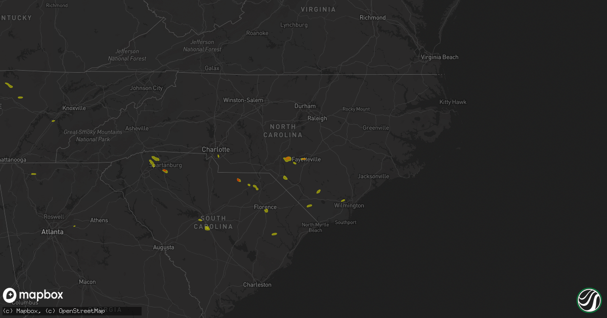
Hail Map on June 25, 2018
Get this storm
June 25 map
$229
one time, instant access
Download today. No call, no setup
Keep the $229
Bought the map and want the full workflow? Apply the entire $229 to a subscription within 7 days. None of it is wasted.
Every map, not just this one
This buys you this map. Subscription and you get every map we run, in the markets you choose from a few cities to whole states to nationwide. Plus real-time alerts the moment a storm fires.
Contact data
Name, contact info, occupancy, even credit band for addresses in the footprint. You go from where it hit to who to call.
Become the source they trust
Unlimited branding weather history reports on demand. You already have the documented answer ready for the property owner, and you are the one who showed up with it.
Property data and RoofTrace estimates
Pull up any address you have got, its value and the exact code rules for that jurisdiction, straight from One Click Code. Then RoofTrace estimates the squares, pitch, and roof value, priced the way you price.
States Impacted by Hail Map on June 25, 2018
Storm reports
Texas
| Date | Description |
|---|---|
| 06/25/20187:50 AM CDT | At 1250 AM CDT, a severe thunderstorm was located 5 miles southeast of Masterson, or 18 miles south of Dumas, moving east at 30 mph. HAZARD...60 mph wind gusts and half dollar size hail. SOURCE...Radar indicated. IMPACT...Minor damage to roofs, siding, and trees is possible. Hail damage to vehicles is expected. Locations impacted include... Borger, Panhandle, Fritch, Stinnett, Sanford, Masterson and Lake Meredith. |
| 06/24/201810:52 PM CDT | At 352 AM CDT, a severe thunderstorm was located 7 miles northeast of Bushland, or 10 miles northwest of Amarillo, moving east at 35 mph. HAZARD...Half dollar size hail. SOURCE...Radar indicated. IMPACT...Damage to vehicles is expected. Locations impacted include... Amarillo. |
| 06/24/201810:09 PM CDT | At 309 AM CDT, a severe thunderstorm was located over Vega, moving east at 30 mph. HAZARD...Ping pong ball size hail and 60 mph wind gusts. SOURCE...Radar indicated. IMPACT...Minor damage to roofs, siding, and trees is possible. People and animals outdoors will be injured. Expect hail damage to roofs, siding, windows, and vehicles. Locations impacted include... Vega and Wildorado. |
| 06/24/20188:02 PM CDT | At 102 AM CDT, a severe thunderstorm was located 15 miles southeast of Nara Visa, moving east at 35 mph. HAZARD...Ping pong ball size hail and 60 mph wind gusts. SOURCE...Radar indicated. IMPACT...Minor damage to roofs, siding, and trees is possible. People and animals outdoors will be injured. Expect hail damage to roofs, siding, windows, and vehicles. Locations impacted include... Vega, Channing, Boys Ranch and Wildorado. |
Tennessee
| Date | Description |
|---|---|
| 06/25/20185:49 PM CDT | Overton sheriff's office reported a tree blown down on highway 85/hilham rd near livingston. Dime size hail also reported with the same storm. |
| 06/25/20181:26 PM CDT | Numerous trees were reported down in madisonville. |
| 06/25/20181:15 PM CDT | Trees were reported down two miles south of chestnut hill. |
| 06/25/20181:10 PM CDT | Numerous trees and power lines were reported down... And there was a partial collapse of a building near the intersection of old washington highway and shipley lane two |
| 06/25/20181:09 PM CDT | Trees were reported down in oneida. |
| 06/25/20181:00 PM CDT | Trees were reported down in oneida. |
| 06/25/201812:55 PM CDT | Numerous trees were reported down with many homes damaged by falling limbs. One home was destroyed by the combination of falling trees and limbs. |
| 06/25/201812:30 PM CDT | Trees and power lines were reported down in the eastern part of knoxville. |
| 06/25/201812:25 PM CDT | Two trees were reported down five miles northeast of philadelphia. |
| 06/25/201812:15 PM CDT | A local report indicates 1.00 inch wind near LOUDON |
| 06/25/201810:40 AM CDT | A few trees down. |
| 06/25/20187:31 AM CDT | At 1231 PM EDT, a severe thunderstorm was located near Fairview, or 7 miles west of Loudon, moving east at 20 mph. HAZARD...60 mph wind gusts and quarter size hail. SOURCE...Radar indicated. IMPACT...Hail damage to vehicles is expected. Expect wind damage to roofs, siding, and trees. Locations impacted include... Oak Ridge, Lenoir City, Kingston, Rockwood, Loudon, Fairview, Midtown, Harriman, Philadelphia, Paint Rock, Bradbury and Tellico Village. |
| 06/25/20186:27 AM CDT | At 1127 AM EDT/1027 AM CDT/, a severe thunderstorm was located 9 miles west of Spring City, or 12 miles northeast of Pikeville, moving east at 15 mph. HAZARD...60 mph wind gusts and quarter size hail. SOURCE...Radar indicated. IMPACT...Hail damage to vehicles is expected. Expect wind damage to roofs, siding, and trees. Locations impacted include... Spring City, Grandview, Piney Falls State Park, Melvine and Stinging Fork Falls State Park. |
| 06/25/20181:32 AM CDT | At 632 PM CDT, a severe thunderstorm was located 8 miles east of Monterey, or 11 miles north of Crossville, moving east at 25 mph. HAZARD...60 mph wind gusts and quarter size hail. SOURCE...Radar indicated. IMPACT...Hail damage to vehicles is expected. Expect wind damage to roofs, siding, and trees. Locations impacted include... Crossville, Fairfield Glade, Slate Springs and Clarkrange. This includes Interstate 40 between mile markers 308 and 318. |
| 06/25/201812:51 AM CDT | At 551 PM CDT, a severe thunderstorm was located near Livingston, moving southeast at 20 mph. HAZARD...60 mph wind gusts and quarter size hail. SOURCE...Radar indicated. IMPACT...Hail damage to vehicles is expected. Expect wind damage to roofs, siding, and trees. Locations impacted include... Livingston. |
| 06/24/201811:13 PM CDT | At 413 PM EDT, a severe thunderstorm was located over Rominger, moving east at 30 mph. HAZARD...60 mph wind gusts and quarter size hail. SOURCE...Radar indicated. IMPACT...Hail damage to vehicles is expected. Expect wind damage to roofs, siding, and trees. Locations impacted include... Boone... Blowing Rock... Beech Mountain... Foscoe... and Sugar Grove.This includes The following Location Appalachian State University. |
| 06/24/201811:00 PM CDT | At 359 PM EDT, severe thunderstorms were located along a line extending from 4 miles north of Beech Mountain to 11 miles northwest of Marion to 6 miles south of Marshall, moving east at 35 mph. HAZARD...60 mph wind gusts and quarter size hail. SOURCE...Radar indicated. IMPACT...Minor hail damage to vehicles is expected. Expect wind damage to trees and power lines. Locations impacted include... Downtown Asheville, Marion, Spruce Pine, Burnsville, Newland, East Asheville, West Asheville, North Asheville, Black Mountain and Woodfin. |
| 06/24/201810:45 PM CDT | At 345 PM EDT, severe thunderstorms were located along a line extending from 5 miles south of Bryson City to 4 miles southwest of Hayesville, moving east at 15 mph. HAZARD...60 mph wind gusts and quarter size hail. SOURCE...Radar indicated. IMPACT...Minor hail damage to vehicles is expected. Expect wind damage to trees and power lines. Locations impacted include... Franklin, Bryson City, Robbinsville, Cherokee, Town Of Santeetlah, Smoky Mountains-Newfound Gap, Smoky Mountains-Fontana Area, Lake Santeetlah, Fontana Lake and Nantahala Lake. |
| 06/24/20189:02 PM CDT | At 201 PM EDT, severe thunderstorms were located along a line extending from near Rockcastle Springs to near Zion Hill, moving east at 45 mph. HAZARD...60 mph wind gusts. SOURCE...Radar indicated. IMPACT...Expect damage to roofs, siding, and trees. Locations impacted include... Williamsburg, Barbourville, Pineville, Middlesboro, Fariston, Brightshade, Varilla, Swan Lake, Cumberland Falls S.P., Goose Rock, Mount Victory and Bush. |
| 06/24/20188:55 PM CDT | At 155 PM EDT, severe thunderstorms were located along a line extending from 6 miles west of Rockwood to near Decatur to near Dayton, moving east at 35 mph. HAZARD...60 mph wind gusts and penny size hail. SOURCE...Radar indicated. IMPACT...Expect damage to roofs, siding, and trees. Locations impacted include... Athens, Lenoir City, Dayton, Kingston, Sweetwater, Rockwood, Loudon, Madisonville, Decatur, Farragut, Fairview, Etowah, Spring City, Midtown, Englewood, Graysville, Vonore, Greenback, Friendsville and Tellico Plains. |
| 06/24/20188:45 PM CDT | At 145 PM EDT, a severe thunderstorm was located near Sevierville, moving east at 35 mph. HAZARD...60 mph wind gusts and penny size hail. SOURCE...Radar indicated. IMPACT...Expect damage to roofs, siding, and trees. Locations impacted include... Knoxville, Maryville, Sevierville, Alcoa, Jefferson City, Newport, Gatlinburg, Dandridge, Pigeon Forge, New Market, Rockford, Baneberry, Parrottsville, Eagleton Village, Strawberry Plains, Greenback, Pittman Center, Townsend, Del Rio and Walland. |
| 06/24/20188:05 PM CDT | At 105 PM EDT, a severe thunderstorm was located over Loudon, moving east at 25 mph. HAZARD...60 mph wind gusts and quarter size hail. SOURCE...Radar indicated. IMPACT...Hail damage to vehicles is expected. Expect wind damage to roofs, siding, and trees. Locations impacted include... Maryville, Lenoir City, Alcoa, Loudon, Louisville, Rockford, Eagleton Village, Vonore, Greenback, Friendsville, Philadelphia, Happy Valley, Clover Hill and Tellico Village. |
| 06/24/20188:01 PM CDT | At 101 PM EDT, a severe thunderstorm was located near Farragut, or 8 miles east of Oak Ridge, moving east at 30 mph. HAZARD...60 mph wind gusts and quarter size hail. SOURCE...Radar indicated. IMPACT...Hail damage to vehicles is expected. Expect wind damage to roofs, siding, and trees. Locations impacted include... Knoxville, Oak Ridge, Sevierville, Alcoa, Farragut, Louisville, Rockford, Karns, Kimberlin Heights, McMahan, Lake Forest, Bearden, Powell, Seymour, Kodak and Mascot. |
Illinois
| Date | Description |
|---|---|
| 06/25/20184:32 AM CDT | Several trees were blown over throughout collinsville. The worst damage occurred near st. Johns cemetery where several large trees and headstones were toppled. |
| 06/25/20184:18 AM CDT | At 918 PM CDT, a severe thunderstorm was located over Tamaroa, or 7 miles northeast of Pinckneyville, moving east at 30 mph. HAZARD...60 mph wind gusts and quarter size hail. SOURCE...Radar indicated. IMPACT...Hail damage to vehicles is expected. Expect wind damage to roofs, siding, and trees. Locations impacted include... Du Quoin, Pinckneyville and Tamaroa. |
| 06/25/20183:57 AM CDT | At 857 PM CDT, a severe thunderstorm was located near Pinckneyville, moving east at 20 mph. HAZARD...70 mph wind gusts and quarter size hail. SOURCE...Radar indicated. IMPACT...Hail damage to vehicles is expected. Expect considerable tree damage. Wind damage is also likely to mobile homes, roofs, and outbuildings. Locations impacted include... Pinckneyville. |
South Carolina
| Date | Description |
|---|---|
| 06/25/20186:57 PM CDT | Reported trees and power lines down along wash lever road. |
| 06/25/20186:52 PM CDT | Reported strong winds that downed several trees in the area. |
| 06/25/20186:48 PM CDT | Sheriff dispatch reported multiple trees down across the county. |
| 06/25/20186:37 PM CDT | Sc highway patrol reported trees down on walker road at sc 283. |
| 06/25/20186:33 PM CDT | One tree down across parkins road. |
| 06/25/20186:30 PM CDT | Sheriff dispatch reported multiple trees down across the central and eastern portion of the county. |
| 06/25/20186:20 PM CDT | Reported numerous trees down in the sandy run community in the northern part of the county. |
| 06/25/20186:20 PM CDT | Schp reported a tree down at highway 248 and louden rd |
| 06/25/20186:20 PM CDT | Schp reported a tree down at brickyard rd and dyson rd |
| 06/25/20186:15 PM CDT | Schp reported a tree down at tedards store rd and scotch cross rd e |
| 06/25/20186:15 PM CDT | Schp reported a tree down at wilson bridge rd and daniel heights rd |
| 06/25/20186:15 PM CDT | Schp reported a tree down at apache dr and fairforest dr |
| 06/25/20186:10 PM CDT | County reports widespread trees and power lines down across the county with a few trees blown down on houses in union. |
| 06/25/20186:10 PM CDT | Schp reported a tree down on tillman territory rd |
| 06/25/20186:10 PM CDT | Schp reported a couple of trees blown down on highway 10 near morton rd |
| 06/25/20186:05 PM CDT | Schp reported a tree down at highway 72 and renno rd |
| 06/25/20186:04 PM CDT | Sheriff dispatch reported multiple trees down across the northern portion of the county. |
| 06/25/20186:00 PM CDT | Tree down along salem road. |
| 06/25/20186:00 PM CDT | Schp reported a tree down at highway 221 and highway 127 |
| 06/25/20185:59 PM CDT | Quarter size hail reported along emanuel church road just west of the airport. |
| 06/25/20185:55 PM CDT | Schp reported a tree down at torrington rd and leesville church rd |
| 06/25/20185:55 PM CDT | Schp reported a tree down on bellview church rd |
| 06/25/20185:55 PM CDT | The congaree national park reported several trees down within the park. A portion of the lower boardwalk was damaged due to fallen trees. |
| 06/25/20185:55 PM CDT | Schp reported a tree down at bethany church rd and highway 308 |
| 06/25/20185:55 PM CDT | Law enforcement reported a tree down on ranch road |
| 06/25/20185:55 PM CDT | Schp reported a tree down at highway 56 and musgrove mill rd |
| 06/25/20185:50 PM CDT | Large tree limbs down. Winds estimated at 60 mph. |
| 06/25/20185:47 PM CDT | Spotter reports tree down on hwy 76. |
| 06/25/20185:36 PM CDT | Trees down blocking roadway. |
| 06/25/20185:36 PM CDT | Highway patrol reported trees down at the intersection of highway 341 and highway 76 near lynchburg. |
| 06/25/20185:35 PM CDT | Schp reported a tree down at old blackstock rd and lincoln school rd |
| 06/25/20185:35 PM CDT | Tree reported down on park ave. At the southern edge of the town limit in olanta... Sc. Large tree was reported down. Call came in at 7:56pm but reporter suggested the |
| 06/25/20185:35 PM CDT | Schp reported a tree down on derrick rd |
| 06/25/20185:35 PM CDT | Schp reported a tree down on beacon light rd |
| 06/25/20185:30 PM CDT | Golf ball size hail. |
| 06/25/20185:25 PM CDT | Tree down on creek rd. |
| 06/25/20185:25 PM CDT | Schp reported a tree down at old georgia rd and i-26 |
| 06/25/20185:25 PM CDT | Schp reported a tree down on dorchester rd |
| 06/25/20185:22 PM CDT | A few trees blown down on scuffletown road near jonesville road. |
| 06/25/20185:22 PM CDT | Report of quarter size hail. |
| 06/25/20185:20 PM CDT | Schp reported a tree down at dillard rd and s batesville rd |
| 06/25/20185:20 PM CDT | Schp reported a tree down at dillard dr and gibbs shoals rd |
| 06/25/20185:20 PM CDT | Schp reported a tree down at griffin rd and highway 29 |
| 06/25/20185:15 PM CDT | Schp reported a tree down at highway 81 and white horse rd. |
| 06/25/20185:15 PM CDT | Schp reported a tree down at robins st and gap creek rd |
| 06/25/20185:15 PM CDT | Schp reported a tree down at s spencer st and duncan-reidville rd |
| 06/25/20185:06 PM CDT | Structual damage to gas station canopy. Also...a large tree blown over in the same area. |
| 06/25/20185:02 PM CDT | Lee county dispatch reported trees down on raccoon road. Time estimated based on radar. |
| 06/25/20185:02 PM CDT | Quarter size hail at hwy 14 and old wagon road. |
| 06/25/20185:00 PM CDT | Amateur radio reported a 6-inch diameter tree limb fell onto moving vehicle on sc 253 just south of mountain creek church rd. Time estimated from radar. |
| 06/25/20185:00 PM CDT | Amateur radio reported a 40 foot tall mimosa tree fell onto a barn at 201 piney road. Time estimated from radar. |
| 06/25/20184:59 PM CDT | Tree down on 5360 pleasant drive. |
| 06/25/20184:55 PM CDT | South carolina highway patrol reported a tree down on highway 321 between robertville and highway 601. |
| 06/25/20184:55 PM CDT | South carolina highway patrol reported a tree down on bethel road near bethel church. The tree was blown down by thunderstorm outflow. |
| 06/25/20184:54 PM CDT | Tree blown down on farrs rd. |
| 06/25/20184:50 PM CDT | Schp reported a tree down at fews bridge rd and gum springs rd |
| 06/25/20184:50 PM CDT | Schp reported a tree down at skyland dr and long shoals rd |
| 06/25/20184:50 PM CDT | Schp reported a tree down on jordan rd |
| 06/25/20184:50 PM CDT | Schp reported a tree down at first ave and roundtree ln |
| 06/25/20184:50 PM CDT | Schp reported a tree down at old white horse rd and keeler mill rd. |
| 06/25/20184:50 PM CDT | Schp reported power lines down at highway 24 and little league dr |
| 06/25/20184:45 PM CDT | Public reported multiple trees blown down in and around pendleton. |
| 06/25/20184:45 PM CDT | Schp reported multiple trees blown down in the blue ridge community |
| 06/25/20184:39 PM CDT | Reported a couple of trees down along highway 15 near the lee county and darlington county line. Also reports of pea size hail in the area. |
| 06/25/20184:35 PM CDT | Schp reported a tree down at asbury dr and hagood rd |
| 06/25/20184:35 PM CDT | South carolina highway patrol reported a tree down on i-26 near mile marker 179 eastbound. The tree was blown down by thunderstorm outflow. |
| 06/25/20184:35 PM CDT | Schp reported a tree down at pumpkintown rd and highway 276 |
| 06/25/20184:35 PM CDT | Schp reported power lines down at highway 276 and geer highway |
| 06/25/20184:35 PM CDT | Schp reported a tree down on geer highway |
| 06/25/20184:30 PM CDT | South carolina highway patrol reported a tree down on edward road near the intersection with black creek road. The tree was blown down by thunderstorm outflow. |
| 06/25/20184:30 PM CDT | Schp reported a tree down at highway 11 and n retreat rd |
| 06/25/20184:25 PM CDT | Sheriff department relayed numerous reports of trees and power lines down across the county. |
| 06/25/20184:20 PM CDT | Trees reported down on jacksonboro road between round o road and parkers ferry road. |
| 06/25/20184:16 PM CDT | Tree down on bridle circle and trilly lane. |
| 06/25/20184:10 PM CDT | Reported golf ball size hail just east of the town of jefferson. |
| 06/25/20184:05 PM CDT | Two large trees down on bridle circle. |
| 06/25/20183:54 PM CDT | Corrects previous tstm wnd dmg report from 12 n winnsboro. Reported several large limbs down along dawkinsville road near the blackstock community. |
| 06/25/20183:42 PM CDT | South carolina highway patrol reported a tree down on mallard road near the intersection with orangeburg road. |
| 06/25/20183:40 PM CDT | Tree reported down near the intersection of butternut road with orangeburg road. |
| 06/25/20183:34 PM CDT | Tree down on holly street in winnsboro mills. |
| 06/25/20183:26 PM CDT | Tree reported down near the intersection of highway 27 with bridlewood farms parkway. |
| 06/25/20183:25 PM CDT | Trees reported down near the intersection of highway 61 with highway 27. |
| 06/25/20183:14 PM CDT | Nws cooperative observer along with highway department reported a tree across river road. |
| 06/25/20183:07 PM CDT | Tree reported down on rose dhu creek plantation. |
| 06/25/20183:05 PM CDT | Report of a couple trees blown down. |
| 06/25/20183:04 PM CDT | Tree reported down along sc highway 9 at clio country club. |
| 06/25/20183:00 PM CDT | Public reported quarter size hail 7 miles se of patrick lasting 5 to 6 minutes via facebook. |
| 06/25/20182:53 PM CDT | Emergency manager reported a tree down just south of patrick along highway 1. |
| 06/25/20182:52 PM CDT | Sheriffs dispatch reported trees down near the intersection of bbb circle and highway 1. |
| 06/25/20182:52 PM CDT | Reported tree limbs down on power lines and a broken power line pole along old swamp road in the sandy run community. |
| 06/25/20182:15 PM CDT | Reported a tree down in the eastbound side of i-26 near mile marker 133. |
| 06/25/20181:55 PM CDT | 1.25 inch hail reported at new cut road and gowan road. |
| 06/25/20181:52 PM CDT | Utility reported tree limbs down on lines along with a broken power pole on old swamp road in the sandy run community. |
| 06/25/20181:50 PM CDT | Public reported trees snapped or uprooted on turning leaf circle |
| 06/25/20181:45 PM CDT | Social media report of a tree down on a wooden fence in the wellford area. |
| 06/25/20181:40 PM CDT | A local report indicates 1.00 inch wind near INMAN |
| 06/25/20181:35 PM CDT | Schp reported a tree down at h st and church ave |
| 06/25/20181:30 PM CDT | Social media report of quarter |
| 06/25/20187:58 AM CDT | At 1257 AM EDT, severe thunderstorms were located along a line extending from 7 miles west of Edisto Beach to 8 miles northwest of Bellinger Hill Area, moving southeast at 35 mph. HAZARD...60 mph wind gusts. SOURCE...Radar indicated. IMPACT...Expect damage to trees and powerlines. Locations impacted include... Hilton Head Island, Bluffton, Beaufort, Port Royal, Edisto Beach, Bellinger Hill Area, Fort Pulaski National Monument and Clarendon.This warning includes I-95 in South Carolina between mile markers 3and 15. |
| 06/25/20184:14 AM CDT | At 914 PM EDT, severe thunderstorms were located along a line extending from near St. Matthews to near Ulmer, moving southeast at 25 mph. HAZARD...60 mph wind gusts. SOURCE...Radar indicated. IMPACT...Expect damage to roofs, siding, and trees. Locations impacted include... Orangeburg, Bamberg, Brookdale, Holly Hill, Branchville, Summerton, Bowman, Elloree, Santee, Ehrhardt, Cameron, Eutawville, Rowesville, Olar, Vance, Cordova, Cope, Govan, Wilkinson Heights and Edisto.This includes the following highways... Interstate 26 between mile markers 144 and 169. Interstate 95 between mile markers 85 and 113. |
| 06/25/20183:57 AM CDT | At 856 PM EDT, severe thunderstorms were located along a line extending from near Pinehurst to 7 miles northwest of Hoffman to 8 miles southwest of Wadesboro, moving southeast at 35 mph. This storm has a history of producing wind damage. HAZARD...60 mph wind gusts and penny size hail. SOURCE...Radar indicated. IMPACT...Expect damage to roofs, siding, and trees. Locations impacted include... Laurinburg, Rockingham, Raeford, Hamlet, Maxton, Hoffman, Antioch, Ellerbe, Dobbins Heights and Wagram. |
| 06/25/20183:52 AM CDT | At 851 PM EDT, severe thunderstorms were located along a line extending from 12 miles northwest of Barnwell to near Mount Vernon, moving east at 45 mph. HAZARD...60 mph wind gusts and penny size hail. SOURCE...Law enforcement reports. Multiple reports of trees blown down. IMPACT...Expect damage to trees and powerlines. Locations impacted include... Statesboro, Reidsville, Metter, Allendale, Millen, Sylvania, Hampton and Claxton.This warning includes... I-16 between mile markers 96 and 130. I-95 in South Carolina near mile marker 68. |
| 06/25/20183:46 AM CDT | At 844 PM EDT, a severe thunderstorm was located near Waynesboro, moving east at 20 mph. HAZARD...60 mph wind gusts and nickel size hail. SOURCE...Radar indicated. Burke County Dispatch reported multiple trees down across the county associated with this storm. IMPACT...Expect damage to roofs, siding, and trees. Locations impacted include... Waynesboro, Sardis, Midville, Girard and Vidette. |
| 06/25/20183:45 AM CDT | At 845 PM EDT, severe thunderstorms were located along a line extending from 8 miles west of Wadesboro to near Kershaw, moving east at 25 mph. HAZARD...60 mph wind gusts. SOURCE...Radar indicated. IMPACT...Expect damage to roofs, siding, and trees. Locations impacted include... Cheraw, Pageland, Kershaw, Chesterfield, Mcbee, Jefferson, Ruby, Patrick, Bethune and Mount Croghan. |
| 06/25/20183:43 AM CDT | At 843 PM EDT, severe thunderstorms were located along a line extending from 9 miles north of Camden to near Forest Acres, moving east at 40 mph. HAZARD...60 mph wind gusts. SOURCE...Radar indicated. IMPACT...Expect damage to roofs, siding, and trees. Locations impacted include... Sumter, Camden, Bishopville, South Sumter, St. Matthews, Eastover, Lugoff, Oakland, Mulberry, Fort Jackson, Millwood, Mayesville, Pinewood, Bethune, Paxville, Cane Savannah, Dalzell, Wedgewood, Cherryvale and Stateburg.This includes the following highways... Interstate 20 in South Carolina between mile markers 78 and 125. Interstate 26 between mile markers 123 and 127, and between milemarkers 131 and 136. Interstate 77 between mile markers 7 and 8. |
| 06/25/20183:14 AM CDT | At 813 PM EDT, severe thunderstorms were located along a line extending from near Manning to near Elloree to 10 miles south of Gaston, moving southeast at 20 mph. HAZARD...70 mph wind gusts and quarter size hail. SOURCE...Radar indicated. IMPACT...Hail damage to vehicles is expected. Expect considerable tree damage. Wind damage is also likely to mobile homes, roofs, and outbuildings. Locations impacted include... Orangeburg, Manning, Brookdale, South Sumter, St. Matthews, Holly Hill, Summerton, Bowman, Elloree, Santee, North, Pinewood, Cameron, Neeses, Eutawville, Paxville, Woodford, Vance, Cordova and Livingston.This includes the following highways... Interstate 26 between mile markers 135 and 169. Interstate 95 between mile markers 85 and 130. |
| 06/25/20183:06 AM CDT | At 806 PM EDT, a severe thunderstorm was located 10 miles southeast of Wrens, or 13 miles west of Waynesboro, moving east at 20 mph. HAZARD...60 mph wind gusts and quarter size hail. SOURCE...Radar indicated. IMPACT...Hail damage to vehicles is expected. Expect wind damage to roofs, siding, and trees. Locations impacted include... Aiken, North Augusta, Lexington, West Columbia, Cayce, Irmo, Waynesboro, Springdale, Fort Gordon, Red Bank, Augusta, Clearwater, Oak Grove, Belvedere, Martinez, Batesburg-Leesville, Hephzibah, South Congaree, Pine Ridge and New Ellenton.This includes the following highways... Interstate 20 in Georgia between mile markers 195 and 201. Interstate 20 in South Carolina between mile markers 0 and 63. Interstate 26 between mile markers 109 and 120, and between milemarkers 128 and 130. Interstate 520 in Georgia between mile markers 1 and 15. Interstate 520 in South Carolina between mile markers 16 and 23. Interstate 77 between mile markers 0 and 2. |
| 06/25/20183:05 AM CDT | At 804 PM EDT, severe thunderstorms were located along a line extending from near Mineral Springs to 7 miles northeast of Irmo, moving southeast at 50 mph. HAZARD...60 mph wind gusts and penny size hail. SOURCE...Radar indicated. IMPACT...Expect damage to roofs, siding, and trees. Locations impacted include... Columbia, Irmo, Forest Acres, Lancaster, Camden, Winnsboro, St. Andrews, Dentsville, Woodfields, Pageland, Kershaw, Elgin, Arcadia Lakes, Eastover, Heath Springs, Lugoff, Irwin, Woodfield, Fort Jackson and Five Points.This includes the following highways... Interstate 126 near mile marker 3. Interstate 20 in South Carolina between mile markers 65 and 105. Interstate 26 between mile markers 96 and 103. Interstate 77 between mile markers 3 and 50. |
| 06/25/20182:59 AM CDT | At 758 PM EDT, a severe thunderstorm was located 12 miles northeast of Monroe, or 6 miles north of Marshville, moving east at 25 mph. HAZARD...60 mph wind gusts and quarter size hail. SOURCE...Radar indicated. IMPACT...Minor hail damage to vehicles is expected. Expect wind damage to trees and power lines. Locations impacted include... Monroe, Indian Trail, Weddington, Stallings, Unionville, Wesley Chapel, Wingate, Waxhaw, Marshville and Lake Park. |
| 06/25/20182:41 AM CDT | At 741 PM EDT, severe thunderstorms were located along a line extending from 11 miles west of Hebron to 12 miles north of Elloree to near Gaston, moving south at 20 mph. HAZARD...60 mph wind gusts and quarter size hail. SOURCE...Radar indicated. IMPACT...Hail damage to vehicles is expected. Expect wind damage to roofs, siding, and trees. Locations impacted include... Manning, South Sumter, Brookdale, St. Matthews, Gaston, Summerton, Eastover, Elloree, Millwood, Swansea, North, Pinewood, Cameron, Paxville, Woodford, Cane Savannah, Lakewood, Privateer and Wedgewood.This includes the following highways... Interstate 26 between mile markers 121 and 148. Interstate 95 between mile markers 101 and 131. |
| 06/25/20182:41 AM CDT | At 740 PM EDT, severe thunderstorms were located along a line extending from near Badin Lake through Albemarle to 6 miles east of Unionville, moving southeast at 30 mph. HAZARD...60 mph wind gusts and nickel size hail. SOURCE...Radar indicated. IMPACT...Expect damage to roofs, siding, and trees. Locations impacted include... Rockingham, Wadesboro, Hamlet, Ansonville, Hoffman, Polkton, Ellerbe, Dobbins Heights, Candor and Lilesville. |
| 06/25/20182:39 AM CDT | At 739 PM EDT, a severe thunderstorm was located near Prosperity, or 10 miles southeast of Newberry, moving east at 10 mph. HAZARD...60 mph wind gusts and quarter size hail. SOURCE...Radar indicated. IMPACT...Hail damage to vehicles is expected. Expect wind damage to roofs, siding, and trees. Locations impacted include... Newberry, Winnsboro, Batesburg, Batesburg-Leesville, Saluda, Whitmire, Prosperity, Ridge Spring, Leesville, Blythewood, Chapin, Ridgeway, Little Mountain, Monetta, Pomaria, Silverstreet, Ward, Peak, Lake Murray Of Richland and Winnsboro Mills.This includes the following highways... Interstate 26 between mile markers 62 and 99. Interstate 77 between mile markers 27 and 50. |
| 06/25/20182:24 AM CDT | At 724 PM EDT, a severe thunderstorm was located near Evans, moving east at 15 mph. HAZARD...60 mph wind gusts and quarter size hail. SOURCE...Radar indicated. IMPACT...Hail damage to vehicles is expected. Expect wind damage to roofs, siding, and trees. Locations impacted include... Grovetown, Evans, Martinez, Fort Gordon, Edgefield, Johnston, Trenton, Parksville, Modoc, Murphys Estates and Clarks Hill.This includes the following highways... Interstate 20 in Georgia between mile markers 181 and 201. Interstate 20 in South Carolina near mile marker 0. Interstate 520 in Georgia between mile markers 1 and 5. |
| 06/25/20182:21 AM CDT | At 721 PM EDT, a severe thunderstorm was located 10 miles northwest of Monroe, or near Hemby Bridge, moving east at 25 mph. HAZARD...60 mph wind gusts and quarter size hail. SOURCE...Radar indicated. IMPACT...Minor hail damage to vehicles is expected. Expect wind damage to trees and power lines. Locations impacted include... Monroe, South Charlotte, East Charlotte, Matthews, Mint Hill, Indian Trail, Weddington, Stallings, Unionville and Pineville. |
| 06/25/20182:13 AM CDT | At 713 PM EDT, severe thunderstorms were located along a line extending from near Gaston to 7 miles southeast of Eastover, moving southeast at 25 mph. HAZARD...60 mph wind gusts and quarter size hail. SOURCE...Radar indicated. IMPACT...Hail damage to vehicles is expected. Expect wind damage to roofs, siding, and trees. Locations impacted include... Orangeburg, Brookdale, St. Matthews, Gaston, Swansea, North, Pelion, Cameron, Neeses, Woodford, Livingston and Wilkinson Heights.This includes the following highways... Interstate 20 in South Carolina near mile marker 47. Interstate 26 between mile markers 120 and 151. |
| 06/25/20181:57 AM CDT | At 657 PM EDT, severe thunderstorms were located along a line extending from near Hebron to near St. Matthews, moving southeast at 15 mph. HAZARD...60 mph wind gusts and quarter size hail. SOURCE...Radar indicated. IMPACT...Hail damage to vehicles is expected. Expect wind damage to roofs, siding, and trees. Locations impacted include... Manning, Summerton, Turbeville, Pinewood, Cameron and Paxville. This includes Interstate 95 between mile markers 100 and 132. |
| 06/25/20181:43 AM CDT | At 643 PM EDT, a severe thunderstorm was located 11 miles east of Gaston, or 13 miles southeast of Cayce, moving southeast at 15 mph. HAZARD...60 mph wind gusts and quarter size hail. SOURCE...Radar indicated. IMPACT...Hail damage to vehicles is expected. Expect wind damage to roofs, siding, and trees. Locations impacted include... St. Matthews.This includes Interstate 26 near mile marker 131. |
| 06/25/20181:38 AM CDT | At 638 PM EDT, a severe thunderstorm was located over Sidney, or 10 miles southwest of Whiteville, moving east at 25 mph. HAZARD...60 mph wind gusts and quarter size hail. SOURCE...Radar indicated. IMPACT...Minor hail damage to vehicles is possible. Expect wind damage to trees and power lines. Locations impacted include... Tabor City, Bethel, Lake Waccamaw, Makatoka, Freeland, Honey Island, Nakina, Old Dock, Exum, Mollie, Bughill, Sidney, Clarendon, Williams, Ash, Crusoe Island and Brunswick. |
| 06/25/20181:22 AM CDT | At 621 PM EDT, severe thunderstorms were located along a line extending from 6 miles northwest of Gastonia to 4 miles northwest of Spartanburg, moving east at 35 mph. HAZARD...60 mph wind gusts and quarter size hail. SOURCE...Radar indicated. IMPACT...Minor hail damage to vehicles is expected. Expect wind damage to trees and power lines. Locations impacted include... Gastonia, Spartanburg, Shelby, Gaffney, Greer, Taylors, Kings Mountain, Mt Holly, Cherryville and Bessemer City. |
| 06/25/20181:10 AM CDT | At 609 PM EDT, severe thunderstorms were located along a line extending from near Sardis to near Brittons Neck, moving south at 15 mph. HAZARD...60 mph wind gusts and penny size hail. SOURCE...Radar indicated. IMPACT...Expect damage trees and power lines. Locations impacted include... Lake City, Kingstree, Johnsonville, Pamplico, Hemingway, Sardis, Hannah, Cades, Poston, Nesmith, Brittons Neck, Indiantown, Gresham, Hebron, Friendfield, Henry, Kingsburg, Scranton, Coward and Olanta.This includes Interstate 95 IN South Carolina near mile marker 147. |
| 06/25/20181:07 AM CDT | At 607 PM EDT, a severe thunderstorm was located over Oatland, or 9 miles north of Georgetown, moving south at 15 mph. HAZARD...60 mph wind gusts and nickel size hail. SOURCE...Radar indicated. IMPACT...Expect damage trees and power lines. Locations impacted include... Georgetown, Jackson, Sampit, Plantersville, Graves, Oatland and Georgetown Memorial Hospital. |
| 06/25/201812:57 AM CDT | At 557 PM EDT, severe thunderstorms were located along a line extending from near Sardis to 7 miles northwest of Oakland, moving east at 40 mph. HAZARD...60 mph wind gusts and quarter size hail. SOURCE...Radar indicated. IMPACT...Hail damage to vehicles is expected. Expect wind damage to roofs, siding, and trees. Locations impacted include... Sumter, South Sumter, Mulberry, Oakland, Millwood, Turbeville, Mayesville, Lynchburg, Cane Savannah, Oswego, Dalzell, Wedgewood, East Sumter, Cherryvale, Rembert, Shiloh and Stateburg.This includes the following highways... Interstate 20 in South Carolina between mile markers 91 and 93, andbetween mile markers 117 and 122. Interstate 95 between mile markers 132 and 146. |
| 06/25/201812:45 AM CDT | At 545 PM EDT, severe thunderstorms were located along a line extending from 9 miles northwest of Shelby to 9 miles northeast of Greenville Downtown, moving southeast at 25 mph. HAZARD...60 mph wind gusts and quarter size hail. SOURCE...Radar indicated. IMPACT...Minor hail damage to vehicles is expected. Expect wind damage to trees and power lines. Locations impacted include... Shelby, Forest City, Cherryville, Boiling Springs SC, Boiling Springs NC, Landrum, Cowpens, Inman, Mayo and Chesnee. |
| 06/25/201812:38 AM CDT | At 537 PM EDT, a severe thunderstorm was located near Marion, moving southeast at 25 mph. HAZARD...60 mph wind gusts and quarter size hail. SOURCE...Radar indicated. IMPACT...Minor hail damage to vehicles is possible. Expect wind damage to trees and power lines. Locations impacted include... Marion, Mullins, Horry, Loris, Galivants Ferry, Zion, Gapway, Brittons Neck, Rains, Gresham, Smithboro, Bayboro, Green Sea, Aynor, Nichols, Carolinas Hospital System - Marion and Loris Community Hospital. |
| 06/25/201812:34 AM CDT | At 533 PM EDT, a severe thunderstorm was located near Kellytown, or near Bishopville, moving east at 10 mph. HAZARD...60 mph wind gusts and quarter size hail. SOURCE...Radar indicated. IMPACT...Hail damage to vehicles is expected. Expect wind damage to roofs, siding, and trees. This severe thunderstorm will remain over mainly rural areas of north central Lee County. |
| 06/25/201812:15 AM CDT | At 515 PM EDT, a severe thunderstorm was located 11 miles southeast of Walterboro, moving east at 10 mph. HAZARD...60 mph wind gusts and penny size hail. SOURCE...Radar indicated. IMPACT...Expect damage to trees and powerlines. Locations impacted include... Charleston, North Charleston, Middleton Place, Magnolia Gardens, I-26/I-526 Interchange, Archdale, Hollywood and Ravenel.This warning includes... I-26 between mile markers 213 and 216. I-526 between mile markers 11 and 19. |
| 06/25/201812:09 AM CDT | At 508 PM EDT, a severe thunderstorm was located near Columbus, moving southeast at 15 mph. HAZARD...60 mph wind gusts and quarter size hail. SOURCE...Radar indicated. IMPACT...Minor hail damage to vehicles is expected. Expect wind damage to trees and power lines. Locations impacted include... Hendersonville, Forest City, Rutherfordton, Columbus, Spindale, Flat Rock, Landrum, Laurel Park, Tryon and Campobello. |
| 06/25/201812:09 AM CDT | At 509 PM EDT, a severe thunderstorm was located near Yauhannah, or 11 miles west of Socastee, moving southeast at 15 mph. HAZARD...60 mph wind gusts and quarter size hail. SOURCE...Radar indicated. IMPACT...Minor hail damage to vehicles is possible. Expect wind damage to trees and power lines. Locations impacted include... Surfside Beach, Garden City, Murrells Inlet, Socastee, Jackson, Plantersville, Burgess, Yauhannah, Bucksville, Bucksport and Waccamaw Community Hospital. |
| 06/24/201811:56 PM CDT | At 455 PM EDT, a severe thunderstorm was located 7 miles south of Pageland, or 23 miles east of Lancaster, moving east at 25 mph. HAZARD...60 mph wind gusts and quarter size hail. SOURCE...Radar indicated. IMPACT...Hail damage to vehicles is expected. Expect wind damage to roofs, siding, and trees. Locations impacted include... Pageland, Chesterfield, Jefferson, Ruby, Patrick and Mount Croghan. |
| 06/24/201811:55 PM CDT | At 455 PM EDT, a severe thunderstorm was located near Pooler, moving northeast at 15 mph. HAZARD...60 mph wind gusts and penny size hail. SOURCE...Radar indicated. IMPACT...Expect damage to trees and powerlines. Locations impacted include... Savannah, Pooler, Bluffton, Bellinger Hill Area, I-16/I-95 Interchange, Wilmington Island, Montgomery and Rincon.This warning includes... I-16 between mile markers 157 and 168. I-516 between mile markers 3 and 9. I-95 in South Carolina between mile markers 2 and 15. I-95 in Georgia between mile markers 98 and 112. |
| 06/24/201811:53 PM CDT | At 453 PM EDT, severe thunderstorms were located along a line extending from 11 miles west of Downtown Asheville to 11 miles northeast of Clayton, moving east at 25 mph. HAZARD...60 mph wind gusts and quarter size hail. SOURCE...Radar indicated. IMPACT...Minor hail damage to vehicles is expected. Expect wind damage to trees and power lines. Locations impacted include... Brevard, Arden, Mills River, Fletcher, Canton, Etowah, Mountain Home, Bent Creek, Clyde and Highlands. |
| 06/24/201811:38 PM CDT | At 438 PM EDT, a severe thunderstorm was located over Slands Bridge, moving east at 10 mph. HAZARD...60 mph wind gusts and penny size hail. SOURCE...Radar indicated. IMPACT...Expect damage to trees and powerlines. Locations impacted include... North Charleston, Summerville, Goose Creek, Hanahan, Middleton Place, Archdale, Slands Bridge and Ladson.This warning includes... I-26 between mile markers 190 and 213. I-526 between mile markers 19 and 21. |
| 06/24/201811:24 PM CDT | At 424 PM EDT, a severe thunderstorm was located 7 miles southeast of Blackstock, or 9 miles north of Winnsboro, moving east at 20 mph. HAZARD...60 mph wind gusts and quarter size hail. SOURCE...Radar indicated. IMPACT...Hail damage to vehicles is expected. Expect wind damage to roofs, siding, and trees. Locations impacted include... Winnsboro and Winnsboro Mills. This includes Interstate 77 between mile markers 36 and 50. |
| 06/24/201811:19 PM CDT | At 419 PM EDT, severe thunderstorms were located along a line extending from 4 miles northwest of Waynesville to 6 miles east of Hiawassee, moving east at 15 mph. HAZARD...60 mph wind gusts and quarter size hail. SOURCE...Radar indicated. IMPACT...Minor hail damage to vehicles is expected. Expect wind damage to trees and power lines. Locations impacted include... Franklin, Sylva, Waynesville, Canton, Cullowhee, Lake Junaluska, Clyde, Highlands, Maggie Valley and Balsam. |
| 06/24/201811:16 PM CDT | At 416 PM EDT, a severe thunderstorm was located 11 miles southwest of Lancaster, or over Great Falls, moving east at 15 mph. HAZARD...60 mph wind gusts and quarter size hail. SOURCE...Radar indicated. IMPACT...Minor hail damage to vehicles is expected. Expect wind damage to trees and power lines. Locations impacted include... Great Falls and Fishing Creek Reservoir. |
| 06/24/201810:52 PM CDT | At 351 PM EDT, a severe thunderstorm was located near Elloree, or 18 miles west of Manning, moving east at 15 mph. HAZARD...60 mph wind gusts and nickel size hail. SOURCE...Radar indicated. IMPACT...Expect damage to roofs, siding, and trees. Locations impacted include... Summerton, Elloree, Santee and Vance. This includes Interstate 95 between mile markers 97 and 111. |
| 06/24/201810:51 PM CDT | At 351 PM EDT, a severe thunderstorm was located 9 miles southwest of Cheraw, moving east at 10 mph. HAZARD...60 mph wind gusts and quarter size hail. SOURCE...Radar indicated. IMPACT...Hail damage to vehicles is expected. Expect wind damage to roofs, siding, and trees. Locations impacted include... Patrick. |
| 06/24/201810:50 PM CDT | At 349 PM EDT, a severe thunderstorm was located 14 miles southeast of Chester, or 5 miles west of Great Falls, moving east at 30 mph. HAZARD...60 mph wind gusts and quarter size hail. SOURCE...Radar indicated. IMPACT...Minor hail damage to vehicles is expected. Expect wind damage to trees and power lines. Locations impacted include... Great Falls and Fishing Creek Reservoir. |
| 06/24/201810:48 PM CDT | At 347 PM EDT, a severe thunderstorm was located over Great Falls, or 14 miles northeast of Winnsboro, moving east at 10 mph. HAZARD...60 mph wind gusts and quarter size hail. SOURCE...Radar indicated. IMPACT...Hail damage to vehicles is expected. Expect wind damage to roofs, siding, and trees. This severe thunderstorm will remain over mainly rural areas of northeastern Fairfield...southwestern Lancaster and northwestern Kershaw Counties.This includes Interstate 77 between mile markers 44 and 50. |
| 06/24/201810:45 PM CDT | At 345 PM EDT, a severe thunderstorm was located over Bluffton, moving northeast at 15 mph. HAZARD...60 mph wind gusts and penny size hail. SOURCE...Radar indicated. IMPACT...Expect damage to trees and powerlines. Locations impacted include... Hilton Head Island, Bluffton, Lemon Island, Rose Hill, Sun City, Calawassie Island, Hilton Head Airport and Pritchardville. |
| 06/24/20189:47 PM CDT | At 247 PM EDT, a severe thunderstorm was located 11 miles southwest of York, or 4 miles southwest of Sharon, moving east at 20 mph. HAZARD...60 mph wind gusts and quarter size hail. SOURCE...Radar indicated. IMPACT...Minor hail damage to vehicles is expected. Expect wind damage to trees and power lines. Locations impacted include... York, Newport, Sharon, Hickory Grove, Mcconnells, Lowrys, Saratt, Bullock Creek and Rock Hill. |
| 06/24/20189:44 PM CDT | At 243 PM EDT, a severe thunderstorm was located 8 miles northwest of Spartanburg, or near Inman, moving east at 15 mph. HAZARD...60 mph wind gusts and half dollar size hail. SOURCE...Radar indicated. IMPACT...Minor hail damage to vehicles is expected. Expect wind damage to trees and power lines. Locations impacted include... Spartanburg, Boiling Springs SC, Wellford, Inman, Mayo, Lake Bowen, USC Upstate, Cedar Springs, Roebuck and Lyman. |
| 06/24/20189:43 PM CDT | At 243 PM EDT, a severe thunderstorm was located 9 miles east of Gaston, or 11 miles southeast of Cayce, moving east at 15 mph. HAZARD...60 mph wind gusts and quarter size hail. SOURCE...Radar indicated. IMPACT...Hail damage to vehicles is expected. Expect wind damage to roofs, siding, and trees. Locations impacted include... St. Matthews.This includes Interstate 26 between mile markers 124 and 127, andbetween mile markers 131 and 134. |
| 06/24/20189:05 PM CDT | At 204 PM EDT, a severe thunderstorm was located 11 miles south of Columbus, or 5 miles southwest of Campobello, moving southeast at 20 mph. HAZARD...60 mph wind gusts and quarter size hail. SOURCE...Radar indicated. IMPACT...Minor hail damage to vehicles is expected. Expect wind damage to trees and power lines. Locations impacted include... Spartanburg, Greer, Boiling Springs SC, Duncan, Lyman, Wellford, Inman, Roebuck, Campobello and Reidville. |
| 06/24/20188:27 PM CDT | The cordova post office reported trees down in the town of cordova. |
| 06/24/20188:23 PM CDT | Corrects previous tstm wnd dmg report from 2 e chesterfield. Sheriffs dispatch reported trees down along zoar road near the town of chesterfield. |
| 06/24/20188:22 PM CDT | Tree reported down on highway 321 near the intersection with main street in sycamore. |
| 06/24/20188:22 PM CDT | Sc highway patrol reported trees down on riverbank drive at summer creek drive. Time estimated based on radar. |
| 06/24/20188:18 PM CDT | Sc highway department reported trees down on guess rd. In denmark. Time estimated based on radar. |
| 06/24/20188:15 PM CDT | Tree reported down on highway 321 in the town of ulmer. |
| 06/24/20188:01 PM CDT | Sc highway patrol reported trees down on wannaridge road at big beaver creek road. Time estimated based on radar. |
| 06/24/20187:56 PM CDT | Sc department of highways reported multiple trees down in barnwell county between barnwell and the south fork of the edisto river including magnolia lane... Hwy 3... Hw |
| 06/24/20187:51 PM CDT | Trees down along salley road near north. |
| 06/24/20187:40 PM CDT | Sc highway patrol reported trees down on fairview road at everett lane. Time estimated based on radar. |
| 06/24/20187:32 PM CDT | Reported a tree on the roadway blocking the intersection of beltline boulevard and cross hill road. |
| 06/24/20187:18 PM CDT | Highway patrol reported trees down along i-20 near mile marker 41. |
| 06/24/20187:15 PM CDT | Highway patrol reported tree down at the intersection of highway 378 and wise ferry road. |
| 06/24/20187:15 PM CDT | Sheriffs dispatch reported multiple trees down across the county. |
| 06/24/20187:10 PM CDT | Fairfield county dispatch reported trees and powerlines down throughout the county. |
| 06/24/20187:10 PM CDT | Reported shady lane blocked due to a tree. Near gaillard street and kinley road. |
| 06/24/20187:10 PM CDT | Newberry county dispatch reported at least 20 trees down across the county. |
| 06/24/20187:10 PM CDT | Reported numerous trees and penny size hail in the sandy run community. |
North Carolina
| Date | Description |
|---|---|
| 06/25/20186:40 PM CDT | Thunderstorm winds downed several trees around stanly county... Including a few within the city of albemarle. |
| 06/25/20186:34 PM CDT | One tree fell on a house in denton. |
| 06/25/20186:30 PM CDT | Several large tree limbs blown off. |
| 06/25/20186:28 PM CDT | Trees blown down at stokes ferry rd and river rd. |
| 06/25/20186:20 PM CDT | Trees down blocking poole rd. |
| 06/25/20186:15 PM CDT | One tree fell on a house in lexington. |
| 06/25/20186:10 PM CDT | Officials have received several reports of trees blown down into residences across the county. |
| 06/25/20186:04 PM CDT | One large tree was reported down on meeting house lane... Near clemmons road. |
| 06/25/20185:56 PM CDT | Trees down on st. Matthews church road. |
| 06/25/20185:55 PM CDT | One tree was reported down on conrad road near shallowford road. |
| 06/25/20185:46 PM CDT | Tree blown down on power line. |
| 06/25/20185:24 PM CDT | Tree down on keaton road. Time radar estimated. |
| 06/25/20185:24 PM CDT | Report of a tree down along capella road near the closer walk baptist church. Time radar estimated. |
| 06/25/20185:18 PM CDT | County reports a couple trees blown down on east center avenue. |
| 06/25/20185:18 PM CDT | Tree down on hoots road near watson road. Time radar estimated. |
| 06/25/20185:18 PM CDT | Tree down over hwy 21 near judge road. Time radar estimated. |
| 06/25/20185:15 PM CDT | Tree down on hwy 66 near brown mountain church road. Time radar estimated. |
| 06/25/20185:12 PM CDT | Tree down near george road. Time radar estimated. |
| 06/25/20184:50 PM CDT | A local report indicates 1.00 inch wind near 2 SSE LAURINBURG |
| 06/25/20184:50 PM CDT | Social media reported numerous small trees blown down in the catfish community. Time estimated from radar. |
| 06/25/20184:45 PM CDT | Broadcast media reported several trees down along river bend rd. Time estimated from radar. |
| 06/25/20184:42 PM CDT | Trees down in the catfish area. |
| 06/25/20184:36 PM CDT | Trees blown down along hwy 321. |
| 06/25/20184:30 PM CDT | Multiple reports of hail up to the size of ping pong balls. |
| 06/25/20184:30 PM CDT | Tree down on lightning lane. Time radar estimated. |
| 06/25/20184:30 PM CDT | Reports of trees down on mountain ridge church road. |
| 06/25/20184:20 PM CDT | Reports of widespread trees and power lines down across the county. |
| 06/25/20184:20 PM CDT | 1 large oak tree down at 515 hilltop acre street. Dime sized hail also reported around time of event. |
| 06/25/20184:18 PM CDT | Spotter reports tree down in lawn on arbor grove church road. Police dispatch reports another tree down on same road. Time radar estimated. |
| 06/25/20184:12 PM CDT | County official reports one house detroyed and 2 other homes with major damage due to fallen trees. |
| 06/25/20184:10 PM CDT | Multiple trees were blown down by thunderstorm winds in the level cross area. |
| 06/25/20184:05 PM CDT | Broadcast media reported multiple trees down at mountain grove baptist church on connelly springs rd. Time estimated from radar. |
| 06/25/20184:00 PM CDT | Social media reported numerous trees down with damage to power lines and buildings in the gamewell area. Time estimated from radar. |
| 06/25/20184:00 PM CDT | Amateur radio reported several trees down at the intersection of nc 18 and antioch rd. |
| 06/25/20183:57 PM CDT | Broadcast media reported several trees down at the j iverson riddle center off of enola rd. Time estimated from radar. |
| 06/25/20183:55 PM CDT | Broadcast media reported a tree down on conley rd. At i-40 and a tree down on jamestown rd. Near reep dr. Time estimated from radar. |
| 06/25/20183:50 PM CDT | Broadcast media reported a tree down at 251 lucky strike drive. Time estimated from radar. |
| 06/25/20183:50 PM CDT | Broadcast media reported widespread damage in morganton along the catawba river. Sanford drive is closed due to damage. Time estimated from radar. |
| 06/25/20183:50 PM CDT | Amateur radio reported numerous trees down across miller hill road and dulatown road. Time estimated from radar. |
| 06/25/20183:45 PM CDT | Broadcast media reported a tree down on 2322 ashworth rd. Between us 221 and i-40. Time estimated from radar. |
| 06/25/20183:42 PM CDT | Tree down on old shulls road near highway 105 |
| 06/25/20183:35 PM CDT | Media report of ping pong size hail in downtown fayetteville. |
| 06/25/20183:35 PM CDT | One tree was reported down on morganton road. |
| 06/25/20183:30 PM CDT | Trained spotter reported numerous trees and powerlines down in western burke county with widespread damage. Time estimated from radar. |
| 06/25/20183:24 PM CDT | Tree down on old shulls road near highway 105. Time radar estimated. |
| 06/25/20183:24 PM CDT | County reports numerous trees down across the northern part of the county. |
| 06/25/20183:20 PM CDT | Broadcast media reported a tree down on sugar hill road. |
| 06/25/20183:20 PM CDT | Broadcast media reported a tree down at lake tahoma rd and toms creek rd. |
| 06/25/20183:20 PM CDT | Broadcast media reported a couple of trees down on highway 221 in the northern part of the county including at honeycutt road. |
| 06/25/20183:05 PM CDT | A couple large trees blown down at the county 911 center. |
| 06/25/20182:55 PM CDT | Trees and power lines down. |
| 06/25/20182:45 PM CDT | Hail at least the size of quarters reported at 3600 phillipi church road. |
| 06/25/20182:42 PM CDT | Hoke county 911 relayed info from public of a tree down on a power line 3100 block of pittman gove church road. |
| 06/25/20182:39 PM CDT | A couple trees blown down. Large hail was also reported. |
| 06/25/20182:26 PM CDT | County reports a few trees blown down across the town. |
| 06/25/20182:18 PM CDT | Several trees were reported down. |
| 06/25/20185:08 AM CDT | At 1008 PM EDT, severe thunderstorms were located along a line extending from 9 miles north of Pope AFB to 7 miles east of Raeford to Laurinburg, moving east at 25 mph. HAZARD...60 mph wind gusts and penny size hail. SOURCE...Radar indicated. IMPACT...Expect damage to roofs, siding, and trees. Locations impacted include... Fayetteville, Fort Bragg, Antioch, Pope AFB, Hope Mills, Spring Lake, Eastover, Stedman, Wade and Autryville. |
| 06/25/20183:14 AM CDT | At 813 PM EDT, severe thunderstorms were located along a line extending from near Randleman to near Seagrove to 7 miles southwest of Troy, moving southeast at 30 mph. HAZARD...60 mph wind gusts and nickel size hail. SOURCE...Radar indicated. IMPACT...Expect damage to roofs, siding, and trees. Locations impacted include... Sanford, Southern Pines, Pittsboro, Carthage, Siler City, Pinehurst, Aberdeen, Goldston, Whispering Pines and Pinebluff. |
| 06/25/20182:23 AM CDT | At 722 PM EDT, a severe thunderstorm was located near Long Creek, or 9 miles north of Leland, moving south at 15 mph. HAZARD...60 mph wind gusts and quarter size hail. SOURCE...Radar indicated. IMPACT...Minor hail damage to vehicles is possible. Expect wind damage to trees and power lines. Locations impacted include... Wilmington, Leland, Northwest, Bishop, Hightsville, Wrightsboro, Montague, Wilmington International Airport, Batarora, The Borough, Phoenix, Castle Hayne, Long Creek, Silver Lake, Belville, Navassa, Sandy Creek and New Hanover Regional Medical Center.This includes the following highways... Interstate 140 US Route 74 between mile markers 424 and 434. US Route 17 in Brunswick County between mile markers 39 and 44. |
| 06/25/20182:17 AM CDT | At 716 PM EDT, a line of severe thunderstorms was moving southeast at 40 to 50 mph into the Warning area. HAZARD...60 mph wind gusts. SOURCE...Radar indicated. IMPACT...Expect damage to trees and crops. Locations impacted include... Greensboro, High Point, Asheboro, Albemarle, Randleman, Troy, Badin Lake, North Carolina Zoo, Thomasville and Kernersville. |
| 06/25/20181:43 AM CDT | At 643 PM EDT, severe thunderstorms were located along a line extending from 9 miles northeast of Mocksville to 3 miles northeast of Huntersville, moving east at 30 mph. HAZARD...60 mph wind gusts and quarter size hail. SOURCE...Radar indicated. IMPACT...Minor hail damage to vehicles is expected. Expect wind damage to trees and power lines. Locations impacted include... Huntersville, Kannapolis, Downtown Concord, Salisbury, Mocksville, West Concord, Cornelius, Mooresville, Davidson and China Grove. |
| 06/25/20181:27 AM CDT | At 623 PM EDT, a line of severe thunderstorms was approaching the Triad from the west. The line will be moving into Forsyth and Davidson Counties between 630 and 645 PM. HAZARD...60 mph wind gusts and half dollar size hail. SOURCE...Radar indicated. IMPACT...Expect wind damage to crops and trees. Locations impacted include... Winston-Salem, Lexington, Thomasville, Kernersville, Clemmons, Bermuda Run, Huntsville, Linwood, Lewisville and Walkertown. |
| 06/25/20181:18 AM CDT | At 617 PM EDT, a severe thunderstorm was located over Francisco, moving southeast at 25 mph. HAZARD...60 mph wind gusts. SOURCE...Radar indicated. IMPACT...Expect damage to roofs, siding, and trees. Locations impacted include... Walnut Cove... Danbury... Sandy Ridge... King... and Pine Hall. |
| 06/25/20181:13 AM CDT | At 613 PM EDT, a severe thunderstorm was located near Elizabethtown, moving south at 10 mph. HAZARD...60 mph wind gusts and quarter size hail. SOURCE...Radar indicated. IMPACT...Minor hail damage to vehicles is possible. Expect wind damage to trees and power lines. Locations impacted include... Whiteville, Lake Waccamaw, Carvers, Hallsboro, Lisbon, Abbottsburg, Redbug, Elkton, Emerson, Council, Clarkton, Bolton and Columbus Regional Healthcare System.This includes US Route 74 between mile markers 391 and 412. |
| 06/25/201812:58 AM CDT | At 558 PM EDT, severe thunderstorms were located along a line extending from near Dockery to North Wilkesboro, moving east at 20 mph. HAZARD...60 mph wind gusts and quarter size hail. SOURCE...Radar indicated. IMPACT...Hail damage to vehicles is expected. Expect wind damage to roofs, siding, and trees. Locations impacted include... North Wilkesboro... Elkin... Wilkesboro... Yadkinville... and Jonesville. |
| 06/25/201812:57 AM CDT | At 556 PM EDT, severe thunderstorms were located along a line extending from 3 miles south of Yadkinville to 10 miles southwest of Lincolnton, moving east at 50 mph. HAZARD...60 mph wind gusts and quarter size hail. SOURCE...Radar indicated. IMPACT...Minor hail damage to vehicles is expected. Expect wind damage to trees and power lines. Locations impacted include... Huntersville, Hickory, Statesville, Newton, Lincolnton, Mocksville, Taylorsville, Cornelius, Mooresville and Davidson. |
| 06/25/201812:22 AM CDT | At 521 PM EDT, severe thunderstorms were located along a line extending from 7 miles northeast of Taylorsville to 5 miles north of Forest City, moving east at 30 mph. HAZARD...60 mph wind gusts and quarter size hail. SOURCE...Radar indicated. IMPACT...Minor hail damage to vehicles is expected. Expect wind damage to trees and power lines. Locations impacted include... Hickory, Lenoir, Morganton, Newton, Taylorsville, St. Stephens, Conover, Longview, Sawmills and Granite Falls. |
| 06/25/201812:17 AM CDT | At 517 PM EDT, a severe thunderstorm was located 7 miles north of Laurinburg, moving southeast at 20 mph. HAZARD...60 mph wind gusts and quarter size hail. SOURCE...Radar indicated. IMPACT...Hail damage to vehicles is expected. Expect wind damage to roofs, siding, and trees. Locations impacted include... Laurinburg, Maxton, Wagram, East Laurinburg and Laurel Hill. |
| 06/25/201812:15 AM CDT | At 515 PM EDT, a severe thunderstorm was located over Maxton, or 9 miles southeast of Laurinburg, moving east at 15 mph. HAZARD...60 mph wind gusts and quarter size hail. SOURCE...Radar indicated. IMPACT...Minor hail damage to vehicles is possible. Expect wind damage to trees and power lines. Locations impacted include... Red Springs, Pembroke, Maxton, Buie, Wakulla, Raemon, Purvis, Prospect, Elrod, Mcdonald and Raynham.This includes the following highways... Interstate 74 near mile marker 191, between mile markers 208 and203, and between mile markers 192 and 200. Interstate 95 IN North Carolina between mile markers 8 and 11. |
| 06/25/201812:13 AM CDT | At 512 PM EDT, severe thunderstorms were located along a line extending from 12 miles northwest of Pickens to 7 miles southwest of Walhalla to 6 miles southwest of Toccoa, moving southeast at 30 mph. HAZARD...60 mph wind gusts and quarter size hail. SOURCE...Radar indicated. IMPACT...Minor hail damage to vehicles is expected. Expect wind damage to trees and power lines. Locations impacted include... Clemson, Toccoa, Seneca, Walhalla, Pickens, Clarkesville, Central, Cornelia, Pendleton and Liberty. |
| 06/25/201812:11 AM CDT | At 510 PM EDT, a severe thunderstorm was located near Aberdeen, or 8 miles south of Southern Pines, moving east at 10 mph. HAZARD...60 mph wind gusts and half dollar size hail. SOURCE...Radar indicated. IMPACT...Hail damage to vehicles is expected. Expect wind damage to roofs, siding, and trees. Locations impacted include... Raeford, Fort Bragg, Antioch, Silver City, Rockfish, Bowmore and Ashley Heights. |
| 06/24/201811:59 PM CDT | At 459 PM EDT, severe thunderstorms were located along a line extending from Summit to Elkville, moving east at 25 mph. HAZARD...60 mph wind gusts and quarter size hail. SOURCE...Radar indicated. IMPACT...Hail damage to vehicles is expected. Expect wind damage to roofs, siding, and trees. Locations impacted include... North Wilkesboro... Wilkesboro... Ronda... Boomer... and Wilbar. |
| 06/24/201811:53 PM CDT | At 453 PM EDT, a severe thunderstorm was located over Fairview, moving east at 10 mph. HAZARD...60 mph wind gusts and quarter size hail. SOURCE...Radar indicated. IMPACT...Hail damage to vehicles is expected. Expect wind damage to roofs, siding, and trees. Locations impacted include... Fairview... Dobson... Pilot Mountain... Pilot Mountain State Park... and Level Cross. |
| 06/24/201811:38 PM CDT | At 437 PM EDT, severe thunderstorms were located along a line extending from 5 miles southeast of Deep Gap to 8 miles east of Marion to 15 miles east of Downtown Asheville, moving east at 45 mph. HAZARD...60 mph wind gusts and quarter size hail. SOURCE...Radar indicated. IMPACT...Minor hail damage to vehicles is expected. Expect wind damage to trees and power lines. Locations impacted include... Lenoir, Morganton, Marion, Sawmills, Granite Falls, Valdese, Gamewell, Hudson, Icard and Cajah's Mountain. |
| 06/24/201811:34 PM CDT | At 433 PM EDT, severe thunderstorms were located along a line extending from 6 miles northwest of Clayton to 6 miles east of Dahlonega, moving east at 30 mph. HAZARD...60 mph wind gusts and quarter size hail. SOURCE...Radar indicated. IMPACT...Minor hail damage to vehicles is expected. Expect wind damage to trees and power lines. Locations impacted include... Toccoa, Clayton, Clarkesville, Cornelia, Baldwin, Demorest, Mount Airy, Alto, Mountain City and Tiger. |
| 06/24/201811:23 PM CDT | At 422 PM EDT, a severe thunderstorm was located near Fayetteville, moving east at 25 mph. HAZARD...60 mph wind gusts and half dollar size hail. SOURCE...Radar indicated. IMPACT...Hail damage to vehicles is expected. Expect wind damage to roofs, siding, and trees. Locations impacted include... Fayetteville, Fort Bragg, Hope Mills, Eastover, Stedman, Autryville, Vander, Cedar Creek, Bushy Lake Natural Area and Bonnie Doone. |
| 06/24/201810:53 PM CDT | At 353 PM EDT, severe thunderstorms were located along a line extending from near Richlands to near Bristol Tn, moving east at 30 mph. HAZARD...60 mph wind gusts and penny size hail. SOURCE...Radar indicated. IMPACT...Expect damage to roofs, siding, and trees. Locations impacted include... Bristol Tn, Bristol Va, Abingdon, Lebanon, Mountain City, Walnut Hill, Glade Spring, Honaker, Damascus, Laurel Bloomery, Emory-Meadow View, Rosedale, Shady Valley, South Holston Dam, Dye, Lindell, Holston, Hansonville, Hilander Park and Benhams. |
| 06/24/201810:31 PM CDT | At 331 PM EDT, severe thunderstorms were located along a line extending from 8 miles southwest of Town Of Santeetlah to 6 miles south of Murphy to near Morganton, moving east at 25 mph. HAZARD...60 mph wind gusts and penny size hail. SOURCE...Radar indicated. IMPACT...Expect damage to roofs, siding, and trees. Locations impacted include... Andrews, Murphy, Hayesville, Shooting Creek, Tusquitee, Topton, Brasstown and Marble. |
| 06/24/201810:28 PM CDT | At 328 PM EDT, a severe thunderstorm was located near Raeford, moving east at 20 mph. HAZARD...60 mph wind gusts and quarter size hail. SOURCE...Radar indicated. IMPACT...Hail damage to vehicles is expected. Expect wind damage to roofs, siding, and trees. Locations impacted include... Fayetteville, Raeford, Antioch, Hope Mills, Stedman, Silver City, Cedar Creek, Bushy Lake Natural Area, Rockfish and Bowmore. |
| 06/24/201810:08 PM CDT | At 308 PM EDT, a severe thunderstorm was located 9 miles west of Downtown Asheville, or near Leicester, moving east at 15 mph. HAZARD...60 mph wind gusts and quarter size hail. SOURCE...Radar indicated. IMPACT...Minor hail damage to vehicles is expected. Expect wind damage to trees and power lines. Locations impacted include... Downtown Asheville, East Asheville, West Asheville, North Asheville, Woodfin, Weaverville, Bent Creek, Leicester, UNC Asheville and B.R. Parkway-East Asheville To Craggy Gardens. |
| 06/24/201810:04 PM CDT | At 303 PM EDT, a severe thunderstorm was located 16 miles northwest of Robbinsville, or 10 miles west of Smoky Mountains-Twentymile Creek, moving east at 15 mph. HAZARD...60 mph wind gusts and quarter size hail. SOURCE...Radar indicated. IMPACT...Minor hail damage to vehicles is expected. Expect wind damage to trees and power lines. Locations impacted include... Robbinsville, Town Of Santeetlah, Fontana Lake, Smoky Mountains-Fontana Area, Fontana Village, Lake Santeetlah, Smoky Mountains-Twentymile Creek, Stecoah, Tapoco and Cheoah. |
| 06/24/20189:15 PM CDT | Large limbs down. |
| 06/24/20189:12 PM CDT | Tree down on rockfish road. Time estimated by radar. |
| 06/24/20189:10 PM CDT | Large limbs down near west gate. |
| 06/24/20188:20 PM CDT | Tree down southeast of norman. Time estimated by radar. |
| 06/24/20188:05 PM CDT | Tree down on cartledge creek road. Time estimated by radar. |
| 06/24/20188:00 PM CDT | One tree was reported down at juniper lake road and murdocksville road. |
| 06/24/20187:50 PM CDT | One tree was reported down across bethlehem church road and scotch burying road. |
| 06/24/20187:45 PM CDT | Corrects previous tstm wnd dmg report from 3 se covington. Tree down on cartledge creek road. Time estimated by radar. |
| 06/24/20187:40 PM CDT | One tree was reported down in the road at u.s. Highway 705 and leaman road. |
| 06/24/20187:30 PM CDT | A tree and power lines were reported down along odell road. |
| 06/24/20187:29 PM CDT | One tree was reported down along highway 211 near the moore county line. |
| 06/24/20187:27 PM CDT | One tree was reported down near browns mills road and bascom chapel road. |
| 06/24/20187:20 PM CDT | Tree reported down at dover church road and dan road. |
| 06/24/20187:18 PM CDT | One tree was reported down along u.s. Highway 74 in peachland... Nc. |
| 06/24/20187:08 PM CDT | One tree was reported down on reynolds street near hickory street. |
| 06/24/20187:02 PM CDT | County reports many trees blown down in the waxhaw to mineral springs area. |
| 06/24/20187:01 PM CDT | Tree down across the road. Reported at mack rd and mcdowell rd... Asheboro. |
| 06/24/20187:01 PM CDT | One tree was reported down across racetrack road. |
Washington
| Date | Description |
|---|---|
| 06/25/20189:28 AM CDT | Srtmc tweet: trees down and single lane traffic on sr 20 at mp 298 about 4 miles west of republic from at 7:28 am. Power lines that maybe down. |
| 06/24/201810:59 PM CDT | At 359 AM PDT, a severe thunderstorm was located 22 miles west of Sherman Pass, or 32 miles northeast of Omak, moving northeast at 70 mph. HAZARD...60 mph wind gusts. SOURCE...Radar indicated. IMPACT...Expect damage to roofs, siding, and trees. Locations impacted include... Ferry, Republic, Danville, Malo, Chesaw, Wauconda, Curlew, Lost Lake Campground, Curlew Lake State Park, Bonaparte Lake Campground and Toroda. |
| 06/24/201810:36 PM CDT | At 335 AM PDT, a severe thunderstorm was located near North Omak, or 9 miles east of Omak, moving north at 65 mph. HAZARD...60 mph wind gusts. SOURCE...Radar indicated. IMPACT...Expect damage to roofs, siding, and trees. Storms have a history of producing damaging winds. Locations impacted include... North Omak, Disautel, Bonaparte Lake Campground, Wauconda and Synarep. |
Iowa
| Date | Description |
|---|---|
| 06/25/20185:17 PM CDT | Rain wrapped tornado lofting debris. |
| 06/25/20184:55 PM CDT | Delayed report. Em confirms brief tornado touchdown southwest of redding. |
| 06/25/20183:35 AM CDT | At 834 PM CDT, a severe thunderstorm was located 4 miles northeast of Essex, or 28 miles west of Corning, moving northeast at 35 mph. HAZARD...60 mph wind gusts. SOURCE...Radar indicated. IMPACT...Expect damage to roofs, siding, and trees. Locations impacted include... Red Oak, Villisca, Essex, Stanton, Coburg, Hepburn and Viking Lake State Park. |
| 06/25/20182:46 AM CDT | At 746 PM CDT, a severe thunderstorm was located over West Des Moines, moving north at 25 mph. HAZARD...60 mph wind gusts. SOURCE...Radar indicated. IMPACT...Expect damage to roofs, siding, and trees. Locations impacted include... Des Moines, West Des Moines, Ankeny, Urbandale, Johnston, Clive, Altoona, Waukee, Norwalk, Pleasant Hill, Grimes, Windsor Heights, Bondurant, Polk City, Saylorville, Mitchellville, Granger, Southridge Mall, Jordan Creek Town Center and Saylorville Lake.This includes the following highways... Interstate 35 between mile markers 63 and 72, and between milemarkers 87 and 96. Interstate 80 between mile markers 118 and 148. Interstate 235 between mile markers 1 and 14. |
Nebraska
| Date | Description |
|---|---|
| 06/25/20186:40 PM CDT | 6-inch diameter and larger tree branches broken. Report received via social media. |
| 06/25/20186:22 PM CDT | Large tree uprooted. |
| 06/25/20186:20 PM CDT | Uprooted tree. |
| 06/25/20186:20 PM CDT | Trees down on 58th and r street. |
| 06/25/20181:34 AM CDT | At 634 PM CDT, a severe thunderstorm was located 6 miles east of Lincoln, moving northeast at 35 mph. HAZARD...60 mph wind gusts. SOURCE...Radar indicated. IMPACT...Expect damage to roofs, siding, and trees. Locations impacted include... Eastern Lincoln, Waverly, Greenwood, Eagle and Alvo. This includes Interstate 80 in Nebraska between mile markers 407 and418. |
| 06/25/20181:12 AM CDT | At 611 PM CDT, a severe thunderstorm was located 4 miles west of Hickman, or 14 miles south of Lincoln, moving northeast at 35 mph. HAZARD...60 mph wind gusts and penny size hail. SOURCE...Radar indicated. IMPACT...Expect damage to roofs, siding, and trees. Locations impacted include... Lincoln, Hickman, Bennet, Roca, Sprague, Stagecoach State Recreation Area, Wagon Train State Recreation Area and Bluestem State Recreation Area.This includes Interstate 80 in Nebraska between mile markers 395 and397. |
Kansas
| Date | Description |
|---|---|
| 06/25/20187:41 AM CDT | At 1241 AM CDT, severe thunderstorms were located along a line extending from 4 miles southwest of Manchester to 12 miles west of Orienta to 5 miles north of Oakwood to 9 miles southwest of Putnam, moving southeast at 55 mph. These are very dangerous storms. HAZARD...80 mph wind gusts and ping pong ball size hail. SOURCE...Radar indicated. IMPACT...Flying debris will be dangerous to those caught without shelter. Mobile homes will be heavily damaged. Expect considerable damage to roofs, windows, and vehicles. Extensive tree damage and power outages are likely. Locations impacted include... Enid, Weatherford, Blackwell, Watonga, Fairview, Cherokee, Medford, Hinton, Hennessey, Helena, Waukomis, Geary, Okeene, Thomas, Hydro, Pond Creek, Garber, Canton, Lahoma and Calumet. |
| 06/24/20189:47 PM CDT | At 247 AM CDT, severe thunderstorms were located along a line extending from Atlanta to near Dexter to 6 miles northwest of Grainola, moving east at 40 mph. HAZARD...60 mph wind gusts and penny size hail. SOURCE...Radar indicated. IMPACT...Expect damage to roofs, siding, and trees. Locations impacted include... Winfield, Sedan, Howard, Cedar Vale, Burden, Moline, Longton, Dexter, Grenola, Atlanta, Peru, Chautauqua, Elk Falls, Elgin, Niotaze, Cambridge, Hale, Maple City and Winfield City Lake.# |
| 06/24/20189:11 PM CDT | At 210 AM CDT, severe thunderstorms were located along a line extending from 2 miles southeast of Arkansas City to 7 miles west of Red Rock, moving east at 45 mph. HAZARD...60 mph wind gusts and penny size hail. SOURCE...Radar indicated. IMPACT...Expect damage to roofs, siding, and trees. Locations in or near the path include... Pawnee... Fairfax... Shidler... Ralston... Burbank... Skedee... Grainola... Foraker... Pearsonia... Sooner Lake... Southern Kaw Lake... Webb City... Apperson... |
| 06/24/20188:24 PM CDT | At 124 AM CDT, severe thunderstorms were located along a line extending from 8 miles southeast of Caldwell to near Ames to 9 miles west of Okarche to near Geary, moving southeast at 55 mph. HAZARD...70 mph wind gusts and quarter size hail. SOURCE...Radar indicated. IMPACT...Hail damage to vehicles is expected. Expect considerable tree damage. Wind damage is also likely to mobile homes, roofs, and outbuildings. Locations impacted include... Western Oklahoma City, Enid, Ponca City, El Reno, Newcastle, Blackwell, Perry, Kingfisher, Tonkawa, Medford, Yukon, Bethany, Mustang, Warr Acres, The Village, Tuttle, Piedmont, Nichols Hills, Hinton and Newkirk. |
Alabama
| Date | Description |
|---|---|
| 06/25/20186:40 PM CDT | Couple small trees and tree limbs down off hwy 169 between crawford and seale. Time estimated from radar. |
| 06/25/20186:20 PM CDT | A few trees reported down with power outages in the local area. |
| 06/25/20182:55 PM CDT | Tree fell on a moving vehicle on cr 14. No injuries reported. Time estimated from radar. |
| 06/25/20182:42 PM CDT | *** 1 inj *** multiple trees down on cliff road in birmingham. One large tree fell on a home... Where major damage occurred and resulted in an entrapment of a resident. |
| 06/25/20182:30 PM CDT | Tree down near intersection of hwy 150 and 3rd ave. Time estimated from radar. |
| 06/25/20182:18 PM CDT | Tree down on rock mountain dr. Time estimated from radar. |
| 06/25/20181:59 AM CDT | At 659 PM EDT, a severe thunderstorm was located near Mulberry Grove, or near Hamilton, moving southeast at 20 mph. HAZARD...60 mph wind gusts and quarter size hail. SOURCE...Radar indicated. IMPACT...Hail damage to vehicles is expected. Expect wind damage to roofs, siding, and trees. Locations impacted include... Hamilton, Waverly Hall, Goat Rock Lake, Ellerslie, Flat Rock, Midland, Mountain Hill, Cataula, Bartletts Ferry Dam, Fortson, Mulberry Grove and Lake Harding. |
| 06/25/20181:18 AM CDT | At 617 PM CDT, a severe thunderstorm was located near Guerryton, or near Hurtsboro, moving southeast at 20 mph. HAZARD...60 mph wind gusts. SOURCE...Radar indicated. IMPACT...Expect damage to roofs, siding, and trees. Locations impacted include... Hurtsboro, Midway, Guerryton, Comer, Spring Hill and Three Notch. |
Florida
| Date | Description |
|---|---|
| 06/25/20186:15 PM CDT | Tree down on caverns road. |
| 06/25/20186:00 PM CDT | Tree down on bradley road. |
| 06/25/20185:55 PM CDT | Photos from viewers of limbs and trees down... As well as destroyed playground equipment. Approximate location off fl-73 near willis. |
| 06/25/20184:05 PM CDT | Photos show a bent metal ham radio antenna and satellite dish... As well as some damage to an awning on a home. Scattered tree limbs also down. |
| 06/25/20184:58 AM CDT | At 958 PM EDT, a severe thunderstorm was located over Obrien, or 10 miles northwest of Ichetucknee Spring, moving northwest at 15 mph. HAZARD...60 mph wind gusts and quarter size hail. SOURCE...Radar indicated. IMPACT...Hail damage to vehicles is expected. Expect wind damage to roofs, siding, and trees. Locations impacted include... Mcalpin, Obrien and Branford. |
| 06/24/20189:05 PM CDT | Powerline down reported near cr 40 and 200th street. Time of event based on radar. |
Missouri
| Date | Description |
|---|---|
| 06/25/20186:58 PM CDT | Photo of 1.25 inch hail from public via social media. Time estimated from radar. |
| 06/25/20185:45 AM CDT | At 1045 PM CDT, a severe thunderstorm was located over Fawn Park, or near Mountain Home, moving northeast at 25 mph. HAZARD...60 mph wind gusts and quarter size hail. SOURCE...Radar indicated. IMPACT...Hail damage to vehicles is expected. Expect wind damage to roofs, siding, and trees. Locations impacted include... Mountain Home... Lakeview in Baxter County... Arkawana... Ott... Ozark Regional Airport... Gamaliel Landing... Fawn Park... Midway in Baxter County... Vidette... Clarkridge... Gamaliel... Three Brothers... Henderson... Norfork Lake... |
| 06/25/20185:05 AM CDT | At 1005 PM CDT, a severe thunderstorm was located near Price Place, or near Bull Shoals, moving east at 20 mph. HAZARD...60 mph wind gusts and quarter size hail. SOURCE...Radar indicated. IMPACT...Hail damage to vehicles is expected. Expect wind damage to roofs, siding, and trees. Locations impacted include... Bull Shoals... Lakeview in Baxter County... Arkawana... Price Place... Gamaliel Landing... Ozark Isle... Fawn Park... Bull Shoals State Park... Ozark Regional Airport... Midway in Baxter County... Clarkridge... Gamaliel... Oakland... Three Brothers... Norfork Lake... Bull Shoals Lake... |
| 06/25/20185:02 AM CDT | At 1002 PM CDT, a severe thunderstorm was located near Gainesville, or 14 miles northeast of Bull Shoals, moving northeast at 50 mph. HAZARD...60 mph wind gusts and quarter size hail. SOURCE...Radar indicated. IMPACT...Hail damage to vehicles is expected. Expect wind damage to roofs, siding, and trees. Locations impacted include... Bull Shoals Lake... Norfork Lake... Gainesville... Bakersfield... Pontiac... Hardenville... Brixey... Sycamore... Tecumseh... Dora... Zanoni... Udall... |
| 06/25/20183:50 AM CDT | 4 inch limbs down. |
| 06/25/20183:30 AM CDT | Public reported several trees uprooted around the fellows lake. |
| 06/25/20182:48 AM CDT | At 748 PM CDT, a severe thunderstorm was located over Oakville, moving east at 15 mph. HAZARD...Quarter size hail. SOURCE...Radar indicated. IMPACT...Damage to vehicles is expected. Locations impacted include... Columbia, Dupo, Millstadt, Oakville, Mehlville and New Hanover. |
| 06/25/20182:12 AM CDT | At 712 PM CDT, a severe thunderstorm was located near Augusta, moving east at 30 mph. HAZARD...60 mph wind gusts and quarter size hail. SOURCE...Radar indicated. IMPACT...Hail damage to vehicles is expected. Expect wind damage to roofs, siding, and trees. Locations impacted include... Chesterfield, Wildwood, Spirit of St. Louis Airport, Augusta, Defiance and Matson.This also includes Babler Memorial State Park. |
| 06/25/20182:04 AM CDT | At 704 PM CDT, a severe thunderstorm was located over Westwood, moving east at 15 mph. HAZARD...60 mph wind gusts and half dollar size hail. SOURCE...Radar indicated. IMPACT...Hail damage to vehicles is expected. Expect wind damage to roofs, siding, and trees. Locations impacted include... St. Louis, Chesterfield, University City, Maryland Heights, Creve Coeur, Overland, Clayton, Jennings, Town and Country, Richmond Heights, Ladue, Brentwood, Maplewood, Olivette, St. John, Normandy, Northwoods, Frontenac, Bel-Ridge and Hillsdale. |
| 06/25/20182:00 AM CDT | Four trees snapped. |
| 06/25/20181:52 AM CDT | Time estimated by radar. |
| 06/25/20181:48 AM CDT | At 648 PM CDT, a severe thunderstorm was located over Treloar, moving east at 15 mph. HAZARD...Ping pong ball size hail and 60 mph wind gusts. SOURCE...Radar indicated. IMPACT...People and animals outdoors will be injured. Expect hail damage to roofs, siding, windows, and vehicles. Expect wind damage to roofs, siding, and trees. Locations impacted include... Washington, New Haven, Marthasville, Treloar, Dutzow and Holstein. |
| 06/25/20181:13 AM CDT | At 613 PM CDT, a severe thunderstorm was located near Hermann, moving east at 15 mph. HAZARD...60 mph wind gusts and quarter size hail. SOURCE...Radar indicated. IMPACT...Hail damage to vehicles is expected. Expect wind damage to roofs, siding, and trees. Locations impacted include... Hermann, Big Spring, Treloar, Berger, Rhineland and McKittrick. This also includes Deutschheim Historic Site. |
| 06/25/201812:09 AM CDT | At 509 PM CDT, a severe thunderstorm was located 8 miles northeast of Chamois, moving northeast at 15 mph. HAZARD...60 mph wind gusts and quarter size hail. SOURCE...Radar indicated. IMPACT...Hail damage to vehicles is expected. Expect wind damage to roofs, siding, and trees. Locations impacted include... Montgomery City, New Florence, Mineola, Big Spring, Rhineland, McKittrick, Danville, Portland, Americus and Reform.This includes Interstate 70 in Missouri between exits 170 and 175. This also includes Graham Cave State Park. |
Montana
| Date | Description |
|---|---|
| 06/25/20183:49 AM CDT | At 849 PM MDT, a severe thunderstorm was located 12 miles southwest of The Knees, or 24 miles north of Great Falls, moving northeast at 40 mph. HAZARD...60 mph wind gusts and quarter size hail. SOURCE...Radar indicated. IMPACT...Hail damage to vehicles is expected. Expect wind damage to roofs, siding, and trees. Locations impacted include... The Knees. |
| 06/25/20183:42 AM CDT | At 842 PM MDT, a severe thunderstorm was located 9 miles south of Geraldine, or 21 miles north of Stanford, moving east at 20 mph. HAZARD...70 mph wind gusts and quarter size hail. SOURCE...Radar indicated. IMPACT...Hail damage to vehicles is expected. Expect considerable tree damage. Wind damage is also likely to mobile homes, roofs, and outbuildings. Locations impacted include... Square Butte. |
| 06/25/20183:22 AM CDT | At 822 PM MDT, a severe thunderstorm was located 12 miles north of Geyser, or 22 miles northwest of Stanford, moving east at 30 mph. HAZARD...60 mph wind gusts and quarter size hail. SOURCE...Radar indicated. IMPACT...Hail damage to vehicles is expected. Expect wind damage to roofs, siding, and trees. Locations impacted include... Square Butte. |
| 06/25/20182:17 AM CDT | At 717 PM MDT, severe thunderstorms were located along a line extending from 11 miles north of Black Eagle to 9 miles west of Belt, moving east at 45 mph. HAZARD...60 mph wind gusts and penny size hail. SOURCE...Radar indicated. IMPACT...Expect damage to roofs, siding, and trees. Locations impacted include... Great Falls, Belt, Black Eagle, Highwood, Carter, Floweree, Portage, Malmstrom Afb, Stockett, Tracy, Centerville, Shonkin, Armington and Sand Coulee. |
| 06/25/20182:04 AM CDT | At 703 PM MDT, a severe thunderstorm was located near Power, or 19 miles northwest of Great Falls, moving northeast at 35 mph. HAZARD...60 mph wind gusts and quarter size hail. SOURCE...Radar indicated. IMPACT...Hail damage to vehicles is expected. Expect wind damage to roofs, siding, and trees. Locations impacted include... Power. |
| 06/24/20188:05 PM CDT | Reports a lot of wind and a lot of pea sized hail. Hail covering the ground. Power went out. Window screens destroyed with some minor glass damage. Paint on house sidin |
| 06/24/20188:05 PM CDT | Facebook report of downed trees... Small hail... And no electricity south of power. Also reports 2 inches of rain. |
| 06/24/20187:30 PM CDT | Good sized cottonwood tree branches down. Estimated to be the size of fence posts. |
Oklahoma
| Date | Description |
|---|---|
| 06/25/20187:45 AM CDT | At 1244 AM CDT, a severe thunderstorm was located near Reydon, moving east at 45 mph. HAZARD...70 mph wind gusts and ping pong ball size hail. SOURCE...Radar indicated. IMPACT...People and animals outdoors will be injured. Expect hail damage to roofs, siding, windows, and vehicles. Expect considerable tree damage. Wind damage is also likely to mobile homes, roofs, and outbuildings. Locations impacted include... Elk City, Sayre, Cheyenne, Burns Flat, Erick, Hammon, Canute, Butler, Carter, Reydon, Foss, Sweetwater, Strong City, Retrop, Delhi, Foss Reservoir, Crawford, Roll, Durham and Stafford. |
| 06/24/201810:41 PM CDT | At 340 AM CDT, severe thunderstorms were located along a line extending from 5 miles north of Rosedale to near Paoli to 4 miles north of Foster, moving east at 50 mph. HAZARD...60 mph wind gusts and penny size hail. SOURCE...Radar indicated. IMPACT...Expect damage to roofs, siding, and trees. Locations impacted include... Ada, Pauls Valley, Purcell, Slaughterville, Wynnewood, Lexington, Stratford, Konawa, Maysville, Byng, Roff, Elmore City, Wayne, Paoli, Asher, Wanette, Francis, Byars, Fitzhugh and Sasakwa. |
| 06/24/201810:31 PM CDT | At 331 AM CDT, severe thunderstorms were located along a line extending from 4 miles south of Duncan to near Randlett to 3 miles southeast of Grayback, moving south at 60 mph. HAZARD...60 mph wind gusts and penny size hail. SOURCE...Radar indicated. IMPACT...Expect damage to roofs, siding, and trees. Locations impacted include... Wichita Falls, Duncan, Burkburnett, Henrietta, Walters, Waurika, Archer City, Iowa Park, Electra, Holliday, Comanche, Geronimo, Grandfield, Temple, Ryan, Petrolia, Scotland, Byers, Dean and Chattanooga. |
| 06/24/201810:29 PM CDT | At 329 AM CDT, severe thunderstorms were located along a line extending from near McLoud to 3 miles east of Pink to 3 miles east of Slaughterville, moving east at 40 mph. HAZARD...60 mph wind gusts and penny size hail. SOURCE...Radar indicated. IMPACT...Expect damage to roofs, siding, and trees. Locations impacted include... Eastern Norman, Shawnee, Seminole, Tecumseh, Choctaw, Noble, Harrah, Slaughterville, McLoud, Wewoka, Prague, Pink, Konawa, Meeker, Maud, Earlsboro, Bowlegs, Asher, Tribbey and Cromwell. |
| 06/24/201810:01 PM CDT | At 301 AM CDT, severe thunderstorms were located along a line extending from 7 miles south of Cedar Vale to Cushing, moving east at 35 mph. HAZARD...60 mph wind gusts and penny size hail. SOURCE...Radar indicated. IMPACT...Expect damage to roofs, siding, and trees. Locations in or near the path include... Pawhuska... Pawnee... Hominy... Cleveland... Mannford... Drumright... Fairfax... Barnsdall... Oilton... Depew... Shidler... Wynona... Jennings... Ralston... Westport... Osage... Hallett... Blackburn... Terlton... Shamrock...This includes Interstate 44 between mile markers 182 and 190. |
| 06/24/20189:44 PM CDT | At 243 AM CDT, severe thunderstorms were located along a line extending from near Foraker to near Jones to near Norge, moving south at 50 mph. HAZARD...60 mph wind gusts and quarter size hail. SOURCE...Radar indicated. IMPACT...Hail damage to vehicles is expected. Expect wind damage to roofs, siding, and trees. Locations impacted include... Oklahoma City, Norman, Edmond, Moore, Midwest City, Stillwater, Shawnee, Duncan, Del City, El Reno, Chickasha, Guthrie, Cushing, Newcastle, Blanchard, Tecumseh, Purcell, Marlow, Chandler and Yukon. |
| 06/24/20188:29 PM CDT | At 128 AM CDT, severe thunderstorms were located along a line extending from 6 miles north of Weatherford to near Burns Flat to 5 miles north of Carter, moving southeast at 55 mph. HAZARD...70 mph wind gusts and quarter size hail. SOURCE...Radar indicated. IMPACT...Hail damage to vehicles is expected. Expect considerable tree damage. Wind damage is also likely to mobile homes, roofs, and outbuildings. Locations impacted include... Elk City, Weatherford, Clinton, Anadarko, Hobart, Cordell, Burns Flat, Carnegie, Thomas, Hydro, Sentinel, Arapaho, Mountain View, Binger, Fort Cobb, Dill City, Canute, Verden, Corn and Lone Wolf. |
| 06/24/20188:19 PM CDT | At 119 AM CDT, severe thunderstorms were located along a line extending from 4 miles east of Wheeler to 7 miles northeast of Hedley, moving east at 35 mph. HAZARD...70 mph wind gusts and quarter size hail. SOURCE...Radar indicated. IMPACT...Expect some tree damage. Damage is likely to mobile homes, roofs, and outbuildings. Hail damage to vehicles is expected. Locations impacted include... Wellington, Shamrock, Wheeler, Hedley, Dodson, Lutie, Twitty, Dozier, Lela, Quail and Samnorwood. |
Virginia
| Date | Description |
|---|---|
| 06/25/20183:00 PM CDT | A few trees were reported down 5 miles northwest of emory. |
| 06/25/201812:47 AM CDT | At 547 PM EDT, severe thunderstorms were located along a line extending from near Flat Rock to near Dockery, moving east at 25 mph. HAZARD...60 mph wind gusts and quarter size hail. SOURCE...Radar indicated. IMPACT...Hail damage to vehicles is expected. Expect wind damage to roofs, siding, and trees. Locations impacted include... Mount Airy... Elkin... Fairview... Flat Rock... and Dobson. |
| 06/24/20188:32 PM CDT | At 132 PM EDT, a severe thunderstorm was located over Skyline, or 9 miles southwest of Whitesburg, moving east at 20 mph. HAZARD...60 mph wind gusts. SOURCE...Radar indicated. IMPACT...Expect damage to roofs, siding, and trees. Locations impacted include... Whitesburg, Jenkins, Winters, Oscaloosa, Flint, Oven Fork, Wright, Colly, Premium, Fishpond Lake, Bellcraft and Trailer. |
Georgia
| Date | Description |
|---|---|
| 06/25/20186:54 PM CDT | Several trees reported down at the intersection of hwy 86 and orianna rd. |
| 06/25/20186:47 PM CDT | Several trees reported down on american legion rd near the intersection with hwy 129. |
| 06/25/20186:37 PM CDT | Irrigation system overturned on dewey warnock rd. Several trees down on dewey warnock rd as well. |
| 06/25/20186:35 PM CDT | Screven county 911 reported a couple of trees down on highwy 301 near dover. |
| 06/25/20186:35 PM CDT | Damage to the roof of a parsonage. About one-quarter of the roof was removed by strong winds. |
| 06/25/20186:34 PM CDT | Sheriffs dispatch reported multiple trees down across the county. Hail of unknown size was reported in the town of grovetown. |
| 06/25/20186:30 PM CDT | Wind equipment at lake thurmond dam reported a wind gust to 59 mph at 730 pm. |
| 06/25/20186:15 PM CDT | Gust of 59 mph reported at eastman awos. |
| 06/25/20186:08 PM CDT | Emergency manager estimated wind gusts to be at least 60 mph near lincolnton. |
| 06/25/20186:07 PM CDT | Three trees down near highway 80 in statesboro...including near burkhalter road... N parker ave... And cambridge road. |
| 06/25/20186:07 PM CDT | Tree down at the intersection of hoody harris rd and mulberry grove rd. |
| 06/25/20185:50 PM CDT | A viewer reported multiple trees and large limbs down near 2500 potter lynn road in collins. |
| 06/25/20185:37 PM CDT | Several reports of single-tree down around the oglethorpe area... Mainly north and west of town. Time estimated from radar. |
| 06/25/20185:28 PM CDT | Report of a tree down at hwy 90w and loblolly road. Time estimated from radar. |
| 06/25/20185:19 PM CDT | Warning point reported trees down in and around brooklet. |
| 06/25/20185:19 PM CDT | Three trees down near highway 80...including near burkhalter road... N parker ave... And cambridge road. |
| 06/25/20185:18 PM CDT | Report of power lines down at the intersection of hwy 117 and pine crest drive in eastman... Ga. |
| 06/25/20185:08 PM CDT | Several trees down on roadways scattered throughout clayton county. Trees have since been cleared from roads. |
| 06/25/20184:53 PM CDT | Tree down across the road on the 1900 block of hwy 16. |
| 06/25/20184:48 PM CDT | Tree down in the emergency lane of i-85 southbound between the exit ramp and hwy 29 overpass. |
| 06/25/20184:45 PM CDT | Tree reported down on south ridge near intersection with piedmont dr in senoia. |
| 06/25/20184:43 PM CDT | Power line down in the road on the 800 block of gary summers rd. Tree also down in this area which caused damage to a utility pole. |
| 06/25/20184:43 PM CDT | Tree down at the intersection of hwy 129 and etheridge rd. |
| 06/25/20184:30 PM CDT | Tree and power lines down on the 400 block of lake cir. |
| 06/25/20184:30 PM CDT | Tree reported down on a home on the 200 block of woodland st near homer. No significant damage to home. |
| 06/25/20184:27 PM CDT | Tree down on power lines on the 300 block of macedonia rd. |
| 06/25/20184:23 PM CDT | Tree reported down on a house near the intersection of old carrollton rd and hwy 27. |
| 06/25/20184:18 PM CDT | Tree reported down on a car at the intersection of hwy 5 and macintosh circle. |
| 06/25/20184:15 PM CDT | Tree reported down at the intersection of county line rd and sims harris rd. |
| 06/25/20184:15 PM CDT | Tree reported down at the intersection of enon rd and old corellia rd. |
| 06/25/20184:12 PM CDT | Several trees down along hwy 16 between the intersection with clem lowell rd and little new york rd. |
| 06/25/20184:07 PM CDT | County reports numerous trees down across the county. |
| 06/25/20184:05 PM CDT | Power lines reported down on hwy 80 at the bibb/crawford county line. |
| 06/25/20183:58 PM CDT | Power lines reported down on hwy 80 at the bibb/crawford county line. |
| 06/25/20183:55 PM CDT | Tree reported down at the intersection of price rd and belvedere rd. |
| 06/25/20183:35 PM CDT | Tree reported down at the intersection of russellville rd and hwy 42. |
| 06/25/20183:30 PM CDT | Six to seven large trees down... One tree through a house at jacksonville rd and pleasant hill church rd. |
| 06/25/20183:17 PM CDT | Multiple trees and power lines reported down along s dixie rd south of dalton. Time and location estimated from radar. |
| 06/25/20183:11 PM CDT | Tree down across the roadway near the intersection of lower dowda mill rd and carlisle rd. |
| 06/25/20183:06 PM CDT | Tree and power lines reported down on the 2800 block of dug gap rd. |
| 06/25/20182:45 PM CDT | Tree reported down on the 500 block of browning shoals rd. |
| 06/25/20182:40 PM CDT | Emergency manager reported multiple trees down...a couple uprooted near the intersection of south 6th street and runnymede road. A small barn was destroyed in this area |
| 06/25/20182:32 PM CDT | Tree and power lines reported down on the 1200 block of pine st in trion. |
| 06/25/20182:26 PM CDT | Tree reported down on alcova dr near the intersection with county line rd. |
| 06/25/20182:18 PM CDT | *** 1 fatal *** a tree fell on a tent at the bert adams boy scount camp. There was one fatality. There were reports of multiple trees down in that area as ems responded |
| 06/25/20182:08 PM CDT | Emergency manager reported multiple medium-sized trees down near the intersection of hwy 162 and lovers lane. Nickel-sized hail also reported. Time estimated from radar |
| 06/25/20181:54 PM CDT | Report of a tree down at the 824 block of carters road. |
| 06/25/20181:54 PM CDT | Report of a tree down on dennis mill road between rock creek bridge and old federal highway south. |
| 06/25/20181:50 PM CDT | Tree down on cr 22 near the ga state line. Time estimated from radar. |
| 06/25/20181:32 PM CDT | Public reported quarter-sized hail between eton and chatsworth. Time estimated from radar. |
| 06/25/20184:55 AM CDT | At 955 PM EDT, a severe thunderstorm was located over Alma, moving southeast at 15 mph. HAZARD...60 mph wind gusts and nickel size hail. SOURCE...Radar indicated. IMPACT...Expect damage to roofs, siding, and trees. Locations impacted include... Alma, Nicholls, Dixie Union, Bristol and New Lacy. |
| 06/25/20183:28 AM CDT | At 827 PM EDT, severe thunderstorms were located along a line extending from 13 miles north of Williston to near Jackson, moving east at 60 mph. HAZARD...60 mph wind gusts and penny size hail. SOURCE...Radar indicated. IMPACT...Expect damage to roofs, siding, and trees. Locations impacted include... Barnwell, Bamberg, Denmark, Savannah River Site, Williston, Blackville, Branchville, Bowman, Ehrhardt, Springfield, Hilda, Neeses, Norway, Rowesville, Snelling, Olar, Kline, Elko, Cordova and Cope.This includes Interstate 95 near mile marker 85.These storms have a history of producing wind damage. |
| 06/25/20183:14 AM CDT | At 813 PM EDT, severe thunderstorms were located along a line extending from 7 miles northeast of Fitzgerald to Ocilla, moving east at 10 mph. HAZARD...60 mph wind gusts. SOURCE...Radar indicated. IMPACT...Expect damage to roofs, siding, and trees. Locations impacted include... Fitzgerald, Ocilla, Mystic, Lulaville, Osierfield, Pinetta, Ashton, Irwinville, Fitzgerald Municipal A/P, Wray, Bowens Mill, Red Bluff, Abba and Queensland. |
| 06/25/20182:29 AM CDT | At 729 PM EDT, severe thunderstorms were located along a line extending from near Pitts to near Abbeville, moving southeast at 15 mph. HAZARD...60 mph wind gusts and quarter size hail. SOURCE...Radar indicated. IMPACT...Hail damage to vehicles is expected. Expect wind damage to roofs, siding, and trees. Locations impacted include... Rochelle, Pitts, Browning, Double Run, Antioch Church, Owensboro and Seville. |
| 06/25/20182:22 AM CDT | At 721 PM EDT, a severe thunderstorm was centered 2 miles north of Dublin, moving east at 10 mph. HAZARD...60 mph wind gusts and quarter size hail. SOURCE...Radar indicated. IMPACT...Hail damage to vehicles is expected. Expect wind damage to roofs, siding, and trees. Locations impacted include... Dublin, East Dublin, Lovett, Rockledge, Brewton and Minter. |
| 06/25/20182:09 AM CDT | At 709 PM EDT, a severe thunderstorm was located over Wenona, or near Cordele, moving southeast at 20 mph. HAZARD...60 mph wind gusts and quarter size hail. SOURCE...Radar indicated. IMPACT...Hail damage to vehicles is expected. Expect wind damage to roofs, siding, and trees. Locations impacted include... Cordele, Arabi, East Crisp, Tremont, Wenona, Hatley and Raines. |
| 06/25/20182:01 AM CDT | At 701 PM EDT, a severe thunderstorm was located near Eastman, moving southeast at 20 mph. HAZARD...60 mph wind gusts and quarter size hail. SOURCE...Radar indicated. IMPACT...Hail damage to vehicles is expected. Expect wind damage to roofs, siding, and trees. Locations impacted include... Eastman, Chester, Rhine, Chauncey, Union, Dubois, Gresston, Plainfield, Yonkers, Roddy, Rowland, Jay Bird Springs, Five Points, Achord and Godwinsville. |
| 06/25/20181:58 AM CDT | At 658 PM EDT, severe thunderstorms were located along a line extending from 10 miles southeast of Gaffney to 10 miles southeast of Abbeville, moving east at 45 mph. HAZARD...60 mph wind gusts and quarter size hail. SOURCE...Radar indicated. IMPACT...Minor hail damage to vehicles is expected. Expect wind damage to trees and power lines. Locations impacted include... Rock Hill, Spartanburg, Greenwood, Laurens, Union, York, Chester, Abbeville, Clinton and Woodruff. |
| 06/25/20181:42 AM CDT | At 641 PM CDT, a severe thunderstorm was located 11 miles west of Chattahoochee, or 12 miles east of Marianna, and is nearly stationary. HAZARD...60 mph wind gusts. SOURCE...Radar indicated. IMPACT...Expect damage to roofs, siding, and trees. Locations impacted include... Sneads, Grand Ridge, Dellwood, Star, Two Egg, Cypress, Alliance and Blue Spring. |
| 06/25/20181:30 AM CDT | At 630 PM EDT, severe thunderstorms were located along a line extending from 5 miles south of Spartanburg to 14 miles north of Abbeville to 7 miles south of Elberton, moving southeast at 40 mph. HAZARD...60 mph wind gusts and quarter size hail. SOURCE...Radar indicated. IMPACT...Minor hail damage to vehicles is expected. Expect wind damage to trees and power lines. Locations impacted include... Laurens, Abbeville, Elberton, Simpsonville, Five Forks, Fountain Inn, Belton, Woodruff, Honea Path and Ware Shoals. |
| 06/25/20181:19 AM CDT | At 618 PM EDT, a severe thunderstorm was located 8 miles northwest of Bay, moving southeast at 10 mph. HAZARD...60 mph wind gusts and quarter size hail. SOURCE...Radar indicated. IMPACT...Minor hail damage to vehicles is possible. Expect wind damage to trees and powerlines. Locations impacted include... Brooklet, Denmark, Leefield, Nevils and Stilson. This warning includes I-16 between mile markers 121 and 129. |
| 06/25/20181:14 AM CDT | At 614 PM EDT, a severe thunderstorm was located over Norman, or 11 miles south of Middleton, moving east at 5 mph. HAZARD...60 mph wind gusts and half dollar size hail. SOURCE...Radar indicated. IMPACT...Hail damage to vehicles is expected. Expect wind damage to roofs, siding, and trees. Locations impacted include... Tignall, Jacksons Crossroads, Mallorysville, Delhi, Norman and Danburg. |
| 06/25/201812:59 AM CDT | At 558 PM EDT, severe thunderstorms were located along a line extending from 8 miles northeast of Greenville Downtown to 3 miles northwest of Anderson to 5 miles southeast of Carnesville, moving southeast at 45 mph. HAZARD...60 mph wind gusts and quarter size hail. SOURCE...Radar indicated. IMPACT...Minor hail damage to vehicles is expected. Expect wind damage to trees and power lines. Locations impacted include... Greenville Downtown, Spartanburg, Anderson, Easley, Clemson, Seneca, Elberton, Hartwell, Pickens and Carnesville. |
| 06/25/201812:50 AM CDT | At 549 PM EDT, a severe thunderstorm was located over Riverdale, or near Jonesboro, moving east at 30 mph. HAZARD...60 mph wind gusts and quarter size hail. SOURCE...Radar indicated. IMPACT...Hail damage to vehicles is expected. Expect wind damage to roofs, siding, and trees. Locations impacted include... Atlanta, Fayetteville, Jonesboro, East Point, Stockbridge, Union City, Forest Park, Riverdale, College Park, Fairburn, Morrow, Lovejoy, Hapeville, Lake City, Hartsfield-Jackson Airport, Lake Spivey, Rex, Hidden Valley Park, Jw Smith Reservoir and Conley. |
| 06/25/201812:40 AM CDT | At 539 PM EDT, severe thunderstorms were located along a line extending from 6 miles southwest of Carnesville to near Jefferson, moving east at 20 mph. HAZARD...60 mph wind gusts. SOURCE...Radar indicated. IMPACT...Expect damage to roofs, siding, and trees. Locations impacted include... Jefferson, Commerce, Danielsville, Maysville, Arcade, Nicholson, Ila, Pocataligo, Peach State Speedway, Diamond Hill, Apple Valley, Neese and Banks Crossing. |
| 06/25/201812:29 AM CDT | At 529 PM EDT, a severe thunderstorm was located over Newnan, moving southeast at 35 mph. HAZARD...60 mph wind gusts and penny size hail. SOURCE...Radar indicated. IMPACT...Expect damage to roofs, siding, and trees. Locations impacted include... Newnan, Fayetteville, Peachtree City, Fairburn, Tyrone, Palmetto, Senoia, Grantville, Luthersville, Moreland, Sharpsburg, Turin, East Newnan, Arnco-Sargent, Cannongate, Sandy Creek, Thomas Crossroads and Madras. |
| 06/25/201812:14 AM CDT | At 514 PM EDT, a severe thunderstorm was located over Clem, or near Carrollton, moving southeast at 15 mph. HAZARD...60 mph wind gusts and half dollar size hail. SOURCE...Radar indicated. IMPACT...Hail damage to vehicles is expected. Expect wind damage to roofs, siding, and trees. Locations impacted include... Newnan, Carrollton, Whitesburg, Dunaway Gardens, Clem, Plant Yates, Byers Crossroads, Lowell, Arnco-Sargent, Roscoe, Handy and Seaton Lake. |
| 06/25/201812:12 AM CDT | At 512 PM EDT, a severe thunderstorm was centered03 7 miles east of Gainesville, moving southeast at 10 mph. HAZARD...60 mph wind gusts and half dollar size hail. SOURCE...Radar indicated. IMPACT...Hail damage to vehicles is expected. Expect wind damage to roofs, siding, and trees. Locations impacted include... Gainesville, Jefferson, Homer, Lula, Maysville, Pendergrass, Gillsville, Talmo and Candler. |
| 06/25/201812:09 AM CDT | At 508 PM EDT, a severe thunderstorm was located near Cuthbert, and is nearly stationary. HAZARD...60 mph wind gusts. SOURCE...Radar indicated. IMPACT...Expect damage to roofs, siding, and trees. Locations impacted include... Cuthbert, White House, Brooksville, Benevolence, Springvale and Wades. |
| 06/25/201812:00 AM CDT | At 500 PM EDT, a severe thunderstorm was located near Lizella, or 10 miles northeast of Roberta, moving southeast at 15 mph. HAZARD...60 mph wind gusts. SOURCE...Radar indicated. IMPACT...Expect damage to roofs, siding, and trees. Locations impacted include... Macon, Payne, Payne City, Wesleyan, Lizella, Lake Tobesofkee, Jack Brown Estates, Skipperton, Rutland, Franklinton, Sandy Point and Arkwright. |
| 06/24/201811:40 PM CDT | At 440 PM EDT, a severe thunderstorm was located over Seaton Lake, or 7 miles east of Carrollton, moving east at 20 mph. HAZARD...60 mph wind gusts and quarter size hail. SOURCE...Radar indicated. IMPACT...Hail damage to vehicles is expected. Expect wind damage to roofs, siding, and trees. Locations impacted include... Carrollton, Whitesburg, Clem, Plant Yates, Byers Crossroads, Abilene, Treasure Lake, Hannah, Arnco-Sargent, Roscoe, Seaton Lake and Fairplay. |
| 06/24/201811:31 PM CDT | At 431 PM EDT, a severe thunderstorm was located near Musella, or 8 miles north of Roberta, moving southeast at 25 mph. HAZARD...60 mph wind gusts and quarter size hail. SOURCE...Radar indicated. IMPACT...Hail damage to vehicles is expected. Expect wind damage to roofs, siding, and trees. Locations impacted include... Culloden, Lizella, Lake Tobesofkee, Sandy Point, Russellville, Brent and Musella. |
| 06/24/201810:59 PM CDT | At 359 PM EDT, a severe thunderstorm was located over Mill Creek, or near Dalton, moving east at 30 mph. HAZARD...60 mph wind gusts. SOURCE...Radar indicated. IMPACT...Expect damage to roofs, siding, and trees. Locations impacted include... Dalton, Mill Creek, Tilton and North Georgia Speedway. |
| 06/24/201810:58 PM CDT | At 357 PM EDT, a severe thunderstorm was located over Eudora, or 10 miles north of Monticello, moving southeast at 15 mph. HAZARD...60 mph wind gusts and quarter size hail. SOURCE...Radar indicated. IMPACT...Hail damage to vehicles is expected. Expect wind damage to roofs, siding, and trees. Locations impacted include... Newborn, Mansfield, Shady Dale, Stewart, Calvin, Farrar, Eudora and North Alcovy. |
| 06/24/201810:24 PM CDT | At 324 PM EDT, a severe thunderstorm was located over Social Circle, or 8 miles south of Monroe, moving east at 25 mph. HAZARD...60 mph wind gusts and quarter size hail. SOURCE...Radar indicated. IMPACT...Hail damage to vehicles is expected. Expect wind damage to roofs, siding, and trees. Locations impacted include... Monroe, Covington, Social Circle, Good Hope, Jersey, Herndonville, Ebenezer, Brick Store and Pannell. |
| 06/24/201810:01 PM CDT | At 301 PM EDT, severe thunderstorms were located along a line extending from near Maryville to 11 miles west of Smoky Mountains-Twentymile Creek to 8 miles east of Etowah to 8 miles north of Ducktown, moving southeast at 30 mph. HAZARD...60 mph wind gusts and quarter size hail. SOURCE...Radar indicated. IMPACT...Hail damage to vehicles is expected. Expect wind damage to roofs, siding, and trees. Locations impacted include... Maryville, Madisonville, Andrews, Murphy, Ducktown, Etowah, Vonore, Greenback, Friendsville, Tellico Plains, Townsend, William L. Davenport Refuge, Big Frog Mountain, McGee Carson Peninsula, Copperhill, Bullet Creek, Archville, Culberson, Mount Vernon and Clover Hill. |
| 06/24/20189:30 PM CDT | At 230 PM EDT, a severe thunderstorm was located near Chatsworth, moving east at 10 mph. HAZARD...60 mph wind gusts and quarter size hail. SOURCE...Radar indicated. IMPACT...Hail damage to vehicles is expected. Expect wind damage to roofs, siding, and trees. Locations impacted include... Chatsworth and Fort Mountain State Park. |
| 06/24/20187:50 PM CDT | Burke county dispatch reported trees down on drone road at hwy 24. |
| 06/24/20187:45 PM CDT | Tree down on a power line resulting in a power outage on the southwest side of ocilla during the monday evening storm. Reported via georgia power website. |
| 06/24/20187:15 PM CDT | Tree and powerline down at the intersection of lee st and sultana dr. |
| 06/24/20187:12 PM CDT | Sheriff dispatch reported a tree down along farmers bridge road just north of brier creek. |
| 06/24/20187:10 PM CDT | Sheriff dispatch reported a tree down just south of keysville on highway 88. |
Kentucky
| Date | Description |
|---|---|
| 06/25/20181:36 PM CDT | Tree was blown down onto highway 190. |
| 06/25/20181:30 PM CDT | Several trees and limbs were blown down onto highway 190 between milemarkers 10 and 12. The time of the event is estimated from radar data. |
| 06/25/20181:26 PM CDT | Tree down off keevy road. |
| 06/25/20181:20 PM CDT | Tree down on browns creek rd. |
| 06/25/20181:17 PM CDT | Tree down on highway 1804 |
| 06/25/20181:17 PM CDT | Trees down in the city limits of williamsburg. Also reports of power outages across county. |
| 06/25/20181:15 PM CDT | Tree down on highway 204 near canada town. |
| 06/25/20181:15 PM CDT | Numerous trees down in hemlock subdivision. |
| 06/25/20181:15 PM CDT | Tree down on highway 1003. |
| 06/25/20181:10 PM CDT | Highway 218 and liletown road blocked due to downed trees. |
| 06/25/20181:00 PM CDT | Trees were reported down in oneida. |
| 06/25/201812:35 PM CDT | Tree fell on home on hwy 119 on helton road. Tree across road at mm12 on 119 at calloway. |
| 06/25/201812:24 PM CDT | Tree down on ky 72. |
| 06/25/201812:15 PM CDT | A tree was blown down along us 119. |
| 06/25/201812:13 PM CDT | A tree fell onto a home and a tree fell onto a vehicle in the calvin vicinity. |
| 06/25/201812:09 PM CDT | Electric pole snapped... Tree down... And a trampoline removed from the property. |
| 06/25/201812:04 PM CDT | A weak tornado skipped along at mainly treetop level near the mourtadier recreation area. Trees were snapped at its initial point near some homes before it dropped down |
| 06/25/201810:50 AM CDT | An ef1 tornado was on the ground for 0.6 miles about 3 miles wsw of beaver dam. Estimated peak winds were 95 to 100 mph in a 100 yard wide swath. Two structures sustain |
| 06/25/20187:20 AM CDT | At 1220 PM CDT, a severe thunderstorm was located near Columbia, moving east at 30 mph. HAZARD...60 mph wind gusts. SOURCE...Radar indicated. IMPACT...Expect damage to roofs, siding, and trees. Locations impacted include... Columbia, Christine, Portland, Absher, Mount Gilead, Bliss, Garlin, Craycraft, Joppa and Purdy. |
| 06/25/20187:20 AM CDT | At 1220 PM CDT, a severe thunderstorm was located near Columbia, moving east at 30 mph. HAZARD...60 mph wind gusts. SOURCE...Radar indicated. IMPACT...Expect damage to roofs, siding, and trees. Locations impacted include... Columbia, Christine, Portland, Absher, Mount Gilead, Bliss, Garlin, Craycraft, Joppa and Purdy. |
| 06/25/20186:59 AM CDT | At 1159 AM CDT, a severe thunderstorm was located 9 miles south of Leitchfield, moving east at 25 mph. HAZARD...60 mph wind gusts. SOURCE...Radar indicated. IMPACT...Expect damage to roofs, siding, and trees. Locations impacted include... Pine Springs, Conoloway, Ponderosa, Iberia, Prosperity, Broadway, Dug Hill, Sadler, Pearman and Anneta. |
| 06/25/20186:45 AM CDT | At 1144 AM CDT, a severe thunderstorm was located 9 miles east of Munfordville, moving east at 25 mph. HAZARD...60 mph wind gusts. SOURCE...Radar indicated. IMPACT...Expect damage to roofs, siding, and trees. Locations impacted include... Greensburg, Monroe, Newt, Pierce, Donansburg, Defries, Thurlow, Whickerville, Webbs and Pascal. |
| 06/25/20186:42 AM CDT | At 1141 AM CDT, a severe thunderstorm was located 11 miles southwest of Leitchfield, moving east at 25 mph. HAZARD...60 mph wind gusts. SOURCE...Radar indicated. IMPACT...Expect damage to roofs, siding, and trees. Locations impacted include... South, Ready, Sadler, Peth and Shrewsbury. |
| 06/25/20186:08 AM CDT | At 1108 AM CDT, a severe thunderstorm was located 9 miles west of Munfordville, moving east at 30 mph. HAZARD...60 mph wind gusts. SOURCE...Radar indicated. IMPACT...Expect damage to roofs, siding, and trees. Locations impacted include... Munfordville, Leitchfield Crossing, Bee, Rowletts, Logsdon Valley, Stockholm, Mount Beulah, Winesap, Woodsonville and Northtown. |
| 06/25/20186:02 AM CDT | At 1102 AM CDT, a severe thunderstorm was located near Hartford, moving east at 30 mph. HAZARD...60 mph wind gusts. SOURCE...Radar indicated. IMPACT...Expect damage to roofs, siding, and trees. Locations impacted include... Casey, Beaver Dam, Horse Branch, Banock, Horton, Windy Hill, Flint Springs, Neafus, Sandefur Crossing and White Run. |
| 06/24/20189:19 PM CDT | At 218 PM EDT, severe thunderstorms were located along a line extending from Red Ash to near Jacksboro, moving east at 40 mph. HAZARD...60 mph wind gusts and penny size hail. SOURCE...Radar indicated. IMPACT...Expect damage to roofs, siding, and trees. Locations impacted include... Maynardville, Rutledge, New Tazewell, Bean Station, Tazewell, Plainview, Harrogate, Blaine, Luttrell, Lone Mountain, Howard Quarter, Arthur, Buffalo Springs, Rose Hill, Big Ridge State Park, Clairfield, Joppa, Springdale, Thorn Hill and Paulette. |
| 06/24/20188:58 PM CDT | At 157 PM EDT, a severe thunderstorm was located over Science Hill, or near Somerset, moving east at 25 mph. HAZARD...60 mph wind gusts. SOURCE...Radar indicated. IMPACT...Expect damage to roofs, siding, and trees. Locations impacted include... Somerset, Science Hill, Bobtown, Wood Creek Lake, Billows, Grade, Hare, Ruth, Bernstadt, Shopville, Mount Victory and Dykes. |
| 06/24/20188:43 PM CDT | At 142 PM EDT, severe thunderstorms were located along a line extending from near Co-Operative to 9 miles northwest of Wartburg, moving east at 20 mph. HAZARD...60 mph wind gusts and quarter size hail. SOURCE...Radar indicated. IMPACT...Hail damage to vehicles is expected. Expect wind damage to roofs, siding, and trees. Locations impacted include... Clinton, La Follette, Oneida, Wartburg, Jacksboro, Huntsville, Helenwood, Jellico, Caryville, Lake City, Norris, Winfield, Sunbright, Norris Dam State Park, Rugby, High Point, Elk Valley, Smokey Junction, Honey Creek State Park and Rosedale. |
| 06/24/20188:09 PM CDT | At 108 PM EDT, a severe thunderstorm was located over Kettle Island, or near Pineville, moving east at 35 mph. HAZARD...60 mph wind gusts. SOURCE...Radar indicated. IMPACT...Expect damage to roofs, siding, and trees. Locations impacted include... Harlan, Pineville, Loyall, Evarts, Wallins Creek, Bobs Creek, Bledsoe, Mary Alice, Dizney, Chevrolet, Varilla and Coldiron. |
Cities Impacted by Hail Map on June 25, 2018
- New Florence, MO
- Montgomery City, MO
- Rhineland, MO
- Portland, MO
- Marthasville, MO
- Du Quoin, IL
- Tamaroa, IL
- Pinckneyville, IL
- Mulkeytown, IL
- Sesser, IL
- Benton, IL
- Christopher, IL
- Campobello, SC
- Wellford, SC
- Inman, SC
- Landrum, SC
- Society Hill, SC
- Patrick, SC
- Effingham, SC
- Florence, SC
- Mount Croghan, SC
- Jefferson, SC
- Pageland, SC
- Greer, SC
- Duncan, SC
- Lyman, SC
- Hemingway, SC
- Nesmith, SC
- Kingstree, SC
- Pauline, SC
- Roebuck, SC
- Spartanburg, SC
- Gaston, SC
- Swansea, SC
- West Columbia, SC
- Lexington, SC
- Raeford, NC
- Lumber Bridge, NC
- Fayetteville, NC
- Aberdeen, NC
- Fort Bragg, NC
- Maxton, NC
- Clarkton, NC
- Whiteville, NC
- Chadbourn, NC
- Clarendon, NC
- Tabor City, NC
- Leland, NC
- Charlotte, NC
- Highwood, MT
- Geraldine, MT
- Geyser, MT
- Loudon, TN
- Livingston, TN
- Rickman, TN
- Monterey, TN
- Crossville, TN
- Chatsworth, GA
- Loganville, GA
- Ferguson, NC
- Hope Mills, NC
- Belvidere, TN
- Fitzgerald, GA
- Rhine, GA
- Strafford, MO
- Springfield, MO
- Fair Grove, MO
- Surrency, GA
- Bristol, GA
- Pooler, GA
- Savannah, GA
- Pitts, GA
- Mountain Home, AR
- Oakland, AR
- Philadelphia, TN
- Leicester, NC
- Eastover, SC
- Clarkesville, GA
- Moore, SC
- Lake Waccamaw, NC
- Hallsboro, NC
- Tignall, GA
- Fairmont, NC
- Orrum, NC
- Dobson, NC
- Elkin, NC
- Carlyle, IL
- Midway, AL
- Statesboro, GA
- Hardaway, AL
- Breese, IL
- Bishopville, SC
- Hartsville, SC
- Eva, AL
- Falkville, AL
- Lenoir, NC
- Morganton, NC
- Mullins, SC
- Marion, SC
- East Dublin, GA
- Dublin, GA
- Johnsonville, SC
- Roanoke, AL
- Columbia, IL
- Saluda, NC
- Mill Spring, NC
- Ten Mile, TN
- Lancaster, SC
- Waxhaw, NC
- Fort Mill, SC
- Tuskegee, AL
- Kershaw, SC
- Round O, SC
- Blackstock, SC
- Pembroke, GA
- Scranton, SC
- Timmonsville, SC
- Olanta, SC
- Brooklet, GA
- Burnsville, NC
- Spruce Pine, NC
- Fort Shaw, MT
- Sainte Genevieve, MO
- Harrison, GA
- Davisboro, GA
- Franklin, NC
- Washington, GA
- Carlton, GA
- New Zion, SC
- Hopkins, SC
- Saint Matthews, SC
- North, SC
- Bonne Terre, MO
- Catlin, IL
- Fairmount, IL
- Appling, GA
- Eastman, GA
- Cabool, MO
- Belt, MT
- De Soto, MO
- Valles Mines, MO
- South Greenfield, MO
- Everton, MO
- Green Mountain, NC
- Wallace, SC
- Cheraw, SC
- Chesterfield, SC
- Sunbright, TN
- Science Hill, KY
- Preston, GA
- Richland, GA
- Adrian, GA
- Taylors, SC
- O'Brien, FL
- Branford, FL
- Nicholls, GA
- Lynchburg, SC
- Georgetown, SC
- Richburg, SC
- Grovespring, MO
- Grovetown, GA
- Harlem, GA
- Dayton, TN
- Darlington, SC
- Adams Run, SC
- Power, MT
- Sun River, MT
- Vaughn, MT
- Laurinburg, NC
- Stoutland, MO
- Richland, MO
- Lebanon, MO
- Boaz, AL
- Albertville, AL
- Ash, NC
- Gadsden, SC
- Summerville, SC
- Carrollton, GA
- Marshfield, MO
- Solo, MO
- Mountain Grove, MO
- Woodruff, SC
- Great Falls, SC
- Holly Ridge, NC
- McBee, SC
- Abbeville, GA
- Rochelle, GA
- Cordele, GA
- Arabi, GA
- Whitesburg, GA
- Marissa, IL
- Lenzburg, IL
- New Athens, IL
- Claxton, GA
- Register, GA
- Coulterville, IL
- Lyons, GA
- Collins, GA
- Danville, IL
- Oakwood, IL
- Westville, IL
- Buckner, IL
- Nashville, IL
- Gresham, SC
- Lula, GA
- Wetumpka, AL
- Port Wentworth, GA
- Goose Creek, SC
- Damascus, GA
- Etowah, TN
- La Fayette, GA
- Guntersville, AL
- Keysville, GA
- Louisville, GA
- Waynesboro, GA
- Wrens, GA
- Licking, MO
- Mayesville, SC
- Cascade, MT
- Bennettsville, SC
- Evensville, TN
- Linn, MO
- Bonnots Mill, MO
- Steedman, MO
- Blackwell, MO
- Park Hills, MO
- Irondale, MO
- Festus, MO
- French Village, MO
- Mineral Point, MO
- Cadet, MO
- Belgrade, MO
- Potosi, MO
- Bixby, MO
- Belleview, MO
- Half Way, MO
- Athens, TN
- Riceville, TN
- Ellington, MO
- Somerset, KY
- Bucyrus, MO
- Seymour, TN
- Marion, NC
- Old Fort, NC
- Hickory Grove, SC
- Chester, SC
- Winnsboro, SC
- Dalton, GA
- Anniston, AL
- Jacksonville, AL
- Cottageville, SC
- Heflin, AL
- Fruithurst, AL
- Roswell, GA
- Rome, GA
- Wadley, AL
- Ellaville, GA
- Salem, AL
- Opelika, AL
- Cusseta, AL
- Valley, AL
- Fort Stewart, GA
- Hamilton, GA
- Cataula, GA
- Moultrie, GA
- Pavo, GA
- Houston, TX
- Berlin, GA
- Trenton, IL
- Pocahontas, IL
- Highland, IL
- Aviston, IL
- Crocker, MO
- Vienna, MO
- Newburg, MO
- Keyesport, IL
- Beckemeyer, IL
- Caledonia, MO
- Conway, MO
- Phillipsburg, MO
- Miller, MO
- Walnut Grove, MO
- Lockwood, MO
- Greenfield, MO
- Elkland, MO
- Bolivar, MO
- Bois D Arc, MO
- Mount Vernon, MO
- Republic, MO
- Ash Grove, MO
- Marionville, MO
- Willard, MO
- Brighton, MO
- Pleasant Hope, MO
- Billings, MO
- Halltown, MO
- Buffalo, MO
- Pomona, MO
- West Plains, MO
- Seymour, MO
- Sweetwater, TN
- Niota, TN
- Stanford, KY
- Asheville, NC
- Ruby, SC
- Resaca, GA
- Horton, AL
- Calhoun, GA
- Lamar, SC
- Elizabethtown, NC
- Kingston, GA
- Sumter, SC
- Elliott, SC
- Rockmart, GA
- Coward, SC
- Turbeville, SC
- Islandton, SC
- Oglethorpe, GA
- Ridgeville, SC
- Tyrone, GA
- Union City, GA
- Palmetto, GA
- Douglasville, GA
- Fairburn, GA
- Atlanta, GA
- Green Pond, SC
- Yemassee, SC
- Union Springs, AL
- Fort Davis, AL
- Rincon, GA
- Guyton, GA
- Ashburn, GA
- Casey, IL
- Stotts City, MO
- Sarcoxie, MO
- Pierce City, MO
- Wentworth, MO
- Rolla, MO
- Bismarck, MO
- Farmington, MO
- Koeltztown, MO
- Argyle, MO
- Freeburg, MO
- Boss, MO
- Salem, MO
- Plato, MO
- Henderson, AR
- New Haven, MO
- Edgar Springs, MO
- Graff, MO
- Tellico Plains, TN
- Vonore, TN
- State Road, NC
- Madisonville, TN
- Rutherfordton, NC
- Lake Lure, NC
- Gillsville, GA
- Blenheim, SC
- Gaylesville, AL
- Brookwood, AL
- Andersonville, GA
- Ravenel, SC
- Ladson, SC
- Chamois, MO
- Sparta, IL
- Urbana, IL
- Saint Joseph, IL
- Fenton, MO
- Eureka, MO
- High Ridge, MO
- Black, MO
- Gravel Switch, KY
- Robbins, TN
- Midway, AR
- Gassville, AR
- Flippin, AR
- Hartville, MO
- Mills River, NC
- Horse Shoe, NC
- Travelers Rest, SC
- Sherwood, TN
- Jonesville, SC
- Evergreen, NC
- Ellijay, GA
- Talking Rock, GA
- Valhermoso Springs, AL
- Laceys Spring, AL
- Lumberton, NC
- Lake City, SC
- Gray, GA
- Macon, GA
- Andrews, SC
- Cades, SC
- Auburn, AL
- Tallassee, AL
- Americus, GA
- Reynolds, GA
- Cuthbert, GA
- Odum, GA
- Lenox, GA
- Marianna, FL
- Millwood, GA
- Oakdale, IL
- Dixon, MO
- Jerome, MO
- Long Lane, MO
- Success, MO
- Valdese, NC
- Whitesburg, KY
- Decatur, TN
- Bryant, AL
- Bryson City, NC
- Ranger, GA
- Chickamauga, GA
- Menlo, GA
- Arab, AL
- Sellers, SC
- Buchanan, GA
- Tucker, GA
- Decatur, GA
- Bartow, GA
- Woodland, AL
- Wedowee, AL
- Williston, SC
- Windsor, SC
- Reidsville, GA
- Notasulga, AL
- Eufaula, AL
- Clinton, MO
- Urich, MO
- Iberia, MO
- Clinton, IL
- Foley, MO
- Saint Louis, MO
- Windyville, MO
- Prairie Du Rocher, IL
- Nancy, KY
- Crawford, TN
- Rock Island, TN
- Laurel Hill, NC
- Marston, NC
- Red Springs, NC
- Hamlet, NC
- Pacolet, SC
- Rocky Face, GA
- Rocky Point, NC
- Galivants Ferry, SC
- Ohatchee, AL
- Matthews, GA
- Bowdon, GA
- Jacksonboro, SC
- Walterboro, SC
- Forsyth, GA
- Culloden, GA
- Altha, FL
- Hardeeville, SC
- Plains, GA
- Coolidge, GA
- Tilton, IL
- Augusta, MO
- Vichy, MO
- Red Bud, IL
- Bloomsdale, MO
- Bunker, MO
- Davisville, MO
- Aldrich, MO
- Dadeville, MO
- Annapolis, MO
- Ironton, MO
- Piedmont, MO
- Coeburn, VA
- Parkers Lake, KY
- Elk Creek, MO
- Houston, MO
- Millers Creek, NC
- North Wilkesboro, NC
- Allons, TN
- Hilham, TN
- Taylorsville, NC
- Kingston, TN
- Hoffman, NC
- Wagram, NC
- Fountain Inn, SC
- Simpsonville, SC
- Crandall, GA
- Old Fort, TN
- Heath Springs, SC
- Valley Head, AL
- Mentone, AL
- Sugar Valley, GA
- Bolton, NC
- Gainesville, GA
- Dallas, GA
- Loris, SC
- Acworth, GA
- Columbia, SC
- Orangeburg, SC
- Salley, SC
- Wedgefield, SC
- Manning, SC
- Snellville, GA
- Newnan, GA
- Munford, AL
- Musella, GA
- Grand Ridge, FL
- Loxley, AL
- Georgetown, FL
- Belle, MO
- Westphalia, MO
- Meta, MO
- Steelville, MO
- Knoxville, TN
- Niangua, MO
- Murphy, NC
- Robbinsville, NC
- Tiger, GA
- Pamplico, SC
- Bethune, SC
- Burgaw, NC
- Alcolu, SC
- Tallapoosa, GA
- Weaver, AL
- Covington, GA
- Social Circle, GA
- Pawleys Island, SC
- Hollywood, SC
- Eclectic, AL
- Ideal, GA
- Trenton, FL
- Ochlocknee, GA
- Fitzpatrick, AL
- Buena Vista, GA
- Simms, MT
- West Frankfort, IL
- Mcminnville, TN
- Union Mills, NC
- Ellsinore, MO
- Ocoee, TN
- Marietta, SC
- Cleveland, SC
- Cameron, NC
- Vass, NC
- Wilmington, NC
- Currie, NC
- Fyffe, AL
- Green Sea, SC
- Norcross, GA
- Peachtree Corners, GA
- Wrightsville, GA
- Chester, GA
- Cochran, GA
- Hurtsboro, AL
- Alma, GA
- Cutler, IL
- Scheller, IL
- Monett, MO
- Gibson, NC
- Hendersonville, NC
- Columbus, NC
- Eldridge, MO
- Camdenton, MO
- Tamassee, SC
- Council, NC
- Bladenboro, NC
- Conway, SC
- Huntsville, AL