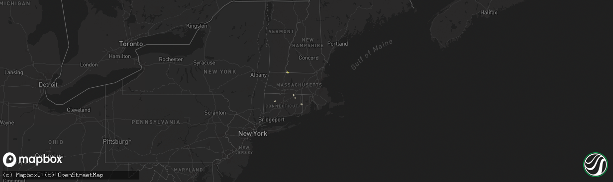
Hail Map in Massachusetts on June 21, 2024
The weather event in Massachusetts on June 21, 2024 includes Hail, Wind, and Tornado maps. 20 states and 254 cities were impacted and suffered possible damage. The total estimated number of properties impacted is 214.
Want more than just the map?
Turn this storm into a full workflow.
- Owner + property data so you know who to knock
- OnDemand branded weather history reports to win the "did we even have hail?" argument
- RoofTrace estimate so reps stop guessing numbers at the door
Bought this map? Upgrade within 7 days and we'll credit the $230. (10-15 min setup call)
Hail
Wind
Tornado
214
Estimated number of impacted properties by a 1.00" hail or larger0
Estimated number of impacted properties by a 1.75" hail or larger0
Estimated number of impacted properties by a 2.50" hail or largerStorm reports in Massachusetts
Massachusetts
| Date | Description |
|---|---|
| 06/21/20244:25 PM CDT | Police report tree down on road... Blocking traffic along pine street. Trained spotter reports tree down along suffield street. Relayed by amateur radio. |
| 06/21/20243:25 PM CDT | A local report indicates 1.00 inch wind near Northfield |
| 06/21/20243:19 PM CDT | Police report tree down along the 60 block of hinsdale road. Relayed by amateur radio. |
| 06/21/20242:59 PM CDT | Trees and wires down along east street in lee. |
| 06/21/20242:54 PM CDT | Trees down on lee road near stockbridge. |
| 06/21/20242:53 PM CDT | Tree down blocking church street in stockbridge. |
| 06/21/20242:49 PM CDT | Tree down blocking great barrington road. |
All States Impacted by Hail Map on June 21, 2024
Cities Impacted by Hail Map on June 21, 2024
- Rudyard, MT
- Egnar, CO
- Williamsfield, OH
- Orwell, OH
- Kinsman, OH
- Farmdale, OH
- Hobson, MT
- Geddes, SD
- Platte, SD
- Rosendale, NY
- Lake Andes, SD
- Armour, SD
- Stanford, MT
- Cedar Valley, UT
- Highland, NY
- Ulster Park, NY
- New Paltz, NY
- Eagle Mountain, UT
- Bosler, WY
- Magna, UT
- Kanab, UT
- Green River, WY
- Draper, UT
- Riverton, UT
- Glenrock, WY
- West Valley City, UT
- Salt Lake City, UT
- Sandy, UT
- Marble Canyon, AZ
- Douglas, WY
- Meeteetse, WY
- Moore, MT
- Cheyenne, WY
- West Greenwich, RI
- Houston, MN
- White Sulphur Springs, MT
- Neihart, MT
- Moosup, CT
- Shawnee, WY
- Thermopolis, WY
- Buffalo, WY
- Northfield, MA
- Vernon, VT
- Lewistown, MT
- Helper, UT
- Price, UT
- Sterling, CT
- Windsor, WI
- Deforest, WI
- Waunakee, WI
- Chambers, AZ
- Alamosa, CO
- Wingdale, NY
- Pawling, NY
- Dover Plains, NY
- Page, AZ
- Monument Valley, UT
- Tohatchi, NM
- Plainfield, CT
- Shiprock, NM
- Mosca, CO
- Sun Prairie, WI
- Madison, WI
- Readstown, WI
- Viroqua, WI
- Chugwater, WY
- Salina, UT
- Lake Powell, UT
- Ganado, AZ
- Stapleton, NE
- Winchester, NH
- Hinsdale, NH
- Farmington, NM
- Sanborn, IA
- Marshall, WI
- Waterloo, WI
- Lander, WY
- Bainbridge, NY
- Mount Upton, NY
- Hartley, IA
- Melvin, IA
- Duchesne, UT
- Sahuarita, AZ
- Lake Mills, WI
- Bluebell, UT
- Altamont, UT
- Wells Bridge, NY
- Unadilla, NY
- Roosevelt, UT
- Huntington, UT
- Bloomfield, NM
- Grover, CO
- Hereford, CO
- Everly, IA
- Mexican Hat, UT
- Tucson, AZ
- Brady, MT
- Conrad, MT
- Gallup, NM
- Ferron, UT
- Towaoc, CO
- Nunn, CO
- Grants, NM
- Riverton, WY
- Cortez, CO
- Otego, NY
- Watertown, WI
- Johnson Creek, WI
- Choteau, MT
- Big Sandy, MT
- Dutton, MT
- Ashford, CT
- Stafford Springs, CT
- North Platte, NE
- Spanish Fork, UT
- Fairview, UT
- Santaquin, UT
- Aztec, NM
- Flora Vista, NM
- Jay Em, WY
- Green River, UT
- Lewis, CO
- Carpenter, WY
- Box Elder, MT
- Spencer, IA
- Milford, IA
- Myton, UT
- Blanding, UT
- Pleasant View, CO
- Dolores, CO
- Cahone, CO
- Torrington, WY
- Vernal, UT
- Dickens, IA
- Ruthven, IA
- Eastford, CT
- Harwinton, CT
- Burlington, CT
- Carter, MT
- Salem, SD
- Canova, SD
- Floweree, MT
- New Raymer, CO
- Monticello, UT
- Winfred, SD
- Terril, IA
- Power, MT
- Norwood, CO
- Lloyd, MT
- Hooper, CO
- Emmetsburg, IA
- Madison, SD
- Montrose, SD
- Fairfield, MT
- Gregory, SD
- Dove Creek, CO
- Colton, SD
- Fort Benton, MT
- Hyde Park, UT
- Thompson, UT
- Moab, UT
- Great Falls, MT
- Highwood, MT
- Mitchell, SD
- Mount Vernon, SD
- Cubero, NM
- Letcher, SD
- Logan, UT
- Dell Rapids, SD
- Garrett, WY
- Utica, SD
- Harrison, SD
- Corsica, SD
- Belt, MT
- Browning, MT
- Pueblo Of Acoma, NM
- Pipestone, MN
- New Holland, SD
- Garretson, SD
- Plankinton, SD
- Geyser, MT
- Geraldine, MT
- Cozad, NE
- Hays, MT
- Wellfleet, NE
- Hayes Center, NE
- Wallace, NE
- Dickens, NE
- Volin, SD
- Alexandria, SD
- Lexington, NE
- Encampment, WY
- Rawlins, WY
- Saratoga, WY
- Gillette, WY
- Denton, MT
- Hilger, MT
- Raynesford, MT
- Palmer, NE
- Sumner, NE
- Miller, NE
- Sheridan, WY
- Dallas, PA
- Craig, CO
- Hayden, CO
- Hamilton, CO
- Steamboat Springs, CO
- Emery, SD
- Central City, NE
- Fullerton, NE
- New Haven, MI
- Columbus, MI
- Goodells, MI
- Buffalo, MT
- Amherst, NE
- Harris, IA
- Lake Park, IA
- Clarks, NE
- Osceola, NE
- Silver Creek, NE
- Spirit Lake, IA
- Payson, AZ
- Garryowen, MT
- Moccasin, MT
- Lodge Grass, MT
- Judith Gap, MT
- Tooele, UT
- Bridgeport, NE
- Bayard, NE
- Winnett, MT
- Ryegate, MT
- Lavina, MT
- Musselshell, MT
- Roundup, MT
- Ingomar, MT
- Broadwater, NE
- Sand Springs, MT
- Lisco, NE
- West Jordan, UT
- Forsyth, MT
- Oshkosh, NE
- Cohagen, MT
- Sedgwick, CO
- Chappell, NE
- Lewellen, NE
- Rosebud, MT
- Hathaway, MT
- Volborg, MT
- Maxwell, NE
- Brady, NE
- Gothenburg, NE
- Callaway, NE
- Ekalaka, MT
- Buffalo, SD


