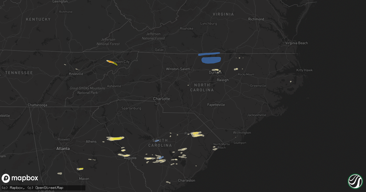
Hail Map in North Carolina on June 20, 2019
Get this storm
June 20 map
$229
one time, instant access
Download today. No call, no setup
Keep the $229
Bought the map and want the full workflow? Apply the entire $229 to a subscription within 7 days. None of it is wasted.
Every map, not just this one
This buys you this map. Subscription and you get every map we run, in the markets you choose from a few cities to whole states to nationwide. Plus real-time alerts the moment a storm fires.
Contact data
Name, contact info, occupancy, even credit band for addresses in the footprint. You go from where it hit to who to call.
Become the source they trust
Unlimited branding weather history reports on demand. You already have the documented answer ready for the property owner, and you are the one who showed up with it.
Property data and RoofTrace estimates
Pull up any address you have got, its value and the exact code rules for that jurisdiction, straight from One Click Code. Then RoofTrace estimates the squares, pitch, and roof value, priced the way you price.
Storm reports in North Carolina
North Carolina
| Date | Description |
|---|---|
| 06/20/20195:49 PM CDT | Wunderground station at caswell dunes |
| 06/20/20195:40 PM CDT | Tree down off piney woods rd. Time estimated by radar. |
| 06/20/20195:21 PM CDT | Multiple power lines down. Time estimated by radar. |
| 06/20/20195:16 PM CDT | Two trees down on deep river rd near us 1. Radar estimated time. |
| 06/20/20195:16 PM CDT | Alligator river bridge. |
| 06/20/20195:16 PM CDT | 63 mph wind gust reported near alligator river bridge. |
| 06/20/20195:15 PM CDT | Several trees down. |
| 06/20/20195:08 PM CDT | Thunderstorm winds downed a tree along vandora springs road between n hall blvd and miriam avenue. Time estimated via radar. |
| 06/20/20195:07 PM CDT | Uprooted 11 inch diameter tree on shore dr in garner. |
| 06/20/20195:06 PM CDT | Multiple trees down. Time estimated by radar. |
| 06/20/20195:05 PM CDT | Duck pier. |
| 06/20/20195:04 PM CDT | Several power lines down. Time estimated by radar. |
| 06/20/20195:00 PM CDT | Trees down and topped off along caratoke hwy. |
| 06/20/20195:00 PM CDT | Tree down in the road reported at pleasant grove church rd... Randolph county... Nc. |
| 06/20/20194:59 PM CDT | Trees down on highway 99n... North of pantego. Time estimated based on radar data. |
| 06/20/20194:58 PM CDT | Multiple trees... Large limbs and power lines down along the south end of knotts island. Report via social media. |
| 06/20/20194:55 PM CDT | Numerous trees and power lines down. |
| 06/20/20194:45 PM CDT | Powerlines down on highway 32n... Near pinetown. Time estimated based on radar data. |
| 06/20/20194:44 PM CDT | Tree down and across the road. |
| 06/20/20194:41 PM CDT | Tree down across the road. |
| 06/20/20194:40 PM CDT | Numerous trees and power lines down. |
| 06/20/20194:40 PM CDT | Two large trees reported down. |
| 06/20/20194:39 PM CDT | Several trees down along hwy 34. |
| 06/20/20194:37 PM CDT | Tractor trailer blown over by strong winds on route 17 bypass. |
| 06/20/20194:35 PM CDT | Extensive roof and interior damage to the building that houses flour girls bakery and several condominiums. |
| 06/20/20194:30 PM CDT | Several trees down in the williamston area... Relayed via social media. Timing based on radar. |
| 06/20/20194:27 PM CDT | Trees down across firetower rd. |
| 06/20/20194:25 PM CDT | Transformer and power lines down in the 900 block of nc route 343. |
| 06/20/20194:16 PM CDT | Thunderstorm winds downed at least two additional trees along new hope road in southern randolph county. |
| 06/20/20194:14 PM CDT | Numerous trees down in southwest chatham county... South of siler city. |
| 06/20/20194:11 PM CDT | Numerous trees and power lines down in the new london area. |
| 06/20/20194:10 PM CDT | Thunderstorm winds downed several trees along 109 south near the intersection of jim elliott road. |
| 06/20/20194:10 PM CDT | Tree down on power line with power outages. Report via social media. |
| 06/20/20194:03 PM CDT | Trees and power lines down. |
| 06/20/20194:00 PM CDT | Trees and power lines down. |
| 06/20/20194:00 PM CDT | Trained spotter reported multiple trees down near gold hill mines historic park. Time estimated from radar. |
| 06/20/20193:57 PM CDT | Trees down. Reported at evanstown rd harrellsville... Nc. Time estimated from radar. |
| 06/20/20193:54 PM CDT | Trees down on nc 45 in cofield... Nc. Time estimated from radar. |
| 06/20/20193:51 PM CDT | Several reports of trees down in winton... Nc. Time estimated from radar. |
| 06/20/20193:50 PM CDT | Multiple reports of trees down on roadways in and around ahoskie... Nc. Time estimated from radar. |
| 06/20/20193:50 PM CDT | Amateur radio reported trees and power lines down on ridge rd between 485 and mallard creek rd. |
| 06/20/20193:45 PM CDT | Trees down. Time estimated from radar. |
| 06/20/20193:45 PM CDT | Several reports of trees down in como... Nc. Time estimated from radar. |
| 06/20/20193:41 PM CDT | Multiple reports of trees down on roads in and around murfreesboro. Time estimated from radar. |
| 06/20/20193:41 PM CDT | Trees down at 1353 nc561 aulander... Nc. |
| 06/20/20193:40 PM CDT | Fire dept/rescue reported a tree down on a house on union new hope rd. |
| 06/20/20193:40 PM CDT | Amateur radio reported trees down on yorktown st in concord. Time estimated from radar. |
| 06/20/20193:40 PM CDT | Tree blocking lassiter mill rd near intersection with waynick meadow rd. Time estimated based on radar. |
| 06/20/20193:40 PM CDT | 911 call center reported numerous trees down in concord. Time estimated from radar. |
| 06/20/20193:35 PM CDT | Trees down. Time estimated from radar. |
| 06/20/20193:34 PM CDT | Trees down. Time estimated from radar. |
| 06/20/20193:33 PM CDT | Tree blocking new hope rd. Near intersection with nc-49 south. Time estimated based on radar. |
| 06/20/20193:30 PM CDT | Trees down. Time estimated from radar. |
| 06/20/20193:25 PM CDT | Downed trees impeding traffic on i95 northbound near mile marker 140 in rocky mount. |
| 06/20/20193:24 PM CDT | Thunderstorm winds downed a few trees near the intersection of old milburnie road and knightdale blvd temporarily closing it. |
| 06/20/20193:20 PM CDT | Fire dept/rescue reported a tree down on a house on joe cloninger rd. |
| 06/20/20193:20 PM CDT | Extensive trees... Power lines... And power poles down at thomas a betts pkwy and us 301 s near north carolina wesleyan college. |
| 06/20/20193:15 PM CDT | Trees down. Time estimated from radar. |
| 06/20/20193:14 PM CDT | Tree blocking roadway on nc-22 near intersection with old liberty rd. Time estimated based on radar. |
| 06/20/20193:05 PM CDT | Fire dept/rescue reported trees and power lines down on eastville dr at hwy 52. |
| 06/20/20193:05 PM CDT | Trees down. Time estimated from radar. |
| 06/20/20193:00 PM CDT | Fire dept/rescue reported a tree down on a house on crescent rd. |
| 06/20/20193:00 PM CDT | 911 call center reported trees down on rainey rd. Time estimated from radar. |
| 06/20/20192:53 PM CDT | Tree reported down in roadway on wicker dr. Near intersection with atlantic ave. Time estimated based on radar. |
| 06/20/20192:50 PM CDT | Several trees down near warrenton. |
| 06/20/20192:45 PM CDT | Multiple trees reported down. Time estimated by radar. |
| 06/20/20192:45 PM CDT | Multiple trees reported down in the towns of butner and creedmoor. |
| 06/20/20192:40 PM CDT | Multiple trees reported down. |
| 06/20/20192:34 PM CDT | Tree fell in residential structure in chapel hill. Time estimated by radar. |
| 06/20/20192:28 PM CDT | Reports of multiple trees down in downtown durham. |
| 06/20/20192:25 PM CDT | Large tree down near intersection of bradshaw quarry rd. And vernon rd. |
| 06/20/20192:23 PM CDT | Long stretch of power lines reported down along east franklin st. Starting at intersection with plant rd. Time is radar-estimated. |
| 06/20/20192:20 PM CDT | 5 power lines and 3 trees reported down in the burlington area. |
| 06/20/20192:10 PM CDT | Tree down along south fayetteville st. In liberty. Time estimated based on radar. |
| 06/20/20192:09 PM CDT | Tree down on a house on the 1100 block of chambers loop road. |
| 06/20/20192:04 PM CDT | Tree reported down near the intersection of hanford rd. And cedarcrest dr. Time estimated based on radar. |
| 06/20/20192:03 PM CDT | Tree down on unoccupied vehicle and blocking roadway near the intersection of tucker st. And fix st. Time estimated based on radar. |
| 06/20/20192:02 PM CDT | Tree down blocking roadway in burlington near virginia ave. And north main street. Time estimated based on radar. |
| 06/20/20192:01 PM CDT | Corrects previous tstm wnd dmg report from burlington. 5 power lines and 3 trees reported down in the burlington area. |
| 06/20/20192:01 PM CDT | Large tree on a house on chambers loop rd. Near riverbend way. |
| 06/20/20191:59 PM CDT | Tree and power pole down blocking randolph st. Time estimated based on radar. |
| 06/20/20191:57 PM CDT | Tree down on a house on the 1800 block of high plains road. |
| 06/20/20191:51 PM CDT | Tree down on a house south of hurdle mills. |
| 06/20/20191:50 PM CDT | Large tree and power line down at intersection of mcgees mill and mt carmel road. Time estimated by radar. |
| 06/20/20191:50 PM CDT | Police and fire is responding to report of tree on house in the burlington area. |
| 06/20/20191:45 PM CDT | Thunderstorm winds downed several trees in and around hyco lake. Two lake weather stations of unknown elevation and siting recorded gusts of 68 and 71mph as the storms |
| 06/20/20191:45 PM CDT | Numerous trees down around southern portions of hyco lake... Especially along wagstaff carver rd. |
| 06/20/20191:39 PM CDT | Wind gust of 58mph measured at 2:39pm. |
| 06/20/20191:38 PM CDT | Tree onto house on james place near guest street. |
| 06/20/20191:35 PM CDT | At least two trees were blown down by strong thunderstorm winds near powell lane off of highway 86. |
| 06/20/20191:35 PM CDT | Tree down blocking yanceyville st. Near east cone blvd. |
| 06/20/20191:32 PM CDT | Tree down blocking east cone blvd near us-29 north. |
| 06/20/20191:30 PM CDT | Multiple trees down across the county. Emergency management reports trees blocking several roads... Including at leasburg; trees over route 62 between bethel and milton |
| 06/20/20191:30 PM CDT | Tree into house. |
| 06/20/20191:21 PM CDT | Utility pole blown over into house. |
| 06/20/20191:21 PM CDT | Tree down blocking doggett rd near bridge over lake townsend. |
| 06/20/20191:14 PM CDT | Tree down blocking spencer dixon rd. Near kellam ridge dr. |
| 06/20/20191:14 PM CDT | Several trees down on pleasant ridge rd. Between lewiston rd. And bunch rd. Time estimated based on radar. |
| 06/20/20191:14 PM CDT | A few trees down around the williamsburg community in rockingham county. |
| 06/20/20191:12 PM CDT | Thunderstorm winds blew a tree on a house at two separate locations on lawsonville avenue. |
| 06/20/20191:11 PM CDT | Tree down on house on briggs st. |
| 06/20/20191:11 PM CDT | One tree down on turner drive. Time estimated by radar. |
| 06/20/20191:05 PM CDT | Trained spotter reported multiple trees down along ostwalt-amity rd and houston rd near the ostwalt community. |
| 06/20/20191:04 PM CDT | Several trees reported down and in roadways across the winston- salem area. |
| 06/20/20191:03 PM CDT | Few trees down in the wentworth area of the county. Time estimated by radar. |
| 06/20/201912:49 PM CDT | Multiple trees down along highway 65 in the walnut cove area of the county. |
| 06/20/201912:43 PM CDT | 2 trees down along the stokes county border. Time estimated by radar. |
| 06/20/201912:34 PM CDT | Several trees down in and around danbury. Time estimated by radar. |
| 06/20/201912:20 PM CDT | Multiple trees down countywide. |
| 06/20/20191:42 AM CDT | At 641 PM EDT, severe thunderstorms were located along a line extending from Mill Creek to near Holden Beach, moving east at 50 mph. HAZARD...70 mph wind gusts and quarter size hail. SOURCE...Radar indicated. IMPACT...Expect considerable tree damage. Wind damage is also likely to mobile homes, roofs, and outbuildings. Locations impacted include... Wilmington, Leland, Oak Island, Carolina Beach, Shallotte, Wrightsville Beach, Kure Beach, Holden Beach, Ocean Isle Beach, Caswell Beach, Bald Head Island, South Masonboro Island, North Masonboro Island, Snows Cut, Ocean Crest Pier, Yaupon Beach, Boiling Spring Lakes, St. James, Southport and Bishop. |
| 06/20/20191:38 AM CDT | At 637 PM EDT, severe thunderstorms were located along a line extending from 10 miles east of Whalebone to near Fort Landing to near Royal, moving southeast at 55 mph. HAZARD...70 mph wind gusts. SOURCE...Radar indicated. IMPACT...Expect considerable tree damage. Damage is likely to mobile homes, roofs, and outbuildings. Locations impacted include... Stumpy Point, Frisco, Buxton, Salvo, Waves, Swindell Fork, Avon, Gull Rock, Fairfield, Rodanthe, New Holland, Lowland, Florence, Nebraska, Royal, Rose Bay, South Creek, Lake Landing, Maribel and Middletown. |
| 06/20/20191:31 AM CDT | At 629 AM EDT, severe thunderstorms were located along a line extending from 8 miles south of Crossville to near Wildwood Lake, moving east at 50 mph. HAZARD...60 mph wind gusts. SOURCE...Radar indicated. IMPACT...Expect damage to roofs, siding, and trees. Locations impacted include... Cleveland, Oak Ridge, Athens, Lenoir City, Dayton, Kingston, Sweetwater, Rockwood, Loudon, Madisonville, Decatur, Benton, Fairview, Etowah, Oliver Springs, Spring City, Charleston, Midtown, East Cleveland and South Cleveland. |
| 06/20/20191:27 AM CDT | At 627 PM EDT, a severe thunderstorm was located 8 miles south of Zebulon, or 14 miles north of Smithfield, moving east at 60 mph. HAZARD...60 mph wind gusts. SOURCE...Radar indicated. IMPACT...Expect damage to roofs, siding, and trees. Locations impacted include... Rocky Mount, Smithfield, Nashville, Wilson, Clayton, Zebulon, Elm City, Fremont, Bailey and Knightdale. |
| 06/20/20191:08 AM CDT | At 607 PM EDT, a severe thunderstorm was located near Goldston, or 7 miles southwest of Pittsboro, moving east at 55 mph. HAZARD...60 mph wind gusts. SOURCE...Radar indicated. IMPACT...Expect damage to roofs, siding, and trees. Locations impacted include... Sanford, Pittsboro, Goldston, Crosswinds Boating Center, Crosswinds Campground, Jordan Lake State Rec Area, Bynum, Seaforth Boat Dock, Moncure and Cumnock. |
| 06/20/201912:52 AM CDT | At 552 PM EDT, a severe thunderstorm was located near Biscoe, or 9 miles southeast of Troy, moving east at 45 mph. HAZARD...60 mph wind gusts. SOURCE...Radar indicated. IMPACT...Expect damage to roofs, siding, and trees. Locations impacted include... Southern Pines, Carthage, Pinehurst, Biscoe, Whispering Pines, Robbins, Star, Candor, Taylortown and Vass. |
| 06/20/201912:52 AM CDT | At 552 PM EDT, severe thunderstorms were located along a line extending from near Grandy to near Pungo Lake, moving east at 65 mph. HAZARD...60 mph wind gusts. SOURCE...Radar indicated. IMPACT...Expect damage to roofs, siding, and trees. Locations impacted include... Kill Devil Hills, Stumpy Point, Southern Shores, Killkenny, Manns Harbor, Waves, Nags Head, Alligator, Gum Neck, Kilkenny, Rodanthe, Mashoes, Manteo, Pungo, Columbia, East Lake, Woodley, Sanderling, Colington and Whalebone. |
| 06/20/201912:45 AM CDT | At 544 PM EDT, a severe thunderstorm was located over Forestbrook, or over Red Hill, moving east at 55 mph. HAZARD...60 mph wind gusts and quarter size hail. SOURCE...Radar indicated. IMPACT...Minor hail damage to vehicles is possible. Expect wind damage to trees and power lines. Locations impacted include... Myrtle Beach, Conway, North Myrtle Beach, Surfside Beach, Sunset Beach, Ocean Isle Beach, Myrtle Beach Airport, Socastee, Red Hill, Little River, Springmaid Pier, Garden City, North Myrtle Beach Airport, Cherry Grove Inlet, Iredell, Carolina Shores, Calabash, Hickory Grove, Homewood and Horry Georgetown Technical College Conway Campus. |
| 06/20/201912:42 AM CDT | At 542 PM EDT, a severe thunderstorm was located 11 miles southeast of Pittsboro, moving east at 50 mph. HAZARD...70 mph wind gusts. SOURCE...Radar indicated. IMPACT...Expect considerable tree damage. Damage is likely to mobile homes, roofs, and outbuildings. Locations impacted include... Raleigh, Cary, Smithfield, Garner, Fuquay-Varina, Clayton, Angier, Apex, Holly Springs and Knightdale. |
| 06/20/201912:41 AM CDT | At 541 PM EDT, a severe thunderstorm was located 8 miles north of Tusculum, or 10 miles northeast of Greeneville, moving east at 30 mph. HAZARD...60 mph wind gusts and quarter size hail. SOURCE...Radar indicated. IMPACT...Hail damage to vehicles is expected. Expect wind damage to roofs, siding, and trees. Locations impacted include... Johnson City, Greeneville, Elizabethton, Erwin, Jonesborough, Tusculum, Banner Hill, Central, Midway, Pine Crest, Unicoi, Leesburg, Chucky, Limestone, Limestone Cove, Telford, Milligan College, Avondale, Embreeville and Davy Crockett Birthplace. |
| 06/20/201912:35 AM CDT | At 535 PM EDT, a severe thunderstorm was located over Seagrove, or near North Carolina Zoo, moving east at 60 mph. HAZARD...60 mph wind gusts. SOURCE...Radar indicated. IMPACT...Expect damage to roofs, siding, and trees. Locations impacted include... Asheboro, North Carolina Zoo, Siler City, Goldston, Seagrove, Ramseur, Franklinville, Robbins, Steeds and Harpers Crossroads. |
| 06/20/201912:33 AM CDT | At 533 PM EDT, severe thunderstorms were located along a line extending from Western Branch to near Northwest, moving east at 55 mph. HAZARD...70 mph wind gusts. SOURCE...Radar indicated. IMPACT...Expect considerable tree damage. Damage is likely to mobile homes, roofs, and outbuildings. Severe thunderstorms will be near, Northwest around 540 PM EDT. Regent University, Kempsville, Virginia Wesleyan University, Norfolk International, Back Bay and Fentress around 545 PM EDT. Princess Anne around 555 PM EDT. Virginia Beach around 600 PM EDT.Other locations impacted by these severe thunderstorms include SouthNorfolk, Rudee Heights, Portlock, Mount Pleasant, Princess AnnePlaza, Sigma, Sandbridge Beach, Herberts Corner, Oceana NAS andMunden. |
| 06/20/201912:23 AM CDT | At 522 PM EDT, severe thunderstorms were located along a line extending from near Lake View to near Galivants Ferry, moving east at 40 mph. HAZARD...60 mph wind gusts and quarter size hail. SOURCE...Radar indicated. IMPACT...Expect wind damage to trees and power lines. Locations impacted include... Whiteville, Mullins, Horry, Tabor City, Loris, Chadbourn, Fair Bluff, Lake View, Hallsboro, Adrian, Redbug, Gapway, Rains, Southeastern Community College, Williams, Goretown, Galivants Ferry, Cherry Grove, Mollie and Sidney. |
| 06/20/201912:10 AM CDT | At 510 PM EDT, severe thunderstorms were located along a line extending from near Tyner to Valhalla to 7 miles southwest of Colerain, moving east at 40 mph. HAZARD...70 mph wind gusts. SOURCE...Radar indicated. IMPACT...Expect considerable tree damage. Damage is likely to mobile homes, roofs, and outbuildings. Severe thunderstorms will be near, Winfall around 520 PM EDT. Hertford and Burgess around 525 PM EDT. Snug Harbor and Cape Colony around 530 PM EDT.Other locations impacted by these severe thunderstorms includeHoliday Island, Smalls Crossroads, Mavaton, Saint Johns, MillCrossroads, Hancock, Center Hill, Yeopim Station, Forestburg andJacocks. |
| 06/20/201912:01 AM CDT | At 500 PM EDT, a severe thunderstorm was located near Rockwell, or 11 miles northwest of Albemarle, moving east at 45 mph. HAZARD...60 mph wind gusts and penny size hail. SOURCE...Radar indicated. IMPACT...Expect damage to roofs, siding, and trees. Locations impacted include... Asheboro, Albemarle, Troy, Badin Lake, North Carolina Zoo, Seagrove, Plyler, Fairview In Union County, Locust and Norwood. |
| 06/20/201912:00 AM CDT | At 500 PM EDT, a severe thunderstorm was located over Green Sea, or 16 miles east of Mullins, moving east at 40 mph. HAZARD...60 mph wind gusts. SOURCE...Radar indicated. IMPACT...Expect wind damage to trees and power lines. Locations impacted include... Ocean Isle Beach, Iredell, Tabor City, Loris, Bethel, Lake Waccamaw, Makatoka, Freeland, Nakina, Exum, Bughill, Longwood, Williams, Ash, Goretown, Grissettown, Old Dock, Mollie, Sidney and Clarendon. |
| 06/19/201911:57 PM CDT | At 457 PM EDT, a severe thunderstorm was located 7 miles east of North Carolina Zoo, moving east at 50 mph. HAZARD...60 mph wind gusts. SOURCE...Radar indicated. IMPACT...Expect damage to roofs, siding, and trees. Locations impacted include... Sanford, Pittsboro, Siler City, Goldston, Broadway, Crosswinds Boating Center, Crosswinds Campground, Gum Springs, Harpers Crossroads and Jordan Lake State Rec Area. |
| 06/19/201911:50 PM CDT | At 449 PM EDT, severe thunderstorms were located along a line extending from near Roxobel to 8 miles southeast of Scotland Neck to near Bethel, moving east at 50 mph. HAZARD...60 mph wind gusts. SOURCE...Radar indicated. IMPACT...Expect damage to trees and powerlines. Severe thunderstorms will be near, Roxobel around 455 PM EDT. Lewiston Woodville around 500 PM EDT. Aulander around 505 PM EDT. Windsor and Powellsville around 515 PM EDT. Colerain around 525 PM EDT.Other locations impacted by these severe thunderstorms include GoosePond, Whites Crossroads, Merry Hill, Kelford, Connaritsa, Edenhouse,Republican, Trap, Mount Gould and Quitsna. |
| 06/19/201911:43 PM CDT | At 443 PM EDT, severe thunderstorms were located along a line extending from 8 miles south of Salisbury to 6 miles west of Uptown Charlotte, moving east at 40 mph. HAZARD...60 mph wind gusts. SOURCE...Radar indicated. IMPACT...Expect damage to trees and power lines. Locations impacted include... Uptown Charlotte, Huntersville, Kannapolis, Downtown Concord, Central Charlotte, Northeast Charlotte, East Charlotte, Northwest Charlotte, West Concord and Harrisburg. |
| 06/19/201911:30 PM CDT | At 430 PM EDT, a severe thunderstorm was located 11 miles north of Badin Lake, moving east at 55 mph. HAZARD...60 mph wind gusts. SOURCE...Radar indicated. IMPACT...Expect damage to roofs, siding, and trees. Locations impacted include... Asheboro, North Carolina Zoo, Seagrove, Ramseur, Denton, Franklinville, Staley, Newsom, Ulah and Coleridge. |
| 06/19/201911:20 PM CDT | At 420 PM EDT, a severe thunderstorm was located near Gastonia, or near Dallas, moving east at 35 mph. HAZARD...60 mph wind gusts. SOURCE...Radar indicated. IMPACT...Expect damage to trees and power lines. Locations impacted include... Gastonia, Northwest Charlotte, Mt Holly, Belmont, Bessemer City, South Gastonia, Dallas, Stanley, Cramerton and Lowell. |
| 06/19/201911:19 PM CDT | At 418 PM EDT, a severe thunderstorm was located near Blue Brick, or near Marion, moving east at 30 mph. HAZARD...60 mph wind gusts and quarter size hail. SOURCE...Radar indicated. IMPACT...Minor hail damage to vehicles is possible. Expect wind damage to trees and power lines. Locations impacted include... Marion, Mullins, Galivants Ferry, Zion, Gapway, Rains, Nichols and Carolinas Hospital System - Marion. |
| 06/19/201911:17 PM CDT | At 416 PM EDT, a severe thunderstorm was located near Dortches, or near Nashville, moving east at 65 mph. HAZARD...60 mph wind gusts. SOURCE...Law enforcement. IMPACT...Expect damage to roofs, siding, and trees. Locations impacted include... Rocky Mount, Tarboro, Nashville, Scotland Neck, Dortches, Bailey, Red Oak, Princeville, Sharpsburg and Spring Hope. |
| 06/19/201911:15 PM CDT | At 415 PM EDT, a severe thunderstorm was located 5 miles southwest of Huntersville, moving east at 40 mph. HAZARD...60 mph wind gusts. SOURCE...Radar indicated. IMPACT...Expect damage to trees and power lines. Locations impacted include... Huntersville, Kannapolis, Downtown Concord, Northeast Charlotte, Northwest Charlotte, West Concord, Mt Holly, Harrisburg, University City and Reedy Creek Park. |
| 06/19/201911:00 PM CDT | At 359 PM EDT, severe thunderstorms were located along a line extending from near Rdu International to near Pittsboro, moving east at 50 mph. HAZARD...70 mph wind gusts and nickel size hail. SOURCE...Radar indicated. IMPACT...Expect considerable tree damage. Damage is likely to mobile homes, roofs, and outbuildings. Locations impacted include... Raleigh, Cary, Pittsboro, Garner, Zebulon, Rdu International, Apex, Holly Springs, Morrisville and Knightdale. |
| 06/19/201910:45 PM CDT | At 345 PM EDT, a severe thunderstorm was located 7 miles southwest of Salisbury, or near China Grove, moving east at 35 mph. HAZARD...60 mph wind gusts and quarter size hail. SOURCE...Radar indicated. IMPACT...Minor hail damage to vehicles is expected. Expect wind damage to trees and power lines. Locations impacted include... Salisbury, China Grove, Spencer, Landis, Enochville, Granite Quarry, Rockwell, Faith, High Rock Lake and Gold Hill. |
| 06/19/201910:41 PM CDT | At 341 PM EDT, severe thunderstorms were located along a line extending from 7 miles northeast of Norlina to near Warrenton to 10 miles east of Henderson, moving east at 60 mph. HAZARD...70 mph wind gusts and nickel size hail. SOURCE...Emergency management reports numerous trees and powerlines down across north central north Carolina. IMPACT...Expect considerable tree damage. Damage is likely to mobile homes, roofs, and outbuildings. Locations impacted include... Rocky Mount, Roanoke Rapids, Nashville, Warrenton, Halifax, Norlina, Dortches, Littleton, Red Oak and Enfield. |
| 06/19/201910:38 PM CDT | At 336 PM EDT, a severe thunderstorm was located just north of RDU International, or 9 miles east of Durham, moving east at 45 mph. Other severe thunderstorms were located across southeastern Durham, northern Wake, southern Granville and northwestern Franklin Counties. HAZARD...60 mph wind gusts. SOURCE...Law enforcement. IMPACT...Expect damage to roofs, siding, and trees. Locations impacted include... Raleigh, Durham, Cary, Creedmoor, Louisburg, Wake Forest, Butner, Franklinton, Kittrell and Bunn. |
| 06/19/201910:15 PM CDT | At 315 PM EDT, a severe thunderstorm was located near Bailey, or 19 miles northeast of Smithfield, moving east at 60 mph. HAZARD...60 mph wind gusts. SOURCE...Radar indicated. IMPACT...Expect damage to roofs, siding, and trees. Locations impacted include... Rocky Mount, Wilson, Elm City, Bailey, Sharpsburg, Middlesex, Sims, Buckhorn Reservoir, Tar River Reservoir and Willbanks. |
| 06/19/201910:14 PM CDT | At 313 PM EDT, severe thunderstorms with a history of producing wind damage were located along a line extending from Mebane through 8 miles east of Randleman to 11 miles northeast of Badin Lake, moving east at 50 mph. This includes portions of Jordan Lake. HAZARD...70 mph wind gusts and quarter size hail. SOURCE...Radar indicated. IMPACT...Hail damage to vehicles is expected. Expect considerable tree damage. Wind damage is also likely to mobile homes, roofs, and outbuildings. Locations impacted include... Durham, Chapel Hill, Burlington, Asheboro, Graham, Hillsborough, Pittsboro, Siler City, North Carolina Zoo and Carrboro. |
| 06/19/201910:06 PM CDT | At 304 PM EDT, a severe thunderstorm was located near Creedmoor, moving northeast at 55 mph. Other sever thunderstorms were ongoing or developing across Durham and Granville Counties. HAZARD...70 mph wind gusts and nickel size hail. SOURCE...Emergency management. IMPACT...Expect considerable tree damage. Damage is likely to mobile homes, roofs, and outbuildings. Locations impacted include... Durham, Chapel Hill, Henderson, Oxford, Creedmoor, Louisburg, Warrenton, Wake Forest, Butner and Franklinton. |
| 06/19/20199:58 PM CDT | At 257 PM EDT, severe thunderstorms were located along a line extending from near Cluster Springs to near Virgilina to near Rougemont, moving east at 50 mph. HAZARD...60 mph wind gusts. SOURCE...Radar indicated. IMPACT...Expect damage to trees and powerlines. Severe thunderstorms will be near, Buffalo Springs around 310 PM EDT. Clarksville around 315 PM EDT. Boydton around 330 PM EDT.Other locations impacted by these severe thunderstorms includeNelson, Beechwood, John H Kerr Dam, Finchley, Skipwith, RogersCorner, Richardson, Bracey, Keats and Buffalo Junction. |
| 06/19/20199:33 PM CDT | At 232 PM EDT, severe thunderstorms were located along a line extending from near Elmo to Yanceyville to near High Point, moving east at 45 mph. HAZARD...60 mph wind gusts, heavy rainfall, and quarter size hail. This storm has a history of producing wind damage across the western Piedmont of NC. SOURCE...Law enforcement. IMPACT...Hail damage to vehicles is expected. Expect wind damage to roofs, siding, and trees. Locations impacted include... Durham, Chapel Hill, Burlington, Graham, Oxford, Roxboro, Hillsborough, Creedmoor, Carrboro and Mebane. |
| 06/19/20199:19 PM CDT | At 219 PM EDT, severe thunderstorms with a history of producing intermittent tree damage were located along a line extending from near Thomasville through Lexington to Salisbury, moving east at 40 mph. HAZARD...60 mph wind gusts and quarter size hail. SOURCE...Radar indicated. IMPACT...Hail damage to vehicles is expected. Expect wind damage to roofs, siding, and trees. Locations impacted include... High Point, Asheboro, Lexington, Randleman, North Carolina Zoo, Thomasville, Seagrove, Linwood, Archdale and Trinity. |
| 06/19/20199:06 PM CDT | At 206 PM EDT, a severe thunderstorm was located over Wentworth, moving east at 55 mph. HAZARD...60 mph wind gusts and quarter size hail. SOURCE...Radar indicated. IMPACT...Hail damage to vehicles is expected. Expect wind damage to roofs, siding, and trees. Locations impacted include... Danville... Reidsville... South Boston... Wentworth... and Yanceyville.This includes The following Location Danville Airport. |
| 06/19/20198:43 PM CDT | At 142 PM EDT, a severe thunderstorm was located near King, or 7 miles northwest of Winston-Salem, moving east at 50 mph. HAZARD...60 mph wind gusts and quarter size hail. SOURCE...Radar indicated. IMPACT...Hail damage to vehicles is expected. Expect wind damage to roofs, siding, and trees. Locations impacted include... Greensboro, Winston-Salem, High Point, Kernersville, Clemmons, McLeansville, Lewisville, Summerfield, Gibsonville and Stokesdale. |
| 06/19/20198:05 PM CDT | At 104 PM EDT, a severe thunderstorm was located over Clingman, moving east at 40 mph. HAZARD...60 mph wind gusts. SOURCE...Radar indicated. IMPACT...Expect damage to roofs, siding, and trees. Locations impacted include... Elkin... Fairview... Yadkinville... Jonesville... and Dobson. |
All States Impacted by Hail Map on June 20, 2019
Cities Impacted by Hail Map on June 20, 2019
- Fort Morgan, CO
- Effingham, KS
- Lancaster, KS
- Sac City, IA
- Lake View, IA
- Wood Lake, NE
- Eustis, NE
- Harrison, NE
- Moorhead, IA
- Runnells, IA
- Prairie City, IA
- Hayes Center, NE
- Wallace, NE
- Blackville, SC
- Diller, NE
- Odell, NE
- Blakely, GA
- Endicott, NE
- Steele City, NE
- Fairbury, NE
- Pampa, TX
- Redwood Falls, MN
- Akron, CO
- Odebolt, IA
- Schaller, IA
- Early, IA
- Leavenworth, KS
- Bonner Springs, KS
- Platte City, MO
- Basehor, KS
- Waldron, MO
- Kansas City, MO
- Kansas City, KS
- Modoc, SC
- Lincolnton, GA
- Plum Branch, SC
- Funk, NE
- Bertrand, NE
- Loomis, NE
- Elm Creek, NE
- Overton, NE
- Holdrege, NE
- Hardy, NE
- Bellvue, CO
- Loveland, CO
- Pierce, CO
- Nunn, CO
- Fort Collins, CO
- McCook, NE
- Bloomington, NE
- Lenora, KS
- Randolph, KS
- Grand Island, NE
- Dannebrog, NE
- Saint Libory, NE
- Carpenter, WY
- Pine Bluffs, WY
- Grover, CO
- Eatonton, GA
- Madison, GA
- Fitzgerald, GA
- Dana, IA
- Jefferson, IA
- Grand Junction, IA
- Arabi, GA
- Ashburn, GA
- Merriman, NE
- Cody, NE
- Clarkfield, MN
- Granite Falls, MN
- Cope, CO
- Padroni, CO
- Merino, CO
- Stoneham, CO
- Sterling, CO
- New Raymer, CO
- Shenandoah, IA
- Blue Earth, MN
- Strasburg, CO
- Harleyville, SC
- Holly Hill, SC
- Wood Lake, MN
- Echo, MN
- Boelus, NE
- Cairo, NE
- Burchard, NE
- Liberty, NE
- Hanover, KS
- Skidmore, MO
- Graham, MO
- Marion, SC
- Florence, SC
- Bennett, CO
- Onawa, IA
- Westboro, MO
- Northboro, IA
- Guyton, GA
- Rincon, GA
- Marsland, NE
- Dimock, SD
- Parkston, SD
- Mount Vernon, SD
- Ethan, SD
- Wilsonville, NE
- Hendley, NE
- Norton, KS
- Morgan, MN
- Springfield, MN
- Comfrey, MN
- Sleepy Eye, MN
- Truman, MN
- Saint James, MN
- Lewisville, MN
- Hanska, MN
- Clements, MN
- Madelia, MN
- Yuma, CO
- Idalia, CO
- Anton, CO
- Joes, CO
- Wray, CO
- Saint Francis, KS
- Kirk, CO
- Vernon, CO
- Imperial, NE
- Vermillion, KS
- Briggsdale, CO
- Republic, KS
- Byron, NE
- Superior, NE
- Webber, KS
- Abbeville, SC
- Bradley, SC
- McCormick, SC
- Calhoun Falls, SC
- Tignall, GA
- Elberton, GA
- Troy, SC
- Mount Carmel, SC
- Salley, SC
- Tifton, GA
- Red Cloud, NE
- Bladen, NE
- Inavale, NE
- Durham, NC
- Whitney, NE
- Crawford, NE
- Monticello, GA
- Juliette, GA
- Melrose, IA
- Albia, IA
- Denver, CO
- Aurora, CO
- Evans, GA
- Augusta, GA
- Page, NE
- Brunswick, NE
- Orchard, NE
- Royal, NE
- Winnetoon, NE
- Benkelman, NE
- Parks, NE
- Sycamore, GA
- Afton, TN
- Limestone, TN
- Chuckey, TN
- Stratton, NE
- Palisade, NE
- Trenton, NE
- Belview, MN
- Creedmoor, NC
- Knoxville, TN
- Greeleyville, SC
- Corsicana, TX
- Perry, IA
- Ogden, IA
- Dixon, NE
- Seneca, KS
- Sabetha, KS
- Oneida, KS
- Nelson, NE
- Saint George, KS
- Wamego, KS
- Scottsbluff, NE
- Alliance, NE
- Woodrow, CO
- Centralia, KS
- Craig, MO
- Fairfax, MO
- Colby, KS
- Karval, CO
- Lexington, NE
- Smithfield, NE
- Amherst, NE
- Kearney, NE
- Riverdale, NE
- Byers, CO
- Hanley Falls, MN
- Sloan, IA
- Hoxie, KS
- Selden, KS
- Stamford, NE
- Long Island, KS
- Deer Trail, CO
- Wetmore, KS
- Vona, CO
- Atchison, KS
- Nortonville, KS
- Arapahoe, NE
- Republican City, NE
- Winterset, IA
- Prole, IA
- Patterson, IA
- Saint Charles, IA
- Milford, NE
- Enigma, GA
- Saint Paul, NE
- Pamplico, SC
- Effingham, SC
- Ault, CO
- Bolivia, NC
- Cummings, KS
- Mankato, KS
- Glen Elder, KS
- Thomaston, GA
- Molena, GA
- Woodbury, GA
- Farnam, NE
- Lusk, WY
- Naponee, NE
- Delia, KS
- Mayetta, KS
- Bellevue, TX
- Appling, GA
- Clarks Hill, SC
- Oberlin, KS
- Herndon, KS
- Champion, NE
- Garrison, UT
- Washta, IA
- Quimby, IA
- Pawnee City, NE
- Axtell, KS
- Baileyville, KS
- Palmer, KS
- Aurora, KS
- Glasco, KS
- Clyde, KS
- Green, KS
- Concordia, KS
- Morganville, KS
- Miltonvale, KS
- Jamestown, KS
- Clay Center, KS
- Clifton, KS
- Leonardville, KS
- Scottsville, KY
- Cordova, SC
- Orangeburg, SC
- Neeses, SC
- Cope, SC
- Rushville, MO
- Correctionville, IA
- Seward, NE
- Chester, NE
- Hebron, NE
- Macon, NC
- Sellers, SC
- Mullins, SC
- Davenport, NE
- Oak, NE
- Fullerton, NE
- Palmer, NE
- Bishopville, SC
- Telford, TN
- Greeneville, TN
- Statesboro, GA
- Metter, GA
- Register, GA
- Ariton, AL
- Brundidge, AL
- Clio, AL
- Axtell, NE
- Minden, NE
- Blue Hill, NE
- Indianola, NE
- Friend, NE
- Cordova, NE
- Exeter, NE
- Formoso, KS
- Courtland, KS
- Jewell, KS
- Rembert, SC
- Preston, GA
- Parrott, GA
- Olsburg, KS
- Westmoreland, KS
- Haigler, NE
- Wauneta, NE
- Atwood, KS
- Shickley, NE
- Branchville, VA
- Boykins, VA
- Forsyth, GA
- Downs, KS
- Esbon, KS
- Chadron, NE
- Beaver City, NE
- Paton, IA
- Hubbell, NE
- Narka, KS
- Munden, KS
- Jennings, KS
- Churdan, IA
- Dearborn, MO
- Gower, MO
- Edgerton, MO
- Skipperville, AL
- Banks, AL
- Troy, AL
- Holbrook, NE
- Edison, NE
- Oxford, NE
- Cambridge, NE
- Rebecca, GA
- Chula, GA
- Barnes, KS
- Waterville, KS
- Blue Rapids, KS
- Onaga, KS
- Maitland, MO
- Maryville, MO
- Hawkinsville, GA
- Pineview, GA
- Unadilla, GA
- Streetman, TX
- Enders, NE
- Grovetown, GA
- North Augusta, SC
- Moorefield, NE
- Lebanon, NE
- Norcatur, KS
- Danbury, NE
- Vesta, MN
- Sanborn, MN
- Seaforth, MN
- Cottonwood, MN
- Lamberton, MN
- Winnebago, MN
- Milligan, NE
- Easton, MO
- Saint Joseph, MO
- Carlton, GA
- Repton, AL
- York, NE
- McCool Junction, NE
- Rexford, KS
- Burlington, CO
- Hemingford, NE
- Plattsburg, MO
- Mound City, MO
- Deshler, NE
- Alma, NE
- Littleton, NC
- Granada, MN
- Bushnell, NE
- Frankfort, KS
- Glendo, WY
- Columbia, NC
- Summerton, SC
- Pinewood, SC
- Stanberry, MO
- Creighton, NE
- Oneill, NE
- Auburn, IA
- Lindon, CO
- Oelrichs, SD
- Valentine, NE
- Ainsworth, NE
- Springview, NE
- Johnstown, NE
- Americus, GA
- Plains, GA
- Dawson, GA
- Kenesaw, NE
- Heartwell, NE
- Montgomery, AL
- Ramer, AL
- Forsyth, MT
- Orleans, NE
- Williston, SC
- Pickering, MO
- Burlington Junction, MO
- Sacred Heart, MN
- Tonganoxie, KS
- Glade, KS
- Phillipsburg, KS
- Mount Ayr, IA
- Valdosta, GA
- Arlington, GA
- Morgan, GA
- Torrington, WY
- Beloit, KS
- Manning, SC
- New Zion, SC
- Norway, SC
- Bird City, KS
- Hay Springs, NE
- Rushville, NE
- Kilgore, NE
- Crookston, NE
- Nenzel, NE
- Gordon, NE
- Ellsworth, NE
- Lakeside, NE
- Hoyt, KS
- Osceola, IA
- Haddam, KS
- Lyons, NE
- Rosalie, NE
- Eutawville, SC
- Crow Agency, MT
- Leary, GA
- Newton, GA
- Rowesville, SC
- Ravenna, NE
- Newville, AL
- Clopton, AL
- Branchville, SC
- Bowman, SC
- Home, KS
- Marysville, KS
- Smithville, GA
- Manhattan, KS
- Hillsborough, NC
- Springfield, SC
- Waco, NE
- Kirwin, KS
- Guide Rock, NE
- Saint Marys, KS
- Rossville, KS
- Elmore, MN
- Seibert, CO
- Logan, KS
- Abbeville, AL
- Shorterville, AL
- Eckley, CO
- Genoa, CO
- Rock Port, MO
- Ludell, KS
- Camden, SC
- Lebanon, KS
- Denmark, SC
- Bamberg, SC
- Galva, IA
- Ida Grove, IA
- Holstein, IA
- Falls City, NE
- Ocilla, GA
- Boone, IA
- Turney, MO
- Albany, GA
- Leesburg, GA
- Breda, IA
- Carroll, IA
- Bouton, IA
- Woodward, IA
- Caryville, TN
- Arcadia, IA
- Wood River, NE
- Netawaka, KS
- Whiting, KS
- Columbia, AL
- Whiting, IA
- Wymore, NE
- Worden, MT
- Watkins, CO
- McFall, MO
- Albany, MO
- Cuba, KS
- Agenda, KS
- Belleville, KS
- Everest, KS
- Randall, KS
- Norway, KS
- Scandia, KS
- Smithville, MO
- Trimble, MO
- Bartley, NE
- Elwood, NE
- De Kalb, MO
- Faucett, MO
- Agra, KS
- Glidden, IA
- Cuthbert, GA
- Farragut, IA
- Hamburg, IA
- Fairfield, TX
- Shelton, NE
- Rockville, NE
- Muscotah, KS
- Culbertson, NE
- Henderson, NE
- Hampton, NE
- Coin, IA
- Cross, SC
- Swan, IA
- Adel, IA
- Gaylord, KS
- Osborne, KS
- Flagler, CO
- Hazard, NE
- Tarkio, MO
- Guilford, MO
- Lawrence, NE
- Castalia, NC
- Louisburg, NC
- Maywood, NE
- Emmett, KS
- Curtis, NE
- Imogene, IA
- Emerson, NE
- Nehawka, NE
- Avoca, NE
- Jansen, NE
- Plymouth, NE
- Fort Leavenworth, KS
- Colquitt, GA
- Horton, KS
- Belgrade, NE
- Gibbon, NE
- Green Pond, SC
- Alton, KS
- Portis, KS
- Salem, NE
- Giltner, NE
- Aurora, NE
- Van Meter, IA
- Warwick, GA
- Amity, MO
- Commerce City, CO
- Maysville, MO
- Easton, KS
- Agency, MO
- Goff, KS
- Corning, KS
- Linn, KS
- Greenleaf, KS
- Pierson, IA
- Benedict, NE
- Weston, MO
- Edgar, NE
- Ong, NE
- Carleton, NE
- Ruskin, NE
- Sutton, NE
- Atlanta, NE
- Odessa, NE
- Pleasanton, NE
- Belvue, KS
- Groom, TX
- Rippey, IA
- Minburn, IA
- Lovilia, IA
- Moravia, IA
- Wellfleet, NE
- De Soto, IA
- De Soto, GA
- Cordele, GA
- Cobb, GA
- Oakfield, GA
- Myrtle Beach, SC
- Athens, TX
- Strang, NE
- McDonald, KS
- Hollenberg, KS
- Morrowville, KS
- Mahaska, KS
- Stromsburg, NE
- Polk, NE
- Conway, SC
- Asheboro, NC
- Fairmont, NE
- Lenox, IA
- Claxton, GA
- Poulan, GA
- Sylvester, GA
- Diagonal, IA
- Gresham, NE
- Sergeant Bluff, IA
- Sioux City, IA
- Salix, IA
- Bronson, IA
- Nashville, NC
- Waycross, GA
- Wathena, KS
- Elsie, NE
- Franklin, NE
- Riverton, NE
- Lohrville, IA
- Vance, SC
- Beaver, IA
- Moncure, NC
- Cozad, NE
- Lumber City, GA
- McRae Helena, GA
- Hazlehurst, GA
- Kimball, NE
- Bern, KS
- Dresden, KS
- Bogue, KS
- Plainview, NE
- Darlington, MO
- Jamestown, SC
- Lake City, IA
- Wall Lake, IA
- Iliff, CO
- Tyndall, SD
- Truro, IA
- Beaver Crossing, NE
- Dorchester, NE
- Bruning, NE
- Belvidere, NE
- Washington, KS
- Kingstree, SC
- Barnard, MO
- Bolckow, MO
- Warrenton, NC
- Albion, NE
- Reynolds, NE
- Pattonsburg, MO
- Graham, TX
- Olney, TX
- Bradshaw, NE
- Rosebud, MT
- Minneota, MN
- Wilcox, NE
- Clearmont, MO
- Forest City, MO
- Maxwell, NE
- Savannah, MO
- Amazonia, MO
- Andalusia, AL
- Madrid, IA
- Jefferson, SD
- Auburn, NE
- Otoe, NE
- Wray, GA
- Lathrop, MO
- Ty Ty, GA
- Verdigre, NE
- Cawker City, KS
- Hubbard, NE
- Waterbury, NE
- Dawson, IA
- Jamaica, IA
- Alcolu, SC
- Juniata, NE
- Laporte, CO
- Recluse, WY
- Weston, WY
- Gillette, WY
- Jonesborough, TN
- Columbia, SC
- Cayce, SC
- Kensington, KS
- Inland, NE
- Trumbull, NE
- Hildreth, NE
- Holstein, NE
- Athol, KS
- Harvard, NE
- Almena, KS
- Clay Center, NE
- Fairfield, NE
- Roseland, NE
- Alda, NE
- Prairie View, KS
- Ayr, NE
- Saronville, NE
- Campbell, NE
- Smith Center, KS
- Upland, NE
- Marquette, NE
- Deweese, NE
- Hastings, NE
- Doniphan, NE
- Central City, NE
- Chapman, NE
- Phillips, NE
- Glenvil, NE
- Blanch, NC
- Oxford, NC
- Ringgold, VA
- Alton, VA
- Providence, NC
- Roxboro, NC
- Milton, NC
- Pelham, NC
- Semora, NC
- Virgilina, VA
- Timberlake, NC
- Hurdle Mills, NC
- Mebane, NC
- Rougemont, NC
- Burlington, NC
- Prospect Hill, NC
- Yanceyville, NC
- Leasburg, NC
- New Ulm, MN
- Wanda, MN
- Darfur, MN
- Amboy, MN


