Hail Map in Texas on May 25, 2022
Get this storm
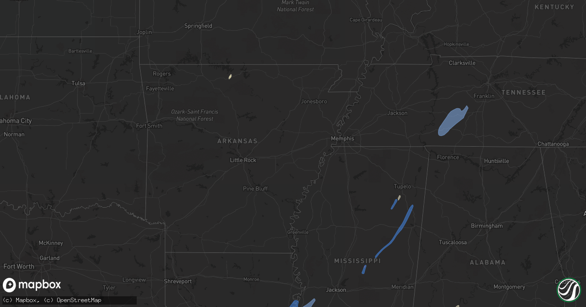
May 25 map
$229
one time, instant access
Download today. No call, no setup
Keep the $229
Bought the map and want the full workflow? Apply the entire $229 to a subscription within 7 days. None of it is wasted.
Every map, not just this one
This buys you this map. Subscription and you get every map we run, in the markets you choose from a few cities to whole states to nationwide. Plus real-time alerts the moment a storm fires.
Contact data
Name, contact info, occupancy, even credit band for addresses in the footprint. You go from where it hit to who to call.
Become the source they trust
Unlimited branding weather history reports on demand. You already have the documented answer ready for the property owner, and you are the one who showed up with it.
Property data and RoofTrace estimates
Pull up any address you have got, its value and the exact code rules for that jurisdiction, straight from One Click Code. Then RoofTrace estimates the squares, pitch, and roof value, priced the way you price.
Storm reports in Texas
Texas
| Date | Description |
|---|---|
| 05/25/20229:07 AM CDT | Downed healthy tree in the middle of the road with 6-8 in. Diameter trunk near los fresnos/laureles on kretz rd between fm803 and fm1575. |
| 05/25/20227:45 AM CDT | At 1244 AM CDT, a severe thunderstorm was located over Caldwell, moving east at 40 mph. HAZARD...70 mph wind gusts. SOURCE...Radar indicated. IMPACT...Expect considerable tree damage. Damage is likely to mobile homes, roofs, and outbuildings. Locations impacted include... Caldwell, Deanville and Chriesman. |
| 05/25/20227:43 AM CDT | At 1242 AM CDT, severe thunderstorms were located along a line extending from 7 miles southeast of Hearne to 9 miles northeast of Caldwell to 6 miles north of Lake Somerville State Park & Trailway to 6 miles northwest of Round Top to near Cistern, moving east at 45 mph. HAZARD...70 mph wind gusts and penny size hail. SOURCE...Radar indicated. IMPACT...Expect considerable tree damage. Damage is likely to mobile homes, roofs, and outbuildings. Locations impacted include... College Station, Bryan, Brenham, Navasota, Hempstead, Bellville, Columbus, Washington, Weimar, Somerville, Snook, Bedias, Kurten, Industry, Burton, Wixon Valley, Millican, Anderson, Lake Somerville Dam and Kyle Field. |
| 05/25/20227:41 AM CDT | At 1240 AM CDT, severe thunderstorms were located along a line extending from 7 miles northwest of Frio Town to 16 miles east of Darling, moving south at 35 mph. HAZARD...Golf ball size hail and 60 mph wind gusts. SOURCE...Radar indicated. IMPACT...People and animals outdoors will be injured. Expect hail damage to roofs, siding, windows, and vehicles. Expect wind damage to roofs, siding, and trees. Locations impacted include... Uvalde, Crystal City, Carrizo Springs, Dilley, Big Wells, La Pryor, Batesville, Asherton, Chula Vista-River Spur, Blewett, Washer, Las Colonias, Winter Haven, Uvalde Estates, Cometa, Brundage, Dabney, Carrizo Hill, Divot and Loma Vista. |
| 05/25/20227:37 AM CDT | At 1237 AM CDT, severe thunderstorms were located along a line extending from 6 miles southwest of Waelder to 7 miles west of Floresville to near Bluff, moving southeast at 45 mph. HAZARD...60 mph wind gusts. SOURCE...Radar indicated. IMPACT...Expect damage to roofs, siding, and trees. Locations impacted include... Pleasanton, Pearsall, Cuero, Gonzales, Floresville, Yoakum, Devine, Jourdanton, Dilley, Poteet, Kenedy, Karnes City, Hallettsville, Poth, Yorktown, Shiner, Charlotte, Stockdale, Moulton and Christine. |
| 05/25/20227:26 AM CDT | At 1226 AM CDT, severe thunderstorms were located along a line extending from 7 miles east of Tanglewood to near Giddings to Cistern, moving east at 45 mph. HAZARD...60 mph wind gusts and penny size hail. SOURCE...Radar indicated. IMPACT...Expect damage to roofs, siding, and trees. Locations impacted include... Bastrop, Giddings, La Grange, Smithville, Schulenburg, Flatonia, Lexington, Fayetteville, Dime Box, Round Top, Fedor, Camp Swift, Circle D-KC Estates, Rosanky, Paige, Muldoon, Tanglewood, Cistern, Lake Somerville State Park & Trailway and Wyldwood. |
| 05/25/20227:20 AM CDT | At 1219 AM CDT, severe thunderstorms were located along a line extending from 8 miles southeast of Cameron to near Lexington to 7 miles southwest of Giddings to near Rosanky, moving east at 30 mph. HAZARD...70 mph wind gusts. SOURCE...Radar indicated. IMPACT...Expect considerable tree damage. Damage is likely to mobile homes, roofs, and outbuildings. Locations impacted include... Caldwell, Somerville, Burton, Lake Somerville Dam, Lake Somerville State Park & Trailway, Carmine, Lyons, Deanville and Chriesman. |
| 05/25/20227:00 AM CDT | Social media report from spacex. |
| 05/25/20222:09 AM CDT | At 708 AM CDT, severe thunderstorms were located along a line extending from 26 miles northeast of Port Mansfield to 10 miles southeast of Boca Chica Beach to 24 miles southwest of Fort Brown Memorial Golf Course, moving southeast at 40 mph. HAZARD...70 mph wind gusts. SOURCE...Radar indicated. IMPACT...Expect considerable tree damage. Damage is likely to mobile homes, roofs, and outbuildings. Locations impacted include... South Padre Island, Southmost, Port Of Brownsville, Boca Chica Beach, Cameron Park, Downtown Brownsville, Brownsville, Lincoln Park, Longoria Elementary School, Sams Memorial Stadium and Beach Access Four.This includes the following highways... Interstate Highway 69 E between mile markers 1 and 9. US Highway 281 between mile markers 832 and 838. |
| 05/25/20222:03 AM CDT | At 702 AM CDT, severe thunderstorms were located along a line extending from 28 miles northeast of Beach Access Six to 8 miles south of Boca Chica Beach to 12 miles southwest of Itec Campus, moving southeast at 45 mph. HAZARD...70 mph wind gusts. SOURCE...Radar indicated. IMPACT...Expect considerable tree damage. Damage is likely to mobile homes, roofs, and outbuildings. Locations impacted include... South Padre Island, Boca Chica Beach, U.s. Coast Guard Station, South Padre Island Police Department and Port Isabel--Laguna Heights. |
| 05/25/20221:26 AM CDT | At 624 AM CDT, severe thunderstorms were located along a line extending from 27 miles northeast of Port Mansfield to near Holly Beach to Santa Maria, moving southeast at 40 mph. HAZARD...60 mph wind gusts. SOURCE...Radar indicated. IMPACT...Expect damage to roofs, siding, and trees. Locations impacted include... Harlingen, San Benito, Raymondville, Los Fresnos, South Padre Island, Lyford, Rancho Viejo, Rio Hondo, Palm Valley and Arroyo City.This includes the following highways... Interstate Highway 69 E between mile markers 1 and 48. US Highway 281 between mile markers 822 and 838. |
| 05/25/202212:56 AM CDT | At 556 AM CDT, a severe thunderstorm was located near Sebastian, moving southeast at 50 mph. HAZARD...60 mph wind gusts. SOURCE...Radar indicated. IMPACT...Expect damage to roofs, siding, and trees. Locations impacted include... Harlingen, San Benito, La Feria, Los Fresnos, Edcouch, Santa Rosa, South Padre Island, Rancho Viejo, Rio Hondo and La Villa.This includes the following highways... Interstate Highway 69 E between mile markers 1 and 40. US Highway 281 between mile markers 820 and 830, and between milemarkers 834 and 838. |
| 05/25/202212:43 AM CDT | At 543 AM CDT, a severe thunderstorm was located near Yturria, or 10 miles north of Raymondville, moving southeast around 40 to 45 mph. HAZARD...60 mph wind gusts. SOURCE...Radar indicated. IMPACT...Expect damage to roofs, siding, and trees. Locations impacted include... Raymondville, Lyford, Arroyo City, Port Mansfield, Hargill, Lasara, San Manuel, Linn, San Perlita and Puerto Rico.This includes the following highways... Interstate Highway 69 E between mile markers 39 and 51. US Highway 77 between mile markers 750 and 762. US Highway 281 between mile markers 746 and 764. |
| 05/25/202212:13 AM CDT | At 512 AM CDT, severe thunderstorms were located along a line extending from 9 miles east of Kingsville Naval Air Station to 8 miles southeast of Rachal, moving east at 40 mph. HAZARD...60 mph wind gusts. SOURCE...Radar indicated. IMPACT...Expect damage to roofs, siding, and trees. Locations impacted include... Armstrong, Encino, Sarita, Rachal, Kenedy County Wind Farms, Norias, El Coyote Ranch Airport, U S 77 Border Patrol Station, Kenedy County Sheriffs Office and Rudolph.This includes the following highways... US Highway 77 between mile markers 710 and 752. US Highway 281 between mile markers 722 and 748. |
| 05/24/20229:08 PM CDT | At 207 AM CDT, severe thunderstorms were located along a line extending from Wallis to near East Bernard to 7 miles northwest of Wharton, moving east at 25 mph. HAZARD...60 mph wind gusts. SOURCE...Radar indicated. IMPACT...Expect damage to roofs, siding, and trees. Locations impacted include... Rosenberg, Katy, Richmond, Wharton, Brookshire, Pecan Grove, southwestern Eldridge / West Oaks, Needville, East Bernard, Fulshear, Pleak, Simonton, Fairchilds, Beasley, Kendleton, Orchard, Cinco Ranch, Weston Lakes, Cumings and New Territory. |
| 05/24/20229:07 PM CDT | At 207 AM CDT, a severe thunderstorm was located near El Indio, moving southeast at 50 mph. HAZARD...60 mph wind gusts and quarter size hail. SOURCE...Radar indicated. IMPACT...Hail damage to vehicles is expected. Expect wind damage to roofs, siding, and trees. Locations impacted include... Carrizo Springs, El Indio, Asherton, Chula Vista, Carrizo Hill, Rosita and Farias Lake. |
| 05/24/20229:02 PM CDT | At 201 AM CDT, severe thunderstorms were located along a line extending from near Speaks to near Olivia to 21 miles southwest of Matagorda Island State Park, moving east at 30 mph. HAZARD...60 mph wind gusts. SOURCE...Radar indicated. IMPACT...Expect damage to roofs, siding, and trees. Locations impacted include... Matagorda, El Campo, Edna, Palacios, South Texas Nuclear Plant, Ganado, Point Comfort, La Ward, Pierce, Indianola, Schicke Point, Olivia, Lolita, Blessing, Markham, Port Alto, Cordele, Louise, Midfield and Morales. |
| 05/24/20229:00 PM CDT | At 200 AM CDT, a severe thunderstorm was located near Tilden, moving southeast at 25 mph. HAZARD...60 mph wind gusts and quarter size hail. SOURCE...Radar indicated. IMPACT...Hail damage to vehicles is expected. Expect wind damage to roofs, siding, and trees. Locations impacted include... Choke Canyon, Tilden, Calliham and Simmons. This includes Interstate 37 near mile marker 73. |
| 05/24/20228:56 PM CDT | At 155 AM CDT, severe thunderstorms were located along a line extending from near Inez to near Bloomington to near Quintana, moving southeast at 45 mph. HAZARD...70 mph wind gusts and penny size hail. SOURCE...Radar indicated. IMPACT...Expect considerable tree damage. Damage is likely to mobile homes, roofs, and outbuildings. Locations impacted include... Victoria, Port Lavaca, Refugio, Woodsboro, Seadrift, Port Oconnor, McFaddin, Guadalupe, Lamar, Point Comfort, Quintana, Long Mott, Green Lake, Brentwood Subdivision, Inez, Telferner, Holiday Beach, Tivoli, Matagorda Island State Park and Alamo Beach.This includes the following highways... US Highway 183 between mile markers 660 and 668. US Highway 59 between mile markers 622 and 642. US Highway 77 between mile markers 586 and 628. US Highway 87 between mile markers 814 and 840. |
| 05/24/20228:31 PM CDT | At 131 AM CDT, severe thunderstorms were located along a line extending from near Normandy to near Loma Vista, moving southeast at 35 mph. HAZARD...60 mph wind gusts and half dollar size hail. SOURCE...Radar indicated. IMPACT...Hail damage to vehicles is expected. Expect wind damage to roofs, siding, and trees. Locations impacted include... Eagle Pass, Crystal City, Carrizo Springs, Dilley, Big Wells, La Pryor, Batesville, El Indio, Asherton, Chula Vista, Chula Vista-River Spur, Darling, Las Colonias, Brundage, Carrizo Hill, Loma Vista, Las Vegas, Bluff, Rosita and Paloma. |
| 05/24/20228:29 PM CDT | At 127 AM CDT, severe thunderstorms were located along a line extending from 10 miles southwest of Centerville to near Bedias to near Navasota to 9 miles north of Bellville to Sublime, moving southeast at 50 mph. HAZARD...60 mph wind gusts. SOURCE...Radar indicated. IMPACT...Expect damage to roofs, siding, and trees. Locations impacted include... Southeastern College Station, northwestern Conroe, Huntsville, Brenham, Katy, Tomball, Navasota, Sealy, Hempstead, Willis, Prairie View, Brookshire, Madisonville, Bellville, Columbus, Eagle Lake, Pinehurst, The Woodlands, Washington and Hockley. |
All States Impacted by Hail Map on May 25, 2022
Cities Impacted by Hail Map on May 25, 2022
- Burlington, KY
- Union, KY
- Dickinson, AL
- Alice, TX
- Flippin, AR
- Lower Peach Tree, AL
- Coy, AL
- Whatley, AL
- Pine Hill, AL
- Jackson, AL
- Grove Hill, AL
- Rushville, IN
- Concepcion, TX
- Milroy, IN
- Yellville, AR
- Okolona, MS
- Shannon, MS
- Mandeville, LA
- Lacombe, LA
- Elberta, AL
- Lillian, AL
- Madison, MO
- Michigantown, IN
- Walton, IN
- Twelve Mile, IN
- Thorntown, IN
- Kewanna, IN
- Bringhurst, IN
- Frankfort, IN
- Kokomo, IN
- Cutler, IN
- Young America, IN
- Burlington, IN
- Lucerne, IN
- Flora, IN
- Camden, IN
- Galveston, IN
- Russiaville, IN
- Kirklin, IN
- Lebanon, IN
- Logansport, IN
- Rochester, IN
- Donovan, IL
- Sheldon, IL
- Kentland, IN
- Thomasville, AL
- Vredenburgh, AL
- Beloit, WI
- Walterboro, SC
- Carthage, MS
- Baileyville, IL
- Waterproof, LA
- Saint Joseph, LA
- Woodville, MS
- Ferriday, LA
- Jonesville, LA
- Monterey, LA
- Port Gibson, MS
- Vidalia, LA
- Natchez, MS
- Newellton, LA
- Lorman, MS
- Fayette, MS
- Hermanville, MS
- Utica, MS
- Pattison, MS
- Roxie, MS
- Wesson, MS
- Crystal Springs, MS
- Hazlehurst, MS
- Lena, MS
- Philadelphia, MS
- West Point, MS
- Noxapater, MS
- Aberdeen, MS
- McCool, MS
- Amory, MS
- Starkville, MS
- Sturgis, MS
- Louisville, MS
- Houston, MS
- Hohenwald, TN
- Mount Pleasant, TN
- Williamsport, TN
- Collinwood, TN
- Waynesboro, TN
- Hampshire, TN
- Centerville, TN
- Duck River, TN
- Linden, TN
- Summertown, TN
- Lawrenceburg, TN
- Mount Auburn, IL
- Illiopolis, IL
- Mount Pulaski, IL
- Edinburg, IL
- Buffalo, IL
- Lincoln, IL
- Stonington, IL
- Blue Mound, IL
- Taylorville, IL
- Wilmington, OH
- Xenia, OH
- Jamestown, OH


