Hail Map in Louisiana on May 25, 2022
Get this storm
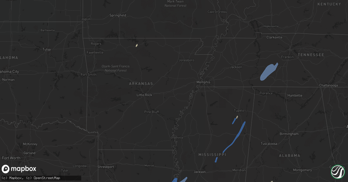
May 25 map
$229
one time, instant access
Download today. No call, no setup
Keep the $229
Bought the map and want the full workflow? Apply the entire $229 to a subscription within 7 days. None of it is wasted.
Every map, not just this one
This buys you this map. Subscription and you get every map we run, in the markets you choose from a few cities to whole states to nationwide. Plus real-time alerts the moment a storm fires.
Contact data
Name, contact info, occupancy, even credit band for addresses in the footprint. You go from where it hit to who to call.
Become the source they trust
Unlimited branding weather history reports on demand. You already have the documented answer ready for the property owner, and you are the one who showed up with it.
Property data and RoofTrace estimates
Pull up any address you have got, its value and the exact code rules for that jurisdiction, straight from One Click Code. Then RoofTrace estimates the squares, pitch, and roof value, priced the way you price.
Storm reports in Louisiana
Louisiana
| Date | Description |
|---|---|
| 05/25/20229:40 AM CDT | Down trees and powerlines. |
| 05/25/20229:16 AM CDT | A power line was brought down on airport road. |
| 05/25/20228:40 AM CDT | Broadcast media reports several snapped trees and tree limbs down in batchelor. |
| 05/25/20228:40 AM CDT | Corrects previous tstm wnd dmg report from batchelor. Broadcast media reports several snapped trees and tree limbs down in batchelor on normandy ln near la1. |
| 05/25/20228:05 AM CDT | Acadiana parish sheriff office reports branch hwy closed until further notice due to power poles knocked down. Time estimated via radar. |
| 05/25/20227:40 AM CDT | Tree down on heritage rd. In the mire community. Photo provided via social media. Time estimated by radar. |
| 05/25/20224:55 AM CDT | At 955 AM CDT, severe thunderstorms were located along a line extending from near Newellton to 7 miles northwest of Port Gibson, moving northeast at 55 mph. HAZARD...60 mph wind gusts. SOURCE...Radar indicated. IMPACT...Expect damage to roofs, siding, and trees. Severe thunderstorms will be near... Afton around 1000 AM CDT. Vicksburg, Le Tourneau and Yokena around 1010 AM CDT. Bovina around 1025 AM CDT. Redwood and Flowers around 1030 AM CDT. Oak Ridge and Youngton around 1035 AM CDT. Valley Park around 1040 AM CDT.Other locations impacted by these severe thunderstorms include Mound,Delta and Richmond. |
| 05/25/20224:29 AM CDT | At 929 AM CDT, severe thunderstorms were located along a line extending from near Newlight to near Natchez, moving northeast at 40 mph. HAZARD...60 mph wind gusts. SOURCE...Radar indicated. IMPACT...Expect damage to roofs, siding, and trees. Severe thunderstorms will be near... Newlight around 935 AM CDT. Somerset around 945 AM CDT. Afton around 955 AM CDT. Alcorn, St. Joseph and Lorman around 1000 AM CDT. |
All States Impacted by Hail Map on May 25, 2022
Cities Impacted by Hail Map on May 25, 2022
- Burlington, KY
- Union, KY
- Dickinson, AL
- Alice, TX
- Flippin, AR
- Lower Peach Tree, AL
- Coy, AL
- Whatley, AL
- Pine Hill, AL
- Jackson, AL
- Grove Hill, AL
- Rushville, IN
- Concepcion, TX
- Milroy, IN
- Yellville, AR
- Okolona, MS
- Shannon, MS
- Mandeville, LA
- Lacombe, LA
- Elberta, AL
- Lillian, AL
- Madison, MO
- Michigantown, IN
- Walton, IN
- Twelve Mile, IN
- Thorntown, IN
- Kewanna, IN
- Bringhurst, IN
- Frankfort, IN
- Kokomo, IN
- Cutler, IN
- Young America, IN
- Burlington, IN
- Lucerne, IN
- Flora, IN
- Camden, IN
- Galveston, IN
- Russiaville, IN
- Kirklin, IN
- Lebanon, IN
- Logansport, IN
- Rochester, IN
- Donovan, IL
- Sheldon, IL
- Kentland, IN
- Thomasville, AL
- Vredenburgh, AL
- Beloit, WI
- Walterboro, SC
- Carthage, MS
- Baileyville, IL
- Waterproof, LA
- Saint Joseph, LA
- Woodville, MS
- Ferriday, LA
- Jonesville, LA
- Monterey, LA
- Port Gibson, MS
- Vidalia, LA
- Natchez, MS
- Newellton, LA
- Lorman, MS
- Fayette, MS
- Hermanville, MS
- Utica, MS
- Pattison, MS
- Roxie, MS
- Wesson, MS
- Crystal Springs, MS
- Hazlehurst, MS
- Lena, MS
- Philadelphia, MS
- West Point, MS
- Noxapater, MS
- Aberdeen, MS
- McCool, MS
- Amory, MS
- Starkville, MS
- Sturgis, MS
- Louisville, MS
- Houston, MS
- Hohenwald, TN
- Mount Pleasant, TN
- Williamsport, TN
- Collinwood, TN
- Waynesboro, TN
- Hampshire, TN
- Centerville, TN
- Duck River, TN
- Linden, TN
- Summertown, TN
- Lawrenceburg, TN
- Mount Auburn, IL
- Illiopolis, IL
- Mount Pulaski, IL
- Edinburg, IL
- Buffalo, IL
- Lincoln, IL
- Stonington, IL
- Blue Mound, IL
- Taylorville, IL
- Wilmington, OH
- Xenia, OH
- Jamestown, OH


