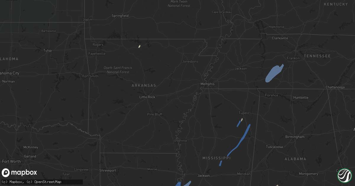
Hail Map in Indiana on May 25, 2022
Get this storm
May 25 map
$229
one time, instant access
Download today. No call, no setup
Keep the $229
Bought the map and want the full workflow? Apply the entire $229 to a subscription within 7 days. None of it is wasted.
Every map, not just this one
This buys you this map. Subscription and you get every map we run, in the markets you choose from a few cities to whole states to nationwide. Plus real-time alerts the moment a storm fires.
Contact data
Name, contact info, occupancy, even credit band for addresses in the footprint. You go from where it hit to who to call.
Become the source they trust
Unlimited branding weather history reports on demand. You already have the documented answer ready for the property owner, and you are the one who showed up with it.
Property data and RoofTrace estimates
Pull up any address you have got, its value and the exact code rules for that jurisdiction, straight from One Click Code. Then RoofTrace estimates the squares, pitch, and roof value, priced the way you price.
Storm reports in Indiana
Indiana
| Date | Description |
|---|---|
| 05/25/20226:24 PM CDT | Lake county dispatch reported downed tree limbs in the munster area. Time estimated by radar. |
| 05/25/20226:20 PM CDT | Lake county dispatch reported downed tree limbs in the dyer area. Time estimated by radar. |
| 05/25/20226:19 PM CDT | Photo shared via social media shows large branch snapped near us-30 and us-41 in schererville. Time estimated by radar. |
| 05/25/20226:10 PM CDT | 1 tree down |
| 05/25/20226:10 PM CDT | Passed along a report from a private weather station. |
| 05/25/20226:10 PM CDT | 1 tree down |
| 05/25/20226:05 PM CDT | Lake county dispatch reported downed tree limbs in the lowell area. Time estimated by radar. |
| 05/25/20226:00 PM CDT | Small tree down shortly after 7pm. |
| 05/25/20226:00 PM CDT | 5 inch in diameter tree limbs down. |
| 05/25/20225:57 PM CDT | Roof from a large metal garage removed and deposited a short distance away. |
| 05/25/20225:55 PM CDT | Delayed report. Large tree snapped in half. |
| 05/25/20225:45 PM CDT | Multiple areas with trees... Limbs and power lines downed between frankfort and michigantown. |
| 05/25/20225:37 PM CDT | 6 inch healthy tree limb down on roof of jeep. |
| 05/25/20225:24 PM CDT | Private weather station reported 73mph gust northwest of kentland. |
| 05/25/20225:24 PM CDT | A couple tree limbs were downed. |
| 05/25/20225:17 PM CDT | *** 1 fatal *** boom lift toppled by thunderstorm winds. One person was in the boom at the time of the strong winds and was killed. |
| 05/25/20224:49 PM CDT | Multiple large trees down. |
| 05/25/20224:49 PM CDT | 6 inch healthy tree limb down on roof of jeep. |
| 05/25/20223:29 PM CDT | 2 power poles snapped... 1 tree down. Time estimated from radar. |
| 05/25/20222:13 AM CDT | At 713 PM EDT, a severe thunderstorm was located near Bristol, or 9 miles east of Simonton Lake, moving north at 50 mph. HAZARD...60 mph wind gusts and penny size hail. SOURCE...Radar indicated. IMPACT...Expect damage to roofs, siding, and trees. Locations impacted include... Three Rivers, Middlebury, Constantine, Bristol, White Pigeon, Marcellus, Union, Flowerfield, Mottville, Moore Park, Jones, Corey Lake, Shavehead Lake, Howardsville, Clear Lake and Wakelee.This includes Interstate 80 in Indiana between mile markers 97 and108. |
| 05/25/20222:00 AM CDT | At 659 PM EDT, a severe thunderstorm was located near Walton, or near Grissom Afb, moving north at 50 mph. HAZARD...60 mph wind gusts. SOURCE...Radar indicated. IMPACT...Expect damage to roofs, siding, and trees. Locations impacted include... Logansport, Peru, Rochester, Grissom Afb, Walton, Bunker Hill, Mexico, Lincoln, Wells, Galveston, Denver, Fulton, Macy, Onward, Nyena Lake, Leases Corner, Deedsville, Hoover, Nead and Anoka. |
| 05/25/20221:55 AM CDT | At 655 PM EDT, a severe thunderstorm was located 13 miles southwest of Walton, or 14 miles west of Kokomo, moving north at 50 mph. HAZARD...70 mph wind gusts. SOURCE...Radar indicated. IMPACT...Expect considerable tree damage. Damage is likely to mobile homes, roofs, and outbuildings. This severe thunderstorm will remain over mainly rural areas of eastern Carroll and northwestern Howard Counties. |
| 05/25/20221:30 AM CDT | At 630 PM EDT, a severe thunderstorm was located south of Frankfort, moving north at 55 mph. HAZARD...60 mph wind gusts. SOURCE...Radar indicated. IMPACT...Expect damage to roofs, siding, and trees. This severe thunderstorm will be near... Frankfort around 635 PM EDT. Michigantown around 640 PM EDT. Burlington around 650 PM EDT.This includes Interstate 65 between mile markers 145 and 151. |
| 05/25/20221:15 AM CDT | At 615 PM EDT, a severe thunderstorm was located near Brownsburg, or 19 miles northwest of Indianapolis, moving north at 50 mph. HAZARD...60 mph wind gusts. SOURCE...Radar indicated. IMPACT...Expect damage to roofs, siding, and trees. This severe thunderstorm will be near... Whitestown around 620 PM EDT. Ulen around 625 PM EDT. Lebanon around 630 PM EDT. Thorntown around 635 PM EDT.This includes the following highways... Interstate 65 between mile markers 128 and 150. Interstate 74 between mile markers 55 and 67.trong thunderstorms |
| 05/25/20221:00 AM CDT | At 559 PM CDT, a severe thunderstorm was located near Lowell, moving north at 45 mph. HAZARD...60 mph wind gusts and penny size hail. SOURCE...Radar indicated. IMPACT...Expect damage to roofs, siding, and trees. Locations impacted include... Hammond, Gary, Tinley Park, Oak Lawn, Calumet City, Merrillville, Chicago Heights, Roseland, East Chicago, Schererville, Hobart, Lansing, Oak Forest, Crown Point, Harvey, Highland, Blue Island, Munster, Dolton and Park Forest.Including the following interstates... I-57 between mile markers 336 and 356. I-80 between mile markers 150 and 155. I-94 between mile markers 66 and 74. I-294 between mile markers 66 and 74. Indiana I-80 between mile markers 1 and 12. Indiana I-90 between mile markers 1 and 18. Indiana I-65 between mile markers 247 and 261.This includes... Indiana University Northwest, Purdue UniversityNorthwest Hammond, Windy City Thunderbolts Baseball, Hollywood CasinoAmphitheatre, Governors State University, Illiana Motor Speedway,Lake County Fairgrounds, Prairie State College, South Shore Rail CatsBaseball, and South Suburban College. |
| 05/25/202212:36 AM CDT | At 536 PM EDT, a severe thunderstorm was located 9 miles east of Fishers, or 13 miles southwest of Anderson, moving north at 40 mph. HAZARD...60 mph wind gusts. SOURCE...Radar indicated. IMPACT...Expect damage to roofs, siding, and trees. This severe thunderstorm will be near... Pendleton around 545 PM EDT. Lapel around 550 PM EDT. Edgewood, Woodlawn Heights and River Forest around 555 PM EDT.Other locations in the path of this severe thunderstorm includeCountry Club Heights.This includes Interstate 69 between mile markers 209 and 225. |
| 05/25/202212:33 AM CDT | At 532 PM CDT, a severe thunderstorm was located near Morocco, moving north at 45 mph. HAZARD...60 mph wind gusts and penny size hail. SOURCE...Radar indicated. IMPACT...Expect damage to roofs, siding, and trees. Locations impacted include... Lowell, Manteno, Momence, Morocco, Lake Village, Grant Park, St. Anne, Hopkins Park, Sun River Terrace, Beaverville, Donovan, Schneider and Sumava Resorts.Including the following interstate... I-57 between mile markers 323 and 324. This includes... US 41 Dragway. |
| 05/24/20227:30 PM CDT | Large tree limbs down... Trampoline flipped. Public estimates between 8:30-8:45pm. |
| 05/24/20227:20 PM CDT | Branch down. |
All States Impacted by Hail Map on May 25, 2022
Cities Impacted by Hail Map on May 25, 2022
- Burlington, KY
- Union, KY
- Dickinson, AL
- Alice, TX
- Flippin, AR
- Lower Peach Tree, AL
- Coy, AL
- Whatley, AL
- Pine Hill, AL
- Jackson, AL
- Grove Hill, AL
- Rushville, IN
- Concepcion, TX
- Milroy, IN
- Yellville, AR
- Okolona, MS
- Shannon, MS
- Mandeville, LA
- Lacombe, LA
- Elberta, AL
- Lillian, AL
- Madison, MO
- Michigantown, IN
- Walton, IN
- Twelve Mile, IN
- Thorntown, IN
- Kewanna, IN
- Bringhurst, IN
- Frankfort, IN
- Kokomo, IN
- Cutler, IN
- Young America, IN
- Burlington, IN
- Lucerne, IN
- Flora, IN
- Camden, IN
- Galveston, IN
- Russiaville, IN
- Kirklin, IN
- Lebanon, IN
- Logansport, IN
- Rochester, IN
- Donovan, IL
- Sheldon, IL
- Kentland, IN
- Thomasville, AL
- Vredenburgh, AL
- Beloit, WI
- Walterboro, SC
- Carthage, MS
- Baileyville, IL
- Waterproof, LA
- Saint Joseph, LA
- Woodville, MS
- Ferriday, LA
- Jonesville, LA
- Monterey, LA
- Port Gibson, MS
- Vidalia, LA
- Natchez, MS
- Newellton, LA
- Lorman, MS
- Fayette, MS
- Hermanville, MS
- Utica, MS
- Pattison, MS
- Roxie, MS
- Wesson, MS
- Crystal Springs, MS
- Hazlehurst, MS
- Lena, MS
- Philadelphia, MS
- West Point, MS
- Noxapater, MS
- Aberdeen, MS
- McCool, MS
- Amory, MS
- Starkville, MS
- Sturgis, MS
- Louisville, MS
- Houston, MS
- Hohenwald, TN
- Mount Pleasant, TN
- Williamsport, TN
- Collinwood, TN
- Waynesboro, TN
- Hampshire, TN
- Centerville, TN
- Duck River, TN
- Linden, TN
- Summertown, TN
- Lawrenceburg, TN
- Mount Auburn, IL
- Illiopolis, IL
- Mount Pulaski, IL
- Edinburg, IL
- Buffalo, IL
- Lincoln, IL
- Stonington, IL
- Blue Mound, IL
- Taylorville, IL
- Wilmington, OH
- Xenia, OH
- Jamestown, OH


