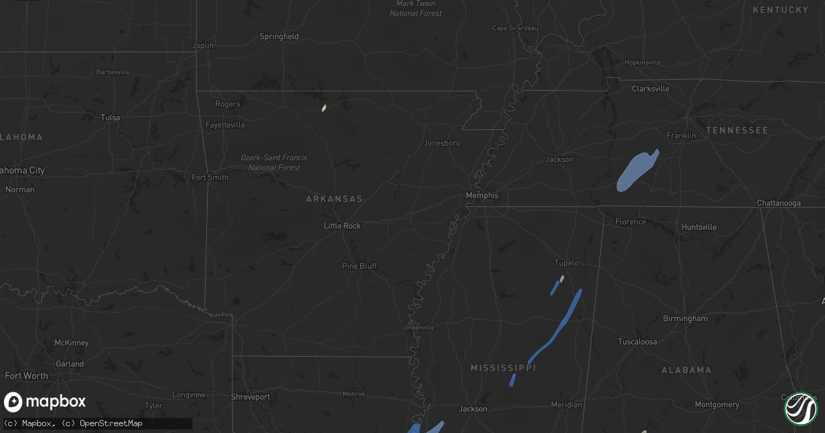
Hail Map in Tennessee on May 25, 2022
Get this storm
May 25 map
$229
one time, instant access
Download today. No call, no setup
Keep the $229
Bought the map and want the full workflow? Apply the entire $229 to a subscription within 7 days. None of it is wasted.
Every map, not just this one
This buys you this map. Subscription and you get every map we run, in the markets you choose from a few cities to whole states to nationwide. Plus real-time alerts the moment a storm fires.
Contact data
Name, contact info, occupancy, even credit band for addresses in the footprint. You go from where it hit to who to call.
Become the source they trust
Unlimited branding weather history reports on demand. You already have the documented answer ready for the property owner, and you are the one who showed up with it.
Property data and RoofTrace estimates
Pull up any address you have got, its value and the exact code rules for that jurisdiction, straight from One Click Code. Then RoofTrace estimates the squares, pitch, and roof value, priced the way you price.
Storm reports in Tennessee
Tennessee
| Date | Description |
|---|---|
| 05/25/20225:30 PM CDT | Facebook report of a tree blown down in front of truck on the natchez trace. |
| 05/25/20225:30 PM CDT | Twitter report of a tree down in centerville and facebook report of another on highway 100 just south of centerville. |
| 05/25/20225:19 PM CDT | Report from mping: 1-inch tree limbs broken; shingles blown off. |
| 05/25/20225:17 PM CDT | Facebook report of several trees blown down around summertown. |
| 05/25/20225:16 PM CDT | Several trees down with one falling on a truck just south of shaffers market. |
| 05/25/20225:14 PM CDT | Several trees were blown down on three oaks road and brace road. |
| 05/25/20225:06 PM CDT | Facebook report of two trees down in hohenwald. |
| 05/25/20225:05 PM CDT | Tree branches broken on parks street and lafayette avenue in lawrenceburg of around 5 to 7 inches in diameter. Parks street tree damage resulted in power outages. |
| 05/25/20225:05 PM CDT | Tennessee valley weather reported several trees... Tree limbs... Power lines and power poles blown down across lawrence county with scattered power outages... Including |
| 05/25/20224:42 PM CDT | Facebook reports of a few trees... Tree limbs and power lines blown down around waynesboro and collinwood with power outages including one tree down on copeland drive. |
| 05/25/202212:25 AM CDT | At 525 PM CDT, severe thunderstorms were located along a line extending from 6 miles west of Centerville to 15 miles northeast of Hohenwald to near Mount Pleasant, moving northeast at 50 mph. HAZARD...60 mph wind gusts. SOURCE...Radar indicated. IMPACT...Expect damage to roofs, siding, and trees. Locations impacted include... Columbia, Centerville, Spring Hill, Mount Pleasant, Thompson's Station, Bon Aqua, Primm Springs, Lyles, Santa Fe, Hampshire, Williamsport, Nunnelly and Pinewood.This includes the following highways... Interstate 65 between mile markers 48 and 50. Interstate 840 between mile markers 6 and 24. |
| 05/24/202211:48 PM CDT | At 448 PM CDT, severe thunderstorms were located along a line extending from near Waynesboro to near Loretto, moving northeast at 45 mph. HAZARD...60 mph wind gusts. SOURCE...Radar indicated. IMPACT...Expect damage to roofs, siding, and trees. Locations impacted include... Lawrenceburg, Hohenwald, Waynesboro, Loretto, St. Joseph, Minor Hill, Ethridge, Henryville, Goodspring, Leoma, Westpoint and Iron City. |
| 05/24/202211:23 PM CDT | At 422 PM CDT, severe thunderstorms were located along a line extending from near Walnut Grove to Muscle Shoals, moving northeast at 45 mph. HAZARD...60 mph wind gusts. SOURCE...Radar indicated. IMPACT...Expect damage to roofs, siding, and trees. Locations impacted include... Lawrenceburg, Waynesboro, Loretto, Collinwood, Clifton, St. Joseph, Leoma, Westpoint, Iron City, Cypress Inn and Lutts. |
| 05/24/202211:13 PM CDT | At 413 PM CDT, severe thunderstorms were located along a line extending from 10 miles southeast of Walnut Grove to 7 miles southeast of Russellville, moving east at 50 mph. HAZARD...60 mph wind gusts and penny size hail. SOURCE...Radar indicated. IMPACT...Expect damage to roofs, siding, and trees. Locations impacted include... Florence, Muscle Shoals, Russellville, Sheffield, Tuscumbia, Moulton, Trinity, Rogersville, Killen and Town Creek. |
All States Impacted by Hail Map on May 25, 2022
Cities Impacted by Hail Map on May 25, 2022
- Burlington, KY
- Union, KY
- Dickinson, AL
- Alice, TX
- Flippin, AR
- Lower Peach Tree, AL
- Coy, AL
- Whatley, AL
- Pine Hill, AL
- Jackson, AL
- Grove Hill, AL
- Rushville, IN
- Concepcion, TX
- Milroy, IN
- Yellville, AR
- Okolona, MS
- Shannon, MS
- Mandeville, LA
- Lacombe, LA
- Elberta, AL
- Lillian, AL
- Madison, MO
- Michigantown, IN
- Walton, IN
- Twelve Mile, IN
- Thorntown, IN
- Kewanna, IN
- Bringhurst, IN
- Frankfort, IN
- Kokomo, IN
- Cutler, IN
- Young America, IN
- Burlington, IN
- Lucerne, IN
- Flora, IN
- Camden, IN
- Galveston, IN
- Russiaville, IN
- Kirklin, IN
- Lebanon, IN
- Logansport, IN
- Rochester, IN
- Donovan, IL
- Sheldon, IL
- Kentland, IN
- Thomasville, AL
- Vredenburgh, AL
- Beloit, WI
- Walterboro, SC
- Carthage, MS
- Baileyville, IL
- Waterproof, LA
- Saint Joseph, LA
- Woodville, MS
- Ferriday, LA
- Jonesville, LA
- Monterey, LA
- Port Gibson, MS
- Vidalia, LA
- Natchez, MS
- Newellton, LA
- Lorman, MS
- Fayette, MS
- Hermanville, MS
- Utica, MS
- Pattison, MS
- Roxie, MS
- Wesson, MS
- Crystal Springs, MS
- Hazlehurst, MS
- Lena, MS
- Philadelphia, MS
- West Point, MS
- Noxapater, MS
- Aberdeen, MS
- McCool, MS
- Amory, MS
- Starkville, MS
- Sturgis, MS
- Louisville, MS
- Houston, MS
- Hohenwald, TN
- Mount Pleasant, TN
- Williamsport, TN
- Collinwood, TN
- Waynesboro, TN
- Hampshire, TN
- Centerville, TN
- Duck River, TN
- Linden, TN
- Summertown, TN
- Lawrenceburg, TN
- Mount Auburn, IL
- Illiopolis, IL
- Mount Pulaski, IL
- Edinburg, IL
- Buffalo, IL
- Lincoln, IL
- Stonington, IL
- Blue Mound, IL
- Taylorville, IL
- Wilmington, OH
- Xenia, OH
- Jamestown, OH


