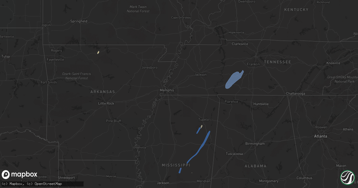
Hail Map on May 25, 2022
Get this storm
May 25 map
$229
one time, instant access
Download today. No call, no setup
Keep the $229
Bought the map and want the full workflow? Apply the entire $229 to a subscription within 7 days. None of it is wasted.
Every map, not just this one
This buys you this map. Subscription and you get every map we run, in the markets you choose from a few cities to whole states to nationwide. Plus real-time alerts the moment a storm fires.
Contact data
Name, contact info, occupancy, even credit band for addresses in the footprint. You go from where it hit to who to call.
Become the source they trust
Unlimited branding weather history reports on demand. You already have the documented answer ready for the property owner, and you are the one who showed up with it.
Property data and RoofTrace estimates
Pull up any address you have got, its value and the exact code rules for that jurisdiction, straight from One Click Code. Then RoofTrace estimates the squares, pitch, and roof value, priced the way you price.
States Impacted by Hail Map on May 25, 2022
Storm reports
Louisiana
| Date | Description |
|---|---|
| 05/25/20229:40 AM CDT | Down trees and powerlines. |
| 05/25/20229:16 AM CDT | A power line was brought down on airport road. |
| 05/25/20228:40 AM CDT | Corrects previous tstm wnd dmg report from batchelor. Broadcast media reports several snapped trees and tree limbs down in batchelor on normandy ln near la1. |
| 05/25/20228:40 AM CDT | Broadcast media reports several snapped trees and tree limbs down in batchelor. |
| 05/25/20228:05 AM CDT | Acadiana parish sheriff office reports branch hwy closed until further notice due to power poles knocked down. Time estimated via radar. |
| 05/25/20227:40 AM CDT | Tree down on heritage rd. In the mire community. Photo provided via social media. Time estimated by radar. |
| 05/25/20224:55 AM CDT | At 955 AM CDT, severe thunderstorms were located along a line extending from near Newellton to 7 miles northwest of Port Gibson, moving northeast at 55 mph. HAZARD...60 mph wind gusts. SOURCE...Radar indicated. IMPACT...Expect damage to roofs, siding, and trees. Severe thunderstorms will be near... Afton around 1000 AM CDT. Vicksburg, Le Tourneau and Yokena around 1010 AM CDT. Bovina around 1025 AM CDT. Redwood and Flowers around 1030 AM CDT. Oak Ridge and Youngton around 1035 AM CDT. Valley Park around 1040 AM CDT.Other locations impacted by these severe thunderstorms include Mound,Delta and Richmond. |
| 05/25/20224:29 AM CDT | At 929 AM CDT, severe thunderstorms were located along a line extending from near Newlight to near Natchez, moving northeast at 40 mph. HAZARD...60 mph wind gusts. SOURCE...Radar indicated. IMPACT...Expect damage to roofs, siding, and trees. Severe thunderstorms will be near... Newlight around 935 AM CDT. Somerset around 945 AM CDT. Afton around 955 AM CDT. Alcorn, St. Joseph and Lorman around 1000 AM CDT. |
Illinois
| Date | Description |
|---|---|
| 05/25/20226:10 PM CDT | Large tree blown over. Time estimated based on radar. |
| 05/25/20226:09 PM CDT | 12 inch maple tree top snapped off tree. |
| 05/25/20226:00 PM CDT | In-10/il-114 blocked at state line road due to a downed tree. Time estimated by radar. |
| 05/25/20224:58 PM CDT | 8 inch wide tree limb down near lorena ave. |
| 05/25/20224:26 PM CDT | Large tree snapped near base. Tree was slightly rotted but had full canopy of leaves. Time estimated from radar. |
| 05/25/20223:15 PM CDT | Reports of damage to a farm from broadcast media and emergency management. Snapped trees and damage to outbuildings. Tornado possible. |
| 05/25/20223:06 PM CDT | A brief tornado caused damage at a farmstead just southeast of the albertus airport. The tornado caused significant damage to an outbuilding... Destroyed a grain bin... |
| 05/25/20223:22 AM CDT | At 822 PM CDT, a severe thunderstorm was located near Mount Pulaski, or 13 miles south of Lincoln, moving north at 45 mph. HAZARD...60 mph wind gusts. SOURCE...Radar indicated. IMPACT...Expect damage to roofs, siding, and trees. This severe thunderstorm will be near... Mount Pulaski around 825 PM CDT. Chestnut around 830 PM CDT. Lincoln and Beason around 835 PM CDT.Other locations in the path of this severe thunderstorm includeAtlanta.This includes the following highways... Interstate 155 between mile markers 0 and 10. Interstate 55 between mile markers 116 and 141. |
| 05/25/20221:57 AM CDT | At 657 PM CDT, severe thunderstorms were located along a line extending from near Webster to near Adair, moving north at 40 mph. HAZARD...60 mph wind gusts. SOURCE...Radar indicated. IMPACT...Expect damage to roofs, siding, and trees. Severe thunderstorms will be near... Blandinsville, Bardolph and New Philadelphia around 710 PM CDT. Bushnell, La Harpe, Disco and Scottsburg around 715 PM CDT.Other locations in the path of these severe thunderstorms includeWalnut Grove, Prairie City Airport and Prairie City. |
| 05/25/20221:32 AM CDT | At 631 PM CDT, severe thunderstorms were located along a line extending from Bowen to Rushville, moving north at 45 mph. HAZARD...60 mph wind gusts. SOURCE...Radar indicated. IMPACT...Expect damage to roofs, siding, and trees. Severe thunderstorms will be near... Augusta, Bowen, West Point and Denver around 635 PM CDT. Basco and Bentley around 640 PM CDT. Carthage and Doddsville around 645 PM CDT. Industry, Ferris and Webster around 650 PM CDT.Other locations in the path of these severe thunderstorms includeBurnside, Adrian, Fountain Green, Pennington Point, La Harpe, Adair,McDonough County 4-H Grounds, Macomb, Dallas City, Bardolph, Disco,Western Illinois University, New Philadelphia, Macomb MunicipalAirport, Spring Lake, Bushnell, Good Hope and Scottsburg. |
| 05/25/20221:12 AM CDT | At 612 PM CDT, a severe thunderstorm was located over Buckhorn, moving north at 45 mph. HAZARD...60 mph wind gusts. SOURCE...Radar indicated. IMPACT...Expect damage to roofs, siding, and trees. This severe thunderstorm will be near... Mount Sterling around 620 PM CDT. |
| 05/24/20228:30 PM CDT | Numerous 3-6 inch branches down. |
| 05/24/20227:45 PM CDT | Tree reported down. Relayed via county dispatch. Time estimated from radar. |
| 05/24/20227:20 PM CDT | Tree limbs down. Relayed via broadcast media. |
Ohio
| Date | Description |
|---|---|
| 05/25/20224:57 AM CDT | At 957 PM EDT, a severe thunderstorm was located over Jamestown, moving north at 40 mph. HAZARD...60 mph wind gusts and penny size hail. SOURCE...Radar indicated. IMPACT...Expect damage to trees and power lines. Locations impacted include... Springfield, Urbana, London, Cedarville, Jamestown, South Charleston, Mechanicsburg, Choctaw Lake, Harmony, Lisbon, Brighton, Lafayette, South Vienna, Tremont City, South Solon, Bowersville, Catawba, Clifton, Mutual and Rosemoor.This includes the following Interstates... I-70 in Ohio between mile markers 53 and 78. I-71 in Ohio between mile markers 58 and 60. |
| 05/25/20224:27 AM CDT | At 927 PM EDT, a severe thunderstorm was located near Wilmington, moving north at 50 mph. HAZARD...60 mph wind gusts and penny size hail. SOURCE...Radar indicated. IMPACT...Expect damage to trees and power lines. Locations impacted include... Springfield, Xenia, Wilmington, Yellow Springs, Cedarville, Enon, Jamestown, South Charleston, Wilberforce, New Jasper, Bowersville, Port William, Clifton, Paintersville, Hustead, Lumberton, Oakland, Selma, Oldtown and Gladstone.This includes the following Interstates... I-70 in Ohio between mile markers 49 and 60. I-71 in Ohio between mile markers 46 and 56. |
| 05/25/20222:03 AM CDT | At 702 PM EDT, a severe thunderstorm was located over Decatur, moving north at 50 mph. HAZARD...60 mph wind gusts. SOURCE...Radar indicated. IMPACT...Expect damage to roofs, siding, and trees. Locations impacted include... Fort Wayne, New Haven, Decatur, Woodburn, Monroeville, Grabill, Monroe, Leo-cedarville, Middletown, Preble, Dixon, Edgerton In Allen County, Peterson, Zulu, Rivare, Townley, Magley, Harlan, Hessen Cassel and Monmouth.This includes the following highways... Interstate 469 between mile markers 12 and 30. Interstate 69 in Indiana near mile marker 320. |
| 05/24/20229:01 PM CDT | Report from mping: 1-inch tree limbs broken; shingles blown off. |
| 05/24/20228:37 PM CDT | 1 tree down paintersville new jasper road |
| 05/24/20228:37 PM CDT | 1 tree down near waynesville jamestown road and hoop road. |
| 05/24/20228:28 PM CDT | 2 trees down |
| 05/24/20228:26 PM CDT | 2 trees down. |
| 05/24/20227:54 PM CDT | Power pole down... Broken limbs... Pine trees uprooted... And roof damage to a post office. |
Tennessee
| Date | Description |
|---|---|
| 05/25/20225:30 PM CDT | Twitter report of a tree down in centerville and facebook report of another on highway 100 just south of centerville. |
| 05/25/20225:30 PM CDT | Facebook report of a tree blown down in front of truck on the natchez trace. |
| 05/25/20225:19 PM CDT | Report from mping: 1-inch tree limbs broken; shingles blown off. |
| 05/25/20225:17 PM CDT | Facebook report of several trees blown down around summertown. |
| 05/25/20225:16 PM CDT | Several trees down with one falling on a truck just south of shaffers market. |
| 05/25/20225:14 PM CDT | Several trees were blown down on three oaks road and brace road. |
| 05/25/20225:06 PM CDT | Facebook report of two trees down in hohenwald. |
| 05/25/20225:05 PM CDT | Tennessee valley weather reported several trees... Tree limbs... Power lines and power poles blown down across lawrence county with scattered power outages... Including |
| 05/25/20225:05 PM CDT | Tree branches broken on parks street and lafayette avenue in lawrenceburg of around 5 to 7 inches in diameter. Parks street tree damage resulted in power outages. |
| 05/25/20224:42 PM CDT | Facebook reports of a few trees... Tree limbs and power lines blown down around waynesboro and collinwood with power outages including one tree down on copeland drive. |
| 05/25/202212:25 AM CDT | At 525 PM CDT, severe thunderstorms were located along a line extending from 6 miles west of Centerville to 15 miles northeast of Hohenwald to near Mount Pleasant, moving northeast at 50 mph. HAZARD...60 mph wind gusts. SOURCE...Radar indicated. IMPACT...Expect damage to roofs, siding, and trees. Locations impacted include... Columbia, Centerville, Spring Hill, Mount Pleasant, Thompson's Station, Bon Aqua, Primm Springs, Lyles, Santa Fe, Hampshire, Williamsport, Nunnelly and Pinewood.This includes the following highways... Interstate 65 between mile markers 48 and 50. Interstate 840 between mile markers 6 and 24. |
| 05/24/202211:48 PM CDT | At 448 PM CDT, severe thunderstorms were located along a line extending from near Waynesboro to near Loretto, moving northeast at 45 mph. HAZARD...60 mph wind gusts. SOURCE...Radar indicated. IMPACT...Expect damage to roofs, siding, and trees. Locations impacted include... Lawrenceburg, Hohenwald, Waynesboro, Loretto, St. Joseph, Minor Hill, Ethridge, Henryville, Goodspring, Leoma, Westpoint and Iron City. |
| 05/24/202211:23 PM CDT | At 422 PM CDT, severe thunderstorms were located along a line extending from near Walnut Grove to Muscle Shoals, moving northeast at 45 mph. HAZARD...60 mph wind gusts. SOURCE...Radar indicated. IMPACT...Expect damage to roofs, siding, and trees. Locations impacted include... Lawrenceburg, Waynesboro, Loretto, Collinwood, Clifton, St. Joseph, Leoma, Westpoint, Iron City, Cypress Inn and Lutts. |
| 05/24/202211:13 PM CDT | At 413 PM CDT, severe thunderstorms were located along a line extending from 10 miles southeast of Walnut Grove to 7 miles southeast of Russellville, moving east at 50 mph. HAZARD...60 mph wind gusts and penny size hail. SOURCE...Radar indicated. IMPACT...Expect damage to roofs, siding, and trees. Locations impacted include... Florence, Muscle Shoals, Russellville, Sheffield, Tuscumbia, Moulton, Trinity, Rogersville, Killen and Town Creek. |
Mississippi
| Date | Description |
|---|---|
| 05/25/20225:30 PM CDT | Mesonet station ptbm6 petit bois is |
| 05/25/20223:19 PM CDT | Large tree was blown down on highway 363 east of the railroad tracks. |
| 05/25/20223:18 PM CDT | One large tree was blown down on county road 503 just north of county road 251. |
| 05/25/20223:18 PM CDT | Trees were knocked down in van vleet near davis lake road. |
| 05/25/20223:08 PM CDT | One tree was knocked down on monroe street in west tupelo. |
| 05/25/20223:03 PM CDT | A few trees were snapped and had large branches broken off along edwin ladner road north of diamondhead. |
| 05/25/20223:03 PM CDT | Power pole and wires were knocked down. |
| 05/25/20222:55 PM CDT | Corrects previous tstm wnd dmg report from guntown. Corrects previous tstm wnd dmg report from guntown. One large tree was blown down on county road 503 just north of c |
| 05/25/20222:55 PM CDT | Corrects previous tstm wnd dmg report from saltillo. Large tree was blown down on highway 363 east of the railroad tracks. |
| 05/25/20222:50 PM CDT | Corrects previous tstm wnd dmg report from tupelo. Corrects previous tstm wnd dmg report from tupelo. One tree was knocked down on monroe street in west tupelo. |
| 05/25/20222:50 PM CDT | Corrects previous tstm wnd dmg report from nettleton. Power pole and wires were knocked down. |
| 05/25/20222:50 PM CDT | Corrects previous tstm wnd dmg report from tupelo. One tree was knocked down on monroe street in west tupelo. |
| 05/25/20222:27 PM CDT | Powerlines down causing power outages across the union area. |
| 05/25/20222:25 PM CDT | Corrects previous tstm wnd dmg report from 7 ese houlka. Trees were knocked down in van vleet near davis lake road. |
| 05/25/20222:06 PM CDT | Several trees down. |
| 05/25/20222:01 PM CDT | A few limbs were blown down near stringer off highway 533 at county road 8. |
| 05/25/20221:57 PM CDT | A tree was blown down on babe knight road off highway 533. |
| 05/25/20221:49 PM CDT | A tree was blown down on laird road at the intersection with pittman road. |
| 05/25/20221:45 PM CDT | Trees and power lines were blown down in the ellison ridge area. |
| 05/25/20221:39 PM CDT | Trees and power lines were blown down in the nanih waiya community. |
| 05/25/20221:37 PM CDT | A tree was blown down on monroe road. |
| 05/25/20221:33 PM CDT | The roof was partially blown off of a house along sims road. |
| 05/25/20221:16 PM CDT | A couple of trees were blown down on highway 485 near good hope baptist church. |
| 05/25/20221:16 PM CDT | A brief tornado with maximum estimated winds of 80 mph moved across portions of rural northwest neshoba county near the alice community. The tornado initially touched d |
| 05/25/20221:10 PM CDT | Trees were blown down on highway 485 near highway 21 south. |
| 05/25/20221:00 PM CDT | A tree was blown down on north 8th avenue in decatur. |
| 05/25/202212:57 PM CDT | A tree was blown down at mile marker 166 on the natchez trace parkway. |
| 05/25/202212:55 PM CDT | Social media report and picture of trees and large limbs blown down in carthage. Possible tornado. |
| 05/25/202212:53 PM CDT | A brief tornado touched down north of old canton rd near chipley rd west of carthage. The tornado peeled back some tin on the roof of a residence before moving northeas |
| 05/25/202212:40 PM CDT | A tree was blown down on utah road. |
| 05/25/202211:55 AM CDT | A tree was blown down at the highway 80 ramp to i-20 eastbound. Several small limbs were also blown down. Report and picture via social media. |
| 05/25/202211:30 AM CDT | Tree down on power lines on santa clair st. |
| 05/25/202211:28 AM CDT | Trees were blown down near the intersection of teresa drive and mcdowell road... As well as near the intersection of paden street and mcdowell road. |
| 05/25/202211:26 AM CDT | Social media report and picture of a tree down near wapt16-tv. |
| 05/25/202211:09 AM CDT | A couple of trees were blown down along didlake road. |
| 05/25/202210:55 AM CDT | A tree blocked the road on lake street. |
| 05/25/202210:50 AM CDT | A tree was blown down along i-55 southbound and blocked both southbound lanes. This occurred between mile markers 48 and 51. |
| 05/25/202210:15 AM CDT | Trees were blown down on old port gibson road. |
| 05/25/20229:57 AM CDT | Trees were blown down on gordon station road. |
| 05/25/20229:22 AM CDT | A tree was blown down on melrose montebello parkway. |
| 05/25/20227:40 AM CDT | At 1239 PM CDT, a severe thunderstorm was located near Ludlow, or 9 miles southwest of Carthage, moving northeast at 40 mph. HAZARD...60 mph wind gusts. SOURCE...Radar indicated. IMPACT...Expect damage to roofs, siding, and trees. This severe thunderstorm will be near... Tuscola around 1245 PM CDT. Carthage around 1255 PM CDT. Renfroe around 105 PM CDT. Edinburg around 110 PM CDT. Zama around 120 PM CDT. Stallo around 130 PM CDT.Other locations impacted by this severe thunderstorm include Lena,Walnut Grove, Redwater and Standing Pine. |
| 05/25/20227:08 AM CDT | At 1208 PM CDT, a severe thunderstorm was located over Sanatorium, or over Magee, moving northeast at 35 mph. HAZARD...60 mph wind gusts. SOURCE...Radar indicated. IMPACT...Expect damage to roofs, siding, and trees. This severe thunderstorm will be near... White Oak around 1225 PM CDT. Raleigh and Center Ridge around 1235 PM CDT. Burns around 1240 PM CDT. Pineville around 1250 PM CDT.Other locations impacted by this severe thunderstorm includeSylvarena, Polkville and Mize. |
| 05/25/20227:07 AM CDT | At 1206 AM CDT, a severe thunderstorm was located 4 miles southwest of Dauphin Island, moving north at 50 mph. HAZARD...60 mph wind gusts. SOURCE...Radar indicated. IMPACT...Expect damage to roofs, siding, and trees. Locations impacted include... Midtown Mobile, Tillmans Corner, Theodore, Grand Bay, Bayou La Batre, Dauphin Island, Semmes, Tanner Williams, Coden, I10 And I65, Mobile Regional Airport and Alabama Port. |
| 05/25/20226:41 AM CDT | At 1140 AM CDT, a severe thunderstorm was located near Lacombe, or 11 miles southeast of Covington, moving northeast at 30 mph. HAZARD...60 mph wind gusts. SOURCE...Radar indicated. IMPACT...Expect damage to roofs, siding, and trees. Locations impacted include... Slidell, Pearl River, Lacombe and Slidell Airport. This includes the following Interstates... Interstate 12 between mile markers 66 and 78. Interstate 59 in Louisiana between mile markers 7 and 10. |
| 05/25/20226:10 AM CDT | At 1110 AM CDT, a severe thunderstorm was located near Hopewell, or near Crystal Springs, moving northeast at 45 mph. HAZARD...60 mph wind gusts. SOURCE...Radar indicated. IMPACT...Expect damage to roofs, siding, and trees. This severe thunderstorm will be near... Terry around 1115 AM CDT. Whites around 1120 AM CDT. Byram and Star around 1125 AM CDT. Richland, Florence and Monterey around 1130 AM CDT. Pearl around 1135 AM CDT. Flowood around 1140 AM CDT. Brandon around 1145 AM CDT. Fannin around 1155 AM CDT. |
| 05/25/20225:53 AM CDT | At 1053 AM CDT, severe thunderstorms were located along a line extending from near Edwards to near Bolton to near Dry Grove, moving northeast at 70 mph. HAZARD...60 mph wind gusts. SOURCE...Radar indicated. IMPACT...Expect damage to roofs, siding, and trees. Severe thunderstorms will be near... Clinton and Brownsville around 1100 AM CDT. Jackson around 1105 AM CDT. Flora and Pocahontas around 1110 AM CDT. Annandale around 1115 AM CDT. Madison, Ridgeland and Myrleville around 1120 AM CDT. Canton and Gluckstadt around 1125 AM CDT. Way and Vaughan around 1130 AM CDT. Sharon around 1135 AM CDT.Other locations impacted by these severe thunderstorms includeLearned and Bentonia. |
| 05/25/20225:38 AM CDT | At 1038 AM CDT, a severe thunderstorm was located over Loyd Star, or near Brookhaven, moving northeast at 50 mph. HAZARD...60 mph wind gusts. SOURCE...Radar indicated. IMPACT...Expect damage to roofs, siding, and trees. This severe thunderstorm will be near... Wesson and Glancy around 1050 AM CDT. Martinsville around 1055 AM CDT. Hazlehurst around 1100 AM CDT. Union and Hopewell around 1115 AM CDT.Other locations impacted by this severe thunderstorm includeBeauregard and Georgetown. |
| 05/25/20225:14 AM CDT | At 1014 AM CDT, severe thunderstorms were located along a line extending from Hermanville to near Union Church, moving northeast at 50 mph. HAZARD...60 mph wind gusts. SOURCE...Radar indicated. IMPACT...Expect damage to roofs, siding, and trees. Severe thunderstorms will be near... Hermanville around 1020 AM CDT. Rocky Springs and Carpenter around 1025 AM CDT. Utica, Reganton, Allen and Peyton around 1030 AM CDT. Barlow around 1035 AM CDT. Newman around 1040 AM CDT. Dentville around 1045 AM CDT. Edwards around 1050 AM CDT.Other locations impacted by these severe thunderstorms includeLearned. |
| 05/25/20224:09 AM CDT | At 909 AM CDT, severe thunderstorms were located along a line extending from 6 miles southeast of Slocum to St. Francisville, moving northeast at 25 mph. HAZARD...60 mph wind gusts and penny size hail. SOURCE...Radar indicated. IMPACT...Expect damage to roofs, siding, and trees. Locations impacted include... New Roads, Jackson, St. Francisville, Centreville, Woodville, Wilson, Norwood, Wakefield, Spillman, Fort Adams, Dolorosa and Crosby. |
| 05/25/20224:03 AM CDT | At 903 AM CDT, a severe thunderstorm was located near Slocum, or 12 miles southeast of Monterey, moving northeast at 40 mph. HAZARD...60 mph wind gusts. SOURCE...Radar indicated. IMPACT...Expect damage to roofs, siding, and trees. This severe thunderstorm will be near... Sibley around 915 AM CDT. Natchez and Vidalia around 930 AM CDT. Cranfield around 940 AM CDT. Stanton around 945 AM CDT.Other locations impacted by this severe thunderstorm includeRidgecrest. |
| 05/24/202210:48 PM CDT | At 347 PM CDT, severe thunderstorms were located along a line extending from 7 miles east of Tishomingo State Park to 7 miles southwest of Belgreen, moving northeast at 40 mph. HAZARD...60 mph wind gusts and penny size hail. SOURCE...Radar indicated. IMPACT...Expect damage to roofs, siding, and trees. Locations impacted include... Florence, Muscle Shoals, Russellville, Sheffield, Tuscumbia, Phil Campbell, Cherokee, Littleville, Leighton and St. Florian. |
| 05/24/20229:20 PM CDT | At 219 PM CDT, a severe thunderstorm was located near Turnerville, or 16 miles north of Stringer, moving northeast at 25 mph. HAZARD...60 mph wind gusts and quarter size hail. SOURCE...Radar indicated. IMPACT...Hail damage to vehicles is expected. Expect wind damage to roofs, siding, and trees. This severe thunderstorm will be near... Rose Hill around 240 PM CDT. Garlandville around 245 PM CDT. Newton around 300 PM CDT.Other locations impacted by this severe thunderstorm include Montroseand Louin. |
| 05/24/20229:06 PM CDT | At 206 PM CDT, a severe thunderstorm was located near Montpelier, moving northeast at 40 mph. HAZARD...60 mph wind gusts. SOURCE...Radar indicated. IMPACT...Expect damage to roofs, siding, and trees. Locations impacted include... Houston, Okolona, Trebloc, Woodland, Sparta, McCondy, Anchor, Van Vleet, Parkersburg, Egypt and Buena Vista. |
| 05/24/20228:58 PM CDT | At 158 PM CDT, a severe thunderstorm was located near Moss, or near Stringer, moving northeast at 45 mph. HAZARD...60 mph wind gusts. SOURCE...Radar indicated. IMPACT...Expect damage to roofs, siding, and trees. This severe thunderstorm will be near... Moss around 205 PM CDT. Vernon around 215 PM CDT. Heidelberg around 220 PM CDT. Paulding and Stafford Springs around 225 PM CDT. Rose Hill around 235 PM CDT. Orange around 240 PM CDT.Other locations impacted by this severe thunderstorm include Soso. |
| 05/24/20228:34 PM CDT | At 134 PM CDT, a severe thunderstorm was located near Sherwood, or 22 miles southwest of Montpelier, moving northeast at 45 mph. HAZARD...60 mph wind gusts. SOURCE...Radar indicated. IMPACT...Expect damage to roofs, siding, and trees. This severe thunderstorm will be near... Maben and Mathiston around 145 PM CDT. Cumberland and Clarkson around 150 PM CDT. Pheba around 155 PM CDT. Montpelier around 205 PM CDT.Other locations impacted by this severe thunderstorm include Mantee,Sturgis and Walthall. |
| 05/24/20228:30 PM CDT | At 130 PM CDT, a severe thunderstorm was located near Stallo, or 8 miles southwest of Louisville, moving northeast at 45 mph. HAZARD...60 mph wind gusts. SOURCE...Radar indicated. IMPACT...Expect damage to roofs, siding, and trees. This severe thunderstorm will be near... Louisville and Mcmillan around 140 PM CDT. Millcreek around 150 PM CDT. Betheden around 155 PM CDT. Craig Springs around 200 PM CDT. Starkville and Oktoc around 210 PM CDT. Sessums around 215 PM CDT. Muldrow around 225 PM CDT.Other locations impacted by this severe thunderstorm includeNoxapater. |
| 05/24/20228:11 PM CDT | At 111 PM CDT, a severe thunderstorm was located over Dixon, or near Philadelphia, moving northeast at 40 mph. HAZARD...60 mph wind gusts. SOURCE...Radar indicated. IMPACT...Expect damage to roofs, siding, and trees. This severe thunderstorm will be near... Philadelphia around 115 PM CDT. Bethsaida around 120 PM CDT. Burnside around 125 PM CDT. Forestdale around 130 PM CDT. Nanih Waiya around 140 PM CDT. Preston around 145 PM CDT.Other locations impacted by this severe thunderstorm include Tucker. |
Missouri
| Date | Description |
|---|---|
| 05/25/20225:00 PM CDT | Several 6 to 12 inch tree limbs down. |
| 05/25/202210:57 AM CDT | Delayed report. An nws storm survey determined that straight line winds estimated at 60 mph uprooted a few trees and broke some large tree branches at a couple residenc |
| 05/24/202211:44 PM CDT | At 443 PM CDT, a severe thunderstorm was located over Brooklyn, moving northwest at 45 mph. HAZARD...60 mph wind gusts and nickel size hail. SOURCE...Radar indicated. IMPACT...Expect damage to roofs, siding, and trees. This severe thunderstorm will be near... Clayton, Hillsdale, Wellston, Velda Village Hills and Uplands Park around 450 PM CDT. University City, Overland, Jennings, Bellefontaine Neighbors, St. John, Dellwood, Normandy, Northwoods, Riverview and Bel-Ridge around 455 PM CDT. Ferguson, St. Ann, Berkeley, Black Jack, Woodson Terrace, Kinloch, Spanish Lake, Lambert-St. Louis International Airport, Breckenridge Hills and Calverton Park around 500 PM CDT.Other locations in the path of this severe thunderstorm includeFlorissant, Hazelwood, Bridgeton, West Alton, Orchard Farms andPortage Des Sioux.This includes Interstate 64 in Illinois near exit 9. This also includes Scott Joplin Historic Site and Horseshoe LakeState Park. |
Florida
| Date | Description |
|---|---|
| 05/25/202210:45 AM CDT | Power line down along elkcam blvd. |
| 05/25/20225:37 AM CDT | At 1037 AM CDT, severe thunderstorms were located along a line extending from Bonifay to 6 miles south of Chipley to 13 miles east of Vernon to 19 miles northeast of Lynn Haven, moving northeast at 40 mph. HAZARD...60 mph wind gusts. SOURCE...Radar indicated. IMPACT...Expect damage to roofs, siding, and trees. Locations impacted include... Chipley, Marianna, Graceville, Bradford, Malone, Cottondale, Greenwood, Alford, Wausau, Campbellton, Bascom, Richter Crossroads, Blue Spring, Star, Jacobs, Bahoma, Compass Lake, Ellaville, Johnson Crossroads and Marianna Municipal A/P. |
| 05/25/20225:22 AM CDT | At 1022 PM CDT, a severe thunderstorm was located 4 miles east of Elberta, or 9 miles east of Foley, moving northeast at 25 mph. HAZARD...60 mph wind gusts and quarter size hail. SOURCE...Radar indicated. IMPACT...Hail damage to vehicles is expected. Expect wind damage to roofs, siding, and trees. Locations impacted include... Ensley, Gonzalez, Lillian, Molino and Elberta. |
| 05/25/20221:14 AM CDT | At 614 AM CDT, a severe thunderstorm was located near Jay, or 8 miles south of Brewton, moving north at 35 mph. HAZARD...60 mph wind gusts. SOURCE...Radar indicated. IMPACT...Expect damage to roofs, siding, and trees. Locations impacted include... Brewton, East Brewton, Castleberry, Jay, Pollard and Riverview. |
| 05/25/202212:29 AM CDT | At 529 AM CDT, severe thunderstorms were located along a line extending from 4 miles north of Gonzalez to 5 miles north of Pace to 3 miles west of Milton to Bagdad, moving north at 40 mph. HAZARD...60 mph wind gusts and penny size hail. SOURCE...Radar indicated. IMPACT...Expect damage to roofs, siding, and trees. Locations impacted include... Pace, Milton, Brewton, Bagdad, East Brewton, Jay, Pollard, Riverview, Pea Ridge, Roeville and Point Baker. |
Texas
| Date | Description |
|---|---|
| 05/25/20229:07 AM CDT | Downed healthy tree in the middle of the road with 6-8 in. Diameter trunk near los fresnos/laureles on kretz rd between fm803 and fm1575. |
| 05/25/20227:45 AM CDT | At 1244 AM CDT, a severe thunderstorm was located over Caldwell, moving east at 40 mph. HAZARD...70 mph wind gusts. SOURCE...Radar indicated. IMPACT...Expect considerable tree damage. Damage is likely to mobile homes, roofs, and outbuildings. Locations impacted include... Caldwell, Deanville and Chriesman. |
| 05/25/20227:43 AM CDT | At 1242 AM CDT, severe thunderstorms were located along a line extending from 7 miles southeast of Hearne to 9 miles northeast of Caldwell to 6 miles north of Lake Somerville State Park & Trailway to 6 miles northwest of Round Top to near Cistern, moving east at 45 mph. HAZARD...70 mph wind gusts and penny size hail. SOURCE...Radar indicated. IMPACT...Expect considerable tree damage. Damage is likely to mobile homes, roofs, and outbuildings. Locations impacted include... College Station, Bryan, Brenham, Navasota, Hempstead, Bellville, Columbus, Washington, Weimar, Somerville, Snook, Bedias, Kurten, Industry, Burton, Wixon Valley, Millican, Anderson, Lake Somerville Dam and Kyle Field. |
| 05/25/20227:41 AM CDT | At 1240 AM CDT, severe thunderstorms were located along a line extending from 7 miles northwest of Frio Town to 16 miles east of Darling, moving south at 35 mph. HAZARD...Golf ball size hail and 60 mph wind gusts. SOURCE...Radar indicated. IMPACT...People and animals outdoors will be injured. Expect hail damage to roofs, siding, windows, and vehicles. Expect wind damage to roofs, siding, and trees. Locations impacted include... Uvalde, Crystal City, Carrizo Springs, Dilley, Big Wells, La Pryor, Batesville, Asherton, Chula Vista-River Spur, Blewett, Washer, Las Colonias, Winter Haven, Uvalde Estates, Cometa, Brundage, Dabney, Carrizo Hill, Divot and Loma Vista. |
| 05/25/20227:37 AM CDT | At 1237 AM CDT, severe thunderstorms were located along a line extending from 6 miles southwest of Waelder to 7 miles west of Floresville to near Bluff, moving southeast at 45 mph. HAZARD...60 mph wind gusts. SOURCE...Radar indicated. IMPACT...Expect damage to roofs, siding, and trees. Locations impacted include... Pleasanton, Pearsall, Cuero, Gonzales, Floresville, Yoakum, Devine, Jourdanton, Dilley, Poteet, Kenedy, Karnes City, Hallettsville, Poth, Yorktown, Shiner, Charlotte, Stockdale, Moulton and Christine. |
| 05/25/20227:26 AM CDT | At 1226 AM CDT, severe thunderstorms were located along a line extending from 7 miles east of Tanglewood to near Giddings to Cistern, moving east at 45 mph. HAZARD...60 mph wind gusts and penny size hail. SOURCE...Radar indicated. IMPACT...Expect damage to roofs, siding, and trees. Locations impacted include... Bastrop, Giddings, La Grange, Smithville, Schulenburg, Flatonia, Lexington, Fayetteville, Dime Box, Round Top, Fedor, Camp Swift, Circle D-KC Estates, Rosanky, Paige, Muldoon, Tanglewood, Cistern, Lake Somerville State Park & Trailway and Wyldwood. |
| 05/25/20227:20 AM CDT | At 1219 AM CDT, severe thunderstorms were located along a line extending from 8 miles southeast of Cameron to near Lexington to 7 miles southwest of Giddings to near Rosanky, moving east at 30 mph. HAZARD...70 mph wind gusts. SOURCE...Radar indicated. IMPACT...Expect considerable tree damage. Damage is likely to mobile homes, roofs, and outbuildings. Locations impacted include... Caldwell, Somerville, Burton, Lake Somerville Dam, Lake Somerville State Park & Trailway, Carmine, Lyons, Deanville and Chriesman. |
| 05/25/20227:00 AM CDT | Social media report from spacex. |
| 05/25/20222:09 AM CDT | At 708 AM CDT, severe thunderstorms were located along a line extending from 26 miles northeast of Port Mansfield to 10 miles southeast of Boca Chica Beach to 24 miles southwest of Fort Brown Memorial Golf Course, moving southeast at 40 mph. HAZARD...70 mph wind gusts. SOURCE...Radar indicated. IMPACT...Expect considerable tree damage. Damage is likely to mobile homes, roofs, and outbuildings. Locations impacted include... South Padre Island, Southmost, Port Of Brownsville, Boca Chica Beach, Cameron Park, Downtown Brownsville, Brownsville, Lincoln Park, Longoria Elementary School, Sams Memorial Stadium and Beach Access Four.This includes the following highways... Interstate Highway 69 E between mile markers 1 and 9. US Highway 281 between mile markers 832 and 838. |
| 05/25/20222:03 AM CDT | At 702 AM CDT, severe thunderstorms were located along a line extending from 28 miles northeast of Beach Access Six to 8 miles south of Boca Chica Beach to 12 miles southwest of Itec Campus, moving southeast at 45 mph. HAZARD...70 mph wind gusts. SOURCE...Radar indicated. IMPACT...Expect considerable tree damage. Damage is likely to mobile homes, roofs, and outbuildings. Locations impacted include... South Padre Island, Boca Chica Beach, U.s. Coast Guard Station, South Padre Island Police Department and Port Isabel--Laguna Heights. |
| 05/25/20221:26 AM CDT | At 624 AM CDT, severe thunderstorms were located along a line extending from 27 miles northeast of Port Mansfield to near Holly Beach to Santa Maria, moving southeast at 40 mph. HAZARD...60 mph wind gusts. SOURCE...Radar indicated. IMPACT...Expect damage to roofs, siding, and trees. Locations impacted include... Harlingen, San Benito, Raymondville, Los Fresnos, South Padre Island, Lyford, Rancho Viejo, Rio Hondo, Palm Valley and Arroyo City.This includes the following highways... Interstate Highway 69 E between mile markers 1 and 48. US Highway 281 between mile markers 822 and 838. |
| 05/25/202212:56 AM CDT | At 556 AM CDT, a severe thunderstorm was located near Sebastian, moving southeast at 50 mph. HAZARD...60 mph wind gusts. SOURCE...Radar indicated. IMPACT...Expect damage to roofs, siding, and trees. Locations impacted include... Harlingen, San Benito, La Feria, Los Fresnos, Edcouch, Santa Rosa, South Padre Island, Rancho Viejo, Rio Hondo and La Villa.This includes the following highways... Interstate Highway 69 E between mile markers 1 and 40. US Highway 281 between mile markers 820 and 830, and between milemarkers 834 and 838. |
| 05/25/202212:43 AM CDT | At 543 AM CDT, a severe thunderstorm was located near Yturria, or 10 miles north of Raymondville, moving southeast around 40 to 45 mph. HAZARD...60 mph wind gusts. SOURCE...Radar indicated. IMPACT...Expect damage to roofs, siding, and trees. Locations impacted include... Raymondville, Lyford, Arroyo City, Port Mansfield, Hargill, Lasara, San Manuel, Linn, San Perlita and Puerto Rico.This includes the following highways... Interstate Highway 69 E between mile markers 39 and 51. US Highway 77 between mile markers 750 and 762. US Highway 281 between mile markers 746 and 764. |
| 05/25/202212:13 AM CDT | At 512 AM CDT, severe thunderstorms were located along a line extending from 9 miles east of Kingsville Naval Air Station to 8 miles southeast of Rachal, moving east at 40 mph. HAZARD...60 mph wind gusts. SOURCE...Radar indicated. IMPACT...Expect damage to roofs, siding, and trees. Locations impacted include... Armstrong, Encino, Sarita, Rachal, Kenedy County Wind Farms, Norias, El Coyote Ranch Airport, U S 77 Border Patrol Station, Kenedy County Sheriffs Office and Rudolph.This includes the following highways... US Highway 77 between mile markers 710 and 752. US Highway 281 between mile markers 722 and 748. |
| 05/24/20229:08 PM CDT | At 207 AM CDT, severe thunderstorms were located along a line extending from Wallis to near East Bernard to 7 miles northwest of Wharton, moving east at 25 mph. HAZARD...60 mph wind gusts. SOURCE...Radar indicated. IMPACT...Expect damage to roofs, siding, and trees. Locations impacted include... Rosenberg, Katy, Richmond, Wharton, Brookshire, Pecan Grove, southwestern Eldridge / West Oaks, Needville, East Bernard, Fulshear, Pleak, Simonton, Fairchilds, Beasley, Kendleton, Orchard, Cinco Ranch, Weston Lakes, Cumings and New Territory. |
| 05/24/20229:07 PM CDT | At 207 AM CDT, a severe thunderstorm was located near El Indio, moving southeast at 50 mph. HAZARD...60 mph wind gusts and quarter size hail. SOURCE...Radar indicated. IMPACT...Hail damage to vehicles is expected. Expect wind damage to roofs, siding, and trees. Locations impacted include... Carrizo Springs, El Indio, Asherton, Chula Vista, Carrizo Hill, Rosita and Farias Lake. |
| 05/24/20229:02 PM CDT | At 201 AM CDT, severe thunderstorms were located along a line extending from near Speaks to near Olivia to 21 miles southwest of Matagorda Island State Park, moving east at 30 mph. HAZARD...60 mph wind gusts. SOURCE...Radar indicated. IMPACT...Expect damage to roofs, siding, and trees. Locations impacted include... Matagorda, El Campo, Edna, Palacios, South Texas Nuclear Plant, Ganado, Point Comfort, La Ward, Pierce, Indianola, Schicke Point, Olivia, Lolita, Blessing, Markham, Port Alto, Cordele, Louise, Midfield and Morales. |
| 05/24/20229:00 PM CDT | At 200 AM CDT, a severe thunderstorm was located near Tilden, moving southeast at 25 mph. HAZARD...60 mph wind gusts and quarter size hail. SOURCE...Radar indicated. IMPACT...Hail damage to vehicles is expected. Expect wind damage to roofs, siding, and trees. Locations impacted include... Choke Canyon, Tilden, Calliham and Simmons. This includes Interstate 37 near mile marker 73. |
| 05/24/20228:56 PM CDT | At 155 AM CDT, severe thunderstorms were located along a line extending from near Inez to near Bloomington to near Quintana, moving southeast at 45 mph. HAZARD...70 mph wind gusts and penny size hail. SOURCE...Radar indicated. IMPACT...Expect considerable tree damage. Damage is likely to mobile homes, roofs, and outbuildings. Locations impacted include... Victoria, Port Lavaca, Refugio, Woodsboro, Seadrift, Port Oconnor, McFaddin, Guadalupe, Lamar, Point Comfort, Quintana, Long Mott, Green Lake, Brentwood Subdivision, Inez, Telferner, Holiday Beach, Tivoli, Matagorda Island State Park and Alamo Beach.This includes the following highways... US Highway 183 between mile markers 660 and 668. US Highway 59 between mile markers 622 and 642. US Highway 77 between mile markers 586 and 628. US Highway 87 between mile markers 814 and 840. |
| 05/24/20228:31 PM CDT | At 131 AM CDT, severe thunderstorms were located along a line extending from near Normandy to near Loma Vista, moving southeast at 35 mph. HAZARD...60 mph wind gusts and half dollar size hail. SOURCE...Radar indicated. IMPACT...Hail damage to vehicles is expected. Expect wind damage to roofs, siding, and trees. Locations impacted include... Eagle Pass, Crystal City, Carrizo Springs, Dilley, Big Wells, La Pryor, Batesville, El Indio, Asherton, Chula Vista, Chula Vista-River Spur, Darling, Las Colonias, Brundage, Carrizo Hill, Loma Vista, Las Vegas, Bluff, Rosita and Paloma. |
| 05/24/20228:29 PM CDT | At 127 AM CDT, severe thunderstorms were located along a line extending from 10 miles southwest of Centerville to near Bedias to near Navasota to 9 miles north of Bellville to Sublime, moving southeast at 50 mph. HAZARD...60 mph wind gusts. SOURCE...Radar indicated. IMPACT...Expect damage to roofs, siding, and trees. Locations impacted include... Southeastern College Station, northwestern Conroe, Huntsville, Brenham, Katy, Tomball, Navasota, Sealy, Hempstead, Willis, Prairie View, Brookshire, Madisonville, Bellville, Columbus, Eagle Lake, Pinehurst, The Woodlands, Washington and Hockley. |
South Carolina
| Date | Description |
|---|---|
| 05/25/20226:15 AM CDT | A brief ef0 tornado knocked down several pine trees near a residence on ritter road. Time estimated from radar data. |
Alabama
| Date | Description |
|---|---|
| 05/25/20224:32 PM CDT | Trees & power lines reported down across the road. |
| 05/25/20224:29 PM CDT | Tree reported down on home. |
| 05/25/20224:29 PM CDT | Multiple trees reported down across the road. Large tree also fell onto vehicle. |
| 05/25/20224:18 PM CDT | Tree reported down near waterloo boat ramp on county road 14 east of main street. Tree also reported blown down on power lines in the same general area. |
| 05/25/20224:18 PM CDT | Tree reported down along riverton rose trail. |
| 05/25/20224:18 PM CDT | Tree reported down on county road 106 near central heights. |
| 05/25/20224:12 PM CDT | Tree reported down near greater fellowship missionary baptist church. |
| 05/25/20224:12 PM CDT | Tree reported down in brush creek park. Fire department was called to assist occupants from a vehicle blocked by a fallen tree. |
| 05/25/20224:06 PM CDT | Tree reported down along ligon springs road. |
| 05/25/202210:34 AM CDT | Minor roof damage to chicken houses along with minor damage to an adjacent small home. A tree nearby was also partially snapped. |
| 05/25/20222:07 AM CDT | At 706 PM CDT, a severe thunderstorm was located near Orrville, or 15 miles southwest of Selmont-West Selmont, moving northeast at 15 mph. HAZARD...60 mph wind gusts and nickel size hail. SOURCE...Radar indicated. IMPACT...Expect damage to roofs, siding, and trees. Locations impacted include... Orrville and Hazen. |
| 05/25/20221:46 AM CDT | At 645 PM CDT, severe thunderstorms were located along a line extending from near Shawnee to 8 miles east of Fulton, moving north at 30 mph. HAZARD...60 mph wind gusts and penny size hail. SOURCE...Radar indicated. IMPACT...Expect damage to roofs, siding, and trees. Locations impacted include... Thomasville, Camden, Pine Hill and Yellow Bluff. |
| 05/25/20221:03 AM CDT | At 602 PM CDT, a severe thunderstorm was located 4 miles south of Whatley, or 9 miles south of Grove Hill, moving northeast at 20 mph. HAZARD...60 mph wind gusts and penny size hail. SOURCE...Radar indicated. IMPACT...Expect damage to roofs, siding, and trees. Locations impacted include... Whatley and Fulton. |
| 05/25/202212:26 AM CDT | At 526 PM CDT, a severe thunderstorm was located 7 miles southwest of Yellow Bluff, or 12 miles east of Thomasville, moving northeast at 25 mph. HAZARD...60 mph wind gusts and penny size hail. SOURCE...Radar indicated. IMPACT...Expect damage to roofs, siding, and trees. Locations impacted include... Yellow Bluff. |
| 05/25/202212:11 AM CDT | At 511 PM CDT, severe thunderstorms were located along a line extending from near Hohenwald to near Lawrenceburg to 9 miles northeast of Lexington, moving northeast at 50 mph. HAZARD...60 mph wind gusts. SOURCE...Radar indicated. IMPACT...Expect damage to roofs, siding, and trees. Locations impacted include... Columbia, Lewisburg, Lawrenceburg, Pulaski, Hohenwald, Mount Pleasant, Summertown, Cornersville, Elkton, Minor Hill, Ethridge, Lynnville, Gordonsburg, Henryville, Culleoka, Santa Fe, Goodspring, Frankewing, Hampshire and Williamsport.This includes Interstate 65 between mile markers 7 and 45. |
| 05/24/202210:35 PM CDT | At 335 PM CDT, a severe thunderstorm was located near Tishomingo State Park, moving northeast at 60 mph. HAZARD...60 mph wind gusts. SOURCE...Radar indicated. IMPACT...Expect damage to roofs, siding, and trees. Locations impacted include... Iuka, Tishomingo State Park, Belmont, Tishomingo, Midway, Golden, Paden, Oldham, Dennis, Blythe Crossing, Bloody Springs, Carter Branch, Mingo, Petertown and Neil. |
| 05/24/202210:03 PM CDT | At 303 PM CDT, severe thunderstorms were located along a line extending from near Tombigbee State Park to near Evergreen to near Smithville, moving northeast at 60 mph. HAZARD...60 mph wind gusts. SOURCE...Radar indicated. IMPACT...Expect damage to roofs, siding, and trees. Locations impacted include... Tupelo, Fulton, Red Bay, Tombigbee State Park, Tishomingo State Park, Belmont, Plantersville, Mantachie, Smithville, Tremont, Tishomingo, Fairview, Burton, New Salem, Sandy Springs, Evergreen, Clay, Hatley, Marietta and Golden. |
| 05/24/20229:35 PM CDT | At 235 PM CDT, a severe thunderstorm was located over Orange, or 12 miles west of Quitman, moving northeast at 50 mph. HAZARD...60 mph wind gusts. SOURCE...Radar indicated. IMPACT...Expect damage to roofs, siding, and trees. This severe thunderstorm will be near... Stonewall around 245 PM CDT. Savoy and Sable around 255 PM CDT. Zero around 300 PM CDT. Increase around 305 PM CDT. Marion around 310 PM CDT. Toomsuba and Alamucha around 315 PM CDT. Kewanee around 320 PM CDT. Lauderdale around 325 PM CDT.Other locations impacted by this severe thunderstorm include Pachuta. |
| 05/24/20229:28 PM CDT | At 228 PM CDT, a severe thunderstorm was located near Pala Alto, or 9 miles northwest of West Point, moving northeast at 40 mph. HAZARD...60 mph wind gusts. SOURCE...Radar indicated. IMPACT...Expect damage to roofs, siding, and trees. Locations impacted include... Amory, Aberdeen, Prairie, Hatley, Gattman, Binford, Becker, Quincy, Wise Gap, Athens, Wren, Strong, East Aberdeen, Bigbee, Muldon and Greenwood Springs. |
| 05/24/20229:21 PM CDT | At 221 PM CDT, severe thunderstorms were located along a line extending from Pala Alto to Sessums, moving northeast at 55 mph. HAZARD...60 mph wind gusts. SOURCE...Radar indicated. IMPACT...Expect damage to roofs, siding, and trees. Severe thunderstorms will be near... West Point around 225 PM CDT. Tibbee and Bent Oak around 230 PM CDT. Columbus and Waverly around 240 PM CDT. Columbus AFB around 245 PM CDT. Kolola Springs and Steens around 250 PM CDT. Caledonia around 255 PM CDT.Other locations impacted by these severe thunderstorms includeArtesia. |
| 05/24/20227:54 PM CDT | Tree reported down at the intersection of moody ln and cross ln. |
Michigan
| Date | Description |
|---|---|
| 05/24/20227:56 PM CDT | Powerline down. |
Kentucky
| Date | Description |
|---|---|
| 05/24/202211:15 PM CDT | At 415 PM EDT, a severe thunderstorm was located near Rising Sun, moving north at 40 mph. HAZARD...60 mph wind gusts and quarter size hail. SOURCE...Radar indicated. IMPACT...Minor hail damage to vehicles is possible. Expect wind damage to trees and power lines. Locations impacted include... Cincinnati, Florence, Forest Park, Harrison, North College Hill, Cheviot, Villa Hills, Mount Healthy, Lawrenceburg, Greendale, Rising Sun, Bright, Hidden Valley, Oakbrook, Burlington, Union, Cleves, Shawnee, Taylor Creek and Bridgetown.This includes the following Interstates... I-74 in Indiana between mile markers 168 and 171. I-74 in Ohio between mile markers 0 and 16. I-75 in Kentucky between mile markers 181 and 182. |
Indiana
| Date | Description |
|---|---|
| 05/25/20226:24 PM CDT | Lake county dispatch reported downed tree limbs in the munster area. Time estimated by radar. |
| 05/25/20226:20 PM CDT | Lake county dispatch reported downed tree limbs in the dyer area. Time estimated by radar. |
| 05/25/20226:19 PM CDT | Photo shared via social media shows large branch snapped near us-30 and us-41 in schererville. Time estimated by radar. |
| 05/25/20226:10 PM CDT | 1 tree down |
| 05/25/20226:10 PM CDT | Passed along a report from a private weather station. |
| 05/25/20226:10 PM CDT | 1 tree down |
| 05/25/20226:05 PM CDT | Lake county dispatch reported downed tree limbs in the lowell area. Time estimated by radar. |
| 05/25/20226:00 PM CDT | 5 inch in diameter tree limbs down. |
| 05/25/20226:00 PM CDT | Small tree down shortly after 7pm. |
| 05/25/20225:57 PM CDT | Roof from a large metal garage removed and deposited a short distance away. |
| 05/25/20225:55 PM CDT | Delayed report. Large tree snapped in half. |
| 05/25/20225:45 PM CDT | Multiple areas with trees... Limbs and power lines downed between frankfort and michigantown. |
| 05/25/20225:37 PM CDT | 6 inch healthy tree limb down on roof of jeep. |
| 05/25/20225:24 PM CDT | Private weather station reported 73mph gust northwest of kentland. |
| 05/25/20225:24 PM CDT | A couple tree limbs were downed. |
| 05/25/20225:17 PM CDT | *** 1 fatal *** boom lift toppled by thunderstorm winds. One person was in the boom at the time of the strong winds and was killed. |
| 05/25/20224:49 PM CDT | Multiple large trees down. |
| 05/25/20224:49 PM CDT | 6 inch healthy tree limb down on roof of jeep. |
| 05/25/20223:29 PM CDT | 2 power poles snapped... 1 tree down. Time estimated from radar. |
| 05/25/20222:13 AM CDT | At 713 PM EDT, a severe thunderstorm was located near Bristol, or 9 miles east of Simonton Lake, moving north at 50 mph. HAZARD...60 mph wind gusts and penny size hail. SOURCE...Radar indicated. IMPACT...Expect damage to roofs, siding, and trees. Locations impacted include... Three Rivers, Middlebury, Constantine, Bristol, White Pigeon, Marcellus, Union, Flowerfield, Mottville, Moore Park, Jones, Corey Lake, Shavehead Lake, Howardsville, Clear Lake and Wakelee.This includes Interstate 80 in Indiana between mile markers 97 and108. |
| 05/25/20222:00 AM CDT | At 659 PM EDT, a severe thunderstorm was located near Walton, or near Grissom Afb, moving north at 50 mph. HAZARD...60 mph wind gusts. SOURCE...Radar indicated. IMPACT...Expect damage to roofs, siding, and trees. Locations impacted include... Logansport, Peru, Rochester, Grissom Afb, Walton, Bunker Hill, Mexico, Lincoln, Wells, Galveston, Denver, Fulton, Macy, Onward, Nyena Lake, Leases Corner, Deedsville, Hoover, Nead and Anoka. |
| 05/25/20221:55 AM CDT | At 655 PM EDT, a severe thunderstorm was located 13 miles southwest of Walton, or 14 miles west of Kokomo, moving north at 50 mph. HAZARD...70 mph wind gusts. SOURCE...Radar indicated. IMPACT...Expect considerable tree damage. Damage is likely to mobile homes, roofs, and outbuildings. This severe thunderstorm will remain over mainly rural areas of eastern Carroll and northwestern Howard Counties. |
| 05/25/20221:30 AM CDT | At 630 PM EDT, a severe thunderstorm was located south of Frankfort, moving north at 55 mph. HAZARD...60 mph wind gusts. SOURCE...Radar indicated. IMPACT...Expect damage to roofs, siding, and trees. This severe thunderstorm will be near... Frankfort around 635 PM EDT. Michigantown around 640 PM EDT. Burlington around 650 PM EDT.This includes Interstate 65 between mile markers 145 and 151. |
| 05/25/20221:15 AM CDT | At 615 PM EDT, a severe thunderstorm was located near Brownsburg, or 19 miles northwest of Indianapolis, moving north at 50 mph. HAZARD...60 mph wind gusts. SOURCE...Radar indicated. IMPACT...Expect damage to roofs, siding, and trees. This severe thunderstorm will be near... Whitestown around 620 PM EDT. Ulen around 625 PM EDT. Lebanon around 630 PM EDT. Thorntown around 635 PM EDT.This includes the following highways... Interstate 65 between mile markers 128 and 150. Interstate 74 between mile markers 55 and 67.trong thunderstorms |
| 05/25/20221:00 AM CDT | At 559 PM CDT, a severe thunderstorm was located near Lowell, moving north at 45 mph. HAZARD...60 mph wind gusts and penny size hail. SOURCE...Radar indicated. IMPACT...Expect damage to roofs, siding, and trees. Locations impacted include... Hammond, Gary, Tinley Park, Oak Lawn, Calumet City, Merrillville, Chicago Heights, Roseland, East Chicago, Schererville, Hobart, Lansing, Oak Forest, Crown Point, Harvey, Highland, Blue Island, Munster, Dolton and Park Forest.Including the following interstates... I-57 between mile markers 336 and 356. I-80 between mile markers 150 and 155. I-94 between mile markers 66 and 74. I-294 between mile markers 66 and 74. Indiana I-80 between mile markers 1 and 12. Indiana I-90 between mile markers 1 and 18. Indiana I-65 between mile markers 247 and 261.This includes... Indiana University Northwest, Purdue UniversityNorthwest Hammond, Windy City Thunderbolts Baseball, Hollywood CasinoAmphitheatre, Governors State University, Illiana Motor Speedway,Lake County Fairgrounds, Prairie State College, South Shore Rail CatsBaseball, and South Suburban College. |
| 05/25/202212:36 AM CDT | At 536 PM EDT, a severe thunderstorm was located 9 miles east of Fishers, or 13 miles southwest of Anderson, moving north at 40 mph. HAZARD...60 mph wind gusts. SOURCE...Radar indicated. IMPACT...Expect damage to roofs, siding, and trees. This severe thunderstorm will be near... Pendleton around 545 PM EDT. Lapel around 550 PM EDT. Edgewood, Woodlawn Heights and River Forest around 555 PM EDT.Other locations in the path of this severe thunderstorm includeCountry Club Heights.This includes Interstate 69 between mile markers 209 and 225. |
| 05/25/202212:33 AM CDT | At 532 PM CDT, a severe thunderstorm was located near Morocco, moving north at 45 mph. HAZARD...60 mph wind gusts and penny size hail. SOURCE...Radar indicated. IMPACT...Expect damage to roofs, siding, and trees. Locations impacted include... Lowell, Manteno, Momence, Morocco, Lake Village, Grant Park, St. Anne, Hopkins Park, Sun River Terrace, Beaverville, Donovan, Schneider and Sumava Resorts.Including the following interstate... I-57 between mile markers 323 and 324. This includes... US 41 Dragway. |
| 05/24/20227:30 PM CDT | Large tree limbs down... Trampoline flipped. Public estimates between 8:30-8:45pm. |
| 05/24/20227:20 PM CDT | Branch down. |
Wisconsin
| Date | Description |
|---|---|
| 05/25/20226:53 PM CDT | Trained spotter reports damage to trees and vehicle at this location. |
| 05/25/20226:50 PM CDT | Storm spotter reports damage to trees and sheet metal roofing. |
| 05/25/20226:50 PM CDT | Video shared via social media confirms tornado at paddock and finley roads. Time estimated from radar. |
| 05/25/20226:49 PM CDT | Ef-0 tornado with estimated peak wind of 75 mph. |
| 05/24/20227:06 PM CDT | Report from mping: trees uprooted or snapped; roof blown off. This report generally matches other reports of damage in the area. |
| 05/24/20227:03 PM CDT | Broadcast media relayed video of damage at wi-213 and west spring creek rd. Time estimated from radar. |
Cities Impacted by Hail Map on May 25, 2022
- Burlington, KY
- Union, KY
- Dickinson, AL
- Alice, TX
- Flippin, AR
- Lower Peach Tree, AL
- Coy, AL
- Whatley, AL
- Pine Hill, AL
- Jackson, AL
- Grove Hill, AL
- Rushville, IN
- Concepcion, TX
- Milroy, IN
- Yellville, AR
- Okolona, MS
- Shannon, MS
- Mandeville, LA
- Lacombe, LA
- Elberta, AL
- Lillian, AL
- Madison, MO
- Michigantown, IN
- Walton, IN
- Twelve Mile, IN
- Thorntown, IN
- Kewanna, IN
- Bringhurst, IN
- Frankfort, IN
- Kokomo, IN
- Cutler, IN
- Young America, IN
- Burlington, IN
- Lucerne, IN
- Flora, IN
- Camden, IN
- Galveston, IN
- Russiaville, IN
- Kirklin, IN
- Lebanon, IN
- Logansport, IN
- Rochester, IN
- Donovan, IL
- Sheldon, IL
- Kentland, IN
- Thomasville, AL
- Vredenburgh, AL
- Beloit, WI
- Walterboro, SC
- Carthage, MS
- Baileyville, IL
- Waterproof, LA
- Saint Joseph, LA
- Woodville, MS
- Ferriday, LA
- Jonesville, LA
- Monterey, LA
- Port Gibson, MS
- Vidalia, LA
- Natchez, MS
- Newellton, LA
- Lorman, MS
- Fayette, MS
- Hermanville, MS
- Utica, MS
- Pattison, MS
- Roxie, MS
- Wesson, MS
- Crystal Springs, MS
- Hazlehurst, MS
- Lena, MS
- Philadelphia, MS
- West Point, MS
- Noxapater, MS
- Aberdeen, MS
- McCool, MS
- Amory, MS
- Starkville, MS
- Sturgis, MS
- Louisville, MS
- Houston, MS
- Hohenwald, TN
- Mount Pleasant, TN
- Williamsport, TN
- Collinwood, TN
- Waynesboro, TN
- Hampshire, TN
- Centerville, TN
- Duck River, TN
- Linden, TN
- Summertown, TN
- Lawrenceburg, TN
- Mount Auburn, IL
- Illiopolis, IL
- Mount Pulaski, IL
- Edinburg, IL
- Buffalo, IL
- Lincoln, IL
- Stonington, IL
- Blue Mound, IL
- Taylorville, IL
- Wilmington, OH
- Xenia, OH
- Jamestown, OH