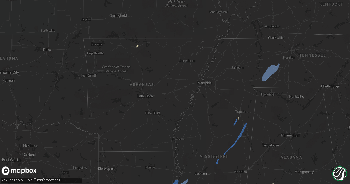
Hail Map in Mississippi on May 25, 2022
Get this storm
May 25 map
$229
one time, instant access
Download today. No call, no setup
Keep the $229
Bought the map and want the full workflow? Apply the entire $229 to a subscription within 7 days. None of it is wasted.
Every map, not just this one
This buys you this map. Subscription and you get every map we run, in the markets you choose from a few cities to whole states to nationwide. Plus real-time alerts the moment a storm fires.
Contact data
Name, contact info, occupancy, even credit band for addresses in the footprint. You go from where it hit to who to call.
Become the source they trust
Unlimited branding weather history reports on demand. You already have the documented answer ready for the property owner, and you are the one who showed up with it.
Property data and RoofTrace estimates
Pull up any address you have got, its value and the exact code rules for that jurisdiction, straight from One Click Code. Then RoofTrace estimates the squares, pitch, and roof value, priced the way you price.
Storm reports in Mississippi
Mississippi
| Date | Description |
|---|---|
| 05/25/20225:30 PM CDT | Mesonet station ptbm6 petit bois is |
| 05/25/20223:19 PM CDT | Large tree was blown down on highway 363 east of the railroad tracks. |
| 05/25/20223:18 PM CDT | One large tree was blown down on county road 503 just north of county road 251. |
| 05/25/20223:18 PM CDT | Trees were knocked down in van vleet near davis lake road. |
| 05/25/20223:08 PM CDT | One tree was knocked down on monroe street in west tupelo. |
| 05/25/20223:03 PM CDT | A few trees were snapped and had large branches broken off along edwin ladner road north of diamondhead. |
| 05/25/20223:03 PM CDT | Power pole and wires were knocked down. |
| 05/25/20222:55 PM CDT | Corrects previous tstm wnd dmg report from guntown. Corrects previous tstm wnd dmg report from guntown. One large tree was blown down on county road 503 just north of c |
| 05/25/20222:55 PM CDT | Corrects previous tstm wnd dmg report from saltillo. Large tree was blown down on highway 363 east of the railroad tracks. |
| 05/25/20222:50 PM CDT | Corrects previous tstm wnd dmg report from tupelo. Corrects previous tstm wnd dmg report from tupelo. One tree was knocked down on monroe street in west tupelo. |
| 05/25/20222:50 PM CDT | Corrects previous tstm wnd dmg report from nettleton. Power pole and wires were knocked down. |
| 05/25/20222:50 PM CDT | Corrects previous tstm wnd dmg report from tupelo. One tree was knocked down on monroe street in west tupelo. |
| 05/25/20222:27 PM CDT | Powerlines down causing power outages across the union area. |
| 05/25/20222:25 PM CDT | Corrects previous tstm wnd dmg report from 7 ese houlka. Trees were knocked down in van vleet near davis lake road. |
| 05/25/20222:06 PM CDT | Several trees down. |
| 05/25/20222:01 PM CDT | A few limbs were blown down near stringer off highway 533 at county road 8. |
| 05/25/20221:57 PM CDT | A tree was blown down on babe knight road off highway 533. |
| 05/25/20221:49 PM CDT | A tree was blown down on laird road at the intersection with pittman road. |
| 05/25/20221:45 PM CDT | Trees and power lines were blown down in the ellison ridge area. |
| 05/25/20221:39 PM CDT | Trees and power lines were blown down in the nanih waiya community. |
| 05/25/20221:37 PM CDT | A tree was blown down on monroe road. |
| 05/25/20221:33 PM CDT | The roof was partially blown off of a house along sims road. |
| 05/25/20221:16 PM CDT | A couple of trees were blown down on highway 485 near good hope baptist church. |
| 05/25/20221:16 PM CDT | A brief tornado with maximum estimated winds of 80 mph moved across portions of rural northwest neshoba county near the alice community. The tornado initially touched d |
| 05/25/20221:10 PM CDT | Trees were blown down on highway 485 near highway 21 south. |
| 05/25/20221:00 PM CDT | A tree was blown down on north 8th avenue in decatur. |
| 05/25/202212:57 PM CDT | A tree was blown down at mile marker 166 on the natchez trace parkway. |
| 05/25/202212:55 PM CDT | Social media report and picture of trees and large limbs blown down in carthage. Possible tornado. |
| 05/25/202212:53 PM CDT | A brief tornado touched down north of old canton rd near chipley rd west of carthage. The tornado peeled back some tin on the roof of a residence before moving northeas |
| 05/25/202212:40 PM CDT | A tree was blown down on utah road. |
| 05/25/202211:55 AM CDT | A tree was blown down at the highway 80 ramp to i-20 eastbound. Several small limbs were also blown down. Report and picture via social media. |
| 05/25/202211:30 AM CDT | Tree down on power lines on santa clair st. |
| 05/25/202211:28 AM CDT | Trees were blown down near the intersection of teresa drive and mcdowell road... As well as near the intersection of paden street and mcdowell road. |
| 05/25/202211:26 AM CDT | Social media report and picture of a tree down near wapt16-tv. |
| 05/25/202211:09 AM CDT | A couple of trees were blown down along didlake road. |
| 05/25/202210:55 AM CDT | A tree blocked the road on lake street. |
| 05/25/202210:50 AM CDT | A tree was blown down along i-55 southbound and blocked both southbound lanes. This occurred between mile markers 48 and 51. |
| 05/25/202210:15 AM CDT | Trees were blown down on old port gibson road. |
| 05/25/20229:57 AM CDT | Trees were blown down on gordon station road. |
| 05/25/20229:22 AM CDT | A tree was blown down on melrose montebello parkway. |
| 05/25/20227:40 AM CDT | At 1239 PM CDT, a severe thunderstorm was located near Ludlow, or 9 miles southwest of Carthage, moving northeast at 40 mph. HAZARD...60 mph wind gusts. SOURCE...Radar indicated. IMPACT...Expect damage to roofs, siding, and trees. This severe thunderstorm will be near... Tuscola around 1245 PM CDT. Carthage around 1255 PM CDT. Renfroe around 105 PM CDT. Edinburg around 110 PM CDT. Zama around 120 PM CDT. Stallo around 130 PM CDT.Other locations impacted by this severe thunderstorm include Lena,Walnut Grove, Redwater and Standing Pine. |
| 05/25/20227:08 AM CDT | At 1208 PM CDT, a severe thunderstorm was located over Sanatorium, or over Magee, moving northeast at 35 mph. HAZARD...60 mph wind gusts. SOURCE...Radar indicated. IMPACT...Expect damage to roofs, siding, and trees. This severe thunderstorm will be near... White Oak around 1225 PM CDT. Raleigh and Center Ridge around 1235 PM CDT. Burns around 1240 PM CDT. Pineville around 1250 PM CDT.Other locations impacted by this severe thunderstorm includeSylvarena, Polkville and Mize. |
| 05/25/20227:07 AM CDT | At 1206 AM CDT, a severe thunderstorm was located 4 miles southwest of Dauphin Island, moving north at 50 mph. HAZARD...60 mph wind gusts. SOURCE...Radar indicated. IMPACT...Expect damage to roofs, siding, and trees. Locations impacted include... Midtown Mobile, Tillmans Corner, Theodore, Grand Bay, Bayou La Batre, Dauphin Island, Semmes, Tanner Williams, Coden, I10 And I65, Mobile Regional Airport and Alabama Port. |
| 05/25/20226:41 AM CDT | At 1140 AM CDT, a severe thunderstorm was located near Lacombe, or 11 miles southeast of Covington, moving northeast at 30 mph. HAZARD...60 mph wind gusts. SOURCE...Radar indicated. IMPACT...Expect damage to roofs, siding, and trees. Locations impacted include... Slidell, Pearl River, Lacombe and Slidell Airport. This includes the following Interstates... Interstate 12 between mile markers 66 and 78. Interstate 59 in Louisiana between mile markers 7 and 10. |
| 05/25/20226:10 AM CDT | At 1110 AM CDT, a severe thunderstorm was located near Hopewell, or near Crystal Springs, moving northeast at 45 mph. HAZARD...60 mph wind gusts. SOURCE...Radar indicated. IMPACT...Expect damage to roofs, siding, and trees. This severe thunderstorm will be near... Terry around 1115 AM CDT. Whites around 1120 AM CDT. Byram and Star around 1125 AM CDT. Richland, Florence and Monterey around 1130 AM CDT. Pearl around 1135 AM CDT. Flowood around 1140 AM CDT. Brandon around 1145 AM CDT. Fannin around 1155 AM CDT. |
| 05/25/20225:53 AM CDT | At 1053 AM CDT, severe thunderstorms were located along a line extending from near Edwards to near Bolton to near Dry Grove, moving northeast at 70 mph. HAZARD...60 mph wind gusts. SOURCE...Radar indicated. IMPACT...Expect damage to roofs, siding, and trees. Severe thunderstorms will be near... Clinton and Brownsville around 1100 AM CDT. Jackson around 1105 AM CDT. Flora and Pocahontas around 1110 AM CDT. Annandale around 1115 AM CDT. Madison, Ridgeland and Myrleville around 1120 AM CDT. Canton and Gluckstadt around 1125 AM CDT. Way and Vaughan around 1130 AM CDT. Sharon around 1135 AM CDT.Other locations impacted by these severe thunderstorms includeLearned and Bentonia. |
| 05/25/20225:38 AM CDT | At 1038 AM CDT, a severe thunderstorm was located over Loyd Star, or near Brookhaven, moving northeast at 50 mph. HAZARD...60 mph wind gusts. SOURCE...Radar indicated. IMPACT...Expect damage to roofs, siding, and trees. This severe thunderstorm will be near... Wesson and Glancy around 1050 AM CDT. Martinsville around 1055 AM CDT. Hazlehurst around 1100 AM CDT. Union and Hopewell around 1115 AM CDT.Other locations impacted by this severe thunderstorm includeBeauregard and Georgetown. |
| 05/25/20225:14 AM CDT | At 1014 AM CDT, severe thunderstorms were located along a line extending from Hermanville to near Union Church, moving northeast at 50 mph. HAZARD...60 mph wind gusts. SOURCE...Radar indicated. IMPACT...Expect damage to roofs, siding, and trees. Severe thunderstorms will be near... Hermanville around 1020 AM CDT. Rocky Springs and Carpenter around 1025 AM CDT. Utica, Reganton, Allen and Peyton around 1030 AM CDT. Barlow around 1035 AM CDT. Newman around 1040 AM CDT. Dentville around 1045 AM CDT. Edwards around 1050 AM CDT.Other locations impacted by these severe thunderstorms includeLearned. |
| 05/25/20224:09 AM CDT | At 909 AM CDT, severe thunderstorms were located along a line extending from 6 miles southeast of Slocum to St. Francisville, moving northeast at 25 mph. HAZARD...60 mph wind gusts and penny size hail. SOURCE...Radar indicated. IMPACT...Expect damage to roofs, siding, and trees. Locations impacted include... New Roads, Jackson, St. Francisville, Centreville, Woodville, Wilson, Norwood, Wakefield, Spillman, Fort Adams, Dolorosa and Crosby. |
| 05/25/20224:03 AM CDT | At 903 AM CDT, a severe thunderstorm was located near Slocum, or 12 miles southeast of Monterey, moving northeast at 40 mph. HAZARD...60 mph wind gusts. SOURCE...Radar indicated. IMPACT...Expect damage to roofs, siding, and trees. This severe thunderstorm will be near... Sibley around 915 AM CDT. Natchez and Vidalia around 930 AM CDT. Cranfield around 940 AM CDT. Stanton around 945 AM CDT.Other locations impacted by this severe thunderstorm includeRidgecrest. |
| 05/24/202210:48 PM CDT | At 347 PM CDT, severe thunderstorms were located along a line extending from 7 miles east of Tishomingo State Park to 7 miles southwest of Belgreen, moving northeast at 40 mph. HAZARD...60 mph wind gusts and penny size hail. SOURCE...Radar indicated. IMPACT...Expect damage to roofs, siding, and trees. Locations impacted include... Florence, Muscle Shoals, Russellville, Sheffield, Tuscumbia, Phil Campbell, Cherokee, Littleville, Leighton and St. Florian. |
| 05/24/20229:20 PM CDT | At 219 PM CDT, a severe thunderstorm was located near Turnerville, or 16 miles north of Stringer, moving northeast at 25 mph. HAZARD...60 mph wind gusts and quarter size hail. SOURCE...Radar indicated. IMPACT...Hail damage to vehicles is expected. Expect wind damage to roofs, siding, and trees. This severe thunderstorm will be near... Rose Hill around 240 PM CDT. Garlandville around 245 PM CDT. Newton around 300 PM CDT.Other locations impacted by this severe thunderstorm include Montroseand Louin. |
| 05/24/20229:06 PM CDT | At 206 PM CDT, a severe thunderstorm was located near Montpelier, moving northeast at 40 mph. HAZARD...60 mph wind gusts. SOURCE...Radar indicated. IMPACT...Expect damage to roofs, siding, and trees. Locations impacted include... Houston, Okolona, Trebloc, Woodland, Sparta, McCondy, Anchor, Van Vleet, Parkersburg, Egypt and Buena Vista. |
| 05/24/20228:58 PM CDT | At 158 PM CDT, a severe thunderstorm was located near Moss, or near Stringer, moving northeast at 45 mph. HAZARD...60 mph wind gusts. SOURCE...Radar indicated. IMPACT...Expect damage to roofs, siding, and trees. This severe thunderstorm will be near... Moss around 205 PM CDT. Vernon around 215 PM CDT. Heidelberg around 220 PM CDT. Paulding and Stafford Springs around 225 PM CDT. Rose Hill around 235 PM CDT. Orange around 240 PM CDT.Other locations impacted by this severe thunderstorm include Soso. |
| 05/24/20228:34 PM CDT | At 134 PM CDT, a severe thunderstorm was located near Sherwood, or 22 miles southwest of Montpelier, moving northeast at 45 mph. HAZARD...60 mph wind gusts. SOURCE...Radar indicated. IMPACT...Expect damage to roofs, siding, and trees. This severe thunderstorm will be near... Maben and Mathiston around 145 PM CDT. Cumberland and Clarkson around 150 PM CDT. Pheba around 155 PM CDT. Montpelier around 205 PM CDT.Other locations impacted by this severe thunderstorm include Mantee,Sturgis and Walthall. |
| 05/24/20228:30 PM CDT | At 130 PM CDT, a severe thunderstorm was located near Stallo, or 8 miles southwest of Louisville, moving northeast at 45 mph. HAZARD...60 mph wind gusts. SOURCE...Radar indicated. IMPACT...Expect damage to roofs, siding, and trees. This severe thunderstorm will be near... Louisville and Mcmillan around 140 PM CDT. Millcreek around 150 PM CDT. Betheden around 155 PM CDT. Craig Springs around 200 PM CDT. Starkville and Oktoc around 210 PM CDT. Sessums around 215 PM CDT. Muldrow around 225 PM CDT.Other locations impacted by this severe thunderstorm includeNoxapater. |
| 05/24/20228:11 PM CDT | At 111 PM CDT, a severe thunderstorm was located over Dixon, or near Philadelphia, moving northeast at 40 mph. HAZARD...60 mph wind gusts. SOURCE...Radar indicated. IMPACT...Expect damage to roofs, siding, and trees. This severe thunderstorm will be near... Philadelphia around 115 PM CDT. Bethsaida around 120 PM CDT. Burnside around 125 PM CDT. Forestdale around 130 PM CDT. Nanih Waiya around 140 PM CDT. Preston around 145 PM CDT.Other locations impacted by this severe thunderstorm include Tucker. |
All States Impacted by Hail Map on May 25, 2022
Cities Impacted by Hail Map on May 25, 2022
- Burlington, KY
- Union, KY
- Dickinson, AL
- Alice, TX
- Flippin, AR
- Lower Peach Tree, AL
- Coy, AL
- Whatley, AL
- Pine Hill, AL
- Jackson, AL
- Grove Hill, AL
- Rushville, IN
- Concepcion, TX
- Milroy, IN
- Yellville, AR
- Okolona, MS
- Shannon, MS
- Mandeville, LA
- Lacombe, LA
- Elberta, AL
- Lillian, AL
- Madison, MO
- Michigantown, IN
- Walton, IN
- Twelve Mile, IN
- Thorntown, IN
- Kewanna, IN
- Bringhurst, IN
- Frankfort, IN
- Kokomo, IN
- Cutler, IN
- Young America, IN
- Burlington, IN
- Lucerne, IN
- Flora, IN
- Camden, IN
- Galveston, IN
- Russiaville, IN
- Kirklin, IN
- Lebanon, IN
- Logansport, IN
- Rochester, IN
- Donovan, IL
- Sheldon, IL
- Kentland, IN
- Thomasville, AL
- Vredenburgh, AL
- Beloit, WI
- Walterboro, SC
- Carthage, MS
- Baileyville, IL
- Waterproof, LA
- Saint Joseph, LA
- Woodville, MS
- Ferriday, LA
- Jonesville, LA
- Monterey, LA
- Port Gibson, MS
- Vidalia, LA
- Natchez, MS
- Newellton, LA
- Lorman, MS
- Fayette, MS
- Hermanville, MS
- Utica, MS
- Pattison, MS
- Roxie, MS
- Wesson, MS
- Crystal Springs, MS
- Hazlehurst, MS
- Lena, MS
- Philadelphia, MS
- West Point, MS
- Noxapater, MS
- Aberdeen, MS
- McCool, MS
- Amory, MS
- Starkville, MS
- Sturgis, MS
- Louisville, MS
- Houston, MS
- Hohenwald, TN
- Mount Pleasant, TN
- Williamsport, TN
- Collinwood, TN
- Waynesboro, TN
- Hampshire, TN
- Centerville, TN
- Duck River, TN
- Linden, TN
- Summertown, TN
- Lawrenceburg, TN
- Mount Auburn, IL
- Illiopolis, IL
- Mount Pulaski, IL
- Edinburg, IL
- Buffalo, IL
- Lincoln, IL
- Stonington, IL
- Blue Mound, IL
- Taylorville, IL
- Wilmington, OH
- Xenia, OH
- Jamestown, OH


