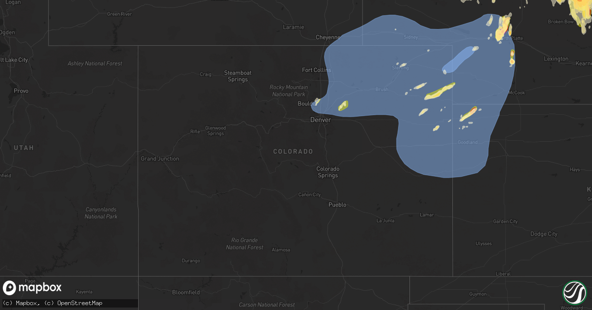
Hail Map in Colorado on May 14, 2025
Get this storm
May 14 map
$229
one time, instant access
Download today. No call, no setup
Keep the $229
Bought the map and want the full workflow? Apply the entire $229 to a subscription within 7 days. None of it is wasted.
Every map, not just this one
This buys you this map. Subscription and you get every map we run, in the markets you choose from a few cities to whole states to nationwide. Plus real-time alerts the moment a storm fires.
Contact data
Name, contact info, occupancy, even credit band for addresses in the footprint. You go from where it hit to who to call.
Become the source they trust
Unlimited branding weather history reports on demand. You already have the documented answer ready for the property owner, and you are the one who showed up with it.
Property data and RoofTrace estimates
Pull up any address you have got, its value and the exact code rules for that jurisdiction, straight from One Click Code. Then RoofTrace estimates the squares, pitch, and roof value, priced the way you price.
Storm reports in Colorado
Colorado
| Date | Description |
|---|---|
| 05/14/20256:50 PM CDT | Power line down by county road 55 north of iliff. Spotter also reported no power in town. Location and time estimated. |
| 05/14/20256:49 PM CDT | Weatherlink station. |
| 05/14/20256:45 PM CDT | Coagmet station csu67 iliff. |
| 05/14/20256:45 PM CDT | Spotter confident in at least 80 mph wind gusts. Damage to branches 7 to 8 inches in diameter reported... As well as an overturned pivot sprinkler. |
| 05/14/20256:41 PM CDT | Awos station k1jw peetz. |
| 05/14/20256:33 PM CDT | Awos station kako akron. |
| 05/14/20256:32 PM CDT | Awos station k1mw sterling 15 wnw. |
| 05/14/20256:23 PM CDT | Awos station kako akron. |
| 05/14/20256:17 PM CDT | Weatherlink station. |
| 05/14/20256:15 PM CDT | Mesonet station bru01 brush. |
| 05/14/20256:15 PM CDT | Awos station kstk sterling. |
| 05/14/20256:13 PM CDT | Spotter and social media posts of at least one tree down on a house in brush. Time and location estimated. |
| 05/14/20256:12 PM CDT | Multiple 3-4 inch diameter tree limbs down. Time estimated. |
| 05/14/20256:12 PM CDT | Weatherlink station. |
| 05/14/20256:10 PM CDT | Power poles down near the intersection of county road 25 and county road r. Time estimated. |
| 05/14/20255:55 PM CDT | Awos station kfmm fort morgan. |
| 05/14/20255:51 PM CDT | Mesonet station co039 wiggins bijou creek. |
| 05/14/20255:51 PM CDT | Wunderground station pws-kcofortm56. |
| 05/14/20255:28 PM CDT | Measured with vantagepro weather station. Also reported 3-4 inch diameter tree limbs down and minor roof damage to outbuilding. |
| 05/14/20255:25 PM CDT | Mesonet station co222 dearfield. |
| 05/14/20255:23 PM CDT | Awos station k1ow 2 nw pawnee buttes. |
| 05/14/20255:18 PM CDT | Weatherlink station. |
| 05/14/20255:14 PM CDT | Asos station kden denver intl airport. |
| 05/14/20255:07 PM CDT | Raws station tt567 crow creek. |
| 05/14/20254:29 PM CDT | Report from mping: quarter |
| 05/14/20254:21 PM CDT | Report from mping: half dollar |
| 05/14/20254:20 PM CDT | A local report indicates 1.00 inch wind near 1 NE Erie |
| 05/14/20254:16 PM CDT | Report from mping: quarter |
| 05/13/20258:15 PM CDT | Up694. |
| 05/13/20258:10 PM CDT | A local report indicates 63 MPH wind near 4 S Burlington |
| 05/13/20258:04 PM CDT | Wxunderground kcoarapa3. |
| 05/13/20258:03 PM CDT | Asos station kitr burlington co airport. |
| 05/13/20257:59 PM CDT | Delayed report. |
| 05/13/20257:57 PM CDT | Reported via social media. Estimated 60 mph winds with under half mile visibility due to dust. |
| 05/13/20257:55 PM CDT | Awos station kheq holyoke airport. |
| 05/13/20257:53 PM CDT | Mesonet station co048 us 385 holyoke. |
| 05/13/20257:50 PM CDT | Weatherlink station. |
| 05/13/20257:47 PM CDT | Mesonet station ew7003 17 n flagler. |
| 05/13/20257:47 PM CDT | Weatherlink station. |
| 05/13/20257:47 PM CDT | Weatherlink station. |
| 05/13/20257:46 PM CDT | Weatherlink station. |
| 05/13/20257:45 PM CDT | County dispatch reported two trees down on houses within holyoke... Along with other tree damage and power outages. Time estimated. |
| 05/13/20257:44 PM CDT | Ambient weather station my_weather_station_. |
| 05/13/20257:43 PM CDT | Kcoflagl13 64 mph gust. |
| 05/13/20257:43 PM CDT | Mesonet station co048 us 385 holyoke. |
| 05/13/20257:37 PM CDT | Wunderground station pws-kcohaxtu21. |
| 05/13/20257:30 PM CDT | Picked house roof up on nw corner and dropped it again. Broke 4 roof trusses. Healthy 12 inch diameter honey locust tree x 25 feet tall nearby was uprooted. |
| 05/13/20257:30 PM CDT | A local report indicates 63 MPH wind near 7 N Stratton |
| 05/13/20257:29 PM CDT | Wxunderground kcovona4. |
| 05/13/20257:29 PM CDT | Weatherlink station. |
| 05/13/20257:26 PM CDT | Awn site brophy. |
| 05/13/20257:21 PM CDT | Corrects previous tstm wnd gst report from 10 ene clarkville. Ambient weather site struckmeyer. |
| 05/13/20257:21 PM CDT | Ambient weather site struckmeyer. |
| 05/13/20257:15 PM CDT | Site kcoflagl2 reports 61 mph wind gust with thunderstorms in area. |
| 05/13/20257:10 PM CDT | Site rmr ranch reports wind gust of 58 mph. |
| 05/13/20257:08 PM CDT | Weatherlink station. |
| 05/13/20257:04 PM CDT | Corrects previous tstm wnd gst report from 8 nnw flagler. Wunderground site kcoflagl13. |
All States Impacted by Hail Map on May 14, 2025
Cities Impacted by Hail Map on May 14, 2025
- Dunseith, ND
- Muenster, TX
- Saint Jo, TX
- Currie, NC
- Warfield, VA
- McKenney, VA
- Roxboro, NC
- Midland, SD
- Dinwiddie, VA
- Blackstone, VA
- Wilsons, VA
- Dewitt, VA
- Virgilina, VA
- Philip, SD
- Milesville, SD
- Stony Creek, VA
- Kittrell, NC
- Franklinton, NC
- Louisburg, NC
- Newton Grove, NC
- Clinton, NC
- Angier, NC
- Lillington, NC
- Washington, NC
- Florence, SC
- Coats, NC
- Willow Spring, NC
- Morganton, NC
- Valdese, NC
- Nebo, NC
- Union Mills, NC
- Bostic, NC
- Marion, SC
- Linden, NC
- Erwin, NC
- Dunn, NC
- Saint Pauls, NC
- Lumberton, NC
- Mcgregor, MN
- Powhatan, VA
- Benson, NC
- Spring Grove, VA
- Littleton, NC
- Enfield, NC
- Cumberland, VA
- Roseboro, NC
- Disputanta, VA
- Waverly, VA
- Marston, NC
- Wagram, NC
- Kilgore, NE
- Nenzel, NE
- Windsor, NC
- Colerain, NC
- Elizabethtown, NC
- Garland, NC
- Fayetteville, NC
- Loris, SC
- Sims, NC
- Salemburg, NC
- Bailey, NC
- Wilson, NC
- Ahoskie, NC
- Conway, SC
- Garysburg, NC
- Pleasant Hill, NC
- Halifax, NC
- Roanoke Rapids, NC
- Murfreesboro, NC
- Charles City, VA
- Valentine, NE
- Pendleton, NC
- Gaston, NC
- Cody, NE
- Williamsburg, VA
- Sumter, SC
- Mullen, NE
- Clarkton, NC
- Manning, SC
- Tar Heel, NC
- Scotland Neck, NC
- Hope Mills, NC
- White Oak, NC
- Oak City, NC
- Goldsboro, NC
- La Grange, NC
- Harrells, NC
- Zebulon, NC
- Godwin, NC
- Laurinburg, NC
- Oxford, NC
- Wakefield, VA
- Rose Hill, NC
- Wallace, NC
- Trego, WI
- Dendron, VA
- Elberon, VA
- Erie, CO
- Lafayette, CO
- North Platte, NE
- Grantsburg, WI
- Faison, NC
- Hudson, CO
- Magnolia, NC
- Teachey, NC
- Longmont, CO
- Keenesburg, CO
- Bennett, CO
- Alcolu, SC
- Roggen, CO
- Campobello, SC
- Chesnee, SC
- Hobgood, NC
- Willard, NC
- Aberdeen, ID
- Broadway, NC
- Fuquay Varina, NC
- Longs, SC
- Kinston, NC
- Inman, SC
- Comstock, NE
- Arcadia, NE
- Ansley, NE
- Thedford, NE
- Saint Francis, SD
- Crookston, NE
- Belvidere, SD
- Long Valley, SD
- White River, SD
- Tryon, NE
- Broken Bow, NE
- Sargent, NE
- Mission, SD
- Westerville, NE
- Burwell, NE
- Taylor, NE
- Gering, NE
- Scottsbluff, NE
- Wood, SD
- Maywood, NE
- Sterling, CO
- Hershey, NE
- Martin, SD
- Wellfleet, NE
- Otis, CO
- Akron, CO
- Potter, NE
- Yuma, CO
- Stratton, CO
- Seneca, NE
- Brewster, NE
- Wanblee, SD
- Wood Lake, NE
- Eckley, CO
- Kirk, CO
- Allen, SD
- Johnstown, NE
- Dunning, NE
- Purdum, NE
- Wray, CO
- Ainsworth, NE
- Idalia, CO
- Vernon, CO
- Long Pine, NE
- Sutherland, NE
- Hayes, SD
- Anselmo, NE
- Sedgwick, CO
- Stapleton, NE
- Elsmere, NE
- Parkton, NC
- Fort Pierre, SD
- Saint Francis, KS
- Haigler, NE
- Holyoke, CO
- Ord, NE
- Halsey, NE
- Elyria, NE
- Champion, NE
- Bird City, KS
- Whitman, NE
- Springview, NE
- Amherst, CO
- Haxtun, CO
- Paoli, CO
- Madrid, NE
- Julesburg, CO
- Venango, NE
- Imperial, NE
- Grant, NE
- Elsie, NE
- Ogallala, NE
- Merriman, NE
- Paxton, NE
- Arthur, NE
- Keystone, NE
- Bishop, TX
- Roma, TX
- Scotia, NE
- North Loup, NE
- Zapata, TX
- Litchfield, NE
- Hyannis, NE
- Bassett, NE
- Loup City, NE
- Amelia, NE
- Stuart, NE
- Atkinson, NE
- Ericson, NE
- Chambers, NE
- Butte, NE
- Fairfax, SD
- Ewing, NE
- Lake Andes, SD
- Geddes, SD
- Kingsville, TX
- Inman, NE
- Emmet, NE
- Oneill, NE
- Page, NE
- Farwell, NE
- Rio Grande City, TX
- Elba, NE
- Niobrara, NE
- Greeley, NE
- Orchard, NE
- Springfield, SD
- Tabor, SD
- Avon, SD
- Bartlett, NE
- Tyndall, SD
- Lesterville, SD
- Scotland, SD
- Utica, SD
- Royal, NE
- Wolbach, NE
- Spalding, NE
- Winnetoon, NE
- Creighton, NE
- Viborg, SD
- Clearwater, NE
- Primrose, NE
- Elgin, NE
- Bloomfield, NE
- Neligh, NE
- Woodsboro, TX
- Brunswick, NE
- Plainview, NE
- Mathis, TX
- Odem, TX
- Taft, TX
- Tomball, TX
- Hockley, TX
- Cypress, TX
- Dilley, TX
- Burbank, OK
- Four Oaks, NC
- Rutland, SD
- Colman, SD
- Flandreau, SD
- Egan, SD
- Ruthton, MN
- Elkton, SD
- Edgerton, MN
- Trent, SD
- Jasper, MN
- Pipestone, MN
- Garretson, SD
- Holland, MN
- Woodstock, MN
- Lake Benton, MN
- Balaton, MN
- Hendricks, MN
- Ivanhoe, MN
- Tyler, MN
- Arco, MN
- Russell, MN
- Lynd, MN
- Mount Olive, NC
- Tracy, MN
- Garvin, MN
- Gary, SD
- Clear Lake, SD
- Strandburg, SD
- Goodwin, SD
- Watertown, SD
- South Shore, SD
- Twin Brooks, SD
- Marietta, MN
- Odessa, MN
- Revillo, SD
- Labolt, SD
- Stockholm, SD
- Big Stone City, SD
- Bellingham, MN
- Milbank, SD
- Corona, SD
- Marvin, SD
- Ortonville, MN
- Summit, SD
- Wilmot, SD
- Peever, SD
- Graceville, MN
- Dumont, MN
- Beardsley, MN
- Barry, MN
- Clinton, MN
- Correll, MN
- Renville, MN
- Wabasso, MN
- Iron Belt, WI
- Sacred Heart, MN
- Redwood Falls, MN
- Clements, MN
- Morgan, MN
- Morton, MN
- Franklin, MN
- Hugo, OK
- Sawyer, OK
- Gibbon, MN
- Hector, MN
- Fort Towson, OK
- Buffalo Lake, MN
- Valliant, OK
- Rufe, OK
- Wright City, OK
- Broken Bow, OK
- Stewart, MN
- Hutchinson, MN
- Ringold, OK
- Brush, CO
- Wiggins, CO
- Fort Lupton, CO
- Snyder, CO
- Hillrose, CO
- Log Lane Village, CO
- Fort Morgan, CO
- Fleming, CO
- Strasburg, CO
- Commerce City, CO
- Brighton, CO
- Denver, CO
- Woodrow, CO
- Watkins, CO
- Byers, CO
- Lindon, CO
- Orchard, CO
- Weldona, CO
- Merino, CO
- Harrisburg, NE
- Galeton, CO
- Kersey, CO
- New Raymer, CO
- Stoneham, CO
- Lodgepole, NE
- Padroni, CO
- Atwood, CO
- Carpenter, WY
- Bushnell, NE
- Gill, CO
- Ovid, CO
- La Salle, CO
- Dix, NE
- Iliff, CO
- Peetz, CO
- Grover, CO
- Briggsdale, CO
- Pine Bluffs, WY
- Kimball, NE
- Sidney, NE
- Greeley, CO
- Crook, CO
- Burns, WY
- Ault, CO
- Eaton, CO
- Hereford, CO
- Cheyenne, WY
- Nunn, CO
- Lucerne, CO
- Platteville, CO
- Evans, CO
- Pierce, CO
- Windsor, CO
- Milliken, CO
- Henderson, CO
- Thornton, CO
- Louisville, CO
- Boulder, CO
- Broomfield, CO
- Westminster, CO
- Dupont, CO
- Aurora, CO
- Dacono, CO
- Johnstown, CO
- Gilcrest, CO
- Firestone, CO
- Frederick, CO
- Carr, CO
- Anton, CO
- Joes, CO
- Cope, CO
- Vona, CO
- Seibert, CO
- Flagler, CO
- Kanorado, KS
- Burlington, CO
- Bethune, CO
- Benkelman, NE
- Parks, NE
- Dalton, NE
- Bridgeport, NE
- Gurley, NE
- Bayard, NE
- Chappell, NE
- McDonald, KS
- Edson, KS
- Enders, NE
- Max, NE
- Wauneta, NE
- Goodland, KS
- Hayes Center, NE
- Atwood, KS
- Palisade, NE
- Stratton, NE
- Wallace, NE
- Ludell, KS
- Trenton, NE
- Herndon, KS
- Culbertson, NE
- Dickens, NE
- McCook, NE
- Brule, NE
- Lewellen, NE
- Big Springs, NE
- Lemoyne, NE
- Oshkosh, NE
- Broadwater, NE
- Lisco, NE
- Hillsdale, WY
- Arriba, CO
- Kit Carson, CO
- Hugo, CO
- Levant, KS
- Cheyenne Wells, CO
- Wallace, KS
- Sharon Springs, KS
- Winona, KS
- Weskan, KS
- Colby, KS
- Brewster, KS
- Arapahoe, CO
- Monument, KS


