Hail Map on September 15, 2026
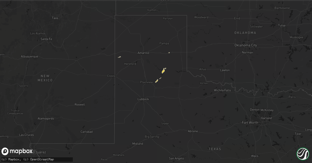
Get this storm
September 15 map
$229
one time, instant access
Download today. No call, no setup
Keep the $229
Bought the map and want the full workflow? Apply the entire $229 to a subscription within 7 days. None of it is wasted.
Every map, not just this one
This buys you this map. Subscription and you get every map we run, in the markets you choose from a few cities to whole states to nationwide. Plus real-time alerts the moment a storm fires.
Contact data
Name, contact info, occupancy, even credit band for addresses in the footprint. You go from where it hit to who to call.
Become the source they trust
Unlimited branding weather history reports on demand. You already have the documented answer ready for the property owner, and you are the one who showed up with it.
Property data and RoofTrace estimates
Pull up any address you have got, its value and the exact code rules for that jurisdiction, straight from One Click Code. Then RoofTrace estimates the squares, pitch, and roof value, priced the way you price.
States Impacted by Hail Map on September 15, 2026
Storm reports
Kansas
| Date | Description |
|---|---|
| 09/15/20266:32 PM CDT | Downed tree and wires near 143rd street. Time estimated from radar. |
| 09/15/20266:08 PM CDT | Report via social media. Time estimated from radar. |
| 09/15/20266:08 PM CDT | Social media report. Time estimated from radar. |
| 09/15/20266:06 PM CDT | Report from mping: half dollar |
| 09/15/20266:02 PM CDT | Report via social media. Time estimated from radar. |
| 09/15/20266:00 PM CDT | Social media report. Observed on interstate 35 near the miami/johnson county line. Time estimated from radar. |
| 09/15/20266:00 PM CDT | Social media report. Time estimated from radar. |
| 09/15/20265:58 PM CDT | Social media report. Time estimated from radar. |
| 09/15/20265:15 PM CDT | Report was from a personal weather station. |
| 09/15/20262:42 PM CDT | Measured at mcconnell afb. |
| 09/15/20262:42 PM CDT | Delayed report... Time estimated from radar and observations. Large panels of a 70 foot wall at a boeing/spirit plant were ripped off. Courtesy of ksn tv. Reported by s |
| 09/15/20261:53 PM CDT | A local report indicates 59 MPH wind near Mcconnell Air Force Bas |
| 09/14/20268:28 PM CDT | Downed tree limbs and wires near merriam drive. Time estimated from radar. |
| 09/14/20268:18 PM CDT | A few reports of downed tree limbs and wires between leawood and grandview. Time estimated from radar. |
| 09/14/20267:39 PM CDT | Downed tree limbs and wires near newton avenue. Time estimated from radar. |
Indiana
| Date | Description |
|---|---|
| 09/15/20266:54 PM CDT | Video from this area appears to show 2 to 4 inch tree limbs falling. |
| 09/15/20266:43 PM CDT | Numerous trees down. Time estimated by radar. |
| 09/14/20269:40 PM CDT | Delayed report of several large tree limbs downed near pretty lake vicinity. Time estimated from radar. |
| 09/14/20269:30 PM CDT | Multiple trees and lines downed by trw winds. Time estimated by radar. |
| 09/14/20269:00 PM CDT | Spotter indicated they measured it on a handheld device. Ksmd gusted to 43 kts nearby. |
| 09/14/20267:25 PM CDT | Delayed report of large tree downed in lake everett area. Time estimated from radar. |
| 09/14/20267:10 PM CDT | Power poles down in this area. Time estimated by radar. |
| 09/14/20267:00 PM CDT | Delayed report of several trees and power lines downed on 475 west. Measured gust to 83 mph. |
| 09/14/20267:00 PM CDT | Delayed report of hail ranging from dime to quarter sized on 475 w. |
Utah
| Date | Description |
|---|---|
| 09/15/20263:10 PM CDT | Mesonet station pc172 junction south. |
| 09/15/20265:30 AM CDT | Mesonet station vrh vernon hill. |
| 09/15/20263:40 AM CDT | Mesonet station pc034 provo canyon. |
| 09/15/20263:30 AM CDT | Mesonet station ut112 sr-112 at mp 6 utah avenue. |
| 09/15/20263:15 AM CDT | Mesonet station smt south mountain. |
| 09/15/20262:55 AM CDT | Mesonet station dpg07 english village. |
| 09/15/20262:40 AM CDT | Mesonet station dpg13 durand road. |
Colorado
| Date | Description |
|---|---|
| 09/14/20267:10 PM CDT | A local report indicates 60 MPH wind near 5 NW Mack |
Oklahoma
| Date | Description |
|---|---|
| 09/15/20265:48 PM CDT | Kavk. |
| 09/15/20265:45 PM CDT | Woodward mesonet. |
| 09/15/20265:44 PM CDT | Kavk. |
| 09/15/20265:40 PM CDT | Woodward mesonet. |
| 09/15/20265:40 PM CDT | Several railroad cars overturned. Time estimated by radar and nearby alva mesonet observations. |
| 09/15/20265:35 PM CDT | Alva mesonet. |
| 09/14/20267:15 PM CDT | Awos station kavk alva. |
Missouri
| Date | Description |
|---|---|
| 09/15/20266:45 PM CDT | Social media report. Time estimated from radar. |
| 09/15/20266:43 PM CDT | Social media report of trees down and a small building severely damaged at a residence north of clifton hill. Time estimated from radar. |
| 09/15/20266:12 PM CDT | Social media report of tree limbs down from strong thunderstorm winds in cosby. Time estimated from radar. |
| 09/15/20266:00 PM CDT | Social media report. Time estimated from radar. |
| 09/15/20266:00 PM CDT | Social media report. Time estimated from radar. |
| 09/15/20265:50 PM CDT | Downed trees reported at shirkey golf course. Time estimated from radar. |
| 09/15/20265:48 PM CDT | Trees and wires down near crispin street. Time estimated from radar. |
| 09/15/20265:47 PM CDT | Several trees down near main street. Time estimated from radar. |
| 09/15/20265:45 PM CDT | Power poles reported down in the richmond area. Time estimated from radar. |
| 09/15/20265:45 PM CDT | Report via social media. Time estimated from radar. |
| 09/15/20265:43 PM CDT | Several downed trees reported along hill street. Time estimated from radar. |
| 09/15/20265:39 PM CDT | Several reports of trees and wires down in the richmond area. Time estimated from radar. |
| 09/15/20265:27 PM CDT | Delayed social media report. Large tree downed across the road in paradise park. Time estimated from radar. |
| 09/14/202610:35 PM CDT | Several reports of tree limbs and wires down northeast of the brookfield area. Time estimated from radar. |
| 09/14/20269:00 PM CDT | Social media report of large tree limbs down at a residence in buckner. Time estimated from radar. |
| 09/14/20268:30 PM CDT | Multiple reports of tree limbs and wires down north of grandview and west of raytown. Time estimated from radar. |
| 09/14/20268:30 PM CDT | Downed trees at 63rd and troost. Time estimated from radar. |
| 09/14/20267:50 PM CDT | Three large oak trees and several tree limbs downed at a property near route 150. Time estimated from radar. |
| 09/14/20267:50 PM CDT | Damaged outbuilding and tree limbs down in greenwood. Time estimated from radar. |
| 09/14/20267:48 PM CDT | Downed wires near main street. Time estimated from radar. |
| 09/14/20267:47 PM CDT | Downed tree limbs and wires in the james a. Reed wildlife area. Time estimated from radar. |
| 09/14/20267:46 PM CDT | Several reports of wires down and power outages northwest of pleasant hill. Time estimated from radar. |
| 09/14/20267:45 PM CDT | Multiple reports of wires down and power outages in the greenwood area. Time estimated from radar. |
| 09/14/20267:44 PM CDT | Reports of wires down in the lake winnebago area. Time estimated from radar. |
| 09/14/20267:18 PM CDT | Social media report. Time confirmed from radar. |
| 09/14/20267:06 PM CDT | Social media report. Time estimated from radar. |
Michigan
| Date | Description |
|---|---|
| 09/14/20269:30 PM CDT | Delayed report of a few trees downed and a few power lines downed in hillsdale... Mi. Time estimated from radar. |
Texas
| Date | Description |
|---|---|
| 09/15/20266:51 PM CDT | A local report indicates 62 MPH wind near 1 NW Lubbock Int. Airpo |
| 09/15/20266:46 PM CDT | The welch mesonet site measured a thunderstorm wind gust of 67 mph. |
| 09/15/20266:39 PM CDT | A local report indicates 70 MPH wind near 1 ENE Morton |
| 09/15/20266:35 PM CDT | A local report indicates 58 MPH wind near 3 WNW Lubbock |
| 09/15/20266:32 PM CDT | Report from mping: quarter |
| 09/15/20266:28 PM CDT | A local report indicates 64 MPH wind near 6 W Lubbock |
| 09/15/20266:14 PM CDT | Power lines down near 7th st and slide rd. |
| 09/15/20265:57 PM CDT | A local report indicates 71 MPH wind near 6 S Wolfforth |
| 09/15/20265:20 PM CDT | Rv flipped along 114 east of smyer. Time estimated by radar. |
| 09/15/20265:10 PM CDT | A local report indicates 1.00 inch wind near Smyer |
| 09/15/20264:47 PM CDT | The andrews mesonet site measured a thunderstorm wind gust of 62 mph. |
| 09/15/20264:10 PM CDT | Xcel mesonet 5.5n of briscoe... Tx. |
| 09/15/20264:00 PM CDT | Additional severe gusts of 58 to 65 mph measured from 401 to 402 pm. |
| 09/14/20267:51 PM CDT | A local report indicates 60 MPH wind near White River Lake |
Illinois
| Date | Description |
|---|---|
| 09/15/20266:05 PM CDT | Numerous trees and power lines were blown down in town. Time estimated from radar. |
| 09/15/20265:50 PM CDT | Downed powerlines and damaged grain bin. |
| 09/15/20265:21 PM CDT | A local report indicates 1.00 inch wind near Delavan |
| 09/14/20269:22 PM CDT | A local report indicates 1.50 inch wind near 3 WSW Alta |
| 09/14/20269:15 PM CDT | A local report indicates 1.50 inch wind near 2 SW Alta |
| 09/14/20268:57 PM CDT | Report of trees and power lines blown down. Relayed by media. Time estimated. |
| 09/14/20267:00 PM CDT | Some trees and power poles blown down in minonk. Delayed report. |
New Mexico
| Date | Description |
|---|---|
| 09/14/202610:25 PM CDT | Emergency management relayed a report of downed powerlines in eunice from thunderstorm winds. |
| 09/14/20269:02 PM CDT | Emergency management relayed a report of power lines down near the intersection of highway 18 and stiles road due to thunderstorm winds. |
Cities Impacted by Hail Map on September 15, 2026
- Wichita, KS
- Derby, KS
- Mcconnell Afb, KS
- Mclean, TX
- Jacksonville, IL
- Alexander, IL
- Quitaque, TX
- Clarendon, TX
- Lockney, TX
- Hereford, TX
- Lakeview, TX
- Cantrall, IL
- Pittsfield, IL
- New Salem, IL
- Mobeetie, TX
- Canadian, TX
- Briscoe, TX
- Wheeler, TX
- Burlington, OK
- Lelia Lake, TX
- Aline, OK
- Waynoka, OK
- Floydada, TX
- Hedley, TX
- Amorita, OK
- Allen, KS
- Barry, IL
- Reading, KS
- Brownfield, TX
- Alva, OK
- Dacoma, OK
- Kiowa, KS
- Waldron, KS
- Osage City, KS
- Lebo, KS
- Eskridge, KS
- San Jose, IL
- Shamrock, TX
- Hagerman, NM
- Abernathy, TX
- Delavan, IL
- Highland, KS
- Seminole, TX
- Green Valley, IL
- White Cloud, KS
- Hazelton, KS
- Plainview, TX
- Pampa, TX
- Attica, KS
- Seagraves, TX
- Petersburg, TX
- Levelland, TX
- Minier, IL
- Hopedale, IL
- Armington, IL
- Arnett, OK
- Shallowater, TX
- Littlefield, TX
- Denver City, TX
- Mackinaw, IL
- Amazonia, MO
- Wellsville, KS
- Rantoul, KS
- Camden, MO
- Richmond, MO
- Green River, UT
- Woodward, OK
- Harper, KS
- Miami, TX
- Anton, TX
- Lubbock, TX
- Smyer, TX
- Troy, KS
- Oregon, MO
- Wathena, KS
- Edgerton, KS
- Paola, KS
- Savannah, MO
- Saint Joseph, MO
- Snowflake, AZ
- Tatum, NM
- Wolfforth, TX
- Danvers, IL
- Stanford, IL
- New Canton, IL
- Goodfield, IL
- Congerville, IL
- Carlock, IL
- Palmyra, MO
- Silver Lake, KS
- Ropesville, TX
- Rayville, MO
- Hannibal, MO
- Welch, TX
- Secor, IL
- El Paso, IL
- Spring Hill, KS
- Gardner, KS
- Clarksdale, MO
- Amity, MO
- Union Star, MO
- Helena, MO
- Carrollton, IL
- Kane, IL
- Fieldon, IL
- Eudora, KS
- Salisbury, MO
- Marceline, MO
- Hale Center, TX
- Olathe, KS
- Clifton Hill, MO
- Idalou, TX
- Washburn, IL
- Lowpoint, IL
- Hull, IL
- New Cambria, MO
- Maysville, MO
- Huntsville, MO
- Syracuse, IN
- Cromwell, IN
- Pierceton, IN
- Larwill, IN
- North Webster, IN
- Enochs, TX
- Stewartsville, MO
- Amherst, TX
- Andrews, TX
- Jacksonville, MO
- Cairo, MO
- Star City, IN
- Kewanna, IN
- Kinderhook, IL
- Benson, IL
- Minonk, IL
- New London, MO
- Albion, IN
- Columbia City, IN
- Kimmell, IN
- Roanoke, IL
- Valparaiso, IN
- Chesterton, IN
- Frankford, MO
- Weatherby, MO
- Remington, IN
- Slaton, TX
- Cosby, MO
- Williamsport, IN
- Mack, CO
- Madison, MO
- Baylis, IL
- Lamesa, TX
- Louisburg, KS
- Bucyrus, KS
- Louisiana, MO
- Easton, MO
- Morton, TX
- Clarence, MO
- Lorenzo, TX
- Dwight, IL
- Odell, IL
- De Witt, MO
- Fort Stockton, TX
- Pleasant Hill, MO
- Gower, MO
- Holliday, MO
- Miami, MO
- Mentone, TX
- De Beque, CO
- Trenton, MO
- Greenwood, MO
- Tarzan, TX
- Ferron, UT
- Paris, MO
- Mount Sterling, IL
- Brookfield, MO
- Laclede, MO
- Camden, IL
- Milan, MO
- Gail, TX
- Marathon, TX
- Springlake, TX
- Coldwater, MI
- Bronson, MI
- Lees Summit, MO
- Brimfield, IL
- Rushville, IL
- Yates City, IL
- Elmwood, IL
- Williamsfield, IL
- Odonnell, TX
- Macon, MO
- Excello, MO
- Plymouth, IL
- Macomb, IL
- Good Hope, IL
- Green City, MO
- Princeville, IL
- Littleton, IL
- Bushnell, IL
- Bucklin, MO
- Shelbina, MO
- Edwards, IL
- Colfax, IN
- Dunlap, IL
- Memphis, MO
- Arbela, MO
- Toluca, IL
- Gorin, MO
- Anabel, MO
- Osseo, MI
- Peoria, IL
- Trivoli, IL
- Frankfort, IN
- Marietta, IL
- Pittsford, MI
- Hudson, MI
- East Peoria, IL
- Farmington, IL
- Peoria Heights, IL
- Mossville, IL
- Callao, MO
- Baldwin City, KS
- Chillicothe, IL
- Edelstein, IL
- Luray, MO
- Jal, NM
- Metamora, IL
- Kahoka, MO
- Hanna City, IL
- Lawrence, KS
- Wayland, MO
- Winamac, IN
- Moberly, MO
- Henrietta, MO
- Revere, MO
- Farmington, IA
- Argyle, IA
- Washington, IL
- Tremont, IL
- Rutledge, MO
- Payson, IL
- Plainville, IL
- Bevier, MO
- Ashland, IL
- Springfield, IL
- Emden, IL
- Eureka, IL
- East Carbon, UT
- Vernal, UT
- Churubusco, IN
- Hartsburg, IL
- Fort Wayne, IN