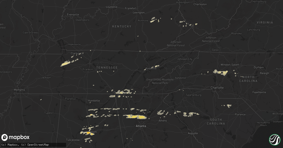
Hail Map in South Carolina on February 28, 2011
Get this storm
February 28 map
$229
one time, instant access
Download today. No call, no setup
Keep the $229
Bought the map and want the full workflow? Apply the entire $229 to a subscription within 7 days. None of it is wasted.
Every map, not just this one
This buys you this map. Subscription and you get every map we run, in the markets you choose from a few cities to whole states to nationwide. Plus real-time alerts the moment a storm fires.
Contact data
Name, contact info, occupancy, even credit band for addresses in the footprint. You go from where it hit to who to call.
Become the source they trust
Unlimited branding weather history reports on demand. You already have the documented answer ready for the property owner, and you are the one who showed up with it.
Property data and RoofTrace estimates
Pull up any address you have got, its value and the exact code rules for that jurisdiction, straight from One Click Code. Then RoofTrace estimates the squares, pitch, and roof value, priced the way you price.
Storm reports in South Carolina
South Carolina
| Date | Description |
|---|---|
| 02/28/20115:35 PM CST | Trees down all across the county |
| 02/28/20115:30 PM CST | Spotter reports a tree fell on a house in ware shoals. No injuries. Red cross assisting. |
| 02/28/20115:18 PM CST | Several large tree limbs blown down in the inman area. |
| 02/28/20114:50 PM CST | Spotter reports finding several large limbs down in their yard from the storm. |
| 02/28/20114:43 PM CST | Tree on road at south green river rd and hwy 29 |
| 02/28/20114:36 PM CST | Several spotters reported trees and power lines blown down in areas from holly grove rd and foster lake rd just north of blacksburg...east to the antioch community. |
| 02/28/20114:35 PM CST | Tree on road at casey creek rd and cherokee circle |
| 02/28/20114:30 PM CST | Side of a shed blown off...roof of another shed peeled back...and 7 pine trees uprooted off of miller road. |
| 02/28/20114:30 PM CST | Trees down |
| 02/28/20114:20 PM CST | Roof shingles blown off residence...2 sheds blown into fence. |
| 02/28/20114:19 PM CST | Tree in roadway |
| 02/28/20114:15 PM CST | Tree on roadway |
| 02/28/20114:01 PM CST | Two trees blown down and some shingles off a roof near the highway 414 and highway 25 intersection |
| 02/27/20117:31 PM CST | 1 large pine tree uprooted along highway 95 just north of the sc welcome center. Time estimated by radar. |
| 02/27/20117:21 PM CST | Multiple wires down on us-52. Time estimated based on radar |
| 02/27/20117:17 PM CST | Trees down at centerville and n center road. Time estimated based on radar |
| 02/27/20117:15 PM CST | Pieces of sheet metal blew off a building and damaged a vehicle. |
| 02/27/20117:12 PM CST | Tree down along kellybelle road. Time estimated based on radar |
| 02/27/20117:12 PM CST | Car accident with a large pine tree down across ousleydale road. No injuries. Several other trees down and some homes damaged. Possible tornado. |
| 02/27/20116:50 PM CST | Trees down throughout county |
| 02/27/20116:48 PM CST | Trees down |
| 02/27/20116:42 PM CST | Trees down |
| 02/27/20116:42 PM CST | Trees down |
| 02/27/20116:42 PM CST | Report of possible tornado touchdown. Sheriff dept en route to check it out. |
| 02/27/20116:30 PM CST | Trees down |
| 02/27/20116:30 PM CST | Corrected location and time. Report of possible tornado touchdown. Sheriff dept en route to check it out. |
| 02/27/20116:24 PM CST | Ef1 tornado near intersection of spearman rd and trinity springs rd one mile nne of silverstreet. |
| 02/27/20116:24 PM CST | Numerous trees down from very intense microburst 2 miles north of silverstreet. |
| 02/27/20116:24 PM CST | Trees down |
| 02/27/20116:24 PM CST | Trees down |
| 02/27/20116:18 PM CST | Trees down |
| 02/27/20116:18 PM CST | A roof ripped off an out building and numerous trees down along trinity church rd |
| 02/27/20116:10 PM CST | Trees down at riverside rd and porter ranch rd |
| 02/27/20116:00 PM CST | Trees down...a few possibly on cars |
All States Impacted by Hail Map on February 28, 2011
Cities Impacted by Hail Map on February 28, 2011
- Erin, TN
- Dickson, TN
- McEwen, TN
- Vanleer, TN
- Groveoak, AL
- Geraldine, AL
- Albertville, AL
- Birmingham, AL
- Palmyra, TN
- Bessemer, AL
- Centre, AL
- Leesburg, AL
- Eva, TN
- Waverly, TN
- Camden, TN
- Big Sandy, TN
- Buford, GA
- Lawrenceville, GA
- Gardendale, AL
- Huntsville, AL
- Silverstreet, SC
- Collinsville, AL
- Cleveland, NC
- Athens, GA
- Jefferson, GA
- Fairmount, GA
- Rydal, GA
- Adairsville, GA
- Jasper, TN
- Cleveland, TN
- Chattanooga, TN
- Signal Mountain, TN
- McDonald, TN
- Ooltewah, TN
- Guild, TN
- Lookout Mountain, TN
- Harrison, TN
- Whitwell, TN
- Apison, TN
- Cumberland City, TN
- Smithville, TN
- Walling, TN
- Lexington, NC
- Pinson, AL
- Holly Pond, AL
- Cullman, AL
- Cooleemee, NC
- Salisbury, NC
- Woodleaf, NC
- Linwood, NC
- Advance, NC
- Mocksville, NC
- Sterrett, AL
- Dalton, GA
- Hanover, WV
- Gilbert, WV
- Simon, WV
- Roswell, GA
- Marietta, GA
- Rome, GA
- Aragon, GA
- Dallas, GA
- Cumming, GA
- Acworth, GA
- Suwanee, GA
- Alpharetta, GA
- Cartersville, GA
- Duluth, GA
- Lindale, GA
- Taylorsville, GA
- Kennesaw, GA
- Kingston, GA
- Silver Creek, GA
- Woodstock, GA
- Rockmart, GA
- Emerson, GA
- Canton, GA
- Dawsonville, GA
- Ball Ground, GA
- Campton, KY
- Danielsville, GA
- Royston, GA
- Waleska, GA
- McAndrews, KY
- Pinsonfork, KY
- Stone, KY
- Hanceville, AL
- Matewan, WV
- New Market, TN
- Cross Hill, SC
- Ninety Six, SC
- Greenwood, SC
- Stanton, KY
- Selma, AL
- Hodges, SC
- Abbeville, SC
- Leeds, AL
- Pikeville, KY
- Kimper, KY
- Raccoon, KY
- Guntersville, AL
- Arab, AL
- Union Grove, AL
- Petersburg, TN
- Marion, AL
- Minter, AL
- Sardis, AL
- South Pittsburg, TN
- Dora, AL
- Statesville, NC
- Falkville, AL
- Sophia, NC
- Stanton, AL
- Fultondale, AL
- Fairfield, AL
- Pleasant Grove, AL
- Mulga, AL
- Dolomite, AL
- Stewart, OH
- Athens, OH
- Guysville, OH
- Murfreesboro, TN
- Ringgold, GA
- Tunnel Hill, GA
- Morris, AL
- Columbiana, AL
- Iva, SC
- Starr, SC
- Bryant, AL
- Trussville, AL
- Mount Olive, AL
- Old Fort, TN
- Fort Payne, AL
- Dawson, AL
- Fyffe, AL
- Attalla, AL
- Boaz, AL
- Knoxville, TN
- Brent, AL
- Ravenna, KY
- Irvine, KY
- Elberton, GA
- Denton, NC
- Asheboro, NC
- Jefferson, SC
- McBee, SC
- Plainville, GA
- Adger, AL
- Trinity, NC
- Somerset, KY
- Strawberry Plains, TN
- Montevallo, AL
- Calera, AL
- Kimberly, AL
- Warrior, AL
- Bradley, SC
- Cave Spring, GA
- Hickory, NC
- Taylorsville, NC
- Lyerly, GA
- Clarksville, TN
- Adams, TN
- Armuchee, GA
- Cumberland Furnace, TN
- Alabaster, AL
- Rising Fawn, GA
- Chickamauga, GA
- Flintstone, GA
- Lookout Mountain, GA
- Rossville, GA
- Sherwood, TN
- Chatsworth, GA
- Waterloo, SC
- Chappells, SC
- Clay City, KY
- Grantville, GA
- Hazel Green, KY
- Springfield, TN
- Orlinda, TN
- Hartwell, GA
- Summerville, GA
- Travelers Rest, SC
- Kershaw, SC
- Strunk, KY
- Cunningham, TN
- Southside, TN
- Colbert, GA
- Hull, GA
- Prestonsburg, KY
- Pilgrim, KY
- Ohatchee, AL
- Alexandria, AL
- Gaylesville, AL
- Ragland, AL
- Jasper, GA
- Somerville, AL
- Eva, AL
- Baileyton, AL
- Joppa, AL
- Salyersville, KY
- Oil Springs, KY
- Brierfield, AL
- Readyville, TN
- Gainesville, GA
- White, GA
- Calhoun, GA
- Ripley, MS
- Gillsville, GA
- Pendergrass, GA
- Homer, GA
- Commerce, GA
- Maysville, GA
- Trenton, GA
- Stevenson, AL
- Flat Rock, AL
- Bridgeport, AL
- Wharncliffe, WV
- Belfry, KY
- Newberry, SC
- Mentone, AL
- Carnesville, GA
- Valdese, NC
- Horton, AL
- Altoona, AL
- Blountsville, AL
- Franklin, GA
- Graysville, AL
- Quinton, AL
- Adamsville, AL
- Chapmansboro, TN
- Ashland City, TN
- Ramseur, NC
- Ocoee, TN
- Kodak, TN
- Springville, AL
- Odenville, AL
- Slade, KY
- Hardy, KY
- Bowman, GA
- Thomasville, NC
- Gadsden, AL
- Cedar Mountain, NC
- Pelham, AL
- Helena, AL


