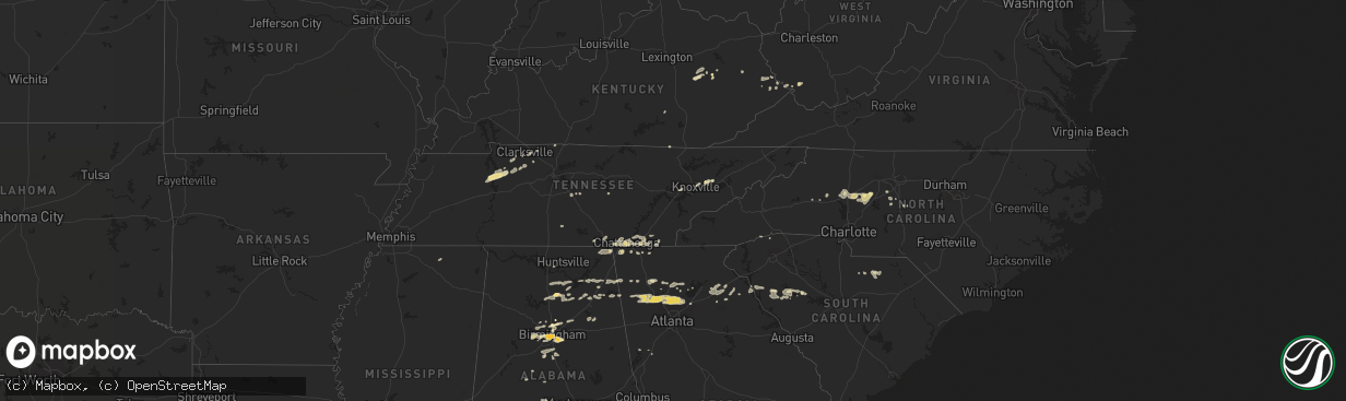
Hail Map in West Virginia on February 28, 2011
The weather event in West Virginia on February 28, 2011 includes Hail map. 9 states and 244 cities were impacted and suffered possible damage. The total estimated number of properties impacted is 0.
Want more than just the map?
Turn this storm into a full workflow.
- Owner + property data so you know who to knock
- OnDemand branded weather history reports to win the "did we even have hail?" argument
- RoofTrace estimate so reps stop guessing numbers at the door
Bought this map? Upgrade within 7 days and we'll credit the $230. (10-15 min setup call)
Hail
0
Estimated number of impacted properties by a 1.00" hail or larger0
Estimated number of impacted properties by a 1.75" hail or larger0
Estimated number of impacted properties by a 2.50" hail or largerStorm reports in West Virginia
West Virginia
| Date | Description |
|---|---|
| 02/28/20119:43 AM CST | A local report indicates 70 MPH wind near 6 WSW CHERRY GROVE |
| 02/28/20119:14 AM CST | A local report indicates 70 MPH wind near 6 WSW CHERRY GROVE |
| 02/28/20119:10 AM CST | Trees down on black diamond rd |
| 02/28/20119:10 AM CST | Tree down coretta coalwood mountain |
| 02/28/20118:50 AM CST | Trees down along rt 219 near hillsboro |
| 02/28/20118:30 AM CST | Quarter size hail covering ground |
| 02/28/20118:30 AM CST | Multiple trees down in webster springs and throughout county. Numerous power outages. |
| 02/28/20118:30 AM CST | Trees down on rt.2 |
| 02/28/20118:20 AM CST | Numerous trees down |
| 02/28/20118:15 AM CST | Numerous trees down |
| 02/28/20118:15 AM CST | Numerous trees down |
| 02/28/20118:07 AM CST | Trees down in park |
| 02/28/20118:05 AM CST | Trees down |
| 02/28/20118:05 AM CST | A local report indicates 1.00 inch wind near 2 SE CHATTAROY |
| 02/28/20118:05 AM CST | Roof blown off fire station radio tower. Multiple trees down. |
| 02/28/20118:00 AM CST | Iflows braxton co communication tower blown over. |
| 02/28/20117:37 AM CST | A local report indicates 64 MPH wind near 3 NE CHARLESTON |
| 02/28/20117:35 AM CST | Trees and powerlines down on oliver street in charleston |
| 02/28/20117:30 AM CST | Numerous trees down in clarksburg |
| 02/28/20117:30 AM CST | Roof partly blown off |
| 02/28/20117:15 AM CST | Aluminum building blown over |
| 02/28/20117:05 AM CST | Several trees down along rt. 10. |
| 02/28/20116:58 AM CST | Trees down. |
| 02/28/20116:58 AM CST | A local report indicates 70 MPH wind near MILTON |
| 02/28/20116:58 AM CST | Trees down |
| 02/28/20116:58 AM CST | A local report indicates 70 MPH wind near MILTON |
| 02/28/20116:30 AM CST | Barn roof damaged. |
| 02/28/20116:30 AM CST | Tree down. Roof on barn damaged. |
All States Impacted by Hail Map on February 28, 2011
Cities Impacted by Hail Map on February 28, 2011
- Erin, TN
- Dickson, TN
- McEwen, TN
- Vanleer, TN
- Groveoak, AL
- Geraldine, AL
- Albertville, AL
- Birmingham, AL
- Palmyra, TN
- Bessemer, AL
- Centre, AL
- Leesburg, AL
- Eva, TN
- Waverly, TN
- Camden, TN
- Big Sandy, TN
- Buford, GA
- Lawrenceville, GA
- Gardendale, AL
- Huntsville, AL
- Silverstreet, SC
- Collinsville, AL
- Cleveland, NC
- Athens, GA
- Jefferson, GA
- Fairmount, GA
- Rydal, GA
- Adairsville, GA
- Jasper, TN
- Cleveland, TN
- Chattanooga, TN
- Signal Mountain, TN
- McDonald, TN
- Ooltewah, TN
- Guild, TN
- Lookout Mountain, TN
- Harrison, TN
- Whitwell, TN
- Apison, TN
- Cumberland City, TN
- Smithville, TN
- Walling, TN
- Lexington, NC
- Pinson, AL
- Holly Pond, AL
- Cullman, AL
- Cooleemee, NC
- Salisbury, NC
- Woodleaf, NC
- Linwood, NC
- Advance, NC
- Mocksville, NC
- Sterrett, AL
- Dalton, GA
- Hanover, WV
- Gilbert, WV
- Simon, WV
- Roswell, GA
- Marietta, GA
- Rome, GA
- Aragon, GA
- Dallas, GA
- Cumming, GA
- Acworth, GA
- Suwanee, GA
- Alpharetta, GA
- Cartersville, GA
- Duluth, GA
- Lindale, GA
- Taylorsville, GA
- Kennesaw, GA
- Kingston, GA
- Silver Creek, GA
- Woodstock, GA
- Rockmart, GA
- Emerson, GA
- Canton, GA
- Dawsonville, GA
- Ball Ground, GA
- Campton, KY
- Danielsville, GA
- Royston, GA
- Waleska, GA
- McAndrews, KY
- Pinsonfork, KY
- Stone, KY
- Hanceville, AL
- Matewan, WV
- New Market, TN
- Cross Hill, SC
- Ninety Six, SC
- Greenwood, SC
- Stanton, KY
- Selma, AL
- Hodges, SC
- Abbeville, SC
- Leeds, AL
- Pikeville, KY
- Kimper, KY
- Raccoon, KY
- Guntersville, AL
- Arab, AL
- Union Grove, AL
- Petersburg, TN
- Marion, AL
- Minter, AL
- Sardis, AL
- South Pittsburg, TN
- Dora, AL
- Statesville, NC
- Falkville, AL
- Sophia, NC
- Stanton, AL
- Fultondale, AL
- Fairfield, AL
- Pleasant Grove, AL
- Mulga, AL
- Dolomite, AL
- Stewart, OH
- Athens, OH
- Guysville, OH
- Murfreesboro, TN
- Ringgold, GA
- Tunnel Hill, GA
- Morris, AL
- Columbiana, AL
- Iva, SC
- Starr, SC
- Bryant, AL
- Trussville, AL
- Mount Olive, AL
- Old Fort, TN
- Fort Payne, AL
- Dawson, AL
- Fyffe, AL
- Attalla, AL
- Boaz, AL
- Knoxville, TN
- Brent, AL
- Ravenna, KY
- Irvine, KY
- Elberton, GA
- Denton, NC
- Asheboro, NC
- Jefferson, SC
- McBee, SC
- Plainville, GA
- Adger, AL
- Trinity, NC
- Somerset, KY
- Strawberry Plains, TN
- Montevallo, AL
- Calera, AL
- Kimberly, AL
- Warrior, AL
- Bradley, SC
- Cave Spring, GA
- Hickory, NC
- Taylorsville, NC
- Lyerly, GA
- Clarksville, TN
- Adams, TN
- Armuchee, GA
- Cumberland Furnace, TN
- Alabaster, AL
- Rising Fawn, GA
- Chickamauga, GA
- Flintstone, GA
- Lookout Mountain, GA
- Rossville, GA
- Sherwood, TN
- Chatsworth, GA
- Waterloo, SC
- Chappells, SC
- Clay City, KY
- Grantville, GA
- Hazel Green, KY
- Springfield, TN
- Orlinda, TN
- Hartwell, GA
- Summerville, GA
- Travelers Rest, SC
- Kershaw, SC
- Strunk, KY
- Cunningham, TN
- Southside, TN
- Colbert, GA
- Hull, GA
- Prestonsburg, KY
- Pilgrim, KY
- Ohatchee, AL
- Alexandria, AL
- Gaylesville, AL
- Ragland, AL
- Jasper, GA
- Somerville, AL
- Eva, AL
- Baileyton, AL
- Joppa, AL
- Salyersville, KY
- Oil Springs, KY
- Brierfield, AL
- Readyville, TN
- Gainesville, GA
- White, GA
- Calhoun, GA
- Ripley, MS
- Gillsville, GA
- Pendergrass, GA
- Homer, GA
- Commerce, GA
- Maysville, GA
- Trenton, GA
- Stevenson, AL
- Flat Rock, AL
- Bridgeport, AL
- Wharncliffe, WV
- Belfry, KY
- Newberry, SC
- Mentone, AL
- Carnesville, GA
- Valdese, NC
- Horton, AL
- Altoona, AL
- Blountsville, AL
- Franklin, GA
- Graysville, AL
- Quinton, AL
- Adamsville, AL
- Chapmansboro, TN
- Ashland City, TN
- Ramseur, NC
- Ocoee, TN
- Kodak, TN
- Springville, AL
- Odenville, AL
- Slade, KY
- Hardy, KY
- Bowman, GA
- Thomasville, NC
- Gadsden, AL
- Cedar Mountain, NC
- Pelham, AL
- Helena, AL


