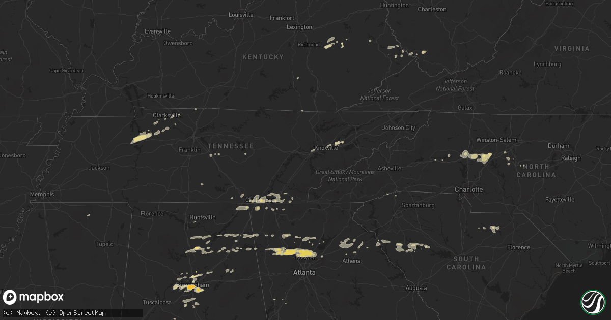
Hail Map in Kentucky on February 28, 2011
Get this storm
February 28 map
$229
one time, instant access
Download today. No call, no setup
Keep the $229
Bought the map and want the full workflow? Apply the entire $229 to a subscription within 7 days. None of it is wasted.
Every map, not just this one
This buys you this map. Subscription and you get every map we run, in the markets you choose from a few cities to whole states to nationwide. Plus real-time alerts the moment a storm fires.
Contact data
Name, contact info, occupancy, even credit band for addresses in the footprint. You go from where it hit to who to call.
Become the source they trust
Unlimited branding weather history reports on demand. You already have the documented answer ready for the property owner, and you are the one who showed up with it.
Property data and RoofTrace estimates
Pull up any address you have got, its value and the exact code rules for that jurisdiction, straight from One Click Code. Then RoofTrace estimates the squares, pitch, and roof value, priced the way you price.
Storm reports in Kentucky
Kentucky
| Date | Description |
|---|---|
| 02/28/201112:30 PM CST | Numerous reports of trees down around the county including talbert and jackson. |
| 02/28/201110:49 AM CST | An nws storm damage survey confirmed an ef-1 tornado with maximum wind speeds of 100 mph touched down about a mile southwest of stanford. The tornado traveled 8 miles b |
| 02/28/20118:35 AM CST | One 8 foot by 12 foot shed was moved about 40 feet by wind. A few shingles and some siding was torn off one structure. Also an unsupported concrete block wall was knock |
| 02/28/20118:32 AM CST | Numerous reports of trees down throughout the county. |
| 02/28/20118:20 AM CST | Hwy 160 closed temporarily due to a tree across the road. |
| 02/28/20118:00 AM CST | A local report indicates 1.00 inch wind near 8 SE WHITLEY CITY |
| 02/28/20117:53 AM CST | Quarter sized hail was reported in pikeville. |
| 02/28/20117:35 AM CST | Trees down and the roof of a barn was blown off on buffalo branch road in corbin in knox county. One rv was also reported blown over in this location. |
| 02/28/20117:30 AM CST | Wind damage occurred to a house and a building on sweet hollow golf course. A mobile home was damaged when a tree fell on it. |
| 02/28/20117:15 AM CST | The pulaski county emergency manager received numerous reports of downed trees and structural damage from around the county. Reports were received of shingles being blo |
| 02/28/20117:15 AM CST | Numerous reports of trees down around the county including talbert and jackson. |
| 02/28/20117:00 AM CST | One tree was blown down on ky highway 30. The time is based on radar estimate. |
| 02/28/20117:00 AM CST | One trailer blow over within the city limits of salyersville. |
| 02/28/20116:54 AM CST | One double wide trailer was blown over and had roof blown off. One single wide trailer had most of its roof blown off. One large apple tree was uprooted. The damage hap |
| 02/28/20116:49 AM CST | Several large trees down or snapped along the mountain parkway near mile marker 68. |
| 02/28/20116:45 AM CST | The lee county superintendent reported that all of the shools county wide were without power due to thunderstorm wind gusts. |
| 02/28/20116:45 AM CST | The pulaski county emergency manager received numerous reports of downed trees and structural damage from around the county. Reports were received of shingles being blo |
| 02/28/20116:40 AM CST | Tree branches the size of a persons arm were being blown down in the community of pulaski south of eubank. |
| 02/28/20116:38 AM CST | A spotter reported that his lawn furniture was being blown around by thunderstorm wind gusts 3 miles south of canel city. Pea size hail was also falling when the report |
| 02/28/20116:37 AM CST | Ef-1 tornado. Tornado path one quarter of a mile long and 100 yards wide. Numerous trees were snapped and scattered. One mobile home had its roof blow off and was pushe |
| 02/28/20116:37 AM CST | Overhang porch and pieces of siding torn off a mobile home. |
| 02/28/20116:35 AM CST | Large trees down on ky 1010 and along the mountain parkway from thunderstorm winds. |
| 02/28/20116:35 AM CST | Power outages were reported in calaboose. |
| 02/28/20116:35 AM CST | Kentucky mesonet measured a peak wind gust of 59 mph. |
| 02/28/20116:33 AM CST | Several houses along landsaw road with tin roofing damaged. Also several trees knocked over from thunderstorm winds along the mountain parkway |
| 02/28/20116:30 AM CST | A local report indicates 1.00 inch wind near CAMPTON |
| 02/28/20116:30 AM CST | Trees were blown down on hwy 1010 in toliver. |
| 02/28/20116:25 AM CST | Roof off part of a home on beech street. Included photo on wsaz web site. |
| 02/28/20116:25 AM CST | Tree of greater than 12 inch diameter blown down onto power lines blocking highway 715 just south of rogers. |
| 02/28/20116:22 AM CST | Trees down |
| 02/28/20116:22 AM CST | Power outages around the county. Numerous reports of trees down throughout the county. |
| 02/28/20116:20 AM CST | Reports of trees down in county |
| 02/28/20116:14 AM CST | Powell county em relayed numerous reports of large trees down and several out buildings damaged or had roofs blown off around the hardwick creek area. |
| 02/28/20116:00 AM CST | Power outages were reported in calaboose. |
| 02/28/20116:00 AM CST | Estil county em relayed report of numerous trees blown down around the county between about 7 and 10 a.m. 4 to 5 thousand people were without power during the morning h |
| 02/28/20116:00 AM CST | Trees were blown down on winchester road just north of the town of palmer on the estill clark county line. |
| 02/28/20114:15 AM CST | Several trees downed near fall of rough. Two downed trees blocked rolling stone acres lane and kiper-whitworth road. |
All States Impacted by Hail Map on February 28, 2011
Cities Impacted by Hail Map on February 28, 2011
- Erin, TN
- Dickson, TN
- McEwen, TN
- Vanleer, TN
- Groveoak, AL
- Geraldine, AL
- Albertville, AL
- Birmingham, AL
- Palmyra, TN
- Bessemer, AL
- Centre, AL
- Leesburg, AL
- Eva, TN
- Waverly, TN
- Camden, TN
- Big Sandy, TN
- Buford, GA
- Lawrenceville, GA
- Gardendale, AL
- Huntsville, AL
- Silverstreet, SC
- Collinsville, AL
- Cleveland, NC
- Athens, GA
- Jefferson, GA
- Fairmount, GA
- Rydal, GA
- Adairsville, GA
- Jasper, TN
- Cleveland, TN
- Chattanooga, TN
- Signal Mountain, TN
- McDonald, TN
- Ooltewah, TN
- Guild, TN
- Lookout Mountain, TN
- Harrison, TN
- Whitwell, TN
- Apison, TN
- Cumberland City, TN
- Smithville, TN
- Walling, TN
- Lexington, NC
- Pinson, AL
- Holly Pond, AL
- Cullman, AL
- Cooleemee, NC
- Salisbury, NC
- Woodleaf, NC
- Linwood, NC
- Advance, NC
- Mocksville, NC
- Sterrett, AL
- Dalton, GA
- Hanover, WV
- Gilbert, WV
- Simon, WV
- Roswell, GA
- Marietta, GA
- Rome, GA
- Aragon, GA
- Dallas, GA
- Cumming, GA
- Acworth, GA
- Suwanee, GA
- Alpharetta, GA
- Cartersville, GA
- Duluth, GA
- Lindale, GA
- Taylorsville, GA
- Kennesaw, GA
- Kingston, GA
- Silver Creek, GA
- Woodstock, GA
- Rockmart, GA
- Emerson, GA
- Canton, GA
- Dawsonville, GA
- Ball Ground, GA
- Campton, KY
- Danielsville, GA
- Royston, GA
- Waleska, GA
- McAndrews, KY
- Pinsonfork, KY
- Stone, KY
- Hanceville, AL
- Matewan, WV
- New Market, TN
- Cross Hill, SC
- Ninety Six, SC
- Greenwood, SC
- Stanton, KY
- Selma, AL
- Hodges, SC
- Abbeville, SC
- Leeds, AL
- Pikeville, KY
- Kimper, KY
- Raccoon, KY
- Guntersville, AL
- Arab, AL
- Union Grove, AL
- Petersburg, TN
- Marion, AL
- Minter, AL
- Sardis, AL
- South Pittsburg, TN
- Dora, AL
- Statesville, NC
- Falkville, AL
- Sophia, NC
- Stanton, AL
- Fultondale, AL
- Fairfield, AL
- Pleasant Grove, AL
- Mulga, AL
- Dolomite, AL
- Stewart, OH
- Athens, OH
- Guysville, OH
- Murfreesboro, TN
- Ringgold, GA
- Tunnel Hill, GA
- Morris, AL
- Columbiana, AL
- Iva, SC
- Starr, SC
- Bryant, AL
- Trussville, AL
- Mount Olive, AL
- Old Fort, TN
- Fort Payne, AL
- Dawson, AL
- Fyffe, AL
- Attalla, AL
- Boaz, AL
- Knoxville, TN
- Brent, AL
- Ravenna, KY
- Irvine, KY
- Elberton, GA
- Denton, NC
- Asheboro, NC
- Jefferson, SC
- McBee, SC
- Plainville, GA
- Adger, AL
- Trinity, NC
- Somerset, KY
- Strawberry Plains, TN
- Montevallo, AL
- Calera, AL
- Kimberly, AL
- Warrior, AL
- Bradley, SC
- Cave Spring, GA
- Hickory, NC
- Taylorsville, NC
- Lyerly, GA
- Clarksville, TN
- Adams, TN
- Armuchee, GA
- Cumberland Furnace, TN
- Alabaster, AL
- Rising Fawn, GA
- Chickamauga, GA
- Flintstone, GA
- Lookout Mountain, GA
- Rossville, GA
- Sherwood, TN
- Chatsworth, GA
- Waterloo, SC
- Chappells, SC
- Clay City, KY
- Grantville, GA
- Hazel Green, KY
- Springfield, TN
- Orlinda, TN
- Hartwell, GA
- Summerville, GA
- Travelers Rest, SC
- Kershaw, SC
- Strunk, KY
- Cunningham, TN
- Southside, TN
- Colbert, GA
- Hull, GA
- Prestonsburg, KY
- Pilgrim, KY
- Ohatchee, AL
- Alexandria, AL
- Gaylesville, AL
- Ragland, AL
- Jasper, GA
- Somerville, AL
- Eva, AL
- Baileyton, AL
- Joppa, AL
- Salyersville, KY
- Oil Springs, KY
- Brierfield, AL
- Readyville, TN
- Gainesville, GA
- White, GA
- Calhoun, GA
- Ripley, MS
- Gillsville, GA
- Pendergrass, GA
- Homer, GA
- Commerce, GA
- Maysville, GA
- Trenton, GA
- Stevenson, AL
- Flat Rock, AL
- Bridgeport, AL
- Wharncliffe, WV
- Belfry, KY
- Newberry, SC
- Mentone, AL
- Carnesville, GA
- Valdese, NC
- Horton, AL
- Altoona, AL
- Blountsville, AL
- Franklin, GA
- Graysville, AL
- Quinton, AL
- Adamsville, AL
- Chapmansboro, TN
- Ashland City, TN
- Ramseur, NC
- Ocoee, TN
- Kodak, TN
- Springville, AL
- Odenville, AL
- Slade, KY
- Hardy, KY
- Bowman, GA
- Thomasville, NC
- Gadsden, AL
- Cedar Mountain, NC
- Pelham, AL
- Helena, AL


