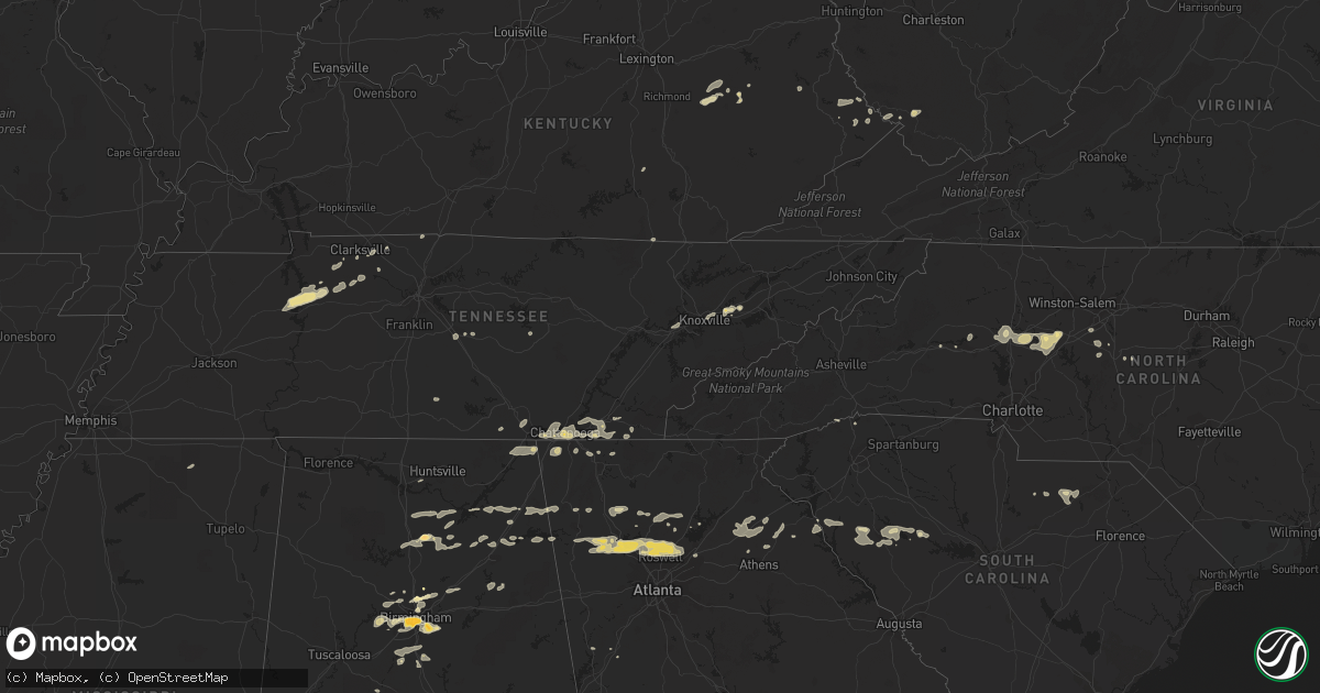
Hail Map in Tennessee on February 28, 2011
Get this storm
February 28 map
$229
one time, instant access
Download today. No call, no setup
Keep the $229
Bought the map and want the full workflow? Apply the entire $229 to a subscription within 7 days. None of it is wasted.
Every map, not just this one
This buys you this map. Subscription and you get every map we run, in the markets you choose from a few cities to whole states to nationwide. Plus real-time alerts the moment a storm fires.
Contact data
Name, contact info, occupancy, even credit band for addresses in the footprint. You go from where it hit to who to call.
Become the source they trust
Unlimited branding weather history reports on demand. You already have the documented answer ready for the property owner, and you are the one who showed up with it.
Property data and RoofTrace estimates
Pull up any address you have got, its value and the exact code rules for that jurisdiction, straight from One Click Code. Then RoofTrace estimates the squares, pitch, and roof value, priced the way you price.
Storm reports in Tennessee
Tennessee
| Date | Description |
|---|---|
| 02/28/20112:05 PM CST | Numerous trees and power lines down in ocoee. |
| 02/28/20112:05 PM CST | Numerous trees and power lines down. |
| 02/28/20112:05 PM CST | Numerous trees down in reliance. |
| 02/28/20112:00 PM CST | *** 1 fatal *** 1 fatality reported 10 miles south of benton in the old fort area on ladd springs rd. Tree fell on a mobile home and killed a 75 year old man. |
| 02/28/20111:45 PM CST | A local report indicates 1.00 inch wind near CLEVELAND |
| 02/28/20111:40 PM CST | Two trees down. |
| 02/28/20111:40 PM CST | Few trees and a flag pole down. |
| 02/28/20111:30 PM CST | Ef1. Max wind speed 90 mph. Path length 2.6 miles. Average path width 85 to 100 yards with a maximum width of 150 yards. Numerous trees down. At least 10 homes with dam |
| 02/28/20111:30 PM CST | Numerous trees and power lines down and 8 homes with damage ranging from minor to major between signal mountain and redbank. |
| 02/28/20111:30 PM CST | Numerous reports of trees and power lines down across across roadways and houses. |
| 02/28/20111:25 PM CST | Ef1. Max wind speed 90 mph. Path length 2.2 miles. Path width from 60 to 90 yards. Numerous trees down. Estimated 25 homes with minor damage. |
| 02/28/20111:25 PM CST | Few trees down near intersection of hooker and wilson roads. |
| 02/28/20111:00 PM CST | Ef0. Maximum wind speed 70 mph. Path width 20 yards. Path length 0.1 mile. Trees down. |
| 02/28/20111:00 PM CST | Few trees down. |
| 02/28/201112:46 PM CST | Structural damage to home near pleasant grove rd. |
| 02/28/201112:45 PM CST | Trees and powerlines down in elora near borderline rd. |
| 02/28/201112:35 PM CST | Structural damage to part of car lot and house near hwy 130. Possible tornado. |
| 02/28/201112:35 PM CST | Extensive structural damage to residences and multiple trees down across areas near pleasant grove rd...turkey creed rd...awalt rd...and hwy 41a. Possible tornado. |
| 02/28/201112:10 PM CST | Two trees and power lines down in the pittman center area. |
| 02/28/201111:48 AM CST | Few trees down. |
| 02/28/201110:45 AM CST | Roof blown off barn at the intersection of carlyle avenue and cedar creek road. |
| 02/28/201110:30 AM CST | Spotter reports at 3728 fredonia road...trees and powerlines down. Debris in fence. No structural damage observed. |
| 02/28/20119:15 AM CST | 1 tree down near junction of hwy 27 and hwy 29. |
| 02/28/20116:45 AM CST | Quarter size hail reported in cumberland furnace. |
| 02/28/20116:20 AM CST | Benton s.o. Reported several locations in central benton county with trees blown down. |
| 02/28/20116:15 AM CST | Sheriff dispatch relayed rpt of downed power lines from school bus driver. |
All States Impacted by Hail Map on February 28, 2011
Cities Impacted by Hail Map on February 28, 2011
- Erin, TN
- Dickson, TN
- McEwen, TN
- Vanleer, TN
- Groveoak, AL
- Geraldine, AL
- Albertville, AL
- Birmingham, AL
- Palmyra, TN
- Bessemer, AL
- Centre, AL
- Leesburg, AL
- Eva, TN
- Waverly, TN
- Camden, TN
- Big Sandy, TN
- Buford, GA
- Lawrenceville, GA
- Gardendale, AL
- Huntsville, AL
- Silverstreet, SC
- Collinsville, AL
- Cleveland, NC
- Athens, GA
- Jefferson, GA
- Fairmount, GA
- Rydal, GA
- Adairsville, GA
- Jasper, TN
- Cleveland, TN
- Chattanooga, TN
- Signal Mountain, TN
- McDonald, TN
- Ooltewah, TN
- Guild, TN
- Lookout Mountain, TN
- Harrison, TN
- Whitwell, TN
- Apison, TN
- Cumberland City, TN
- Smithville, TN
- Walling, TN
- Lexington, NC
- Pinson, AL
- Holly Pond, AL
- Cullman, AL
- Cooleemee, NC
- Salisbury, NC
- Woodleaf, NC
- Linwood, NC
- Advance, NC
- Mocksville, NC
- Sterrett, AL
- Dalton, GA
- Hanover, WV
- Gilbert, WV
- Simon, WV
- Roswell, GA
- Marietta, GA
- Rome, GA
- Aragon, GA
- Dallas, GA
- Cumming, GA
- Acworth, GA
- Suwanee, GA
- Alpharetta, GA
- Cartersville, GA
- Duluth, GA
- Lindale, GA
- Taylorsville, GA
- Kennesaw, GA
- Kingston, GA
- Silver Creek, GA
- Woodstock, GA
- Rockmart, GA
- Emerson, GA
- Canton, GA
- Dawsonville, GA
- Ball Ground, GA
- Campton, KY
- Danielsville, GA
- Royston, GA
- Waleska, GA
- McAndrews, KY
- Pinsonfork, KY
- Stone, KY
- Hanceville, AL
- Matewan, WV
- New Market, TN
- Cross Hill, SC
- Ninety Six, SC
- Greenwood, SC
- Stanton, KY
- Selma, AL
- Hodges, SC
- Abbeville, SC
- Leeds, AL
- Pikeville, KY
- Kimper, KY
- Raccoon, KY
- Guntersville, AL
- Arab, AL
- Union Grove, AL
- Petersburg, TN
- Marion, AL
- Minter, AL
- Sardis, AL
- South Pittsburg, TN
- Dora, AL
- Statesville, NC
- Falkville, AL
- Sophia, NC
- Stanton, AL
- Fultondale, AL
- Fairfield, AL
- Pleasant Grove, AL
- Mulga, AL
- Dolomite, AL
- Stewart, OH
- Athens, OH
- Guysville, OH
- Murfreesboro, TN
- Ringgold, GA
- Tunnel Hill, GA
- Morris, AL
- Columbiana, AL
- Iva, SC
- Starr, SC
- Bryant, AL
- Trussville, AL
- Mount Olive, AL
- Old Fort, TN
- Fort Payne, AL
- Dawson, AL
- Fyffe, AL
- Attalla, AL
- Boaz, AL
- Knoxville, TN
- Brent, AL
- Ravenna, KY
- Irvine, KY
- Elberton, GA
- Denton, NC
- Asheboro, NC
- Jefferson, SC
- McBee, SC
- Plainville, GA
- Adger, AL
- Trinity, NC
- Somerset, KY
- Strawberry Plains, TN
- Montevallo, AL
- Calera, AL
- Kimberly, AL
- Warrior, AL
- Bradley, SC
- Cave Spring, GA
- Hickory, NC
- Taylorsville, NC
- Lyerly, GA
- Clarksville, TN
- Adams, TN
- Armuchee, GA
- Cumberland Furnace, TN
- Alabaster, AL
- Rising Fawn, GA
- Chickamauga, GA
- Flintstone, GA
- Lookout Mountain, GA
- Rossville, GA
- Sherwood, TN
- Chatsworth, GA
- Waterloo, SC
- Chappells, SC
- Clay City, KY
- Grantville, GA
- Hazel Green, KY
- Springfield, TN
- Orlinda, TN
- Hartwell, GA
- Summerville, GA
- Travelers Rest, SC
- Kershaw, SC
- Strunk, KY
- Cunningham, TN
- Southside, TN
- Colbert, GA
- Hull, GA
- Prestonsburg, KY
- Pilgrim, KY
- Ohatchee, AL
- Alexandria, AL
- Gaylesville, AL
- Ragland, AL
- Jasper, GA
- Somerville, AL
- Eva, AL
- Baileyton, AL
- Joppa, AL
- Salyersville, KY
- Oil Springs, KY
- Brierfield, AL
- Readyville, TN
- Gainesville, GA
- White, GA
- Calhoun, GA
- Ripley, MS
- Gillsville, GA
- Pendergrass, GA
- Homer, GA
- Commerce, GA
- Maysville, GA
- Trenton, GA
- Stevenson, AL
- Flat Rock, AL
- Bridgeport, AL
- Wharncliffe, WV
- Belfry, KY
- Newberry, SC
- Mentone, AL
- Carnesville, GA
- Valdese, NC
- Horton, AL
- Altoona, AL
- Blountsville, AL
- Franklin, GA
- Graysville, AL
- Quinton, AL
- Adamsville, AL
- Chapmansboro, TN
- Ashland City, TN
- Ramseur, NC
- Ocoee, TN
- Kodak, TN
- Springville, AL
- Odenville, AL
- Slade, KY
- Hardy, KY
- Bowman, GA
- Thomasville, NC
- Gadsden, AL
- Cedar Mountain, NC
- Pelham, AL
- Helena, AL


