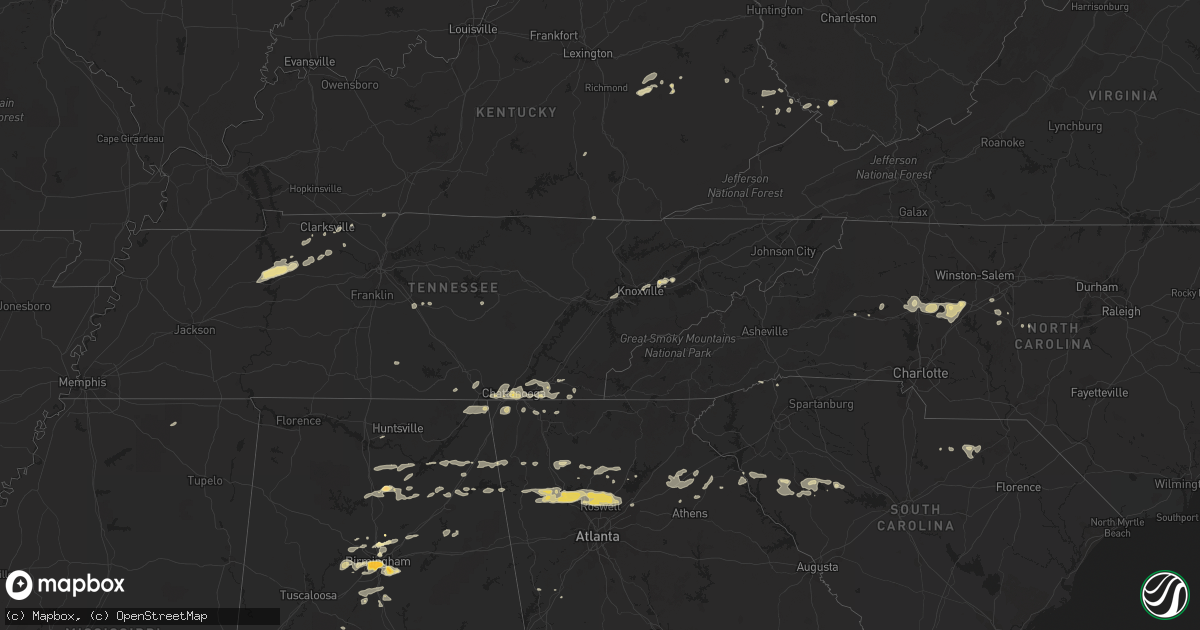
Hail Map in Alabama on February 28, 2011
Get this storm
February 28 map
$229
one time, instant access
Download today. No call, no setup
Keep the $229
Bought the map and want the full workflow? Apply the entire $229 to a subscription within 7 days. None of it is wasted.
Every map, not just this one
This buys you this map. Subscription and you get every map we run, in the markets you choose from a few cities to whole states to nationwide. Plus real-time alerts the moment a storm fires.
Contact data
Name, contact info, occupancy, even credit band for addresses in the footprint. You go from where it hit to who to call.
Become the source they trust
Unlimited branding weather history reports on demand. You already have the documented answer ready for the property owner, and you are the one who showed up with it.
Property data and RoofTrace estimates
Pull up any address you have got, its value and the exact code rules for that jurisdiction, straight from One Click Code. Then RoofTrace estimates the squares, pitch, and roof value, priced the way you price.
Storm reports in Alabama
Alabama
| Date | Description |
|---|---|
| 02/28/20115:45 PM CST | 18-wheeler overturned on interstate 65 near pintlala exit. |
| 02/28/20115:37 PM CST | The tornado touched down just to the west of the intersection of deer trace road and county road 37 and traveled southeast for almost 5 miles lifting just to the west o |
| 02/28/20115:29 PM CST | Several trees were blown down along cr160 north of lafayette. At least 6 homes suffered roof damage and several autos were damaged by fallen trees. Possible tornado. |
| 02/28/20115:29 PM CST | Several trees were blown down along cr160 north of lafayette. At least 6 homes suffered roof damage and several autos were damaged by fallen trees. Possible tornado. To |
| 02/28/20115:20 PM CST | Possible tornado. Highway 31 and county road 107 north of prattville. Trees and powerlines down. Trees on homes. |
| 02/28/20115:18 PM CST | Trees down and mobile home overturned at harris and chad roads. No injuries |
| 02/28/20115:18 PM CST | Trees down on jackson road and also on mercer road. |
| 02/28/20115:15 PM CST | Mobile homes damaged at county road 104 and county road 107 north of central alabama electric bridge. |
| 02/28/20115:05 PM CST | The tornado touched down just to the west of interstate 65 in autauga county and tracked to the southeast and lifted near the town of elmore in elmore county. Numerous |
| 02/28/20114:30 PM CST | Trees down. |
| 02/28/20114:22 PM CST | Trees were blown down in the shinbone area. |
| 02/28/20114:22 PM CST | Trees were blown down. |
| 02/28/20113:53 PM CST | A weak brief tornado touched down along cr 46 grist mill road. The tornado moved eastward and ended just after it crossed reynolds mill road. Several trees were snapped |
| 02/28/20113:50 PM CST | Trees and power lines down near cedar springs road. |
| 02/28/20113:50 PM CST | Trees and power lines were blown down around town. |
| 02/28/20113:50 PM CST | Power line down between alabama highway 21 and bullocks ferry road |
| 02/28/20113:50 PM CST | Power pole down on george douthit drive. Trees were also blown down in the area. |
| 02/28/20113:45 PM CST | Trees were blown down in fort mcclellan. |
| 02/28/20113:36 PM CST | At least 5 trees were either snapped off or uprooted near vincent. Some tree damage also occurred near vincent elementary school and one tree was blown down at highway |
| 02/28/20113:36 PM CST | Tree down at highway 25 at low road and myrtlewood drive. |
| 02/28/20113:26 PM CST | Large old oak tree was blown down onto a home. |
| 02/28/20113:05 PM CST | Hail as large as ping pong balls in brook highland. |
| 02/28/20113:01 PM CST | Hail as large as golf balls on red mountain. |
| 02/28/20113:00 PM CST | In avondale area. |
| 02/28/20112:55 PM CST | Metal flagpole snapped in half. |
| 02/28/20112:45 PM CST | Trees down. Walkers chapel road and laceys chapel raod. |
| 02/28/20112:41 PM CST | Hail up to the size of golf balls |
| 02/28/20112:40 PM CST | Trees were blown down in centre.a few trees landed on homes. One auto accident occurred as a vehicle was blown around in the high wind. No injuries. |
| 02/28/20112:39 PM CST | Golf ball size hail reported near antioch. |
| 02/28/20112:35 PM CST | Barn collapse off county road 167 and possible home damage in the same area. Trees were also blown down in the area. No injuries. |
| 02/28/20112:30 PM CST | Roof off barn on blackwell road. |
| 02/28/20112:30 PM CST | Trees downm and minor roof damage to a garage roof. |
| 02/28/20112:26 PM CST | Large old oak tree was blown down onto a home. |
| 02/28/20112:25 PM CST | Trees down and tin blown off roof. |
| 02/28/20112:25 PM CST | Trees down at duck springs elementary. |
| 02/28/20112:21 PM CST | Trees were blown down. |
| 02/28/20112:13 PM CST | Trees were blown down. |
| 02/28/20112:11 PM CST | Quarter size hail reported in pleasant hill area. |
| 02/28/20112:11 PM CST | Quarter size hail reported on fruit farm rd east of fort payne. |
| 02/28/20112:11 PM CST | Quarter size hail reported in plesant hill area. |
| 02/28/20112:05 PM CST | Trees down at duck springs elementary. |
| 02/28/20111:59 PM CST | Several trees down across cr 811. |
| 02/28/20111:47 PM CST | Several trees down across guntersville state park. |
| 02/28/20111:43 PM CST | Several power lines down across sunset dr and lurleen b wallace dr. |
| 02/28/20111:33 PM CST | Reported several trees down across arab. |
| 02/28/20111:21 PM CST | Two trees were knocked down on college street in scottsboro. Time estimated by radar. |
| 02/28/201112:50 PM CST | Damage to building on hwy 72. |
| 02/28/201112:45 PM CST | Several roof shingles were torn off by thunderstorm winds. |
| 02/28/201112:42 PM CST | Damage to barns and multiple trees down around hazel green in north madison county. |
| 02/28/201112:37 PM CST | Reported power lines down on robert strong dr and baltimore hill rd in moores mill community. Time estimated by radar. |
| 02/28/201112:18 PM CST | An ef-1 tornado with winds of 95 mph...path length of 4.2 miles...and path width of 200 yds touched down along borderline rd between everett jones rd and greenville pk. |
| 02/28/201112:08 PM CST | Power outages near the intersection of snake rd and parker rd. |
| 02/28/201112:02 PM CST | Roof damage...and trees downed on poplar creek rd west of athens |
| 02/28/201111:46 AM CST | Roof damage to mobile home near us 72 on sledge rd. Other structural damage reported along with several power lines down. |
| 02/28/201111:46 AM CST | Three large trees cause damage to awning at colbert county high school. |
| 02/28/201111:43 AM CST | Roof peeled off barn. |
| 02/27/20117:36 PM CST | Trees down and blocking roadway...via ema |
| 02/27/20116:54 PM CST | Three trees reported down at the intersection of dusty road and sandfort road...with one large tree blocking the roadway. |
All States Impacted by Hail Map on February 28, 2011
Cities Impacted by Hail Map on February 28, 2011
- Erin, TN
- Dickson, TN
- McEwen, TN
- Vanleer, TN
- Groveoak, AL
- Geraldine, AL
- Albertville, AL
- Birmingham, AL
- Palmyra, TN
- Bessemer, AL
- Centre, AL
- Leesburg, AL
- Eva, TN
- Waverly, TN
- Camden, TN
- Big Sandy, TN
- Buford, GA
- Lawrenceville, GA
- Gardendale, AL
- Huntsville, AL
- Silverstreet, SC
- Collinsville, AL
- Cleveland, NC
- Athens, GA
- Jefferson, GA
- Fairmount, GA
- Rydal, GA
- Adairsville, GA
- Jasper, TN
- Cleveland, TN
- Chattanooga, TN
- Signal Mountain, TN
- McDonald, TN
- Ooltewah, TN
- Guild, TN
- Lookout Mountain, TN
- Harrison, TN
- Whitwell, TN
- Apison, TN
- Cumberland City, TN
- Smithville, TN
- Walling, TN
- Lexington, NC
- Pinson, AL
- Holly Pond, AL
- Cullman, AL
- Cooleemee, NC
- Salisbury, NC
- Woodleaf, NC
- Linwood, NC
- Advance, NC
- Mocksville, NC
- Sterrett, AL
- Dalton, GA
- Hanover, WV
- Gilbert, WV
- Simon, WV
- Roswell, GA
- Marietta, GA
- Rome, GA
- Aragon, GA
- Dallas, GA
- Cumming, GA
- Acworth, GA
- Suwanee, GA
- Alpharetta, GA
- Cartersville, GA
- Duluth, GA
- Lindale, GA
- Taylorsville, GA
- Kennesaw, GA
- Kingston, GA
- Silver Creek, GA
- Woodstock, GA
- Rockmart, GA
- Emerson, GA
- Canton, GA
- Dawsonville, GA
- Ball Ground, GA
- Campton, KY
- Danielsville, GA
- Royston, GA
- Waleska, GA
- McAndrews, KY
- Pinsonfork, KY
- Stone, KY
- Hanceville, AL
- Matewan, WV
- New Market, TN
- Cross Hill, SC
- Ninety Six, SC
- Greenwood, SC
- Stanton, KY
- Selma, AL
- Hodges, SC
- Abbeville, SC
- Leeds, AL
- Pikeville, KY
- Kimper, KY
- Raccoon, KY
- Guntersville, AL
- Arab, AL
- Union Grove, AL
- Petersburg, TN
- Marion, AL
- Minter, AL
- Sardis, AL
- South Pittsburg, TN
- Dora, AL
- Statesville, NC
- Falkville, AL
- Sophia, NC
- Stanton, AL
- Fultondale, AL
- Fairfield, AL
- Pleasant Grove, AL
- Mulga, AL
- Dolomite, AL
- Stewart, OH
- Athens, OH
- Guysville, OH
- Murfreesboro, TN
- Ringgold, GA
- Tunnel Hill, GA
- Morris, AL
- Columbiana, AL
- Iva, SC
- Starr, SC
- Bryant, AL
- Trussville, AL
- Mount Olive, AL
- Old Fort, TN
- Fort Payne, AL
- Dawson, AL
- Fyffe, AL
- Attalla, AL
- Boaz, AL
- Knoxville, TN
- Brent, AL
- Ravenna, KY
- Irvine, KY
- Elberton, GA
- Denton, NC
- Asheboro, NC
- Jefferson, SC
- McBee, SC
- Plainville, GA
- Adger, AL
- Trinity, NC
- Somerset, KY
- Strawberry Plains, TN
- Montevallo, AL
- Calera, AL
- Kimberly, AL
- Warrior, AL
- Bradley, SC
- Cave Spring, GA
- Hickory, NC
- Taylorsville, NC
- Lyerly, GA
- Clarksville, TN
- Adams, TN
- Armuchee, GA
- Cumberland Furnace, TN
- Alabaster, AL
- Rising Fawn, GA
- Chickamauga, GA
- Flintstone, GA
- Lookout Mountain, GA
- Rossville, GA
- Sherwood, TN
- Chatsworth, GA
- Waterloo, SC
- Chappells, SC
- Clay City, KY
- Grantville, GA
- Hazel Green, KY
- Springfield, TN
- Orlinda, TN
- Hartwell, GA
- Summerville, GA
- Travelers Rest, SC
- Kershaw, SC
- Strunk, KY
- Cunningham, TN
- Southside, TN
- Colbert, GA
- Hull, GA
- Prestonsburg, KY
- Pilgrim, KY
- Ohatchee, AL
- Alexandria, AL
- Gaylesville, AL
- Ragland, AL
- Jasper, GA
- Somerville, AL
- Eva, AL
- Baileyton, AL
- Joppa, AL
- Salyersville, KY
- Oil Springs, KY
- Brierfield, AL
- Readyville, TN
- Gainesville, GA
- White, GA
- Calhoun, GA
- Ripley, MS
- Gillsville, GA
- Pendergrass, GA
- Homer, GA
- Commerce, GA
- Maysville, GA
- Trenton, GA
- Stevenson, AL
- Flat Rock, AL
- Bridgeport, AL
- Wharncliffe, WV
- Belfry, KY
- Newberry, SC
- Mentone, AL
- Carnesville, GA
- Valdese, NC
- Horton, AL
- Altoona, AL
- Blountsville, AL
- Franklin, GA
- Graysville, AL
- Quinton, AL
- Adamsville, AL
- Chapmansboro, TN
- Ashland City, TN
- Ramseur, NC
- Ocoee, TN
- Kodak, TN
- Springville, AL
- Odenville, AL
- Slade, KY
- Hardy, KY
- Bowman, GA
- Thomasville, NC
- Gadsden, AL
- Cedar Mountain, NC
- Pelham, AL
- Helena, AL


