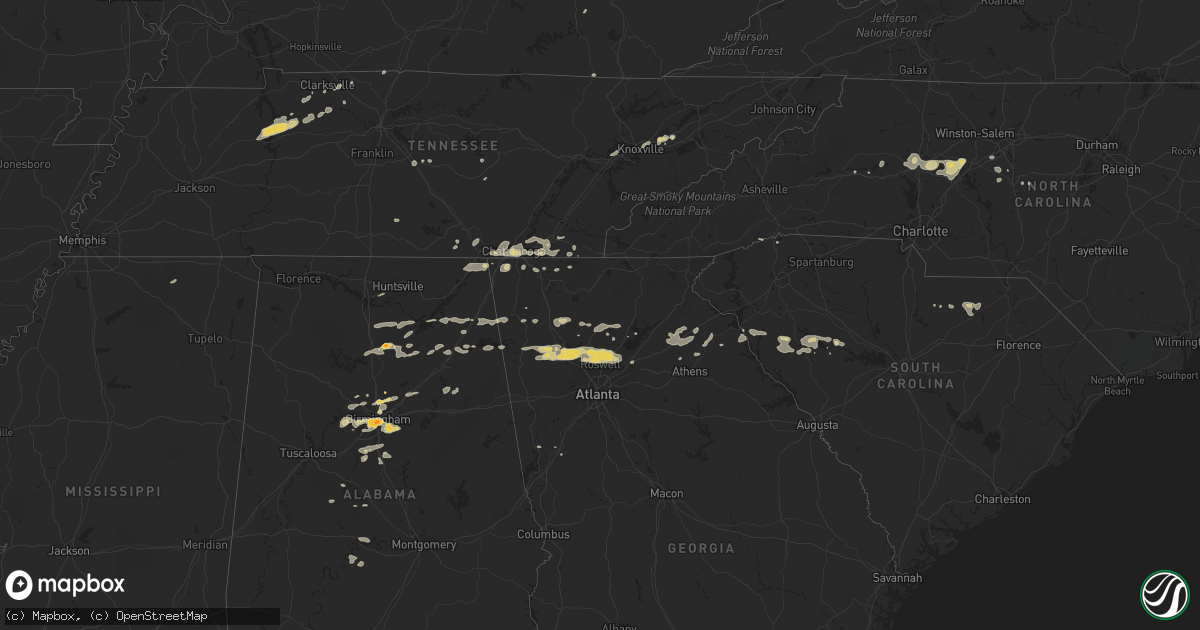
Hail Map on February 28, 2011
Get this storm
February 28 map
$229
one time, instant access
Download today. No call, no setup
Keep the $229
Bought the map and want the full workflow? Apply the entire $229 to a subscription within 7 days. None of it is wasted.
Every map, not just this one
This buys you this map. Subscription and you get every map we run, in the markets you choose from a few cities to whole states to nationwide. Plus real-time alerts the moment a storm fires.
Contact data
Name, contact info, occupancy, even credit band for addresses in the footprint. You go from where it hit to who to call.
Become the source they trust
Unlimited branding weather history reports on demand. You already have the documented answer ready for the property owner, and you are the one who showed up with it.
Property data and RoofTrace estimates
Pull up any address you have got, its value and the exact code rules for that jurisdiction, straight from One Click Code. Then RoofTrace estimates the squares, pitch, and roof value, priced the way you price.
States Impacted by Hail Map on February 28, 2011
Storm reports
Georgia
| Date | Description |
|---|---|
| 02/28/20115:25 PM CST | Bartow county ema relayed a report of many trees down in adairsville. |
| 02/28/20115:20 PM CST | Metal roof blown off building |
| 02/28/20115:16 PM CST | Trees down from dewy rose to rockbranch |
| 02/28/20115:12 PM CST | Tree down along highway 172 |
| 02/28/20115:08 PM CST | Tree down in goldmine area |
| 02/28/20115:00 PM CST | Tree down |
| 02/28/20114:52 PM CST | Madison county 911 relayed reports of widespread tree damage in the county. More than a dozen trees were downed. |
| 02/28/20114:52 PM CST | Public reported quarter sized hail. |
| 02/28/20114:45 PM CST | The 911 center of gwinnett county reported a tree down on a house in lawrenceville on guardian way. |
| 02/28/20114:37 PM CST | Public reported a couple of trees down in winder. |
| 02/28/20114:25 PM CST | Banks county emergency management relayed reports that downtown maysville had power out. |
| 02/28/20114:25 PM CST | Banks county emergency management reported multiple downed trees. A storage shed and store signs were blown onto us 441. |
| 02/28/20114:15 PM CST | Spotter reported 1.25 inch diameter hail in roswell. |
| 02/28/20113:57 PM CST | Trained spotter reported quarter sized hail in kennesaw near i-575 and bells ferry. |
| 02/28/20113:57 PM CST | Cherokee county emergency management relayed reports downed trees and powerlines south of canton. |
| 02/28/20113:55 PM CST | Cherokee county emergency management relayed a report of half dollar sized hail. |
| 02/28/20113:54 PM CST | Cherokee county emergency management relayed reports on 6 downed trees and power lines in woodstock. |
| 02/28/20113:53 PM CST | Amateur radio relayed reports of structure damage. The back wall of a building was blown down on cherokee drive. |
| 02/28/20113:50 PM CST | Public reported quarter to half dollar sized hail. |
| 02/28/20113:48 PM CST | Cherokee county emergency management reports power outages in most of woodstock. |
| 02/28/20113:44 PM CST | Public reported measuring a gust of 62 mph and a wind of 28 mph with an anemometer on the pickens-dawson county line. |
| 02/28/20113:39 PM CST | Cherokee county emergency management reported several downed pine trees. |
| 02/28/20113:35 PM CST | Bartow county ema relayed a report of many trees down in the cartersville area. |
| 02/28/20113:15 PM CST | Public reported a flagpole snapped by strong winds west of cave spring near the georgia-alabama border. |
| 02/28/20113:15 PM CST | Several trees down from sky valley southward |
| 02/28/20113:15 PM CST | Polk county 911 relayed a reports of a downed tree on highway 100 in cedartown. |
| 02/28/20113:15 PM CST | Spotter reported 1.25 inch diameter hail in roswell. |
| 02/28/20113:00 PM CST | Bartow county ema relayed a report of many trees down in adairsville. |
| 02/28/20112:45 PM CST | The union county 911 center reports 3 power lines down. |
| 02/28/20112:44 PM CST | Towns county 911 relayed reports of over 9 trees downed in the county. Traffic lights were also reported out. |
| 02/28/20112:44 PM CST | Union county 911 relayed reports of over 20 trees down and 5 power lines down across the county. |
| 02/28/20112:30 PM CST | Fannin county 911 relayed reports of over 20 downed trees and 5 downed powerlines in the county. |
| 02/28/20112:10 PM CST | Emergency management in walker county reported quarter-sized hail between chickamagua and rock spring. |
| 02/28/20112:10 PM CST | Walker county emergency management relayed reports of over a dozen trees downed between chickamauga and rock spring in walker county. |
| 02/28/20112:10 PM CST | Murray county 911 relayed reports of 3 downed trees on highway 411 in northern murray county. |
| 02/28/20112:00 PM CST | Whitfield county emergency management reports several trees down on highway 71 just south of the georgia-tennessee border. |
| 02/28/20112:00 PM CST | Whitfield county 911 relayed report of 2 downed trees on houses in cohutta. |
| 02/28/20111:42 PM CST | Catoosa county 911 relayed reports of 3-4 trees down. |
| 02/28/20111:30 PM CST | Dade county emergency management reports widespread tree damage in north dade county. Includes damage to 2 houses along highway 299 and in the pinecrest subdivision fro |
| 02/28/20111:30 PM CST | Dade county 911 relayed reports of widespread downed trees in and around trenton. |
| 02/28/20111:30 PM CST | Walker county 911 relayed reports of downed power lines causing a power outage in rossville. |
| 02/28/20111:30 PM CST | Walker county 911 relayed reports of quarter sized hail around rossville. |
Alabama
| Date | Description |
|---|---|
| 02/28/20115:45 PM CST | 18-wheeler overturned on interstate 65 near pintlala exit. |
| 02/28/20115:37 PM CST | The tornado touched down just to the west of the intersection of deer trace road and county road 37 and traveled southeast for almost 5 miles lifting just to the west o |
| 02/28/20115:29 PM CST | Several trees were blown down along cr160 north of lafayette. At least 6 homes suffered roof damage and several autos were damaged by fallen trees. Possible tornado. |
| 02/28/20115:29 PM CST | Several trees were blown down along cr160 north of lafayette. At least 6 homes suffered roof damage and several autos were damaged by fallen trees. Possible tornado. To |
| 02/28/20115:20 PM CST | Possible tornado. Highway 31 and county road 107 north of prattville. Trees and powerlines down. Trees on homes. |
| 02/28/20115:18 PM CST | Trees down and mobile home overturned at harris and chad roads. No injuries |
| 02/28/20115:18 PM CST | Trees down on jackson road and also on mercer road. |
| 02/28/20115:15 PM CST | Mobile homes damaged at county road 104 and county road 107 north of central alabama electric bridge. |
| 02/28/20115:05 PM CST | The tornado touched down just to the west of interstate 65 in autauga county and tracked to the southeast and lifted near the town of elmore in elmore county. Numerous |
| 02/28/20114:30 PM CST | Trees down. |
| 02/28/20114:22 PM CST | Trees were blown down in the shinbone area. |
| 02/28/20114:22 PM CST | Trees were blown down. |
| 02/28/20113:53 PM CST | A weak brief tornado touched down along cr 46 grist mill road. The tornado moved eastward and ended just after it crossed reynolds mill road. Several trees were snapped |
| 02/28/20113:50 PM CST | Trees and power lines down near cedar springs road. |
| 02/28/20113:50 PM CST | Trees and power lines were blown down around town. |
| 02/28/20113:50 PM CST | Power line down between alabama highway 21 and bullocks ferry road |
| 02/28/20113:50 PM CST | Power pole down on george douthit drive. Trees were also blown down in the area. |
| 02/28/20113:45 PM CST | Trees were blown down in fort mcclellan. |
| 02/28/20113:36 PM CST | Tree down at highway 25 at low road and myrtlewood drive. |
| 02/28/20113:36 PM CST | At least 5 trees were either snapped off or uprooted near vincent. Some tree damage also occurred near vincent elementary school and one tree was blown down at highway |
| 02/28/20113:26 PM CST | Large old oak tree was blown down onto a home. |
| 02/28/20113:05 PM CST | Hail as large as ping pong balls in brook highland. |
| 02/28/20113:01 PM CST | Hail as large as golf balls on red mountain. |
| 02/28/20113:00 PM CST | In avondale area. |
| 02/28/20112:55 PM CST | Metal flagpole snapped in half. |
| 02/28/20112:45 PM CST | Trees down. Walkers chapel road and laceys chapel raod. |
| 02/28/20112:41 PM CST | Hail up to the size of golf balls |
| 02/28/20112:40 PM CST | Trees were blown down in centre.a few trees landed on homes. One auto accident occurred as a vehicle was blown around in the high wind. No injuries. |
| 02/28/20112:39 PM CST | Golf ball size hail reported near antioch. |
| 02/28/20112:35 PM CST | Barn collapse off county road 167 and possible home damage in the same area. Trees were also blown down in the area. No injuries. |
| 02/28/20112:30 PM CST | Trees downm and minor roof damage to a garage roof. |
| 02/28/20112:30 PM CST | Roof off barn on blackwell road. |
| 02/28/20112:26 PM CST | Large old oak tree was blown down onto a home. |
| 02/28/20112:25 PM CST | Trees down at duck springs elementary. |
| 02/28/20112:25 PM CST | Trees down and tin blown off roof. |
| 02/28/20112:21 PM CST | Trees were blown down. |
| 02/28/20112:13 PM CST | Trees were blown down. |
| 02/28/20112:11 PM CST | Quarter size hail reported in plesant hill area. |
| 02/28/20112:11 PM CST | Quarter size hail reported on fruit farm rd east of fort payne. |
| 02/28/20112:11 PM CST | Quarter size hail reported in pleasant hill area. |
| 02/28/20112:05 PM CST | Trees down at duck springs elementary. |
| 02/28/20111:59 PM CST | Several trees down across cr 811. |
| 02/28/20111:47 PM CST | Several trees down across guntersville state park. |
| 02/28/20111:43 PM CST | Several power lines down across sunset dr and lurleen b wallace dr. |
| 02/28/20111:33 PM CST | Reported several trees down across arab. |
| 02/28/20111:21 PM CST | Two trees were knocked down on college street in scottsboro. Time estimated by radar. |
| 02/28/201112:50 PM CST | Damage to building on hwy 72. |
| 02/28/201112:45 PM CST | Several roof shingles were torn off by thunderstorm winds. |
| 02/28/201112:42 PM CST | Damage to barns and multiple trees down around hazel green in north madison county. |
| 02/28/201112:37 PM CST | Reported power lines down on robert strong dr and baltimore hill rd in moores mill community. Time estimated by radar. |
| 02/28/201112:18 PM CST | An ef-1 tornado with winds of 95 mph...path length of 4.2 miles...and path width of 200 yds touched down along borderline rd between everett jones rd and greenville pk. |
| 02/28/201112:08 PM CST | Power outages near the intersection of snake rd and parker rd. |
| 02/28/201112:02 PM CST | Roof damage...and trees downed on poplar creek rd west of athens |
| 02/28/201111:46 AM CST | Roof damage to mobile home near us 72 on sledge rd. Other structural damage reported along with several power lines down. |
| 02/28/201111:46 AM CST | Three large trees cause damage to awning at colbert county high school. |
| 02/28/201111:43 AM CST | Roof peeled off barn. |
| 02/27/20117:36 PM CST | Trees down and blocking roadway...via ema |
| 02/27/20116:54 PM CST | Three trees reported down at the intersection of dusty road and sandfort road...with one large tree blocking the roadway. |
Illinois
| Date | Description |
|---|---|
| 02/28/201110:33 AM CST | Most homes damaged near intersection of 40 and 143... Holes in siding... Trees blown down. |
| 02/28/20117:46 AM CST | East of i-55....on stauton rd one half mile south of goshen...old barn flattened...large debris field |
| 02/28/20117:45 AM CST | Parts of a barn roof and siding...a flattened shed...and a vehicle 20 plus yards off the roadway off of county road 21 near kuhn station road. |
| 02/28/20117:41 AM CST | Est. 70mph winds... Half inch tree limbs down |
Tennessee
| Date | Description |
|---|---|
| 02/28/20112:05 PM CST | Numerous trees and power lines down. |
| 02/28/20112:05 PM CST | Numerous trees and power lines down in ocoee. |
| 02/28/20112:05 PM CST | Numerous trees down in reliance. |
| 02/28/20112:00 PM CST | *** 1 fatal *** 1 fatality reported 10 miles south of benton in the old fort area on ladd springs rd. Tree fell on a mobile home and killed a 75 year old man. |
| 02/28/20111:45 PM CST | A local report indicates 1.00 inch wind near CLEVELAND |
| 02/28/20111:40 PM CST | Few trees and a flag pole down. |
| 02/28/20111:40 PM CST | Two trees down. |
| 02/28/20111:30 PM CST | Numerous trees and power lines down and 8 homes with damage ranging from minor to major between signal mountain and redbank. |
| 02/28/20111:30 PM CST | Ef1. Max wind speed 90 mph. Path length 2.6 miles. Average path width 85 to 100 yards with a maximum width of 150 yards. Numerous trees down. At least 10 homes with dam |
| 02/28/20111:30 PM CST | Numerous reports of trees and power lines down across across roadways and houses. |
| 02/28/20111:25 PM CST | Few trees down near intersection of hooker and wilson roads. |
| 02/28/20111:25 PM CST | Ef1. Max wind speed 90 mph. Path length 2.2 miles. Path width from 60 to 90 yards. Numerous trees down. Estimated 25 homes with minor damage. |
| 02/28/20111:00 PM CST | Ef0. Maximum wind speed 70 mph. Path width 20 yards. Path length 0.1 mile. Trees down. |
| 02/28/20111:00 PM CST | Few trees down. |
| 02/28/201112:46 PM CST | Structural damage to home near pleasant grove rd. |
| 02/28/201112:45 PM CST | Trees and powerlines down in elora near borderline rd. |
| 02/28/201112:35 PM CST | Extensive structural damage to residences and multiple trees down across areas near pleasant grove rd...turkey creed rd...awalt rd...and hwy 41a. Possible tornado. |
| 02/28/201112:35 PM CST | Structural damage to part of car lot and house near hwy 130. Possible tornado. |
| 02/28/201112:10 PM CST | Two trees and power lines down in the pittman center area. |
| 02/28/201111:48 AM CST | Few trees down. |
| 02/28/201110:45 AM CST | Roof blown off barn at the intersection of carlyle avenue and cedar creek road. |
| 02/28/201110:30 AM CST | Spotter reports at 3728 fredonia road...trees and powerlines down. Debris in fence. No structural damage observed. |
| 02/28/20119:15 AM CST | 1 tree down near junction of hwy 27 and hwy 29. |
| 02/28/20116:45 AM CST | Quarter size hail reported in cumberland furnace. |
| 02/28/20116:20 AM CST | Benton s.o. Reported several locations in central benton county with trees blown down. |
| 02/28/20116:15 AM CST | Sheriff dispatch relayed rpt of downed power lines from school bus driver. |
Indiana
| Date | Description |
|---|---|
| 02/28/20116:53 AM CST | Part of roof torn off house. Swing set blown across yard. |
West Virginia
| Date | Description |
|---|---|
| 02/28/20119:43 AM CST | A local report indicates 70 MPH wind near 6 WSW CHERRY GROVE |
| 02/28/20119:14 AM CST | A local report indicates 70 MPH wind near 6 WSW CHERRY GROVE |
| 02/28/20119:10 AM CST | Trees down on black diamond rd |
| 02/28/20119:10 AM CST | Tree down coretta coalwood mountain |
| 02/28/20118:50 AM CST | Trees down along rt 219 near hillsboro |
| 02/28/20118:30 AM CST | Quarter size hail covering ground |
| 02/28/20118:30 AM CST | Trees down on rt.2 |
| 02/28/20118:30 AM CST | Multiple trees down in webster springs and throughout county. Numerous power outages. |
| 02/28/20118:20 AM CST | Numerous trees down |
| 02/28/20118:15 AM CST | Numerous trees down |
| 02/28/20118:15 AM CST | Numerous trees down |
| 02/28/20118:07 AM CST | Trees down in park |
| 02/28/20118:05 AM CST | Roof blown off fire station radio tower. Multiple trees down. |
| 02/28/20118:05 AM CST | A local report indicates 1.00 inch wind near 2 SE CHATTAROY |
| 02/28/20118:05 AM CST | Trees down |
| 02/28/20118:00 AM CST | Iflows braxton co communication tower blown over. |
| 02/28/20117:37 AM CST | A local report indicates 64 MPH wind near 3 NE CHARLESTON |
| 02/28/20117:35 AM CST | Trees and powerlines down on oliver street in charleston |
| 02/28/20117:30 AM CST | Roof partly blown off |
| 02/28/20117:30 AM CST | Numerous trees down in clarksburg |
| 02/28/20117:15 AM CST | Aluminum building blown over |
| 02/28/20117:05 AM CST | Several trees down along rt. 10. |
| 02/28/20116:58 AM CST | Trees down |
| 02/28/20116:58 AM CST | A local report indicates 70 MPH wind near MILTON |
| 02/28/20116:58 AM CST | Trees down. |
| 02/28/20116:58 AM CST | A local report indicates 70 MPH wind near MILTON |
| 02/28/20116:30 AM CST | Tree down. Roof on barn damaged. |
| 02/28/20116:30 AM CST | Barn roof damaged. |
Maryland
| Date | Description |
|---|---|
| 02/28/201111:51 AM CST | Tree on power lines blocking rt 4 n of prince frederick |
South Carolina
| Date | Description |
|---|---|
| 02/28/20115:35 PM CST | Trees down all across the county |
| 02/28/20115:30 PM CST | Spotter reports a tree fell on a house in ware shoals. No injuries. Red cross assisting. |
| 02/28/20115:18 PM CST | Several large tree limbs blown down in the inman area. |
| 02/28/20114:50 PM CST | Spotter reports finding several large limbs down in their yard from the storm. |
| 02/28/20114:43 PM CST | Tree on road at south green river rd and hwy 29 |
| 02/28/20114:36 PM CST | Several spotters reported trees and power lines blown down in areas from holly grove rd and foster lake rd just north of blacksburg...east to the antioch community. |
| 02/28/20114:35 PM CST | Tree on road at casey creek rd and cherokee circle |
| 02/28/20114:30 PM CST | Side of a shed blown off...roof of another shed peeled back...and 7 pine trees uprooted off of miller road. |
| 02/28/20114:30 PM CST | Trees down |
| 02/28/20114:20 PM CST | Roof shingles blown off residence...2 sheds blown into fence. |
| 02/28/20114:19 PM CST | Tree in roadway |
| 02/28/20114:15 PM CST | Tree on roadway |
| 02/28/20114:01 PM CST | Two trees blown down and some shingles off a roof near the highway 414 and highway 25 intersection |
| 02/27/20117:31 PM CST | 1 large pine tree uprooted along highway 95 just north of the sc welcome center. Time estimated by radar. |
| 02/27/20117:21 PM CST | Multiple wires down on us-52. Time estimated based on radar |
| 02/27/20117:17 PM CST | Trees down at centerville and n center road. Time estimated based on radar |
| 02/27/20117:15 PM CST | Pieces of sheet metal blew off a building and damaged a vehicle. |
| 02/27/20117:12 PM CST | Tree down along kellybelle road. Time estimated based on radar |
| 02/27/20117:12 PM CST | Car accident with a large pine tree down across ousleydale road. No injuries. Several other trees down and some homes damaged. Possible tornado. |
| 02/27/20116:50 PM CST | Trees down throughout county |
| 02/27/20116:48 PM CST | Trees down |
| 02/27/20116:42 PM CST | Trees down |
| 02/27/20116:42 PM CST | Report of possible tornado touchdown. Sheriff dept en route to check it out. |
| 02/27/20116:42 PM CST | Trees down |
| 02/27/20116:30 PM CST | Trees down |
| 02/27/20116:30 PM CST | Corrected location and time. Report of possible tornado touchdown. Sheriff dept en route to check it out. |
| 02/27/20116:24 PM CST | Ef1 tornado near intersection of spearman rd and trinity springs rd one mile nne of silverstreet. |
| 02/27/20116:24 PM CST | Trees down |
| 02/27/20116:24 PM CST | Numerous trees down from very intense microburst 2 miles north of silverstreet. |
| 02/27/20116:24 PM CST | Trees down |
| 02/27/20116:18 PM CST | A roof ripped off an out building and numerous trees down along trinity church rd |
| 02/27/20116:18 PM CST | Trees down |
| 02/27/20116:10 PM CST | Trees down at riverside rd and porter ranch rd |
| 02/27/20116:00 PM CST | Trees down...a few possibly on cars |
Ohio
| Date | Description |
|---|---|
| 02/28/20116:30 AM CST | Power lines down near guysville. Trees down throughout county |
| 02/28/20116:25 AM CST | Tree down in town of dart |
| 02/28/20116:20 AM CST | Multiple trees down. Some power outages. |
| 02/28/20116:15 AM CST | Tree down on house in vincent |
| 02/28/20116:15 AM CST | Tree down on dazell rd on rt 821 |
| 02/28/20116:15 AM CST | Tree down on rt 821 at dazell road in town of whipple |
| 02/28/20116:15 AM CST | Several trees down including a tree down over power lines |
| 02/28/20116:08 AM CST | Tree downed. |
| 02/28/20116:03 AM CST | Tree downed. |
| 02/28/20116:00 AM CST | A small barn... Several trees and minor roof damage to 2 homes south of state route 50 on county road 12 |
North Carolina
| Date | Description |
|---|---|
| 02/28/20115:20 PM CST | Trees down |
| 02/28/20114:48 PM CST | Randolph co 911 reported tree down on power line in asheboro at zoo parkway and 220 s |
| 02/28/20114:47 PM CST | Trees and power lines down |
| 02/28/20114:47 PM CST | Davindson co 911 reported tree down on rd in churchland at boones cave rd and s hwy 150 |
| 02/28/20114:41 PM CST | Trees and power lines down |
| 02/28/20114:40 PM CST | Trees and power lines down |
| 02/28/20114:38 PM CST | Trees and power lines down |
| 02/28/20114:30 PM CST | A local report indicates 1.00 inch wind near LEXINGTON |
| 02/28/20114:26 PM CST | Davidson co 911 reported power line down at hwy 8 and owen rd |
| 02/28/20114:25 PM CST | Power lines down at satesville blvd and enon chruch rd |
| 02/28/20114:20 PM CST | Orange co 911 reported tree down in orange grove at bradshaw quarry rd |
| 02/28/20114:18 PM CST | Davindson co 911 reported tree down on rd in churchland at boones cave rd and s hwy 150 |
| 02/28/20114:18 PM CST | Spotter reported up to 1 inch hail nw of salisbury. |
| 02/28/20114:13 PM CST | Trees down on the south side of town |
| 02/28/20114:00 PM CST | Trees down on house on island ford rd |
| 02/28/20113:58 PM CST | A local report indicates 1.00 inch wind near 2 NW STATESVILLE |
| 02/28/20113:56 PM CST | Broadcast media reported a sunroom torn off and part of the roof damaged at a home on pilch rd near amity hill rd. Trees were blown down in this area as well. |
| 02/28/20113:55 PM CST | Power line down on jane sower rd. |
| 02/28/20113:55 PM CST | Trees uprooted and dog house and swingset blown across road |
| 02/28/20113:55 PM CST | Tornado reported south of i-40 exit 148 no damage as yet |
| 02/28/20113:38 PM CST | 2 trees down on st peters church rd along with pea size hail |
| 02/28/20113:35 PM CST | Broadcast media reported several homes damaged by falling trees on the west side of lookout shoals lake. |
| 02/28/20113:14 PM CST | Media reports several trees blown down on bethel rd...some on homes. |
| 02/28/20113:12 PM CST | 1.5 to 2 mile wide swath of wind damage in glenwood. Trees down on houses and cars. |
| 02/28/20112:52 PM CST | Trees and power lines down in southern alarka. |
| 02/28/20112:48 PM CST | Trees and power lines down |
| 02/28/20112:40 PM CST | 2 trees reported down off hwy 28 just south of almond. |
| 02/28/20112:00 PM CST | Quarter size hail covered the ground on trade lane. |
| 02/27/20116:20 PM CST | Moore co 911 received report from spotter of trees down off hwy 211 near taylortown |
Missouri
| Date | Description |
|---|---|
| 02/28/20115:06 PM CST | Large pine tree 35 to 40 foot tall uprooted. Also one storage shed overturned. |
| 02/28/20118:25 AM CST | Smaller trees uprooted... Shingles torn off houses. |
| 02/28/20118:16 AM CST | Numerous 4 to 5 inch diamter limbs down... Est 2 foot diameter tree branch down. |
| 02/28/20117:17 AM CST | On christopher dr... Large older tree down partially blocking road... And a car port blown over and collapsed. This damage viewed enroute to work this morning. |
Pennsylvania
| Date | Description |
|---|---|
| 02/28/20118:15 AM CST | 15 to 20 trees down. |
| 02/28/20117:13 AM CST | 1 medium tree down on race track road. In north strabane township. |
| 02/28/20117:10 AM CST | Trees down |
| 02/28/20117:00 AM CST | Trees down on cole road |
| 02/28/20117:00 AM CST | Trees down on pleasant valley road |
| 02/28/20116:30 AM CST | Trees down on onramp to highway 19 in north strabane township |
| 02/28/20116:30 AM CST | Several trees down in chartiers township |
Kentucky
| Date | Description |
|---|---|
| 02/28/201112:30 PM CST | Numerous reports of trees down around the county including talbert and jackson. |
| 02/28/201110:49 AM CST | An nws storm damage survey confirmed an ef-1 tornado with maximum wind speeds of 100 mph touched down about a mile southwest of stanford. The tornado traveled 8 miles b |
| 02/28/20118:35 AM CST | One 8 foot by 12 foot shed was moved about 40 feet by wind. A few shingles and some siding was torn off one structure. Also an unsupported concrete block wall was knock |
| 02/28/20118:32 AM CST | Numerous reports of trees down throughout the county. |
| 02/28/20118:20 AM CST | Hwy 160 closed temporarily due to a tree across the road. |
| 02/28/20118:00 AM CST | A local report indicates 1.00 inch wind near 8 SE WHITLEY CITY |
| 02/28/20117:53 AM CST | Quarter sized hail was reported in pikeville. |
| 02/28/20117:35 AM CST | Trees down and the roof of a barn was blown off on buffalo branch road in corbin in knox county. One rv was also reported blown over in this location. |
| 02/28/20117:30 AM CST | Wind damage occurred to a house and a building on sweet hollow golf course. A mobile home was damaged when a tree fell on it. |
| 02/28/20117:15 AM CST | Numerous reports of trees down around the county including talbert and jackson. |
| 02/28/20117:15 AM CST | The pulaski county emergency manager received numerous reports of downed trees and structural damage from around the county. Reports were received of shingles being blo |
| 02/28/20117:00 AM CST | One trailer blow over within the city limits of salyersville. |
| 02/28/20117:00 AM CST | One tree was blown down on ky highway 30. The time is based on radar estimate. |
| 02/28/20116:54 AM CST | One double wide trailer was blown over and had roof blown off. One single wide trailer had most of its roof blown off. One large apple tree was uprooted. The damage hap |
| 02/28/20116:49 AM CST | Several large trees down or snapped along the mountain parkway near mile marker 68. |
| 02/28/20116:45 AM CST | The lee county superintendent reported that all of the shools county wide were without power due to thunderstorm wind gusts. |
| 02/28/20116:45 AM CST | The pulaski county emergency manager received numerous reports of downed trees and structural damage from around the county. Reports were received of shingles being blo |
| 02/28/20116:40 AM CST | Tree branches the size of a persons arm were being blown down in the community of pulaski south of eubank. |
| 02/28/20116:38 AM CST | A spotter reported that his lawn furniture was being blown around by thunderstorm wind gusts 3 miles south of canel city. Pea size hail was also falling when the report |
| 02/28/20116:37 AM CST | Overhang porch and pieces of siding torn off a mobile home. |
| 02/28/20116:37 AM CST | Ef-1 tornado. Tornado path one quarter of a mile long and 100 yards wide. Numerous trees were snapped and scattered. One mobile home had its roof blow off and was pushe |
| 02/28/20116:35 AM CST | Kentucky mesonet measured a peak wind gust of 59 mph. |
| 02/28/20116:35 AM CST | Large trees down on ky 1010 and along the mountain parkway from thunderstorm winds. |
| 02/28/20116:35 AM CST | Power outages were reported in calaboose. |
| 02/28/20116:33 AM CST | Several houses along landsaw road with tin roofing damaged. Also several trees knocked over from thunderstorm winds along the mountain parkway |
| 02/28/20116:30 AM CST | Trees were blown down on hwy 1010 in toliver. |
| 02/28/20116:30 AM CST | A local report indicates 1.00 inch wind near CAMPTON |
| 02/28/20116:25 AM CST | Roof off part of a home on beech street. Included photo on wsaz web site. |
| 02/28/20116:25 AM CST | Tree of greater than 12 inch diameter blown down onto power lines blocking highway 715 just south of rogers. |
| 02/28/20116:22 AM CST | Trees down |
| 02/28/20116:22 AM CST | Power outages around the county. Numerous reports of trees down throughout the county. |
| 02/28/20116:20 AM CST | Reports of trees down in county |
| 02/28/20116:14 AM CST | Powell county em relayed numerous reports of large trees down and several out buildings damaged or had roofs blown off around the hardwick creek area. |
| 02/28/20116:00 AM CST | Power outages were reported in calaboose. |
| 02/28/20116:00 AM CST | Estil county em relayed report of numerous trees blown down around the county between about 7 and 10 a.m. 4 to 5 thousand people were without power during the morning h |
| 02/28/20116:00 AM CST | Trees were blown down on winchester road just north of the town of palmer on the estill clark county line. |
| 02/28/20114:15 AM CST | Several trees downed near fall of rough. Two downed trees blocked rolling stone acres lane and kiper-whitworth road. |
Cities Impacted by Hail Map on February 28, 2011
- Erin, TN
- Dickson, TN
- McEwen, TN
- Vanleer, TN
- Groveoak, AL
- Geraldine, AL
- Albertville, AL
- Birmingham, AL
- Palmyra, TN
- Bessemer, AL
- Centre, AL
- Leesburg, AL
- Eva, TN
- Waverly, TN
- Camden, TN
- Big Sandy, TN
- Buford, GA
- Lawrenceville, GA
- Gardendale, AL
- Huntsville, AL
- Silverstreet, SC
- Collinsville, AL
- Cleveland, NC
- Athens, GA
- Jefferson, GA
- Fairmount, GA
- Rydal, GA
- Adairsville, GA
- Jasper, TN
- Cleveland, TN
- Chattanooga, TN
- Signal Mountain, TN
- McDonald, TN
- Ooltewah, TN
- Guild, TN
- Lookout Mountain, TN
- Harrison, TN
- Whitwell, TN
- Apison, TN
- Cumberland City, TN
- Smithville, TN
- Walling, TN
- Lexington, NC
- Pinson, AL
- Holly Pond, AL
- Cullman, AL
- Cooleemee, NC
- Salisbury, NC
- Woodleaf, NC
- Linwood, NC
- Advance, NC
- Mocksville, NC
- Sterrett, AL
- Dalton, GA
- Hanover, WV
- Gilbert, WV
- Simon, WV
- Roswell, GA
- Marietta, GA
- Rome, GA
- Aragon, GA
- Dallas, GA
- Cumming, GA
- Acworth, GA
- Suwanee, GA
- Alpharetta, GA
- Cartersville, GA
- Duluth, GA
- Lindale, GA
- Taylorsville, GA
- Kennesaw, GA
- Kingston, GA
- Silver Creek, GA
- Woodstock, GA
- Rockmart, GA
- Emerson, GA
- Canton, GA
- Dawsonville, GA
- Ball Ground, GA
- Campton, KY
- Danielsville, GA
- Royston, GA
- Waleska, GA
- McAndrews, KY
- Pinsonfork, KY
- Stone, KY
- Hanceville, AL
- Matewan, WV
- New Market, TN
- Cross Hill, SC
- Ninety Six, SC
- Greenwood, SC
- Stanton, KY
- Selma, AL
- Hodges, SC
- Abbeville, SC
- Leeds, AL
- Pikeville, KY
- Kimper, KY
- Raccoon, KY
- Guntersville, AL
- Arab, AL
- Union Grove, AL
- Petersburg, TN
- Marion, AL
- Minter, AL
- Sardis, AL
- South Pittsburg, TN
- Dora, AL
- Statesville, NC
- Falkville, AL
- Sophia, NC
- Stanton, AL
- Fultondale, AL
- Fairfield, AL
- Pleasant Grove, AL
- Mulga, AL
- Dolomite, AL
- Stewart, OH
- Athens, OH
- Guysville, OH
- Murfreesboro, TN
- Ringgold, GA
- Tunnel Hill, GA
- Morris, AL
- Columbiana, AL
- Iva, SC
- Starr, SC
- Bryant, AL
- Trussville, AL
- Mount Olive, AL
- Old Fort, TN
- Fort Payne, AL
- Dawson, AL
- Fyffe, AL
- Attalla, AL
- Boaz, AL
- Knoxville, TN
- Brent, AL
- Ravenna, KY
- Irvine, KY
- Elberton, GA
- Denton, NC
- Asheboro, NC
- Jefferson, SC
- McBee, SC
- Plainville, GA
- Adger, AL
- Trinity, NC
- Somerset, KY
- Strawberry Plains, TN
- Montevallo, AL
- Calera, AL
- Kimberly, AL
- Warrior, AL
- Bradley, SC
- Cave Spring, GA
- Hickory, NC
- Taylorsville, NC
- Lyerly, GA
- Clarksville, TN
- Adams, TN
- Armuchee, GA
- Cumberland Furnace, TN
- Alabaster, AL
- Rising Fawn, GA
- Chickamauga, GA
- Flintstone, GA
- Lookout Mountain, GA
- Rossville, GA
- Sherwood, TN
- Chatsworth, GA
- Waterloo, SC
- Chappells, SC
- Clay City, KY
- Grantville, GA
- Hazel Green, KY
- Springfield, TN
- Orlinda, TN
- Hartwell, GA
- Summerville, GA
- Travelers Rest, SC
- Kershaw, SC
- Strunk, KY
- Cunningham, TN
- Southside, TN
- Colbert, GA
- Hull, GA
- Prestonsburg, KY
- Pilgrim, KY
- Ohatchee, AL
- Alexandria, AL
- Gaylesville, AL
- Ragland, AL
- Jasper, GA
- Somerville, AL
- Eva, AL
- Baileyton, AL
- Joppa, AL
- Salyersville, KY
- Oil Springs, KY
- Brierfield, AL
- Readyville, TN
- Gainesville, GA
- White, GA
- Calhoun, GA
- Ripley, MS
- Gillsville, GA
- Pendergrass, GA
- Homer, GA
- Commerce, GA
- Maysville, GA
- Trenton, GA
- Stevenson, AL
- Flat Rock, AL
- Bridgeport, AL
- Wharncliffe, WV
- Belfry, KY
- Newberry, SC
- Mentone, AL
- Carnesville, GA
- Valdese, NC
- Horton, AL
- Altoona, AL
- Blountsville, AL
- Franklin, GA
- Graysville, AL
- Quinton, AL
- Adamsville, AL
- Chapmansboro, TN
- Ashland City, TN
- Ramseur, NC
- Ocoee, TN
- Kodak, TN
- Springville, AL
- Odenville, AL
- Slade, KY
- Hardy, KY
- Bowman, GA
- Thomasville, NC
- Gadsden, AL
- Cedar Mountain, NC
- Pelham, AL
- Helena, AL